Unifly, in cooperation with Nexova, have successfully completed the SecureUTM 2 Phase I under the European Space Agency’s (ESA) NAVISP program, with emphasis on mitigating GNSS jamming and spoofing.
The project establishes a certification-aligned, risk-driven cybersecurity foundation for secure, resilient and scalable unmanned traffic management (UTM) and U-space services across Europe.
As drone operations grow in complexity and cross-border interoperability, cybersecurity is becoming essential for operational continuity and public trust. SecureUTM 2 embeds cybersecurity engineering into the core architecture of UTM systems, aligning with European U-space regulations, Common Criteria methodology and ENISA risk frameworks. Security is treated as a foundational design principle rather than a late-stage compliance requirement.
Building on SecureUTM 1, SecureUTM 2 Phase I significantly expanded the cybersecurity baseline for UTM systems. Key outcomes include:
Refinement of a harmonized Protection Profile (PP) for UTM
Development of an updated Security Target (ST) for the Unifly platform
Structured risk assessment and certification-aligned gap analysis
Definition of a secure architectural baseline addressing real-world U-space complexity
Setup of a PoC Testbed
Risk-based engineering roadmap
A control-by-control gap assessment translated cybersecurity requirements into a prioritised implementation roadmap. Focus areas include:
PNT source authentication and plausibility checks
Enhanced session integrity and transport protection
Denial-of-Service resilience
Device-level authentication and auditing
Secure storage and encryption
This structured approach supports operational deployment and future EU cybersecurity certification readiness.
Validated mitigations for GNSS and PNT threats
SecureUTM 2 phase I placed strong emphasis on GNSS jamming and spoofing risks increasingly observed in drone operations. Practical, layered mitigations were validated through a dedicated U-space proof-of-concept testbed with Hardware-in-the-Loop UAV simulations.
Validated measures include:
On-board GNSS jamming detection
Fleet-level interference inference
Trajectory plausibility and conformance monitoring
OSNMA-based message verification
Structured anomaly logging and alerting
The testbed enables repeatable attack simulation, KPI-based evaluation and regulator-ready evidence generation.
Foundation for Phase II and European deployment
Phase I also delivered a structured U-space testbed blueprint, verification methodologies and digital twin foundations to support continued validation, operator training and continuous cybersecurity testing.
SecureUTM 2 directly supports Belgium’s U-space deployment strategy and strengthens its position in secure drone integration.
Phase II will focus on implementing prioritised controls, expanding validation capabilities and further aligning with EU certification frameworks.
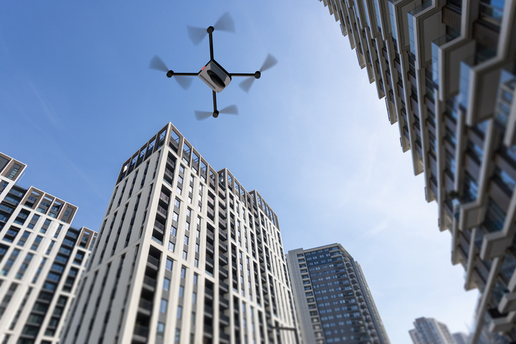
It cannot be denied that people are seeing more objects flying in the night sky. It is suspected that these are unauthorized UAVs collecting information over U.S. and international military bases and, well, also over people looking up at the sky in their backyards at night. It is unlikely that these unidentified flying objects are causing much harm to the civilian population other than being a curiosity. However, it remains unclear what they might be doing over military installations.
In November and December 2024, numerous reports emerged of UAVs surveilling residential neighborhoods, restricted zones and critical infrastructure across the Northeast United States. This includes areas such as water storage facilities, transmission lines, railway installations, police departments — both local and federal — and military bases.
Military bases reporting UAV overflights included Wright-Patterson Air Force Base in Ohio, Picatinny Arsenal and Naval Weapons Station in New Jersey and Ramstein Air Base in Germany. In the UK, Royal Air Force (RAF) bases at Lakenheath, Mildenhall, Feltwell and Fairford in the South of England all reported unauthorized UAV overflight activity, which is somewhat concerning for nuclear weapons bases in Europe. Lakenheath appears to have scrambled F-15s to investigate one such UAV incursion.
Detecting and mitigating threats
In the United States, the increased intensity of UAV sightings has residents and Congress concerned, while various authorities claim that most of these incidents are harmless. A joint statement by the Department of Homeland Security, the Federal Bureau of Investigation, the Federal Aviation Authority (FAA) and the Department of Defense stated:
“Having closely examined the technical data and tips from concerned citizens, we assess that the sightings to date include a combination of lawful commercial drones, hobbyist drones, and law enforcement drones, as well as manned fixed-wing aircraft, helicopters, and stars mistakenly reported as drones. We have not identified anything anomalous and do not assess the activity to date to present a national security or public safety risk over the civilian airspace in New Jersey or other states in the Northeast.”
Nevertheless, these agencies reported, “Local commanders are actively engaged to ensure there are appropriate detection and mitigation measures in place.”
No other major announcements have followed these incidents, but it would seem logical that military bases have begun activating existing detection and defensive systems. Known countermeasures may include specialized radar, laser, optical, acoustic and radio frequency (RF) detection and defensive systems.
Radar always has been employed to detect airborne intruders, and the reflections from them appear on a display, which the ground user can then align with a range of potential defenses. However, UAVs are generally small, while conventional radar is designed to pick up hefty reflections from the surface of full-size commercial and military aircraft.
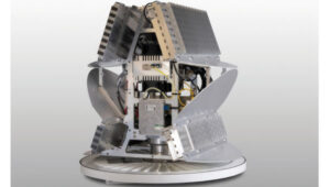
Photo: Robin Radar Systems
Robin Radar Systems
Robin Radar Systems in Holland has worked to refine radar that can detect small flying objects. Birds can cause havoc at airfields where aircraft take off and land at high rates, so detecting birds for airfield operators is one angle for which Robin Radar Systems has developed a reflection capability. A large bird and a UAV might be very similar in size. To differentiate the two, the company found a way to see a Doppler effect (speed differences) within a radar return, which indicates the spinning rotors of a UAV rather than flapping wings — a system they term micro-Doppler radar. This detection system works to find objects many miles away and at well-defined approach angles from the radar antenna. Therefore, these X-Band radars are mostly based at the places you want to protect, such as airfields. Some radars also can be packaged to be transportable, perhaps for military applications, where a temporary base needs to know if enemy attack UAVs might be on their way.
Other principal detection systems include “sniffing” RF frequencies to detect UAV control signals, but this has a shorter range than radar and does not easily determine distance or approach angle without several triangulating bases. Additionally, of course, UAVs without control signals cannot be detected with this particular RF technology. Optical systems using still/video/infrared (IR) cameras are good in daylight, but not so good in the dark. Acoustic systems use microphones or an array of microphones to listen for rotor sounds but have a shorter range (less than 1/3 of a mile).
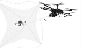
Then, if you have suitable defensive capabilities, you could either take down an unwanted UAV by flying a counter-UAV to collide with and destroy it or by trapping it in a net. In a military situation, many UAVs have been shot down by various types and calibers of guns — and even by very expensive missiles. Electronic defenses include jamming guidance and/or control signals by transmitting signals that overcome and scramble the GNSS and/or control signal or by frying its electronics using high-power microwave transmissions or high-powered laser(s) — these last two systems are expensive and heavy, which makes them cumbersome.
Spoofing the on-board GNSS receiver by transmitting false satellite signals to steer the UAV away from its target recently has been used by Ukrainian forces to steer attack UAVs back into neighboring countries.
GNSS jamming is widely used, and there are numerous equipment suppliers; however, spoofing systems are less common due to their additional complexity and cost. Some RF systems can collect data from the opposing UAV and even detect where the operator might be located.
Of course, not all UAVs straying into restricted airspace come from operators with bad intentions — some might be “Sunday-driver” recreational UAV flyers who have allowed their UAVs to stray into the wrong area. This is another reason the FAA requires formal UAV operator training and certification for commercial operations, but this is not required for recreational UAV flyers.
DroneHunter drone net capture system. (Photo: Fortem Technologies)
FAA regulations
The FAA regulations for UAVs are fairly easy to understand, and it would probably take an intentional effort to fly unauthorized into restricted airspace. Otherwise, stay at or below 400 ft, don’t exceed 100 mph, don’t go where you shouldn’t, file a flight plan — ask permission using the automated FAA LAANC online tool — but always stay within visual range of the UAV. Those are most of the basics. Additionally, to operate a UAV commercially, you must also register it with the FAA and install an electronic device to tell everyone in the surrounding airspace the drone’s registration number, which is traceable to the owner/operator. Never fly near clouds, comply with local rules when flying recreationally, and never, ever fly into restricted airspace, particularly around airports, without prior authorization.
These multiple reported UAV incursions violate FAA regulations, so it is reasonable to assume the operators are deliberately flying illegally. Recreational flying requires the operator to see the UAV at all times — so flying at night is not legal either, as the rules state not to fly an hour after sunset or an hour before sunrise. Operators in restricted airspace are committing a crime punishable by fines and/or years in prison. Yet they still fly, so are they nuisance operators who don’t care or is the activity criminally motivated or orchestrated offshore?
Utilizing UTM
Would the coming unmanned aircraft system traffic management (UTM) have been able to keep these intruders away? I am not sure, but UTM is designed to manage UAV traffic, so presumably, it could manage these UAVs to comply with traffic requirements. However, these intruders are already ignoring existing laws, so UTM may more readily enable the identification of rogue UAVs and operators. Recent tests at the FAA/NASA UTM test range in North Texas have drawn huge interest from Walmart and Amazon, as they push to get UAV package delivery working. Wing now delivers for Walmart using a production UTM system in Dallas and Fort Worth, Texas.
To wrap this up, amongst many recently reported unidentified flying objects, several have been identified as probable UAVs, and some of those over restricted areas could be detected and managed with existing technologies. FAA regulations ban flights in restricted airspace unless approved — i.e., working in coordination with those ground facilities. There are UTMs for UAVs already being used commercially, which could assist in managing all UAVs.
Unmanned Traffic Management (UTM) is an air traffic management system for UAVs and other unmanned air taxis or similar aircraft. In the United States, this is in airspace below 400 ft, avoiding other airborne traffic — including other UAVs — and informing authorities of your intended flight plan and how you execute it versus the posted plan.
Where are we on getting such a system? Well, there is an entire directory of nearly 80 UTM suppliers, mostly commercial outfits that offer UAV traffic control of some description for some application – typically like surveying a limited area for construction or maybe a related military application. Few companies possess “full function” UTM capabilities, along with extensive expertise and experience. Each commercial flight needs the approval of the FAA, so software packages include an FAA application to fly and feedback of authorization for the flight plan, as well as approval of operator certification and UAV type. There are complex packages from third-party sources, including NASA-developed UTM, as well as independent commercial systems.
So, how would that work across a major geographical area, such as the entire United States? The FAA and NASA have been working to establish how it could work, at least at a test site in Dallas, Texas.
First, the industry participants in this trial who wanted to operate in the same area had to accede to cooperate. Agreements were signed and means were established for data to flow between the participants, their drones and the FAA (the North Texas Shared Airspace Implementation). The limits of the area near Dallas/Fort Worth for the trial were established as the boundaries in which the parties would fly and, in this case, complete deliveries. The players are Walmart, Amazon, Wing, Manna and ANRA, with FAA and NASA watching carefully.
One of the principal actors in Air Traffic Management (ATM) is ANRA in Washington D.C., with offices in London, UK, and New Delhi, India. With more than 100 customers in 15 countries and more than 200 projects, their UTM/ATM systems are gaining wider experience in several different airspaces and differing traffic compositions. The system is evolving with wider applications as installations worldwide meet new requirements. AAM for eVTOL passenger-carrying aircraft provides mission planning, traffic deconfliction, vehicle tracking, constraints management, route authorization and vehicle registration. EVTOL aircraft will likely fly not only in and out of existing airports but also from new Vertiports specially built for short-hop eVTOL flights across cities. ANRA has already engineered a Vertiport Management System (VMS) to control unmanned and autonomous access to airports and Vertiports alike.
Another unrelated development in the world of UAVs is the phenomenon of high-altitude platform station (HAPS) UAVs and their ground infrastructure. Although flying at altitudes on the edge of space, it is likely special provisions would be required within its associated UTM system to keep track and warn other high-altitude flyers. Nevertheless, the highest-flying commercial aircraft would probably be at an altitude nearly 30,000 ft below HAPS remote Stratospheric perch.
Airbus Zephyr HAPS. (Photo: Aalto)
Airbus company Aalto Haps, based in Farnborough, UK, is now responsible for the manufacture, operation and commercialization of the Airbus Zephyr HAPS vehicle line. Designed to fly for months at a time, with wings covered in solar cells for power, Zephyr has established a world record of 64 days on station in the Stratosphere, and aalot has a target to fly for 200 days regularly.
So, what do you do with such a high-altitude, long-persistence platform? Well, it is like having your own satellite, which you can hang payloads on for tasks such as surveillance, disaster assessment and relief, border control, and numerous precision GNSS applications. With an apparent footprint of close to 3,000 square miles and an appropriate communications relay capability, you have a cell-phone tower in the sky. Perhaps even a partial equivalent to the Space-X Starlink space-based satellite communication service for provision of voice and internet, but seemingly far less infrastructure than the conventional 250 ground cell-towers needed for such an area.
Places starved of phone and internet service — such as Africa — could greatly benefit from flying their kite and gaining wide area coverage. To demonstrate how this capability would work, Aalto recently established a presence in Laikipia, Kenya, building an AALTOPORT ground facility and working with the Kenyan civil aviation authority to qualify Zephyr and its communications role for operations in Kenyan airspace. It is, of course, opportune that Kenya’s location on the equator provides access to one of the most sunny days available to power Zephyr at altitude. Laikipia County is also on a raised plateau, providing Zephyr with an altitude advantage for initial launch. Incidentally, Aalto flew Zephyr for 13 days over Kenya to prove the point.
With the facility in the UK able to build Zephyr-like UAVs every three months or so, Aalto aims to establish a number of hubs (such as the one in Kenya) around the world and operate a number of HAPS aircraft continuously, providing communications and all sorts of services commercially.
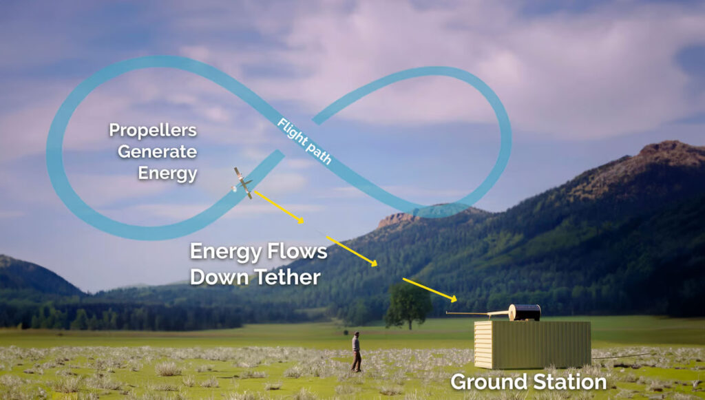
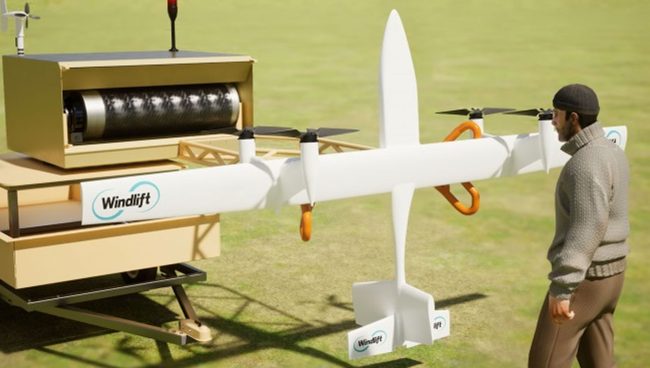
A new startup is investigating the concept of putting a tethered drone in the air with specially designed propellers driven by electric motors. This combination then turns into electricity generators for a particular flight pattern.
Windlift power generation cycle. (Photo Windlift)Transportable power generation. (Photo Windlift)
Initially focused on propeller design, Windlift was established in 2006 and is still based in Durham, North Carolina. Its approach is to use UAVs as a power source — flying repeatedly in a figure of eight, potential energy is converted to electricity in several non-powered phases of flight. The specially designed rotors turn to capture energy in those phases and their prop motors become generators of electric current, which is passed to the ground through the tether wire, to be ultimately supplied to the grid.
However, this setup could be portable, making it suitable for a small military or research team in the field needing power. This portability could be related to a $30 million contract Windlift has received from the U.S. Naval Research Laboratory, which is interested in technologies that the Navy and Marine Corp could use. Under the contract, the building and testing of a working prototype and demonstration to the Department of Defense is required. According to Windlift, this is a successful result of several earlier, smaller Small Business Innovation Research contracts to helped develop the necessary technological elements of today’s system.
Commercially, the UAV power generation approach appears to be extremely cost-effective versus the costs associated with today’s wind farms of huge wind turbines. Not only is the construction cost of each tower, its generator, and the huge blades very high, but the wear and tear of operations over time require expensive maintenance. Meanwhile, the UAV, while still in its infancy with lots of reliability and weatherproofing to be accomplished, has the potential to reduce power generation costs by up to 80%, Windlift said.
This month’s UAS news indicates how UTM is well along the path towards managing UAV integration into the National Airspace System, HAPS high-altitude aircraft may be back in the news as Aalto moves forward with commercialization plans, and yet another application for UAVs appears to involve a new potential approach for power generation. A pretty wide range of unmanned requirements and applications.
uAvionix has introduced truSky ADS-B spoofing detection for its SkyLine uncrewed aircraft system (UAS) beyond visual line of sight (BVLOS) services.
The uAvionix truSky validation process uses a network of low-profile deployed dual-frequency ADS-B ground receivers to evaluate each signal transmitted from the aircraft. The system then compares the received signals to confirm that the signal originated from the aircraft’s position.
When used within the uAvionix SkyLine platform, each aircraft track point is color-coded based on its confidence score. The validation score is then transmitted along with the position updates of the aircraft using SkyLine API.
TruSky is being piloted in numerous locations in the United States and is available as a component of uAvionix’s SkyLine UAS BVLOS service or as an API for integration into uas GCS, UTM, or ATM platforms.
DroneShield and Pierce Aerospace have partnered to integrate Pierce Aerospace’s Flight Portal ID remote ID technologies into DroneShield’s counter-unmanned aerial system (C-UAS) and command and control systems (C2), which includes DroneSentry-C2. The integration will provide enhanced situational awareness to end users.
The inclusion of Flight Portal ID’s remote ID data feeds into DroneShield’s DroneSentry-C2 system enables end users to correlate and positively identify UAS. This enhances security operations and provides a holistic air picture with target discrimination.
Flight Portal ID remote ID technology consists of remote ID receivers, broadcast modules, software, integration capabilities and remote administration services. It has an integration service record with several commercial unmanned traffic management (UTM), detect and avoid, Department of Defense C2 and C-UAS systems.
“The integration of Flight Portal ID and DroneSentry-C2 provides users with the comprehensive picture needed to deconflict their airspace, maintain safe flight operations for both crewed and uncrewed aircrafts, while also having the real-time intelligence and means necessary to protect that airspace,” said Matt McCrann, CEO of DroneShield.
The combined technology has a wide range of end user applications, as UTM C-UAS solutions continue to merge for several user segments, across civilian government, military and private use cases.
The joint capabilities will be available to customers in 2023.
The flight test is the third of several to simulate a variety of real-world scenarios that demonstrate how UTM and ATM intersect with multiple aircraft types.
M3 Systems, Pipistrel and Volocopter have completed their first joint flight test campaign in France at Pontoise airfield.
The week-long flight tests simulated three different avoidance maneuvers in real-world situations where unforeseen circumstances occur, such as a complete airport or vertiport closure, an unavailable final approach and takeoff area, and traffic deconfliction.
M3 Systems was created from engineering activities in GNSS and consulting activities in air traffic management (ATM), including for uncrewed aircraft. M3 played a role in Galileo signal definition, among other projects for Europe’s various space agencies. Pipstrel is a light aircraft manufacturer specializing in electric propulsion, and Volocopter specializes in urban air mobility (UAM) systems.
The joint campaign among the three companies — with French partners Groupe ADP and its subsidiary Hologarde — aimed to achieve smooth interaction within and between the new lower airspace’s unmanned traffic management (UTM) and standard civil aviation ATM systems.
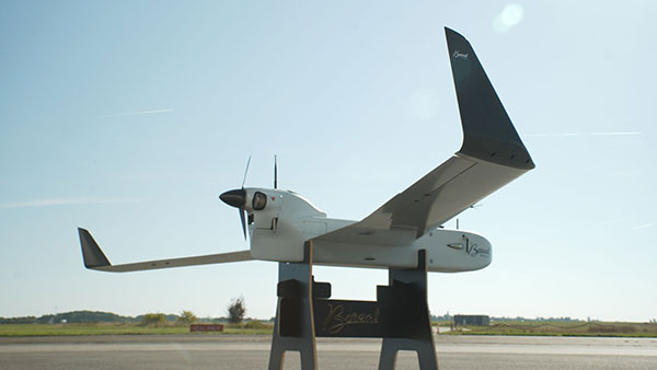
The Boreal system is a fixed-wing UAV with high-endurance and heavy payload capacity. (Photo: M3 Systems)
The aviation industry is experiencing an innovation upsurge driven by technology and societal pressure for new forms of aviation focused on sustainable, digital and autonomous air mobility. The resulting solutions will generate a significant increase in traffic density in the lower airspace.
Because existing ATM systems are not designed to handle such volumes or digitalization, coordinating existing and new traffic management systems for brand-new aircraft integration will ensure efficient large-scale operations. This includes commercial, general and drone aircraft for cargo and passenger flights, both crewed and uncrewed.
The CORUS-XUAM project, funded by the European Union’s initiative Single European Sky ATM Research (SESAR) Joint Undertaking, focuses on solving the challenge of conventional and new traffic management system integration and consists of 19 partners and 11 third parties. M3 Systems, Pipistrel and Volocopter all completed individual flight-test campaigns before this event to bring their aircraft in line with the U-space services.
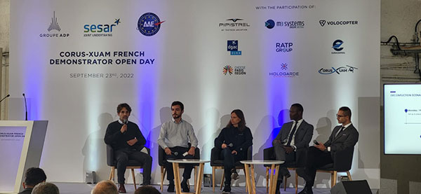
A week of flight tests ended with an Open Day air show and presentations. (Photo: M3 Mobility)
The CORUS-XUAM flight test conducted at Pontoise airfield near Paris is the third of several flight tests to simulate a variety of real-world scenarios that demonstrate how UTM and ATM intersect with multiple aircraft types.
Moreover, the CORUS-XUAM project will continue to proactively test and create a safe and controlled lower airspace under the European Union’s ambitious Single European Sky (SES) initiative throughout 2022.
The successful flight tests at Pontoise airfield were conducted with M3 System’s Boreal remotely piloted aircraft system, Pipistrel’s crewed Velis Electro, the only type-certified electric aircraft in commercial service in the world, and Volocopter’s fullscale, remotely piloted 2X prototype. Pipistrel uses the conventional ATM tower and system while Volocopter and M3 Systems use the UTM system. The following three flight scenarios were tested:
The unexpected occupancy of a final-approach-and-takeoff plan and aircraft diversion because of priority landing of another aircraft (Pipistrel and Volocopter aircraft).
The diversion of a flight path because of the closure of an airport or vertiport (M3 Systems).
The diversion of a flight path with two aircraft flying the same path (M3 Systems and Volocopter aircraft).
“These successful tests confirm that our Boreal UAS will be an enabler for future XUAM operations in situations where aircraft need to safely divert paths to another vertiport due to an unforeseen closure or another aircraft in the air,” explained Marc Pollina, M3 Systems CEO. “By providing rerouting demonstrations and tactical communications with U-Space service providers, M3 Systems can support future coordination between AAM and airport operators.”
Pipistrel is “As the manufacturer of the only type-certified electric aircraft in commercial service in the world, proud to take part in technical projects that shape the vision of air mobility and make progress in a meaningful way,” said Gabriel Massey, Pipistrel president. “The CORUS project and Paris demonstrations clearly show how UAM vehicles will be able to fly safely in regular airspace post-2030 and will help to unlock new lower-noise and lower-emission air passenger and air cargo services.”
In 2019, Volocopter tested its 2X ATM integration at Helsinki airport and was actively involved in the development of the European U-Space Concept of Operations, according to Oliver Reinhardt, Volocopter’s chief risk and certification officer. “Building an efficient ecosystem around UAM is Volocopter’s mission, and connecting ATM/UTM integration with our digital platform, VoloIQ, is poised to be an integral part of bringing UAM to megacities worldwide,” Reinhardt said. “I am looking forward to the next CORUS-XUAM test flights later this year in Germany and what we can achieve there.”
The project has received funding from the SESAR Joint Undertaking under the European Union’s Horizon 2020 research and innovation program under grant agreement No. 101017682.
Altitude Angel, a unified traffic management (UTM) technology provider, is bringing to market airspace management solution GuardianUTM Enterprise.
GuardianUTM Enterprise provides a view of the airspace in the vicinity of airports and enables airport to start designing and providing UTM services for drone companies and drone operators, using Altitude Angel’s proven digital authorization and flight-management technology.
GuardianUTM Enterprise will initially be deployed to support regional and local airports and airfields.
Europe’s EASA U-Space regulations are expected to become law on Jan. 1, 2023. GuardianUTM Enterprise is designed to enable airspace authorities to digitize approvals for drone operations using services integrated with Common Information Service (CIS) and U-Space Service Providers (USSP) architectures.
Using GuardianUTM Enterprise, airports can set access policies and create automation workflows accessible via Altitude Angel’s UTM ecosystem. This ecosystem is used by hundreds of thousands of drone pilots, manufacturers and software companies to guarantee the airport the best available view of the sky and nearby drone operations, ensuring a growing sector of the aviation market is able to access the new airport UTM Service.
For larger airports with counter-UAS solutions, data from on-site surveillance systems can be optionally integrated to give airport security staff greater situation intelligence which is a critical step in encouraging greater drone use.
The solution can be rapidly deployed and configured for airports of any size; providing a flexible platform for enabling drones to be safely integrated in the airspace around these facilities: a crucial step in unlocking a wide variety of unique use-cases for drones.
GuardianUTM Enterprise provides digitalization of pre-flight and take-off approvals to drone operators within airspace. It offers high levels of automation, including customized automated access policies and approval workflows of unmanned operations.
The UPP results will provide a proof of concept for UTM capabilities and serve as the basis for policy considerations, standards development and the implementation of a UTM system.
“The demonstrations will help move us closer to safe beyond-visual-line-of-sight drone operations,” said Pamela Whitley, the FAA’s acting assistant administrator for NextGen. “Flight testing UTM capabilities in high-density airspace will help us develop policy for safely and efficiently integrating drones into our national airspace while benefiting and serving communities.”
The demonstrations showcased emerging UTM capabilities that will support beyond-visual-line-of-sight (BVLOS) operations:
The FAA UTM Flight Information Management System prototype and infrastructure, which gives the FAA access to information from industry and other stakeholders.
New technologies and data to validate the latest international standards for remote identification and support authorized users with specific operator data.
In-flight separation from other drones or manned aircraft in high-density airspace to validate recently proposed international UTM standards to help drones avoid each other.
UAS volume reservations to notify drone operators of emergencies and make sure other UTM capabilities work properly in these scenarios.
Secure information exchanges between the FAA, industry and authorized users to ensure data integrity.
Each event attracted more than 100 participants and included local and state elected officials and representatives from international civil aviation authorities. Both test sites collaborated with drone operators and local public safety agencies to demonstrate scenarios that featured various complex UTM capabilities working together to support BVLOS operations with increasing volumes and densities.
MAAP hosted an event on Oct. 28 in partnership with UAS Service Suppliers (USS) AirMap, AiRXOS, ANRA Technologies, and Wing. On Nov. 9, NYUASTS hosted its showcase in coordination with the Griffiss International Airport, Northeast UAS Airspace Integration Research Alliance (NUAIR), and USS partners AiRXOS, ANRA Technologies, AX Enterprize, and OneSky.
The FAA has worked closely with NASA, industry and other stakeholders since 2017 to identify the initial set of capabilities needed to support small drone operations and advance UTM. The FAA Reauthorization Act of 2018 extended the objectives of the program to further enable safe BVLOS drone operations, paving the way for the program.
Stay tuned for more updates on how emerging technologies are being field tested to support the growing UAS industry.
The Sagar Defence Spectre UAV. (Photo: Sagar Defence Engineering)
Altitude Angel, an unmanned traffic management (UTM) technology provider, is partnering with Mumbai-based Sagar Defence Engineering Ltd. in BVLOS trials supported by India’s Directorate General of Civil Aviation (DGCA).
Together, Altitude Angel and Sagar Defence have been selected by India’s DGCA to carry out beyond-visual-line-of-sight (BVLOS) drone operations. The results of the trials will help define India’s regulatory framework for unmanned aerial vehicles (UAVs) in routine UAV deployment.
Altitude Angel’s GuardianUTM platform will enable BVLOS drone flights around a multitude of real-life scenarios including medical and cargo delivery, surveillance operations, survey & mapping, and search & rescue operations.
The Union Government has recently begun the process of granting regulatory permissions to the operation of drones for commercial purposes.
On participating in the BVLOS trials Richard Ellis, Altitude Angel’s chief business officer, said, “The potential for UAV use in India is immense so we’re excited to be partnering with Sagar Defence on these BVLOS trials. The ability to fly safely and securely BVLOS will unlock the potential of drones not just in India, but across the world. With Sagar, we’re very much looking forward to showcasing our proven technology to demonstrate the amazing use-cases of drones.”
Mridul Babbar, Sagar Defence’s business development head added, “Sagar Defence Engineering and Altitude Angel, two highly skilled teams, coming together for the BVLOS trials is a very strong partnership and one we’re thrilled to be part of. The combination of our UAVs and Altitude Angel’s world leading UTM platform will undoubtedly help advance the prospects of BVLOS flight across India and beyond.”
The BVLOS trials are scheduled to take place from August through to October 2020.
The trials will further build on trials Altitude Angel has been involved in this year. The company served as the lead and umbrella UTM for the Lake Kivu Challenge, part of the African Drone Forum, which took place on the shores of Lake Kivu, Rwanda, in January.
Altitude Angel, a London, U.K.-based unmanned traffic management (UTM) technology provider, is releasing an open-sourced project, Scout.
Scout’s hardware and firmware enable drone manufacturers, software developers and commercial drone pilots to quickly connect to its global UTM.
Primarily intended for use in commercial and industrial drone applications, Scout provides the capability to securely obtain and broadcast a form of network remote ID, widely seen as a necessary step for enabling routine drone use and flights beyond visual line of sight.
Because it is open source, both the hardware and the firmware can be enhanced and incorporated into a virtually limitless set of scenarios, according to Altitude Angel.
Altitude Angel also has made available a surveillance API that allows integrators to both share and receive flight data from a variety of sensors and devices in near real time, providing a comprehensive real-time picture of the airspace.
While many remote ID systems are broadcast only, Scout offers two-way communication and is fully open-sourced. The ability to talk back to the drone enables the Altitude Angel UTM service to help the drone avoid collisions with other aerial vehicles, or restricted airspace.
From launch, Scout will use identifiers obtained freely from Altitude Angel’s GuardianUTM platform. It will work in combination with a pre-flight (flight-plan sharing) service and is supported through integration with Altitude Angel’s Tactical Conflict Resolution Service.
Scout will enable the drone to report its real-time location using GPS-type sensors and relay this data via a secure, encrypted mobile communications link across 3G, 4G and 5G networks to Altitude Angel. It is powered by an internal rechargeable (via micro USB) lithium battery.
Altitude Angel has also provided reference design plans for the case that can be 3D printed. Scout has been designed to satisfy emerging network remote ID standards, such as ASTM.
Because the firmware is open source, the telemetry can be sent to other systems as required by the implementor.
A two-wire I2C upgrade to the circuit schematics, plus version 2 of the firmware (both scheduled for June), will subsequently enable the full two-way communication between the Scout device and the drone’s onboard systems, allowing the drone to respond directly to information received from the UTM.
In the interim, early adopters will have the opportunity to begin to integrate with Altitude Angel’s UTM services, test the hardware and test communication. Position data Altitude Angel receives from Scout is then automatically used by its Flight Information Management System (FIMS) to help provide traffic deconfliction.
Plans, firmware and schematics can be accessed via the Altitude Angel GitHub repositories.
Analytics provider Teoco has been selected by Telstra — a mobile network in Australia — to assist with the development of its UAV strategy.
Telstra will use Teoco’s AirborneRF solution to assess the readiness of its radio access network for future UAV applications, including communications, navigation, surveillance, safety and identity.
Teoco is a provider of analytics, assurance and optimization solutions to more than 300 communication service providers (CSPs) and OEMs worldwide.
Already deployed by several tier-one operators globally, AirborneRF ensures effective, mission-critical connectivity to enable effective traffic management and control for UAVs in the lower airspace. Telstra will use the solution to develop a platform for enabling a multitude of mission-critical services, vital in supporting successful UAV operations.
The platform provides a link between cellular networks and aviation systems, such as air traffic management (ATM), unmanned traffic management (UTM) and flight information management systems (FIMS).
TEOCO’s AirborneRF solution will play an important role in assisting Telstra enable a safe, equitable, secure and reliable urban air space platform. This has become all the more important to Telstra following Uber’s decision in 2019 to use Melbourne as one of three pilot cities to test out its “flying taxis” — the pilot is expected to begin this year, with commercial operations planned for 2023.
Telecommunications companies can provide needed UAV services via their mobile networks. For the internet of things (IOT), they can provide drone registration, activation and identification. For 5G, they can provide super low-latency remote command and control and high-resolution video carriage.
“We have been running a number of drone-related technology assessments with various industry customers, within law enforcement, humanitarian aid, post disaster, first responders and city councils, over the past 12 months,” said Thomas Neubauer, vice president of Business Development, TEOCO.
“Commercial UAVs present a huge opportunity for [[telecommunications]] operators, but only if supporting mobile networks deliver the required connectivity to keep them airborne,” Neubauer said. “Mobile networks were not designed to meet the needs of the aviation industry, so tight focus is needed to guarantee the quality of service needed to safeguard the additional revenue that connected skies promise. Our Airborne RF solution offers this guarantee to a growing number of major operators around the world.”
New solution integrates the real-time Kongsberg IRIS UAS airspace management picture into the AiRXOS’ Air Mobility Platform to provide integrated unmanned traffic management services around critical infrastructure
AiRXOS, part of GE Aviation, has fully integrated the real-time airspace picture from the Kongsberg Geospatial IRIS airspace management application into its own Air Mobility Platform for unmanned traffic management.
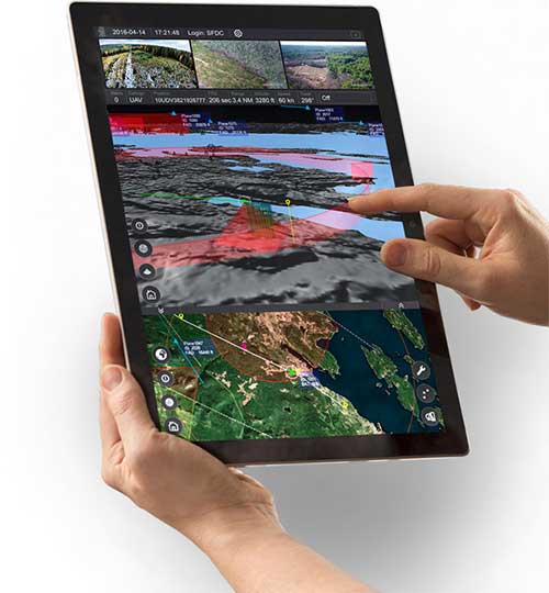
IRIS UAS is a spatial awareness system that allows UAS pilots to operate safely beyond visual line of sight (BVLOS). The system is shown here running on a Windows Surface Pro tablet. (Photo: Kongsberg Geospatial)
IRIS UAS fuses multiple disparate, real-time sensor feeds to create a highly accurate airspace picture around critical infrastructure locations such as airports.
This provides real-time calculation of aircraft separation, airspace monitoring alerts and communications line-of-sight prediction to enable detect and avoid for safe beyond visual line of sight (BVLOS) operations.
The real-time local airspace picture is then integrated into the cloud-based AiRXOS’ Air Mobility Platform, a dynamic, cloud-based foundation, purpose-built for advanced operations and the evolving future of transportation.
The Air Mobility Platform manages the volume, density, and variety of unmanned traffic management (UTM) data, and provides enterprises with a single platform to connect and manage operations, applications and devices.
Through this collaboration, the companies will provide UTM customers with a fully integrated view of airspace for real-time airspace insights, and greater scalability and repeatability of advanced operations.
“Situational awareness of the airspace across applications, unmanned aerial system (UAS) advanced operations, conformance monitoring, compliance, and pilots is critical to a UTM environment — allowing enterprises to be more responsive and efficient,” said Ken Stewart, CEO, AiRXOS. “Our partnership combines Kongsberg Geospatial’s expertise in airspace management with AiRXOS’ dynamic platform, applications, and services, providing customers with the opportunity to truly scale critical infrastructure advanced UAS operations like BVLOS and multi-vehicle, helping to lower risk and increase savings.”
“We’re very pleased to be working with an unmanned traffic management innovator like AiRXOS,” said Ranald McGillis, president of Kongsberg Geospatial. “Their ability to create a comprehensive surveillance view of operations and then to scale it for a nationwide use provides an excellent and very unique use case for our technology.”