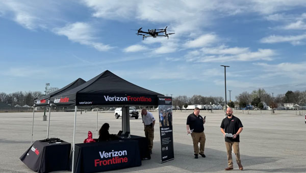
The National Oceanic and Atmospheric Administration (NOAA) has entered into a three-year Cooperative Research and Development Agreement (CRADA) with Verizon Frontline to refine the use of uncrewed aircraft systems (UAS) for assessing storm damage. This initiative aims to provide rapid and accurate damage assessments following severe weather events such as tornadoes and hurricanes.
Verizon Frontline will deploy its UAV technology to capture high-resolution imagery of areas affected by storms, providing crucial data to NOAA’s National Weather Service (NWS) and the National Severe Storms Laboratory. This imagery will assist in post-storm damage assessments and contribute to research aimed at understanding tornado behavior and improving severe weather warnings.
“Following a crisis, the initial imagery available is often from satellites, which may not offer the best resolution. Our goal with NOAA is to provide high-resolution imagery much faster, enhancing the support to emergency management and public safety agencies,” said Verizon Frontline Crisis Response Team member, Chris Sanders.
The collaboration represents a step forward in integrating modern technology into traditional environmental and emergency management practices, aiming to improve outcomes after natural disasters.
The Mobile World Conference (MWC) returns to the Las Vegas Convention Center on September 26 to 28, 2023.
The event will feature exhibition from major U.S. operators, including AT&T business, T-Mobile business, and Verizon business as well as new sessions dedicated to sports and entertainment, software developers and the GSMA’s SEC CON event.
MWC, in partnership with the Cellular Telephone Industries Association (CTIA), invites industry leaders and attendees to connect and discuss topics such as the industry’s transition to a circular economy, the future role of artificial intelligence (AI) in society, and what comes after 5G.
To reflect the United States’ position as a global technology hub and a market at the forefront of 5G innovation, the event is centered around four key themes:
5G Acceleration, as adoption explodes to become the most common mobile technology in North America by 2025.
Age of AI, as the world awakes to the opportunities and challenges of generative AI.
Digital Everything, as the expansion of digital technologies is felt across every industry, from sports and entertainment to manufacturing, financial services and smart mobility.
Enterprise Mobility, as the revolutionary phase of 5G in enterprise is well underway.
The event will feature a variety of keynote speakers, including Amanda Toman, the director for the Public Wireless Supply Chain Innovation Fund at the National Telecommunications and Information Administration (NTIA) within the U.S. Department of Commerce.
For the first time, the GSMA will bring its SEC CON event to MWC Las Vegas on day two, welcoming leading security experts to explore the importance of keeping telecoms infrastructure secure in times of conflict.
A full directory and registration can be found on the MWC Las Vegas website.
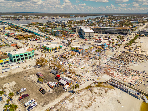
A photo taken in the aftermath of Hurricane Ian shows the massive destruction on Fort Myers beach. (Photo: felixmizioznikov/iStock/Getty Images Plus/Getty Images)
Not to harp on an event that’s already passed out of the headlines and national coverage, but Hurricane Ian — a Category 4 storm that hit Florida in September — was full of destructive winds and caused major damage that could be with us for years before things get fixed. One source also indicated that so far we have lost 157 people, mostly from drowning — nothing will ever fix those losses.
So harp on I will, especially about the role drones and drone pilots played in rescuing survivors, and determining and mitigating effects of the storm.
The place that took the hurricane hardest was Fort Myers on the southwest Florida coast. The following video is from a security camera.
While Hurricane Ian was making a mess of Cuba and crawling over the Caribbean and into the Gulf of Mexico, drones were already flying over areas where the storm could cross from the Gulf onto land — initially forecast around Tampa. But the forecast landfall continued to drift south, over where I live in Venice and 150 miles south of Tampa to Fort Myers.
Before landfall, drone operators in Fort Myers were gathering video/geolocation information on buildings and streets in the path that the forecast 14-foot storm surge might take. They identified areas of potential damage and places people might need rescue.
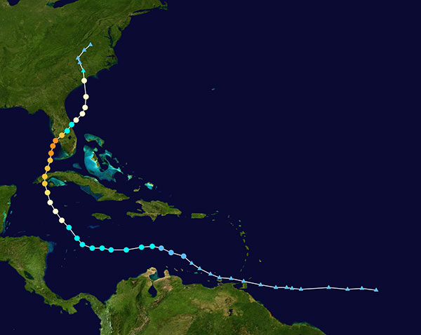
Map plotting the storm’s track and intensity using data from the National Hurricane Center and a NASA image. (Image: public domain/FleurDeOdile/Wikipedia)/
After the storm hit, first responders began searching more than 400 destroyed houses in Fort Myers, some using the pre-storm drone video to rescue any trapped survivors.
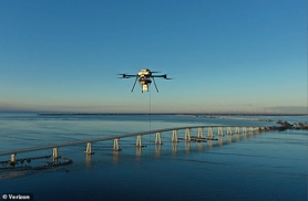
The need was not only for access in difficult conditions, but also for communications. AT&T reportedly got cell coverage up quickly in a couple of areas, and Verizon flew tethered drones (capable of flying for up to 1,000 hours) to restore phone coverage over a circular radius area of five to seven miles. Verizon also hooked up generators and engaged satellite internet coverage for local use, and took a portable cell-site on a barge out to Sanabel Island, which had been cut off from the mainland. T-Mobile put generators at cell-sites that lost power and deployed satellite and ground-based portable cell coverage.
Verizon tethered drones provided cellular service for first responders. (Photo: Verizon)
Powerful Drone
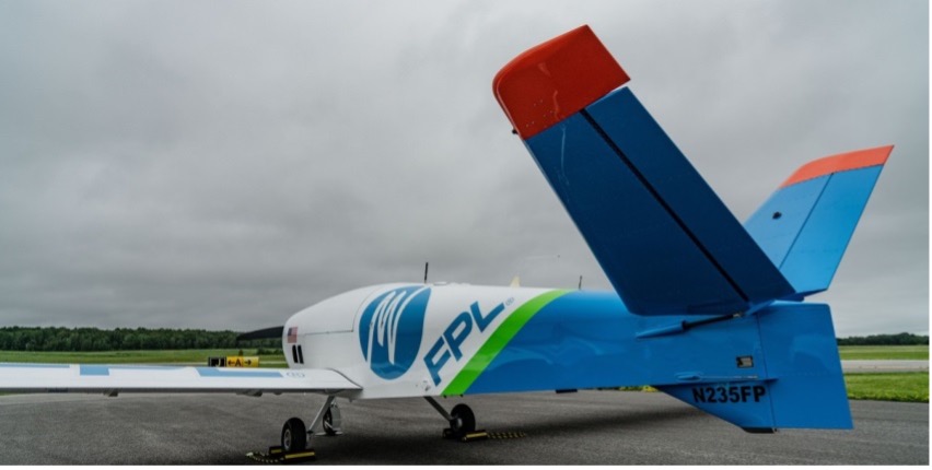
Loss of power was another issue. Florida Power and Light (FPL) flew its recently acquired fixed-wing FPLAir One drone to assess damage to its power distribution infrastructure, which supplies about 12 million people on Florida’s west coast.
FPL drone used in power loss assessment. (Photo: FPL)
Using the drone in damage assessment efforts enabled FPL to get suitable crews to the right places early in the recovery effort.
FPLAir One is a group 4/5 large UAV. It appears to be a Navmar Applied Sciences Corporation (NASC)/Sonex Aerospace TEROS unmanned aircraft, which is based on an earlier Sonex-powered glider design introduced in 2003. Because of this heritage and its rugged airframe, the TEROS is ideally suited for flights in high wind conditions — great for FPL’s long-range pre- and post-storm assessment application using FLIR and video cameras.
The drone’s extensive prior airframe proving is assisting NASC/Sonex in its quest for certification of TEROS by the Federal Aviation Administration (FAA). FAA certification will ultimately support its integration into the National Airspace System (NAS) and allow operators to move on from the individual FAA approvals required for each operational drone scenario.
Drones to the Rescue
The principal application for hundreds of drone flights by several organizations was search and rescue for missing residents, mostly in the flooded area in and around Fort Myers. Drones also helped rescue people in North Port, where floodwater was as high as four feet, collapsing roofs and trapping people in their homes.
Skydio provided drones for several search-and-rescue programs by police and other agencies, as well as coaching personnel who might lack experience in flying them. More than 500 drone flights were accomplished in the first days after the storm, a large number using autonomous flight capability, greatly assisting rescue efforts to locate trapped people. First responders were also able to determine whether access was possible, or what steps were initially needed to even enable access.
Insurance companies are also using drone assessment video, determining the level of damage to homes and vehicles, in an effort to put assistance where it was most needed early on. Using artificial intelligence to align food-stamp users with badly damaged homes identified on satellite images in Lee, Collier and Charlotte counties, GiveDirectly offered immediate $700-assistance to many survivors. If all these offers were accepted, the cost could be as much as $2.4 million in no-strings-attached immediate aid for those worst hit.
In the aftermath of the largest, most damaging hurricane to hit the United States since 1935, volunteers, first responders, drone pilots, aid agencies, and power, communication and insurance companies all made use of drones. These agencies and companies are still helping many thousands of people to survive and start the long task of picking up the pieces of their lives.
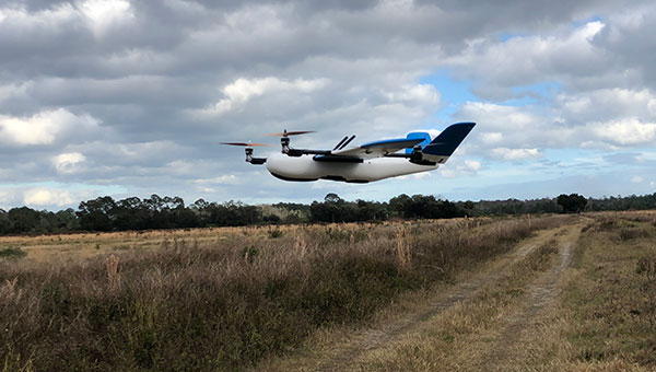
A Censys Technologies Sentaero equipped with a Verizon 4G/LTE link. (Photo: Skyward)
Skyward, A Verizon company, has signed a Memorandum of Agreement (MOA) with the U.S. Federal Aviation Administration (FAA) to test cellular-connected drones. Cellular-connected drones could unlock complex operations like beyond visual line of sight (BVLOS), universal traffic management (UTM) and one-to-many operations.
Titled “Unmanned Aircraft Systems (UAS) — Cellular Technologies to Support UAS Activities,” the MOA enables Skyward and the FAA to mutually research the capabilities of cellular communication networks for command and control (C2) within the National Airspace System.
Partially focused on safety-critical C2 data, the three-year MOA also allows the two groups to propose standards for operations, including BVLOS and over commercial wireless spectrum. Skyward and Verizon will also be using the data and information collected in the course of the MOA to inform its discussions on C2 and BVLOS operations in the FAA’s BVLOS Advisory and Rulemaking Committee.
Today, most commercial drones use unlicensed spectrum, which is restricted in range and subject to interference, limiting its use for complex operations. Verizon’s 4G LTE nationwide coverage, provided over spectrum protected from interference, presents an enormous opportunity for drone operations.
The MOA will inform regulations regarding spectrum used in the C2 link between the drone operator and drone. The MOA will also facilitate information sharing between the FAA and Skyward as the parties continue to explore how wireless networks can support drone operations.
The MOA is inspired by the previous industry collaborations with the FAA, but is intended to address complex UAS operations through joint data collection and analysis.
The agreement also follows Skyward’s announced emergency waiver to inspect critical communications infrastructure near the Big Hollow wildfire in Washington in September 2020. The industry’s first known fully remote BVLOS operation with no pilot or visual observer on site demonstrated low-risk operation as well as a need for analyzing and sharing fully remote data with standard bodies and the FAA.
“Cellular-connected drones play a critical role in enabling tomorrow’s safe, reliable and secure drone operations,” said Matt Fanelli, Director of Strategy and Operations at Skyward. “We are thrilled to be laying this foundation with the FAA and are confident that our efforts will help inform technical standards from which industry regulations authorizing low-risk BVLOS and one-to-many operations will flow.”
Skyward, a Verizon company, has announced its integration with Pix4D, a photogrammetry software suite for drone mapping. The partnership gives customers the ability to turn drone data into 2D maps and 3D models.
Enterprises and drone pilots can now plan flights, receive approval to fly in controlled airspace with LAANC, fly with Skyward’s InFlight ground control station, and process data using Pix4D — all from within the Skyward platform.
“Skyward has been bringing our customers tools to access airspace, plan and fly — now they can produce business-ready data deliverables without leaving Skyward,” said Mariah Scott, Skyward president. “Enterprises in construction, energy and utilities, and the public sector can get even more ROI out of their drone programs when combining Skyward’s drone management platform with Pix4D’s market-leading photogrammetry tools.”
Skyward Mapping & Modeling, powered by Pix4D, enables customers to create, view, measure, and export 2D orthomosaic maps and 3D photogrammetric models right from Skyward’s web app. With the processing power of Pix4D, Skyward customers can get business-ready data sets through a seamless plan, fly, process workflow.
“Enterprises are seeking to scale their drone operations and transform their businesses with better data and faster time to insight. Skyward’s platform, along with the power of Pix4D, delivers a powerful, comprehensive solution,” said Christopher Cressy, Pix4D managing director for North America.
To learn more about Skyward’s mapping and modeling features, join a webinar on June 8 at 2 p.m. ET. Enterprises and commercial operators can try Skyward Mapping & Modeling powered by Pix4D free for 30 days.
Hyper Precise Location (HPL), a real-time kinematics (RTK) service, is now available via Verizon ThingSpace to customers and application developers in more than 100 U.S. markets. When paired with Verizon’s 5G Edge capabilities, HPL provides precise positioning data for emerging cellular-vehicle-to-everything (C-V2X) technology, which is necessary for certain safety applications.
Verizon recently teamed with automakers to demonstrate vehicle-pedestrian safety scenarios made possible through HPL, 5G Edge and C-V2X.
HPL is software as a service (SaaS) that provides a stream of real-time GNSS correction data to device receivers, enabling location accuracy within 1-2 centimeters, for users on 5G and 4G networks. This can enable high-scale, low-cost, centimeter-level location capabilities for industries such as automotive, HD mapping, robotics, construction, and smart agriculture (AgriTech). Designed and deployed in a privacy-protective manner, HPL does not store or share user location data.
HPL embraces open delivery standards including RTCM for its data streams, with others to be added on a rolling basis. IoT devices using HPL can be accessed and managed through a user API and the ThingSpace IoT management platform. Support resources on ThingSpace will detail API integration, coverage availability, and more.
“Hyper Precise Location stands to boost or enable next-gen technologies across industries, from intelligent-driving to drone delivery to highly automated operations within construction, agriculture, and much more,” said TJ Fox, SVP of Industrial IoT and automotive for Verizon Business. “HPL’s fast expanding coverage area, API friendliness, privacy protection, and use of open-delivery standards make it ideal for developers and customers demanding precision and flexibility.”
In August, Verizon announced it is also developing HPL next-gen road safety and highly advanced driving solutions through partnerships with location and mapping expert HERE Technologies (HERE) and Renovo, the automotive software company. HPL can also support other emerging technologies that depend on high-level location accuracy, such as delivery drones, and advanced IoT applications, such as infrastructure monitoring, critical asset tracking, and high value shipping.
The acquisition will expand Verizon’s robotic capabilities to power the future of robotic automation for enterprise customers
Verizon has entered into a definitive agreement to acquire incubed IT, the creator of a software platform providing autonomous navigation tools to administer, manage and optimize mixed fleets of robots in industrial settings.
“This acquisition further demonstrates Verizon’s commitment to developing new and innovative businesses and use cases leveraging the power of 5G,” said Rima Qureshi, chief strategy officer at Verizon. “Mobile robot orchestration is a real and emerging challenge faced by enterprises today. By integrating incubed IT’s autonomous software with Verizon’s 5G platform, we will have the ability to power robotic automation at scale. This will create new opportunities for enterprise customers to better and more effectively monitor and optimize their business processes.”
Upon closing and as Verizon continues to expand its 5G coverage, capacity and mobile-edge compute capabilities, incubed IT’s autonomous software will enable enterprise customers to gain new efficiencies as they scale their autonomous mobile robot fleets.
Incubed IT’s award-winning software enables robots to localize and navigate autonomously and can be easily integrated into nearly any mobile robot. Their products include:
Smart Shuttle Navigation Toolkit: Transmits near real-time data to navigate autonomous mobile robots (AMRs)
Fleet Management Server: Manages AMR Fleet & Routing Operations
Data Monitoring and Analytics: Near real-time monitoring and advanced
reporting
“Incubed IT’s next-generation software and autonomous fleet management server are foundational components for the future of terrestrial robotics,” said Elise Neel, vice president of Verizon New Business Incubation. “When we combine incubed IT’s capabilities with the reliability, responsiveness and vast capabilities of Verizon’s 5G platform, we will enable faster, less expensive and more effective adoption of robotic automation for enterprises everywhere.”
Incubed IT’s autonomous navigation software features include:
No need to specify transport paths up front
No predefined paths
Instant rerouting
Obstacle avoidance
Safe operation in areas with other vehicles and humans
Incubed IT’s employees will join the Verizon New Business Incubation team, whose mission is to scale new automation businesses, fueled by the inherent orchestration power of 5G. The incubed IT team will continue to drive development, sales and support for its customers and suite of products across a fleet of diversified robotic partners.
“We are proud of all the incubed IT team has accomplished to get us to this point, and we look forward to expanding on our successes and capabilities,” said Stephan Gspandl, incubed IT CEO. “By joining the Verizon team, we have the opportunity to bring our software to broader audiences and to help create the future of robotic automation.”
The transaction is subject to customary closing conditions and is expected to close in the first half of 2021.
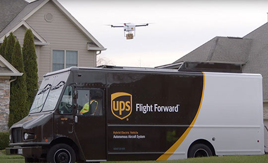
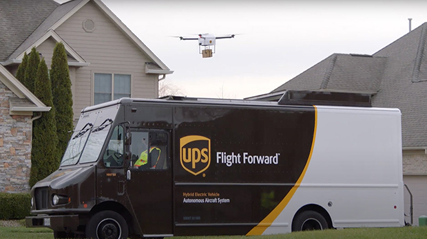
Skyward, a Verizon company, and UPS Flight Forward will collaborate to deliver retail products with drones connected to Verizon 4G LTE, as well as testing and integrating 5G for delivery.
“We will need the ability to manage and support multiple drones, flying simultaneously, dispatched from a centralized location, operating in a secure and safe environment,” said Carol B. Tomé, CEO of UPS. “To do this at scale, alongside Verizon and Skyward, we’ll need the power of 5G.”
“We’re just beginning to see how the power of 5G Ultra Wideband will transform the way businesses operate,” said Rima Qureshi, chief strategy officer at Verizon. “By partnering with UPS and other innovative companies, we can learn from each other’s expertise and collaborate to create solutions that help move the world forward.”
Photo: Verizon
In 2020, Verizon, UPS Flight Forward and Skyward started testing 4G LTE in delivery drones to demonstrate cellular reliability and performance at altitude.
“The low latency of 5G and edge compute is ideal for monitoring air traffic in and out of a busy logistics hub, especially those using mixed fleets of autonomous vehicles like drones, trucks and planes,” said Mariah Scott, Skyward President. “This year, we’ll be taking the collaboration with UPS further by testing 5G Ultra Wideband integrations to connect the sky.”
UPS has operated more than 3,800 successful drone delivery flights since the creation of UPS Flight Forward, its drone delivery company, certified by the Federal Aviation Administration in 2019. But in 2020, drone delivery emerged as much more than rapid delivery of essential healthcare items — during the global pandemic it provided high-risk seniors a rapid and contactless delivery option to remain healthy at home.
“Using Verizon’s 5G and Skyward, we’ll be able to transform the delivery experience — more personal, more on-demand and with the same safety, efficiency and reliability our customers trust today,” said Bala Ganesh, vice president, Advanced Technology Group at UPS.
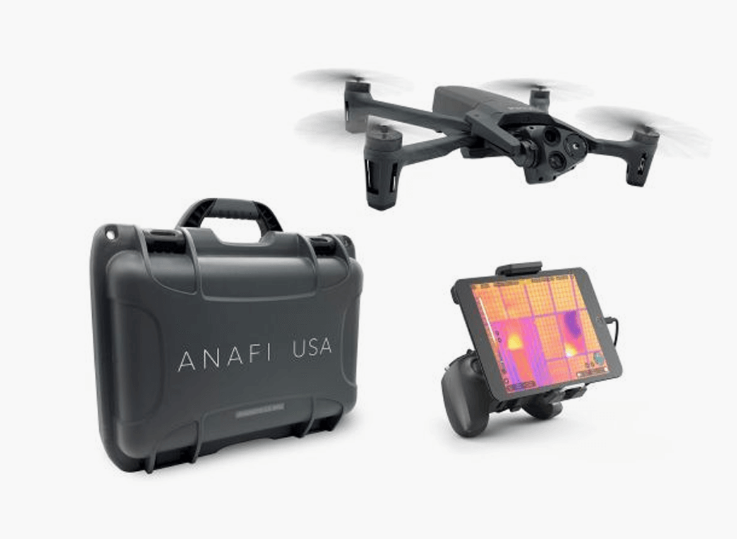
Skyward, a Verizon company, and Parrot, a European drone group, are partnering to deliver Parrot ANAFI drones along with Skyward drone program management, flight-log sync and training to U.S. enterprises.
In particular, the new speaks to a widespread need among U.S. companies and public agencies for a secure, high-end drone manufactured domestically. Sold by Skyward, the ANAFI USA and training package gives enterprises a one-stop shop for building and scaling a drone program with aircraft, policies and procedures, training, and automatic flight log sync to the software platform to manage it all.
“ANAFI USA was designed to meet the needs of the most demanding professional users while offering enterprise data security and privacy,” said Henri Seydoux, founder and CEO of Parrot. “Now, combined with Skyward’s enterprise drone solutions covering training and integrated software platforms, professional users have access to one of the most comprehensive suites of hardware, software and services.”
In addition to its security benefits, Parrot’s ANAFI USA features 32x zoom 4K HDR video and thermal imaging capabilities. It is portable, weather-resistant and ready to launch in seconds.
“Now enterprises can maximize their investment in the ANAFI USA by pairing it with Skyward’s in-person and online operator training and robust management platform,” said Mariah Scott, president of Skyward, A Verizon company. “This is just the beginning of a strong partnership with Parrot. Look for continued feature integration and connectivity offerings as we move the industry forward together.”
Skyward users can automatically log flights from the Parrot FreeFlight 6 piloting application for the ANAFI, ANAFI Thermal and ANAFI USA drones with additional integration features coming soon to maximize the value of both platforms.
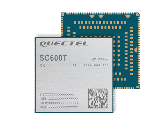
The SC600T-NA and SC600Y-NA are industrial-grade LTE Cat 6 modules with an operational and certified built-in Android 9.0 OS.
The SC600T-NA is based on the Qualcomm Snapdragon MSM8953 and supports Octa-core A53 up to 2.0 GHz, camera 24 MP and video 4K at 30 fps.
The SC600Y-NA adopts the Qualcomm Snapdragon SDM450 and Octa-core A53 up to 1.8 GHz, camera 21 and video 1080 at 60 fps.
A multi-constellation GNSS receiver is available in both modules, which is ideal for applications that require fast and accurate fixes, such as in-car video streaming and live video devices, the company said.
Both modules integrate 2 GB LPDDR3 + 16 GB eMMC flash and support WUXGA display.
With powerful engines, the two modules are fully integrated with Bluetooth, Wi-Fi capability and strong multimedia functions include support for dual LCDs and dual touch panels with independent display and operation. The modules can support a maximum of four cameras with two working simultaneously. Quick Charge 3.0 technology can facilitate various smart devices, including vending machines, smart cash registers, smart delivery machines and more.
Designed for North America, both modules work on FDD-LTE bands B2/B4/B5/B7/B12/B13/B14/B17/B25/ B26/B66/B71, TDD-LTE band B41 and WCDMA bands B2/B4/B5.
“These two modules for North America have passed another industry milestone. They will enable IoT designers, manufacturers and their customers to utilize the latest and leading LTE network technologies from America’s most awarded network,” said Patrick Qian, chairman and CEO of Quectel. “The new generation Cat 6 smart modules are critical for devices to utilize the processing power whenever needed.”
Using RTK’s pinpoint-level location data in the Verizon network is a building block to bring to scale emerging technologies such as driverless city zones, expansion of precision agriculture and drone delivery.
Verizon has launched what it calls hyper-precise location using real-time kinematics (RTK) to provide accuracy within one to two centimeters on the Verizon network.
Verizon has built and deployed RTK reference stations nationwide so that compatible internet of things (IoT) devices can receive the higher accuracy. Verizon is working to make RTK accessible with myriad device makers.
RTK will also support emerging technologies that depend on high-level location accuracy, such as delivery drones and customer-approved location data for first responders in emergencies.
RTK technology reduces the cost and risk associated with inaccurate location data, Verizon said in a press release. “Billions of IoT devices across a multitude of industries will benefit from improved location accuracy, with hyper-precise location information enabling a host of new services.
“For instance, robotics at distribution centers will be able to perform more efficient, accurate and safe logistics operations. More accurate positioning can help speed deployment of high-value assets in emergency situations to the precise location, and more precise tracking of emergency equipment can provide faster redeployment in disaster response scenarios.”
The rollout of its hyper-precise location services along with Verizon’s 5G Ultra Wideband network and 5G Edge will pave the way for more autonomous technologies, the company said.
“We are scaling RTK to enable mobile location accuracy to within a few centimeters, transforming what is currently possible when it comes to location-enabled services and new IoT solutions coming onto the market,” said Nicola Palmer, chief product development officer for Verizon. “Continued growth in the IoT environment means billions of devices in fields where precision location services are becoming more critical, such as vehicle automation, unmanned aerial vehicles, precision agriculture technology, infrastructure monitoring, asset tracking and high-value shipping.”
Image: 4X-image iStock / Getty Images Plus / Getty Images
Reimagining road safety
In partnership with HERE Technologies, Verizon is building next-generation technologies for vehicle and pedestrian safety using hyper-precise high-definition mapping and RTK.
This work paves the way for connected services that are designed to drive road safety improvements. By creating a vehicle-to-network (V2N) communication system equipped with hyper-local location accuracy, collision avoidance applications can precisely identify vehicles, pedestrians and bicycles, and relay the information through Verizon’s 5G Edge and HERE’s AI to predict likely travel paths and warn vehicles of impending potential collisions. This partnership is one of multiple recent initiatives Verizon has taken to increase road safety.
“Moving beyond the static fidelity of satellite-based location data enables an exciting new generation of connected, autonomous experiences,” said Jørgen Behrens, SVP, chief product officer at HERE Technologies. “By pairing HERE’s live, hyper-precise HD Map and HD Positioning technologies with intelligent RTK algorithms, and making that scalable, Verizon is putting a transformative level of location insights into the hands of developers and consumers alike.”
Powering the autonomous future
Hyper-precise location accuracy will be critical to advancing autonomous driving and together, Verizon and Renovo are ushering in a new era of transformative solutions critical for the future of autonomy on the road. These solutions leverage machine learning and RTK technology, powered by a combination of next-generation solutions such as 5G.
“RTK is a critical technology for advanced driving assistance systems (ADAS). Accurate positioning helps ADAS vehicles navigate better, drive smoother, and react faster to the surrounding environment,” said Christopher Heiser, CEO and Co-Founder of Renovo. “Nationwide, reliable RTK networks make for a viable way to deliver these enhanced capabilities to mass-market cars and trucks. For companies that manage the huge datasets that power next-generation vehicle platforms like Renovo, this is very exciting.”
IoT devices currently using RTK can be accessed and managed through Verizon’s ThingSpace management platform and APIs.
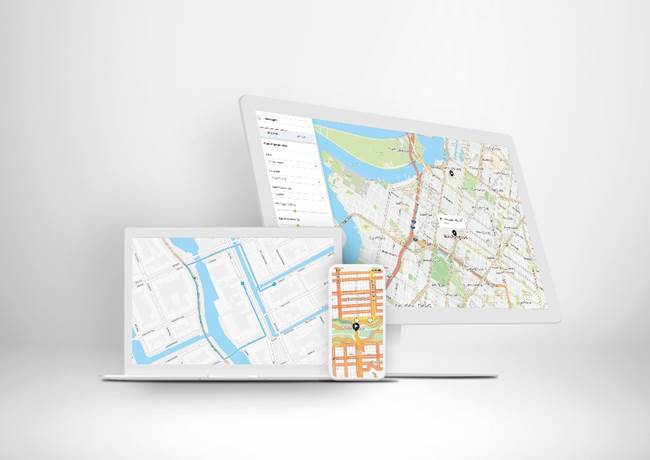
Verizon will integrate TomTom’s Maps application programming interfaces (API) and software development kits (SDK) into its location-services offering, making it easier for the developer community to build upon and integrate the platform. The developers’ portal is available at developer.tomtom.com. More information from
The agreement is an expansion of the existing TomTom and Verizon agreement, where TomTom provides location-based services to enhance Verizon’s current suite of location-based data, navigation, and intelligence.
“We look forward to continuing to build upon and evolve our product suite with TomTom’s technology,” said Jeff Frantz, executive director, Verizon Location Services. “By expanding our agreement, we are furthering our commitment to providing best-in-breed location technology for Verizon and our customers.”
“We’re determined to make it as easy as possible for developers to have access to our Maps APIs and SDKs so we’re delighted that Verizon is offering TomTom products to their location-services customers,” said Anders Truelsen, managing director, TomTom Enterprise.
5G and HD Maps. In the last quarter of 2019, the companies also announced an innovation project using Verizon 5G Ultra Wideband and TomTom HD Maps to help make intersections safer for emergency vehicles.