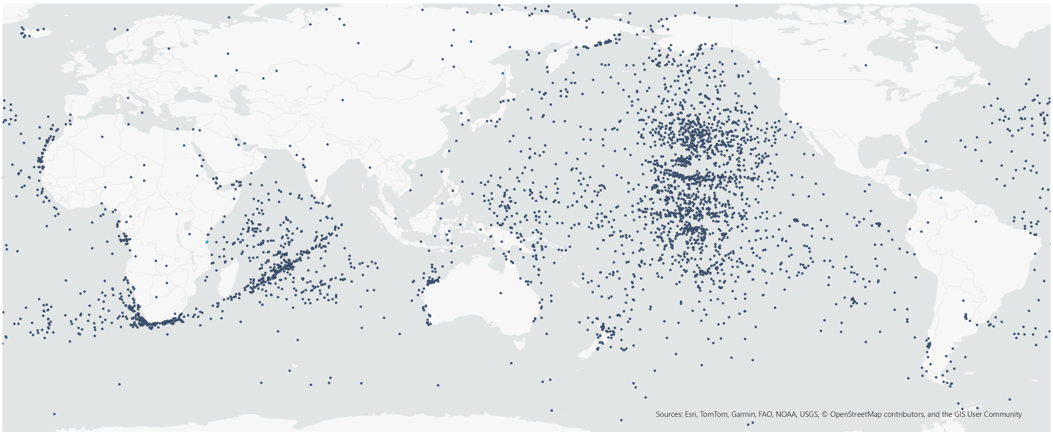
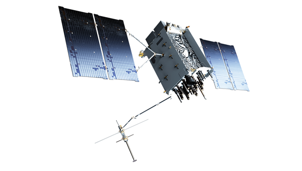
ArkEdge Space successfully launched its micro-satellite AE1a on March 30, and has begun initial checkout following the establishment of communications through test radio signals.
AE1a is a technology demonstration satellite developed to advance maritime digitalization by enabling wide-area, real-time vessel tracking and communications. The satellite adopts ArkEdge Space’s standardized 6U satellite bus in its large-antenna configuration. In addition to demonstrating a deployable antenna for VDES (VHF Data Exchange System) applications, AE1a will improve and validate core technologies for a VDES receiver.
AE1a will operate in coordination with AE1d, which began operations in January 2025, and AE3Va, which began operations in June 2025, forming a three-satellite constellation for demonstration across wide-area maritime areas.
AE3Va continues to acquire AIS signals across multiple sea areas, including waters around Japan and vessel-congested areas along critical shipping lanes. Accumulated reception data is being systematically verified and analyzed.
Going forward, the program will advance from reception-focused demonstration to two-way communications, including transmission from orbit. This will enable satellites to deliver operational information directly to vessels, expanding the scope of VDES demonstration and advancing progress toward concrete use-case validation across the maritime sector.
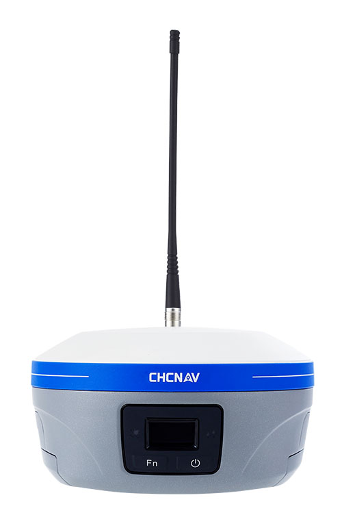
CHC Navigation has announced major updates to its i93, i85 and i76 GNSS receivers, as well as the iBase professional base station. The updates are designed to further improve positioning stability, simplify field setup, and expand operational capability across demanding surveying environments.
Enhanced RTK performance with the CHCNAV StellaX GNSS chip The updated i93, i85 and i76 receivers integrate the CHCNAV StellaX GNSS chip with multi frequency signal tracking and advanced anti interference mitigation. This design is intended to support more reliable GNSS RTK positioning and more consistent data collection in complex terrain and in areas with partial GNSS satellite visibility.
PointSky GNSS corrections service for remote surveying To reduce reliance on cellular networks and local radio links, the updated i93 and i85 now include a one-year standard subscription to the CHCNAV PointSky service. PointSky delivers GNSS corrections via satellite, enabling users to reach a 2.5 cm precision fix in three to five minutes. This capability supports surveying operations in remote locations such as mountains, forests and deserts where network coverage can be limited or unavailable.
Longer range radio operation and simplified iBase startup The iBase base station now integrates CHCNAV DistLink technology and improved data compression to increase radio sensitivity and support up to 30 km coverage for linear projects such as highways and railways. Power consumption has also been optimized to support more than 13 hours of continuous operation without external batteries. To streamline setup, iBase includes a one button startup sequence designed to automatically pair with rover units, reducing the need for manual parameter configuration in the field.
Infleqtion has announced availability of its first quantum-enabled precision timing solution delivered as part of the company’s partnership with Safran Electronics & Defense. The new solution includes Infleqtion’s Tiqker quantum optical clock, which has been integrated and validated with Safran’s White Rabbit and SecureSync systems.
Modern systems, from financial markets to military operations, telecom networks and datacenters, depend on technologies such as GPS or GNSS for precise timing, but these are vulnerable to jamming, spoofing, and natural disruption. As threats to traditional timing infrastructure grow, the need for resilient, independent alternatives has become critical.
In a recent live demonstration conducted in partnership with Quantum Corridor, the solution integrating Tiqker, White Rabbit and SecureSync system was validated in a real-world environment, demonstrating picosecond accuracy vs. nanosecond GPS accuracy.
The combined, validated solution delivers enhanced stability and resilience, ensuring continuity of operations for mission-critical systems even in environments where traditional timing signals are challenged or denied.
The collaboration between Infleqtion and Safran Electronics & Defense makes the validated solution available to customers globally, across allied defense, telecommunications, and critical infrastructure sectors, enabling rapid deployment of precision timing architectures designed to operate even in GNSS-challenged environments.
The European Union Aviation Safety Agency (EASA) and EuroControl have published a joint action plan designed to strengthen the safety and resilience of European aviation operations amid the growing challenge of GNSS interference.
GNSS provides aircraft with precise positioning, navigation and timing information that is essential for a wide range of functions. Interference with the signals has become a regular occurrence, in particular on the edge of conflict zones, and poses a threat to safety. The action plan focuses on maintaining safety in the near term while limiting impacts on airspace capacity and containing the threat of GNSS interference. It sets out short, mid- and long-term measures to mitigate the threat with harmonized operational procedures and to strengthen the robustness of GNSS‑based operations by clearly defining who needs to act, and by when.
“While the potential threat to aviation safety from GNSS interference has so far been mitigated by short-term actions such as raising pilot awareness, it is clear that more needs to be done,” said Florian Guillermet, EASA executive director. “This action plan lays out and prioritizes short, mid and longer-term actions and, importantly, also assigns roles to the various aviation actors. By working together with EuroControl and pooling our expertise, we have been able to create a strong plan that will enable the wider sector to come together to counter this threat.”
“GNSS interference remains a significant and evolving challenge for European aviation, making today’s action plan an important step forward in our collective response,” said Raúl Medina, director-general, EuroControl. “The action plan concretely supports our Member States and aviation partners as we work together to ensure the evolution and resilience of aviation’s critical infrastructure — one of the core goals of EuroControl’s Trajectory 2030 strategy. I welcome the strong cooperation and close coordination with EASA and all our partners across the aviation sector on this plan, which demonstrates our shared commitment to safety, and aims at delivering tangible benefits for the network, operators and passengers by making GNSS‑based operations more robust.”
Key elements of the joint action plan The action plan is built on several core pillars designed to strengthen Europe’s ability to detect, manage and mitigate GNSS interference.
Through joint monitoring and data-sharing, EASA and EuroControl aim to establish a common, validated operational picture of GNSS interference events across Europe, enabling more accurate detection, reporting and situational awareness. By pooling expertise and operational data, the two organisations will deepen their understanding of interference patterns, operational impacts and associated safety risks, with the aim of delivering consistent and harmonized guidance to air navigation service providers (ANSPs), airlines, and national authorities to ensure rapid and aligned responses to interference incidents.
In close partnership, EASA and EuroControl will develop updated operational guidance for flight crews and air traffic controllers to help them manage disruptions effectively and maintain safe operations in degraded navigation environments and join forces and expertise for investigations into ongoing GNSS interference. The two organisations will also promote improved mechanisms for timely information exchange through Member States, ensuring that events with both civil and military dimensions are addressed in a coordinated and transparent manner to minimize disruption and preserve airspace capacity.
The action plan envisages close collaboration with A/C manufacturer and avionics industry to support the development of more robust, interference‑resilient avionics solutions over the longer term. It addresses the concerns expressed in a letter sent on June 6, 2025, by 13 EU Member States to the European Commission that called for immediate and coordinated European action to address the growing number of Radio Frequency Interference (RFI) events affecting GNSS‑based systems. The action plan also integrates proposals and guidance from international partners including the International Civil Aviation Organization (ICAO), and the International Air Transport Association (IATA).
Background GNSS enables more efficient flight paths, reduces fuel consumption, and supports the implementation of Performance-Based Navigation (PBN), which allows aircraft to fly more direct routes and operate safely in areas with limited ground-based infrastructure.
However, the growing challenge of RFI — whether intentional (jamming or spoofing) or unintentional — poses a threat to the resilience of these systems. The most severe interference typically occurs near conflict zones, but GNSS performance may be affected well beyond these areas. Although aircraft can operate safely without GNSS, disruptions can reduce resilience and the continuity of operations.
Anello Photonics and Q-CTRL have entered a strategic partnership to develop resilient navigation solutions for unmanned aerial vehicles (UAVs) operating in environments where GPS is degraded or unavailable.
The collaboration focuses on integrating Anello’s Silicon Photonics Optical Gyroscope (SiPhOG) technology with Q-CTRL’s Ironstone Opal quantum magnetic navigation capabilities. This integration creates a multi-layered quantum navigation solution (QNS) designed to provide continuous, bounded positioning estimates that do not degrade over the course of a mission. By combining silicon photonics-based inertial sensing with quantum-powered magnetic map matching, the companies aim to provide a critical backup to GNSS.
Reliability in satellite navigation has become a significant concern across both defense and commercial sectors. Vulnerabilities such as jamming and spoofing pose a documented $1B daily threat in the United States, impacting logistics, transport, and military operations. Recent disruptions in the Persian Gulf have further highlighted the challenges faced by maritime and aerial platforms when GNSS signals are compromised.
The initiative represents the first time these two specific technological approaches have been integrated to scale quantum navigation solutions. As electronic warfare evolves and the use of autonomous systems expands, the ability to operate without a constant GPS signal is becoming a standard requirement for next-generation mobility and mission-critical platforms.
In my February GPS World newsletter, I highlighted that the National Geodetic Survey (NGS) staff participated in GeoWeek 2026 in Denver. They engaged with geospatial product and service users and provided the latest updates on the status of the modernization. On March 25, 2026, as President of American Association for Geodetic Surveying (AAGS), I participated in a GeoWeek webinar titled “NSRS Modernization is Here: What Surveyors Need to Know Now.”
The webinar was based on presentations by NGS and others at GeoWeek 2026. The webinar provided the status of NGS’s new modernized NSRS and the professional societies (AAGS, ASCE, ASPRS, and NSPS) addressed how they are helping others to prepare for the change. It is available to everyone under the “On-Demand Webinars” section of Geo Week News here: https://www.geoweeknews.com/webinars.
First, at the end of February’s newsletter, I shared my main thoughts and concerns that I believe NGS and the broader community should carefully consider before NGS adopts the new modernized NSRS.
I encourage you to watch the GeoWeek Webinar mentioned above for the latest update from NGS on the modernized NSRS.
I have already shared my concerns directly with NGS, but it’s important that they also hear from the user community. You can provide feedback via [email protected], user forums, or upcoming webinars and Q&A sessions.
Although I covered these points in my last newsletter, I believe they remain important, so here’s a shorter version of my key thoughts and concerns:
Timeline uncertainty: Clearer, more frequent milestone updates (beyond the Track Our Progress page) would help manage expectations.
OPUS and processing continuity: NGS should commit to a longer grace period — or ideally a defined parallel support window — for legacy OPUS tools (particularly OPUS-Projects 5) after the official adoption of the modernized NSRS.
Data access and usability in the new DDS: The new web-based system needs to provide robust APIs or export options that are comparable to those in current datasheets/legacy tools.
Transformation tools and legacy data handling:Users need confidence that transformations minimize errors, especially in deformation-prone areas.
Communication and outreach: Case studies, training resources, and FAQs that describe real-world practical examples, tailored to common workflows, need to be developed and documented.
Again, I encourage anyone reading this (including NGS staff) to test the beta products actively, submit detailed feedback, and participate in forums/Q&As. The community input will make or break the success of this once-in-a-generation update
Regarding the 2026 Society of Land Surveyors of Iowa (SLSI) Annual Meeting, I was grateful to receive the invitation and truly enjoyed attending. As always, I came away from this gathering of surveyors with valuable insights.
The conference was exceptionally well organized, with plenty of time for meaningful interactions among attendees, exhibitors, and speakers. In total, 285 people attended.
As expected, I presented on the new modernized NSRS. The topics I covered are listed in the box titled “Topics Addressed During my ½ Day Session on the New NSRS.”
I was fortunate to have Ben Sullivan, Seiler Geospatial, set the stage for my presentation by providing a short introduction to the new modernized NSRS. He provided an overview that addressed: (1) what the new national datum is, (2) how it will affect the geospatial community, and (3) how users can prepare for it once officially released by the NGS.
Topics Addressed During My Half-Day Session on the New NSRS
What to expect between NAD 83 (2011) and NATRF2022 in Iowa?
Why is NGS modernizing the NSRS and what are the expected coordinate changes in Iowa?
How are reference frames and datums defined?
What are the differences in CORS coordinates between the Multi-year CORS Solution 2 (MYCS2) and Multi-year CORS Solution 3 (MYCS 3) in Iowa?
What does NGS mean by time-dependent coordinates and why is it necessary for the new, modernized NSRS?
How will plate tectonics be handled in the new, modernized NSRS?
What’s the difference between NAD 83 (2011) epoch 2010.0 and NATRF2022 epoch 2020.0 in Iowa?
What are the differences between Reference Epoch Coordinates (REC) and Survey Epoch Coordinates (SEC)?
What’s the difference between ITRF2020 and NATRF2022 in Iowa?
How do you use NCAT to convert between reference frames and compute State Plane Coordinates?
Why is it important to have the appropriate metadata of your old projects for the implementation of the new, modernized NSRS?
What to expect between NAVD 88 and NAPGD2022 in Iowa?
How will orthometric heights be determined in the new, modernized NSRS; that is, how will NAPGD2022 orthometric heights be determined in the new NSRS?
Review of Computing GNSS-Derived Heights
What’s the estimated difference between NAVD 88 and NAPGD2022 epoch 2020.0 in Iowa?
How will NAPGD2022 Orthometric heights be determined using GEOID2022?
What are the differences between GEOID2022 models and Hybrid Geoid Model GEOID18 in Iowa?
How will NAPGD2022 affect the National Flood Insurance Program and the Elevation Certificate?
Updates from the National Geodetic Survey at GeoWeek 2026
Many of the topics covered in my session have been addressed in previous newsletters. For example:
My June 2020 newsletter explained how NAPGD2022 orthometric heights will be determined using GEOID2022, and why NGS will require GNSS occupations on primary marks when submitting leveling projects.
Whenever I attend conferences, I visit exhibitors to ask about the modernized NSRS. Many had heard of it, but only a few could explain the differences or how their company will adapt products and services to the new reference frames. Several said their company is aware of the change but couldn’t specify how or when they’ll respond. I encourage all users to contact their equipment and software providers and request a detailed plan for addressing the new NSRS.
I want to highlight two sessions I found both very interesting and important for surveyors. They were presented by Todd Horton, PE, PLS of Meridian Geospatial.
Meridian Geospatial Consulting Todd Horton, PE, PLS, is the owner of Meridian Geospatial Consulting, LLC. Todd has provided technician training and continuing education seminars for the land surveying industry since 2005. Todd served in the US Air Force and with the Illinois Department of Transportation in planning, design, construction, surveying and maintenance of civil engineering projects including commercial structures, airfields, utility systems and highways. He joined the full-time faculty at Parkland College in Champaign, IL, where he taught land surveying and construction management courses for 25 years. Todd founded the land surveying associate degree program at Parkland College in 2001. Having retired from full-time teaching, Todd has joined Farnsworth Group Inc. as a part-time senior project land surveyor. You can reach him at [email protected]. (From https://www.meridiangeospatial.com/)
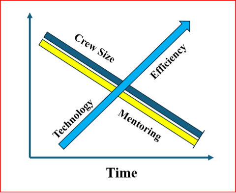
One of Horton’s presentations was titled “Professional Ethics.” In it, he highlighted how new technology is reducing the size of surveying crews and improving overall efficiency. However, this comes at the cost of reduced opportunities for mentoring the next generation of survey technicians and surveyors.
I’ve recreated his diagram below to illustrate the issue.
Crew Size vs. Mentorship
Crew vs Mentorship. (Recreated from Todd Horton’s presentation)
As shown in Horton’s diagram, while new technology increases efficiency and allows for smaller survey crews, it also reduces the time available for surveyors to mentor technicians and the next generation of professionals.
Training and mentoring are extremely important for the continued growth and development of individuals in the surveying and mapping community.
He explained that the world consists of two types of individuals: specialists, who have a narrow skill set and limited opportunities, and generalists, who possess broader knowledge and skills, think multi-faceted, and are forward-looking.
He emphasized that a professional surveyor typically needs 3 to 5 surveying technicians to successfully complete a project. While professional surveyors regularly attend training sessions (as evidenced by many participants at this conference), technicians often have little or no access to formal training.
He advocated that technicians should be trained as generalists. This means equipping them not only with better tools and equipment, but also with a strong foundational knowledge and skill set — especially understanding the “why” behind the “how.” This deeper knowledge enables them to prevent problems before they occur and effectively troubleshoot issues when they arise.
I addressed this same concern in my November 2022 newsletter, where I warned that the industry is creating a growing number of “buttonologists” — technicians who rely heavily on pushing buttons without deeper understanding.
This trend concerned me then, and it still does today. That’s why I was especially pleased to hear Todd directly address the issue and offer a clear path forward for improving training and development for both technicians and surveyors.
A participant at one of my workshops stated that “GPS has made geodesists out of all of us.” In my opinion, the advancements in GNSS equipment and processing software provided some users with a “false sense of knowledge or security” that they understood what was happening within the “black box.” One of my colleagues at NGS said that the new equipment and software programs were creating a field force of “buttonologists.”
He highlighted that the surveying community needs more technicians than licensed professionals. As a result, we should prioritize training and development for technicians. This is a constant need and would help reduce turnover rates.
He also emphasized the importance of growing future professionals from within the technical ranks. Doing so would increase technicians’ motivation and desire for advancement, making them more eager to take on greater responsibility and pursue professional growth.
He provided the following training approaches:
On-the-job training
Self-guided study
Continuing education resources
Online content
College courses
Live skill training
He noted that these investments in training will yield the following advantages in professional and organizational development:
Enhanced employee skills
Opportunities for career advancement
Stronger organizational performance
Sustained competitiveness via continuous learning
Increased productivity
Higher employee retention
A thriving culture of innovation
Horton also discussed a training program he’s involved in that not only trains technicians but also includes training for the trainers. This “train-the-trainer” approach helps accelerate the program’s growth and impact.
For more information, I encourage you to reach out to Horton directly for additional details about his programs and his ideas on improving technician training.
Horton also gave a very good session on a very difficult subject, that is ALTA/NSPS “Relative Positional Precision (RPP).”
As a side note: see the box titled “Top 5 Key Changes in the 2026 ALTA/NSPS Standards” for the key changes in the 2026 ALTA/NSPS standards. Detailed information on the ALTA/NSPS 2026 document can be downloaded at the following NSPS weblink: https://nsps.us.com/page/2026ALTA.
Precision (RPP): The clarification of RPP is a core technical change. While it does not alter how surveys are performed, it improves consistency and understanding of measurement quality expectations across the profession.
Shift from “on the ground” to “practices generally recognized as acceptable” (Sections 5 & 6): This is one of the most significant forward-looking changes. It explicitly accommodates modern technologies such as drones, lidar and future tools (including AI), without locking the standards to specific methods.
Expanded guidance on sourcing title evidence when a recent title commitment is unavailable: This change directly affects research responsibilities and risk management, especially on projects where title information is incomplete, delayed, or unconventional.
Requirement to note evidence of possession or occupation along the entire perimeter: This materially broadens what must be considered and documented in the field, regardless of how close that evidence is to the boundary line – an important title-risk issue.
Clarification that verbal (“parol”) statements must be noted when made: This adds explicit documentation requirements tied to conversations with landowners or occupants, which can be critical in dispute resolution and liability defense.
Todd started his presentation by providing RPP as defined by ALTA/NSPS (2026):
Relative Positional Precision (RPP) is the acceptable indicator of measurement quality on an ALTA.NSPS Land Title Survey.
It is defined as the length of the semi-major axis, expressed in meters or feet, of the error ellipse of the line connecting the monuments or witnesses marking adjacent boundary corners of the surveyed property at the 95 percent confidence level.
His session was organized into nine sections labeled RPP Keys for Success:
Choose one equipment and a measurement method based on the accuracy needs of the project.
Use well-adjusted instruments and procedures to eliminate systematic errors in measures.
Make internal checks to detect blunders in measurements.
Make redundant measurements to have a large degree of freedom.
Access the quality of control that will be used.
Avoid weak network geometry.
Organize all field measurements for software input.
Establish standard errors for all observation conditions.
Adjust and analyze results.
In these sessions, he covered fundamentals including:
precision vs. accuracy,
systematic vs. random errors, and
absolute vs. relative accuracy.
Horton emphasized that systematic errors follow mathematical or physical laws and can usually be modeled or reduced with proper procedures, while random errors persist after blunders and systematic errors are addressed. By using improved equipment and proper procedures to detect, reduce, or remove errors, users lower the uncertainty in their results — reducing uncertainty should be a goal for any product or service.
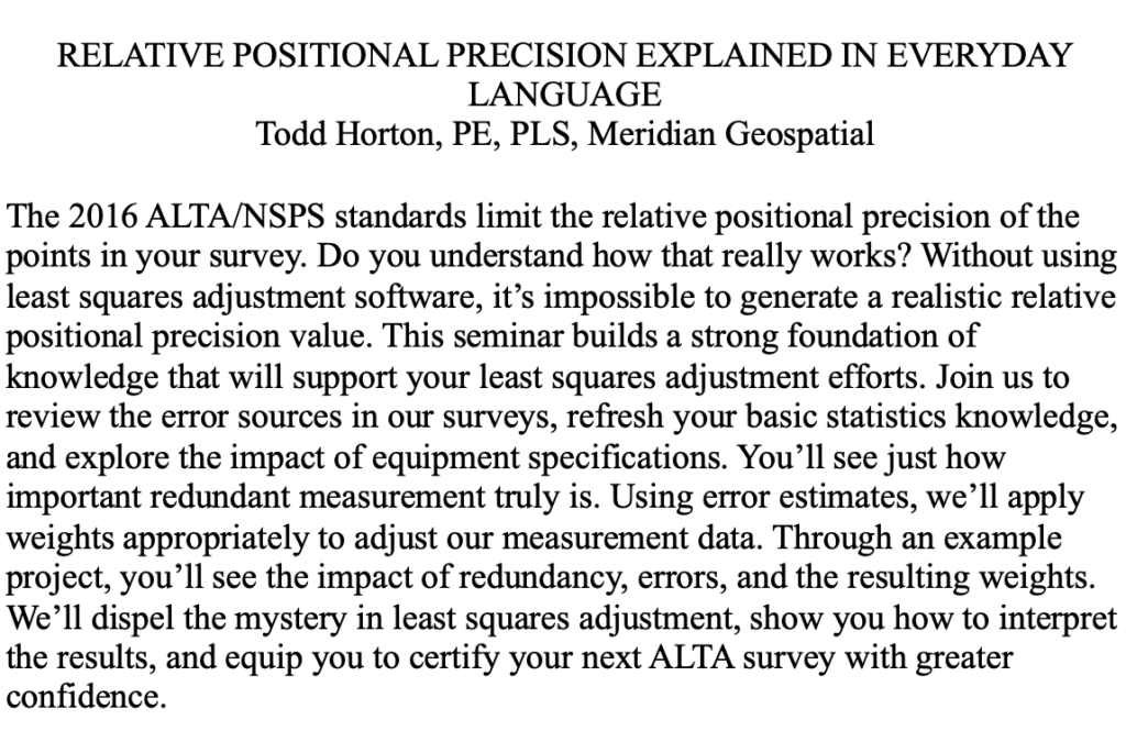
Many people are familiar with the classic bow-and-arrow (or target) diagram that illustrates the difference between precision and accuracy.
I recreated Horton’s diagram on this topic because it effectively highlights that our ultimate goal in surveying is to reduce uncertainty in our results.
As the diagram shows, simply repeating observations can give the appearance of good precision, but it does not guarantee accuracy. The result can be high precision with low accuracy — and therefore a large remaining uncertainty.
Precision vs. Accuracy
Recreated from Todd Horton presentation
Todd noted that most RPP values are derived from a properly weighted least-squares adjustment. Many manufacturers’ software packages now use least squares to estimate RPP, making it essential to provide accurate error estimates so the data are correctly weighted in the adjustment.
To illustrate this point, he provided clear examples of the following concepts:
Determining the appropriate error estimates for data,
Measuring errors,
Degrees of freedom and redundancy,
Significance and confidence intervals,
Appropriate weights of measurements,
Propagation of errors, and
Statistical tests for analysis of data and results.
He explained how to compute the allowable RPP and offered practical advice on selecting the appropriate equipment and measurement methods, tailored to the accuracy requirements of the project.
In my opinion, this topic can be challenging to grasp without a strong mathematical background. Todd did an excellent job explaining the concepts clearly while avoiding excessive mathematical detail.
To illustrate the RPP, Todd presented two real-world examples of combined networks using GNSS and traverse data. The first example combined GNSS with an open traverse using EDM, horizontal, and zenith angles. The second example incorporated RTK GNSS vectors with a closed traverse using classical survey data.
This was an excellent session. I highly recommend reaching out to Todd for more details about his programs and insights.
I want to thank the organizing committee of the 2026 SLSI Annual Meeting for the kind invitation to participate in their conference. I truly enjoyed the experience and came away with many valuable insights from this excellent gathering of surveyors.
The GPS World Buyers Guide is the only comprehensive and continuously updated directory of leading providers of GNSS and other positioning, navigation and timing (PNT) solutions and services.
If you’re seeking products and services, you have two resources available at your fingertips: the print Buyers Guide that appears in our May/June issue, and the online version that’s accessible 24/7 at gpsworldbuyersguide.com.
We’re proud GPS World’s Buyers Guide was the industry’s first online buyers guide to feature hundreds of manufacturers, products and services. The print version of our Buyers Guide has been available for more than 25 years.
We make it easy to find what you’re looking for. You can search for manufacturers by name, or location. You can search for products and services by name, or product categories and subcategories.
We make it easy for manufacturers and suppliers to list their products and services. It’s free because we want to ensure our Buyers Guide is all-inclusive and offers accurate and reliable information. We encourage manufacturers and suppliers not listed in our Buyers Guide to create a new listing, which can be continuously updated and seen year-round.
The GPS World Buyers Guide is the industry’s most trusted resource of GNSS and PNT solutions and service providers. Watch for the latest version in the May/June issue and online at gpsworldbuyersguide.com.
In the meantime, check out our Simulator Buyers Guide on page 35 of this issue. It features simulator tools, devices and software from prominent companies that aid GNSS receiver manufacturers in product design.
You can rely on GPS World to deliver trusted, reliable resources when you need them most.
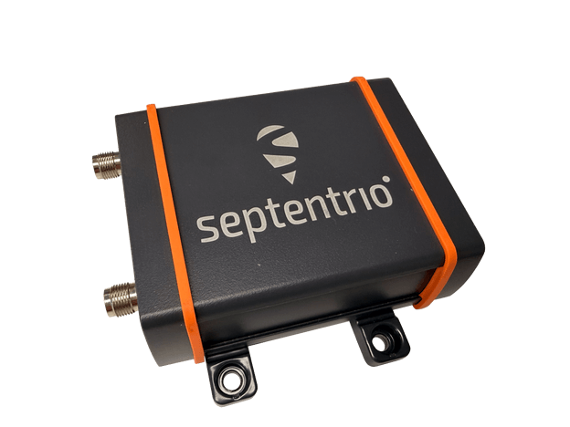
Septentrio, part of Hexagon, offers a new enclosed multi-frequency GNSS receiver: AsteRx EB.
The cost-effective product offers uncompromised high-accuracy positioning and GNSS heading for industrial robots, port logistics, marine, and scalable automation applications. Its IP67 enclosure protects the receiver from harsh weather conditions, while built-in advanced GNSS+ algorithms ensure reliable operation in environments that are challenging for GNSS, such as areas with foliage or near GNSS interference sources.
The RAIM+ integrity monitoring system ensures truthful positioning, which is essential for autonomous navigation. The compact enclosure of AsteRx EB enables easy installation, reducing time-to-market.
“AsteRx EB is an ideal boxed receiver for customers who need reliable, resilient, and highly accurate positioning in a compact form factor and at a price point that makes rapid scale-up possible,” said Danilo Sabbatini, Product Manager at Septentrio, part of Hexagon.
In a dual-antenna configuration, AsteRx EB delivers sub-degree GNSS heading for systems that require orientation in addition to RTK positioning. The built-in AIM+ anti-jamming and anti-spoofing technology protects the receiver from intentional or unintentional GNSS interference.
AsteRx EB extends Septentrio’s lineup of enclosed GNSS receivers. Like mosaic-go, it can be used for quick and easy testing or evaluation of Septentrio’s reliable positioning technology. Thanks to its robust housing, it can be deployed in a wide range of industrial applications. For systems exposed to very harsh weather conditions or intense mechanical stress, the AsteRx RB3 ultra-rugged receiver provides the highest level of protection.
As GPS World readers know, the growing prevalence of GPS/GNSS jamming and spoofing outside of conflict zones interrupts vital aviation safety technologies and presents challenges to maritime commerce and the global economy. An alarming example is playing out along the Baltic Sea and the North Sea, prompting 13 coastal European nations and Iceland to highlight in January 2026 “growing GNSS interference” and collectively reinforce requirements to comply with existing regulations and international law designed to ensure the safety of all maritime vessels engaged in shipping.
As commercial aircraft report navigation anomalies and maritime operators experience false position data in congested waterways, global authorities are sounding alarms that GNSS interference will continue to rise without immediate action. In March 2025, the International Civil Aviation Organization (ICAO), International Telecommunication Union (ITU), and International Maritime Organization (IMO) issued a joint warning expressing “grave concern” that disruptions from GNSS jamming and spoofing constitute an urgent threat to public safety, telecommunications networks and international commerce.
Compounding harmful interference incidents led the GPS Innovation Alliance (GPSIA) to act. Defeating illegal and harmful interference outside of combat zones requires a coordinated, whole-of-government strategy that focuses on stopping bad actors through deterrence and enforcement, and directing resources toward preventing and sanctioning those violating international commitments and laws prohibiting jamming and spoofing. Investing in GPS modernization and integrating innovative signals from complementary PNT satellite systems into devices and receivers will deliver PNT that surpasses today’s technologies to the global community.
Roadmap for Action
In September 2025, GPSIA led a coalition of leading industry groups in sending a letter to the Departments of Defense and Transportation that called for urgent action to address GPS jamming and spoofing. We noted the United States has the technology and expertise to solve this issue, and the administration has the power to act. GPSIA followed the letter with a whole-of-government strategy providing a clear roadmap for the administration. While some recommendations have been implemented, other opportunities remain.
Focus on the Real Culprits
The culprits in each of these scenarios are bad actors putting public safety and global commerce at risk with harmful interference outside conflict zones. The global community relies on several unique technologies that can be impacted by harmful interference, such as cellular and Wi-Fi signals, radars and automated information systems. The misplaced focus on faint GNSS signals or dependencies on GNSS derail collective efforts to immediately regain interference-free global commerce and bolster public safety.
Governments and international organizations mandate certain industries integrate safety-of-life technologies into their operations — and they do, at great cost. Officials should in turn be given the political support and resources to stop bad actors from intentionally interfering with them.
What to Do Next
Public and continued diplomatic engagement are critical. By amplifying European counterparts, condemnations from senior U.S. officials can raise the reputational costs for bad actors and reaffirm international norms that protect GNSS signals and other technologies from harmful interference.
Engaging with the ICAO is important. The U.S. should reinforce its commitment to providing modern civil GPS signals that support navigation in international airspace and encourage ICAO to prioritize the enforcement of global GNSS protections.
GPSIA also recommends Executive agencies establish an interagency task force that rapidly identifies and disseminates information about interference events with civil operators, including sanitized intelligence information on intentional jamming and spoofing of commercial aircraft and ships.
Civil operators also should be invited to participate in interference coordination calls and reporting. Sharing radio-frequency interference data, incident reports and threat assessments among military and civil agencies and operators is essential to preserving public safety. The Performance-based Operations Aviation Rulemaking Committee’s recommendations for continuity of operations during GPS disruption events should continue to be implemented with urgency.
The GPS III satellite has additional anti-interference features. (Image: Lockheed Martin)
Deterrence and information sharing must be coupled with sustained enforcement. Federal agencies have taken welcome action to interdict illegal jamming equipment, reporting an 830% increase in seizures since 2021. We applaud the U.S. government for prioritizing resources to stop the illegal import and sale of these devices.
GPSIA commends the Kingdom of Norway’s annual Jammertest, which allows receiver and device manufacturers to test interference detection and counter jamming and spoofing. These realistic test scenarios, together with strengthened enforcement and prioritized intelligence collection and analysis, will enhance public safety.
Modernize GPS
While GPS satellites continue operating with an extraordinary 99.99% availability and no outages on record, the health of the constellation and jamming and spoofing incidents affecting receivers and devices, demand action. The final GPS III satellite is scheduled to launch this spring. Next-generation GPS IIIF satellites are being built. Their launches should be prioritized to reduce the number of satellites on orbit that are one system or subsystem away from failure. GPSIA welcomed the passage of the FY2026 Defense Appropriations Bill, which bolstered national and economic security by investing needed funding for modernized GPS IIIF satellites and long-term PNT leadership.
Notably, the current GPS program plan does not include counter-spoofing technologies. Implementing counter-spoofing authentication capabilities for Wide Area Augmentation System (WAAS) signals would further strengthen aviation resilience.
Ground infrastructure modernization is equally important. The GPS ground station must be able to command and monitor GPS III and IIIF satellites and the modern L5 aviation signal.
Streamline Regulatory Activities
Regulatory modernization represents another area of progress. In September 2025, the State Department removed jam-and spoof-resistant Controlled Reception Pattern Antennas (CRPAs) from the International Traffic in Arms Regulations (ITAR), fulfilling one recommendation from GPSIA’s strategy.
Certification processes also must evolve, and integration of CRPAs into aircraft should be accelerated. The modern L5 signal and counter spoofing signal authentication signals must be incorporated into FAA-certified and other receivers as soon as possible.
Recommendations for the FCC
President Trump’s December 2025 Executive Order (EO), “Ensuring American Space Superiority,” directs U.S. departments and agencies to detect and counter threats to U.S. space infrastructure. It also states that his administration will enable industry to develop and deploy advanced space capabilities, including terrestrial and cislunar PNT applications. This EO should serve as a “North Star” for the FCC, resulting in increased enforcement resources to address illegal jamming and spoofing, and a regulatory environment prioritizing innovative, advanced commercial satellite PNT systems that complement GPS. Demonstrating American leadership in space demands that we step forward, not backwards, in our PNT capabilities.
The FCC is evaluating the record developed in its Notice of Inquiry, Promoting the Development of PNT Technologies and Solutions, and is reportedly considering future rulemaking. The FCC’s task is not to replace GPS, but to ensure that the regulatory environment protects its spectrum, increases enforcement actions against those perpetuating harmful interference and enables innovation that complements this foundational system. This balanced approach will fulfill President Trump’s mandate, preserving public safety and economic security, and ensure continued American leadership in PNT.
Global Safety and Commerce
Baltic and North Sea shipping lanes have become a flashpoint for GPS jamming and spoofing, prompting 13 European nations and Iceland to issue a joint warning in January 2026 over interference threatening maritime safety and global commerce. (Photo: Dmitri Toms / iStock / Getty Images Plus / Getty Images)
The FCC’s Notice of Inquiry uncovered dozens of PNT technologies, ranging from those in the marketing stage, to hyper-localized solutions, to proposals to exploit “signals of opportunity.” Creativity and ingenuity abound in the commission’s record, but the docket’s many filings lacked technical details to evaluate whether the systems advance the nation’s PNT leadership.
The hallmarks of GPS are its worldwide coverage, and the continuity, availability, integrity and accuracy of its signals. Our modern global community deserves complementary PNT systems and signals that meet or exceed GPS capabilities. A few satellite-based solutions stood out as holding promise to do so.
Systems operating in low-Earth orbit (LEO) can transmit stronger signal power due to their proximity to Earth, improving performance in urban environments and contested spectrum conditions. Systems operating in different frequency bands, such as TrustPoint’s C-band system, add spectral diversity, making it far more difficult for an adversary to disrupt all PNT services simultaneously. When combined with modernized GPS signals and authentication capabilities, this layered approach can deliver robust services while complementing the foundational role of GPS.
Terrestrial systems cannot replicate global coverage of satellite constellations. They are also vulnerable to wildfires, hurricanes and other disasters.Building parallel terrestrial networks would require significant investment while delivering a fraction of modernized satellite systems’ capabilities. Nor do terrestrial signals provide the continuity, availability, integrity and accuracy of satellite systems.
The Progress is Real
GPSIA is pleased to report that progress is being made in several areas outlined in its “whole-of-government” strategy. It’s time to accelerate that progress. In May 2026, GPSIA members will convene to evaluate this strategy and outline what more the PNT industry can do to play a part in defeating harmful interference. Our members also will meet with government officials to underpin that government-led enforcement and solutions to jamming and spoofing can further illustrate the importance of PNT to U.S. leadership in space, and national security, public safety and the global economy.
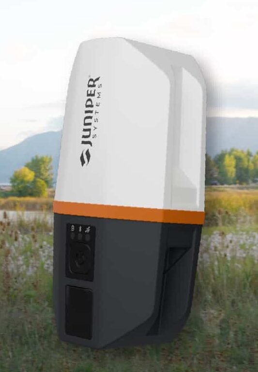
Juniper’s newest GNSS receiver, the Juniper Spire, is designed to simplify location data collection. With the Spire, users can achieve high-accuracy results with a light, compact design, one-button operation, and corrections services right out of the box.
Built for rugged environments and long workdays, it offers seamless integration with mobile devices and data collection apps, making it a reliable companion for all GIS and asset mapping applications.
It is designed for work in both remote areas and urban settings, and supports SBAS, Network RTK, and future correction services. Gather meter to centimeter-level data with our most forgiving antenna. With fast satellite acquisition, multi-constellation tracking, and extended battery life, it delivers consistent performance across a wide range of applications—from environmental monitoring to utility inspections.
Key features include:
Accuracy down to the 2cm range
Worldwide corrections with SBAS, RTK, and future compatibilities
SparkPNT has released the SparkPNT Facet FP, a high-precision GNSS receiver designed to deliver centimeter-level accuracy with a focus on long-term flexibility, ease of use, and open-source innovation.
Built for a rapidly evolving positioning landscape, the Facet FP combines multi-band, multi-constellation GNSS support with fully open-source firmware — giving users a platform that can adapt as technologies continue to advance. Built to last, all models are contained in a robust waterproof cast-aluminum housing, with an internal structure designed for compatibility with the company’s Flex system of GNSS modules.
This gives users the choice between three different modules, plus the choice of having tilt-compensation or not, offering six different options with a range of price-points, securities and accuracies for different needs and applications.
Other notable features include:
MFi Certification
LoRa radio with detachable antenna
Internal survey-grade L1/L2/L5/L6 GNSS antenna
IP-67 rated housing that blocks out dust, water and other environmental hazards
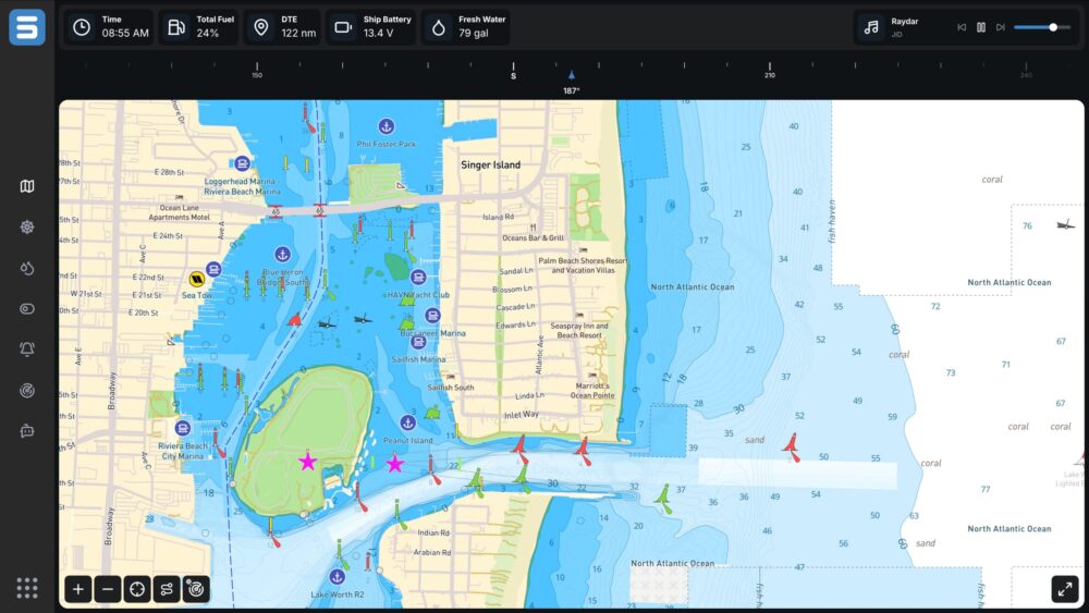
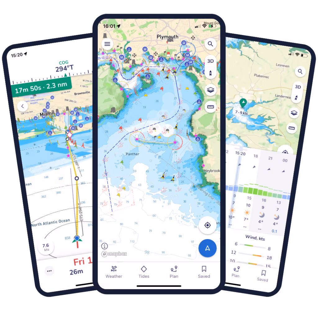
Marine technology company Savvy Navvy has partnered with Seaward Automation to integrate its full navigation solution to their Command vessel management system, completing a fully integrated helm experience for boaters worldwide.
Officially launching at the Palm Beach International Boat Show taking place March 25-29, the integration combines Seaward Automation’s innovative vessel system with Savvy Navvy’s intuitive, data-rich navigation charts.
The Command interface enables real-time control of critical vessel systems while consolidating multiple standalone displays into a single integrated helm experience. It is fully customizable for OEM integration or refit applications, ensuring a seamless fit for any vessel.
Credit: Savvy Navvy
In less than 18 months since launch, award-winning Savvy Integrated has quickly gained traction with marine manufacturers and boat builders looking for modern and flexible navigation solutions.
Seaward Automation specializes in advanced, logic-based automation solutions for sportfishing vessels and pleasure craft, as well as sailing yachts and commercial marine platforms. Its full vessel automation platform, Command, launched less than a year ago.
Savvy Navvy provides smart routing, giving users the optimal route and dynamic ETAs based on real-time data: departure time, chart information, weather conditions, tide, boat specifications and local regulations.
A live demo of Savvy Navvy on the Command platform will be available at the boatshow, Slip A215.