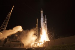
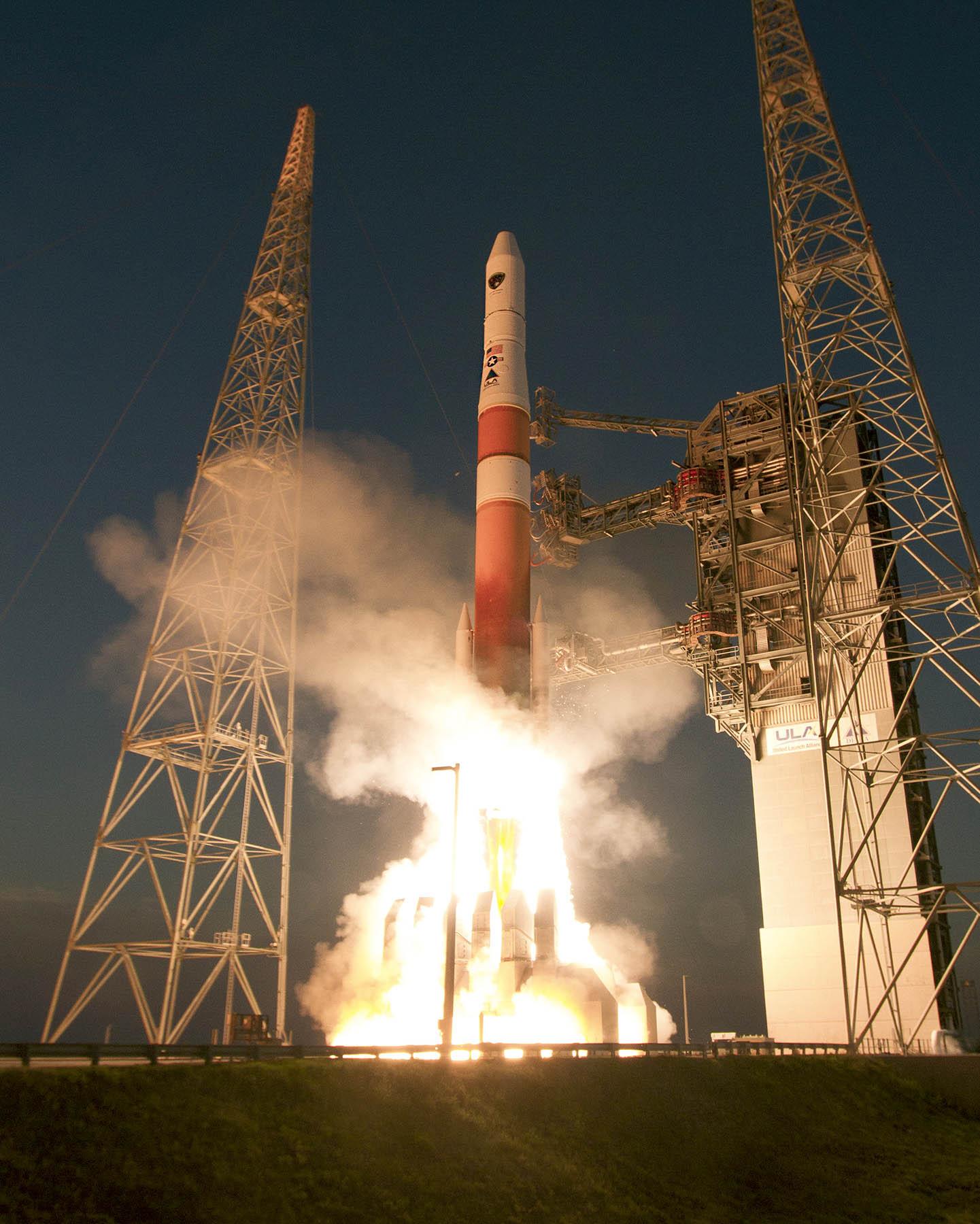
Lockheed Martin has received a potential $105 million firm-fixed-price task order from the U.S. Space Force’s Space Systems Command to supportGPS IIIF launch and on-orbit testing.
The award covers services related to the Architecture Evolution Plan (AEP) operational control system. This includes support for launch, early orbit operations and eventual disposal of GPS IIIF satellites (space vehicles SV11-22). The effort is part of ongoing work to sustain and manage next-generation positioning, navigation and timing capabilities for military users.
Work under the sole-source task order will take place in Colorado Springs, Colorado, through March 2030. The contract is managed by SSC’s satellite communication and PNT office at Peterson Space Force Base. SSC obligated $13.4 million from fiscal 2026 research, development, test and evaluation funds at the time of award.
Lockheed Martin’s previous contracts supporting the GPS IIIF program include a nine-year, $1.36 billion contract in 2018 to produce the 11th and 12th GPS IIIF satellites, and a $509.8 million contract modification for GPS IIIF space vehicles 21 and 22 granted in May 2025. SV-21 and SV-22 are expected to be delivered by November 2031.
Currently, 37 Global Positioning System satellites are on-orbit, with 29 of them set healthy. The system continues to provide an average 48-centimeter position accuracy. Despite this achievement, the U.S. government — specifically, the Space Force — continues to modernize GPS’s space, control and military user equipment segments.
Modernization of the space segment is centered on the GPS III satellites, which provide up to eight times better anti-jam capability and a new L1C signal to improve user connectivity. GPS IIIF satellites, scheduled for delivery starting in early 2026, will add a search-and-rescue payload, a fully digital navigation payload, and greatly enhanced anti-jam capability for military operations.
Modernization of the control segment is focused on the next-generation Operational Control System (OCX), scheduled to become operational early next year. OCX will sport an updated architecture to provide enhanced command-and-control capabilities and enhanced cybersecurity. Despite the pandemic, all 17 global OCX monitoring station installations were completed last summer, and most of the remaining equipment was fielded by the end of 2021.
Twenty-four GPS satellites are broadcasting the military code (M-code). The Modernized GPS User Equipment (MGUE) program is developing military GPS receivers able to take advantage of these signals to improve defenses against spoofing and jamming while allowing navigation warfare operations.
On the civil side, GPS modernization will play a key role in the development of the Next Generation Air Transportation System and intelligent transportation systems. The Department of Defense coordinates its GPS activities with the Department of Transportation (DOT), the Federal Aviation Administration (FAA) and many other federal departments and agencies via the National Executive Committee for Space-Based PNT. The term “space-based PNT” refers to GPS, GPS augmentations and other GNSS.
However, this government-wide coordination and cooperation is contradicted by the stand of the Federal Communications Commission (FCC) on the matter of Ligado Networks’ applications to modify its license for terrestrial service, which it approved in 2020. The FCC’s decision is opposed by the executive branch, represented by the National Telecommunications and Information Administration (NTIA), and by 14 federal agencies and departments individually (including the departments of Defense, Transportation, State, Treasury, Justice, Interior, Agriculture, Commerce, Energy and Homeland Security), as well as by the National PNT Advisory Board and by most GNSS receiver manufacturers and aviation organizations. NTIA took the unprecedented step of filing a still-pending petition for reconsideration with the FCC. The concern is that Ligado’s proposed transmission power exceeds the thresholds established by the DOT’s April 2018 GPS Adjacent Band Compatibility study to protect GPS users from harmful interference.
So, the list of threats to GPS now includes solar flares, spoofing, jamming, “legal jamming” by Ligado, and the Russian government’s recent threat to destroy GPS satellites. Modernizing GPS must proceed hand-in-hand with protecting it.
Russia’s military could target GPS and communication satellites as part of its war in Ukraine, reports Space News.
The news outlet cites U.S. National Reconnaissance Office (NRO) Director Christopher Scolese speaking Feb. 23 at the National Security Space Association’s Defense and Intelligence Space Conference.
“I think we’re seeing pretty clearly that Russia is committed to doing what they want to do in Ukraine, and they want to win,” Scolese said. “So I think it’s fair to assume that, to the extent that they can, and to the extent that they feel it won’t extend the conflict out of their control, that they will extend it into space.”
An attempt to disrupt the United States’ space ability could affect satellites of private operators as well, such as Maxar, which is distributing imagery of the conflict.
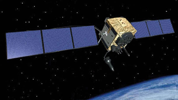
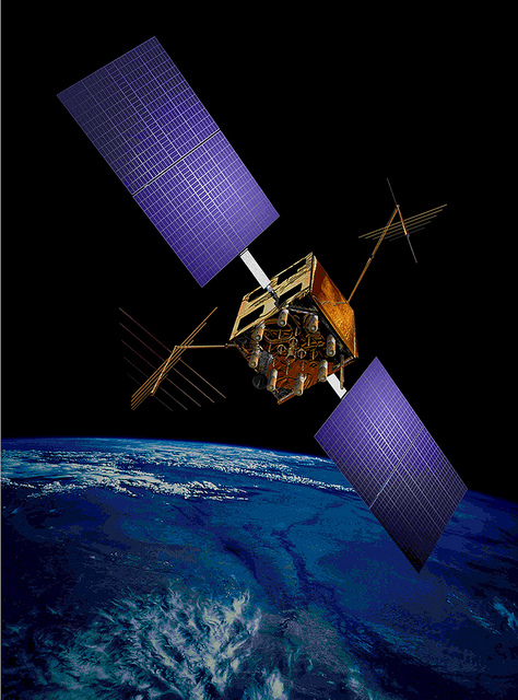
A next-generation GPS III satellite on orbit. (Artist’s Rendering: Lockheed Martin)
In mid-November, Russia destroyed a retired satellite with a ground-based anti-satellite (ASAT) weapon. This created significant debris, which endangered other assets in low-Earth orbit, including the International Space Station (ISS). Two Russian cosmonauts were serving on the seven-person ISS crew at the time.
Based on the ASAT demonstration and unclassified reports from the U.S. Director of National Intelligence, it is pretty clear that Russia can destroy all, or at least most, GPS satellites in one go.
What is less clear, is whether Russia would really do that.
To find out, Dana A. Goward spoke with George Beebe, who once served as the Central Intelligence Agency’s top analyst for Russia and Eastern Europe. He is now the director of programs at the Center for the National Interest, a center-right think tank.
Dana A. Goward: Russia’s threat to destroy GPS was made shortly after they destroyed an old satellite in space. What do you make of that demonstration, and all the dangerous debris it created?
George Beebe: Well, they were clearly sending a message — several messages, in fact. First, of course, that they have the ability to destroy satellites in space. This is part of a larger narrative they want to tell — that they are a world power which must be reckoned with. And it is no coincidence that this was done while they were amassing troops along Ukraine’s borders.
Another message is that they know the U.S. and Europe are very dependent on space, and we are vulnerable there.
DG: But the space debris will threaten satellites and people in low-Earth orbit for years to come. That seems to be reckless and counter to their own interest.
GB: While others see that as reckless and irresponsible, Russian officials almost certainly see it as an expression of resolve. That was actually another message. They were saying, “We are willing to endanger our own equipment and people.”
Translate that to their concern about keeping Ukraine from joining NATO and otherwise falling into the West’s sphere of influence. It might be, “We are willing to accept the pain in order to keep Ukraine from leaving our orbit.”
Unfortunately, I am not sure most Western leaders picked up on the “We are resolved” message.
DG: Attacking GPS would be a huge, devastating and dangerous move, though. How could things get so bad they would do that?
Beebe is the author of The Russia Trap. (Cover: Thomas Dunne Books)
GB: Russia sincerely believes it is generally threatened by the West, and specifically by NATO.
Since the fall of the Soviet Union, they have seen their global influence recede, and Western influence on their borders greatly expand. Some of their neighbors have joined NATO. Others, like Ukraine, have not, but would like to eventually come under the NATO umbrella. For the Kremlin, this is unacceptable. It is akin to what Soviet missiles in Cuba were for the United States.
Over the last decade and a half, Putin has rebuilt the Russian military. He is now looking to draw lines in the sand for the West to not cross.
At the same time, the West feels threatened by Russia. Hitler’s aggression and refusal to be appeased by territorial concessions is standard reading in every Western history class. American and European leaders feel compelled to hold the line and not give into what they see as Putin’s territorial ambitions.
This is a very dangerous situation as both sides see themselves acting defensively and the other acting aggressively.
DG: I guess it is much easier to justify something to yourself and your compatriots if you think you are only acting in self-defense.
GB: Exactly. The problem comes when one side does something in self-defense and, in response, the other side feels compelled to do something as well. This can spawn an escalating tit-for-tat that spirals out of control into a bigger conflict no one wants.
DG: The West is imposing economic sanctions. At least that is harder to interpret as aggressive.
GB: Before World War II, the U.S. imposed severe economic sanctions on Japan in response to its expansionist moves in Asia. The sanctions were so severe that they were crippling and threatened to bring down Japan’s military government. The week before Pearl Harbor, the Japanese delivered a diplomatic note to the United States saying the sanctions amounted to an act of war. So, economic sanctions are not always an absolutely safe route.
DG: Do you think Russia would ever really attack GPS? And how might that go down?
GB: It depends on how backed into a corner they feel. They certainly know that our military and our homeland are very dependent on GPS, and we have no real alternative in place. It doesn’t help that they are much less dependent on GLONASS and have an alternative for when signals from space are not available.
So, they can definitely do more harm to us than we can to them by interfering with navigation satellites.
It would take a lot to goad them into physically attacking GPS satellites. That would be an irreversible step they undoubtedly understand could lead to all-out war.
Far more likely would be a cyber-attack on the systems controlling the GPS constellation. Such an attack could be harder to attribute to them. It could also be reversed if they got what they wanted.
I could also see them jamming GPS and Galileo signals across Europe and the United States as part of an escalated conflict. Russian forces excel at electronic warfare, and the jamming could easily be turned off once they achieved their goals, or if things seemed to be getting out of hand.
Photo: Stanislav Ostranitsa/iStock/Getty Images Plus/Getty Images
19% of tracked space objects threaten GPS and other GNSS satellites. While there are many fewer objects in MEO than in LEO, the risk in the former is arguably greater because GPS is so critical to almost all of our technology.
The Risk
GNSS satellites, especially GPS satellites, are critical to the well-being and smooth functioning of economies and national security. This is especially true in Europe and the United States, which do not have complementary terrestrial systems able to provide vital positioning, navigation and timing (PNT) services when signals from space are not available.
While the probability of debris damage to GNSS in medium Earth orbit (MEO) is much less than for satellites in low Earth orbit (LEO), the consequences of such an event would be much, much higher. The loss of one satellite would be a concern; that of multiple satellites, a major problem. The unthinkable chaos, national security damage, and severe economic impacts to the $21 trillion U.S. GDP make the risk unacceptable.
For those who think we need not worry about the low probability of collisions at MEO, the Galileo collision avoidance maneuver in March 2021 should be a wakeup call. The problem is here. We need to act now.
Background
Much like a nuclear fission reaction, the problem of space debris starts small then grows exponentially, as each collision creates more pieces that, in turn, can collide with other objects.
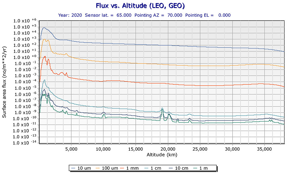
The MEO debris environment is 100 times less dense than the LEO. The spatial density of orbital debris in LEO (up to 2,000 km), shown in Figure 1, suggests that LEO is the likely location where a runaway chain reaction will initiate. This could easily result in a region of space so dangerous that it would effectively deny access to MEO, where the GPS constellation resides.
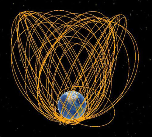
While the debris situation at MEO is much better, there are still 4,021 tracked debris objects that could impact GPS and other GNSS satellites. Because future orbital debris collisions in LEO will be responsible for more debris in MEO, the situation is guaranteed to get worse. The dead and debris objects in highly elliptical, or Molniya, orbits, shown in Figure 2, could be responsible for such collisions pushing LEO debris into MEO.
Contributions to the general MEO debris population come from launch systems and other factors. Early GPS satellites (Block II/IIA/IIR) used internal orbital-insertion motors to avoid leaving uncontrolled stages in the operational orbit range when moving from transfer orbit to MEO. For survivability reasons, they were also deployed with sufficient fuel to make several major orbital moves. Unfortunately, later versions used separate orbital-insertion stages, which were left drifting in the orbital neighborhood and carried less fuel, resulting in fewer possible maneuvers to avoid collisions.
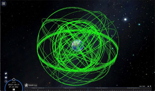
Using the CelesTrak visualization interface to extract space situational awareness data captured by the Combined Force Space Component Command’s 18th Space Control Squadron (18 SPCS) reveals a much more dire image of MEO. Of the 21,266 total tracked objects in Earth’s orbit, 157 are active GNSS satellites, as shown in Figure 3.
Figure 3. Active GNSS satellites. (Image: Celestrak)
However, a total of 4,021 objects reside or pass through MEO, which are either active (331), dead (668), debris (1,761), rocket bodies (1,100) or unknown (161) objects, as shown in this video.
These 4,021 objects represent 19% of the total number of tracked objects from the 18 SPCS space catalog. While the total 21,266 tracked objects is a far cry from the 100 million objects NASA’s Orbital Debris Program Office represents, one can imagine that a significant portion of untracked debris objects, under 10 cm in size, reside or pass through MEO as well. This is significant, according to NASA, which says that objects with a diameter of 1 cm to 10 cm are the most dangerous due to the lack of tracking data, which essentially makes them invisible.
False Sense of Security
The growing orbital-debris concern is a threat too big to ignore. Unfortunately, to date attempts to manage space traffic have amounted to passive measures, such as establishing policy, characterizing the environment, and creating orbital protection guidelines. Even the highly touted, $6 billion U.S. “Space Fence” is a passive measure that contributes nothing active to solve the problem. Not at all a “fence,” it is merely a way to detect the larger and more dangerous debris.
These efforts may, in all actuality, be counterproductive if they instill a false sense of security in the public and government leaders that the problem is being adequately addressed.
A Proactive Solution
Since 1978, the orbital debris population has been touted as our biggest space problem. It is important to do as much as we can with policies and procedures to keep the problem from getting worse faster. However, even if we humans were to completely resist our seemingly natural impulse to pollute everywhere we go, collisions with existing debris would continue to increase the number of dangerous objects in orbit.
Active debris removal (ADR) is the only solution. The sooner it begins, the safer we will all be. Like the oceans and cyberspace, orbital space suffers from the tragedy of the commons. Everyone wants to use it, but no one owns it. No one is responsible for ensuring it is cared for and maintained. As a result, user behavior is difficult to control, and the environment often suffers. Government action, presumably supporting the best interests of all users, is the default answer.
The proposed Space Debris Act of 2021 is a great start. It paves the way for persistent funding and creates an industry responsible for safeguarding humanity’s orbital infrastructure. It would introduce tax credits to incentivize non-government funding contributions and reduce the price of debris removal, so that satellite operators and the emerging space tourism industry can afford to clean up space where they plan to operate.
The bill is currently being presented by OrbitGuardians to members of Congress for sponsorship. Organizations wishing to support these efforts should contact Ken Eppens at OrbitGuardians at [email protected].
GPS/GNSS and other critical space assets are at an unacceptable level of risk from debris. It is time to safeguard orbital infrastructure to protect the interests of the United States and humanity’s future in space.
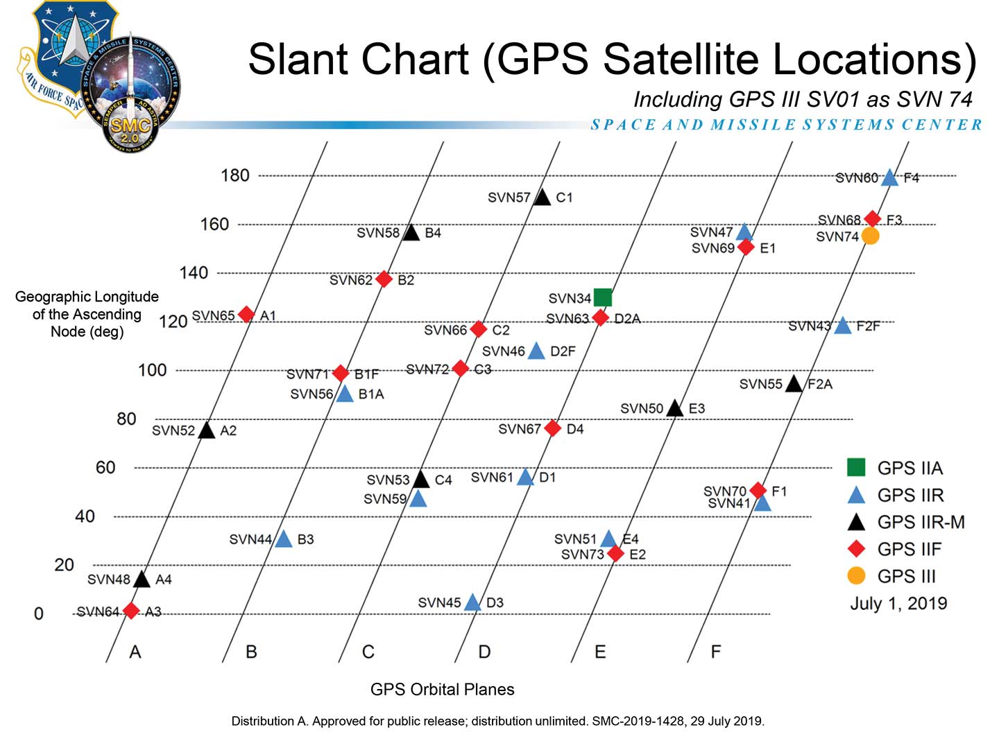
The GPS Directorate has approved a change to the Navstar GPS Control Segment to User Support Community Interfaces ICD-GPS-240 and ICD-GPS-870, reports the U.S. Coast Guard Navigation Center.
The change removes the GPS satellite plane/slot and clock information from the Operational Advisory message. SVN/PRN, block type and NANU details will continue to be included.
The change proposal was approved by the GPS Interface Control Working Group in December 2018.
A depiction of the GPS constellation of satellites with slot and plane designations has been published by the U.S. Coast Guard Navigation Center as an easy-to-read graphic for use by the GPS user community.
Chart: NAVCEN
The chart can be found on the NAVCEN Constellation Status page and will be updated with the commissioning of new GPS satellites or upon any change in the constellation.
The second Lockheed Martin GPS III satellite completes a test simulating a strenuous launch environment.
The launch is the most strenuous part of a satellite’s life. To survive the extreme sound wave pressure and pounding vibrations generated by more than 700,000 pounds of thundering rocket thrust, spacecraft need a solid, reliable design if they hope to arrive operational on orbit.
On July 13, Lockheed Martin’s second, fully assembled GPS III space vehicle (SV) completed a realistic simulation of its future launch experience and passed this critical acoustic environmental test with flying colors, the company said.
During acoustic testing, GPS III SV02 was blasted with deafening sound reaching 140 decibels in a specialized test chamber equipped with high-powered horns. (Photo: Lockheed Martin)
During acoustic testing, the GPS III SV02 satellite was continuously blasted with sound reaching 140 decibels in a specialized test chamber equipped with high-powered horns. For comparison, that is about as loud as an aircraft carrier deck and human hearing starts to be damaged back at about 85 decibels, the company said. The test uses sound loud enough to literally shake loose anything not properly attached.
“With this launch-simulation test, we are talking about sophisticated, advanced satellite technology and electronics enduring tremendous forces and then working flawlessly afterward,” said Mark Stewart, Lockheed Martin’s vice president for Navigation Systems. “Passing this test with GPS III SV02 further validates the robustness of our GPS III design. We credit this success and risk-retirement to all the pathfinding work we accomplished early in the program.”
The GPS III SV02 satellite is part of the U.S. Air Force’s next generation of GPS satellites and will bring critical new capabilities to the warfighter. GPS III will have three times better accuracy and up to eight times improved anti-jamming capabilities.
Spacecraft life will extend to 15 years, 25 percent longer than the newest GPS satellites on-orbit today. GPS III’s new L1C civil signal also will make it the first GPS satellite to be interoperable with other international global navigation satellite systems.
GPS III SV02 is Lockheed Martin’s second GPS III satellite to successfully complete acoustic testing. The company’s first satellite, GPS III SV01 — which is in storage awaiting its expected 2018 launch — completed acoustic testing in 2015.
The GPS III SV02 satellite is now being prepared for Thermal Vacuum (TVAC) testing this fall, where it will be subjected to extreme cold and heat in zero atmosphere, simulating its on-orbit life. The satellite is expected to be delivered complete to the Air Force in early 2018.
GPS III SV02 is the second of 10 GPS III satellites Lockheed Martin is contracted for and is assembling in full production at the company’s GPS III Processing Facility near Denver. The $128 million, state-of-the-art manufacturing factory includes a specialized cleanroom and testing chambers designed to streamline satellite production.
Lockheed Martin’s GPS III satellite design includes a flexible, modular architecture that allows for the insertion of new technology as it becomes available in the future or if the Air Force’s mission needs change. Satellites based off this design are already proven compatible with both the Air Force’s next generation Operational Control System (OCX) and the existing GPS constellation.
The U.S. Air Force’s fleet of GPS Block IIR and IIR-M satellites, manufactured by Lockheed Martin, have reached 200 collective years of operational life. The 20 satellites make up about two thirds of the current GPS constellation.
Originally launched between 1997 and 2009 to add capabilities to the GPS constellation and to replace other aging satellites, the 12 GPS IIR and eight IIR-M satellites have maintained an availability record of 99.96 percent, which represents only 10 minutes of down time per satellite during all their years of operation.
The 200-year milestone will be celebrated with a brief cake-cutting “ceremony” during ION GNSS, on Wednesday at 12:30 p.m., at the Lockheed Martin booth.
“This is a tremendous GPS operations and sustainment performance milestone, and we applaud the men and women of the Second Space Operations Squadron of the Air Force’s 50th Space Wing, as well as the industry team who support them,” said Mark Stewart, vice president for Lockheed Martin’s Navigation Systems mission area. “The world relies on GPS every day for things like synchronizing global banking and investing, shipping and transportation, search and rescue operations, ATM transactions and even precision farming.”
This spring, the IIR-M satellites played a major role in the continued modernization of the GPS constellation. To help manufacturers develop and test next-generation advanced civil GPS receivers, under the direction of Air Force Space Command and in collaboration with the Department of Transportation, these satellites began early broadcasting of test civilian navigation, or CNAV, messages on a new signal planned for all future satellites.
Making these milestones even more significant is the fact that the GPS IIR and IIR-M satellites were designed to last 7.5 years, or collectively about 150 years. All 12 IIR satellites are currently operating beyond their design life with the oldest operating for more than 16.5 years. Three of eight GPS IIR-M satellites have surpassed their expected life span and all satellites will have done so in 2017.
To meet evolving GPS user demands, Lockheed Martin is developing the next-generation GPS III satellites. These satellites will deliver three times better accuracy, provide up to eight times improved anti-jamming capabilities, and include enhancements which extend spacecraft life to 15 years, 25 percent longer than the newest Block IIF satellites. GPS III will be the first generation of GPS satellite with a new L1C civil signal designed to make it interoperable with other international GNSS.
Starting Friday, September 5, GPS satellite SVN-35 will resume transmitting L-band signals using PRN03, according to a Notice Advisory to Navstar Users (NANU) issued today.
According to GPS WorldAlmanac editor Richard Langley, the resumption is being done in an effort to determine the exact status of SVN-35’s remaining clock. However, the satellite will remain unusable as the Air Force conducts its tests.
Below is the full text of the NANU.
NOTICE ADVISORY TO NAVSTAR USERS (NANU) 2014069 NANU TYPE: GENERAL
*** GENERAL MESSAGE TO ALL GPS USERS ***
On approximately 05 Sep 2014 SVN35 will resume transmitting L-band utilizing PRN03. At L-band activation, SVN35/PRN03 will be unusable until further notice. Additionally, no broadcast almanacs will include SVN35/PRN03 until further notice.
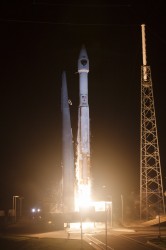
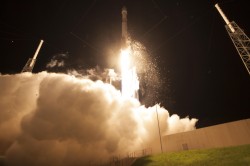
A United Launch Alliance (ULA) Atlas V rocket carrying the seventh GPS IIF satellite for the U.S. Air Force launched at 11:23 p.m. EDT Friday, August 1 (03:23 UTC, August 2), from Space Launch Complex-41 at Cape Canaveral, Florida.
GPS IIF-7 launches into orbit. (Photo credit: United Launch Alliance)
A United Launch Alliance (ULA) Atlas V rocket carrying the seventh GPS IIF satellite for the U.S. Air Force launched at 11:23 p.m. EDT Friday, August 1 (03:23 UTC, August 2), from Space Launch Complex-41 at Cape Canaveral, Florida.The Boeing-built satellite has sent the signals to controllers that confirm it is currently operating properly within the constellation.
Boeing and the Air Force will complete the full on-orbit checkout of the satellite in August. The GPS IIFs offer improved signal accuracy, better anti-jamming capability, longer design life and the new civilian L5 signal.
“We are providing our Air Force partner and GPS users with a steady supply of advanced GPS IIFs,” said Craig Cooning, president of Boeing Network & Space Systems. “Our robust launch tempo requires vigilance and attention to detail, and mission success is our top priority. We continue to partner with the Air Force and ULA to effectively execute the launch schedule.”
GPS IIF-7 is the seventh of 12 such satellites Boeing has built for the U.S. Air Force, and the third on-orbit delivery this year. GPS IIF-8, slated for launch during the fourth quarter, arrived at Cape Canaveral on July 16 to undergo final launch preparations. GPS IIF-7 will join a worldwide timing and navigation system utilizing 24 satellites in six different planes, with a minimum of four satellites per plane positioned in orbit approximately 11,000 miles above the Earth’s surface.
“Congratulations to the U.S. Air Force and all of our mission partners on the successful launch of the Atlas V carrying the GPS IIF-7 satellite,” said Jim Sponnick, ULA vice president, Atlas and Delta Programs. “ULA launch vehicles have delivered all of the current generation of GPS satellites, which are providing ever-improving capabilities for users around the world.”
This mission was launched aboard an Atlas V Evolved Expendable Launch Vehicle (EELV) 401 configuration vehicle, which includes a 4-meter-diameter payload fairing. The Atlas booster for this mission was powered by the RD AMROSS RD-180 engine, and the Centaur upper stage was powered by a single Aerojet Rocketdyne RL10A engine.
The EELV program was established by the United States Air Force to provide assured access to space for Department of Defense and other government payloads. The commercially developed EELV program supports the full range of government mission requirements, while delivering on schedule and providing significant cost savings over the heritage launch systems.
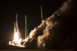
GPS IIF-7 launches into orbit. (Photo credit: United Launch Alliance)
According to Innovation editor Richard Langley, it appears that the satellite will be assigned PRN09, currently unused by the constellation.
The Initial NORAD 2-line element set indicates that the satellite has been launched into the F plane and is drifting towards its assigned orbital slot:
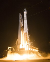
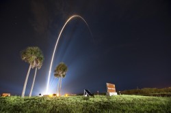
The GPS IIF-6 satellite was launched May 16. Photo credit: United Launch Alliance.
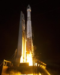
The Air Force is set to launch the seventh GPS IIF satellite this Friday.
An Atlas V 401 will launch the GPS IIF-7 mission for the U.S. Air Force on Friday, August 1, from Space Launch Complex (SLC)-41 at Cape Canaveral Air Force Station, Florida. The 18-minute launch window opens at 11:23 p.m. EDT.
A live webcast of the launch will begin at 11:03 p.m. EDT. To keep up to speed with updates to the launch countdown, dial the ULA launch hotline at 1-877-852-4321 or join the Facebook conversation and follow UA on Twitter using the hashtag #GPSIIF7.
GPS IIF-7 is one of the next-generation GPS satellites, incorporating various improvements to provide greater accuracy, increased signals, and enhanced performance for users.
The Air Force Second Space Operations Squadron indicates that IIF-7, SVN-68/PRN-3, will replace SVN-43 in the F plane slot 3 (F3). SVN-43 will be re-phased from F3 to the F2F slot to replace SVN-26. SVN-33 will be taken out of the operational constellation the day after SVN-68 launch and sent to Launch, Anomaly and Disposal Operations (LADO).
SVN-33 was launched on April 9, 1996, successfully serving over 17.5 years, 10.5 years beyond its design life. SVN-26 will back-up SVN-43 once it completes its re-phase journey.