Tag: IFEN GmbH

  • Faux signals for real results: IFEN

    Faux signals for real results: IFEN

    An exclusive interview with Jürgen Pielmeier, managing director, IFEN. For more exclusive interviews from this cover story, click here.


    In which markets and/or applications do you specialize?

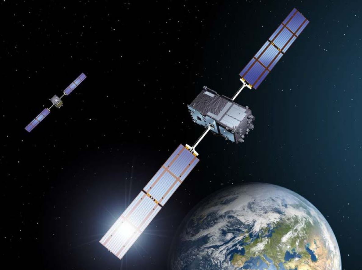
    IFEN is offering RF simulation solutions for all GNSS markets, except the defense market with encrypted signals. The major market in recent years was the ‘New Space’ market, mainly focused to design and test PNT navigation solutions as part of (primarily) LEO satellite constellations using existing GNSS systems. With the many new players around the world, there are many market opportunities. To be successful in this ‘New Space’ market requires simulation support of all GNSS systems and signals, modelling LEO dynamics and environment and providing multiple RF-outputs (enabling systems with several GNSS antennas located on the satellite). With our latest ‘NCS NOVA+’ RF simulator, support of up to 4 RF-antenna simulations is possible. From basic RF system up to integrated SIL and HIL systems, the level of required solutions is very diverse by the different applications. The IFEN RF simulator is also offering a full ‘radio occultation’ simulation capability specifically for this market.

    The second important market is the automotive/maritime PNT market requiring fully integrated HIL simulation solutions. Excellent integration capability into external environment simulation systems with a rich set of interfaces and short latencies are keys for this market. To further penetrate this market, IFEN will implement some major enhancements during this and next year within its RF simulator products.

    How has the need for simulation changed in the past five years, with the completion of the BeiDou and Galileo GNSS constellations, the rise in jamming and spoofing threats, the sharp increase in corrections services, and the advent of new LEO-based PNT services?

    Today, supporting all existing GNSS systems with all related signal components on all frequencies is a must have for all high-end RF simulators. Keeping the RF simulators up-to-date with the new and continuously evolving GNSS signals is required to be sustainably competitive. Specifically, beyond the L-band signals, we are also fully supporting the S-band signals of the NavIC constellation. The continuously increasing number of available GNSS satellites and signals requires that the RF simulator capabilities are fully scalable to provide sufficient resources to simulate all signal channels. Our new NCS NOVA+ simulator is our first RF simulator with strong scalability capabilities, to be further extended in the coming years.

    In recent years, adding support for the simulation of jamming and spoofing threats was a major driver for the market. Our latest RF simulator generation ‘NCS NOVA+’ is fully supporting all types of jamming and spoofing, fully integrated into our RF simulators to enable coherent signal generation. With the coming ‘DFMC’ (SBAS/GBAS dual-frequency multi-constellation) based safety-of-life and automated driving applications, the need to support advanced jamming and spoofing simulation solutions will be a continuous driver also for the future.

    Adding the ‘High Accuracy Service’ (HAS) PPP-correction capability on Galileo E6-B signal in our coming V2.9 release is driven by the increased request for PPP corrections services. We expect further improvements here in the coming years, especially to cover the emerging PPP-RTK market needs.

    With the coming age of LEO-PNT services, this is the most important driver for the next five years, extending the signal frequencies beyond the current L- and S-band signals, seeing new modulations, two-way transfer and many more topics. This will require strong development efforts on the RF simulator side, to provide suited RF test tools in time to LEO-PNT system designers and developers, but also the related user terminal developers. IFEN is currently preparing to take this next major step in its RF simulator capability portfolio.

    In particular, regarding some of the new PNT services being developed, how do you simulate them realistically without the benefit of recordings of live sky signals?

    Facing the lack of live sky signals when developing RF simulator capabilities is a continuous challenge. It requires to a certain signal simulation flexibility designed into the receiver, good and theoretical understanding of specific implications of new designed signals. As soon as real signals are then available, simulation and real signals will be compared and if required the simulation fidelity will be adjusted to meet the real signals.

    Are accuracy requirements for simulation increasing, to enable emerging applications?
    Concerning the core accuracy parameters requested in recent years, we saw no increase in required accuracy, as the typical requested accuracy are anyway far beyond the real signals accuracy.

    Are all your simulators for use in the lab or are some for use in the field? If the latter, for what applications and how do they differ from the ones in the lab? (For starters, I assume that they are smaller, lighter, and less power-hungry…)

    Currently all our simulators are designed for usage within the laboratory. However, we recognize an increased request for in-field capable RF simulators, specifically to perform spoofing of real SIS to test deployed GNSS receivers in the field. Offering a portable in-field solution is in the mid-term planning, but not a current driver for our developments.

    What are some of your recent successes?

    The most important recent success is the Galileo 2nd generation Test User Receiver contract from the European Space Agency. Within this contract, the ‘NCS NOVA+’ simulator as RF test tool will be upgraded to full G2G signal generation capability. The new already implemented G2G signals enabling shorter TTFF, improved acquisition performance but also higher updates rates (e.g. for PPP-RTK). Up to end of the year the G2G signal will be fully implemented in our RF simulator, including the next generation of advanced authentication solutions.

  • Online Exclusive: Faux Signals for Real Results

    Online Exclusive: Faux Signals for Real Results

    Image: Safran Federal Systems (formerly Orolia Defense & Security)
    Image: Safran Federal Systems (formerly Orolia Defense & Security)

    As the number of constellations, satellites, and signals has grown in recent years — especially in the past few years, with the completion of the BeiDou and Galileo constellations — simulator manufacturers have been challenged to keep up. Threats of jamming and spoofing also increased. Then, a few companies began to develop new positioning, navigation and timing (PNT) constellations in low-Earth orbit (LEO).

    For the August 2023 cover story, I discussed these challenges and the prospect for the simulation industry with representatives of six companies: Safran Federal Systems (formerly Orolia Defense & Security), Racelogic, CAST Navigation, IFEN, Spirent Communications and Spirent Federal Systems.

    Due to the limited space available in print, I was able to use only used a small portion of the interviews I conducted for our August cover story. For full transcripts of them see below:

    • Full interview with Tim Erbes, Technical Director, Safran Federal Systems (formerly Orolia Defense & Security).
    • Full interview with Julian Thomas, Managing Director, Racelogic.
    • Full interview with Jürgen Pielmeier, Managing Director, IFEN.
    • Full interview with Mark Holbrow, VP of Product Development, Spirent Communications and Roger Hart, Sr. Director of Engineering, Spirent Federal Systems.
  • IFEN releases new NCS Nova RF signal simulator

    IFEN releases new NCS Nova RF signal simulator

    Release V2.8 provides advanced interference, spoofing, encryption and authentication simulation capability

    Photo: IFEN
    Photo: IFEN

    IFEN GmbH has released a new version of its NCS Nova RF signal simulator, offering a full package of advanced simulation capabilities.

    With its now-integrated interference generation capability (AWGN, CW, pulsed and chirp), NCS Nova version 2.8 can generate coherent interference signals with a signal power of up to –30 dBm.

    The ability to assign two users to one RF output enables integrated spoofing scenarios with a single RF output (one user is the original simulated user; the other is the target spoofing user). Thus, spoofing is available even with an entry-level single RF Nova.

    The key feature of this new release is the new navigation message authentication (NMA) simulation capability, compliant to User ICD 1.0 for the Galileo E1-B OSNMA. Beyond basic authentication-testing capability, specific OSNMA events can be simulated. Testing OSNMA-enabled receivers under these specific events is key to ensuring compliant receiver behavior. The supported events include both a public key renewal and revocation and TESLA keychain renewal and revocation. Also, GPS cross-authentication is fully supported.

    Finally, the new release fully supports generation of Galileo E6-C encrypted codes. This enables users to take full advantage of the Galileo third-frequency pilot signal.

  • Launchpad: GPS chips, drones, mapping software

    Launchpad: GPS chips, drones, mapping software

    A roundup of recent products in the GNSS and inertial positioning industry from the May 2021 issue of GPS World magazine.


    OEM

    GNSS/LTE Antenna

    Low profile for covert installations

    Photo: Maxtena
    Photo: Maxtena

    The MEA-GNSS-LTE-MM is a two-in-one low-profile antenna solution that combines GNSS and LTE antennas in one. It is suitable for asset tracking as well as industrial and internet of things (IoT) applications. The antenna offers an ultra-low profile rugged IP67-rated design with a magnet mounting and customizable cables and connector options. The small size makes it a desirable solution for covert installations.

    Maxtena, maxtena.com

    Enhanced Simulator

    Supports Galileo OS SIS ICD V2.0

    Photo: IFEN
    Photo: IFEN

    The NCS Nova GNSS simulator now fully supports the simulation of Galileo Open Service (OS) signal improvements based on the new Galileo OS SIS ICD V2.0. The NCS Nova GNSS simulator is a high-end, powerful and easy-to-use satellite navigation testing and R&D device, the company said. It is fully capable of multi-constellation and multi-frequency simulations for a wide range of GNSS applications. It provides multiple GNSS frequencies in one box. A key enhancement to the NCS Nova GNSS simulator is comprehensive support of new Galileo OS signal message improvements on E1B. By enabling real-time simulation of the Galileo OS message improvements, the NCS Nova GNSS Simulator expands the user’s Galileo signal capability.

    IFEN GmbH, www.ifen.com

    Time Server

    Defends against GPS jamming, spoofing

    Photo: Microchip
    Photo: Microchip

    The SyncServer S600 Series network time server and instrument is now integrated with BlueSky technology signal-anomaly detection software. With the upgrade, the SyncServer S600 Series now provides GPS jamming and spoofing detection and protection, in combination with local radio-frequency data-logging and analysis. The Stratum 1 instrument continuously monitors local GPS constellation health and examines GPS and local RF signal integrity to assure validity. If an anomaly is detected, the solution sends an alarm and, if necessary, the SyncServer instrument can be shifted to alternative time sources or an internal oscillator. This protects ongoing timing outputs while ensuring only minimal, predictable timing degradation to vital network and business operations in applications ranging from banking and stock trading to electric utilities and aerospace and defense.

    Microchip Technology, microchip.com

    L1+L5 receiver

    Provides fast updates, multipath resistance

    Photo: Telit
    Photo: Telit

    The SE868SY-D is a multi-frequency, high-precision GNSS receiver module for applications that require high accuracy, fast updates, multi-constellation support and multipath resistance. At 11 x 11 mm, the SE868SY-D accommodates ultra-compact devices and internet of things (IoT) trackers. Available now, the high-precision SE868SY-D module is Telit’s first multi-frequency, multi-constellation GNSS receiver module, featuring an ultra-sensitive -167 dBm (tracking) RF front end. By using both the L1 and L5 bands, the SE868SY-D supplies a higher location accuracy than single-frequency devices, even in high-multipath environments such as urban canyons.

    Telit, telit.com

    Miniature Cellular Module

    Photo: u-blox
    Photo: u-blox

    Optimized for power-sensitive devices

    The ALEX-R5 miniature cellular module integrates low-power wide-area connectivity and GNSS technology into an ultra-small system-in-package (SiP) form factor. It is based on the secure UBX-R5 LTE-M/NB-IoT chipset platform with out-of-the-box Secure Cloud functionality and the u‑blox M8 GNSS chip for location accuracy. It has a 14 × 14-mm footprint and 23-dBm cellular transmission power, enabling devices to operate effectively in all signal conditions. A dedicated GNSS antenna interface enables independent, simultaneous operation of the u‑blox M8 GNSS chip. The ALEX-R5 is suitable for wearables and connected medical devices.

    u-blox, u-blox.com


    SURVEYING & MAPPING

    Data controller

    Features 5-inch brightly lit, anti-glare screen

    The Trimble TSC5 Controller with the Siteworks SE Starter Edition. (Photo: Trimble)
    Photo: Trimble

    The TSC5 is a rugged, lightweight field data controller for land construction and surveying. Its backlit alphanumeric keypad is usable while wearing gloves. The battery provides all-day power on a single charge, with an optional external battery nearly doubling the power for extended use. It has a lightweight, ergonomic design and is suitable for rugged environments, with resistance to shock, dust and water. Running on the Android 10 operating system, the TSC5 is fully integrated with Trimble Access 2021 Field Software and Siteworks Software as well as Trimble Forensics Capture. The EM100 Empower module provides GNSS connectivity.

    Trimble, trimble.com

    Data management platform

    Based in the cloud

    Image: NV5 Geospatial
    Image: NV5 Geospatial

    INSITE is a comprehensive cloud-based platform that enables users to more efficiently manage geospatial data, from acquisition to delivery. With applications designed for electric utilities, telecommunications and governments, INSITE provides tools to support the entire geospatial data lifecycle — project tracking, data collection and delivery, quality control, on-demand reporting, analytics and enterprise integration. INSITE enables users to import, search, analyze, manage, integrate and export all types of geospatial data and multimedia. As a cloud-based platform, INSITE improves speed and efficiency, minimizes storage expenses and supports greater collaboration.

    NV5 Geospatial, www.nv5.com


    TRANSPORTATION

    Fleet Monitoring

    Detects risky driver behaviors

    Photo: Geotab
    Photo: Geotab

    The Surfsight AI-12 camera solution is designed to help improve fleet safety through its continuous recording and advanced machine vision (MV) and artificial intelligence (AI) technology. Offered by Lytx, it integrates with Geotab’s telematics platform to provide fleets with insight into driver behavior through a combination of MV+AI, sensors, and live video streaming. The Surfsight AI-12 provides distracted driving detection, audio and visual alerts and the ability to connect auxiliary cameras. Its MV+AI technology can help identify risky driving behaviors including smoking, eating and drinking, handheld device use, unbelted driver and distracted driver. When connected with Geotab’s GO9 device, it can also capture video evidence of sudden acceleration, sharp turns and harsh braking. Through access to these insights, fleet managers can help prevent avoidable accidents and reduce the likelihood of driver or pedestrian injury, insurance claims, maintenance costs and downtime.

    Surfsight, surfsight.com

    Geotab, www.geotab.com

    Edge Subsystem

    Suitable for rolling stock, automotive and heavy-duty applications

    Photo: Eurotech
    Photo: Eurotech

    The BoltGPU 10-31 is a GPU-accelerated subsystem for machine vision and artificial intelligence (AI) applications at the edge and on vehicles. The BoltGPU 10-31 provides multi-constellation GNSS with untethered dead reckoning for geolocation. A factory option for high-precision real-time kinematic (RTK) GNSS is available. It also has Wi-Fi 6, Bluetooth 5.1 and option for LTE cellular. It is powered by NVIDIA Jetson Xavier NX and combines a 6-core, high-performance ARM CPU with a 384-core GPU and 48 Tensor Cores, offering power efficiency and accelerated computing. The rugged, fanless unit allows for simultaneous execution of neural models and the processing of multiple high-resolution, high-frame-rate sensors, even in harsh environments.

    Eurotech, eurotech.com

    Map system add-on

    High-frequency change management for map platforms

    Screenshot: Carmera
    Screenshot: Carmera

    Carmera’s Change-as-a-Service (CaaS) uses consumer-grade cameras from its fleet partners and customer vehicles to detect and log changes, reducing the cost of map maintenance. With a network of commercial fleet–mounted visual probes, it overcomes the problem of GPS canyons in urban areas using a blended algorithm to localize its auto-based probes with pinpoint accuracy. CaaS is designed to be an add-on to existing map systems (both HD and SD), and will identify, analyze and localize both road inventory changes and traffic-impacting events, such as construction. A live sandbox has launched in the San Francisco-Silicon Valley area for companies to test the CaaS technology on real urban and suburban streets.

    Carmera, carmera.com

    Parking Assist

    Indoor mapping for autonomous vehicles

    Parkopedia is designed to address challenges in navigating indoor parking facilities: system blackouts, finding a vehicle within large parking facilities, and locating services such as EV charging stations. Parkopedia provides indoor maps based on high-definition 3D models of indoor parking facilities for in-vehicle navigation. Parkopedia technology can also be used for automated valet parking. Its proprietary SLAM system integrates lidar, IMU, GNSS and high-resolution imagery.

    Parkopedia, business.parkopedia.com

    Marine navigator

    Optimized for power-sensitive devices

    Photo: Veratron
    Photo: Veratron

    The Acqualink NavSensor can be used with any multifunction N2K-networked multifunction display. Its GPS receiver module provides position, speed and vector data, and UTC time. The inertial sensor delivers pitch and roll data. An integrated fluxgate compass with a +/- 40° tilt angle delivers course heading and the information needed by a networked autopilot to stay on course. Built-in barometer and air temperature sensors offer indicators of impending weather changes. The radome has an IPX6 extended protection rating. It is powered by the NMEA network and operates between –4° and 158° F.

    Veratron, veratron.com


    UAV

    Tactical UAV

    Field testing for USMC this year

    Photo: Periscope Aviation
    Photo: Periscope Aviation

    The Periscope tactical-grade UAV provides efficiencies in flight time, endurance and payload capacity. Designed for military and other federal government customers, the high-performance UAVs accomplish mission-critical tasks with speeds of up to 100 mph. They are optimized for specific mission requirements including tactical resupply, remote communications, and enhanced C4ISR. In September, Periscope Aviation won a contract to deliver prototype Tactical Resupply Unmanned Aircraft Systems (TRUAS), which the U.S. Marine Corps will field test at Yuma Proving Grounds this year. The UAVs will fly 60–90 pounds of cargo to locations 10–20 kilometers away, delivering supplies such as food, water, fuel and ammunition to marines on the front line.

    Periscope Aviation, www.chartisfed.com/periscope-aviation

    VTOL drone

    Uses a closed hardware and software system

    Photo: Fixar
    Photo: Fixar

    The Fixar 007 is a vertical takeoff and landing commercial drone with primary application in the mapping and surveying, monitoring, mining, oil and gas, energy and agricultural sectors. The intuitive approach to working with its ground control station simplifies use (flight preparation is estimated to take only 5 minutes). With inertial orientation, the Fixar 007 can work stably under magnetic anomalies and in the event of satellite loss. A wide range of modifications is available. The Fixar 007 uses a closed, specially designed hardware and software system that guarantees security of information. The applications and UAV use a special communication protocol that eliminates control interception.

    Fixar, fixar.pro

    Caged drone

    For industrial inspections, first response

    Photo: Skypersonic
    Photo: Skypersonic

    Skycopter is a ready-to-fly UAV designed to work in extreme conditions and tight spaces. The drone is enclosed and protected by an external ultra-light and ultra-resistant cage to ensure safety and avoid damage to inspected structures and to the airframe itself. The Skycopter‘s tiltable camera can record 1920 x 1080 video at 60 FPS while sending latency-free images to the ground in 5.8 GHz for first-person view on a display or (optional) high-definition goggles. It uses an ultra-bright LED system for applications in complete darkness. The Skyloc real-time location and monitoring system provides control and tracking with high accuracy in indoor scenarios or where GPS is not available.

    Skypersonic, skypersonic.net

  • IFEN enhances its NCS Nova GNSS simulator for Galileo OS

    IFEN enhances its NCS Nova GNSS simulator for Galileo OS

    New Galileo OS SIS ICD V2.0 is now fully supported by IFEN’s NCS Nova GNSS simulator

    Photo: IFEN
    Photo: IFEN

    IFEN GmbH, a manufacturer of GNSS navigation test products and services, announced that its NCS Nova GNSS simulator now fully supports the simulation of Galileo Open Service (OS) signal improvements based on the new Galileo OS SIS ICD V2.0.

    The NCS Nova GNSS simulator is a high-end, powerful and easy-to-use satellite navigation testing and R&D device. It is fully capable of multi-constellation and multi-frequency simulations for a wide range of GNSS applications. It provides multiple GNSS frequencies in one box.

    A key enhancement to the NCS Nova GNSS simulator is comprehensive support of new Galileo OS signal message improvements on E1B. By enabling real-time simulation of the Galileo OS message improvements, the NCS Nova GNSS Simulator expands the user’s Galileo signal capability.

    The NCS Nova GNSS simulator will, in future, also fully support the new Galileo E1B OS-Navigation Message Authentication (OS-NMA) and Galileo E6B High Accuracy Service (HAS) capabilities.

    The GNSS simulator enhancements were developed through ESA’s Navigation Innovation and Support Programme (NAIVSP) Element 2, within the project STX2G.

    “Through a simple software update, NCS Nova GNSS Simulator customers can automatically generate the new Galileo signal capabilities,” said Günter Heinrichs, head of Client Solutions at IFEN. “Adding Galileo OS signal improvement support to our NCS Nova GNSS simulator comes at the perfect time given the recent release of the Galileo OS SIS ICD V2.0 specification.”

  • IFEN offers cost-effective NCS TITAN GNSS simulator

    IFEN GmbH’s Titan GNSS simulator has up to 256 channels (and 1024 multipath channels) and up to 4 RF outputs per chassis, providing flexibility and outstanding performance, according to IFEN.

    The extra complexity and cost of using multiple signal generators is avoided, improving reliability without compromising on functionality, IFEN said in a news release.

    The innovative design of the NCS Titan allows users configure channels for any GNSS signals and allocate those channels to any of the RF outputs fitted. This flexibility enables the same simulator hardware to be used for an extensive range of tests, for all types of GNSS applications.

    The NCS Titan GNSS simulator by IFEN.
    The NCS Titan GNSS simulator by IFEN.

    The NCS Titan sets new standards in the field of GNSS Simulation, in terms of fidelity, accuracy, dynamics, iteration rates and reliability, the company said.

    “The launch of our brand new NCS Titan GNSS Simulator represents another milestone for our NCS GNSS simulator products,” explained Günter Heinrichs, head of customer applications at IFEN. “This shows clearly once again our commitment to ongoing product enhancement and dedication to providing our customers with best GNSS test equipment on the market.”

    The NCS TITAN GNSS Simulator has been developed in cooperation with WORK Microwave GmbH, Germany.

  • 2016 Simulator Buyers Guide

    2016 Simulator Buyers Guide

    Cast Navigation IFEN
    GmbH
    Racelogic Skydel Spectracom Spirent Federal Systems

    Cast Navigation

    CAST-3000: Complete GPS/INS Integration Testing

    Photo: Cast Navigation CAST-3000: Complete GPS/INS Integration TestingCAST GNSS/INS simulators generate high-fidelity GNSS RF signals along with the coherent digital inertial signals that allow for the precise stimulation of the next generation of GNSS/INS navigation equipment. CAST’s GNSS/INS systems provide the highly precise system performance that is required to aid in the integration and testing of the next-generation of GNSS navigation system technologies. The 35-year-old company’s business focus is supplying GNSS/INS simulators, GNSS/INS test equipment, and GPS/INS support services to government and military avionics laboratories, prime contractors, GNSS receiver manufacturers and system integrators.

    The CAST-3000 fully supports integration testing of GPS/INS navigation systems where the inertial sensor and GPS receiver are either tightly or ultra-tightly coupled. The CAST-3000 produces GPS RF signals coincident with simulated IMU sensor data that provide dynamic testing in the laboratory environment for military and government applications. CAST has worked closely with both Honeywell and Northrop Grumman over the past two decades in the development of the CAST-3000, which

      • provides strapdown IMU measurement data synchronized with GPS RF data to the navigation system under test.
      • contains a mature avionic sensor simulation Barometric Altimeter model.
      • includes high rate inertial measurements with very high degree of fidelity to support testing of high-performance coupled systems.
      • simulates sensors to provide the necessary fully coordinated, dynamic vertical channel aiding needed to maintain Kalman filter stability of the navigation system.
      • includes years of development and refinement of the precise GPS/INS synchronization capability needed for simulation of aircraft dynamics.
      • includes a complete 6-DOF motion generation capability.

    www.castnav.com
    phone: 978 858-0130
    email: [email protected]

    Ifen GmbH

    NavX-NCS Professional GNSS Simulator
    NavX-NCS Essential GNSS Simulator

    IFEN-NavX-NCSThe flexibility of the NavX-NCS Professional GNSS Simulator allows it to be configured with up to 108 channels and all of the following signals:

    • GPS L1/L2/L5 C/A and P-code and L2C
    • GLONASS G1/G2 standard and high-accuracy codes
    • Galileo E1/E5/E6 (BOC/CBOC/AltBOC)
    • BeiDou B1/B2/B3
    • SBAS L1/L5 (WAAS, EGNOS, MSAS, GAGAN, SDCM)
    • IRNSS L5/S-band
    • QZSS L1 and L1-SAIF
    • IMES

    The user can assign signals freely to any of the RF modules fitted to the simulator. This allows the same hardware to be used in a range of different configurations.

    Signals can be added by software license with no need to return the hardware for upgrade.

    Up to four independent RF outputs can be fitted, enabling the user to simulate multiple antenna locations simultaneously (allowing simulation of multiple antennas on one vehicle, multiple vehicles simultaneously, a mixture of static locations and mobile vehicles, and multiple antenna elements for Controlled Reception Pattern Antenna [CRPA] testing).

    The comprehensive and easy-to-use Control Center operating software allows the operator to quickly create realistic test scenarios for effective testing of user equipment.

    IFEN also offers the NavX-NCS Essential GNSS Simulator, which is available with 21 or 42 channels and is capable of simulating GPS L1 (including SBAS L1), GLONASS G1, Galileo E1, BeiDou B1, QZSS L1 and IMES. The simulator is also supplied with Control Center operating software for comprehensive scenario generation.

    www.ifen.com
    For USA and Canada:
    Mark Wilson
    phone: 951-739-7331
    email: [email protected]
    For Rest of World:
    Dr. Guenter Heinrichs
    phone: +49-8121-2238-20
    email: [email protected]

    Racelogic

    LabSat 3 and LabSat Real-Time

    Photo: Racelogic LabSat 3 and LabSat Real-TimeLabSat 3 from Racelogic is a low cost, stand-alone, battery-powered, multi-constellation, RF record and replay device, designed to assist GNSS engineers in the development and testing of their products. By capturing live-sky RF signals, it enables repeatable and realistic testing to be carried out under controlled conditions, and is available as a record and replay, or replay only version; either one, two or three constellation types generate a single, dual or triple constellation file.

    With standalone operation, LabSat 3 can be used in any outdoor location to create real-world scenarios for eventual replay back in the lab. As well as being able to simultaneously record or replay GPS, GLONASS, BeiDou, QZSS, Galileo and SBAS signals, it can log CAN bus, serial or digital data, embedded alongside the satellite information. This additional information can then be replayed alongside the GNSS output, with synchronization to within 60 nanoseconds. A 1 PPS signal can also be generated using the internal GPS receiver.
    LabSat 3 can be used as a replay system out of the box with a set of 60 pre-recorded scenarios supplied as part of the package, recorded from various locations around the globe.

    Additionally, SatGen software allows for scenario generation of user-defined trajectories, with precise control over velocity, heading, height and constellation profiles, giving the test engineer the ability to develop their product using simulations that would be difficult or impossible to record due to geographic location or safety constraints. NMEA and KML imports are supported.

    New for 2016 is LabSat Real-Time, which allows for bench testing of GNSS devices where a current time stamp is required. SatGen V3 PC software generates a live signal stream to a LabSat RT unit which up converts the RF data from digital to analogue with less than one second latency. LabSat RT operates on any two of the three constellations of GPS, GLONASS and BeiDou.

    www.labsat.co.uk
    phone: +44 (0)1280 823803

    Skydel

    SDX: Software-Defined GNSS Simulator
    Software-Defined Innovation

    Photo: Skydel SDX: Software-Defined GNSS Simulator Software-Defined InnovationSkydel brings a new generation of GNSS simulators to the market. With the SDX simulator, signals are modulated by the graphics processing unit (GPU) as opposed to dedicated FPGAs found in traditional simulators. This allows new possibilities, such as adding signals and constellations without resorting to additional hardware. This design offers many benefits:

    • The number of channels is defined by the GPU, eliminating the need to buy additional proprietary FPGA-based hardware whenever more channels are needed.
    • Price per simulated channel is greatly reduced by using powerful, mass-produced off-the-shelf hardware such as graphic cards and software-defined radios. Moreover, the same hardware can be repurposed for numerous applications.
    • Numerous hardware configurations provide flexibility ranging from single software-defined receiver (SDR) setups to racked instruments multi-element systems.
    • SDX can be distributed over many computers, GPUs and signal generators to expand its capabilities.

    Turnkey or Software-Only Solutions

    SDX users can reuse their own SDR with the software-only solution, or choose a turnkey solution that comes with all the required hardware and a preconfigured laptop or desktop. Skydel can customize turnkey solutions to meet special requirements.

    SDX Key Features

      • Real-time signal generation for multiple GNSS constellations
      • Directional jammers
      • Multi-element antenna with better than 1 degree of phase offset
      • SDK for GNSS signal customization (injection and modification of navigation message and code)
      • 1000-Hz update rate: realistic high-dynamic trajectories
      • High-quality and precise GNSS signal
      • Hardware-in-the-loop (HIL) integration
      • Generate Python automation scripts from the simulator’s graphical user interface (GUI)
      • Powerful Python, C++ and C# API to configure and control the simulator remotely
      • Windows and Linux compatible

    SDX is designed for military, research, industrial and consumer applications.

    www.skydelsolutions.com
    [email protected]

    Spectracom

    All Constellations, All Frequencies

    Photo: Spectracom All Constellations, All FrequenciesSpectracom GSG-5/6 series simulators are easy-to-use, feature-rich and affordable, offering value compared to the limitations of testing from “live sky” signals. The Spectracom platform approach allows users to buy what they need today and upgrade later. The adaptability of the GNSS RF generation platform can extend it to applications for intelligent repeating and meaconing.

    Test Solutions

    • Position accuracy and dynamic range/sensitivity
    • Simulate movements/trajectories anywhere on or above Earth
    • Sensitivity to GPS impairments: loss of satellites, multipath, atmospheric conditions, interference, jamming and spoofing
    • Conducted or over-the-air RF
    • GPS time-transfer accuracy
    • Effect of leap-second transition
    • Multi-constellation testing
    • Modernization signals/ frequencies
    • Keyless military SAASM and dual-frequency and survey-grade receiver testing
    • Application packages for RTK, A-GPS, CRPA (controlled radiation pattern antennas)
    • Hardware-in-the-loop (HIL) integration

    Infrastructure Possibilities

    • Zone-based indoor location (intelligent repeating)
    • Other meaconing applications

    GSG-6 Series 64-channel multi-frequency, advanced GNSS simulator is powerful enough for any cutting-edge test program. GPS, GLONASS, Galileo, Beidou, QZSS and IRNSS signals are available across multiple frequencies. The GSG-6 is designed for military, research or professional applications.

    GSG-5 Series 16-channel multi-constellation L1-band GNSS simulator is designed for commercial development/integration programs. If the user is developing commercial products with GNSS capability, the GSG-5 will shorten test programs with confidence.

    GSG-51 single channel signal generator is designed for one purpose — fast, simple Go/No-Go manufacturing test and validation, ensuring the manufacturing line is operating at full capacity with confidence in quality.

    spectracom.com
    email: [email protected]
    phone: +1-585-321-5800

    Spirent Federal Systems

    GSS9000 simulator, CRPA Test System, GSS6425 RPS

    Photo: Spirent Federal Systems GSS9000 simulator, CRPA Test System, GSS6425 RPSSpirent Federal provides simulators that cover all price points, from high-end research and development, to integration/verification, to single-channel production testing.

    GSS9000. The Spirent GSS9000 multi-frequency, multi-GNSS RF constellation simulator can simulate signals from all GNSS and regional navigation. The GSS9000 offers a four-fold increase in RF signal iteration rate (SIR) over Spirent’s GSS8000 simulator.

    The GSS9000 SIR is 1000 Hz (1ms), enabling higher dynamic simulations with more accuracy and fidelity. It includes support for restricted and classified signals from the GPS and Galileo systems, as well as advanced capabilities for ultra-high dynamics. It can evaluate resilience of navigation systems to interference and spoofing attacks, and has the flexibility to reconfigure constellations, channels and frequencies between test runs or test cases.

    Hardware changes can be made in the field, supported by the new on-board calibrator module. The GSS9000 is extensible and can support the widest range of carriers, ranging codes and data streams for the Galileo, GPS, GLONASS, and BeiDou systems, as well as regional/augmentation systems. Multi-antenna/multi-vehicle simulation for differential GNSS and attitude determination, and interference/jamming and spoofing testing, are also supported.

    CRPA Test System. Spirent’s Controlled Reception Pattern Antenna (CRPA) Test System generates both GNSS and interference signals. Users can control multiple antenna elements. Null-steering and space/time adaptive CRPA testing are both supported by this comprehensive approach.

    GSS6425. The Spirent GSS6425 RPS quickly and simply records complex real-world RF environments, capturing both GNSS signals and atmospheric/interference effects. These environments can then be replayed repeatedly to the hardware software under test, reducing project, travel and engineering costs.

    www.spirentfederal.com
    phone: 801 785 1448; fax: 801 785 1294
    email: [email protected]
    Key contacts:
    Jeff Martin, Sales East
    Kalani Needham, Sales West

  • Expert Opinions: What key challenge should developers test for in a full PNT solution?

    Q: What key challenge should system integrators and product developers test for in a full position, navigation and timing solution?

    Günter Heinrichs Director, Customer Applications, IFEN Gmbh
    Günter Heinrichs
    Director, Customer Applications, IFEN GmbH

    A: Spoofing is normally associated with the creation of false signals in order to generate a position error, but the same technique may be used to distort a timing solution. With GNSS timing systems being used in critical infrastructure, like power supply, financial transactions and data network synchronization, disruption of timing solutions could have catastrophic implications. GNSS simulators can be used to test the vulnerability of current timing systems and also the effectiveness of potential mitigation techniques.


    Roger Hart Director of Engineering, Spirent Federal
    Roger Hart
    Director of Engineering, Spirent Federal

    A: An expanded set of tests for anomalous conditions. The growing number of GNSS signals offers attractive performance benefits, but also multiplies exposure to GNSS errors and interference. Functional requirements are clear to the developer and are naturally developed first. Defining response to anomalies is a less clear task, which too easily becomes a secondary concern. To ensure coverage of the larger test space, multi-GNSS development now requires that anomalous cases be addressed earlier, at priority on par with core functional requirements.


    John Fischer Chief Technology Officer, Spectracom
    John Fischer
    Chief Technology Officer, Spectracom

    A: Multi-Constellation performance. Using two or more constellations can significantly increase coverage under adverse, limited-sky-view situations. Using two or more frequency bands will combat interference and jamming, and deriving a PNT solution from multiple constellations is a great way to detect spoofing. Integrators/ developers should be using a simulator to verify how the system/receiver behaves under loss of sky view, jamming or spoofing when tracking any combination of multiple constellations.


    Mark Sampson LabSat Product Manager, Racelogic
    Mark Sampson
    LabSat Product Manager, Racelogic

    A: The recent explosion of wearable technology has led to a proliferation of devices being used in “edge-case” situations, with receiver performance being put under greater pressure to perform in a multitude of potential scenarios. A record and replay simulator gives you real signals as opposed to modeled ones, allowing for GNSS product development to be conducted with absolute realism, resulting in greater robustness within the market.


    Iurie Ilie Chief Technology Officer & Co-founder, Skydel Solutions
    Iurie Ilie
    Chief Technology Officer & Co-founder, Skydel Solutions

    A: The threat of intentional broadcasting of a fake GNSS signal is dangerously growing. GPS spoofing is real and not a military-only concern. The proliferation of SDR and open-source code make spoofing accessible to malicious people even without extensive knowledge in the field of GNSS. Most GPS receivers, as tests show, are vulnerable to spoofing, and no warnings are generated when it happens. Test engineers should definitely consider spoofing attack detection in their test plans.