Safran Electronics & Defense has acquired Syntony GNSS, a simulator and receiver company founded in 2015 in Toulouse, France. The acquisition is intended to strengthen Safron’s resilient PNT innovations.
Under the agreement, signed Feb. 13, Safran will take 100% of Syntony’s share capital, subject to customary regulatory approvals. Financial terms were not disclosed.
A European leader in GNSS solutions for underground environments, Syntony has developed unique expertise to ensure reliable positioning in contexts where satellite signals are unavailable.
Syntony’s technology addresses a major challenge of satellite navigation systems: the vulnerability of GNSS signals to physical obstacles, jamming and interference. To tackle this, Syntony has developed several critical technologies, including:
Controlled reception pattern antennas (CRPAs) that make GNSS receivers less sensitive to jamming and spoofing — essential for flight safety and the protection of sensitive infrastructure.
Software-defined radio (SDR), a digital radio that can change function (switching from FM to Wi-Fi or GPS) through a simple software update without changing hardware, allowing it to adapt to threats or to changes in received or transmitted signals. It offers compactness and scalability, particularly suited to embedded systems and the requirements of modern operational environments.
In addition, Syntony develops GNSS receivers for next-generation satellites, particularly for low Earth orbit (LEO) constellations, further strengthening Safran Electronics & Defense’s offering in the space-based PNT and New Space sectors.
Syntony employs nearly 70 people across Toulouse and Paris.
For Safran Electronics & Defense, this acquisition makes it possible to offer more comprehensive equipment that is also more compact and energy-efficient, while remaining adaptable to the constant evolution of signals. These gains in weight and power consumption are essential for future civilian and military platforms (drones and counter-drone systems, missiles, aircraft and low-orbit satellites).
Mayflower Communications Company, a Massachusetts-based leader in advanced anti-jam system solutions for military and commercial markets, has been granted two U.S. patents — US 11,262,457 and US 12,235,365 — that significantly advance its GNSS anti-jam capabilities.
The patents expand Mayflower’s proprietary technology into signals of opportunity (SoOP), enabling interference suppression across both Iridium and GNSS frequency bands.
GPS remains a cornerstone of positioning, navigation and timing (PNT) for both military and commercial platforms. However, its vulnerability to intentional and unintentional jamming and spoofing has underscored the need for more resilient PNT solutions. Signals of opportunity — non-navigational RF signals not originally intended for PNT — can serve as valuable backups when GPS signals are degraded or denied. But like GPS, these signals are also susceptible to interference and require protection to be viable contributors to a resilient PNT framework.
Mayflower’s newly patented technology provides simultaneous protection of GPS and Iridium satellite signals within a compact, low size, weight and power (SWaP) footprint — critical for modern platforms operating in GPS-contested environments.
“The issuance of these seminal patents by the U.S. Patent and Trademark Office affirms Mayflower’s continued leadership in resilient PNT technologies for both military and commercial markets,” said Triveni Upadhyay, president of Mayflower. “Our innovative approach to filtering interference across multiple satellite communication systems — including Iridium — demonstrates our ability to meet the growing demand for GPS-alternative solutions. Leveraging signals of opportunity without significantly increasing SWaP is a key milestone in delivering more robust, operationally viable PNT systems. We’re excited to bring this technology to our partners across sectors.”
L3Harris has demonstrated a positioning, navigation and timing (PNT) solution for the U.S. Space Force’s Space Systems Command that is adaptable across platforms, fully reprogrammable on orbit and scalable to support more signals and increased power as PNT threats evolve. According to L3Harris, the solution is designed to provide the Space Force with the flexibility to deploy smaller, multi-launch-capable satellites, thereby strengthening or diversifying its satellite constellation.
During a two-day design concept review, L3Harris presented a resilient-GPS (R-GPS) prototype that exceeded current requirements, highlighting its potential to accelerate the Space Force’s roadmap for a stronger, more adaptable PNT infrastructure. Using the Navigation Technology Satellite-3 reprogrammable payload and NSA-certified cryptography, the company simulated the operation of an R-GPS satellite transmitting navigation signals. These signals were successfully acquired and tracked by monitoring stations, military receivers and commercial equipment, demonstrating that R-GPS technology can be seamlessly integrated into the existing GPS framework.
“Our team transmitted, tested and validated a core set of R-GPS signals across the entire enterprise to demonstrate a fully reprogrammable, resilient PNT solution for the Department of Defense,” said Ed Zoiss, president of Space and Airborne Systems at L3Harris. “We leveraged best-in-class commercial technology and the government’s investment in NTS-3 PNT technologies.”
L3Harris followed a “prototyping with purpose” approach that showcased maturity far beyond a traditional Preliminary Design Review, resulting in a low-risk, achievable plan for the future development phases of the R-GPS program. The L3Harris R-GPS design includes capabilities aligned to future Lite Evolving Augmented Proliferation, providing an opportunity for roadmap acceleration and reduction in lifecycle costs.
“Our approach supports satellite design verification, proves compatibility with the Control Segment and user equipment, and enables early integration opportunities,” Zoiss said. “After more than five decades in the field, we understand the challenges in aligning the Space, Control and User segments of the GPS enterprise, so we used a holistic, unified approach.”
The Design Concept Review demonstrated how the L3Harris R-GPS satellite can minimize impact on existing control systems while maintaining backward compatibility with current and future user equipment. In 2024, L3Harris was selected to design concepts for Phase 0 of the R-GPS program through the Space Enterprise Consortium, which the National Security Technology Accelerator manages. The agile R-GPS satellite program aims to reduce costs by launching eight smaller, more advanced space vehicles simultaneously, allowing the United States to quickly modernize GPS.
On June 13, following reports of Israeli airstrikes on Iran, interference rates in the Strait of Hormuz spiked. GPSJam.org, a service that tracks satellite signal interference, now reports medium-level disruption (between 2% and 10%) across the Gulf region. This is no isolated blip, but part of a pattern: electronic warfare is increasing in global hotspots. It’s also a warning.
Modern warfare is no longer about guns and bombs. Jamming, spoofing and using ever-more sophisticated cybertricks to disrupt GNSS are now regular tactics used to sow disorder. They are cheap, deniable, and often highly effective. But they also expose a dangerous weakness in how we navigate, communicate, and coordinate. If GPS is the backbone of global positioning, we are learning just how brittle it can be.
Strait of Hormuz Under Threat
The Strait of Hormuz is a narrow channel through which around one-fifth of the world’s oil passes, and here, ships are now at risk not only from pirates and mines, but from corrupted satellite signals. Spoofers can broadcast false GPS positions to nearby vessels. In recent years, we have seen ships appear to sail across runways, airports, and deserts, thanks to malicious signal interference. In aviation, spoofed or jammed GNSS signals have led to aircraft turning around mid-air or being diverted. These are real and growing threats.
As someone who has worked in naval intelligence and the defense industry for decades, I have seen how quickly technology evolves, and how slow we can be to protect our own systems. But there are solutions to the problem I’ve described. One is laser-based optical communications.
The Need for Resilient PNT
Laser communication is very difficult to jam or spoof. Unlike the low-power radio frequencies used by GPS, a laser beam is narrow, focused, and nearly impossible to intercept without being detected. And because lasercom is optical, not radio, it isn’t vulnerable to the same types of interference. That makes laser communication ideal for high-security communications and low latency support in contested environments.
Optical ground station networks, when paired with optical satellite links, also offer vastly higher data transfer capacity than conventional RF systems. Optical links can now carry 1,000 times more data than their RF counterparts. At a time when threats are growing quickly and data needs are exploding, that kind of capacity is essential.
This will make you wonder why lasercom isn’t more widely used. The answer is that only in recent years has it become mature and able to be deployed rapidly. Systems that once seemed exotic or experimental are now proven, reliable, and ready to scale. Many space agencies and defense organizations, including the US Department of Defense and NATO, are investing in them.
To be clear, optical comms will not replace GPS or radio. But they can supplement and support it, especially in high-risk areas where GNSS is under attack. Just as militaries don’t rely on one radar or one radio channel, governments shouldn’t rely on a single source of truth for navigation and timing.
Escalating Threats to Critical Infrastructure
When you depend on precise location data for everything from logistics to drone strikes to the safe passage of oil tankers, the idea that one bad actor with a spoofer can throw you off course is a real concern. When the threat can be made a reality without firing a shot, you can be sure it will be used more and more often.
Just as satellites offer a way to monitor subsea cable sabotage, they also offer a chance to future-proof our navigation and communication networks. The same technology that is being used to track ships and sense underwater disruptions can be adapted to create robust, high-speed, interference-proof backup channels. Governments that invest in this infrastructure now will be in a far stronger position to deter attacks, respond quickly, and maintain operational clarity when others cannot. We wish it were otherwise, but the world is becoming more dangerous, and attacks will accordingly become more common.
If the last year has taught us anything, it’s that infrastructure is no longer neutral. It’s considered a legitimate target, particularly by those whose aim is to create confusion and disorder. GNSS isn’t immune to this trend. In fact, because of it’s importance, it’s a prime target. We have to stop assuming that what worked in peacetime will work at a time of conflict. That, sadly, is the reality of this moment.
What urgent policy or industry actions are needed to protect and advance resilient PNT services amid spectrum sharing debates and GNSS regulation changes?
Jules McNeff, vice president, strategy & programs, Overlook Systems Technologies
In my article, “Is There a Silver Bullet for Resilient PNT?”, I addressed the confusion caused by the numerous and diverse industry initiatives now being offered. Industry is understandably motivated to provide resilient PNT capabilities, but each also wants the government to pick its solution and make policy decisions accordingly. Spectrum sharing decisions that favor a single service provider may harm others in a crowded space, and so are difficult or impractical, as we have seen with the decades of litigation associated with LightSquared/Ligado and the spectrum surrounding the GPS L1 frequency.
Not everyone can win that competition, and as I noted at the end of the article, “Unless our government accepts responsibility, there will be no PNT silver bullet for domestic CI. Experience shows that industry will not solve this problem alone.”
For years, I have advocated that U.S. PNT technology policy be managed and services acquired holistically as vital dual-use civil/military capabilities. For the civilian community, that means making sure the national leadership understands the reliance our domestic critical infrastructure (CI) has on constant access to precise PNT to maintain continuity of operations across all CI sectors in the face of well-known threats. The leadership must then decide whether that reliance deserves proactive attention by the government to ensure PNT continuity is not disrupted.
Several years ago, I suggested that significant regulatory changes were needed in how civil PNT services were handled throughout U.S. CI. Both the Departments of Homeland Security and Transportation were assigned responsibility in Presidential Directives for finding a GPS backup to PNT services in domestic CI. I won’t revisit that years-long debate (which is still unsolved), but I will revive the framework of the suggestion.
The DOT has overall responsibility for civil agency PNT matters, and DHS frequently cites lack of regulatory authority as a limitation on its ability to encourage compliance in the CI sectors for which it is responsible. Therefore, I suggested that the National Space-Based PNT Executive Committee consider regulatory changes to expand the definition of the Transportation CI Sector to include safe and uninterrupted transportation of all elements contributing to domestic critical infrastructure. In addition to current air, road, rail, and oil/gas pipeline transportation, add the interstate transport of information (Communications and IT), electrical energy (Power Grids), economic transactions (Finance), crops (Agriculture), and water, as well as domestic maritime services (U.S. Coast Guard) and possibly emergency response services in the case of large disasters.
In the spirit of the former Interstate Commerce Commission, which years ago was replaced by a DOT Surface Transportation Board (primarily concerned with freight rail), the DOT may then seek expansions to STB authorities and membership to address the PNT dependencies and vulnerabilities affecting those fundamentally transportation-oriented activities vital to the viability of all U.S. critical infrastructure sectors.
— Jules McNeff Overlook Systems Technologies
Miguel Amor, chief marketing officer, Hexagon’s Autonomy & Positioning Division
Regulatory authorities must quickly approve and protect RF spectrum allocated for new PNT capabilities, particularly for emerging low-Earth orbit (LEO) constellations. These systems offer clear advantages in signal strength, geometric diversity and resilience against jamming and spoofing. Without timely and well-defined spectrum authorization, along with strong adjacent-band protections, the deployment of GNSS receivers capable of supporting these constellations will be delayed.
On the industry side, LEO PNT developers must urgently finalize signal structures and release Interface Control Documents, enabling GNSS receiver manufacturers to begin implementation, validation and system integration.
— Miguel Amor Hexagon Positioning Intelligence
Mitch Narins, Strategic Synergies
Interesting and timely question. I’ve written quite a few pieces and papers on the need for resilient and robust PNT services. If I were to point to a single thing that has held the US (and many other countries in the world back (except for China) it is lack of strong mission-oriented, dedicated leadership. It has been said that the definition of a committee is an entity with four or more legs and no brain. It is time to designate a single entity and a single office and a single person as responsible for ensuring resilient PNT services to US critical infrastructure so as to maintain the safety and security and economic benefits these these sectors support. Some wise men once came up with the idea that a government must “provide for the common defense” and “support the general welfare.” Resilient PNT is essential to achieving both.
In addition to the lack of empowered, centralized PNT leadership, a key problem that has impeded progress towards resilient PNT is the lingering belief by many that given enough time and money and spectrum, GNSS-sole means is achievable and that all non-GNSS systems (affectionately called “Legacy PNT Systems”) can be discontinued. In fact, over the years budget justifications for GNSS systems have used discontinuance of ground-based systems as “a benefit” to balance out the costs of establishing, updating, and operating GNSS.
Engineering System Designer should never fall in love with their solutions. The mission, i.e., the needs of the customers must always remain their first concern. After many years, integrity was added to the list of PNT metrics; coverage has yet to be officially added. Yet, even today, there remains confusion regarding the availability metric and the associated risks. For GNSS systems, the risk of losing required PNT metrics should always be considered “1.0”, and therefore, for critical infrastructure users and providers, require effective and implementable contingency/continuity of operation plans. Loss of PNT performance (accuracy, availability, integrity, continuity, and coverage) the using GNSS can no longer be considered a “Black Swan” event.
— Mitch Narins Strategic Synergies
In the February 2025, Professor Washington Ochieng proposed the following question to the GPS World EAB.
When we discuss the security of GNSS/PNT systems, we nearly always focus on interference — i.e., meaconing, intrusion, jamming or spoofing. However, GNSS/PNT systems are embedded in systems of systems that also offer many other opportunities for cyberattacks. What should we do about it?
I have thought for some time about why this is an issue. This is an interesting question, and the answer should be straightforward – but it’s not. For whatever reason, it seems many in the “cyber community” believe they are different, somehow, and apart. This has been apparent to me in dealing with those in the cyber community regarding their PNT dependencies and vulnerabilities going back to the creation of USCYBERCOM as a separate combatant command within the DoD. Those in the cyber world seemingly do not see a need to recognize and account for the intersection of PNT and cyber as mutually integral parts of a broader Information Technology ecosystem. Yet, across that entire IT ecosystem, PNT is simultaneously an enabler and a product of IT functionality, as communications and data systems could not operate without it, and it is likewise vital to IT users in executing their diverse missions. Ultimately, interference effects, whether from jamming or spoofing in their various forms or from digital intrusions of one kind or another, disrupt vital elements of that IT ecosystem. Our national and economic security depend on the continuous, reliable, uncorrupted functioning of IT services enabled by and delivering PNT information. So, a straightforward but difficult to implement answer is that we need formal education programs to routinely inform the leaders of industry and government (and the public) of the ubiquitous, vital role of positioning and timing (what we call PNT) throughout all the systems-of-systems whose operation depends on the IT ecosystem – and how to tell if something is amiss.
Merriam-Webster defines a “silver bullet” as a magical weapon, one that instantly solves a long-standing problem. Well, it’s been about 30 years. Despite studies, analyses, tests, demonstrations and much hand-wringing, no silver bullet technology has been identified to back up the myriad GPS dependencies that now permeate U.S. critical infrastructure (CI).
The President, members of Congress, Deputy Secretaries and the President’s National Space-Based PNT Advisory Board have all weighed in to insist that such a backup be put in place to preserve the operational continuity of domestic CI, all to no avail. As a participant in or observer of virtually all these efforts over the past 20 years, I am as familiar with and frustrated as anyone by the lack of progress or urgency.
Now, the Federal Communications Commission (FCC) is the latest to join the fray in late March with a public hearing preceded by a Notice of Inquiry (NOI) on Promoting the Development of PNT Technologies and Solutions, as well as a separate but related Notice of Proposed Rulemaking on improving wireless E911 location accuracy. As with many of the preceding efforts, the NOI is comprehensive and seems all-inclusive regarding both technologies and governance, and it is timely, as it follows many recent press reports on both GPS and CI vulnerabilities. One can hope that its findings will be compelling and capable of implementation, though the sheer range of responses it invites in light of numerous recent industry initiatives for PNT services may only confuse the situation further.
The NOI reflects the recent marketing of PNT services to the government by NextNav, the National Association of Broadcasters (NAB), various commercial SATCOM providers and others. NextNav proposes a commercial PNT service, potentially in conjunction with cellular communications providers, and the NAB proposes a Broadcast Positioning System (BPS) that would include PNT information with television signals using a proposed new broadcast standard. Both entities have separately petitioned the FCC for consideration of rulemaking changes to facilitate their planned solutions. However, their proposals highlight the confusion that can be created by commercial interests that do not take account of some fundamental differences between PNT and communications services.
PNT services have unique requirements for coverage, availability, continuity, integrity and time management that differ from those for communications services, and which dictate how PNT services are provided and employed, particularly when nationwide service is required. This is not to say that the noted PNT initiatives involving market-focused communications providers should not be considered as viable complements to space-based GPS service. However, a viable backup to GPS must be able to provide service in rural and remote portions of the country, where commercial markets are lacking and robust commercial services are not available.
There are significant differences among civil and military PNT service requirements. The Department of Defense (DOD) recognized the reality of this common variation in services, and in its 2019 Department of Defense PNT Enterprise Strategy envisioned a multi-layered PNT architecture consisting of global, regional and local sources of PNT information to support U.S. and allied military systems worldwide. The global PNT layer is space-based and ubiquitous, with 3D position and precise time available worldwide. The regional PNT layer may be space-based or terrestrial with national or international coverage where PNT resiliency must be assured. The local layer may be space-based, terrestrial, and/or autonomous using manmade and natural PNT sources over a limited area based on source design and performance.
In proposing to back up GPS use in domestic CI, both NextNav and the proposed BPS seem to be positioning themselves to serve as the regional layer for the entire country, though both are fundamentally focused on urban markets. NextNav proposes PNT services in urban areas using a network of beacons, potentially partnering with cell phone service providers to provide broader reach, primarily for timing. NextNav also offers a special precise vertical location service for first responders in select metro areas.
The BPS proposal envisions mesh networks of television broadcast antennas, where one TV station is the lead for timing and provides a timing signal to other (follower) stations in a metro area. The PNT information (time, tower location) is contained in a small portion of each main TV broadcast message frame. In effect, it is a new instantiation of a technology demonstrated in 2008 by Naval Academy Midshipman David Taweel in collaboration with Johns Hopkins APL. Using time-managed TV transmissions in Washington and Baltimore, he designed and executed a closed-course UAV flight profile to demonstrate use of signals of opportunity (SOO) for navigation in the absence of GPS. In the same period, a company called Rosum briefly marketed similar PNT services using TV and other SOO transmissions. The technology was stymied by the lack of a nationwide broadcast standard for time-synchronized TV transmissions, which are essential to enable receivers to calculate PNT solutions. This is apparently still a problem today, as the NAB petition to the FCC requests that the latter mandate adoption by TV broadcasters of a new standard that will enable the BPS signal but will also require changes to TV sets and converter boxes. The end user market for a TV-based service is undefined, as is the willingness of station operators nationwide to accept a new standard.
Both NextNav and BPS technologies have performed well within structured demonstrations conducted independently and by the government, and I don’t doubt their technical viability as local layer complements to GPS, particularly for timing. However, as complete backups to GPS positioning and timing services nationwide, issues of adding necessary infrastructure and coordinating precise time management among the range of broadcast system partners and cell network providers become cost prohibitive to serve remote and rural areas where relevant markets don’t exist. Also, TV towers, are sited to provide optimum reception of TV signals in their service areas but not to optimize geometric separation among them that is necessary for positioning services, particularly beyond the margins of metro areas. Finally, neither provider would be able to back up GPS in supporting national security and economic activities in the Alaskan Arctic region and over the northern ocean areas abutting the United States and Canada, where GPS may realistically be threatened in the face of growing competition from U.S. adversaries.
In that context, and with respect to all the studies assessing GPS backups, NextNav stated in an FCC filing, “No one else has proposed a credible solution to the widely recognized and increasingly urgent problem that the United States has no wide-scale [terrestrial PNT] service to complement and back up GPS where the GPS signal is obstructed or when outages occur.”
This is simply not correct, as government studies over years have identified enhanced Loran (eLoran) as the most viable and affordable backup to GPS, and eLoran remains the only terrestrial PNT service that can efficiently back up GPS nationwide, including the Alaskan Arctic and northern oceans. However, since 2015, and despite Congressional support, deliberate political resistance within OMB and resulting DOT/DHS inaction and attempts to shift responsibility to industry have allowed much of the legacy Loran infrastructure to degrade. Costs have risen, and the government is now considering selling the system off, losing access to the valuable sites where eLoran transmissions would be most useful to back up civil GPS use. At the same time, our adversaries in Russia, China and (reportedly) Iran, continue to build out eLoran networks of their own to back up their use of space-based PNT services.
Unless our government accepts responsibility, there will be no PNT silver bullet for domestic CI. Experience shows that industry will not solve this problem alone.
RNT Foundation President Dana A. Goward was in London last week for a PNT Leadership Seminar. Here is his report.
In March 2021 the United Kingdom’s government told parliament that a national positioning, navigation, and timing (PNT) strategy was to be published imminently.
Yet, in addition to the normal duties of running the world’s sixth largest economy, the last 20 months have been busy for the UK government: evolving issues with Brexit, more COVID, three prime ministers, Russia’s invasion of Ukraine, financial crises… Small wonder that publishing a strategy to address a “not-right-now” concern hasn’t come to the top of the pile.
Royal Institute of Navigation Leadership Seminar
Yet PNT resilience is an incredibly important issue requiring long-term solutions. As a “learned society,” the Royal Institute of Navigation (RIN) has a duty to bring together professional expertise and educate the public on such important topics.
On Nov. 1, the RIN convened a UK PNT Leadership Seminar with “the UK’s leaders in government, industry, academia and key user communities.” Its goals were to not only highlight the economic benefits of resilient PNT leadership for the UK, but also to “develop a view of approaches, priorities and next steps.”
Attendees expressed a wide variety of concerns. These ranged from difficulties growing and retaining talent in the field, to a lack of understanding among the public and government about the essentiality of PNT to virtually every aspect of modern life.
There was general agreement that establishing a coherent and resilient PNT program in Britain would have dual benefits.
First, it would help protect the nation’s economy and national security. Malicious and natural threats to space-based PNT mean that complementary systems are needed to mitigate outages. A government sponsored study in 2017 estimated losses exceeding £5B during a five-day outage. The study’s authors conceded at the event that longer outages would realize much larger per day losses as infrastructure and systems increasingly suffered.
Action to mitigate disruption of space-based PNT was especially important for the UK, according to the concept paper, because “the sectors where the UK has the most value at risk from a loss of GNSS-provided PNT are precisely the sectors that lack adequate resilient backup options.”
Image: London Economics report
Economic Benefits of Resilience
Secondly, British PNT resilience would also have great positive benefit to the economy, especially if the UK established itself as a leader in the field. A concept paper prepared for the seminar by London Economics found that the value chain for the UK would include research and development, provision of PNT infrastructure, PNT module manufacturing, system integration,and application development.
Among the UK stakeholders most likely to benefit, according to the paper, were companies and institutions that were part of the value chain, along with user communities, government and the public overall.
Attendees and the London Economics concept paper agreed that consistent and focused government leadership was essential. Government must create the conditions and confidence to stimulate the whole ecosystem to deliver resilience and the associated economic benefits. In fact, the paper envisioned the government as an “anchor customer” for resilient PNT providers and device manufacturers. This idea echoed that expressed by representatives of PNT providers in the United States earlier this year. The need for government to protect itself with resilient PNT (thus becoming an anchor customer) was a primary theme during a PNT roundtable held by the U.S. Department of Transportation in August.
Getting Government’s Attention
Finding a way to communicate the importance of PNT and UK government leadership in a way that would generate action was another theme from seminar attendees. One panel member despaired the problem was “Little Susie hasn’t died yet.” It is hard to get government’s attention without a disaster of some sort. Another attendee suggested creating a video to increase public awareness thereby causing government to take notice and act.
Finding a high-profile champion was also discussed. An attendee told a story about a member of the royal family’s interest in quantum technologies, how that led to meetings with government, and establishment of the UK’s £1B quantum tech program. While several indicated this isn’t really a path RIN could use, a combination of personal connections or celebrity with the ability to “tell the story” can be very helpful.
Parliament also Concerned
Just three days after the RIN event, the UK government’s leadership of resilient PNT efforts was also formally criticized by Parliament.
It described PNT services as “key enablers of Critical National Infrastructure (CNI) sectors that underpin our national security and defence interests as well as a wide range of other economic activities…”
After reviewing testimony received by the committee the report made several important findings.
Regarding GPS and Galileo:
“The reliance on foreign systems is concerning due to the potential for the UK to be blocked from using them in the future. Reliance on space-based systems is also not advisable as these can be disrupted through jamming attacks or adverse space weather. The loss of PNT services would be detrimental to the UK, with power distribution, financial transactions, and transport systems all seriously affected, and the UK’s national security put at severe risk.”
Commenting on the UK government’s efforts with OneWeb:
“We are concerned that the Government seems to be progressing towards plans to use OneWeb’s low Earth orbit (LEO) satellite constellation to provide PNT services in the future, despite suggestions from experts that there are many technical issues…”
And the Science and Technology Committee is not alone in Parliament being concerned with the nation’s lack of progress on PNT. In its October 2022 report “Defence Space: through adversity to the stars” the House of Commons Defence Committee said:
“Given the vital need for a resilient PNT network both for defence and for other aspects of critical national infrastructure we are deeply concerned by the complacent attitude towards PNT within government, and by the seemingly low priority which the MOD [Ministry of Defense] attaches to this work. Government must publish the conclusions of the SBPP and should set out a clear timetable for producing and taking forward the UK’s PNT strategy in its response to this report.”
‘Move PNT in Government above the Department Level’
Expressing the utmost frustration, last week’s report from the Science and Technology Committee recommended reassigning responsibility for PNT to a higher level of government than where it is positioned now.
The Department for Business, Energy and Industrial Strategy (BEIS) is the ministry currently responsible for publishing and implementing the long-delayed PNT Strategy.
The committee said that this long delay is evidence the ministry is “…refusing to commit to the critical action that needs to be taken.”
It also said:
“…we believe the responsibility for PNT should lie outside of any one department. The Government should establish the National Security Adviser (NSA) as having overall responsibility for the UK’s access to secure PNT capabilities. The NSA should ensure that the importance of developing secure PNT systems is understood throughout Government and take responsibility for developing a programme and budget for the work that needs to be carried out.”
UK Cross-Government PNT Office
For now, there is no evidence the UK government will adopt Parliament’s recommendation to move responsibility for PNT to the National Security Adviser.
However, BEIS has created a cross-government PNT effort to address the nation’s needs. Attendees at the RIN seminar reported that the team is staffed with representatives from several departments, including the MOD.
Seminar attendees said that PNT is getting to be MOD’s highest space-based priority. While not in a position to lead, Defence was strongly supporting cross-government efforts.
NextNav Inc., a GPS and 3D geolocation company, has acquired Nestwave SAS, a privately held company specializing in low-power geolocation.
The acquisition was completed Oct. 31 for $18 million.
NextNav is based in McLean, Virginia, and Nestwave is located in based in Neuilly-sur-Seine, France. Nestwave provides advanced geolocation solutions to internet of things (I0T) modem and digital signal processor vendors and end IoT users.
Nestwave will adopt NextNav’s name and be integrated into existing TerraPoiNT engineering and technology efforts, with all Nestwave employees remaining with the company. Nestwave CEO Ambroise Popper will become NextNav’s vice president and general manager in France and is joining NextNav’s executive leadership team, while Nestwave CTO and Founder Rabih Chrabieh will serve as vice president of engineering.
The combination of NextNav’s technology with Nestwave’s LTE/5G capabilities will allow NextNav to intelligently combine signals from existing terrestrial LTE/5G networks with its own highly synchronized TerraPoiNT system to deliver near nationwide resilient 3D position, navigation and timing (PNT) capabilities that contribute to dramatically lower deployment costs.
The company serves markets including timing for critical infrastructure, aviation, automotive, IoT and other mass market applications sooner.
“The acquisition of Nestwave presents a unique opportunity for NextNav to optimize further the use of its existing spectrum bandwidth, while contributing to a drastic decrease of our TerraPoiNT system’s future capital and operating expenditures,” said Ganesh Pattabiraman, NextNav co-founder and CEO.
“By leveraging Nestwave’s unique technology and ambient LTE/5G waveform, NextNav can gain significant spectral efficiency, accelerate the availability of resilient PNT and release the underlying spectrum’s capacity for additional data-oriented services. An LTE/5G waveform also enables broader penetration of NextNav’s applications and technology across the handset and device ecosystem for all of its products and target markets,” Pattabiraman said.
Pattabiraman continued, “Nestwave brings not only a physical presence in Europe, but also a team of professionals who have established strong relationships with European Union representatives that will be beneficial as we continue active conversations with government officials in the United States, Europe and globally over GPS/GNSS resilience.
“The transaction is not expected to materially increase the company’s operational cash burn, and the lowered capital requirements will enable us to quickly scale our GPS resiliency capabilities in both the United States and global markets sooner than previously anticipated.”
As PNT becomes critical to more economic activities, any disruption in availability, reliability, resilience and integrity would weaken the critical infrastructure that sustains national security, business operations and public safety, according to experts speaking at the Geospatial World Forum.
This growing dependency on PNT services — and the potentially high economic cost of vulnerabilities — underscores how vital GPS and GNSS systems are to the global economy and national security of countries worldwide, the experts said. Resilient PNT systems are necessary to combat GPS/GNSS outages.
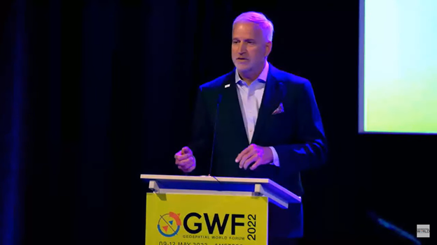
Robert Cardillo (Photo: GWF)
Building resilience into these systems will require multiple technologies ranging from network time-transfer services to terrestrial wireless infrastructure and low-Earth-orbit (LEO) satellites.
The Geospatial World Forum opened in Amsterdam on May 10. The second plenary of the day focused on the value of PNT in the global economy. Geospatial World is a global think tank working towards raising awareness around the use of geospatial data and technologies among governments and policymakers, businesses, and the public at large.
Robert Cardillo, president of The Cardillo Group and former director of the U.S. National Geospatial Intelligence Agency (NGA), headed the panel of experts.
“Our existence on this planet has been shaped by our individual and collective awareness of place and our confidence to be able to move securely and efficiently from one place to another, all within that common framework of position, navigation and timing, or PNT,” he said.
“The smartphone is a wonderful example of how far PNT has been integrated into our lives,” said Trimble founder Charlie Trimble. He laid down three basic phases involved in leading PNT to its place in the world economy.
“The path from the dawn of space age to the smartphone was anything but obvious or straightforward,” Trimble said. “First, Sputnik led to the global navigation systems. Second, the Shuttle disaster led us to the realization that the satellite system was an information utility. And now, the integration of PNT into the mobile and immobile internet is changing our world.”
From left: Charlie Trimble, Martin Sweeting, Rodrigo da Costa and Gillian Smith. (Photo: GWF)
“Our first contract was with ESA (European Space Agency) to look at the feasibility of using a navigation and timing satellite using small-satellite techniques, which in 1985 was considered a wacky idea,” recounted Martin Sweeting, executive chairman of Surrey Satellite Technology Ltd. “At ESA, we have embarked on a project called Hydro GNSS, which uses Surrey’s GNSS reflectometry to address several climate related issues, be it water detection or biomass, etc. This doesn’t stop here; we are looking at the lunar economy. PNT has indeed a very bright future, not just on Earth but also looking through this decade into the use of PNT on the lunar surface.”
Rodrigo da Costa
“New things are happening, particularly in the area of governmental satellite communications, space situational awareness and others, which are benefitting citizens every day,” said Rodrigo da Costa, executive director, EU Agency for the Space Programme (EUSPA). “Galileo, EGNOS (European Geostationary Navigation Overlay Service), Copernicus and GOVSATCOM programs are key areas of EU space activities. All these programs are massive investments and in the end, the result comes from their utilization in the different areas of our economy and daily life.”
“Just in the United States alone, GPS is approaching USD 1 trillion in terms of economic impact and is doubling every 2-3 years. But it is a single point of failure. This highlights the need for resilient PNT,” said Gillian Smith, vice president of marketing, NextNav. “We believe that our needs have evolved beyond technology that was really created in the ’60s. We need increased accuracy and availability in the urban environments in particular.
“I think many of you have experienced it if you’ve tried to use it in any major city,” Smith said. “That blue dot is going to bounce off of buildings and not be very accurate. We need indoor tracking and mapping. We need altitude data so that you know what floor you’re on when you’re thinking about accurate location. We also need to increase resilience and redundancy. That’s going to give us all increased security as well.”
The Value of GPS
GPS jamming and interference is a grave issue that has come under the spotlight particularly since the Russian invasion of Ukraine, according to Geospatial World.
In 2019, a Washington, D.C., think tank documented more than 10,000 cases of GPS interference (jamming and spoofing) in the previous five years from Russia. By 2021, these had become increasingly sophisticated. In a peculiar case, the crew onboard NATO ships in Odessa saw their position being given as Crimea.
In the past six months, even before the war on Ukraine began, there were reports of GPS jamming in and around that region. In March, the EU Aviation Safety Agency had issued warnings of GNSS spoofing and jamming for flights over Europe, in particular around countries neighboring Ukraine and Russia.
Globally, the economic impact of GPS/GNSS disruption is difficult to state. The potential economic consequences of failing to sufficiently protect sources of PNT are enormous, with estimates ranging from millions to billions of dollars depending on the type, length, severity and geographic scope of the disruption.
Furthermore, the impact of a GPS/GNSS outage extends beyond basic economics and could result in risk to life. Emergency services, distress beacons and telecommunications networks all rely on PNT services — any disruption could cause serious consequences.
A 2019 report sponsored by the National Institute of Standards and Technology estimated that the loss of GPS would cost the U.S. economy USD 1 billion a day.
A 2017 study in the United Kingdom estimated a five-day GNSS disruption would lead to an economic impact of GBP 5.2 billion (USD 7.2 billion), with road, maritime and emergency service impacts accounting for 88 percent of the cost.
Safran has entered into exclusive discussions to acquire Orolia from Eurazeo alongside the founders and management. Orolia is a world leader in resilient positioning, navigation and timing (PNT) solutions that improve the reliability, performance and safety of critical civilian, military and space operations, including in harsh or altered GNSS environments.
Safran is an international high-technology group, operating in the aviation (propulsion, equipment and interiors), defense and space markets. Headquartered in Paris, France, Safran has a global presence, with 76,000 employees and sales of 16.5 billion euros in 2020.
Orolia has a broad portfolio of technologies across the resilient PNT value-chain with full system capabilities, and is a provider of PNT equipment, simulation and test solutions. Orolia is also providing emergency locator beacons for commercial aviation and military applications.
The acquisition “represents a unique opportunity for Safran and Orolia to extend their resilient PNT solutions, through their remarkable complementarities,” Safran stated in a press release. “With this addition, Safran will be able to build a world-leading position in all aspects of PNT, inertial navigation, time and GNSS receivers and simulators, covering aerospace, governmental and high integrity applications.”
Safran intends to accelerate the development of Orolia under the leadership of CEO Jean-Yves Courtois, and in full collaboration with its teams. “The combination of Orolia and Safran will create a PNT world leader with capabilities that will be unsurpassed in depth and breadth,” Courtois said. “Our perfect complementarity in terms of technology expertise, market presence and geographic footprint will allow us to push further resilient PNT to the next level and to offer our government, aerospace and commercial customers the most advanced solutions they need for their critical operations. Orolia will contribute especially through its world-leading positions in timing, GNSS simulation and emergency location technologies, and through its strong presence in the U.S. market. We are looking forward to working with our new Safran colleagues to advance our common vision.”
Orolia is expected to generate revenues of more than EUR 100 million in 2021 and has approximately 435 employees with facilities in France, the United States, Switzerland, Spain and Canada.
The terms of the deal were not disclosed. The transaction is subject to the usual regulatory approvals. Orolia will be consolidated within Safran’s Equipment & Defense division upon closing, expected around mid-2022.
Russia’s recent threat that it could blow up all the GPS satellites with its new anti-satellite technology (ASAT) should come as no shock to those following space-related events. In the past, China shot down one of its own low-Earth-orbit satellites (LEOS) using a medium-range ballistic missile, and the United States used a modified antiballistic missile to shoot down one of its own spy satellites.
Blowing up satellites, solar flares, ever-increasing hazards from “space junk” and thousands of new satellites in the launch queue all make space a congested and increasingly dangerous place.
Locata Corporation and Ursa Navigation Solutions Inc. (UrsaNav) have announced a technology partnership specifically aimed at providing resilient PNT (positioning, navigation and timing) solutions to national governmental and commercial interests globally. Combining Locata’s high-accuracy local-area and UrsaNav’s very wide-area PNT produces a potent solution that lessens any nations’ dependency on easily disrupted and increasingly vulnerable space-based signals.
Locata has for many years been delivering proven centimeter-level positioning and picosecond-level timing to demanding users including the U.S. Air Force, NASA and globally significant commercial partners. Professional users in demanding industries such as ports, mining, the military, aviation, automotive, logistics, indoor positioning and high-accuracy timing depend on Locata systems every day.
UrsaNav’s eLoran and LFPhoenix technologies provide nanosecond-level timing, meter-level positioning, and short-message-service-like data transmissions at distances often exceeding 1,000 miles over land and 1,800 miles over water. Its two-way low-frequency time and frequency transfer (TWLFTFT) service is embedded in the PNT signal, providing a wireless timing synchronization conduit between any set of transmission sites.
When UTC-synchronized time is injected into any transmission site (node), such as from USNO/NIST, NPL or BIPM, it can then be securely networked to every other node in view. UrsaNav’s patented encryption techniques can be applied to the entire signal or any component.
Combining these proven technologies enables development of national-level terrestrial positioning and timing systems that are resilient, sovereign-controlled, and flexible enough to meet both long haul backbone and local high-accuracy critical infrastructure needs, the companies said, adding that over-reliance on space can be mitigated with built-in failover capability and overlapping coverage.
Many publicly available reports show both Locata and UrsaNav technologies have been tested by the United States and the United Kingdom under extreme GPS jamming and spoofing conditions, and yet they continued to provide the PNT their users require.
The MarRINav Report — funded by the European Space Agency (ESA) and researched over several years by eight top UK/EU bodies — recommended eLoran (UrsaNav) and Locata as terrestrial technologies for protection of UK shipping, ports and other key critical-infrastructure sectors.
The partners agree that a system-of-systems approach for resilient PNT must include a GNSS component, a fiber component, and a robust terrestrial wireless component that can be used to distribute solid PNT over nationally controlled radio frequencies.
The interlocking terrestrial capabilities developed by Locata and UrsaNav are unique in the PNT industry, are easily integrated with other PNT solutions, and can operate in standalone, interleaved, or layered modes — the very definition of a system-of-systems approach. Together, they can provide the core technology platform for purely national or cooperative international PNT services.
Program will support positioning, navigation and timing (PNT) research at colleges and universities around the world
Orolia has created the Orolia Academic Partnership Program (OAPP) to build a community to help foster global PNT research and collaboration at top engineering schools and research institutions.
Orolia will provide qualified institutions with access to the company’s signature Skydel GNSS simulation engine, an advanced GNSS and PNT testing and simulation tool.
Webinar scheduled
Orolia will host a webinar on Dec. 14 at 11:00 a.m. EST to introduce OAPP and answer questions about the program and Skydel. Register here.
Orolia also created an online forum to support its vision to form an interactive community focused on the future of GNSS and PNT research and education.
The forum allows users to interact with other users and Orolia experts, share information, ask questions and receive feedback. A host of white papers, application notes and detailed technical documents are also available.
The Skydel platform
Skydel is an innovative GNSS simulation platform that leverages software, advanced graphics cards and software-defined radios. Users can build custom signals and connect to other systems and devices (such as sensors and inertial measurement units) through Orolia’s open-source plug-in capabilities.
Skydel also includes the ability to generate and test the vulnerability of GNSS/GPS with integrated interference, jamming and spoofing capabilities. Because Skydel leverages commercial off-the-shelf hardware, it can run independently of simulation vendors’ hardware.
“Skydel platform’s versatility and capabilities allow users to perform tests in the field, in the lab, and at home — whether you are running a turnkey system provided by Orolia, our partners, or through your own proprietary hardware,” said Lisa Perdue, director, PNT Testing and Simulation at Orolia. “Unlike other GNSS simulators, Skydel is the only professional platform offering a plug-in architecture that provides real-time and direct access to the core simulation engine. This plug-in architecture unlocks a new range of application and customization that is impossible to imagine with traditional instruments.”
Perdue added that plug-ins can be shared with the open-source community to leverage all the benefits from a collaborative ecosystem. “We believe this modern architecture is the perfect approach to support academic research as well as allowing users to go further into system integration and customization,” she said.
The University of Stuttgart in Germany is an academic partner. (Photo: Regenscheit, Universität Stuttgart)
Stuttgart Institute a Pioneer
More than 40 schools throughout North America, Europe, South and Central America and Asia-Pacific are enrolled in OAPP, including the Institute of Navigation (INS) at the University of Stuttgart in Germany, where Skydel is fueling pioneering student research.
“Skydel allows our students to carry out complex field tests, such as simulating laboratory scenarios in real time and using radio hardware to send signals to commercial or self-developed receivers,” said Thomas Hobiger, INS. “We can compare our navigation solutions with the simulated trajectories while showing the absolute accuracy of our algorithms, meaning the deviation from the actual position.”
Hobiger added the INS wants graduates to be well-prepared for the demands of the industry and future innovation. According to Statista consumer research, the installed base of GNSS devices worldwide stood at 6.4 billion units in 2019. The Asia-Pacific region led the way, accounting for 3.4 billion GNSS devices, with forecasts suggesting this is set to rise to 5.1 billion devices by 2029.
“OAPP members can contribute to this community to share their advancements, upload code or make their work available to others in our GitHub repository,” Perdue said. “The goal is to ensure that members can access ideas and expertise of other users across the globe.
“The need for continuous and reliable GNSS signals as well as methods to protect those signals from jamming, spoofing or meaconing is growing exponentially worldwide,” Perdue said. “These are the main reasons why engineering students should gain valuable experience using a platform that provides accurate PNT simulation and measurement.”