Tag: San Francisco

  • Autonomous vehicles connect the world

    Autonomous vehicles connect the world

    Image: gorodenkoff iStock/Getty / Images Plus/Getty Images
    Image: gorodenkoff iStock/Getty / Images Plus/Getty Images

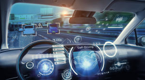
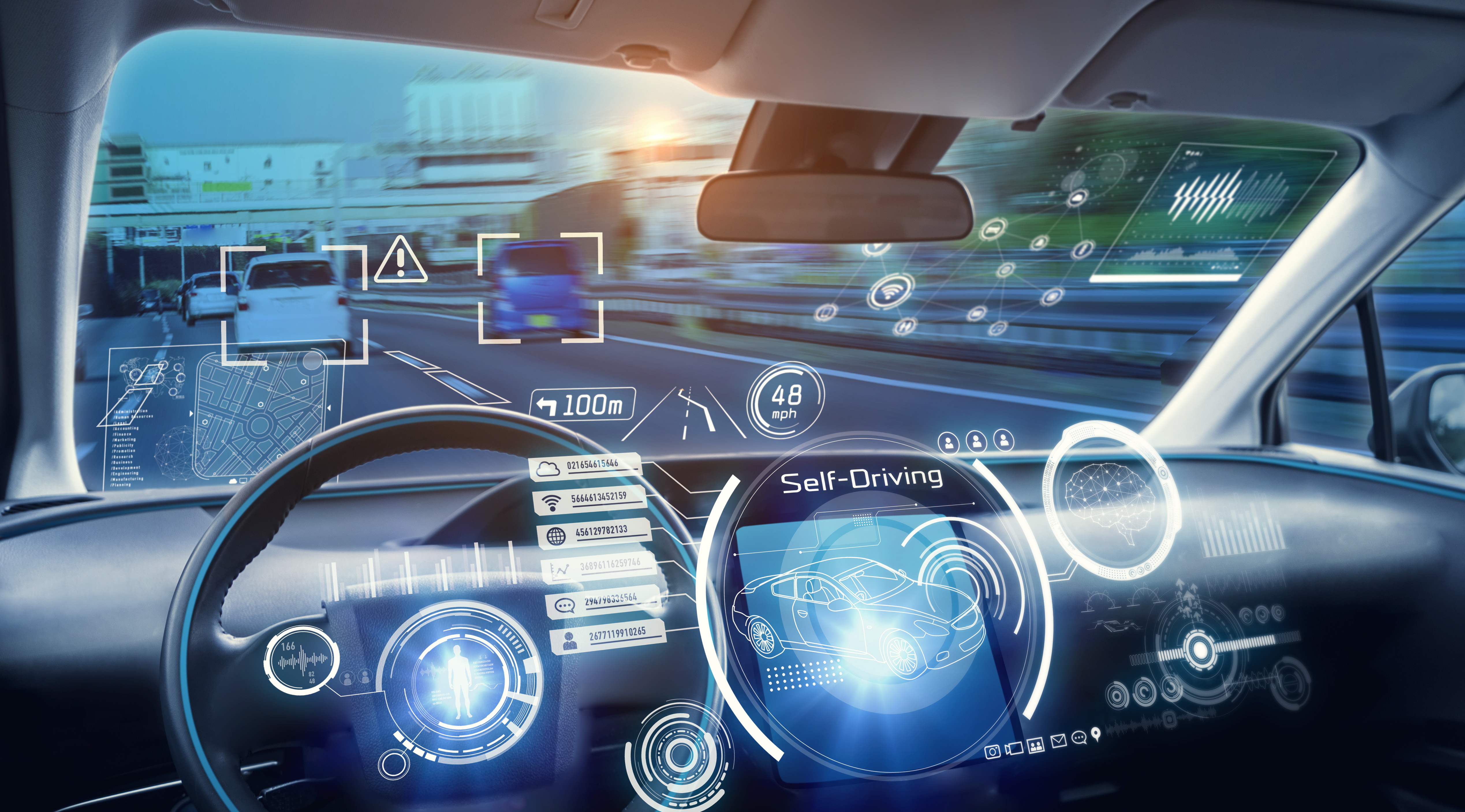
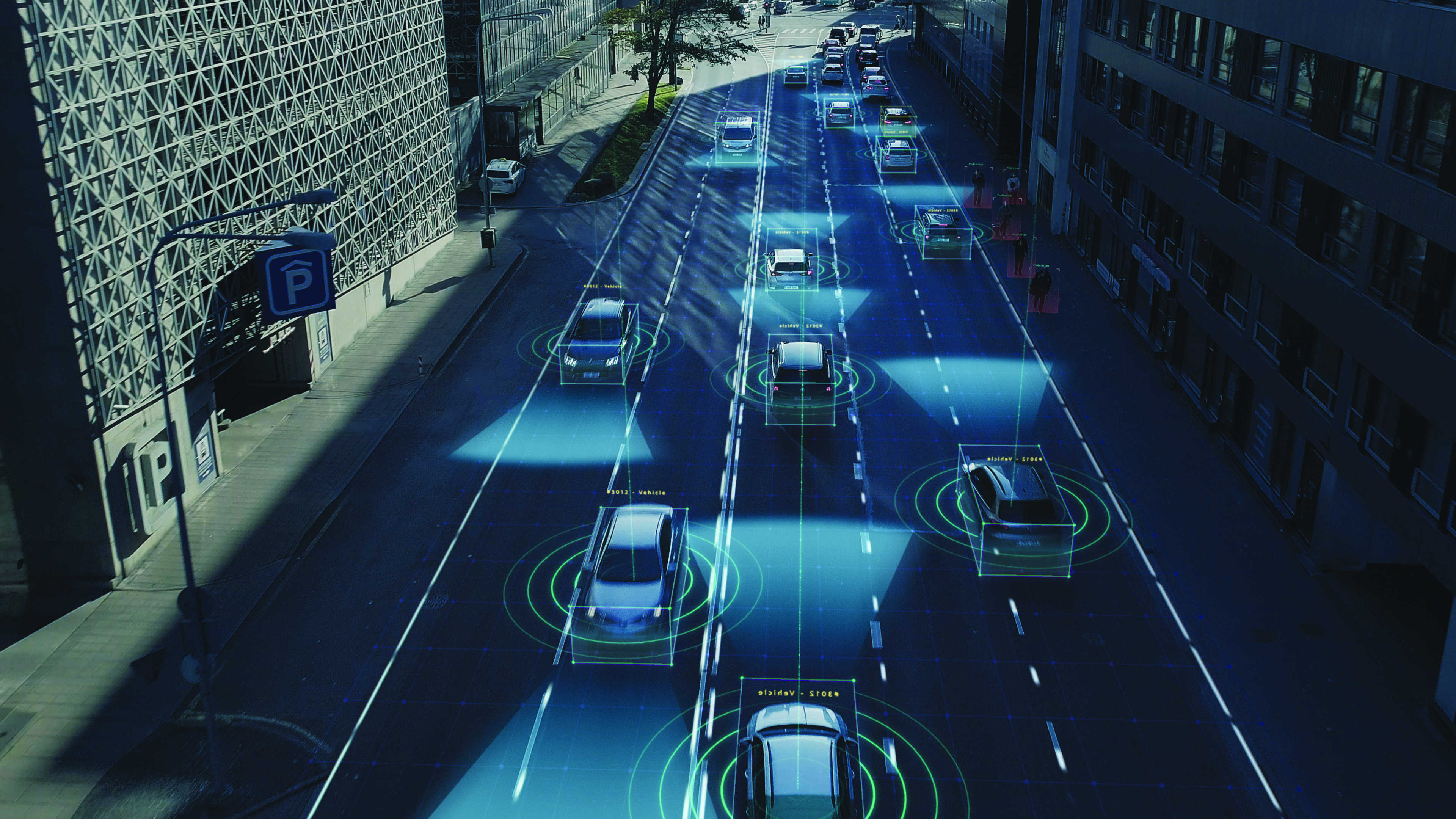
    Autonomous vehicles are a truly fascinating innovation. Most modern vehicles on roadways around the world have some level of autonomy, ranging from Level 1 features such as cruise control to Level 5 fully autonomous features such as the ability to monitor roadway conditions and perform safety-critical tasks without intervention by a human driver.

    Even though autonomous vehicles have been continually developed and tested for years, adoption has been minimal. According to the University of Michigan Center for Sustainable Systems, a majority of researchers, manufacturers and experts predict widespread adoption of Level 5 autonomous vehicles by 2030 or later.

    Several barriers have delayed the adoption of autonomous vehicles, such as concerns about safety, data security and cyberattacks; lack of consumer demand; liability laws and lack of regulatory legislation; and doubts as to their economic viability.

    While their adoption is slow, autonomous vehicles have been widely praised for the range of benefits they would provide. According to the U.S. National Highway Traffic Safety Administration, they include: much greater road safety due to features such as advanced driver assistance systems, lidar, cameras, inertial navigation systems and more; greater independence for people with disabilities, senior citizens and low-income individuals; reduced road congestion due to the lower number of crashes and an increase in ride-sharing; and environmental benefits as the automotive industry transitions to all-electric vehicles.

    Several technology and automotive companies also have seen the potential benefits of autonomous vehicles for many applications and the potential impact they could have on communities worldwide. In response, these companies have supported autonomous vehicle innovation and adoption by offering new products and working closely with educators, nonprofit organizations and other groups who aim to leverage it to connect the world.

    Education meets automated racing

    Safran Electronics & Defense, which specializes in resilient positioning, navigation and timing (PNT) solutions, has advanced the adoption of autonomous vehicles with its simulation software while simultaneously supporting current students in their academic pursuits.

    To jointly develop future PNT technology and solutions Safran’s Minerva Academic Partnership Program supports partnerships with the academic community by providing its technology for student-led research projects that use GNSS signals. Leisa Butler, the program’s chair, elaborated on its mission: “Collaborating with our customers in academia while advancing PNT education is the program’s core purpose. We provide members with access to our powerful Skydel GNSS simulation engine.”

    Safran and auburn university students are pictured with their autonomous F1 race car that competed in the Indy Autonomous Challenge on the Las Vegas Motor Speedway at CES 2023. Auburn students used Skydel, a Safran simulation engine, to improve the capabilities of the car and to learn how to make it safe and reliable on the track. (Image: Safran Electronics & Defense)
    Safran and auburn university students are pictured with their autonomous F1 race car that competed in the Indy Autonomous Challenge on the Las Vegas Motor Speedway at CES 2023. Auburn students used Skydel, a Safran simulation engine, to improve the capabilities of the car and to learn how to make it safe and reliable on the track. (Image: Safran Electronics & Defense)

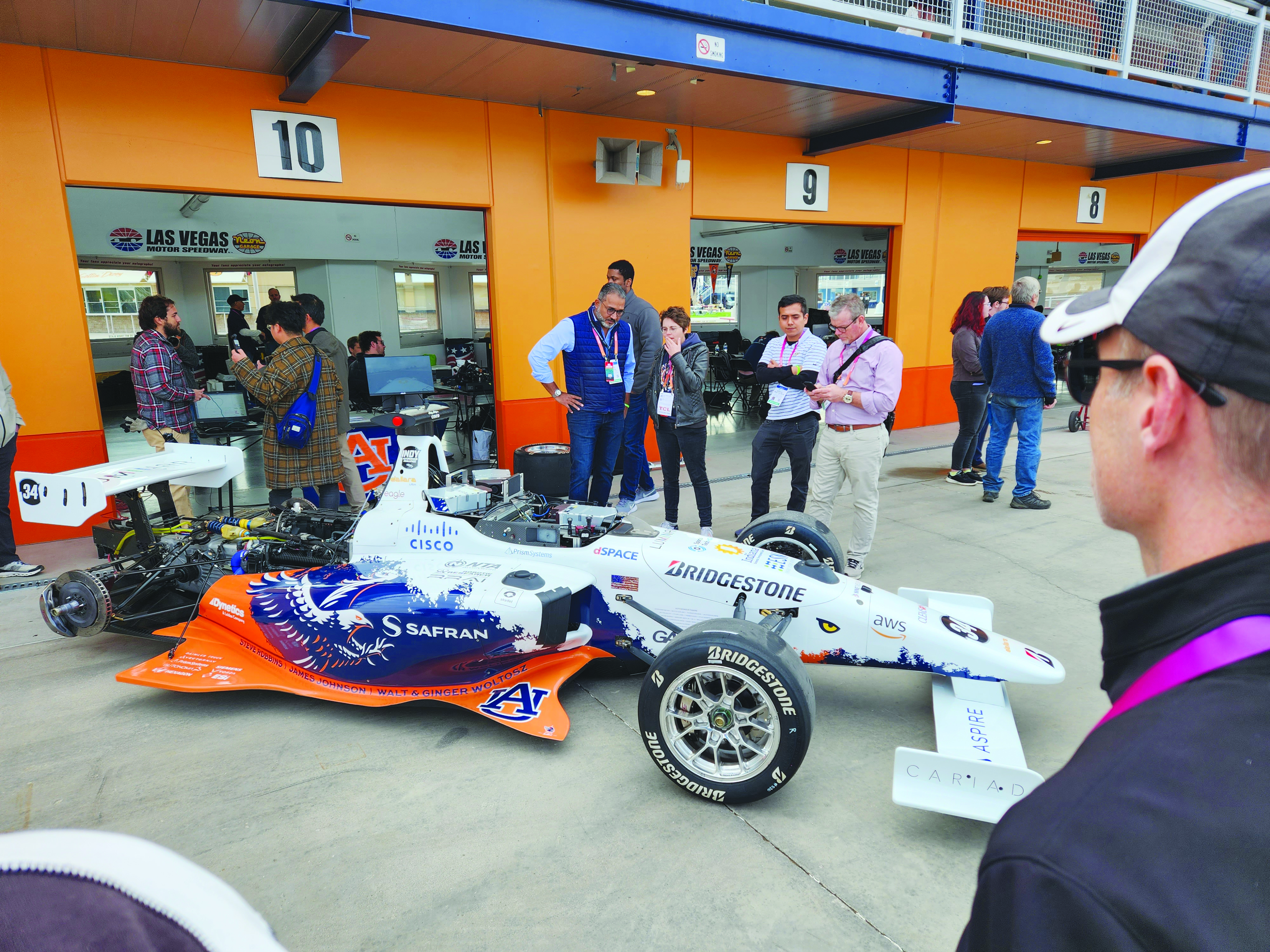
    As a part of the program, Safran has a long-established partnership with Auburn University’s College of Engineering. Safran and Auburn University students participated in the Indy Autonomous Challenge, which took place on January 7, at the Las Vegas Motor Speedway during the 2023 Consumer Electronics Show. Nine autonomous Formula 1 race cars, representing colleges and universities from around the world, took part in a head-to-head driverless racing competition with some vehicles reaching speeds of more than 190 mph.

    Safran has supported Auburn students before, during, and after this challenge by enabling them to leverage its GNSS simulators, such as Skydel and the GSG-8, which are used in the university’s autonomous vehicle lab. Butler said that giving students access to the simulation software prior to the high-speed races helped them troubleshoot and test the vehicles and improve the results.

    “Resolving issues in the lab improves safety while saving time and money,” Butler stated. “The Indy car features multiple antennas. Since Skydel can support multiple instances simultaneously, the team can test heading and realistic scenarios in a simulated environment. This is before they race next to other vehicles at high speeds.

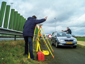
    Safran also supports the general advancement of autonomous vehicle technology. Positioning and navigating autonomous vehicles involves the use of multiple technologies, including GNSS.

    “Skydel is a valuable tool for the autonomous vehicle industry that wants realistic lab testing because it can support multiple, independent trajectories or antenna outputs simultaneously,” Butler said. She also pointed to the importance of developing mitigation techniques against jamming and spoofing.

    “Using a simulator with the Skydel engine allows the user to test in all sorts of challenging environments before putting the wheels on the pavement. This lets the user make sure the vehicle is ready for real-world navigation and avoid costly mistakes. It also gives them a chance to practice and develop countermeasures against unintentional interference and malicious actors.”

    Butler added that Safran is proud to support students who are helping to develop automated technology.

    “Supporting Auburn’s Autonomous Vehicle team is an honor and a privilege. Student research represents the future of our industry,” Butler said. “We are proud to support them and see what they can accomplish with our simulation tools. We are confident that they will be able to gain valuable insights that will help them design, build and test their autonomous vehicles. It is our hope that their hard work will lead to the development of safe, efficient and affordable autonomous vehicles in the future.”

    Accelerating mobility

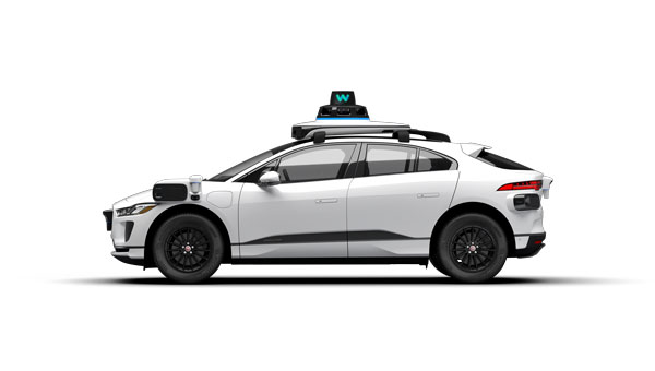
    Waymo, based in Mountain View, California, is an autonomous driving technology company. Formerly known as the Google self-driving car project, it was founded in 2009 and aimed to drive more than 10 uninterrupted 100-mile routes autonomously.

    Its first fully autonomous ride on public roads took place in 2015, then Waymo became an independent self-driving technology company in 2016. It launched its first public trial of autonomous ride-hailing vehicles, called Waymo One, in Phoenix, Arizona in 2017, and has expanded its completely autonomous ride-hailing service trials to Scottsdale, Arizona, as well as San Francisco and Los Angeles.

    The Waymo vehicle fleet also became fully electric this year.

    360° Lidar, Radar, and cameras make up most of the technical elements of the fifth-generation Waymo fully autonomous vehicles. They also have redundant steering and braking, backup power systems, redundant inertial measurement systems for positioning, and more. (Image: Waymo)
    360° Lidar, Radar, and cameras make up most of the technical elements of the fifth-generation Waymo fully autonomous vehicles. They also have redundant steering and braking, backup power systems, redundant inertial measurement systems for positioning, and more. (Image: Waymo)

    Driving Change

    According to its website, Waymo “represent[s] a diverse set of communities and interests, and we are coming together because we all share the belief that autonomous driving cars can save lives, improve independence, and create new mobility options.”

    Some of Waymo’s community partners include Bike MS, the Arizona Council of the Blind, the Foundation for Senior Living, and Mothers Against Drunk Driving.

    One community story to note is Waymo’s partnership with First Pace AZ — a supportive housing community for adults with autism, Down syndrome and other types of neurodiversity — to explore how Waymo could aid neurodiverse people.

    Eli is a resident of First Place AZ and an adult with neurodiversity. He does not drive and relies heavily on ride-hailing services, carpooling, and the train to get to work and to volunteer. Not all public transportation is always available or accessible at certain hours. Additionally, human-driven rideshare and carpooling services can present bias from drivers and other passengers who do not understand the behavioral nuances of people who are neurodiverse.

    To test the autonomous ride-hail Waymo One system, Eli and Natasha Grant, director of workplace and community inclusion at First Place AZ, hailed a ride to a local animal shelter.

    After using the Waymo One service, Eli believed Waymo’s technology could help him stay connected to his community, wherever he may live in the future. Grant added that autonomous vehicles provide independence for individuals who may otherwise not be able to go to places to which they want and need to go.

    Breaking social barriers

    Community partners that fight food insecurity use Cruise’s autonomous vehicles to pick up left over food from businesses. (Image: Cruise)
    Community partners that fight food insecurity use Cruise’s autonomous vehicles to pick up left over food from businesses. (Image: Cruise)

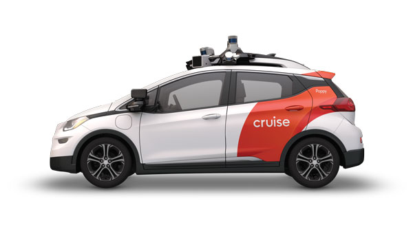
    Cruise is a self-driving car company based in San Francisco, California, and offers driverless rides in San Francisco; Austin, Texas; and Phoenix, Arizona. It was founded in 2013 by Kyle Vogt and acquired by General Motors in 2016.

    Cruise first offered driverless ride-share services for its employees in 2017. In early 2020, the company began testing those driverless rides on public roads in San Francisco. Later that year, Cruise switched gears and repurposed a portion of its all-electric autonomous vehicle fleet to deliver meals to the community during the COVID-19 pandemic. It also began self-driving delivery trials in Arizona.

    In 2021, Cruise announced plans for international driverless testing and expansion in Dubai and Japan. The next year, it opened its fully driverless service to public riders in San Francisco.

    Delivering Hope

    Cruise works with several community partners, such as the National Federation of the Blind, the SF-Marin Food Bank, and the San Francisco Giants.

    “At Cruise, our commitment to social impact is a vital part of our business and an extension of our mission to improve life in our cities, especially for people underserved by transportation today,” the Cruise website stated.

    In June, Cruise partnered with Replate — a nonprofit food rescue platform — to fight food insecurity and food waste in San Francisco and other communities. The partnership aims to use Cruise’s all-electric autonomous vehicle fleet, integrated with a national network of food recovery partnership from Replate, to pick up leftover food from local businesses and deliver it to organizations that help fight food insecurity.

    The goal of the partnership is to create a sustainable cycle of food rescue that fights hunger and waste in local communities.

  • Seen & Heard: Autonomous vehicles and Apple AirTags

    Seen & Heard: Autonomous vehicles and Apple AirTags

    “Seen & Heard” is a monthly feature of GPS World magazine, traveling the world to capture interesting and unusual news stories involving the GNSS/PNT industry.


    Image: iStock/Getty Images Plus/Getty Images
    Image: iStock/Getty Images Plus/Getty Images

    San Francisco Not Keen on Avs

    San Francisco officials aren’t happy with autonomous vehicles (AV) on their streets. They say the AVs are at fault for traffic violations and congestion, delays in emergency response and public transport — even trips onto public sidewalks. California officials granted the first AV deployment permits this year, allowing companies to release self-driving cars onto city streets and to provide passenger service as robotaxis. State governments have the legal power to grant permits to AV companies to conduct testing and ride-hail services, leaving city officials powerless to control self-driving car incidents that affect public safety.


    (Image: Apple)
    Image: Apple

    AirTag under Fire 

    Two women have filed a class-action lawsuit against Apple, claiming its AirTag trackers are being used for malicious and criminal purposes. Both women say they were tracked by ex-partners using Apple AirTags hidden in their belongings. They are seeking damages for negligence and privacy violations, and are hoping to prevent Apple from continuing to manufacture the product with “design flaws.”


    (Image: TU Delft/Frank Auperlé)
    Image: TU Delft/Frank Auperlé

    Navigating Urban Canyons with SuperGPS 

    Researchers at Delft University of Technology, Vrije Universiteit Amsterdam and VSL have developed an alternative positioning system that is more robust and accurate than GPS, especially in urban settings. The aim of the project — SuperGPS — was to develop an alternative positioning system that makes use of mobile telecommunications networks instead of satellites and that has better accuracy than GPS. A prototype of the infrastructure achieved an accuracy of 10 centimeters. The new technology is important for the implementation of a range of location-based applications, including automated vehicles, quantum communication and next-generation mobile communication systems.


    (Image: Allison Usavage/Cornell University)
    Image: Allison Usavage/Cornell University

    Robots Head to Vineyards

    Cornell researchers have designed PhytoPatholoBots (PPB) that will be deployed in vineyards across the country next spring in the first of a four-year project at Cornell, which is led by the University of Minnesota. The autonomous robots will collect data on the health of each grapevine, helping growers to evaluate their vineyards. The robots are part of the Specialty Crops Research Initiative, bringing innovation to the wine and grape industries.

  • Self-driving cars: Innovative or a nuisance?

    Self-driving cars: Innovative or a nuisance?

    Photo:
    Image: iStock/Getty Images Plus/Getty Images

    San Francisco local officials are questioning the safety of autonomous vehicles (AV), also known as self-driving cars, due to frequent reports of traffic violations, delaying public transportation and emergency vehicles, causing traffic congestion as well as driving onto public sidewalks.

    California officials granted the first AV deployment permits this year, allowing companies to release self-driving cars onto city streets and to provide passenger service as robotaxis. Since granting permits to AV companies such as Waymo and Cruise, self-driving vehicles have been creating a multitude of issues with public safety, including a recent incident of a Cruise AV stopping a bus on its route for over seven minutes.

    As state governments have the legal power to grant permits to AV companies to conduct testing and ride hail services, city officials are left powerless to control self-driving car incidents that affect residents and public safety. City officials also struggle to obtain information regarding AV-induced road blockages and even a comprehensive list of all companies have deployed self-driving vehicles onto their roads.

  • NextNav, Satelles collaborate on Bay Area alternative PNT testbed

    NextNav, Satelles collaborate on Bay Area alternative PNT testbed

    Technology evaluation capabilities inaugurated in demonstration for U.S. Department of Homeland Seurity

    NextNav and Satelles Inc. have partnered on an alternative positioning, navigation and timing (PNT) testbed in the San Francisco Bay area.

    Designed and managed by NextNav with a timing source from Satelles, the testbed creates scenarios and conditions to rigorously test the precision and resilience of alternative PNT solutions, allowing technologies to be evaluated in the absence of signals from GPS and other GNSS.

    NextNav used the testbed to demonstrate the precision and resilience of the company’s TerraPoiNT network in a GPS-denied environment using STL from Satelles as its absolute timing source. This demonstration for the U.S. Department of Homeland Security (DHS) showcased the timing accuracy and resilience of TerraPoiNT, which delivered timing synchronization better than 50 nanoseconds in urban and semi-urban settings.

    As a source of GPS/GNSS-independent time that the U.S. National Institute of Standards and Technology (NIST) determined is highly consistent with Coordinated Universal Time (UTC) — including in deep indoor environments — STL provided the timing signal for the demo instead of GPS.

    The advent of the alternative PNT testbed is timely given the recent publication of “Understanding Vulnerabilities of Positioning, Navigation, and Timing” by the Cybersecurity and Infrastructure Security Agency (part of DHS). This important CISA publication urges owners and operators of critical infrastructure to adopt the responsible use of PNT as defined in Executive Order 13905. The new testbed will be used to demonstrate applications for emergency services, telecommunications, financial markets, the electrical grid, and other critical infrastructure sectors.

    “Demonstrating the accuracy and resilience of alternative PNT solutions is integral in validating the capabilities of alternative PNT solutions and, ultimately, increasing adoption across use cases and applications,” said Ashu Pande, TerraPoiNT VP at NextNav. “With the development of this testbed, we can emulate real world deployment scenarios and can more effectively instill confidence across the PNT industry in the viability of alternate PNT solutions.”

    “The development of this testbed will enable the rigorous, transparent, and replicable testing of alternative PNT solutions,” said Christina Riley, VP of Commercial PNT at Satelles. “We’re excited to be integrated as the GNSS-independent timing reference for this alternative PNT testbed and are looking forward to continuing our collaborative work to build stronger PNT solutions to augment GPS globally.”

    The U.S. Department of Transportation categorized TerraPoiNT from NextNav and STL from Satelles as the top-ranked PNT systems in its technology demonstration report released in January. The testbed collaboration between these complementary alternative PNT service providers underscores the companies’ commitment to promoting the adoption of multiple technologies that complement and augment GPS/GNSS to protect the operations of critical infrastructure.

    Image: imaginima/iStock / Getty Images Plus
    Image: imaginima/iStock/Getty Images Plus/Getty Images
  • USGS Offers New Series of California Offshore Maps

    Map of sediment thickness in state waters offshore of San Francisco. About 21,000 years ago, sea level in this area was about 125 m lower and the shelf offshore San Francisco was an emergent land surface. At that time, the Sacramento River drained through the Golden Gate and eroded a valley ("the San Francisco paleovalley”) that was filled with sediment during subsequent sea-level rise. The thickest young sediment in the region occurs in the “San Andreas graben,” a basin that formed by crustal down dropping along the offshore section of the San Andreas fault. There is very little sediment on the shelf offshore of southern Ocean Beach (a pattern that extends south to Pescadero), a factor important for understanding and forecasting coastal erosion in this area.
    Map of sediment thickness in state waters offshore of San Francisco. About 21,000 years ago, sea level in this area was about 125 m lower and the shelf offshore San Francisco was an emergent land surface. At that time, the Sacramento River drained through the Golden Gate and eroded a valley (“the San Francisco paleovalley”) that was filled with sediment during subsequent sea-level rise. The thickest young sediment in the region occurs in the “San Andreas graben,” a basin that formed by crustal down dropping along the offshore section of the San Andreas fault. There is very little sediment on the shelf offshore of southern Ocean Beach (a pattern that extends south to Pescadero), a factor important for understanding and forecasting coastal erosion in this area.

    Three new sets of maps detail the offshore bathymetry, habitats, geology and submarine environment of the seafloor off the coast of San FranciscoDrakes Bay and Tomales Point.

    Critical for resource managers, the maps are part of the California Seafloor and Coastal Mapping Program, a series of maps published by the U.S. Geological Survey with support from the California Ocean Protection Council, NOAA and 15 other state and federal partners. The maps are designed to be used by a large stakeholder community and the public to manage and understand California’s vast and valuable marine resources.

    “OPC is proud to be a partner in this interagency effort,” said California’s Secretary for Natural Resources and OPC Chair John Laird. “These maps are critical to the state’s innovative approach to coastal resource management. USGS’s products form the foundation for assessing the performance of our Marine Protected Area network and preparing for climate change impacts such as sea-level rise.”

    “NOAA is pleased to be partnering in this integrated ocean and coastal mapping project. By working with partners from across federal, state, academic, and private sectors, we are able to combine data resources and maximize our efficiency in applying a ‘map once, use many times’ approach that benefits all,” said Rear Admiral Gerd F. Glang, director NOAA’s office of coast survey.

    The program was initiated seven years ago with the goal of comprehensively surveying and mapping all of California’s state waters. The vision was tremendously ambitious — comparable mapping on this scale has not been attempted anywhere else in the world, the USGS said. Each of the three publications includes 10 map sheets, a pamphlet and a digital data catalog.

    The maps and mapping data have a large range of applications. They provide:

    • a foundation for assessing marine protected areas and habitats;
    • baselines for monitoring coastal change and sea-level-rise impacts;
    • critical input data for modeling and mitigation of coastal flooding;
    • a framework for understanding coastal erosion and developing regional sediment management plans;
    • contributions to earthquake and tsunami hazard assessments;
    • more accurate maps for safer navigation;
    • and essential information for planning, siting, or removing offshore infrastructure.

    The new “Offshore of San Francisco” maps document the complex submarine environments along the inlet to San Francisco Bay formed by strong tidal currents, including spectacular sand waves, a deep scour pool beneath the Golden Gate, and the dynamic offshore San Francisco mouth bar and “Potato Patch” shoal.

    Sediment distribution maps reveal only a thin sediment cover offshore of the Ocean Beach (San Francisco) erosional hotspot (a pattern extending south to San Gregorio), indicating that today’s present coastal erosion will be a continuing problem, likely to be exacerbated by continuing sea-level rise.

    Geologic maps incorporating subsurface data document the location and geometry of the San Andreas, San Gregorio and Point Reyes fault systems, and show how their interactions led to uplift of Point Reyes and development of a deep sediment-filled basin.

    The Drakes Bay and Vicinity, and Offshore of Tomales Point maps reveal the diverse and complex range of seafloor habitats typical of the California coast, ranging from the rugged granitic bedrock along the high-energy west coast of Point Reyes, to smooth sand and mud in the more protected Drakes Bay environment that includes the Point Reyes State Marine Reserve.

    “There is a ‘WOW!’ factor to the new high-resolution datasets and maps,” said Sam Johnson, the USGS project lead. “They’re allowing scientists to pose new questions and are having a significant role in stimulating research.  We’re also seeing a positive impact on public education and awareness.”

    To date, 12 map sets and catalogs have been published. Ten additional map sets are now being formatted for publication, which will complete coverage in the Santa Barbara Channel (Oxnard to Gaviota) and from Marina northward to beyond the Russian River.

    The maps are created through the collection, integration, interpretation, and visualization of swath sonar data, acoustic backscatter, seafloor video, seafloor photography, high-resolution seismic-reflection profiles, and bottom-sediment sampling data.

    The California Seafloor and Coastal Mapping Program is a collaborative effort supported by the USGS, the California Ocean Protection CouncilNOAACalifornia State University at Monterey BayMoss Landing Marine Laboratories, and other academic, government, and industry partners.

    Map of offshore sediment thickness in State Waters between Drakes Bay and Salt Point, north of the Russian River. The thickest sediment in the region occurs offshore of the Russian River, and in a large bar along the south flank of Point Reyes Head. There is a relative lack of offshore sediment between Bodega Head and Point Reyes, where the shelf is characterized by abundant rocky habitat and much of the coastal sediment is trapped in large onshore dune fields.
    Map of offshore sediment thickness in State Waters between Drakes Bay and Salt Point, north of the Russian River. The thickest sediment in the region occurs offshore of the Russian River, and in a large bar along the south flank of Point Reyes Head. There is a relative lack of offshore sediment between Bodega Head and Point Reyes, where the shelf is characterized by abundant rocky habitat and much of the coastal sediment is trapped in large onshore dune fields.
    Perspective view looking to the southeast over entrance to San Francisco Bay. Golden Gate Bridge is to left (east) of this view. The large sand-wave field lies within Golden Gate channel, and formed from sediment transported out of the Bay by strong tidal currents. Profile A–A’ shows that the larger bedforms can reach heights of over 7 m and are asymmetrical with steeper sides towards the open coast. A smaller field of sand waves to south near Baker Beach shows the opposite symmetry (steep sides toward the Bay) indicating that the strongest tidal currents in that local area are directed eastward.
    Perspective view looking to the southeast over entrance to San Francisco Bay. Golden Gate Bridge is to left (east) of this view. The large sand-wave field lies within Golden Gate channel, and formed from sediment transported out of the Bay by strong tidal currents. Profile A–A’ shows that the larger bedforms can reach heights of over 7 m and are asymmetrical with steeper sides towards the open coast. A smaller field of sand waves to south near Baker Beach shows the opposite symmetry (steep sides toward the Bay) indicating that the strongest tidal currents in that local area are directed eastward.
    “Seafloor character” map of the San Francisco Region. This is a type of habitat map that classifies the seafloor based on surface hardness and roughness. Such maps are used in various types of ecosystem assessments and seafloor zoning, such as delineation or monitoring of marine protected areas.
    “Seafloor character” map of the San Francisco Region. This is a type of habitat map that classifies the seafloor based on surface hardness and roughness. Such maps are used in various types of ecosystem assessments and seafloor zoning, such as delineation or monitoring of marine protected areas.
    Bathymetry bounding Tomales Point. Rugged and massive granite outcrops extend offshore from Tomales Point to water depths of as much as 60 meters. Offshore sedimentary rock outcrops (lower left part of image) form distinctive “ribs” on the seafloor and have a notably different appearance. There is minimal sediment on this part of the California shelf because the watersheds draining the west flank of Tomales Point are very small and because Tomales Point and Tomales Bay block sediment transport from the north. Rocky-shelf outcrops and rubble are excellent habitats for rockfish and lingcod, recreationally and commercially important species. Tomales Bay, approximately 20-km long and 1- to 2-km wide, formed along a submerged portion of the San Andreas Fault (very shallow water depths preclude collection of high-resolution bathymetric data at the mouth of Tomales Bay).
    Bathymetry bounding Tomales Point. Rugged and massive granite outcrops extend offshore from Tomales Point to water depths of as much as 60 meters. Offshore sedimentary rock outcrops (lower left part of image) form distinctive “ribs” on the seafloor and have a notably different appearance. There is minimal sediment on this part of the California shelf because the watersheds draining the west flank of Tomales Point are very small and because Tomales Point and Tomales Bay block sediment transport from the north. Rocky-shelf outcrops and rubble are excellent habitats for rockfish and lingcod, recreationally and commercially important species. Tomales Bay, approximately 20-km long and 1- to 2-km wide, formed along a submerged portion of the San Andreas Fault (very shallow water depths preclude collection of high-resolution bathymetric data at the mouth of Tomales Bay).

    Maps: USGS