Author: Don Jewell

  • Lost Over the Pacific

    Lost Over the Pacific

    There I was, well above Angels 40, sound asleep wearing a positive pressure oxygen mask and helmet with the droning of multiple jet engines in the background for company. Then, I was abruptly awoken by an aircrew member urgently calling my name.

    On waking I noticed that it was colder and darker than I remembered when I had nodded off. The only light was that strange ambient light you only experience at high altitudes, and there was zero radio chatter in my helmet headset.

    When I reached the cockpit, I noticed the ambient light again because the radar screens were blank, as were all the electronic screens for our multiple sensors, and then it dawned on me. There had been some kind of an electrical failure. I glanced at the navigation displays to determine our position, and to my dismay, discovered they were all blank and lifeless as well. This should not have been, as all navigation and emergency avionics instruments had extensive battery backups.

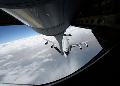
    Then I looked closer and noticed that not only were the screens blank, but the inertial power switches were in the standby position. All kinds of thoughts raced through my mind as the pilot-in-command, easily 20 years my senior (we will call him Bill for brevity) explained that after the fifth and last over-water air refueling things were progressing nominally — until they weren’t. Suddenly, amber and yellow caution lights appeared, followed quickly by red warning lights, all of which warned of imminent power failures of the jet-engine-driven generators. The special mission aircraft we were flying had enormous generators on all engines, so large they precluded thrust reversers on any of the engines. The aircraft needed all that power to function as a mission aircraft, but fortunately needed no electrical power to remain airborne.

    We completed the “total loss of electrical power” checklist, and for the time being all was well. The copilot calculated the aircraft could fly for another 10+ hours with IFR reserves using the fuel on board, and from our high altitude could “glide” with engines at idle for a couple hundred miles. So, no worries right?, as one of our Australian exchange pilots liked to say. Of course, there were several worries, the main one being no one knew exactly where we were. Like Daniel Boone we were not officially lost, just a bit bewildered.

    Airborne Class

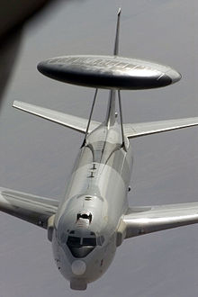
    Another aircrew instructor and I were onboard this particular aircraft enroute to what must remain an undisclosed location down under, to teach a class and develop a curriculum on overwater navigation for crews flying reconnaissance aircraft. My apologies for the brevity, but that is all I am allowed to say about the aircraft and our mission to this day.

    The aircraft had every bell and whistle you can imagine and then some, but it was essentially an electric aircraft as far as mission and navigation were concerned, and at the moment we were fresh out of that commodity. My instructor colleague and I were about to give out first impromptu overwater navigation class at altitude. We were not yet in extremis, but if we did not do everything exactly right, it might be everyone’s last overwater navigation class.

    Back to Basics by Necessity

    I had one of my flight bags with basic navigation gear with me on the flight deck and not stowed in the cargo hold, which was not accessible in flight. In that bag I had protractors, rulers, various conversion tables including the critical Aeronautical Almanac and Sight Reduction Tables for Air Navigation, plus an antique but serviceable sextant. The sextant needed to be treated with kid gloves, which is why I had the bag with me rather than stowed in the baggage compartment.

    Sextant courtesy of Landfall navigation.
    Sextant courtesy of Landfall navigation.

    My colleague and I suggested that as an augmented crew, we run through the emergency checklist for total loss of electrical power once again. Then we reviewed the Dash One (aircraft bible) on electrical failures and recommended actions plus all the flight crew actions 30 minutes prior to the power failure. We checked circuit breakers throughout the aircraft including in the mission compartment, the avionics and the mission equipment bays. We found nothing amiss except a plethora of red warning lights that told us nothing new; we were literally in the dark.

    The good news was that aerodynamically the aircraft was performing perfectly. Considerable experience with the persnickety nature of emergencies and aircraft electrical systems precluded making any drastic changes. The autopilot was off and the aircrew was hand-flying the aircraft that, when perfectly trimmed, actually required very little effort. That was good, since under even the best scenario we were “feet wet” — over water for at least another seven hours.

    Just before the massive electrical failure, the navigator calculated the aircraft was passing the “go-no-go equidistant” point of flight, which on long overwater flights means the aircraft, under nominal conditions and considering the prevailing wind and drift, could proceed to the landing destination but no longer had fuel or endurance to return to a suitable airport nearest the original “feet wet” departure point. In other words, we only had enough fuel to continue to our destination and could not turn around and return to another suitable airport to land. Plus, deviating from our scheduled route and flight plan without being able to notify the flight-following stations meant that if we ditched, no one would be looking for us in the right location. Additionally, politically the number of foreign airports where we could land our type of reconnaissance aircraft were few and far between. We elected to proceed to our original destination.

    This was not a democratic process or decision, as the pilot-in-command always has the last say. He is ultimately responsible for the aircraft and crew. But we were all in the same predicament, so after we had each voiced our opinions, the aircraft commander made the correct decision to proceed and to change the aircraft configuration as minimally as possible. This meant we would not try to bring the generators back online until we were over land and within gliding distance of a suitable airport, which by our best guess was seven hours distant.

    The aircraft had a RAT,  or ram air turbine, for just such emergencies, except that it was not for this emergency. RATs are typically used for short durations, generating power to make emergency radio calls. Once deployed, a RAT could not reliably be re-stowed, and there was no record of anyone having deployed a RAT for more than seven hours. Plus, it would probably affect the handling of the aircraft. No one knew exactly how nor how much drag it would produce, and how it would affect our endurance or emergency glide capabilities. Best to leave the RAT stowed for now. If the engine generators and bus did not come back online once we were over or near land, then we would consider deploying it and making emergency radio contact. While being out of radio contact was not unusual for our type of aircraft, the FAA and its equivalent at our destination would probably be the agencies initially concerned. As a last resort, our parachutes all had survival radios that could be utilized for communications on guard channel — presuming someone was monitoring guard and heard our call.

    Older Is Not Necessarily Better

    We were straight and level on a heading for our destination, determined from the original flight plan and from weather and atmospheric data more than 48 hours old. We needed real-time or as close to zero age of data as we could manage, and it would have to be generated internally.

    The aircrew was a senior crew, but rarely flew over water out of sight of land or out of range of electronic navigation aids. The aircrew was, to put it politely, on average nearly twice the age of my colleague and I, who were qualified overwater aircrew instructors. The aircraft commander was still ultimately in charge, but his comment or charge to us was, “OK guys, you’re the experts, now what?”

    Status Quo

    As far as arriving at our destination, if the engines continued to run and we continued on this course, without encountering or having to deviate blindly around significant weather, we would eventually make land fall feet dry. We would then hopefully extend the RAT, make radio contact, and explain our predicament to ground control or the country’s Air Defense fighters scrambled to intercept us for violating their Air Defense Identification Zone (ADIZ) without the proper radio calls. This is where the handheld radios in our parachutes would come in handy, explaining on guard channel to the fighter/interceptor pilots that we were allies and good guys and just experiencing a communications failure. All of which would be embarrassing and potentially fraught with dangerous consequences, but which could be avoided if the power miraculously came back on or if we followed the emergency “communication out” ADIZ penetration procedures for that particular country.

    These emergency procedures, while almost global in nature, were well known in theory but rarely, if ever, practiced by flight crews. They consisted of: flying within a prescribed 10-mile wide corridor, arriving at the ADIZ penetration point on course and on time, and then flying a specific triangular pattern for three consecutive iterations, while listening on guard, if possible, and then proceeding to our original destination as planned, possibly still “comm out,” flying a communications out, VFR (visual) approach and landing as planned. Such an arrival might create a minor stir, but we would be seen as obeying the international flight rules and hopefully no one would be chastised or court-martialed.

    Do We Have a What?

    To accurately fly the ADIZ penetration procedures, we needed to know where we were, how fast we were flying (our groundspeed), and what factors were affecting our flight planned heading. Since it was still daylight, our best bet was to use “back to basics” navigation techniques to determine our groundspeed, and then as the stars appeared, we could better determine our position and refine our heading.

    The crew regarded me with some skepticism as they realized I intended to use an old-fashioned sextant to determine the speed and heading and then navigate a multi-hundred-million-dollar modern reconnaissance aircraft. An aircraft with multiple Doppler receivers, inertial navigators, pinpoint radars, satellite communications, racks for a GPS receiver that had yet to be installed and an avionics suite that was second to none at the time. I proposed we navigate for seven hours with an obviously antique handheld brass sextant that I pulled carefully out of a velvet pouch stowed in my flight bag. And I would have done just that, if I had not realized that this aircraft also had a sextant port when the flight engineer mumbled something about a dusty old sextant case being strapped down in the avionics bay.

    Within minutes, the old sextant case was opened to reveal a pristine sextant still wrapped in depot preservatives. It may have literally never been used since it was put on the aircraft, probably as a safety afterthought. Certainly no one on the crew had ever used one on this aircraft, and the senior navigator had not used one since navigator school at Mather Air Force Base in California. Since there was no electrical power, we were not sure the sextant would work or if the displays would be readable. After checking it over, we pushed it through the sextant port and were rewarded with a good pressure seal. We found a spare D-cell battery to power the sextant in emergency mode, hooked up that cable and were in business. General Curtis LeMay would have been proud.

    Non-Traditional Navigation Sensors

    For those of you not familiar with celestial navigation, or using a sextant with the accompanying Air Almanac Star Reduction Tables (remember, the Sun is a star) basically it goes something like this:

    Celestial navigation is the ancient art and science of position fixing that enables a navigator to navigate without relying on dead reckoning, to determine their position. Celestial navigation uses ‘sights,’ which are angular measurements taken between a celestial body and the visible or artificial horizon. The sun is most commonly used, but navigators also use the moon, a planet or one of 57 other navigational stars whose coordinates are tabulated in the Nautical and Air Almanac.

    “Celestial navigation sights locate one’s position on or above the Earth. At a given time, any celestial body is located directly over one point on the Earth’s surface. The latitude and longitude of that point is known as the celestial body’s geographic position (GP) or sub-point, which can be determined from tables in the Air Almanac.

    “The measured angle between the celestial body and the visible or artificial horizon is directly related to the distance between the celestial body’s GP or sub-point and the observer’s position. After some computational sight reductions, this measurement is used to plot a line of position (LOP) on a navigational chart, the observer’s position being somewhere on that line. Most navigators use sights of three to five stars and plot the resulting LOP(s) to minimize the chance for error.”

    To begin the process, we needed to know time as exactly as possible, the date where we were located, our altitude and, if possible, an approximation of our location and direction of flight. All that information is provide by crewmember timepieces and basic navigation instruments that don’t rely on electrical power. You enter the tables and complete the pre-computation worksheet with the derived data, which you dial manually into the collimators of the sextant. Then with our bubble sextant representing the horizon, you place the Sun in the middle of the bubble and collimate on it for two minutes, read the resulting number off the sextant, convert it to a distance from the celestial bodies’ known sub-point, and that is your LOP. Since we were traveling in a southwesterly direction, the Sun provided a speed or velocity LOP. It would not determine our location with any certainty, but would provide a reliable estimation of our speed over the Earth.

    We knew our basic air speed from the onboard instruments that were still working, but we needed to know our ground speed, which is affected by head, tail or cross winds. Two such Sun sightings over a period of 10 minutes multiplied by 6 gave us our ground speed, and when compared to our airspeed told us that we had a 40-knot tailwind, likely due to a forecast large low-pressure system behind us. Consequently, we would be drifting to the left, which would cause us to steer right a few degrees of our intended course, since the planned tail wind was only 20 knots, not 40. Now we knew our groundspeed and refined our ETA (estimated time of arrival) at the ADIZ penetration point. We conducted Sun shots and calculations every 30 minutes until the Sun set and the stars were visible. Shooting and plotting multiple stars for positions is just a bit more complicated and time consuming, but because it results in an actual position, rather than a speed line, it is much more valuable.

    We had additional sources of data as well, which surprised the senior crew — whom we were essentially instructing in the basics of emergency overwater navigation. We plotted the best dead-reckoning line of position based on the flight plan and last known position. Then we plotted several more lines of position based on temperature, ground speed and pressure readings. This is a technique rarely used by navigators today, but one that helps you double-check your assumptions and flight planning data. In the Northern Hemisphere, a low pressure system behind you when heading southwesterly will nominally result in a tailwind and drift to the left of your course, based on the old mnemonic high up right and low down left, just as longitude and latitude mathematical values are based on the mnemonic East is least (minus) and West is best (plus). Similarly, if the temperature is rising over time, then you are most likely drifting to the right. If it decreases, you are likely drifting to the left. Lows are typically cooler than highs. If the barometric pressure is rising, then you are drifting right, and if it lowers, then you are drifting left. These are not all hard and fast rules — you can be on the backside of a major weather system and experience all these phenomenon — but if you are not being tossed about in the middle of a major thunderstorm, these mnemonics can save your life.

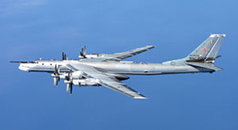
    Normally a navigator will take one sextant shot per hour while averaging wind, pressure and temperature data over the same time. Given our dire circumstances, we calculated pre-comps and shot planets and stars continuously, on the average of three sights per hour, and took temperature and pressure readings every 10 minutes for the next 7 hours. Arriving at the ADIZ penetration point, we flew our three triangular patterns and were shortly thereafter intercepted by a Canberra aircraft that was conveniently in the area (it turns out our hosts had been expecting us and determined from the radio silence that something was amiss). The Canberra pilot informed us on guard channel (those wonderful parachute radios proved a godsend) that he would lead us to our destination. Thankfully, the weather was VFR (visual flight rules). We followed him down on a visual approach to our destination, and when he broke off in the pattern, we landed uneventfully.

    We attempted to bring the engine generators online 30 minutes before the predicted ADIZ point without success. However, in the process the battery connections were re-energized and the inertial devices woke up. Because an airborne initialization required more than an hour’s time, we used them as a groundspeed reference only. Frankly, all the warning messages and flashing lights in the otherwise dark cockpit were almost more of a distraction than help.

    Debrief

    During the mission debrief, the maintenance crews informed us that a faulty sensor and a computer glitch had caused the power problems. Our generators were fine, but the faulty sensor and computer software had combined to shut down all generators.

    Lessons Learned

    Looking back on this flight many years later, in retrospect I believe we made all the right decisions. We continued to our destination and did not attempt to fix a major problem over water as long as the basic airframe and engines were doing their job. We followed our flight plan, and if we had ditched, we would have hopefully been found along our route of planned flight.

    We made use of the instruments and crew-member capabilities on hand. We used a navigation method vetted over literally hundreds of years with the most modern versions of that equipment available. The crew learned how to use basic data almost always available on any aircraft, powered or not, to lay down not one but multiple lines of position.

    Today, if the same scenario came about, the basic decisions would be the same, except that crew members would merely pull out their pocket GPS navigation devices, probably mostly iPhones, and using a power-saving battery plan, navigate their way to their destination. The difference is that the data — weather, groundspeed, altitude, heading and ETA, even to various waypoints — would be instantly available, and it would be accurate to within feet and nanoseconds, not miles and minutes. They might even have been able to call ahead.

    Inertial Inertia

    Contrary to what some in the Defense Department have been saying, the inertial devices onboard would have been just as ineffective if this scenario was repeated today. The critical and operational limiting caveats that most laymen and even some military users miss about individual inertial devices is that they are intrinsically dumb devices that experience drift and bias phenomena that are not always predictable. Inertial units do not know when or where they are until they are told. Even after they are told, if the inertial units lose power without a battery backup, they need to be told time and time again when and where they are. GPS performs this function very well, and together the two systems are almost the perfect navigation combination.

    Without an internal clock and coordinate system (chip-scale atomic clocks [CSAC] will work only after they are initialized and told what time it is, a function more often than not performed by GPS today and in the foreseeable future), an inertial device will not show you where you are on a map display or in any discernible or chartable coordinates. An inertial device, while it is superbly equipped to measure movement in every axis, is basically a three-dimensional device. Inertial units detect up from down, left from right, and acceleration or de-acceleration, but they do not detect changes in time or know their starting, way or endpoints in discernible coordinates without being told. So, yes, Mr. Secretary, it would be great to have an inertial that would run for a thousand years, but first you need the miniaturized atomic reference systems, power systems and coordinate determination systems that will run that long as well.

    In other words, we need an inertial system that is a system of systems, which today are ideally comprised of CSAC and GPS devices with a laser gyro. In the not too distant future, a cold atom interferometer MEMS (microelectromechanical system) inertial with CSAC and GPS all backed up by eLORAN is probable. That, however, is a story for another time.

    Until next time, wax nostalgic — dig out your old sextant and take a sighting. Until then, happy navigating, and remember that GPS is brought to you courtesy of the United States Air Force.

  • L2C and Next-Generation Smart PNT Receivers

    L2C and Next-Generation Smart PNT Receivers

    Are you using a legacy-model PNT (position, navigation and timing) receiver or a smart PNT receiver, and why does it matter? Don’t have a clue? Read on! Hint — L2C and CNAV (civilian navigation message format) are the major reason it matters. Yes, it’s all because of L2C, the controversial GPS civilian signal that seems to always be in the news and just keeps getting better the more we learn about it.

    It was just 30 months ago that I penned a column titled 2C or not 2C: An Important Signal Question.

    A couple of weeks ago, Alan Cameron, our esteemed editor in chief — penned a follow-on editorial comprised of excerpts from techies, subject-matter experts and editors, including yours truly, exchanging opinions about the flexibility, sustainability and capability of the GPS L2C signal and all that signal enables.

    I won’t bother to go into the details or history of the L2C signal here, as I did that in excruciating detail 30 months ago. However, let’s consider L2C 30 months on and determine if the landscape has changed.

    What is L2C?

    According to the official U.S. government PNT website, “L2C is the second civilian GPS signal, designed specifically to meet commercial needs.” As it turns out, the military needs L2C as much as the civilian world, but that is a story for another time. When combined with L1 C/A (coarse acquisition signal) in a dual-frequency GNSS receiver, L2C enables ionospheric corrections, a technique that boosts accuracy. Civilians with dual-frequency GPS receivers typically enjoy the same or better accuracy as the military.

    For professional and high-precision users with existing dual-frequency receivers, L2C delivers faster signal acquisition, enhanced reliability and greater operating range. L2C broadcasts at a higher effective power than the legacy L1 C/A signal, making it more jam and interference resistant, plus it’s easier to receive signals under trees and indoors. The U.S. Commerce Department estimates L2C will generate about $6 billion in economic productivity benefits through the year 2030. Considering there are more than four billion GPS users around the world today, the DOC economic benefits number seems rather low.

    L2C Status

    The first GPS IIR-M (R= Replenishment, M= Modernized with M-code and L2C) satellite featuring L2C launched on Sept. 26, 2005, and is still operational today. Every GPS satellite fielded since then (18 SVs, including SVN 49) has included an L2C transmitter. This equates to 16 operational L2C satellites on orbit and transmitting, with GPS IIF-10 being number 17 when it is fully commissioned. With 17 SVs (GPS satellite vehicles) on orbit, the L2C system is officially near Initial Operating Capability (IOC). With the requisite ground system upgrades, which are in the works, this means that on any given day most users will have at least one or more L2C signals in view. You can be sure manufacturers will be quick to take advantage of the geometry.

    SVN49 in space  (artist’s rendering).  The signal anomaly from SVN 49 alerted researchers to new possibilities in analysis and monitoring.
    LMCO GPS IIRM Satellite Vehicle On Orbit. (Artist’s rendering courtesy of Lockheed Martin)

    Legal Caveats

    “In April 2014, the U.S. Air Force began broadcasting civil navigation (CNAV) messages on the L2C and L5C signals. Prior to that time, L2C and L5C provided a default message or Message Type Zero, containing no data. Adding additional CNAV message types required upgrades to the GPS control segment. On Dec. 31, 2014, the Air Force began transmitting CNAV uploads on a daily basis. L2C should continue to be considered pre-operational and should be employed at the user’s own risk.”

    Now the lawyers are happy.

    So What?

    What does this mean for the average user? You might be surprised at the answer. Depending on how technical you are and exactly how you use GPS, it could mean that all your “legacy” GPS receivers are about to become obsolete. Or, depending on the company that builds your receivers and the amount of foresight they built in, it could just mean a few firmware upgrades and new applications.

    Regardless, with the full implementation of L2C GPS signals and navigation messages, GPS will never be the same again. This is not to say your legacy receiver will not work just as efficiently as it does today, and in fact you will probably be able to use it quite effectively for years. But it will not be able to take full advantage of all the capabilities L2C enables without an upgrade, if indeed it is upgradeable.

    Legacy versus Smart

    No matter how much or how little you paid for your GPS/GNSS/PNT receiver, it is essentially — except for a few notable exceptions — a legacy receiver. For example Trimble is ahead of the game as they began producing L2C capable receivers as early as 2003 and are just waiting for the additional L2C messages to be defined. Again, those receivers that are not L2C-ready or capable are what I will classify as a legacy receiver, simply because of all the future capabilities that are missing. Your current PNT receiver may have the potential to be a smart receiver — it may have the technical capability to process far more than it does today. But, unfortunately, essentially almost every receiver, again with a few exceptions, on the market today falls into the “legacy ” category.

    Is My Legacy Device Considered Obsolete?

    Now that I have your attention and have probably riled more than a few GPS device manufacturers, please allow me to explain. In the past, your GNSS/PNT device (for brevity’s sake, I will default to PNT for the rest of the column) has basically performed a simple function. It displayed your position, and perhaps maps and other ancillary data (targets or destinations) after it received, decoded, verified and applied timing signals and a very small number of navigation messages.

    It accomplished this feat typically from a cold start in under 120 seconds. Maybe much less. Recently, I was privileged to view a demonstration of a receiver from a major manufacturer that performed a warm restart in less-than-ideal conditions and displayed a useful position in 1/20th of a second. As amazing as that may be, it is still today classified as a legacy receiver. It accomplished its task; it supplied a useful position both in human and machine language that could be utilized by both. In the past, this was the task your receiver accomplished routinely. With the full implementation of L2C, all that changes and changes drastically. I call it a revolution for PNT, but alas I am frequently given to hyperbole. However, give me a moment and see if you don’t agree.

    I was attracted to a Wall Street Journal headline recently by a company that I know well, since they have an abundance of well-known and multi-talented former military leaders. That company, Accenture, puts it this way: “Change is good. Transformation is even better.” That is exactly where I believe we stand today with L2C. It is a game changer.

    For example, just this week in the WSJ, which I read cover to cover six days a week, I saw stories about Audi vehicles driving autonomously from coast to coast, over 3,000 miles without driver intervention. Contrary to many manufacturers, Audi is quick to credit GPS with a large portion of the proprietary Audi (VW) technology and the capability it enables. There was a story about commercial vehicles, over-the-road diesel trucks that may have even more capabilities than the Audi. Again, with GPS as the prime contributor. The same WSJ story mentioned that, “Some of the features being added to trucks are similar to those in cars, but generally the move to autonomy in commercial and industrial vehicles is far ahead of the autonomous systems offered on most passenger vehicles. Already, mining vehicles and military forklifts are operated without drivers.”

    Amazingly, these capabilities depend greatly on GPS, but exist without the full implementation of the revolution that L2C, CNAV and multiple nav messages will bring.

    L2C CNAV Message Structure.
    L2C CNAV Message Structure.

    L2C Ready

    I have over the past year seen advertisements for PNT devices that proclaim they are L2C ready. I beg to differ, but only because my definition of L2C ready probably varies greatly from that of the devices’ marketing department. Beyond its signal structure, L2C has a new messaging capability.

    As stated earlier, the L2C signal is heads and shoulders above most other GNSS signals in strength, code structure and security. L2C delivers faster signal acquisition, enhanced reliability, and greater operating range. L2C broadcasts at a higher effective power than the legacy L1 C/A signal, making it interference and jam resistant and easier to receive under trees and indoors. These attributes make it a great signal and when you consider the carrier-phase and RTK (real time kinematic) capabilities, which really are real-time today. It is a very appealing signal indeed.

    For precision and timing users, the carrier phase of the L2C signal, non-coded carrier, is 1,000 times more stable than the fully coded L2C signal. The L2C carrier-phase stability will remain unchanged until the semi-codeless transition date of Dec. 31, 2024, per the FRP or Federal Radio Navigation Plan of 2014. Then officially all bets are off, but who knows? That date could be extended.

    However, the real and future strength of the L2C signal structure is hiding in one or more (accurately 255 more, for a total of 256) messages that can be utilized in a myriad of ways and applications. These are messages, nav-messages if you will, that your new or updated PNT device will be able to utilize for who knows how many functions. Just use your imagination. Here are some ideas I have for using the additional L2C messaging capability.

    • Send 250+ other navigation messages, to be defined.
    • Send continuous atmospheric corrections (such as ionospheric) for each two degrees of longitude around the globe or in one degree increments if you consider land mass applications only.
    • John Deere and Trimble as the leading commercial and civil providers of navigation data could appropriate a small fragment of the messages for their global navigation and timing corrections to their agricultural and precision users/customers around the globe.
    • Companies or governments could send nominal navigation or even text-based navigation-related messages to users anywhere an L2C signal can be received.
    • Companies could shut down and render useless receivers from users that have not paid their bills or were abusing the system.
    • Companies could send small firmware updates or notices of larger updates directly to users. Data could include active hyperlinks.
    • Precision, scientific and premium users might have the capability to receive constant correction updates that make their PNT receiver a centimeter or potentially a millimeter level device.
    • Receivers with communications — four billion plus smartphones and other devices with PNT capabilities and built-in communications — could become sensors capable of being sampled at will. These devices have the potential to be considered remote monitoring stations both for PNT and communications purposes. They could report both communications and PNT jamming or interference. They could also help track intentional jammers.

    If you think about it hard enough, you will see that this modest list of capabilities with the proper security either make spoofing an impossibility or without proper security a malicious nightmare.

    I hope by now you catch my drift and have come up with some ideas of your own concerning how the additional 250+ L2C messages could be utilized. We’re unsure how many messages will actually be available or how the messages will be used. The government will, out of operational necessity, require a small number, so right now your guess is as good as mine.

    Keep in mind that L5C and M-code will have the same capabilities on differing frequencies, and different governing bodies will decide how the signals and 750-plus multiple-messaging capabilities are allocated and utilized. That is all hopefully in the near future. How that process unfolds, technically and operationally, will have a great deal to do with how successful and ubiquitous L2C becomes. The process alone will undoubtedly spawn thousands of articles; however, right now we are primarily discussing the necessity for smart receivers to fully utilize the additional L2C messages. For along with all the potential capabilities comes a processing and communications tail that does not exist today, except in a few instances that we can’t go into in this venue.

    Relative

    This is probably a good time to further qualify what I mean by legacy versus smart receivers. Were the appellation “legacy” not already in our vernacular concerning today’s highly functioning devices, it would not be one I would have chosen. However, it is and we are stuck with it. Consider that there are static high-end (read premium quality) single GNSS receivers that “see” more than 50-60 separate GNSS satellite vehicles and processes more than 150 GNSS signals. This does not take into consideration all the augmented and companion signals some of these devices are capable of processing. Many of these devices are very difficult to jam and literally cannot be spoofed, and still today they are legacy receivers in relationship to L2C capabilities.

    However, I am told such high-end receivers are absolutely L2C ready, which may mean the additional L2C messages are ready to be processed and applied, received or rejected, whenever they are properly and officially defined. This brings us to the future definition or next generation smart L2C receiver.

    Smart L2C PNT Receiver

    For the first time a smart PNT L2C capable receiver will have the ability to:

    • Select between GPS only, GPS + GLONASS, or full GNSS mode with ancillary corrections such as WAAS and EGNOS, and work with, process or reject messages, making a decision about some or all the signals it has in view. While there are receivers that accomplish some of these functions today, they do not typically have the option of accepting or rejecting a GPS navigation message if it is properly formatted and verified. L2C smart receivers will — indeed must — at a minimum possess and correctly utilize that capability.
    • Alert users concerning new navigation message(s) and determine automatically or with user input whether the navigation message should be applied immediately, in the near future, put on hold or totally rejected.
    • Alert users to the effect that applying new or multiple navigation messages will have on the current PNT display and possibly the current mission or operation. For example, if you are a precision user, think millimeters for level of accuracy, utilizing PNT to measure tectonic plate movement — you are very interested in relative displacement over time and you may have no desire to apply a multiple nanosecond correction that could move your current measured position several inches or feet. If you are a geocacher, you do not want the coordinates of your latest buried treasure to dynamically change.
    • Determine if the latest valid navigation message(s) apply to your geographic area or, for mobile receivers, your destination, and what effect incorporating the messages will have on your displayed position or ETA.
    • Display a text-based navigation message if it is addressed to your device.
    • Require password(s) for certain actions — be they sensitive, proprietary, classified or of a “cannot undo” nature. Passwords could also be required in the message format before it could be unlocked and applied.
    • Determine and alert users if multiple navigation or device-control messages conflict with organizational or user-defined parameters.
    • Alert users to malicious messages or spoofing attempts.
    • Alert users to GNSS assets that are no longer available or go offline, such as during the two total GLONASS constellation shutdowns when GLONASS signals were not available for several hours. In the case of Apple iPhones, the GLONASS constellation-wide shutdown meant these devices went from multiple GNSS devices to “GPS plus PNT augmentation (WAAS) and other onboard sensors” devices. This is something many users may not care about, but is definitely worth a user-defined parameter for a warning message.
    • The ability to permanently reject a certain type of message by type, source, timeframe, etc.

    By now, I hope you see the trend. You can probably think of many more possibilities for future GNSS or PNT receivers and the necessity for them to be loaded with computing and communications capabilities, especially where L2C is concerned — indeed, where all the CNAV signals and messages are concerned.

    Bottom Line

    The bottom line is L2C is a potentially revolutionary signal for GPS/PNT; it opens incredible opportunities for entrepreneurs, manufacturers and users at a minimum. We now all have some hard and important questions to consider before we purchase our next-generation PNT device or upgrade our legacy device.

    Until next time, happy navigating, and I hope to see everyone at ION GNSS+ in September in Tampa, Fla. Remember, GPS is brought to you courtesy of the United States Air Force.

  • ION-JNC and the Nascent Paradigm

    ION-JNC and the Nascent Paradigm

    In late June, I had the honor and privilege of attending and participating in the Institute of Navigation’s Joint Navigation Conference (ION-JNC) in Orlando, Fla. This year attendance was up by 20 percent. The entire event was FOUO (For Official Use Only) with a classified (SECRET) day on Thursday held at, as improbable as it seems, a joint military and Walt Disney location known as Shades of Green. It gives Mickey Mouse and the military a whole new meaning!

    The classified day included a remarkable War Fighter Panel, which, full disclosure, I have had the honor along with my colleague Jim Doherty at IDA (Institute For Defense Analyses) of co-chairing for the last several years. It is always heart-warming and invariably enlightening to hear our warfighters discuss capabilities that GPS enables for them in times of peace and war. You could even say this was the theme of the conference: “The capabilities that GPS technology enables.”

    You might assume an FOUO- and SECRET-level conference would be slim pickings for a journalist. If that is all that transpired, then you would be correct; however, all the conversations outside the official sessions, especially around the displays and exhibitors’ booths, make it more than worthwhile. Not to mention all the tidbits you pick up at breakfast, lunch, dinner and evening socials. One of the most common phrases I heard all week was, “Now don’t quote me on this, but…” or the one I like to hear, “OK, this is on the record” or “You are recording this, right?” Everyone has a message!

    ION-JNC in Dayton, Ohio

    For the next two years (2016-17) ION-JNC will be held in beautiful downtown Dayton, Ohio, at the Dayton Convention Center. Dayton is home to the famous Wright Brothers Cycle Shop and the Wright Flyer.

    Take-off of the 1903 Wright Flyer, the world's first powered, sustained and controlled heavier-than-air flight on Dec. 17, 1903.
    Take-off of the 1903 Wright Flyer, the world’s first powered, sustained and controlled heavier-than-air flight on Dec. 17, 1903.

    Dayton also hosts the world-famous National Museum of the USAF (United States Air Force) located on Wright-Patterson Air Force Base (WPAFB). The classified day will be held at the prestigious USAF Institute of Technology (AFIT), also on WPAFB, where many an Air Force officer has earned a master’s and or Ph.D. The papers and sessions should be outstanding in view of the venue and the presence of the Air Force Research Laboratory (AFRL) at WPAFB, which is known as the Air Force’s only organization wholly dedicated to leading the discovery, development and integration of warfighting technologies for air, space and cyberspace forces.

    Register early and send your clearance if you have one; it just gets better every year.

    SpaceX and Falcon 9

    Elon Musk,CEO Space Exploration Technology Corp. (Photo Courtesy of Tesla Motors)
    Elon Musk,CEO Space Exploration Technology Corp.
    (Photo Courtesy of Tesla Motors)

    I arrived in Orlando on Sunday, June 21 (yes, I traveled on Father’s Day) because events start bright and early Monday morning, to hear about the Falcon 9 launch failure, the first for that family of launchers. Even though it occurred 130+ seconds into the launch segment, if the rocket fails to deliver the payload or supplies to orbit or their destination, it is generally referred to as a launch failure. Technicians and subject-matter experts will be debating for some time exactly what caused the failure, but there can be no doubt this is a big blow to the Space Exploration Technology Corporation — better known as SpaceX.

    I have known Elon Musk and experienced his outsize ego casually for more than 20 years, and I am constantly amazed at his accomplishments and would never bet against him. I do not mean the ego remark in a negative way, because history proves that if Elon says he will accomplish the seemingly impossible, then he will do just that. Can you say Tesla Motors? Setbacks just make him and his team more determined.

    “It is difficult to say what is impossible, for the dream of yesterday is the hope of today and the reality of tomorrow.” — Dr. Robert Goddard

    Gwynne Shotwell, COO Space Exploration Technology Corporation. (Photo Courtesy of SpaceX)
    Gwynne Shotwell, COO Space Exploration Technology Corp. (Photo Courtesy of SpaceX)

    However, launch setbacks are played out on a national stage where lives may well be at stake. SpaceX President and COO (Chief Operating Officer) Gwynne Shotwell, the brains of the outfit, who is as alluring as she is brilliant, said following the launch failure, “I’m sure we will find the cause rapidly and resume normal launch operations within a year.”

    Reportedly, SpaceX is already a bit tardy in scheduled launches with an enviable backlog totaling approximately $7B, many of which are government payloads. In the end, this merely highlights that the launch business is a tough nut to crack, and attention to detail is paramount. Every little detail must be scrutinized numerous times.

    BAR

    In the mid 1990s, Dr. John Darrah and I (then AFSPC Chief Scientist and Deputy respectively) under the auspices of Air Force Space Command and the Institute For Defense Analyses (IDA) formed a high-level group of subject matter experts (SMEs) to review why the U.S. government, in the matter of a few months, put several billion dollars worth of space hardware into saltwater instead of the vacuum of space. The group was labeled the BAR, or Broad Area Review, and its task was to euphemistically “bar” this type of abnormal launch activity from ever happening again. I can honestly say the BAR has been wildly successful.

    There have been five separate BARs to date, and there has not been a military or national security space launch failure since the BAR’s inception. There have begen more than 120 successful launches by Lockheed Martin, Boeing and the combined organization known as ULA or United Launch Alliance. I am not at liberty to reveal the findings of the various BARs, but obviously attention to detail is key to any successful endeavor.

    SpaceX vaulted from an upstart small company with a few employees to a certified government space launch contractor with more than $7 billion in contracts and 3,000+ personnel on the payroll in only 13 years. SpaceX previously successfully launched two cargo resupply missions to the space station. To date, it is the only predominantly commercial space company to accomplish that task.

    Therefore, I am sanguine without a doubt (now I sound like Elon) that SpaceX will quickly discover the malfunction that caused the launch failure and correct it immediately. This is not to say that anyone at SpaceX has been intentionally careless, but the successful space launch business today is by necessity an OCD (obsessive compulsive disorder) culture of attention to detail where items are checked not once or twice but 20 times to make sure nothing has been overlooked or assumed. However, for SpaceX the critical task, for the success of the company and future astronauts’ lives, depends on SpaceX’s assurance there will be no more failures for any reason. The U.S. military has proven for the last 16 years — 16 years without a single national security space launch failure — that it is an achievable goal. Note: Currently SpaceX launches do not fall under the purview of the BAR, a situation easily rectified.

    Assured Access to Space

    General (USAF, Ret) Thomas S. Moorman Jr. (Photo Courtesy of the USAF)
    General (USAF, Ret) Thomas S. Moorman Jr.
    (Photo Courtesy of the USAF)

    Lest we forget, behind all the technological arguments and/or failures is the crux of the matter, which is nothing less than assured access to space and all that capability enables, which of course includes GPS. In 2006, General (USAF Retired) Thomas S. Moorman Jr., former AFSPC commander and VCSAF, wrote in the highly esteemed AFSPC publication High Frontier regarding a Senior Leader’s Perspective on Assured Access to Space. He stated clearly that

    “Assured access [to space] is a requirement for critical national security, homeland security and civil missions, and is defined as a sufficiently robust, responsive and resilient capability to allow continued space operations, consistent with risk management and affordability.”

    In referring to his now famous and eponymous study, he stated that,

    “The study found that most people wanted to describe assured access in terms of reliability. As the study team progressed in our analysis, it became apparent that often what people were describing was the need for resiliency rather than reliability. Reliability describes the dependability of a specific booster while resiliency considers the collective ability of all available launch systems to meet national security need.

    “While our recent launch record…is indeed impressive, we should not rest on our laurels. Assured access is not a destination, but rather a journey. As a nation, we need to continue to adequately fund space launch operations and develop the next-generation technologies that will increase responsiveness, improve reliability, and reduce costs. Through these actions, we can ensure the nation will have continuous, uninterrupted access to space for decades to come.”

    In that light it is possible — even probable — that SpaceX will help us strive, reach and continue with that vaunted goal; contrarily, you may remember a few months ago SpaceX sued the U.S. government because the government was not moving quickly enough for Space X with certifications and validations for SpaceX launch vehicles. The U.S. government knows first hand how difficult the space launch business can be, and it wanted to ensure that not only was SpaceX ready but that their family of vehicles were reliable. The government’s caution has unfortunately been validated, as this was the second SpaceX launch failure, although the first and hopefully the last in the Falcon 9 family of vehicles. All is not lost, and the future actually looks bright for SpaceX if it will just put egos aside, listen to the launch subject matter experts and pay attention to every little detail.

    Competition may well be viewed as a “good thing” in the space launch business. However, it is always trumped by assured access to space, which is a critical national security requirement. Competition and national security needs must be balanced with the emphasis on what is gained by assured access to the high ground of space. Elon Musk, Gwynne Shotwell and the SpaceX team may well be capable of showing the rest of us “how it is done,” but first they must demonstrate unerring dependability, reliability and resiliency. I wish SpaceX the best of luck and every success.

    Nascent Leadership Paradigm — People on the Move

    For some unfathomable reason, at least intellectually, all the USAF Leadership Schools, or at least the majority, are located in Montgomery, Ala. Now personally I happen to like Montgomery and its laid-back southern charm. It was also once the capitol of the Confederacy, which is apropos nothing except it seems to be a hot topic or trigger word these days. Be that as it may, Montgomery and Air University are not exactly Oxford, Cambridge or Eton, and yet the university in its many incarnations has produced outstanding military leaders in its 95-year history. And yet in my numerous tenures at this prestigious institution, it has been made clear by the staff that this is an institution with bipolar tendencies.

    On the one hand, it is made clear to every officer and student that the national military establishment thrives on rules and regulations, and those wishing to abuse or ignore them can readily and rapidly be replaced. Some instructors I encountered (not all certainly, and probably not the cream of the crop) would have you believe that individualism has its place — just not in the U.S. military. Then, in the next class or session, you hear stories about visionaries such as Claire Chennault, Jimmy Doolittle and William “Billy” Mitchell, who never colored within the lines. Not to disparage Air University, but I have always had a problem with this school tenet, as it tends to disregard personality, relationships and leadership. I often think of General Dwight Eisenhower’s comments concerning his rebellious, unorthodox and rule-breaking friend U.S. Army General George Patton. Eisenhower made numerous famous comments about Patton’s rebellious nature, his inability to follow orders and his swashbuckling uniforms that once paraded 24 general’s stars at one time on one non-standard uniform, and yet in official comments written after Patton’s untimely death Eisenhower wrote:

    “He [Patton] was one of those men born to be a soldier, an ideal combat leader whose gallantry and dramatic personality inspired all he commanded to great deeds of valor. His presence gave me the certainty that the boldest plan would be even more daringly executed. It is no exaggeration to say that Patton’s name struck terror at the heart of the enemy.”

    In other words personality, individualism, reputation and leadership do make a difference, and in times of war, leaders bearing those qualities are difficult if not impossible to replace. But in times of peace, those qualities still matter, and we should never take those leaders for granted. I mention this because in the past several months, several Air Force leaders considered key to the GPS program have either retired, been promoted or left government service for personal reasons.

    USAF General Ellen Pawlikowski is only the third female four-star general in USAF history, and she recently left SMC (Space and Missile Systems Center) for a job at the Pentagon, where she worked space and GPS acquisition and policy issues. From there she was promoted to four stars and now sits as just the ninth commander of Air Force Materiel Command. Gen. Pawlikowski was replaced at SMC by Lt. Gen. Samuel Greaves (USAF).

    Brigadier General William Cooley (USAF) recently pinned on his first star while serving as the director of the GPS Directorate at SMC. He was recently selected for reassignment as program executive, Programs and Integration, Office of the Under Secretary of Defense for Acquisition, Technology and Logistics, Missile Defense Agency (MDA), Redstone Arsenal, Alabama —an organization where Lt. Gen. Sam Greaves once served as the deputy commander. Can you say career broadening? Brig. Gen. “Wild Bill” Cooley is being replaced by USAF Colonel Steve Whitney, who has distinguished himself with yeoman service at the directorate as the GPS Military User Equipment (MUE) guru.

    David W. Madden serves as a member of the Defense Intelligence Senior Executive Service and functions as the executive director, Space and Missile Systems Center, Air Force Space Command, Los Angeles Air Force Base, Calif. He is the senior civilian executive and the deputy program executive officer for Space. His responsibilities include managing the research, design, development, acquisition and sustainment of satellites and the associated ground command and control systems and user terminals. In his military career, Dave served as the GPS Wing Commander at SMC. For personal and professional reasons, Dave has decided to leave government service soon, and my sources tell me he will take up a position in Denver, Colo. Unfortunately, I am not currently at liberty to say where. I have been told the name of Dave’s replacement, but it was in an FOUO session and therefore not currently releasable. Suffice it to say, the individual is eminently qualified.

    Each of the individuals mentioned has a very strong personality and a certain way of doing business. I have known them all for years and can honestly say their personalities and personal leadership styles dominated their successful careers to date. Frankly, I don’t see that changing. So, when you hear that military personnel are interchangeable and personalities don’t matter, as I unfortunately heard a very senior official say publicly recently, please take that with a huge grain of salt and skepticism. People, personalities and leadership styles do matter, especially outside-the-box thinkers and leaders. Let’s wish everyone the best in their new endeavors.

    Until next time, Happy Navigating, and remember: GPS is brought to you courtesy of the United States Air Force.

  • The Internet of Everything: It’s All in the Timing

    40th Annual NIST Time and Frequency Metrology Seminar

    There were four of us, mature males who all remember having a crush on Annette Funicello, were seated around a table avidly discussing deviant behavior with a sometimes rapt mixed-gender audience. The four of us, loudly discussing deviant, and only occasionally aberrant behavior, were doctors: David Allan the world renowned creator of Allan Deviation or variance fame, Judah Levine, world renowned nuclear physicist and Father Time of NIST (National Institute of Standards and Technology), Neil Ashby, former chair and currently Professor Emeritus of Physics at UC Boulder, also from NIST, along with yours truly representing GPS World magazine and the Institute for Defense Analyses. Our ever-changing audience was composed of the 40+ members from around the globe attending the 40th Annual NIST Time and Frequency (T&F) Metrology Seminar, held June 2-5 in stunningly beautiful Boulder, Colo.

    Of course, the numerous deviant behaviors under discussion had more to do with the sometimes-fickle performance of various atomic reference systems than they did anatomy. And we were speaking loudly because that is what most men of our age do. Dr. David Allan frequently threw in quotes and anecdotes from his recently published book on time, It’s About Time, about which you will read more later.

    The NIST T&F Metrology Seminar is truly one of a kind, easily the best in the world for time and frequency metrology. I have been fortunate enough to attend numerous times. I can truly say I have never found it repetitive or boring. There are so many exciting discoveries concerning time, which David Allan staunchly maintains is a purely human construct, and how time applies to our everyday lives, especially to GPS — all PNT systems actually — that it is impossible not to be constantly fascinated.

    NIST Mission

    NIST Boulder is all about research and development for timing standards, which is a benign way of saying NIST SMEs (subject matter experts) are the world’s foremost authorities on time and metrology. To wit, NIST has produced no less than four Nobel Prize winners in metrology, the last being awarded in 2012. The atmosphere at NIST and the University of Colorado Boulder campus is such that you can’t help but feel certain there are more Nobel Prizes for NIST on the horizon.

    David Howe (Ph.D.), my NIST host and group leader of the Time and Frequency Metrology Division, explained that his organization, which sponsors the seminar, is an operating unit of the Physical Measurement Laboratory of the National Institute of Standards and Technology (NIST), an agency of the U.S. Department of Commerce. The NIST T&F Division is located in Boulder at the NIST Boulder Laboratories, just across from the street from the University of Colorado. Many of the NIST researchers are also University of Colorado professors, adjuncts or graduate students.

    The NIST mission includes:

    • Maintaining the primary frequency standard for the United States
    • Developing and operating standards of time and frequency
    • Coordinating United States time and frequency standards with other world standards
    • Providing time and frequency services for United States clientele
    • Performing research in support of improved standards and services

    Precise time and frequency information is required by electric power companies, radio and television stations, telephone companies, air traffic control systems, participants in space exploration, computer networks, scientists monitoring data of all kinds, and navigators of many types. These users need to compare their own timing equipment to a reliable, internationally recognized standard. NIST provides this standard for the United States.

    Of course one of the largest distribution networks for timing data is through the Global Positioning System (GPS), which provides this data globally to more than 4+ billion users and millions of timing systems everyday, numerous times per day. The number of times GPS time is utilized per day is almost impossible to calculate, but most certainly resides in the trillions.

    The NIST Time and Frequency distribution system delivers NIST Internet time over the Internet at the rate of 8 billion requests per day from servers at 25 locations across the United States.

    The frequency stability provided by classic Cesium and Rubidium atomic reference systems onboard GPS payloads have historically been on the order of 1 x 10-14. While this is the stability provided by the GPS IIF rubidium clocks, currently the rubidium clocks being prepared for GPS III are achieving frequency stability on the order of 1 x 10-15 under laboratory conditions, an order of magnitude better than the current on-orbit clocks.

    This is actually an amazing feat. For those of you who don’t deal in scientific notation on a daily basis, this means — since it is on a logarithmic scale — that the frequency stability of GPS III’s atomic clocks have the potential to be 10 times as stable as the IIF clocks, which are currently the most stable and accurate GPS clocks on orbit to date.

    Where atomic reference systems are concerned, we routinely speak of frequency stability and not clock accuracy. It is the stability over measured epochs, short and long, that matters most. Indeed, it is the oft-misunderstood frequency stability uncertainty expressed as delta f/f = 1 x 10-16 that produces the clock accuracy to within one standard (SI) second in three hundred (yes, 300) million years — a statistic that is obviously not directly observable, but reasonably predictable. Hence, as Judah Levine often says, where stability is concerned you are an historian, but where accuracy is concerned you are a prophet. NIST defines an SI second as the duration of 9,192,631,770 cycles of the cesium hyperfine transition.

    Tom O’Brian, the current chief of the NIST Time and Frequency Division, explained that this level of precision is equivalent to measuring the distance from the Earth to the Sun, a distance of 150 million kilometers, to the uncertainty of 15 microns or 1/10 the thickness of a human hair. While that is impressive, the best is yet to come. NIST is currently working on research-grade optical clocks, which we could reasonably expect to see on orbit one day in future GPS payloads, with an optical frequency stability equivalent to delta f/f = 2 x 10-18 or accuracy equal to 1 second in 15 billion years. Again this is the equivalent of measuring the distance from the Earth to the Sun to an uncertainty of 0.3 micron or the size of a virus.

    So What?

    Many of you may be asking why, as a GPS user, or merely as a user of technology, you should care about accurate and stable time reference systems. Marc Weiss, a long-time acquaintance and noted researcher at NIST (now in semi-retirement), very eloquently put his thoughts about time in an introduction to a recent timing white paper*, which has been slightly edited for length, current trends and readability. [Ed. So as to not be accused of putting words or opinions in the authors’ mouths, we have provided a reference for the unedited paper at the end of the referenced section]. Marc and several other metrology luminaries express their feelings concerning the future of time and why we should all care:

    We stand at the advent of a revolutionary new economy fueled by the global Internet of Everything (IOE). The IOE is a combination of traditional telecom systems with a growing need for wireless technology, and the emerging Internet of Things (IOT) including Machine-to-Machine (M2M) technology. Several current technology providers predict there will be a trillion global endpoints connected to the Internet by 2022, with $14.4 trillion in value at stake.

    One fundamental enabler of this revolution is a marriage of timing signals and data that breaks through existing barriers. Currently, optimal use of data in computing and networking is anathema to optimal use of timing signals. Computer hardware, software and networking all isolate timing processes, allowing the data to be processed with maximum efficiency due in part to asynchrony. Yet, the coordination of processes, the time stamping of events, latency measurements and optimal use of precious spectrum are all enabled by ever more accurate and stable timing.

    Timing is critical for the future development of and improvements to several high-value applications. For example, in smart transportation systems the exchange of information between vehicles, highways, and civil authorities depends on a robust ubiquitous timing system to ensure the rapid, accurate synchronization and provenance of data. Similar requirements are found in the operation of power grids, especially now that wind farms, solar arrays and the like require different control strategies, which are a critical part of the system. Modern medical applications such as tele-surgery and real time integrative online medical conferences, as well as applications in financial systems are all important examples that require accurate and stable timing signals and may well affect us all.

    There are three different types of timing signals for dependable synchronization: frequency, phase, and time. Frequency can be supplied by an individual clock, such as a commercial (atomic) Cesium or Rubidium standard, though practicality drives the use of local oscillators that require calibration and active reference signals. [Ed. Many of these local reference systems and oscillators are routinely updated by GPS signals.] By contrast, phase and time synchronization always require the transport of timing signals plus data. Timing signals are physical, they occur on the physical layer of networks. Indeed the IoT has many devices and applications that require frequency, time and/or phase synchronization. Frequency, time and phase all need to cross layers, boundaries, and networks from their sources in accurate clocks. Requirements for these transfer systems include parameters that create different, perhaps orthogonal, demands on systems. Accuracy, stability, integrity and even non-repudiability requirements are realized with varying demands on different systems….

    To facilitate the massive growth of the IoE, data processing and networking require new designs at fundamental levels, allowing integration with precise and verifiable time, frequency and phase signals.

    Timing performance is fundamentally dependent upon an underlying oscillator, or ensemble of oscillators and the clocks constructed based on these oscillators.

    However, it is apparent to us that many of the researchers and developers of the various time aware systems operate independently of each other. They attend different conferences, read different literature, and in general do not interact sufficiently to achieve the breakthroughs needed. In our minds this calls for a dedicated and collaborative “across the stack” research collaboration focused on two or three comprehensive challenge problems.

    * Time-Aware Applications, Computers, and Communication Systems (TAACCS), A White Paper, Feb. 15, 2015. Available from http://nvlpubs.nist.gov/nistpubs/TechnicalNotes/NIST.TN.1867.pdf

    Fortunately, this is what researchers, scientists, analysts and metrology experts do at NIST and what we learned about during the T&F Metrology Seminar. The bottom line is many perturbations affect timing signals from atomic reference systems and even local quartz oscillators (clocks). The more these perturbations are understood, the easier they are mitigated and the more stable and accurate our timing signals will be and the faster technology — PNT (position, navigation and timing), clock and otherwise — advances.

    For many traditional timing applications and developing “post-timing” applications, stability is more important than accuracy; just as for most advanced technology applications, frequency is more important than time of day.

    NIST clearly states its Time and Frequency Metrology Group has the world’s most advanced measurement and calibration facilities for characterizing noise components in oscillators and frequency synthesizers. NIST engages in numerous research and development activities to determine the cause of various types of noise for the purpose of isolating and reducing it, leading to improved components, instruments, techniques and results that are often critical in modern applications. In other words, you have to thoroughly understand a clock issue before you can begin to mitigate issues affecting it. NIST, a synecdoche for understanding time, does that better than any other metrology laboratory in the world today when it comes to atomic reference systems.

    What Is Time and Why Does It Matter?

    Accurate timing and synchronization are a crucial part of the world’s critical national infrastructure and of modern technology in general, especially the timing signals from GPS satellites, which are used by billions of users continuously every day — although most users remain unaware of the importance and impact that accurate and stable timing has on their everyday lives.

    Tom O’Brian reminded us that even St. Augustine of Hippo wondered about time. In circa 400 he wrote:

    “What then is time? If no one asks me, I know.
    If someone asks me to explain, I know not.”

    Then, just 1500 years later in 1930, Albert Einstein had this to say about time:

    “Space and time are modes by which we think, not conditions under which we live.”

    Therefore, I agree with David Allan when he posits that time is a human invention with which only humans struggle. Be that as it may, it is still a condition we live under, and when you consider all the forces, minute to infinite, that affect atomic reference systems and clocks in general, it is amazing our clocks function as well as they do.

    Consider that atomic clocks, and even quartz clocks to some extent, are affected by the following elemental and environmental forces and more in the laboratory:

    • Motion
    • Acceleration
    • Gravity – Earth, Moon and planetary
    • Changes in elevation
    • ~23 different types of noise
    • Temperature
    • Magnetic fields
    • Earth’s Poles
    • Tides
    • Light (including lasers)
    • Electricity
    • General and Special Relativity
    • Radiation

    The United States Air Force then takes these delicate clocks, atomic (Rubidium and Cesium) as well as quartz VCXOs and OXOs, and launches them (with violent maneuvers) into space in a Medium Earth Orbit that regularly intersects the Van Allen radiation belt. Once on orbit, the clocks routinely experience every one of the listed forces and more on both a regular and changing basis. Of course, we expect the GPS clocks to operate at the same standards and with the same stability and accuracy they displayed in the laboratory. Not asking much are we?

    The amazing fact is that thanks to the dedicated scientists and physicists at NIST and other timing laboratories, the clocks work as advertised and continue to do so sometimes for more than 20 years. The current GPS III Rubidium clocks being tested and aged at NRL (Naval Research Laboratory) and other locations around the U.S .are posited to be the first 30-year Rubidium standards with nominal frequency stability of 1 x 10-15. This should provide GPS with another nanosecond of timing accuracy and another 12 inches of positioning accuracy. There will be three of these extremely stable Rubidium clocks on board each GPS III satellite — no Cesium clocks for this family of satellites. Horologists around the world are hoping it is truly a 30-year tube and that only one Rubidium will be required. Only time will tell.

    Little Known Factoid (LKF): The first family of GPS satellites on orbit made use of a General and Special Relativity switch that could be set in one of three positions: neutral, plus or minus, depending on whether the universe was relatively static, expanding or shrinking in size. Guess where the switch was set initially and (hint, hint) it could be changed via software from the ground. Drop me a line @ [email protected] and let me know what you think — posit or know, as the case may be.

    Thanks

    My thanks to David Howe, Judah Levine, Neil Ashby, David Allan (Ph.D.s all) and Danielle Lirette, who made my visit to NIST such a wonderful experience.

    It’s About Time

    Earlier I mentioned physicist David Allan’s wonderful book, published in 2014. It’s About Time: Science Harmonized with Religion. Allan is about science harmonized with religion and where we are in God’s time. I am halfway through the 402-page tour de force on time, and it is a fascinating read. It is a 50-year biography and history of atomic reference systems, since the first atomic clock only came about in 1949. You’ll be amazed how that happened. Based on what I have read so far, I highly recommend this scientific tome, which is very readable and understandable even for the lay reader. I promise a full review in a future column.

    Until then, Happy Navigating! I hope to see many of you at ION JNC (Institute of Navigation Joint Navigation Conference) in Orlando, Fla., June 21-26. There will be a classified day on Thursday, June 25 and a Warfighters Panel as well. Hope you can join us. Remember, GPS is brought to you courtesy of the United States Air Force.

  • Tim Tebow, GPS, Space Acquisition, 60 Minutes and the GAO

    Don Jewell
    Don Jewell

    Tim Tebow, GPS, space acquisition, 60 Minutes and the GAO.

    One of these things is not like the others. When you first learn this Sesame Street song as a child, where it may be presented as a series of cartoonish pictures, the odd item is usually fairly obvious. Years later, when you encounter this deceptively simple statement on a physics test at Stanford University — where the choices are beguilingly similar formulas or algorithms — the correct answer may be a bit more difficult to determine, and may actually require serious thought.

    It seems the U.S. government (USG) acquisition cadre seems to have a similar problem when it comes to recognizing the critical importance of small businesses. The USG has a federally documented mandate and stringent policies (unfortunately, often ignored) in place to support small businesses in the United States. Supposedly, a quota system is in place where, in a perfect world, 23 percent of all eligible contracts should be won and performed by small businesses — the word eligible being the fly in the ointment.

    Small Business

    For government contractor purposes, what exactly is a small business? This is not an easy question to quantify or answer simply but let’s try. NAICS (North American Industry Classification System) codes specify, among other requirements, the maximum number of employees in a business qualified to compete for contracts of a certain dollar amount — that is one way to designate not only a small company, but their small business qualifications as well. Some companies are not only small in size, but have special qualifications that allow them to compete in a special category for certain contracts; such as being owned by a woman, a Native American, an Eskimo, a handicapped person (any of the five senses), or by the economic success or lack thereof, where the business is geographically located, or the population it serves and employs.

    As you can readily see, this small business definition can become unwieldy in a hurry. For our purposes, let’s describe a small business as a company of 500 employees or less that may meet any or all of the aforementioned qualifications, but most importantly meets the operational requirement of having a certain field of expertise for which it is known and at which it excels in. In short, the small company is the domain expert in a certain field of endeavor and typically is sought after by government (municipal, state and federal) and commercial entities alike for their expertise.

    Such companies are also sought out by large government contractor competitors known as prime companies that may range in size from several thousand to hundreds of thousands of employees. These companies have historically been likened to a battleship that takes forever to change course. The large primes are the Warren Buffets of government contracting, as they typically have tons of resources and stores of cash, but they historically lack the flexibility, expertise and low cost structure (read low overhead) of the small companies. Therefore, the smaller companies are frequently sought out as critical team members on large government contracts at all levels. Plus, since there is supposedly, in writing anyway, a small business quota system in place, if you can place a small company on any government contract, so much the better. To the prime and the U.S. government, it may be just statistics, but to the small company, it is often a matter of success or failure for the company.

    It is a fact of life in government contracting that many times the small companies’ domain expertise is why the prime, who put a winning team together, wins the big contract in the first place. You would think this would ensure success for the small company. However, “build a better mouse trap” and “build it and they will come” are nice clichés, but often get lost in the real profit-and-loss world of government contracting.

    In my experience, problems typically come about because both the government and the prime contractors lose sight of why the small, domain expert company is on the team in the first place. Great small companies are so good at what they do, they typically under promise and over deliver and begin to make both the government oversight institutions and the prime look bad. By bad, I mean less efficient, not as capable, and burdened with a plethora of rules and regulations and monstrous overhead rates that rarely apply to small companies.

    Don’t think that I have a problem with prime contractors. I worked for two of the largest for many years and they were and are great companies. None of the satellites we have in orbit today would be there without prime contractors. So prime contractors are a great asset to this country and to the space programs, but even large primes occasionally lose their way or fail to deliver.

    Acquisition Analogy

    Bear with me as I present a simple football analogy some serious thought as it pertains to GPS contracting.

    Tim Tebow was/is arguably one of the most famous and sought after American college football quarterbacks of all time. He was the first college sophomore to win the coveted Heisman Trophy, the First round NFL draft pick in 2010, and the winner of two NCAA National Football Championships.

    At the conclusion of his phenomenal college career, Tim Tebow held the Southeastern Conference’s all-time records in college football for both career passing efficiency and total rushing touchdowns, appearing second and tenth (respectively) in the NCAA record book in these categories.

    Playing his rookie season for the Denver Broncos, Tim started the last three games and became the team’s full-time starting quarterback beginning in the sixth game of 2011. The Denver Broncos were a dismal 1–4 before Tim became the starting quarterback, but began winning with him on the field, playing just as he did in college, often scrambling and running with the football and coming from behind late in the fourth quarter to win. Under his tutelage and leadership, Denver won their first AFC West title and first playoff game since 2005, defeating the Pittsburgh Steelers in overtime.

    Tebow the Pro

    What happened next? This is where is gets interesting and pertinent to government space acquisitions.

    What happened is Tebow changed. He was made to conform to what is viewed as proper professional football behavior. Professional football pundits criticized Tim Tebow for everything from his scrambling and running plays to his obviously devout displays of Christian faith. Statements were made such as “He will get hurt scrambling and running the ball so much, then Denver will not have him as a starting quarterback.” “These college plays he keeps running just don’t work in the NFL.” “Tim needs to wake up and realize he is not in college anymore.”

    Amazingly, despite all the critiques, the Tim Tebow college-based solution was working. College plays and Christianity were the formula that worked for Tim in college and was obviously, despite his critics, working well in the NFL, at least for the Denver Broncos. For all the other NFL teams, not so much. Then it all started to come apart, because what the other NFL teams were really admitting to was what psychologists call social phobia or the fear of being embarrassed. In other words, what the other NFL teams were really saying was:

    “Come on Denver, we can’t have a college quarterback, using old college plays, defeating the NFL’s finest teams. It makes us all look bad. People pay big money to see NFL teams win on Sunday and Thursday. So get this flea flickering wunderkind under control and come back into the fold. You and your college quarterback are embarrassing the league with your success!”

    The Denver Broncos and subsequently other teams in the NFL bowed to pressure and forced Tim Tebow to drastically change the way he played football. The winning formula was shelved, and T2 was made to conform. When that happened, he became the league’s top-losing quarterback. His once accurate passes started to miss their mark because he was told to stay safely in the pocket and not scramble or run with the ball, even though historically his most accurate passes were thrown while on the run. Since he no longer scrambled or ran, he not only lost accuracy but historically the yards he gained running with the football were gone as well. So he rapidly became just what the league declared he should be, not a winning collegiate quarterback in the NFL, but a nominal losing NFL quarterback. At least he was not doing anything outside the norm for the NFL. He was no longer embarrassing the league by winning, but by finally playing by the rules and losing.

    Now let’s take the Tim Tebow saga and apply it specifically to federal government GPS acquisitions, or simply to space acquisition practices in general.

    Random Scenario

    Let’s take a random and totally make-believe scenario and say the federal government requires a new command and control system (C2) for a large global satellite constellation. For purposes of this imaginary scenario, I need to remind you of an old adage, that unfortunately is not imaginary, in the national security space business concerning space C2 systems. It goes like this: The space hardware is 95 percent complete when a team member remarks, ‘Wow! this satellite system is going to be the best in the world at what it does! I can’t wait to see the whole system up and running.” Another team member ponders that statement and replies, “A system, what system? All we have is space hardware. How are we going to launch it, control it (TT&C) and send and receive operational data? Oh yeah, we need a space C2 system. We better get right on that!” You may laugh, but this exact scenario has been played out more times than anyone cares to admit. But, of course, this is all just make believe! Right?

    RFI/RFQ

    Now imagine for a moment that you find yourself in this situation. As a member of the U.S. government acquisition team, at an SPO or (Special, Space, Strategic, Scientific — take your pick) Program Office, you quickly put an RFI (Request for Information) or an RFQ (Request for Quote) together just to see which companies have the requisite expertise and how much they, the companies, estimate it will cost to complete the C2 system for your constellation. The only problem being that in the RFI or RFQ, which is typically just a few pages, you only delineate the actual basic requirements and you only give the responding companies 30 days to determine how they will go about controlling a constellation you have been building for the last five years. Imagine that! The important part of the scenario is that the RFI/RFQ is actually on the street.

    You can be assured most of the five big space primes are going to reply. After all, they have teams of highly qualified proposal writers that do nothing but respond to these requests. While the response process is often a thing of beauty, it is also frequently highly inefficient and misleading. Remember an RFI/RFQ format is almost inconsequential, as it is just the response the government is looking for at this point: Does your company or team of companies have the qualifications to do the work? How long will it take? How much will it cost?

    This is far from the end of the story or process. Typically several small companies also respond to Space C2 RFIs and RFQs, primarily because the request concerns their area of expertise, not from a process point of view but from a domain expertise point of view, which may require radically different approaches.

    Small technological companies in the space control business are usually flexible and agile, no-nonsense, lean and mean, replete with subject matter experts that specialize in C2 for satellite systems, both commercial and for the USG. They may well be the best in the world at what they do. Alas, they initially and naively think that is all that is required. They may even be under contract to the federal government doing exactly the type of work the RFI/RFQ specifies is needed, but they are frequently overlooked because they are, you guessed it, a small company. However, being small and sometimes naïve, they answer the RFIs and RFQs with enthusiasm, expectations and hope that the system will work and they will be recognized for their expertise, low cost, low overhead and even their outstanding past and present performance. Then, to quote Gilda Radner, “Oh, Never mind!”

    Finally, the other shoe drops, as eventually the actual thousand-plus page RFP (Request For Proposal) is released. The RFP has critical detailed data for program success but unfortunately also contains frequently superfluous documentation and tedious requirements lists known as CDRLS (Contract Data Requirements Lists) that commonly reference hundreds of compliance documents so obscure that the USG provides the documents in a special digital online library, because no entity other than the USG would ever bother to keep such sleep-inducing documentation on hand. In this case, 90 percent of the CDRLs do not involve actual C2 of a space constellation, or whatever expertise is required to accomplish the mission, but rather they invariably pertain to some obscure government regulation concerning report formats and interfacing with the government oversight companies and committees.

    Too Small To Succeed

    Unfortunately we have all heard of companies and institutions that are supposedly too big to fail but what about too small to succeed? In one real-world example, and the USG actually put this in writing, the small expert company that was utilizing its expert system software to actively launch and control spacecraft flawlessly for seven years and is still actively controlling critical space payloads today was told in a competition debrief that they did not fully qualify for the new C2 RFP. Not because of any lack of expertise or past or current performance issues, but because they were too small — not that they could not and were not actually successfully accomplishing the same mission currently (they were the incumbent), but that they did not have the requisite number of personnel to interface with the government on a daily basis during the C2 contracts development phase. This 200+ person small expert company was told they would need to hire another 80 administrative staff just to keep up with the government paperwork and oversight the new C2 program would generate. None of these ‘required’ positions were engineers or subject-matter experts, just paper pushers that generate tons of paper and of charge at a high hourly rate that would add approximately $5M to the contract bid price. True story; sad but true.

    So the small company, fully qualified to accomplish the task in record time and for a pittance, a fact nervously recognized by some in the government and by the primes, is not awarded the contract because their hourly rates are half those of the big primes, they can do the work in two years versus six, which for some reason is considered a high-risk proposal, and they do not have the additional 80 staff members sitting around waiting to respond to every government inquiry. Just like Tim Tewbow they were embarrassing the USG and worrying the big primes.

    All is not lost. The small company is approached by Prime-A, a large company that is competing for the C2 contract even though they had never launched or controlled a satellite of this type before and are not known for their expertise in the space C2 area. Seeing the handwriting on the wall, the small company agrees to join Prime-A’s team on the six-year $900M effort that the small company was prepared to accomplish for $200M in only 24 months. Twelve months later, the contract is awarded to Prime-A. During the government debrief, one of the primary reasons for the “win” for Prime-A is because they teamed with the right small company — you guessed it, the one with all the domain expertise that was currently doing the work. Smart move by Prime-A.

    Ok, so all’s well that ends well, right? Unfortunately, Prime-A now makes a bad move and announces just days after winning the new C2 contract that, having reconsidered their position, now that they have won, they will not be utilizing the tried-and-true operationally proven system from our small expert company, that actually helped them win the contract. No, Prime-A has decided to develop their own brand-new C2 system, become a competitor to the small expert company (a teammate), and allow the government to pay for it all. Of course, the end product, if it is ever successfully developed, will be a totally unproven and proprietary system and will take twice as long, cost five times as much and be far less capable, without any flexibility. But competition is king!

    Time Passes

    Five years into our imaginary scenario and the C2 program is years behind schedule. The only deliverables the USG has in its possession are those accomplished by the small company partner with the C2 domain expertise, along with invoices from Prime-A that add a 20 percent handling fee or surcharge to all the small company’s accomplishments and that now make the original $900M program a $1.8B program that will only accomplish 50 percent of the original RFP’s stated objectives. The program has moved so far to the right that full completion of all program phases will now take 10-12 years at a cost surpassing $4.2B, during which time all the space hardware will be placed in storage for an additional cost of $1M per space vehicle per year, because the space hardware cannot be launched and fully utilized without the C2 system that makes them incredibly valuable global assets instead of space junk on orbit. More space debris if you will.

    Of course, if the small expert company had been awarded the contract or their product had been utilized by Prime-A at the outset, to do the job it currently does so well, valuable space assets would be ready for launch today and ready to benefit mankind worldwide. BTW the USG would also have $1.4B more in its coffers.

    But, alas, that is not how our imaginary scenario plays out. In this scenario the small space company experiences the Tim Tebow process and government indoctrination. Their expertise is discounted because they are playing with the “big boys” now, and they are required to hire 80 additional administrative personnel just to compete. They are required to submit all work product through Prime-A that adds an extra 20-50 percent just to process the paperwork and keep the marching army of support staff employed.

    As a consequence of the teaming agreement, the small expert company can no longer talk directly to USG representatives who are now suddenly very interested in the original $200M, 24-month proposal. As a member of Prime-As team, the small expert company cannot undertake any independent actions. It is under the thumb of the prime, and the USG will never have the opportunity to take the road less traveled that leads to success and a winning season with a small company. They have been Tebowed!

    Rare

    Fortunately, the imaginary scenario you just read rarely happens. The USG acquisition teams are very good at what they do, and they rarely allow the scenario described to take place. However, rarely is not “never,” and unfortunately similar scenarios do occasionally take place. Sometimes the USG just makes bad decisions. They fail to realize the true potential and the true domain expertise provided by small expert companies.

    Budget

    In this budget seques-castration era USG acquisition personnel and decision makers need to look beyond procedures, precedence and tradition. They need to think outside the proverbial box and consider all their options. A satellite C2 system does not require a huge prime company and a marching army of a thousand or more personnel. Constellation C2 can and has historically been accomplished by companies just like the 200+ commercial company in our scenario. Additionally once the USG realizes the prime has failed they need to stop throwing “good money after bad” and restructure the contract, reassign tasks or simply re-compete the contract. As I have said in these pages many times there is not a single satellite constellation in orbit today that requires a $1.6B and certainly not a $4.2B C2 system. And we should not have to wait for 10-12 years for it to come to fruition.

    That is outrageous, I hear you say, and you would be correct. But, of course, this is just an imaginary scenario! Surely that never really happened, did it?

    To quote Winston Churchill, as I have numerous times, “Gentlemen, we have run out of money; now we have to think.”

    60 Minutes and GAO

    Recently the investigative news program 60 Minutes has become keenly interested in space and so far it has been a great experience for AFSPC (Air Force Space Command), the United States Air Force (USAF) and the USG. Space and the technology it enables are force multipliers and our freedoms in this great country of ours depend more and more on the space domain and billions of people around the globe depend on GPS for positioning, navigation and timing. GPS is without a doubt the most successful and important constellation in orbit today; bar none. It is a good news story and one of which we can all be proud. Let’s hope it continues to be a good experience.

    However, when the GAO, or Government Accountability Office, comes calling the story or experience is not always so positive. The word is out that the GAO has been snooping around AFSPC and several prime space contractors and small space companies as well. As the investigative arm of Congress, government programs rarely fare well or, should I say, sometimes bid “farewell” once the GAO is on the scent. I challenge you to find a single government program manager that can say he is just waiting with fond hopes for Congress to tell him how to run his program.

    Bottom Line

    This could be an outstanding and pivotal year for NFL football, for Tim Tebow and for USG space acquisition programs, if we all learn the hard lessons from the Tim Tebow experience. Don’t mess with success, and bigger and more sophisticated is not always better.

    So, which word in the title is not like the others? Only time will tell.

    Until next time, happy navigating, and remember: GPS is brought to you free of charge, courtesy of the U.S. Air Force.

  • GPS III Update: First Satellite Ready for Testing

    Report from the 31st Space Symposium

    Don Jewell
    Don Jewell

    COLORADO SPRINGS, Colo. — I had the pleasure of having an early breakfast on this beautiful Colorado morning with Mark Stewart, VP and program manager at Lockheed Martin in Denver for the GPS III program. Mark was very upbeat, a normal state for him actually, and stated that GPS III SV1 was fully integrated — payload, bus and propulsion segments — on April 7, and “all is proceeding according to plan.”

    “SV1 is ready to begin environmental testing at the vehicle level and there are no liens going forward,” Mark said. “There are no current issues or concerns.”

    Currently, the schedule calls for SV1, per Space and Missile Systems Center (SMC) mandate (read that as Lt. Gen. Sam Greaves) to process through acoustic testing to simulate the acoustics of launch and early orbit maneuvers. Then the complete vehicle will endure a rigorous thermal vacuum testing procedure that should be completed by this summer (2015).

    Barring any major anomalies, I am still predicting that SV1 will be through tests by the end of this calendar year. That is not a LMCO prediction as much as it is mine. With that schedule intact, SV1 should be ready for launch by the first quarter of the calendar year 2016. Great news. I will have photos of the mated segments, which make up GPS III SV1, as soon as they are cleared for release. More later.

  • What to Do, Who to See at the 31st Space Symposium

    What to Do, Who to See at the 31st Space Symposium

    Logo: 31st Space Symposium

    As I write this, the 31st Space Symposium (SS) will kickoff in just 5 days, on April 13 at the incomparable Broadmoor Resort in Colorado Springs, Colo., at the foothills of the beautiful Rocky Mountains.

    Neil deGrasse Tyson (courtesy of PBS)
    Neil deGrasse Tyson (courtesy of PBS)

    If you haven’t figured it out already, the 31st SS is not a WWII German unit designation, but the 31st Space Symposium, which Dr. Neil deGrasse Tyson, famed astrophysicist, bestselling author, director of the Hayden Planetarium and host of the hugely successful television series Cosmos: A Spacetime Odyssey, simply calls “the most awesome symposium in the world.” Very high praise indeed, and a sentiment with which I totally agree.

    Breaking Records

    This year’s Space Symposium, which is sponsored by the Space Foundation, will be the largest ever held in terms of venue, size (number of exhibitors and speakers) and attendance. Approximately 10,000 space enthusiasts are expected to attend, and I hope you are one of them. My sources tell me the classified sessions (Cyber 1.5 and classified space sessions) are filled to overflowing — no new registrations allowed there. The exhibitor space at the Ball Aerospace Exhibit Center and Pavilion is bursting at the seams. The organizers are turning exhibitors away, so better luck next year. But if you just want to attend the greatest space symposium in the world, bar none, there is still time to register.

    By the way, if you haven’t figured it out already, this is a truly international event. My sources at the Space Foundation stated that the 31st Space Symposium will have more international participation than ever, including more than 150 exhibits of the world’s latest space technology, products and services. The Ball Aerospace Exhibit Center will host more than 30 first-time exhibitors with more than a dozen countries represented, including: Austria, Canada, Denmark, France, Germany, Japan, New Zealand, Norway, Scotland, Sweden, Turkey, the UK and the U.S. The symposium is expected to attract space leaders from more than 25 countries, representing all sectors of the global space community.

    Everyone who is anyone in the space world will probably be there or be represented. Consequently, the networking capabilities are unparalleled. Not to mention just being able to avail yourself of the world-famous Broadmoor Resort hospitality, plus the crisp, clean and cool mountain air at 6,000 feet.

    Event Preparation

    For many years, the event was known as the National Space Symposium. It outgrew that moniker many years ago, and is now simply known as the Space Symposium.

    Every year before I attend the Space Symposium, I make a “ToDoToDay” list of topics I want to explore, both as a journalist and in my senior space analyst profession. Plus, of course, I make a list of people I definitely want to talk with or interview. This year, I thought I would share some of those to-dos with you, because you may indeed have some of the same interests.

    GPS III

    Mark Stewart, Lockheed Martin GPS III program manager (Courtesty of Lockheed Martin)
    Mark Stewart, Lockheed Martin GPS III program manager (courtesy of Lockheed Martin)

    Wearing my subject matter expert (SME) hat, so to speak, I recently had the honor of touring the Lockheed Martin (LMCO) Space Systems facility in Waterton Canyon (far West Denver), Colorado, where the GPS III satellites are built, integrated and otherwise readied for launch. I took the opportunity to chat with Mark Stewart and his crew. Mark is vice president for manufacturing and space systems and program manager for GPS III.

    I learned that the first GPS III space vehicles (SVs) is much farther along than most everyone thinks. The problematic MDU (Mission Data Unit — the heart of the system) from Exelis has been fully tested and integrated into the payload. GPS III SV1 was only three days from being totally integrated or mated, as they say, with the on-orbit propulsion portion of the payload (the remainder of the LMCO A2100 bus) and beginning its months-long testing, certification and verification process. According to Mark, GPS III SV-01 — which powered on initially in February 2013 — now is in integration and test flow leading up to final delivery to the Air Force.

    While it was thrilling to see everything finally coming together, I will also tell you candidly that the next milestone everyone is asking about, the first GPS III launch date, is probably as fluid as the Snake River in Spring. So, while I do not feel comfortable quoting a first launch date, and LMCO would not give me a firm date for delivery of the first GPS III SV, I do feel comfortable making this prediction: Barring any unforeseen major issues during testing, LMCO will be ready to deliver to the U.S. government the first ready-to-launch GPS III satellite by the end of this calendar year. That’s right, in my humble opinion the first GPS III SV will be ready to deliver to the Air Force by December 2015. When it will actually be launched is anybody’s guess; obviously, the sooner the better. Apropos of the Boeing IIF initial launches and critical on-orbit anomalies, the sooner the LMCO GPS III is put into orbit for full-scale operational and mission analysis tests the better.

    LADO and OCX

    The critical question of course is: Will the U.S. Air Force (USAF) have a ground control system that can successfully and reliably launch and support a full-up GPS III SV by the end of 2015? Certainly not if they stay the course with OCX, but there are alternatives, and you know who you are! Can you say LADO, Launch/Early Orbit, Anomaly Resolution, Disposal and Operations System?

    Consider that LADO has been utilized to launch GPS satellites as far back as the GPS IIR-M family of satellites, also produced by LMCO, one of which was successfully launched on October 17, 2007, using the then-new LADO system. That milestone ensured the GPS program continued to provide superior space-based navigation for billions of users, military, civilian and commercial, around the globe using industry-leading highly modified (Aces Premier) commercial launch technology. This significant achievement was the culmination of outstanding teamwork between the USAF, Braxton Technologies, the engineering firm and the prime contractor.

    The LADO system formed and is still the backbone of the new GPS Command and Control (C2) functionality implemented by the prime contractor. It known today as the Advanced Architecture Evolution Plan (AEP). Subsequently, LADO is now the primary launch system for all current and future (IIR-M, IIF and possibly GPS III) satellites, which should allow the U.S. Air Force to retire some outdated legacy GPS ground support and command and control systems.

    The first successful 2007 LADO launch and control of an operational GPS IIR-M satellite, and the 1SOPS and 2SOPS operators’ acceptance of the GPS LADO system, was proof that commercial software can be deployed effectively even in a militarily critical mission system, saving the government both cost and schedule without sacrificing mission-unique capabilities.

    In my humble opinion, that is where we need to go today. Let’s return to the tried-and-true LADO and prime contractor partnership and launch the first GPS III SV by the end of this year, or certainly by early 2016. Please notice I have not made any statements concerning scrapping the hugely expensive, 100-percent-over-budget-and-schedule (years behind) OCX program of record. Under Secretary of Defense for Acquisition, Technology and Logistics (USDATL) Frank Kendall recently announced the controversial decision that OCX as the program of record would go forward under strict scrutiny with definite milestones that must be met. Scrutiny is a fickle mistress, and historically on the OCX program, milestones are there to be missed. Meanwhile, the USAF requires a tried, proven and utterly reliable capability to launch GPS III SVs as soon as the first few become available. The USAF must place several GPS IIIs on orbit for a full checkout to ensure there are no major anomalies. Currently, LADO had an eight-year proven track record with no failures, and it remains the only program that can initiate, control and dispose of residual GPS satellites — including the IIAs, which are the longest lived GPS satellites on orbit today.

    Beware, there will be many naysayers in government circles, and you may meet some of them at the symposium, that will tell you it is just not possible. But just stop by and talk candidly with LMCO Space Systems and Braxton Technologies personnel, and see what they have to say. You may be surprised by what you hear.

    Then stop by the Raytheon booth and check on the status of OCX.

    Lynn Dugle (courtesy of Raytheon)
    Lynn Dugle (courtesy of Raytheon)

    Female Executives in the News

    Speaking of OCX and Raytheon, Lynn Dugle retired from Raytheon on March 2, 2015. Historically, Lynn has been a very capable executive. She is the former president of Raytheon’s Intelligence, Information and Services (IIS) business, which handles several key U.S. Air Force space contracts, including OCX, the current program of record for the next-generation ground system for GPS III. Dugle served as president of the division beginning in 2009.

    David Wajsgras (your guess is as good as mine), Raytheon’s former senior vice president (SVP) and chief financial officer (CFO), has replaced Dugle. Wajsgras served as SVP and CFO of Raytheon Company from March 2006 to March 2015.

    David Wajsgras (courtesy of Raytheon)
    David Wajsgras (courtesy of Raytheon)

    As a member of Raytheon’s senior leadership team, he directed Raytheon’s overall financial strategy. In my humble opinion, he has his work cut out for him. He will need all of his financial expertise and acumen to make OCX a success — financially and, hopefully, operationally. The program is grossly over budget, several years behind schedule, and reportedly, my sources tell me, far less capable than originally planned. Good luck, David. 

    As long as we are still speaking primarily of female executives with great track records, USAF Lieutenant General Ellen Pawlikowski, who I have had the honor of knowing and working with for the past 25 years, was recently nominated for her fourth star. General Pawlikowski successfully commanded the SMC (Space and Missile Systems Center) and served as Program Executive Officer (PEO) for Space for three years at Los Angeles Air Force Base in California. Among her many successful space acquisition programs, she was responsible for GPS procurement during her tenure.

    Lt. Gen. Ellen Pawlikowski, USAF (Courtesy of the USAF)
    Lt. Gen. Ellen Pawlikowski, USAF (courtesy of the USAF)

    Currently, General Pawlikowski serves on the East Coast in the Pentagon as the military deputy to William LaPlante, Ph.D., the assistant secretary of the Air Force for acquisition. In other words, LaPlante is the Air Force’s Service Acquisition Executive, responsible for all Air Force research, development and acquisition activities. Previously, just to add to her mystique, General Pawlikowski spent more than one tour at the super secret National Reconnaissance Office.

    When confirmed, General Pawlikowski will be only the third female four-star general in U.S. Air Force history. A well-deserved honor and one that certainly merits acknowledgement. General Pawlikowski is scheduled to speak several times at the Space Symposium, so when you see her, congratulate her on a job well done and on being nominated for her fourth star, and wish her luck in her new assignment as the head (four-star commander) of Air Force Materiel Command.

    Before we leave the female leader category, my sources tell me that USAF Colonel DeAnna Burt, commander of the 2nd Space Operations Squadron (2 SOPS, the GPS squadron) from 2008 to 2010, will in June 2015 become only the third female commander of the 50th Space Wing at Schriever AFB, Colorado — home to 2 SOPS. She follows in the very capable footsteps of then-Colonel Suzanne (Zan) Vautrinot, who was the first female wing commander at the50th Space Wing followed by then-Colonel Teresa (Terry) Djuric. Note that both Suzanne and Terry, who are now retired from active duty, went on to become general officers in the USAF.

    Commander AFSPC – Gen. John Hyten (Courtesy of the USAF)
    Commander AFSPC – Gen. John Hyten (courtesy of the USAF)

    Currently, Colonel Burt serves as director of the Air Force Space Command (AFSPC) Commander’s Action Group for General John Hyten. General Hyten, the current commander of AFSPC, is himself a former 50th Space Wing commander, and he will also be speaking several times at the space symposium. Here’s a big hint: As a four-star general, General Hyten has morphed into quite a forceful, informative, entertaining and engaging speaker. You won’t want to miss any of his presentations.

    If you see Colonel Burt at the Space Symposium, please congratulate her on her new assignment, and you might offer her your prayers for the incredible amount of responsibility she is about to assume. I’m betting she can handle it.

    GPS Directorate

    Another USAF general officer you are sure to run into at the Space Symposium is a newly minted brigadier general known by some as Wild Bill Cooley. General Cooley, who is currently the director of the GPS Directorate at SMC, was pinned on just a few weeks ago and will be speaking several times at the symposium. Wild Bill also deserves your congratulations. By all accounts, he is doing a great job and has more stars in his future.

    The Place to Be

    So, while there are several points to be made, a key one appears to be that if you are heavily involved with the GPS program inside and outside the USAF and you do a good job, it can work wonders for your career. If you want to hear from those who have been successful, the 31st Space Symposium is the place to be.

    I hope to see you at the Broadmoor April 13-16. Come early and wear your walking shoes. Please stop by the GPS World booth and say hello to everyone. I will be there for sure.

    As I wind up this to-do list, I will tell you about another Space Symposium event where it is important, even critical, to be seen. Everyone who is anyone will be attending the Connecting Colorado private function on Wednesday evening, April 15. The event is hosted by the Braxton Science and Technology Group; this is the third year for the coveted event. As I have stated before, I have attended 26 of the 31 Space Symposiums, and I have never been to an after-hours function during that time that even approaches the quality and class that Connecting Colorado exudes. It is a first-class event in a visually stunning venue, where private access passes are required to enter and guards are serious about keeping out gatecrashers. If history is any guide, it promises to be an amazing evening of fine wines, sumptuous food, quality cigars, roaring fireplaces and professional camaraderie that can’t be beat. Plus, the networking opportunities are endless. In other words, the Connecting Colorado event is what all the other after-hours Space Symposium events long to be or wish they could emulate. I can’t wait. I hope to see you there, and at the 31st Space Symposium. By the way, April in the Rocky Mountains means dress appropriately — warmly works for me.

    Until next time, Happy Navigating, and remember: GPS is brought to you courtesy of the United States Air Force.

    Don Jewell
    Don Jewell
  • Flying Without GPS One Dark, Stormy Night

    Flying Without GPS One Dark, Stormy Night

    Don Jewell
    Don Jewell

    Editor’s Note: Don Jewell, GPS World’s Defense PNT newsletter editor, served 30 years in the United States Air Force as an aviator and a space subject-matter expert. The views expressed are his own.

    It was a dark and stormy night, followed by an even more challenging predawn in the far North. Clouds and blowing snow mixed with stinging ice crystals scudded over the ocean and the hills of southwest Iceland. I knew from personal experience that the crew inside the Airborne Warning and Control Aircraft (AWAC) E3, especially the cockpit crew, were watching the weather closely as they listened to tiny ice pellets pinging off the aircraft. The winds gusted at 20-30 knots from the east, and the Keflavik tower was in the midst of turning the airport around, which meant that all aircraft would depart to the east over land, versus the normal departure SID (Standard Instrument Departure) to the west over water.

    (I must interrupt my tale briefly to tell you that GPS plays no role in the 1978 drama that is about to unfold. At its conclusion, I will describe the differences GPS has made in the operation of strategic military aircraft, and why a recent book is one of the best arguments for GPS/PNT systems I have ever read.)

    Air-Control-WingI was stationed as a permanent party USAF officer in Iceland assigned to Detachment One of the 552d Airborne Warning and Control Wing which flew the latest AWACs out of Iceland to help defend the GI-UK (Greenland, Iceland, United Kingdom) gap. Russian TU-95 four-engine turbo-prop Bear bombers flew non-stop over the GI-UK gap, at jet speeds (550-575 mph) from Murmansk in what was then the Soviet Union, on a regular basis, en route to visually and electronically surveilling and reconnoitering — spying on — the East Coast of the United States, and then landing in communist-controlled Cuba.

    Russian TU-95 “Bear” Bomber (courtesy of Wikipedia and RAF).
    Russian TU-95 “Bear” Bomber (courtesy of Wikipedia and RAF).

    That memorable morning just before Christmas in 1978, I was the Supervisor of Flying (SOF) for all USAF military aircraft at Keflavik AB, which was both an Icelandic commercial airport and U.S. military installation. As SOF, I double-checked all the flight information for the AWACS aircraft, visually checked that the aircraft were ready for take off and flight, and surveyed the airport and runway environment to make sure there were no hazards to the aircraft or crew. Because the weather was rapidly deteriorating that morning, I also checked all the alternates for the AWACS in England and Scotland.

    Supervisor of Flying (SOF)

    AWACS (Photo courtesy of the USAF).
    AWACS (Photo courtesy of the USAF).

    I was comfortable in my Command Vehicle, a new British Range Rover, vintage 1978, equipped with a plethora of radios that connected me to everyone on the airfield, including the control tower and the U.S. military Command Post. Externally, the vehicle had a constantly flashing yellow light so that I could be easily seen and identified by the tower and the aircraft I inspected. There were external blue and red lights and sirens, which came into play when we launched the alert E3 aircraft or there was an emergency. All in all it was a very comfortable and functional mobile airfield office. But this morning I had a welcome addition. My boss, Major General-selectee John L. (Pete) Piotrowski, the 552nd Wing Commander, had stopped by on his way from Japan, en route the long way home to the AWACS base, Tinker AFB in Oklahoma.

    For many officers (I was just a major at the time), having your General Officer boss onboard might have been intimidating, but not for me. General Piotrowski was a valued mentor and friend as well as a true gentleman and professional USAF officer of the highest caliber, and frankly, I welcomed his presence and experience. I was happy he had come to personally check out the very first AWACS detachment. Little did I know how pivotal his presence would be that cold, dark and blustery Icelandic morning.

    There were two full crews aboard the AWACS aircraft I had just checked and cleared for departure, a senior crew in the cockpit and two mission crews that would get some much needed training on the way back to Tinker, so they would not go “non-current” over the Christmas holidays. Crews typically deployed to Iceland from Tinker AFB for a 10-day tour and then rotated back to CONUS and then to other disparate operation locations around the globe.

    (Courtesy of the USAF).
    (Courtesy of the USAF).

    Weather and planning-wise, Iceland was the most challenging for the E3 aircrews because of the annual snowfall of 311 inches and the siren call of suitable and weather-wise more hospitable alternates, with proper facilities and security arrangements, which were more than a hour away in England and Scotland, so planning was key. However, that morning all the crew was thinking about was getting home and enjoying the holidays (we called it “gethomeitis”) and, unfortunately, it played a key role in that mornings near catastrophe. I, of course, wanted to impress my boss with my thoroughness and professionalism, so I was double- and triple-checking every little detail.

    Remember, 1978 was the same year the first fully operational, non-test, GPS satellite was launched into MEO orbit, so there were no GPS receivers on the AWACS aircraft. Instead, at that time the prevailing technology called for precisely surveyed aircraft parking spots on the ramp. The coordinates of these spots were typically entered into the E3’s INSs (inertial navigation systems) before they taxied for takeoff. Because the departing AWACs were nominally always parked in the same spots near the prevailing runway for a quick reaction or alert takeoff, the procedure quickly became routine for the AWACs flight crews. This routine also contributed to the nearly catastrophic incident that blustery and memorable morning.

    Even with the deteriorating weather and the gusty winds, there appeared to be no reason why the E3 should not depart on schedule. Then, just five minutes before scheduled take off, the wind shifted dramatically and suddenly to an easterly direction. The tower immediately “turned the airfield around” and cleared the E3 for a takeoff to the east – the only problem was the aircraft was already lined up on the prevailing runway ready for a routine westerly departure. So the Icelandic controllers in the Keflavik tower promptly cleared the E3 for a rapid taxi down the active runway, so they could turn around (180 degrees) on the other end and still make an on-time takeoff. This was actually rather a common occurrence for those of us who were permanent party, so no one was concerned.

    The E3 Aircraft Commander (AC) was a senior 06 — an USAF full Colonel. (Note: The subsequent safety investigation proved the AC’s rank and seniority, plus the crew’s reluctance to question his decisions, were a contributing factor in the incident.) The colonel responded to the tower, “Roger, understand, cleared for takeoff” and the aircraft began to roll down the runway in what General Pete, the tower personnel and I all initially assumed would be a fast taxi to the other end of the runway. At the time, I remember thinking, “I wonder why he did not respond correctly with the complete clearance, which was to taxi to the other end of the runway and then be cleared for takeoff to the East?” However, since it was 0500 and no other aircraft were in the area, no one was too concerned — until we saw that the E3 aircraft was continuing to accelerate to the point that the spray caused by the tires and the blowing snow thrown up by the four big jet engines nearly obliterated the aircraft from our vantage point.

    General Piotrowski (Photo Courtesy of the USAF).
    General Piotrowski (Photo
    Courtesy of the USAF).

    I think General Pete and I realized at the same moment that the EA was making a dangerous downwind departure. However, we realized it too late, as did the tower. General Pete and I simultaneously reached for the radio microphone, connecting us to the departing E3 aircraft at the same moment, but then neither of us made the radio call to the aircraft because we realized the pilot in command would have his hands full. At this point, the aircraft was going much too fast to stop on the wet and icy runway available, plus the AC did not need the distraction of a radio call in the middle of what was rapidly becoming a possible emergency situation. I do vaguely remember turning on my red and blue lights and my siren and accelerating down the active runway, in pursuit of the E3, and making the radio call “SOF on the Active” to the tower, as I wanted to be as close to the aircraft as possible if it stopped with hot brakes, or crashed into the barrier or the water. E3 (707 320B) aircraft are notoriously susceptible to control and start issues with tailwinds, and I must admit that I did not think for a moment the aircraft stood a chance of actually getting airborne. Miraculously, the E3 managed to lift off in the overrun at the far end of the runway and grudgingly managed what appeared to be about a five to ten feet per minute positive climb rate out over the water, before it rapidly disappeared into the lowering cloud deck.

    General Pete and I sat there in shock and disbelief for a full five minutes before we heard the tower give the aircraft a new departure heading and frequency. We waited to be sure the aircraft replied, and since no emergency was declared, we knew they were finally safely on their way home.

    Needless to say, incident and safety reports were filed, audiotapes from the tower were copied and forwarded to the 552nd Wing Safety Office, and I filed my SOF report. Normally, I would have called the 552d Wing Commander as well, but of course he was seated right there beside me. Long story short, the rest of the flight went without a hitch, and the crew landed safely at Tinker AFB 14 hours later after a successful mission that included two aerial refuelings. The flight crew was immediately suspended pending an investigation and the aircraft was impounded and inspected.

    AWACS refueling (Photo courtesy of the USAF).
    AWACS refueling (Photo courtesy of the USAF).

    Two months later, I attended the safety inquiry at Tinker AFB into the incident in question. At the time of the incident, only the Keflavik tower, General Pete, myself and the cockpit crew knew what had happened. The 20+ mission crew members had no idea their lives had been in peril. There were reportedly comments among the mission crew about an extremely long takeoff run, but beyond that, there were no crew concerns.

    During the hearing, the AC admitted that once he realized his mistake and calculated he could not stop the aircraft on the wet and slippery runway, he asked for full military power (military-rated thrust) on all four engines, which means the throttles were pushed to the stops and every ounce of power the engines had was engaged. It was a matter of life and death, and yet at the inquiry, when General Piotrowski fired most of the flight crew and told them to find jobs elsewhere, there were no raised voices or angry words, no shouting or swearing. General Piotrowski handled it like the true gentlemen he still is today. Later that same day over lunch, I asked him how he could remain so calm. He replied, “Don, always remember, when you are in the right and you have the power to make the right decision, there is never a need for shouting or cursing or loud voices. Do what is right and do it quickly and firmly but calmly. Emotions have no place in these types of decisions.”

    This was merely one of the leadership lessons I learned from this great man, wonderful leader, mentor and friend. I have known General “P” for over 38 years now, and have never seen him lose his cool. He is the consummate professional and, frankly, I could tell General Pete stories all day long, but fortunately I don’t have to because he wrote a wonderful can’t-put-it-down book — The Secret War and Other Conflicts — about his life and the lessons he learned during his almost 40-year career in the USAF. There are many more stories like the one you just read, and at the end of each chapter in his book are the lessons he learned and that he hopes we all learn as well.

    GPS Connection

    There is, of course, a definite GPS/PNT connection, even though I am reasonably sanguine General Piotrowski did not have that in mind when he penned this 715-page tome of military life and knowledge. Every scenario in this very educational book that relates to military operations and/or training has the same theme for aviators everywhere.

    There I was trying to figure out where I was, where the target or destination was, and how I could get there, and once there how I could deliver my ordnance, my passenger(s) and/or just get the aircraft safely back on terra firma. 

    In this regard, and so many others, General Pete is right on the money, and he should know. Like many of us, including General Curtis LeMay, he trained as a navigator and an aviator.

    Take the AWAC E3 aircraft and the whole support system that surrounds it. How did the introduction and integration of GPS change those operations and procedures? To say the least, the changes GPS enabled were drastic — revolutionary versus evolutionary — to those of us who have experienced pre- and post-GPS AWAC flights.

    The most obvious change both to the AWAC organization and to the USAF, as it pertains to the rated career field, is that the navigator position was eliminated on the E3 and several other large flight-crew-type aircraft. The navigator planned all the missions for the aircrew, including the flight route (on the ground and inflight), planned and ran the rendezvous for the air refuelings (typical AWAC sorties average 14 hours), and trained with and used a sextant (sun, moon and stars) for navigation in case in war time the electronic navigation aids were unavailable. The navigation system supplied the position, time and velocity references to the mission end of the operation. That crew position and all the manual functions associated with it were eliminated when GPS was installed on the aircraft. The operations still had to be performed and the mission successfully completed, but GPS proved to be so accurate and provided such reliable information that the navigator position was no longer necessary. The position and timing accuracy sent from the navigation hardware and software to the mission computers improved to the point it was accurate to the centimeter level — versus thousands of feet with the old system.

    In the old, pre-GPS days, the navigator or pilot would initialize a time hack for all crew members and members of a flight so that everyone had the same time reference as the lead pilot or aircraft. That timing was — five, four, three, two, one hack! — accurate to a whole second and no more. Today, GPS provides continuous atomic-clock-level global timing for everyone. All systems onboard the aircraft, as well as the ground interfaces and communications systems, are accurate to over a millionth of a second and no time hacks are necessary.

    Additionally, in the pre-GPS days, aircraft — even the versatile E3, which is capable of and has historically fulfilled the functions of an FAA Control facility for aircraft — mostly flew airways over CONUS and used Federal Aviation Administration radio-based navigation aides such as TACAN (Tactical Air Navigation), VORs (VHF-Very High Frequency Omni Directional Radio Range systems), VORTACS and DMEs (Distance Measuring Equipment) to determine their position while the navigator practiced his craft. However, go feet wet — that is, strike out over water where none of those navigation aides exist, en route to Hickam AFB, Hawaii, for instance — and all of a sudden the navigator became the most important member of the crew. Today’s AWAC aircraft and most modern GPS-equipped military aircraft are able to fly direct to any point in CONUS or anywhere on the globe, saving thousands of hours of flying time, wear and tear on the aircraft and crew, and of course fuel and money. The savings are practically incalculable, but certainly run into the hundreds of millions if not billions of dollars a year. Plus, from a military point of view, the safety factor of putting bombs on target the very first time, day or night, from any location on the Earth cannot be accurately calculated, especially when you consider the number of lives saved.

    In WW II, in Vietnam and even in Korea the U.S. Army Air Corps and USAF would fly hundreds and then tens of sorties, endangering thousands of lives, just to take out a single bridge that a single JDAM (Joint Direct Attack Munition) or any GPS-guided weapon today can take out from such a distance that the aircrew may never actually see the bridge, but be certain to a high degree that it was destroyed with a single weapon and a single sortie.

    Ask any pre-GPS navigator or aviator, and they will tell you that the biggest error in any bombing mission was always target error. This error extended to exactly where the target was located, how it was defended and how it could be destroyed. With modern GPS weapons, all those variable target errors are greatly minimized. Human lives may not be involved as GPS is capable of providing the PNT information necessary for a UAV (unmanned aerial vehicle) to perform the mission, sans any threat to the pilot or weapons systems officer, who may well be thousands of miles away from the fight.

    So, back to General Pete’s book. As you read this wonderful compendium of Air Force lore and knowledge and become involved in the scenarios of just getting to and from the targets in war time, to airfields in bad weather and home again through the clouds, think from time to time about how GPS has greatly simplified all those tasks and made them infinitely doable. Indeed, this 715-page aeronautical volume is one of the best arguments for GPS/PNT systems I have ever read.

    Basic Airman to General: The Secret War and Other Conflicts – Lessons in Leadership and Life

    (Courtesy of Barnes & Noble)
    ISBN-13: 9781493161874, Publisher: Xlibris Corporation, Publication date: 1/28/2014 (Courtesy of Barnes & Noble)

    This remarkable manuscript is so much more than the biography of a two-striper airman that retired as a four-star general. Amazing as that accomplishment is, the true value of the book is in the journey it took to get there — the life lived and lessons learned.

    True to form, General Pete pulls no punches in his biography – in print as in life what you see with General Pete is what you get. He is honest to a fault, and is as critical of himself as he is the United States Air Force he loves and served in uniform for almost 40 years. I recommend this book as an Air Force primer to anyone thinking of joining the military and to members of Congress who never served in the military, and unfortunately that number stands at 80% today, because truly they (Congress) don’t have a clue what putting your life on the line to defend your country means. They have no idea what flying, fighting and dying for your country means. They have no idea of the sacrifices made by USAF military forces on a daily basis.

    Treachery

    Unfortunately, during the Vietnam War there was a very revealing event that highlights a major failing of civilian leadership that cannot be reconciled or apologized for but is still a major lesson that must be learned by everyone in the U.S. military and in the U.S. government. General Piotrowski reveals treacherous acts by the Kennedy and Johnson administrations that literally took my breath away. It made me physically ill. I have to admit I was gasping for breath after I read it and I had to sit down. I was so shocked that I read it several times and still had trouble believing what was revealed. Don’t get me wrong, I certainly never doubted General Piotrowski’s veracity concerning the politician’s confession; I was and am still just amazed that anyone in the U.S. government in any position of power could be so ignorant and criminally naive. General Piotrowski reveals stunning facts about the Vietnam War on pages 246-247 of his 715 page-turner of a book that shook me to my core. General Piotrowski writes:

    “Nearly twenty years later, [ed. after the Vietnam War ended] I saw former Secretary of State Dean Rusk being interviewed by Peter Arnett on a CBS [ed. CBC] documentary called “The Ten Thousand Day War.” Mr. Arnett asked, “It has been rumored that the United States provided the North Vietnamese government the names of the targets that would be bombed the following day. Is there any truth to that allegation?”

    To my astonishment and absolute disgust, the former Secretary responded, “Yes. We didn’t want to harm the North Vietnamese people, so we passed the targets to the Swiss embassy in Washington with instructions to pass them to the NVN government through their embassy in Hanoi.” As I watched in horror, Secretary Rusk went on to say, “All we wanted to do is demonstrate to the North Vietnamese leadership that we could strike targets at will, but we didn’t want to kill innocent people. By giving the North Vietnamese advanced warning of the targets to be attacked, we thought they would tell the workers to stay home.”

    No wonder all the targets were so heavily defended day after day! The NVN obviously moved as many guns as they could overnight to better defend each target they knew was going to be attacked.  Clearly, many brave American Air Force and Navy fliers died or spent years in NVN prison camps as a direct result of being intentionally betrayed by Secretary Rusk and Secretary McNamara, and perhaps, President Johnson himself. I cannot think of a more duplicitous and treacherous act of American government officials.  Dean Rusk served as Secretary of State from January 21, 1961, through to January 20, 1969, under President John F. Kennedy and Lyndon B. Johnson.  Perhaps Senator John McCain, POW for five years and presidential candidate in 2008, was one of the many victims of this utter stupidity and flawed policy flowing from President Lyndon B. Johnson. Mr. Peter Arnett opined that this would be a treasonous act by anyone else.”

    After reading this horrendous revelation, I was so shocked I couldn’t function properly for the rest of the day. I am still aghast and incredulous that government officials could be so deceitful. I lost so many friends, aviator comrades and loved ones in that terrible war, including my father who was literally eaten from the inside out by parasites and the drugs and alcohol he used to try and dull the physical and mental pain and anguish. There are still tens of thousands of veterans suffering today from the effects (such as PTSD – post traumatic stress disorder) of that war, and to think that our government leaders at the highest levels told our enemy what our targets would be on a daily basis because they cared about Vietnamese civilian casualties. Seriously, we were at war. Obviously the administrations, especially the SECDEFs and Secretary’s of State, did not care about American lives, especially American fliers. You can never hope to win a war when all of your targeting information is being treacherously given to the enemy on a daily basis. I am still incredulous they could be so treacherous.

    Lessons Learned

    Yes, this is sensational and revealing, and there are obviously lessons to be learned — indeed, lessons that the current administration could, should and indeed must learn — such as allowing military professionals to do what they do best and stop micromanaging the Defense Department. But this represents merely a handful of lessons, and this book, this wonderful tome concerning life and leadership at all levels from basic airman to four-star general, is such an educational tool for today’s leaders that it needs to be required reading at all the service academies, certainly the United States Air Force Academy (USAFA). But you don’t have to be in the government or the military to enjoy and learn from the life lessons presented here. General Piotrowski is incredibly honest about his triumphs, his failures, his family life, and his service. He is brutally honest and self-effacing concerning the effects of time spent away from his family defending his nation. Not only in wartime, but during the Cold War as well. For example, remember AWAC aircraft at the time had no CONUS (Contiguous United States) mission, so all the missions were flown overseas. I flew AWAC missions for nine years, average sortie length 12-14 hours, including four years flying NATO AWAC aircraft from Geilenkirchen, Germany, and one year in Iceland. The other four years I was TDY (temporary duty) overseas an average of 220 days per year. General Piotrowski did the same and more, and believe me, it is a huge sacrifice for the service member and their families.

    So, there is a lot of good fatherly advice in this book, and I only wish someone like General Pete could have written this book 40 years ago when I was a young lieutenant.

    The bottom line is the title says it all: Basic Airman to General; The Secret War and Other Conflicts — Lessons in Leadership and Life. Get a copy today, you won’t be disappointed.

    Until next time, happy navigating, and remember: GPS is brought to you courtesy of the United States Air Force.


  • Out in Front: GPS III and the Budget Blues

    Don Jewell
    Don Jewell

    Guest column by Don Jewell, Defense Editor

    In the 2016 President’s Budget, submitted in February, the U.S. Air Force requested a budget of $122.2 billion. That exceeds the Office of Management and Budget’s recommendation by almost $10 billion. I applaud the Air Force action and think it may be too little, too late.

    On the satellite or hardware side of the house, GPS III has problems centering on development and delivery issues with a subcontractor. In this case, however, the whole satellite program is not failing; just a component, albeit an important one: the Mission Data Unit or MDU.

    For GPS III+, the Air Force plans for a two-phased competition process: a Production Readiness competition for up to three firm-fixed price contracts to mature competitors’ production designs for a competition in a full and open competition for up to 22 GPS III Production SVs [satellite vehicles] with an expected award in FY17/18. 

    This sounds great if you need an entirely new GPS III system, which consists of, at a minimum, a new payload, satellite, launcher and ground C2 system. OCX is only designed to work with current and planned GPS SVs, and it doesn’t even do that today. In fact, the government only needs an MDU, a critical part of the payload. Failure to produce the MDU on time has delayed GPS III by 18 months to date.

    More troubling to me are the phrases from the government plan that essentially mean “We are going to pay competitors to mature their technology so they can compete against the current prime (LMCO), who is building the first 10 GPS III satellites.” The government is saying the competitors on their own cannot compete against LMCO so we, the government, are going to give them contracts and lots of money to help them get to a point where they can compete, and then we are going to have a recompetition.

    This will to take at least three years and cost hundreds of millions of dollars, and LMCO may well win again in the end, but at least we will have conducted a competition. Does this make sense? 

    Will the U.S. Air Force initiate a competition to acquire an entirely new GPS III SV, or fix the problem with the current GPS III program, the MDU? It appears the Air Force is looking to pursue an entirely new GPS III system to include SVs.

    A significant added cost to the GPS budget concerns the need for a new ground C2 system if the total new systems approach is taken. If preliminary elements of the GPS space segment are developed without cross-checking the impact to the GPS control segment, technical, operational, budgetary and schedule impacts will be significant.

    The already troubled next-generation GPS ground control system, OCX, budget likely has not considered the integration costs of a newly developed, yet-to-be-procured GPS III+ SV. OCX today is geared for the GPS III already contracted for, and it is failing to meet that challenge in a spectacular and expensive way. It is possible, even probable, that OCX integration costs for yet another new model of GPS III family of satellites would increase the OCX budget significantly — unless one assumes that the Air Force acquires a perfectly matched new satellite that integrates seamlessly with OCX.What are the chances of that, and why would you spend hundreds of millions of scarce acquisition dollars to procure an exact and more expensive replica?

    Budget constraints are tight and getting tighter, mandating the Air Force “do more with less” in every context. For GPS III SVs, this means developing an alternate MDU rather than buying a new block of GPS SVs.

  • USAF FY16 Budget Plus $10B More, Please!

    The long-anticipated 2016 President’s Budget (PB) was submitted to Congress in early February. The PB is the spark that ignites the lengthy and often contentious congressional budget process, including: adopting a budget resolution framework, developing numerous discretionary spending bills, reconciling legislation between the House and Senate, approving continuing resolution stop-gap measures and finally, hopefully, appropriating funds for various programs — including the Global Positioning System (GPS) as part of the Department of Defense’s (DoD’s) U.S. Air Force (USAF) budget request.

    For FY (Fiscal Year 1 Oct – 30 Sep) 2016, the U.S. Air Force requested a topline budget of $122.2 billion in Air Force controlled funding that exceeds funding levels recommended by the OMB (Office of Management and Budget) and laid out in the Budget Control Act by almost $10 billion. Several well-meaning friends still in high places in the government immediately sent me copies of the USAF budget while it was still warm, so to speak, and thought that I would be “properly incensed” — proffered one old friend — over the so-called $10B overdraft. I hate to disappoint my friends, but in the spirit of the USAF policy of putting the Bottom Line Up Front, I applaud the Air Force action and personally think it may be too little, too late. The supplemental request or overdraft should probably have been more on the order of $20B, not $10B.

    Hollow Force

    This is not an emotional reaction, but a reasoned statement by a seasoned veteran airman of 30 years in the USAF, yours truly, who served through at least two periods of a “hollow force” that were devastating not only to the USAF as an institution, but to the DoD as a whole and to all the personnel who served during these austere and dangerous times. And, yes, I am equating a hollow force with a dangerous force. Indeed, the term “hollow force” officially refers to military and government forces that certainly, on the surface, appear to be “mission ready,” but upon close examination suffer from moderate to severe shortages of personnel and equipment as well as deficiencies, to varying degrees, in training.

    Gen Mark A Welsh III, Chief of Staff, USAF, testifying before the Senate Armed Services Committee 201 (Photo courtesy of USAF - SSG Sean K. Harp).
    Gen Mark A Welsh III, Chief of Staff, USAF, testifying before the Senate Armed Services Committee 201 (Photo courtesy of USAF – SSG Sean K. Harp).

    In recent testimony before the Senate Armed Services Committee, along with his fellow service chiefs, General Mark A. Welsh III, chief of staff of the United States Air Force, laid out the dangers inherent in the hollow force when he stated:

    “Last year, our readiness levels reached an all-time low. As we struggle to recover, we don’t have enough units ready to respond immediately to a major contingency, and we’re not always able to provide fully mission-ready units to meet our combatant commanders’ routine rotational requirements.

    “The Air Force’s modernization forecasts also are bleak. About 20 percent of [our] aircraft flying today were built in the 1950s and 1960s, and more than half of the rest are 25 years old or older.

    “And now, due to sequestration, we’ve cut about 50 percent of our currently planned modernization programs.”

    To someone who lived through the hollow force in the past, this is a scary description and prospect for our airmen. In describing the results of budget cuts and difficult decisions regarding program terminations that result in a hollow force, General Welsh put it this way:

    Without these tough calls, the Air Force ‘will be neither ready to fight today, nor viable against the threats of tomorrow’.” 

    Indeed, a hollow force puts every ones lives in danger. During the post-Vietnam hollow force created by the peanut farmer, there were times when there were B52 aircraft sitting alert just for the spy satellite photo ops that did not have engines in the nacelles nor certified crews to fly them. Aircrews were lucky if they were able to fly four hours per month, and believe me, that made us all less than proficient. I remember one incident specifically. My oxygen (O2) mask had failed on a previous flight and I needed a new one. In the high-performance aircraft in which we flew, regulations required an O2 mask be attached to our helmet and actually in place with crewmembers in the cockpit breathing pure (100%) O2 above a certain altitude. Because of budget cuts, I was issued a waiver, a piece of paper that said I was legal to fly without a fully functioning O2 mask. Fortunately I never was forced to fly without a fully functioning O2 mask, but what if I had been? What if I had passed out from O2 deprivation? What about the other members of the crew? What purpose did the piece of paper serve, other than mollifying a paper pusher’s conscience? Would the Air Force crash investigators have found it in the wreckage and said, “Oh, it’s OK, he had a waiver!” These are the types of things that can happen with a “hollow force.” We don’t need to go there again, and if nothing else, the extra $10B may be just the ticket to keep the aircrews proficient and equipment maintained.

    The Color of Money

    I know that budgeting and spending other people’s money seems like a simple issue, but with the government, nothing is ever simple. Consequently, the DoD has established an entire university system, known as the Defense Acquisition University (DAU), to train acquisition, program and financial officials in handling government acquisition funds, along with other procurement activities. Under the Budget Control Act guidelines and the Congressional cost-cutting exercise known as Seques-castration, 2016 is another cost-cutting year. That is significant when you understand that the USAF and all of DoD are still reeling from more than ten years of war, on more than one front, along with previously mandated significant budget and manpower cuts that seriously impacted the ability of the USAF to accomplish its multitude of missions.

    Consider that budget cuts have a lingering, insidious and costly effect in equipment not maintained or replaced, training not accomplished, R&D not conducted, new technologies not developed, and inevitably the inability to accomplish the mission. A lot of the complexity in these budget-cutting moves relates to what the government refers to as the color of money. For example budgetary funds are appropriated and obligated for the USAF, and most other services, according to the following formula:

    • O&M – Operations and Maintenance – Obligated for 1 year
    • MILPERS – Military Personnel – Obligated for 1 year
    • RDT&E – Res Dev Test & Eval – Obligated for 2 years
    • PROC – Procurement – Obligated for 3 years
    • MILCON – Military Construction – Obligated for 5 years

    As you can see, all funds are not obligated for just one year and then the money expires. Indeed, there are several colors of money, and failing to fund an RDT&E effort can have catastrophic results on the future of that program and associated programs that might benefit from the technology not developed. At any one time, the USAF is juggling budgets stretching across years and programs and moving money or robbing Peter to pay Paul.

    FM (Financial Management) or financial and program management gurus at any one time are managing funds that originated as many as five years previously, plus the current year’s budget, while planning on how to use funds that might carry over to next year. They have just submitted the FY16 budget, which also means they are now hard at work on the FY17 budget without knowing what will be obligated for FY16. Across all those budget years, they have to deal with the arcane rules concerning the color of money. Yes, they are professionals (I’ve been married to one of the best for 35+ years), and they do a great job, but face it — sometimes they are just taking a well-educated guess and hoping for supplemental funding just to meet basic requirements.

    Seriously, FM’ers live for the fairytale that one day a combatant commander will say, “Hey, your mission is more important than mine, so I will ‘MIPR’ (a one-time financial move) my funding to your budget line for your project.” Let’s see — a pig is not aerodynamically designed to fly…

    Space    

    Funding for all space programs is especially critical, as the entire space arena is known as a force multiplier, in that satellites and space platforms provide and enable capabilities that increase the effectiveness and reach of all military and government personnel. Therefore, when space programs are not funded, delayed or are cut, the impact ripples across the entire DOD. This is especially true of GPS and PNT (Position, Navigation and Timing) systems which have become so ubiquitous, they are considered a must-have utility for billions of users around the globe, not just the U.S. government. In fact, military and government users may be the smallest segment of users for GPS and PNT services today, which is ironic when you consider that, as General John Hyten (USAF), commander of Air Force Space Command, loves to remind us, “GPS is provided to the world, and over three billion plus users, free of charge 24/7, by the United States Air Force.”

    OCX – Next-Generation Space Control Segment

    Unfortunately, a couple of major GPS-related programs are in trouble. For OCX, the Next-Generation Control Segment for GPS, my sources tell me, and 2016 budget documents clearly show, that current costs attributable to the prime contractor greatly exceed the contract award specification of ~$886M by a factor of 100% ,with a delivery date still far out on the horizon — somewhere around 2020 with a total program costs of $3.6B. That’s the bad news; the good news is there are definitely sound alternatives, and my sources tell me they are being belatedly explored.

    Sometimes the behemoth primes are just that: too big and too expensive. Oftentimes the real subject matter experts (SMEs) reside in the smaller, boutique, more agile companies that can do the job in 24 months for $200M, which is a price that was quoted to me recently by a company with skin in the game, since their software products are responsible for launching and controlling all of the GPS satellites launched in the last eight years without a single failure. Plus, sources inside the company tell me that they have already developed a complete launch and initial checkout system for GPS III, which the OCX prime contractor is still struggling to construct.

    This is where the USAF and OSD must step back and assess the OCX program for all its merits versus costs. GPS is not that complicated a satellite system, and yet we are on course to spend $3.6B for a ground C2 (Command and Control) system that will still have significant shortcomings. If it were the perfect C2 system in the end, that would be one consideration, but in fact, as the prime has admitted, it will be far from what was initially envisioned, and the total program costs will have grown by almost 400%.

    This scenario begs the question: As the GPS acquisition authority, which product would you trust, a known product derived from a proven government and commercial satellite launch and C2 capability in operation today from a reliable company that has a flawless track record of GPS launches for the last eight years? Or a brand-new unproven product costing billions of dollars from a company that is clearly struggling technically and financially and has, at the end of the day, never launched or controlled a single GPS satellite? The answer seems clear to me. Obviously, there are valid alternatives, and in this budget environment the USAF needs to take a look at replacements, alternatives, supplements and backups, however you choose to phrase it, to OCX.

    As we were going to press, we learned that Mr. Kendall has given the OCX Program a green light, but with several caveats indicating the program will be closely watched in the future. Mr. Kendall confirmed that while the OCX costs had indeed doubled, he was going to stay the course for now.

    Major General Roger Teague, director of space programs for the Air Force acquisition chief, said a review by chief arms buyer Frank Kendall went well, but program officials and the contractor got “tough marching orders” to stick to schedule and cost targets. That is well and good, but history shows us that it has never happened in the past with the OCX program, and so some tough changes are going to have to be made if they are going to stay on track. We wish them well.

    GPS III – Next Generation Space Segment

    On the satellite or hardware side of the house, the GPS III — or next-generation GPS satellite — is also having problems, but in this case it centers on development and delivery issues with a subcontractor having serious technical issues and who has failed to deliver on cost or schedule. That subcontractor was just last week bought by a bigger prime, so we will have to wait and see what happens. In this case, however, the whole satellite program is not failing just a component, albeit an important one, the Mission Data Unit or MDU. Although again the answer seems simple, there are bigger forces at play, and one of them is wrapped up in a new government initiative known as Better Buying Power 3.0.

    Better Buying Power 3.0 

    The current GPS III+ budget input states: “In an effort to implement Better Buying Power 3.0 (BBP 3.0) to control production costs, the [U.S.] Air Force intends to create a competitive environment. Options for the GPS III competition continue to be explored by USD (AT&L) [Under Secretary of Defense for Acquisition, Technology and Logistics], Mr. Frank Kendall.

    Frank Kendall, under secretary of Defense for Acquisition, Technology and Logistics; the Under Secretary flag.
    Frank Kendall, under secretary of Defense for Acquisition, Technology and Logistics; the Under Secretary flag.

    The Under Secretary of Defense for Acquisition, Technology and Logistics, or USD (AT&L), is a senior civilian official in the Office of the Secretary of Defense within the Department of Defense. USD (AT&L) is the principal staff assistant and advisor to the Secretary of Defense and the Deputy Secretary of Defense for all matters concerning departmental acquisitions and the general management of the department as a whole, which means he is a significant decision-maker where DoD acquisitions are concerned, and he has something to say about the plans for those acquisitions. Obviously, those plans need to make sense, financially, operationally and hopefully logically. Mr. Kendall, who has been in his current position for almost four years, has brought a much needed common-sense approach to government acquisition, and we can only hope he continues to make judicious, practical and logical decisions.

    For GPS III+, the U.S. Air Force’s published notional plan is for a two-phased competition process. Phase one is a Production Readiness competition for up to three firm-fixed price contracts to mature competitors’ production designs for a competition in Phase two. Phase two will be a full and open competition for up to 22 GPS III Production SVs [satellite vehicles] with an expected award in FY17/18. The [U.S.] Air Force GPS Directorate received USD (AT&L) approval to purchase GPS III SV09-10 from the incumbent Lockheed Martin (LMCO) at the December 2014 Defense Acquisition Board (DAB), in order to sustain the GPS constellation while competitive options are pursued.” [Bold added for emphasis.] See the budget document here.

    The “government speak” sounds great if you need an entirely new GPS III system, which consists of, at a minimum, a new payload, satellite, launcher and ground C2 system (remember OCX is only designed to work with current and planned GPS SVs, and it doesn’t even do that today). But, in fact, the U.S. government only needs an MDU, which is a critical part of the payload. Indeed, failure to produce the MDU on time has delayed the entire GPS III program by about 18 months to date.

    Even more troubling to me is the seemingly innocuous phrases from the government plan that states “create a competitive environment…firm-fixed price contracts to mature [up to three] competitors’ production designs,” which is nothing more than government speak for “We are going to pay competitors to mature their technology so they can compete against the current prime (LMCO), who is currently building the first 10 GPS III satellites.” In effect, the government is saying the competitors on their own cannot compete against LMCO so we, the government, are going to give them contracts and lots of money to help them get to a point where they can compete, and then we are going to have a recompetition. Of course, this is going to take at least three years and cost hundreds of millions of dollars, and LMCO may well win again in the end, but at least we will have conducted a competition. Does this approach make sense? Does it pass the financial, operational, and logic tests? Does it pass the Washington Post test? I guess we will have to wait and see if Frank Kendall agrees.

    BBP 3.0

    So, what exactly is the initiative known as Better Buying Power 3.0? It’s DoD’s mandate to “do more with less”:

    “DoD’s Mandate To Do More Without More

    “Better Buying Power (BBP) is the implementation of best practices to hopefully strengthen the Defense Department’s buying power, improve industry productivity, and provide an affordable, value-added military capability for the warfighter and government user. Launched in 2010, BBP encompasses a set of fundamental acquisition principles to achieve greater efficiencies through affordability, cost control, elimination of unproductive processes and bureaucracy, and promotion of competition. BBP initiatives also incentivize productivity and innovation in industry and Government, and improve tradecraft in the acquisition of services.”

    Sounds great, doesn’t it? Now for the rest of the story.

    We can all agree that defense budgets are tight, so it will be interesting to see how BBP 3.0 plays out in the arena for GPS SVs. Will the U.S. Air Force initiate a competition to acquire an entirely new GPS III SV, or fix the problem with the current GPS III program, the MDU? Recall my previous column concerning the GPS III Sources Sought, in which the GPS III MDU was compared to an aircraft engine and the GPS III satellite was compared to an aircraft. In this analogy, the Air Force didn’t ask for companies/competitors to produce a new aircraft just because it needed an alternate engine. It simply contracted for another engine supplier — the most cost-effective competition that adheres to the principles of BBP 3.0. However, from the GPS Directorate budget language quoted earlier, it appears as if the Air Force is looking to pursue an entirely new GPS III system to include SVs, rather than just procure an alternate MDU.

    In my humble opinion, stringently applying BBP 3.0 to GPS III issues means simply to employ competition at the correct level (i.e., for the engine rather than the entire aircraft). An interesting feature and significant added cost to the GPS budget, which I briefly mentioned earlier, concerns the need for a new ground C2 system if the total new systems approach is taken. For, indeed, if preliminary elements of the GPS space segment are developed without cross-checking the impact to the GPS control segment, the technical, operational, budgetary and schedule impacts will be significant. For example, the already troubled next-generation GPS ground control system, OCX, budget likely has not considered the integration costs of a newly developed, yet-to-be-procured “production ready” GPS III+ SV. Indeed, OCX today is geared for the GPS III already contracted for and it is failing to meet that challenge in a spectacular and expensive way. So it is possible, even probable, that OCX integration costs for yet another new model of GPS III family of satellites would increase the OCX budget significantly…unless of course one assumes that the U.S. Air Force acquires a perfectly matched, new GPS III satellite that integrates seamlessly with OCX. In other words, an entirely new GPS III SV would need to be perfectly matched to the current GPS III SV — and what are the chances of that, and why would you spend hundreds of millions of scarce acquisition dollars to procure an exact and more expensive replica?

    Budget constraints are tight and getting tighter. BBP 3.0 mandates the Air Force “do more with less” in every context. For GPS III SVs, this means developing an alternate MDU rather than buying a new block of GPS SVs.

    Until next time, Happy Navigating, and remember: GPS is brought to you free of charge by the United States Air Force.


  • What Is a Brigadier? And as a GPS User, Why Do I Care?

    What Is a Brigadier? And as a GPS User, Why Do I Care?

    Col. William Cooley, Director, U.S.A.F. Global Positioning Systems Directorate.
    Col. William Cooley, Director, U.S.A.F. Global Positioning Systems Directorate.

    This is the story we ran in GPS World magazine just moments after the announcement was made that Colonel William Cooley, Ph.D., director of the GPS Directorate, was nominated by President Obama to the U.S. Senate for appointment to the rank of Brigadier General in the United States Air Force (USAF).

    Colonel William Cooley, director of the Global Positioning Systems Directorate, has been nominated by President Obama to the Senate for appointment to the rank of brigadier general, United States Air Force, according to an announcement by Secretary of Defense Chuck Hagel. He is the first SPO director in many years to be nominated for general officer rank, according to Don Jewell, GPS World’s contributing editor for defense.

    Cooley is currently serving as senior materiel leader and director, Global Positioning Systems Directorate, Air Force Space Command, Los Angeles Air Force Base, California.

    “This is a great accomplishment for Bill and for the GPS community,” Jewell said. “We are all certainly very proud of him and his accomplishments and his unflagging support for the PNT community globally.”

    “This nomination is an outstanding achievement as it clearly demonstrates continued senior leadership confidence in his ability to lead the men and women in our Air Force. We have been privileged to see that for ourselves here at SMC,” said Samuel A. Greaves, Lieutenant General, USAF, Commander, Space and Missile System Center.

    Col. Cooley authored GPS World’s Directions 2015 article on the outlook for GPS in our December issue,What It Takes to Make a Gold Standard.”

    So What?

    For those of us who have spent our lives as military “brats” and/or as members of the U.S. military, announcements such as this are certainly great news, but we tend to take them in stride, as this is the way promotions to the General Officer ranks have always been announced. However, shortly after this short article appeared, I received numerous emails that, after extending congratulations to Colonel Cooley, tended to fall into specific categories:

    1. So what? Why should I care?
    2. Obviously promotions are a good thing, but why is this one so important?
    3. What is a brigadier general anyway?
    4. The Air Force does not have brigades, so how can he be a brigadier general?
    5. How many different kinds of generals are there, and where does a brigadier general place if you put them in order?

    Our editor-in-chief, Alan Cameron, had some of the same questions asked of him, so we thought we would briefly put this announcement in perspective for those of you not steeped in military history and lore. I will concentrate on the USAF, United States Air Force, as this is most pertinent to our discussion concerning Colonel Cooley. I will add links to rank charts and explanations for the other services as well. I will concentrate on the officer ranks for the purpose of this article. Plus, I will highlight Colonel Cooley’s career as an officer in order to make it more personal and easier to relate.

    If you are one of those civilians who do not understand the military hierarchy, especially the rank structure, do not feel alone. It was revealed just a few days ago that in our new Congress, only 20 senators (20%) and 89 representatives (20.5%) are veterans, according to the authoritative Vital Statistics on Congress, published by The Brookings Institution. That is down from more than 77% in both houses of Congress after WWII and more than 75% in 1975 toward the end of the Vietnam War. How times have changed.

    United States Air Force (USAF) Rank Structure

    U.S. Air Force Ranks — Enlisted and Officer, from Lowest to Highest
    Pay Grade Rank Abbreviation Classification
    E-1 Airman Basic AB Enlisted Airman
    E-2 Airman Amn Enlisted Airman
    E-3 Airman First Class A1C Enlisted Airman
    E-4 Senior Airman SrA Enlisted Airman
    E-5 Staff Sergeant SSgt Noncommissioned Officer
    E-6 Technical Sergeant TSgt Noncommissioned Officer
    E-7 Master Sergeant MSgt Noncommissioned Officer
    E-8 Senior Master Sergeant SMSgt Noncommissioned Officer
    E-9 Chief Master Sergeant CMSgt Noncommissioned Officer
    E-9 Command Chief Master Sergeant CCM Noncommissioned Officer
    E-9 Chief Master Sergeant of the Air Force CMSAF Noncommissioned Officer (Special)
    O-1 Second Lieutenant 2d Lt Commissioned Officer
    O-2 First Lieutenant 1st L Commissioned Officer
    O-3 Captain Capt Commissioned Officer
    O-4 Major Maj Field Officer
    O-5 Lieutenant Colonel Lt Co Field Officer
    O-6 Colonel Col Field Officer
    O-7 Brigadier General Brig General Officer
    O-8 Major General Maj G General Officer
    O-9 Lieutenant General Lt Ge General Officer
    O-10 General Gen General Officer
    O-10 General of the Air Force GAF General Officer


    The USAF officer rank structure is similar for all the services, except that the USAF no longer has warrant officers. Please allow me to answer upfront the most frequent question from audiences where I am asked about senior military rank: “If a major outranks a lieutenant, then why does a lieutenant general outrank a major general?” It sounds strange, but understand that the designation of lieutenant general historically, since the Middle Ages, was held by the second in command on the battlefield, who was normally subordinate to a captain general, which is a term and rank no longer in use today. Clear as mud, right? These designations have been around for hundreds of years and are really pretty simple once you take the time to learn them.

    Promotions

    If we look at Colonel Cooley‘s dates of promotion, you will see how long he spent in each grade — grades are depicted numerically 0-1 through 0-10 and ranks are spelled out. An 0-1 is a second lieutenant, etc. Colonel Cooley is currently a field grade officer, what some informally call a full-bird colonel. The insignia for a colonel is an eagle, and the grade is 0-6. Colonel Cooley has been nominated to be a senior officer, general officer (GO), an 0-7 or brigadier general (Brig Gen), which is designated by a single star. Don’t let all the nomenclature confuse you. Colonel Cooley is about to become a Brig Gen, or BG as it is sometimes referred to, and that is a feather in his cap as well as for GPS, the directorate and SMC. As Martha Stewart is fond of saying, “It’s a good thing.”

    Colonel Cooley’s Effective Dates of Promotion

    • Second Lieutenant May 19, 1988
    • First Lieutenant June 19, 1990
    • Captain June 19, 1992
    • Major Oct. 1, 1999
    • Lieutenant Colonel March 1, 2004
    • Colonel Sept. 1, 2007
    • Nomination to be a Brigadier General January 2015

    Just as in the civilian world, typically as you climb up the ladder of rank, your responsibilities increase. In the military, typically you become more of a generalist, and you are looked to more for your leadership abilities than your specific technical or educational abilities. Although it all comes together in a package, when you are promoted to the General Officer ranks. The senior leadership in the USAF considers the whole man when deciding who will lead the airmen of the future. Everyone in the USAF is an airman, in that they serve in the United States Air Force, and then they are designated by their rank.

    Colonel Cooley has been in the USAF for almost 27 years and could conceivably remain for another seven years or so. Most GOs retire at about 55 years of age. The only reason this number is nebulous is that as a general officer, you serve at the convenience of the president of the United States, and he can ask you to leave the service or retire at his pleasure, or he can ask you to remain, just as CEOs do in corporate life and careers. Except in this case, the asking or directing is being accomplished by the highest-ranking leader in our government and the U.S. military, the president of the United States fulfilling his role as the commander-in-chief of the U.S. Armed Forces.

    Colonel Cooley’s Education

    Another major factor in military life is education, although in recent years — primarily during the last 10 years we have been at war —several military leaders have tried to downplay that facet of military preparedness, which I personally think is a mistake. Those who argue for not considering education as a key element for promotion point out that leadership, especially during war time, is key, and leading and inspiring men and women is more important than academic degrees. Without a doubt, leadership qualities are important, but how does an education disqualify anyone from being a leader? It does not; just the opposite is true, because in today’s increasingly technically oriented world, I maintain that both qualities are critically important in our leaders. I would much rather follow a Harvard-educated president with a law degree from Columbia than I would an unemployed felonious house painter. This is a history test! Did you pass? Now, let’s take a look at Colonel Cooley’s rather impressive educational background.

    • 1988 Bachelor of Science, Mechanical Engineering, Rensselaer Polytechnic Institute, Troy, N.Y.
    • 1990 Master of Science, Mechanical Engineering, University of New Mexico, Albuquerque, N.M.
    • 1995 Squadron Officer School, Maxwell AFB, Ala.
    • 1997 Doctor of Philosophy, Engineering Physics, Air Force Institute of Technology, Wright-Patterson AFB, Ohio
    • 2003 Air Command and Staff College, Maxwell AFB, Ala. (Distinguished Graduate & No. 2 in class)
    • 2007 National War College, Fort Lesley J. McNair, Washington, D.C.
    • 2008 Program Managers Course, Defense Systems Management College, Fort Belvoir, Va.
    • 2009 Senior Manager Course in National Security, Elliott School of International Affairs, George Washington University, Washington, D.C.
    • 2009 Executive Program Managers Course, Defense Systems Management College, Fort Belvoir, Va.
    • 2011 USAF Enterprise Leadership Seminar, University of Virginia, Charlottesville, Va.

    I mention education here primarily because it is so critical, and it is evident that Colonel Cooley is one of those well-educated leaders who continually seek to improve themselves. All war-time education aspersions aside, it is one of the obvious reasons he has been nominated to be a general officer. Statistics show that only 0.23% of all officers will be promoted to the rank of brigadier general — roughly 1/5 of 1% — and that only 1.76% of officers in the USAF have Ph.Ds.

    Having said that, the USAF is also the most educated officer corps of all the services, with 36% having bachelor’s degrees, 49% having master’s degrees, 1.76% having Ph.D.s and 10.32% having professional degrees such as MDs and JDs (2.92% didn’t respond). If you are adding in your head, you will see this adds up to 100%, because having a college degree is a requirement to be a commissioned officer in the USAF. So you see, education does matter, and is a core concept for the entire USAF officer corps. This is not true of all services.

    Location, Location, Location

    As in corporate life, certain jobs and positions in the military prepare an individual to be a general officer. Usually these jobs are well known. Being a successful squadron, group and/or wing commander certainly prepares you to be competitive for a general officer nomination. In effect, this can mean that you command anywhere from 50 to 5,000 personnel, and how well you execute your command and accomplish your mission usually determines how competitive you will be for increased rank and responsibility.

    I mention this only because Colonel Cooley had to overcome what can only be described as a handicap as his position as wing commander of the GPS Wing, which was then redesignated as a directorate, at which time he became director of the GPS Directorate. This position, although critically important to the success of the GPS mission, has not exactly been a breeding ground for general officer nominations.Indeed, it has usually been perceived as a final or retirement assignment for most of the colonels assigned there. I can only remember four other colonels in the last 40 years, and I have known them all, that went on to become general officers. Several of the colonels have gone on to higher positions in the government as civilians, but only four prior to Bill have actually made general officer rank.

    Scrutiny

    Allow me point out what should be obvious by now. Unlike corporate America, every aspect of the senior military officer’s life is open to public scrutiny and review. They literally live in glass houses. As you have seen, where we were educated, how much money we make, when we made each promotion — to the day, and where we were assigned is open for anyone to view. The life of a senior military officer is indeed an open book, and that can be both good and bad. On the plus side, smart junior officers learn from that openness and prepare for their future accordingly. If things go wrong, however, there is no place to hide.

    Personal Life

    Now for a personal comment: I have had the pleasure of knowing and working with Colonel William Cooley, whom I affectionately refer to as Wild Bill, for several years, both at the Air Force Research Laboratory (AFRL) and the Space and Missile Systems Center (SMC) at Los Angeles Air Force Base. I can honestly say I have been impressed. He has a great sense of honor and integrity and is obviously well educated. He engenders respect from his peers and subordinates alike, because when he is engaged with you in a discussion, you have his undivided attention. He makes you feel as if you are the only person in the room and your opinion is the only one that matters. Once you realize that, it makes you want to ensure what you are saying is absolutely correct and worthwhile.

    It is a trait shared by many great leaders, and Wild Bill practices it daily. It is indeed a trait or a talent that I wish more of our leaders would/could employ. That is not to say that Bill, especially the engineer and Ph.D. part of his personality, will not question you, argue with you or disagree with you, but he will never disparage you or your opinion, and that is but one of the key traits, along with his great sense of humor, that makes Colonel Cooley a great leader. Most importantly, it engenders loyalty among his peers and subordinates alike. I hope there will be many more stars in his future.

    That’s Why!

    Now you know why Colonel Cooley being nominated to be a Brigadier General is so important, and why it is specifically important for the GPS Directorate, as it gives future directors hope, and why it is important to us as GPS users — there is now another general officer and leader that understands GPS and can defend it when necessary from all the naysayers and pseudo-political wannabe subject matter experts I wrote about last month. Colonel Cooley is the real deal. I know I sleep better at night knowing there are leaders like Brigadier General Select William (Wild Bill) Cooley standing watch. Aim high!

    What Is Don Reading?

    I won’t go into the gory details but I had major heart surgery recently and just a week or so before Christmas I was contentedly settled in my Colorado mountain home with the snow swirling outside amid sub zero temperatures. Inside the fireplace was roaring and I was comfortably ensconced in my favorite leather chair just wishing for a good book to read when what should arrive in the mail but The Elbe Resolution, the latest creation and continuing World War I and World War II saga by Dr. Lloyd Holm.

    You may remember his first book, The Ledgerbegan with the famous and recently celebrated 100th Anniversary of the Christmas Truce of WWI.


    I wrote about Dr. Holm’s wonderful first book, back in August 2013 and I have been anxiously awaiting the sequel ever since. The second volume continues the same story line in fine fashion and I can truly say that, just like the first book, I could not put it down. What a wonderful read.

    It is painstakingly accurate historically and linguistically, while the characters, many of who carry over from the first book, are all absolutely believable and captivating. The story is alternatingly heart-warming and heartbreaking as you are caught up in the drama and pathos of World War II.

    The best news is that the story continues, and now I have the opportunity to anxiously await the third volume!

    An artist's impression from The Illustrated London News of January 9, 1915: "British and German Soldiers Arm-in-Arm Exchanging Headgear: A Christmas Truce..."
    An artist’s impression from The Illustrated London News of January 9, 1915: “British and German Soldiers Arm-in-Arm Exchanging Headgear: A Christmas Truce…” Photo: The Illustrated London News
    Author Dr. Lloyd Holm.
    Author Dr. Lloyd Holm.

    Whatever you do, please find a copy of this book today and settle in for a great read. You will not be disappointed.

    And while you are reading, note how many times the primary issue that many of our soldiers, sailors and airmen faced during the two world wars was figuring out where they were and where the enemy was located. It was almost a full-time job. What they would have given for a GPS!


  • Reflections and Hope for GNSS

    For me, 2014 marks 40 years of my long association with the positioning, navigation and timing (PNT) gold standard we call the global positioning system (GPS), and I find it only prudent and natural to reflect on what has, for many, been a tumultuous 12 months.

    In this regard, I find that I am not alone. Many seasoned veterans (who, unfortunately, by necessity must remain anonymous) have taken the opportunity to take pen in hand and jot down a few of their thoughts for my perusal and cogitation. Not to digress, but I find that many of us of a certain age, when we wish to convey our considered thoughts privately to a trusted colleague, more often than not accomplish said task with a fountain pen and luxurious heavy linen writing stock or in a private conversation, versus email and quick messages on social media.

    In putting the following thoughts together, I have availed myself of those thoughtfully scribed missives from trusted colleagues. The following conveys some thoughts to contemplate on current tactical and strategic PNT matters.

    Political SMEs

    Without a doubt, the most troubling, or certainly discussed, topics this year have revolved around the spurious thoughts, rhetoric and unfortunate resulting public statements by PNT neophytes in positions of power whom, not being from the most lucid generation, seem to believe that GPS or GNSS are vulnerable and should be replaced — end of discussion — no further thought given to the problem other than surely something will come along to replace it — and preferably overnight, at that. Obviously, I am incredulous and find the statements to be nothing more than political hype purveyed by luddites that are essentially technically hapless and clueless. Alas, some are in positions of power where they are frequently and regrettably quoted in the press. Lamentably, the technically clueless parameter rarely keeps them from speaking their — if you will pardon the over-generous appellation — mind.

    Rather than merely complain about political appointees and their hapless, uninformed ramblings, as it is after all a national pastime, I will follow the edict and sage advice of a fellow thinker, mentor and Eminence Grise, General Pete Piotrowski (USAF, Ret.) who pontificated to a young executive officer over four decades ago, “Never come to me with a problem, as problems are nothing more than opportunities waiting to be recognized — so come to me with opportunities and implementation plans that are actionable.”

    Applying that astute and long-remembered advice to our GNSS opportunity leaves us with an essentially technical and actionable way ahead. There can be no question that GPS or GNSS should remain as the baseline bedrock for all PNT solutions while technology provides ample opportunities for enhancements, augmentations and verifications, not merely inadequate substitutions. As one of my colleagues at the Royal Institute of Navigation stated recently, “Truly robust position, navigation and timing will always require a combination of dissimilar PNT technologies.” The top three that come to mind are:

    1. eLoran
    2. Inertial systems
    3. All signals available

    At the risk of belaboring the obvious for my regular, informed readers, let’s take a brief look at each supporting opportunity.

    eLoran

    eLoran in many forms has been around for decades longer than many users realize, and was just months away from being fully implemented in 2010 (more than 80% complete) when it was unceremoniously, all politics aside, abruptly curtailed by those technical luminaries in the OMB (Office of Management and Budget) and the current administration. Since that time companies and countries around the globe, except for the United States of course, have charted their own course for eLORAN both as an independent PNT system and as an augmentation, enhancement and backup to GNSS with accuracies and availability (essentially not capable of being jammed) that rival and exceed most any other non-GNSS PNT system available today.

    In Rotterdam earlier this year, I saw firsthand and wrote about an eDLoran or differential eLORAN system,that, “with modern monitoring can result in consistent horizontal accuracies approaching five meters on a moving platform.” eLORAN has shown the capability to broadcast continuously with several thousand watts of low frequency signal power and provide a PNT system that is reliable and accurate, while essentially making it ludicrous to try and jam or intentionally interfere with GNSS signals. The two systems utilized jointly, GNSS and eLORAN, are an unbeatable combination.

    I am currently contractually embargoed, but hope to write more about some amazing new eLoran receivers in the New Year. However, I can legally say now that I have recently been made aware of two separate multi-GNSS-eLoran receivers that are both affordable and portable. More than that I cannot say, but just think about what that means when you consider there are fully operational eLoran transmitters literally scattered around the globe today, except for the United States, of course. An embarrassing situation that hopefully our Congress will remedy soon.

    Some exceptional multi-PNT devices, which I am allowed to mention, are the UrsaNav UN-155 Resilient PNT receivers from Chuck Shue and company. These innovative new products utilize PNT information from multiple sources including GNSS, eLoran, and maritime medium-frequency beacon systems. The UN-155 contains an embedded computer for easy updating of software and algorithms for resilient PNT, and provides a robust navigation and timing output. While this is not yet a portable unit, miniaturization is all the rage.

    Inertial Systems

    Which is a great segue to our next opportunity, MEMS (micro-electro-mechanical sensors) inertial devices. These are routinely and historically described as devices capable of providing tightly coupled integration of GPS precise point positioning (PPP) and MEMS-based inertial systems. While the tightly coupled descriptor essentially involves Kalman filters and shared positioning data descriptors and fields, there have recently been cogent arguments for an independent non-tightly coupled MEMS inertial device as well, perhaps even both types of devices coupled to a multi-GNSS device with eLORAN.

    Think about it only momentarily and the advantages become obvious for both approaches, and even more so for a combined approach. Again, I am prohibited from providing too many details, due to upcoming press releases and device announcements from major players in the field, but 2015 appears to be promising for new and innovative inertial integration technologies. Suffice it to say, the U.S. Army is enamored with this approach, as well they should be, with the key for the U.S. military being a sustainable low-cost MEMS-inertial . . . and there my tale of new advancements must end — for now.

    For your edification and to help me better understand the new MEMS gyros and inertial units, a well-known GPS-savvy Stanford University professor emeritus recently stated, “Don, think of it this way, the rotation of a MEMS gyro component exerts perpendicular coriolis force on a resonating proof mass and the displacement is measured capacitively and converted to algorithmic terms for inputs to a Kalman filter or to an independent display for the user as required. Our desire is that, in the near future, both operations will transpire simultaneously and independently. Simple, right?”

    Of course it’s not simple or we would all have them in our iPhones, I thought. Then it hit me, we do have accelerometers in our iPhones, as well as basic gyroscopic functions. There are applications today that make use of these devices as highly evolved pedometers capable of correcting and tracking our position inside GPS-denied environments, such as underground, in dense urban environments and deep inside buildings. Not to be flippant, but it appears there is an “app for that,” and 2015 holds the promise for even better technology for PNT device integration. Stay tuned.

    All Signals Available

    Which brings us to one of my favorite topics — all signals available. As simple as this concept seems to be, as in “are you smarter than a fifth grader?”, I was briefed earlier this year along with several of my fellow technical SME (subject-matter expert) journalists by one of those interim pseudo-technical political appointees that wants to replace GPS/GNSS. Be assured it was a very serious briefing and venue, no clown costumes in sight. The appointee briefed — with a straight face, no less — that current government PNT receivers would have a difficult time with GEO (Geostationary Earth Orbit) versus MEO (Medium Earth Orbit) PNT signals simply because of the physics involved. To which, channeling John Belushi in Continental Divide, I very ungraciously and forthrightly replied, “Difficult physics such as the physics employed daily in my iPhone 6+, which is a multi-GNSS device, utilizing MEO and GEO GNSS signals globally, which are integrated with inputs from ground transmitters and onboard accelerometers. You mean those difficult physics?” Can you picture speechless?

    Consider that the iPhone 6+ today incorporates multi-GNSS signals (GPS and GLONASS) plus WAAS and EGNOS, which are GEO PNT transmitters — bent pipes, if you will. The iPhone utilizes and fully integrates PNT signals from space, terrestrial signals from cellular towers, and Wi-Fi computer networks, as well as onboard accelerometers in an area of real estate roughly the size of a quarter.

    Trimble navigation has a fixed commercial PNT unit today, about the size of a softball, that does all this and much more while parsing 129 separate GNSS signals globally, which allow it to determine its position to the centimeter and reject all signals that try to deviate from the known truth set. Plus, it transmits all known positioning parameters, utilized and automatically rejected, to a website. So I submit that our opportunities for PNT today are not restrained by technology, but by atrocious limitations imposed by politicians masquerading as subject-matter experts. Someday I may deign to tell you how I really feel. Allow me to caveat my remarks by saying there are some wonderfully competent government technologists that I have the pleasure to work with on a regular basis, and I applaud their acumen, dedication and hard work.

    Fight Back

    The question remains: How do we fight back against the pseudo-technical pols and their pronouncements concerning the future of PNT? The solution is simple. Educate yourself concerning the art of the possible. Read a book on the subject. I have recommended many fine references over the years. By all means, for the most up-to-date information, read fine publications like GPS World, and of course, I humbly commend my column to you, if you are so inclined. Education may not be the only panacea, but historically, the more we know about a subject, the less likely we are to fall for the falderal and spin routinely spewed forth by the technically clueless with a political agenda.

    To paraphrase Winston Churchill, who once said, when he was encouraging his neophyte code breakers at Bletchley Park to be more well read, “Read a single book on any single subject and you will know more about that subject than most of the world.” I would add a single caveat from Harry Potter’s creator:

    Books are like mirrors: if a fool looks in, you cannot expect a genius to look out.

    —J.K. Rowling

    Stay with me, and we will explore all these opportunities and more in the coming New Year. Fortunately, hope springs eternal.

    Until next time, Merry Christmas, Happy New Year, happy navigating and remember: GPS is brought to you courtesy of the United States Air Force.