Author: Don Jewell

  • Professors That Make a Difference

     Being First

    Despite being an avowed Anglophile since my first visit to the United Kingdom, somewhere around 50+ years ago, I just could not help myself. Professor David Last, Professor Emeritus at the University of Wales (Bangor) and former president of the Royal Institute of Navigation (RIN) was holding forth, with that wonderful, attention-arresting public school accent, on weighty PNT (position, navigation and timing) matters before an awestruck audience.

    Professor Emeritus David Last.
    Professor Emeritus David Last.

    And what did I do? I just could not stop myself reminding him and everyone within earshot that the American Institute of Navigation (ION) predated the British Royal Institute of Navigation by more than two years. The point being, of course, that while two years actually makes little difference in the scheme of things, actuarially speaking we yanks rarely have the opportunity to make such a claim where our stiff upper-lipped Red Coat cousins are concerned. So, when the opportunity presents itself, as it typically does at ION GNSS+, then in my opinion, we former colonists just have to jump in with both feet — or one if by land and two if by sea, and all that.

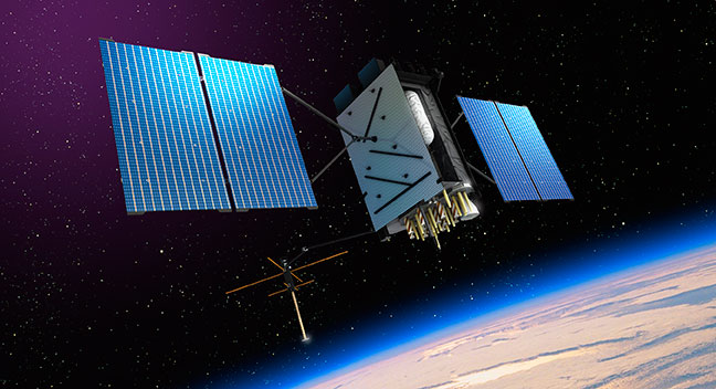
    An even more compelling argument for being first revolves around GPS versus Galileo operational satellites. The first GPS operational launch occurred in 1978, while Galileo has yet to launch a non-R&D operational PNT satellite, into a useable orbit that is. Now, before you accuse me of being smug, I am actually making a case for increased cooperation between the United States Air Force (USAF) and our European counterparts (ESA) where precision positioning, navigation and timing (PNT) schemes are concerned. For when it comes to satellite navigation and PNT, we yanks can definitely declare “been there, done that” mistakes and successes. What better place to “crow,” or rather, impart our considerable knowledge and network with fellow PNT aficionados, than at ION GNSS+.

    ION GNSS+

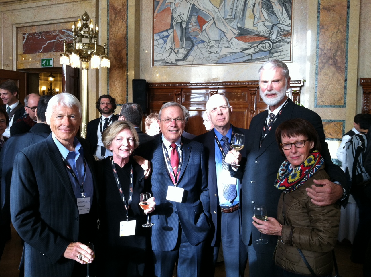
    All vocal eloquence jealousies and juvenile kidding aside, in many respects the ION GNSS+ event is actually the epitome of international cooperation in the PNT and GNSS (Global Navigation Satellite System) arena. This annual premiere event is described as “the world’s largest technical meeting and showcase of GNSS technology, products and services,” and I wholeheartedly agree. Indeed, the 2014 event, which took place from September 8-12 at the Tampa Convention Center in Tampa, Florida, had the stated goal of bringing together international leaders in GNSS and related positioning, navigation and timing fields to present new research, introduce new technologies, discuss current policy, demonstrate products and exchange ideas. It was a networking paradise in a wonderful, albeit somewhat steamy, venue, which you can review in two excellent videos concerning the event at the ION website.

    This ION conference improves every year in content and attendance, and this year was no exception. Congratulations to Lisa Beaty and her whole team for a great conference, year after year. My favorite events are the annual GPS World Leadership Dinner and the prestigious annual ION Kepler award luncheon. Notice a trend?

    GPS World Leadership Dinner

    This much ballyhooed event becomes more and more of a draw each year. Tickets are coveted (as scare as hen’s teeth as Granny used to say) and competition is fierce. Every year we have about twice as many people wanting to attend as we have room to accommodate them. So the competition is never boring. This year was special in that one of our own GPS editors was nominated for an award and was overwhelmingly elected to receive it.

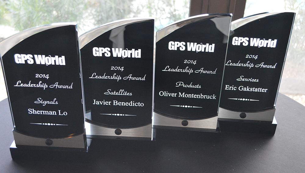
    The Leadership Award winners this year were Javier Benedicto Ruiz, the Galileo Project Manager from the European Space Agency (ESA), who won in the Satellites category, while an old friend Sherman Lo, who is a senior research engineer and associate investigator (APNT) at Stanford University, won in the Signals category. Our own Eric Gakstatter, contributing editor for Survey and GIS from GPS World, won in the Services category; and finally Oliver Montenbruck, who is head of the GNSS Technology and Navigation Group, from DLR, the German Space Operations Center, won in the Products category.

    The 2014 leadership awards, determined by a poll of 40 industry professionals, await the start of the ceremony.
    GPS World 2014 Leadership Trophies.

    The invited guests, and there was not an empty seat in the house, heard various perspectives from sponsors Lockheed Martin, Exelis, Raytheon, and Braxton Technologies, as well as visions of GNSS progress from our four award winners.

    This event will be covered in much more depth in our December issue, but suffice it to say it was as usual a great event. I wonder from year to year how we will ever top the previous year’s entertainment, which always involves audience participation, but Alan Cameron just keeps coming up with outrageous ideas that seem to always pan out. Hope to see you there in Tampa next year.

    The Kepler Award

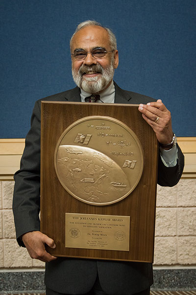
    This year, the highly prestigious ION Kepler Award was won by Dr. Pratap Misra. Even though I am happy to say that through the years many of my friends and colleagues have won this coveted award, I can honestly say, in my opinion, there has never been a more deserving award winner than Professor Pratap Misra.


    [Correction: The newsletter summary of this article misspells Pratap Misra’s name. We apologize for the error.—Editors]


    Pratap Misra, 2014 Kepler Award recipient.
    Pratap Misra, 2014 Kepler Award recipient.

    I have had the good fortune to know Professor Misra for many years, and frankly erroneously assumed, along with many others, that since he is so obviously deserving he had previously won the Kepler Award.

    The Kepler Award is presented annually by ION in recognition of an individual’s unparalleled, sustained and significant contributions to the development of satellite navigation. It is the highest honor bestowed by ION’s Satellite Division. Professor Pratap from Tufts University meets and exceeds all of these qualifiers and more. He is simply self-effacing and polite as he quietly goes about being the best in all he endeavors.

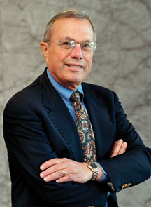
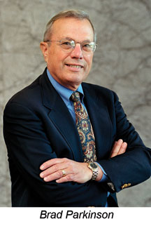
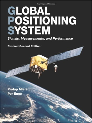
    Throughout the years, I have found Pratap to be extremely dedicated to his work, and more recently to his students. These are key attributes. Academically, I can honestly say that the authoritative tome Global Positioning System: Signals, Measurements and Performance that he coauthored with, another friend and colleague, Professor Per Enge of Stanford University, is among the most dog-eared in my PNT library. This widely praised volume is often described as a “comprehensive introduction to GPS: the system, signals, receivers, measurements, and algorithms for estimation of position, velocity, and time.” And while it was originally intended as a textbook for senior or graduate-level engineering courses, it also serves remarkably well as a self-study guide for practicing engineers and as a reference tool for writers and researchers. I consider it to be one of the three PNT bibles that are a must-have in every PNT subject-matter expert’s (SME) library. (The other two are  Global Positioning System: Theory and Applications, Volumes 1 and 2, by Bradford W. Parkinson and James J. Spilker, and Understanding GPS: Principles and Applications, Second Edition, by Elliott Kaplan and Christopher Hegarty.)

    Revised Second Edition by Pratap Misra and Per Enge.
    Revised Second Edition by Pratap Misra and Per Enge.

    In recent years, Pratap Misra has been honored as both an ION and IEEE Fellow and has served as a past chairman of the ION Satellite Division. He has held numerous volunteer positions within ION, but most recently he has focused on something near and dear to his heart, the support of student programs. This is where Professor Pratap Misra is without peer. Frankly it is obvious that his students adore him, and it is due in no small part to his single-minded dedication to and concern for them.

    Every time we meet, the majority of his words and thoughts concerns his students. Their welfare is always uppermost in his priority list. Inevitably, while we are attempting to conduct a quiet and private conversation or interview, we are constantly being interrupted by well-meaning students, past and present, who just want to thank Pratap for his help and support. I could fill up several pages with the technical accomplishments of Professor Pratap Misra, but none of those accomplishments, recognitions or awards mean as much to him as the love, support and success of his students. It is so obvious to anyone who pays attention that he wholeheartedly thinks of his students as and treats them just like family.

    I am sure, or at least hope, we all have past professors or teachers in our lives that we remember fondly, and then there are the few or perhaps only the one that changed the course of our lives for the better. Professor Pratap Misra is one of those rare latter individuals, so deserving of the appellation — a professor that made a difference in the lives of his students. I am so proud that he deservedly won the Kepler Award and am deeply honored that I can call him my friend.

    GPS-IRT Update

    The Global Positioning System Independent Review Team (GPS-IRT) is now officially part of the Independent Strategic Assessment Group (ISAG) under the auspices of the Institute for Defense Analyses (IDA). For 19+ years, the GPS-IRT was a separate team within IDA that researched GPS matters with the “goal of insuring both the military and civilian communities would benefit from new GPS/PNT capabilities and services.”

    As a result of this organizational change, Air Force Space Command (AFSPC) chose to formally recognize the GPS-IRT’s 19+ years of effort in support of GPS modernization.

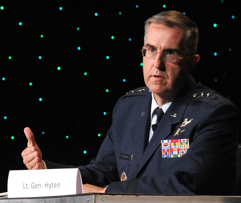
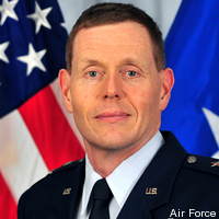
    Last Thursday, General John Hyten (USAF), the commander of Air Force Space Command, presented a commemorative plaque to Mr. Kirk Lewis, the executive director at IDA, for both the GPS-IRT and the ISAG. The plaque will be displayed with the GPS satellite on permanent display at AFSPC headquarters, in the James V. Hartinger building on Peterson Air Force Base, Colorado. The plaque contains the names of the four prestigious chairmen who led the GPS-IRT over the last 19 years, as well as the names of the members of the IRT over that same time period. Sadly, two of the chairmen and five of the members are no longer with us, but we can only hope they are looking down upon us fondly and giving us guidance of a different sort.

    Until next time, happy navigating, and remember: GPS is brought to you courtesy of the United States Air Force.

  • Danger, Will Robinson! Beware the IMES of Japan

    Danger, Will Robinson! Beware the IMES of Japan

    IMES-1-B
    The IMES navigation concept. Credit: IMES

    In May 2011, Dinesh Manandhar and Hideyuki Torimoto of GNSS Technologies, Inc., Japan, penned a very interesting article in GPS World titledOpening Up Indoors: Japan’s Indoor Messaging System, IMES. The opening paragraph of their lengthy article seemingly describes the Holy Grail for the indoor positioning lobby:

    “An indoor messaging system (IMES) has been developed to meet the challenges of indoor and deep indoor positioning, as a system that can be implemented in any device that has a GPS/GNSS receiver without hardware modification. IMES can provide reliable 3D position data with a single transmitter device without performing range calculation[s].”

    They go on to describe the IMES concept thusly:

    “The main concept of IMES is to transmit position and floor ID of the transmitter with the same RF signal as GPS. IMES transmits latitude, longitude, height, and floor ID by replacing the ephemeris and clock data in the navigation message of GPS. A single unit of IMES is enough to get the position data, since the position itself is directly transmitted.”

    Now, you don’t have to be a rocket scientist to start thinking about interference and spoofing issues or risks, especially when you read that the navigation message ephemeris and clock data are being replaced by data broadcast by IMES. To be fair, the authors address these issues briefly:

    “Since IMES shares the same frequency as [the] GPS L1 band (1575.42 MHz), there is an interference level that IMES may have on GPS signals. This interference has been studied in detail by conducting experiments and simulations. Based on these studies and analysis, various methods have been considered to avoid harmful interference to GPS signal. To avoid such interference, IMES center frequency is shifted by +/– 8.2 KHz from GPS L1 band. This will have the least impact on the GPS L1 band signal. For example, if the IMES signal is –110 dBm (very strong) and the GPS signal is –142 dBm (very weak), the loss of GPS signal (C/N0) due to IMES is less than 2 db. If the IMES signal is –120 dBm and the GPS signal is –142 dBm, there is no loss of GPS signal (C/N0). Based on this analysis, the IMES transmitter power must be controlled such that the maximum power to the receiver does not exceed –110 dBm at a distance of 3 meters from the transmitter. [There are] guideline[s] specified in the QZSS IS document for setting the transmitter effective isotropic radiated power (EIRP) based on location.”

    Let’s put these concerns in perspective. I thoroughly enjoyed the article and firmly believe that we desperately need to solve the indoor positioning and navigation problems, especially for our warfighters and first responders. While many of today’s excellent commercial receivers work well indoors near windows and doors, they are absolutely abysmal underground and deep inside large buildings with lots of metal, or in the middle of dense urban canyons such as Tokyo, Japan. Without a doubt, there is a dire need for a system like IMES — or maybe exactly like IMES — but there must be some caveats and stipulations as to how the IMES system is implemented.

    Not Alone

    Fortunately, I am far from being a lone wolf in voicing my concerns and my position, for once again the conspiracy theorists as well as renowned scientist and policy makers are concerned about IMES and the operating systems they supposedly desire to replace or augment. Chief among them is the Father of GPS, Dr. Bradford Parkinson, who has frequently described improperly operated in-band pseudolites as “…just another name for a legal jammer or spoofer.” Having known Brad for almost 40 years, I am convinced few GPS experts in the world today have as much experience with pseudolites as Dr. Parkinson. Consequently, the very reason that an indoor navigation system such as IMES is needed may well be a portent for why it may well fail, unless it is implemented properly.

    It would be easy but extremely tedious to write about the numerous issues facing IMES in a complicated and technical manner. Certainly previous articles have become bogged down in minutia, and I want to avoid that. It is actually very simple. The issues are fairly straightforward and should be faced head on and not hidden in the midst of tech-speak lingo, legal jargon, policy minutia or politics. So lets dive straight in, shall w,e and make sure these issues see the light of day?

    Interference

    There can be no doubt that IMES has the potential to significantly interfere with GPS and QZSS signals. The authors of the IMES article are quite clear concerning the potential for interference, and in their own way attempt to mitigate it with signal power restrictions. Their example of a small three- to four-story building with IMES transmitters may indeed be adequate for signal power mitigations, but what happens in Tokyo where tall buildings — skyscrapers if you will — abound? When the Tokyo Skytree skyscraper opened to the public in 2012, it was then listed as the world’s tallest tower and Japan’s biggest new landmark. At over 2,080 feet tall, this is definitely the type of building where one would need an IMES system. With an average of 20 IMES transmitters per floor and weighing in with over 200 floors, we can quickly see that there would be over 4,000 IMES transmitters in this one building alone, all broadcasting simultaneously on or near the center frequency for GPS. Absent stringent regulations and infinite care (the IMES article authors propose that the pseudolite network operator will have the responsibility to continuously monitor each pseudolite and the pseudolite network to prevent interference), and perhaps even with those caveats in place, the GPS L-band noise floor would be such that GPS signals would be incapable of being received.

    Now, put 20 such buildings in a ten-block area and the noise floor would be almost incalculable and certainly not predictable. Dr. Parkinson’s fears are realized; your legalized IMES system becomes a distributed network of jammers and/or spoofers. However, technically IMES is currently far from being a legal jammer or spoofer as currently IMES transmitters are not legal to operate in the GPS band at 1559-1610 MHz under the International Telecommunications Union (ITU) Treaty per the International Table of Frequency Allocations of the ITU Radio Regulations. The ITU further states that IMES currently operates on an interfering basis with the co-primary allocations (ARNS/RNSS) in this band, and therefore are in violation of the ITU Treaty. However, Japan’s frequency regulatory agency can develop and implement regulations that allow IMES operations. When this occurs, if not operated within stringent guidelines, IMES could then be considered a legalized jammer or spoofer.

    Even the Joint Research Centre of the European Commission, the JRC, states in its Executive Summary on pseudolites that in-band pseudolites pose a significant jamming risk to GNSS receivers. Specifically they state:

    Pseudolites or pseudo-satellites are an emerging technology with the potential of enabling satellite navigation indoors. This technology found several applications that are not limited to indoor navigation. Precise landing, emergency services in difficult environments and precise positioning and machine control are few examples where pseudolite technology can be employed.

    Despite the great potential of this technology, severe interference problems with existing GNSS services can arise. The problem can be particularly severe when considering non-participating receivers — legacy devices not designed for pseudolite signals. The design of pseudolite signals is thus a complex problem that has to account for market requirements (modifications of existing receivers for enabling the use of pseudolite signals, measurement accuracy, target application), regulatory aspects (frequency bands to be allocated for pseudolite services) and interference problems.

    JRC investigates the main aspects to be considered for the design of a pseudolite signal standard minimizing the interference problem without compromising the location capabilities of the system. The focus is on the signal characteristics and topics relevant for the signal design.

    Pseudolite or Communications System

    The second technical portion of the interference issue revolves around how exactly you define IMES, for when you are dealing with radio regulation agencies semantics matter. Think back to the first paragraph of this article where the IMES authors defined IMES as a messaging system. That certainly sounds like a communications system to me, and others agree. Consequently, the question has been raised and rightfully so: Is IMES a navigation and positioning system, a pseudolite or a communications system? Honestly, to me it sounds like a bit of all three, but if you define it as a communications system, then Japan is seeking to authorize the integration of a communications system with known significant interference issues with GPS signals right in the middle — indeed, potentially on the center frequency of the protected navigation band using terrestrial PRN codes assigned by the U.S. government. If IMES is deemed an indoor pseudolite, then the interference issues are still there. But it is defined as a bonafide PNT system using authorized terrestrial PRN codes. Talk about a bucket of worms!

    The issues here are numerous, and they need to be fully addressed to ensure that all those who are potentially affected clearly understand what is being proposed and the risk for the public at large, including who owns responsibility if something goes wrong. I could go on for several pages on this issue alone, but suffice it to say, we do not want to authorize a communications system that is a known and acknowledged GPS interferer right in the middle of the band — or anywhere in the band for that matter. Remember all the issues GPS had in the past several years with a communications system in adjacent bands. So, do we really want a known communications system — or communications system masquerading as a pseudolite, for that matter — with known GPS signal interference issues in the restricted GPS frequency spectrum? The blaringly obvious answer is absolutely not! Yet this is exactly what the IMES authors are proposing not only for Japan, but eventually, if they receive authorization, for other countries around the globe as well. Japan has twice petitioned the U.S. government to make the assigned IMES terrestrial PRN code allocations global in nature. Fortunately, to date those request have been denied.

    Dichotomy

    Certainly, other countries and companies have noticed this apparent frequency authorization dichotomy and are following suit. For instance the Conference of European Postal and Telecommunications agencies, or CEPT, which is Europe’s regional representative to the World Radiocommunication Conference (WRC), has proposed adding several troubling IMES-related agenda items for the quadrennial WRCs coming up in 2015 and 2019. Even more importantly, these critical issues could be aired in the next three weeks, as the agenda for the 2015 WRC will be largely set at a plenipotentiary conference happening October 20 through November 8 in Busan, South Korea.

    There are what I consider to be dangerous proposals under consideration by the ITU (International Telecommunication Union), which should concern GNSS users worldwide. The ITU is the United Nations’ specialized agency for information and communication technologies — ICTs. This is the ITU, where every member state (currently 193) gets one vote, whether they fully understand the technical issues or not and regardless of whether they are a space-faring nation or have a dog in the fight, so to speak. This means that the vote of tiny Saint Lucia counts the same as the United States or Canada or Australia. The ITU charter is to “…allocate global radio spectrum and satellite orbits, develop the technical standards that ensure networks and technologies seamlessly interconnect, and strive to improve access to ICTs to underserved communities worldwide.” Fortunately, the ITU regulations, unlike the CEPT or IMES proposals, wisely require new transmitters proposing to operate in the radio navigation spectrum to operate without causing interference to primary users. Meanwhile, there are member states, countries and companies that want to capitalize on this seeming dichotomy within the global safety-of-life, historically protected, radio bands. Those nefarious efforts, for the future of GPS and GNSS worldwide, need to be stopped in their tracks.

    Spectrum is a limited and valuable resource, to say the least, and here fortunately the ITU regulations have it right and do not risk human life, by intruding and potentially interfering with the frequencies used globally by airliners to control, route and land aircraft. I am convinced there are solutions available to us through cooperative efforts with the ITU and other national organizations that will produce pseudolites without causing interference in the protected safety-of-life frequency bands.

    When Is a PRN Code Not a PRN Code?

    Some of you who are a bit more savvy or have been following this fiasco for some time may now be thinking, what’s the problem, the IMES authors are merely using and proposing further use of U.S. government-authorized terrestrial PRN codes for IMES. This indeed touches on the third thorny issue, which is not only technical but political as well — the use of and authorization to use PRN codes for what is ostensibly a communications system, if you believe the authors of the IMES article, who go to great lengths to differentiate IMES from pseudolites. They continually make the argument that IMES is not a pseudolite, but as we shall soon see, when the U.S. government authorized these specific PRN codes (173-182) for Japan, they were to be used solely for a low-power terrestrial pseudolite program, not an in-band communications system.

    Technically, these specific PRN codes assigned to the Japanese for IMES expire in 2017. The authorization of these PRN codes come with numerous restrictions that legally make the codes useful only for the Japanese landmass. This is where the technical, political and operational issues come to a head. We are in for some tough sledding here. However, I will endeavor to make it as simple as possible.

    History

    In 2007, ten PRN codes were specifically assigned to the Japan Aerospace Exploration Agency or JAXA “for the Indoor Messaging System (IMES) terrestrial pseudolites of the Quasi-Zenith Satellite System (QZSS).” The Memorandum of Agreement from the GPS Wing at SMC (Space and Missile Systems Center) in Los Angeles at Los Angeles Air Force Base (LAAFB) clearly states that the codes are valid for ten years and expire on 19 November 2017, unless a renewal application is filed and approved. Hence, PRN codes 173-182 for IMES were assigned with several crucial caveats and restrictions by the U.S. government that are definitely pertinent to our discussion:

    1. The codes are designated for low-power terrestrial regional applications limited to Japan only.
    2. Although the GPS Wing conducts an initial check on PRN number requests with respect to potential interference issues, the issuance of a PRN number does not convey authority to radiate in the [GPS] band. In order to radiate in the GPS L1 band, the applicant [Japan] shall obtain a frequency assignment from the [Japanese] national authority.
    3. The GPS Wing assumes no responsibility for ensuring systems using these spreading codes follow domestic radio frequency regulations or other applicable laws or regulations, or for ensuring that systems using GPS PRN codes do not cause radio frequency interference.
    4. GPS PRN codes were developed for signals transmitted from satellites, and are not necessarily optimized for use by terrestrial transmitters.
    5. The maximum effective isotropic power for each terrestrial transmitter will be less than -94 dBW.
    6. The QZSS [organization] is responsible for the redistribution of these spreading codes throughout Japan and will limit their use to Japan only.

    With all these restrictions, it is difficult to see how the IMES authors could legally use, distribute or promote authorization of IMES and the use of the PRN codes outside of Japan and at the power levels related in the GPS World IMES article. Regardless of the IMES author’s interpretation of the PRN code assignment, the GPS Wing 2007 Memorandum restrictions and caveats are clear, and it cannot be disputed that the codes expire in 2017 unless renewed by the USAF. The PRN codes are restricted to the landmass of Japan even if they are renewed, and if IMES wishes to broadcast anywhere in the GPS band, they need to have permission from their national frequency allocation authority (the Ministry of Internal Affairs and Communications, which is equivalent to the U.S. FCC –Federal Communications Commission) to do so.

    The Way Ahead

    This is the easy part from my perspective. See if you don’t agree. If the U.S. government is concerned about IMES and what Japan is planning to do with the assigned PRN codes for terrestrial use, the U.S. government through the USAF has the options to:

    1. Rescind the PRN codes immediately.
    2. Insure the Japanese adhere to the caveats and restrictions in the original Memorandum.
    3. Simply refuse to renew or recertify the codes for future use and/or recommend for IMES frequencies that are outside the protected GPS band.
    4. Update and clarify the footnote on the GPS Wing PRN Codes website pertaining to the Japanese IMES PRN Codes with all the restrictions listed in the GPS Wing Memorandum so other countries will realize this is not a global IMES PRN assignment.

    Japan is a valuable ally and we need to work together cooperatively, but frankly, the plans laid out for IMES by the authors in the GPS World article must be troubling to those whose job it is protect the GPS spectrum and enforce mutual agreements with our allies. If we were just concerned about a Japanese IMES system, this whole discussion might be moot. However, other countries and commercial companies around the world are watching closely and laying the groundwork for similar IMES and pseudolite incursions into the GPS L-band spectrum — if the Japanese are allowed to proceed and the limited use of PRN codes for IMES is not clarified for all. No one, and I include the Japanese, wants to see this happen if it means interference with GPS, and QZSS for that matter.

    Fortunately, where European countries are concerned, there are the ITU regulations. Specifically for GPS and pseudolites, the CEPT regulation has a license condition that requires the pseudolite network operator to submit to the European country regulator confirmation of the terrestrial PRN codes from the GNSS operator before operating pseudolites in the GPS band. So again, the U.S. government wields the hammer here.

    Therefore, the U.S. government must act immediately and decisively to put an end to the threats against the protected GPS spectrum caused by the proposed in-band IMES system. At the same time, the Japanese government has an obligation and responsibility to adhere to the letter of the law where the original GPS Wing 2007 IMES Memorandum is concerned.

    Finally, the U.S. government must urgently engage cooperatively with the European Union administration and Japan to prevent the authorization and proliferation of interfering devices in the GNSS frequency bands, and to work together to ensure the positive benefits to GNSS from commercializing pseudolite uses outside the GNSS radio frequency bands. GNSS manufacturers worldwide are successfully marketing commercial pseudolites that do not cause interference. In my opinion, this is the way to go both in terms of regulations and governance.

    Until next time, happy navigating, and remember GPS is brought to you free of charge by the United States Air Force.

  • Galileo Conspiracy Theory

    Galileo Conspiracy Theory

    PLUS: Flying for GPS Book Review

    Do you know any conspiracy theorists? You know, those folks who I am sure are well meaning, but see a conspiracy behind every event? Think Mel Gibson in the great 1997 movie with the very imaginative title Conspiracy Theory. Well, the conspiracy theorists have been coming out of the woods following the Galileo launch fiasco, and they are blaming both the Russians and European Space Agency for allowing the Russians the capability to effectively render useless what should have been the first two operational Galileo PNT satellites.

    Think about it. The European Union spends more than 17 years gearing up for a launch of the first two operational Galileo satellites, and they leave the final orbit determination to equipment from a country (Russia) that their countries, and the United States, are collectively (European Union) currently sanctioning for numerous treaty and humanitarian violations.

    Who knows? Maybe this was all just a big mistake, and there were no overt actions taken by Russia to place the two Galileo satellites in the wrong orbit. Frankly, I have no idea if the final stage was sabotaged or not, but it makes for an interesting theory and gedankenexperiment. It also should serve as a warning to the U.S. government, especially the USAF when it comes to utilizing the remaining Russian rocket engines we have in stock.

    I have been to the location where the handover of the Russian rocket motors takes place. The motors are delivered by the Russians and accepted by USAF and United Launch Alliance officials. Then, I have been assured, that the engines are gone over with a fine-tooth comb. Hopefully, there is no opportunity for a motor that has been tampered with passing our inspections, validations and launch certifications. Still, there is always that niggling worry in the back of your mind that won’t go away. So, even if the conspiracy theorists are all wet, and I hope they are, the whole Galileo launch fiasco should still serve as a warning to our National Military Space (NMS) acquisition and launch certification officials. A little extra scrutiny of Russian-manufactured space equipment might be in order.

    Of course, there does not have to be a conspiracy. It could be just bad luck or poor workmanship. It is public knowledge that the Russians have had numerous launch and space-equipment failures in recent months, while the U.S. has had more than 115 consecutive NMS launches without a single failure. Indeed, there has not been a single NMS launch failure since the Broad Area Review (BAR) in the late ’90s.

    There have been two additional follow-on BARs since and they all recommended greater situational awareness and attention to detail. So maybe the Russians just need a good BAR — pun intended. At any rate we should know in the next few months as there are no fewer than three separate European investigations being conducted as I write this. Let’s hope the conspiracy theorists are all just crying wolf.

    Flying for GPS Book Review

    Flying-for-GPS-JacobsonThis is the title of a new book by an old friend and colleague, Len Jacobson. This is Len’s second full-length book, as he writes copious articles (many for GPS World) and chapters of books for other writers. In my opinion, this is the better of his two books, although the first book was much more technical in nature. It sits on my GPS bookshelf and I refer to it frequently. So maybe this one is just a better read.

    When Len’s autographed book arrived, I dove into it and immediately discovered it is as much about Len and his life before and since GPS (BCEGPS and ADGPS if you will) as it is about the Global Positioning System per se. This is certainly not a criticism, merely an observation, since the personal touch makes this book come alive.

    Seriously, this book is an unabashed personal history, a travelogue and a history of the GPS program all rolled into one, and although Len cautions readers to only read Part Two if they only want to know about GPS, I maintain that you will miss a great read if you go that route.

    Len Jacobson
    Len Jacobson

    As I said, I have know Len since about 1975 ,and even though we have known each other for 39 years I had no idea of all the qualifications Len brought to GPS and how his life, after 1975, has revolved around this singular military weapons system.

    The book is a tour de force for GPS, but also is about an engineer coming of age in the 1960s during the Vietnam War. Len describes the technology and communications capabilities and programs that made GPS possible. But more than that, he also goes into the personalities, and this may be the highlight of the book for many. He names names when possible, and obscures them when circumstances, personal preferences and legal precedents demand it. Still, most of the time ,if you were around in the halcyon days of Parkinson and Getting, then you know exactly who Len is describing. And even if you don’t know, it is fun to guess.

    Len gives some painful insights to the birth pains that GPS experienced — to include the early rejections by both the military and the Federal Aviation Administration (FAA). And his description of the whole Selective Availability saga sheds new light for me on just what took place, and I was there.

    Throughout the book, Len describes his life and key roles in self-deprecating terms, and yet acknowledges he was known far and wide. I can personally attest to this, as a GPS proselytizer. There is another word I could use, but since this is a family magazine I will forego the opportunity. Let’s just say that if Len was in the room, you knew you were going to hear about or talk about the latest in GPS technology.

    Some of you might describe parts of the book as esoteric trivia concerning GPS, and while that may be true, Len presents it in such a way that you want to file that bit of trivia away for a rainy day and then spring it on your PNT colleagues when they least expect it. For instance, I found it very compelling when Len describes on page 95 the history of the Chinese BeiDou program. I think you will be surprised. I was.

    And in the end, many of the companies that Len worked for over the years no longer exist today, such as Figgie, but fortunately many of the people are still around. And Len doesn’t pull any punches. He relates stories of business intrigue, intransigence and even bigotry. He even manages to include the Lacy Peterson murder investigation.

    I hope I have piqued your interest, because this is a unique book that everyone who is evenly remotely interested in the history of GPS and PNT in general should read. Highly recommended. Read a quick excerpt from this unique GPS tome on the GPS World website if you have the time.

    Happy navigating!

    Don Jewell


    Until next time happy navigating and remember GPS is brought to you free of charge by the United States Air Force. Aim High!


  • Latest Words from the Acquisition Guru  of the World’s Gold Standard for PNT

    Latest Words from the Acquisition Guru of the World’s Gold Standard for PNT

    Col. William Cooley, Director, U.S.A.F. Global Positioning Systems Directorate.
    Col. William Cooley, Director, U.S.A.F. Global Positioning Systems Directorate.

    Colonel William “Wild Bill” Cooley, director of the GPS Directorate at Space and Missile Systems Center, discusses CNAV signals, GPS IIF launches, and the OCX with Defense Editor Don Jewell.

    There is probably no busier United States Air Force officer than Colonel William “Wild Bill” Cooley, Ph.D., the director of the GPS Directorate at Space and Missile Systems Center (SMC), Air Force Space Command (AFSPC), Los Angeles AFB, California. He is the driving force for all things dealing with acquisition and development for GPS. Currently, he is juggling so many objects, it is amazing that he is not totally overwhelmed. Consider the issues with the Next-Generation Operational Control System (OCX), GPS IIF, GPS III, and military government user equipment (MGUE), plus a plethora of classified endeavors we can’t even discuss here. He is one busy man, but even with all that, he found time to sit down and answer a few questions in an effort to bring us all up to speed on GPS and PNT.

    Don Jewell (DJ): One of the hot topics at all the symposia lately, here and abroad, has been the broadcasting of additional civilian navigation signals and messages. The U.S. Department of Transportation (DOT) originally objected and sent a strongly worded and probably unadvisable letter to General Shelton (AFSPC/CC) on the matter, but sanity prevailed, and the GPS navigation signals on L2C- and L5C-capable satellites began broadcasting with full navigation messages on April 28. However, we understand DOT still insists some restrictions be put in place for the L5C signal. Can you provide us with an update and a status on that program? Plus, what can users expect in the way of improved accuracy and signal availability?

    Colonel “Wild Bill” William Cooley (WBC): As of April 28, the civil navigation message (CNAV) broadcast was implemented on all operational GPS satellites capable of transmitting the L2C and L5 signals. Currently, seven GPS IIR-M satellites broadcast L2C, and six GPS IIF satellites broadcast L2C and L5. On average, users may expect at least one L2C-broadcasting satellite to be in view at all times.

    The CNAV message content now includes the minimum message set needed to support the positioning, navigation, and timing mission, namely Broadcast Message Types (MT) 10, 11, 30, and 33, which contain information about the satellites’ position, clock, health, and corrections, in lieu of the previously transmitted MT-0 placeholder or default message.

    The Air Force intends to broadcast L2C messages with the health bit set healthy and L5 messages with the health bits set unhealthy until sufficient monitoring capabilities are available for the L5 signal. We expect the accuracy to be slightly less than the Legacy Navigation Message (LNAV) because we are only updating the satellites two times each week. The accuracy should improve to be slightly better than LNAV beginning this December, when we begin updating the CNAV message on each satellite daily.

    DJ: The M-code (military code) and MNAV (military navigation) signals are also being broadcast on M-code-capable satellites. So, the same questions apply: what can our warfighters and government users expect as far as M-code availability and accuracy? What can you say about the multiple messaging capabilities both on the civilian and military (CNAV and MNAV) signals?

    WBC: Like the civil CNAV message, the modernized military-data message MNAV will enable military users to take advantage of all of the performance improvements offered by a modernized military signal. We can expect continued accuracy improvements as newer satellites replace aging satellites.
    MNAV broadcast testing will continue occasionally in support of developmental test events for the next-generation military GPS receiver cards.

    DJ: I know we can get in sensitive territory here in a hurry, but since we are discussing the military signals, can you give us an update on the long-running MGUE and M-code program? When can government users expect to see an actual signal and a receiver with M-code chips and/or modules that utilize the military only signals? Plus — and here’s where we have to be careful — what can you say about the security, availability, and accuracy of the military signal?

    WBC: The M-code-capable military receiver (MGUE) modules in development have successfully acquired and tracked M-code during live-sky tests, and we have many more tests scheduled. MGUE is expected to begin fielding by 2017, at which point at least 18 M-code-capable GPS satellites are expected to be on orbit, providing global four-in-view coverage of full M-code capabilities.

    In the meantime, the most recent GPS IIF satellite launches have raised the total number of M-code-capable modernized GPS spacecraft to 14 (seven GPS IIR-M and seven GPS IIF). This provides four or more M-code satellites in view globally at least 50 percent of the time, and at least one M-code satellite in view continuously. This increasing M-code satellite signal coverage will enable effective, realistic, developmental and operational testing of MGUE receivers.

    The new GPS III block of satellites will provide an M-code signal with greater security, and higher power, comparable availability, and accuracy when compared with the GPS IIF satellites, allowing users to operate closer to jammers and under trees, as well as with greater resistance to jamming and spoofing. Also OCX will offer significantly improved crypto protection and cyber security.

    DJ: Recently, the U.S. Air Force successfully launched the fifth, sixth, and seventh SVs in the GPS IIF family of satellites in less than seven months. Quite a feat! Congratulations are in order for that milestone. However, in the past, the checkout times averaged approximately 30 days. In fact, speed in initializing the IIF SVs and declaring them operational seemed to be an unofficial goal. On GPS IIF-5, however, the rapid checkout timelines have been extended considerably. Can you enlighten us concerning the checkout program and what the government hopes to achieve?

    WBC: There are three key dates with regard to checkout timelines: completion of on-orbit checkout, the transfer of Satellite Control Authority (SCA), and the Operational Acceptance of the vehicle. Measured from launch, the nominal on-orbit checkout timeline is 21 days. The nominal checkout for SCA transfer is 28 days. For the IIF-5 mission, the on-orbit checkout occurred in six days and the SCA in 11 days, a record for the IIF program!

    The operational acceptance was completed 60 days later, following an on-orbit observation validating a requirement to see if the vehicle works as expected without receiving any commands from the ground segment in that time period.

    This may explain the perceived extended checkout, which is in reality a delayed operational acceptance.
    The average time to SCA transfer for the first four vehicles is 42 days. The average is inflated due to a long checkout of the first GPS IIF space vehicle, which took 88 days. From IIF-2 to the present, the average SCA transfer time has been 21 days.

    Using SCA transfer time makes the most sense, because that is the time it took the SPO to go through the entire process (to include meetings and documentation) to hand over the vehicle.

    DJ: Can you give us a status update on the entire GPS IIF family of satellites? How are the SVs faring in orbit, and are the clocks proving to be as stable and accurate as forecast?

    WBC: The first seven of 12 GPS IIF satellites are currently on-orbit and meeting all mission requirements. Of the remaining satellites, one is being prepared for launch in October 2014, one is being prepared for shipment to Cape Canaveral AFS, two are in storage, and one is completing production. The oldest satellite is now four years old. The legacy GPS satellites have remained operational well past their design lives, demonstrating the high-quality engineering and mission-assurance practices used on this program. The clocks are improving the overall accuracy of the constellation with the best-ever day (measured in Signal-in-Space User Range Error) in June 2013 of 46.6 centimeters and the best week in April 2014 of 64.6 centimeters.

    DJ: What exactly do the IIFs mean to the GPS modernization program, for the average user and for the GPS constellation and program as a whole?

    WBC: The 12 Boeing-built GPS IIF satellites will provide improved signals that will enhance the precise global positioning, navigation, and timing (PNT) services supporting both the warfighter and the growing civilian needs of our global economy. The next-generation satellites will provide improved accuracy through advanced atomic clocks, a longer design life than previous GPS satellites, and a new operational third civil signal (L5) that benefits commercial aviation and safety-of-life applications. It will also continue to deploy the modernized capabilities that began with the modernized GPS IIR satellites, including a more robust military signal.

    The anomalies that we have seen on orbit have been resolved either through rework at the factory or through modifications in flight software.

    av_gpsiif7_l1382201472731AM63
    GPS IIF Launch. The seventh of the follow-on generation, rising August 1.

    DJ: Bill, that’s comforting, but what about the clocks on the IIF SVs? There were serious problems with the Cesium clocks on the first couple of launches. Are the operators now able to utilize or activate either the Rubidium or the Cesium atomic reference systems?

    WBC: Don, the answer is yes. The system has triple redundancy with two Rubidium frequency standard clocks and one Cesium frequency standard.

    DJ: What about signal strength and stability on the IIF birds?

    WBC: In addition to an increased number of signals, GPS IIF provides more than the legacy power levels, and all signals on GPS IIF meet stability requirements. For reference, the GPS IIR-M series introduced one new L1 and two new L2 signals, while GPS IIF introduced the new L5 signal. All of these signals are part of the GPS IIF navigation payload and provide information including GPS date and time, satellite health, satellite ephemeris (for individual satellite positioning), and almanac information (for information on other satellites in the constellation).

    The L1 frequency carries the L1 C/A code for civil users, and the L1 P (Y) code and L1 M-code for military users. The L2 frequency carries the first modernized civil signal, L2C, and the L2 P (Y) code and L2 M-code for military users. Finally, the L5 frequency carries the newest modernized civil signal.

    Modernized GPS civil signals provide dual-frequency signals to all GPS users, enabling ionospheric corrections that greatly improve the accuracy. The new L5 signal will be used for safety-of-life applications, including aviation. In addition to an increased number of signals, GPS IIF provides more than the legacy power levels, and all signals on GPS IIF meet stability requirements.

    DJ: Let’s move to the ground segment. OCX, the next-generation GPS Command and Control (C2) system, has literally moved to the right on the schedule timeline for every month it has been in existence since it was awarded in 2010. The end date just keeps getting farther and farther away. OCX is also currently exceeding the original contract budget by a large margin.

    What’s the problem? Is OCX more difficult or complicated than originally planned? Is there any good news to report to users on OCX? What can users expect in the future?

    Just so our readers know, just what is it that OCX brings to the GPS arena that cannot be provided by the current Architecture Evolution Plan (AEP) C2 system? Why do we need OCX? And in your opinion is it still a viable option? Are there contingency plans?

    My apologies — that is about eight questions in one, but hopefully you can bring us up to speed on OCX.

    WBC: Actually, the primary drivers of schedule delays for OCX are related to:

    • issues with the integration and testing of Block 0 on the cyber-hardened infrastructure; and
    • the concurrent systems engineering approach for Block 1 and Block 2, which drove a high rate of rework and inefficient staffing.

    The OCX program is a pathfinder for many of the U.S. Air Force’s and Department of Defense’s most rigorous Information Assurance (IA) and Cyber Security requirements, which have turned out to be more complex to implement than anticipated.

    OCX is a challenged program, but there is progress to report. Raytheon completed a hardware compatibility and integration test with the non-flight test bed of the Lockheed Martin GPS III space vehicle. This test validated the network infrastructure’s ability to communicate between the Lockheed Martin Launch and Checkout Capability and the Raytheon Launch and Checkout System, sending commands to the full-sized, functional satellite prototype test bed.

    In addition, Raytheon and Lockheed Martin completed the third of five planned launch and early orbit exercises to demonstrate launch readiness. This exercise used new installments of the Raytheon OCX software and network infrastructure to demonstrate space-ground communications for initial acquisition, orbit-raising maneuver planning and execution, and basic anomaly detection and resolution.

    Another recent accomplishment was the merging of the Cyber Security hardware and software baseline with the Block 0, Launch and Checkout System, mission applications. The completion of this merge allowed the program to enter formal integration and test activities, which are ongoing.

    The full capabilities of OCX provide more than a dozen new capabilities for the GPS mission. OCX enables the full capabilities of the modernized navigation signals: adding L2C and L5 for civil users, M-code secure signal for military users, an internationally compatible L1C, as well as worldwide monitoring of these modern signals for quality and integrity.

    OCX enables operation of the new GPS III satellites. As we discussed previously, OCX will provide the USAF’s most rigorous cyber-security capabilities, built in from the OCX foundation.

    Raytheon just completed implementation of a program re-plan, which implemented lessons learned to date to correct many of the development challenges encountered, and created a lower risk schedule for delivery. With these changes, the program remains a viable and important component of the modernized GPS enterprise.

    DJ: With that in mind, when do you currently plan on having the first GPS III OCX-controlled launch? Original schedules called for a late 2014 date, then it was 2015, and now we are hearing 2016 or as late as 2018 for OCX. Are there viable alternatives, and if so, can you tell us what they are and if they are being pursued?

    WBC: OCX and GPS III are synchronized to support launch of the first vehicle in the second half of 2016, conditioned upon launch manifest availability. Contingency plans are being developed, but will only be implemented if warranted by the risk.

    DJ: Now, Bill, I am not asking you to blow your own horn here, but frankly we have heard nothing but good reports from SMC and the GPS Directorate since you arrived about 14 months ago. That is a short period of time, but evidently you have made your presence felt and have had a major impact on the GPS program overall. What have you done differently that seems to work so well? To what do you ascribe your success so far?

    WBC: Thank you, Don. I’m very happy to hear the reports are positive, but the credit goes to the men and women of the GPS Directorate, our federally funded Research and Development Center personnel, and our contractors. My job is to continually assess the challenges and barriers that slow modernization. I help resolve the challenges or get additional resources if needed to enable the team to accomplish their important mission.

    I am incredibly fortunate in that the GPS team is passionate about our mission to maintain the Gold Standard for position, navigation, and timing (PNT) for the world. The entire directorate understands the critical role we play for civilian and military users worldwide, and that knowledge motivates and energizes us every day!

    I’m the luckiest colonel in the Air Force because I get to work alongside this terrific team of government and contractor professionals on one of the most important missions in the U.S. Air Force.

    DJ: Obviously you are proud of your team, and you know what it means to be a great leader. In closing, do you have any final comments?

    WBC: Don, just that the GPS Directorate and our contractor team, along with our partners at the 2nd Space Operations Squadron (2SOPS) who fly the GPS constellation 24/7, take our job seriously and understand the important mission we have: to provide reliable and precise position, navigation, and timing services for America’s warfighters, our allies, and civilian users around the globe. GPS is the Gold Standard for space-based PNT today, and we are modernizing to ensure GPS is the Gold Standard for the future.

  • GPS III Sources Sought?

    GPS III Sources Sought?

    Artist's rendering of GPS III satellite (courtesy of Lockheed Martin).
    Artist’s rendering of GPS III satellite (courtesy of Lockheed Martin).

    So, there I was, sipping a cold green tea in the shade on my back deck in the beautiful foothills of the Rocky Mountains in early June, when the phone began to ring off the hook. Upon answering, I was hit with a barrage of questions. Have you seen the GPS III Sources Sought? What should we do? Do you have any advice? Should we respond? But by far the question I thought expressed most everyone’s initial reaction of incredulity was “Are these guys serious?” For frankly this Sources Sought does contain a bit of a giggle factor.

    The questions continued and the phone rang all week. Officially the Sources Sought being referenced is the GPS III Space Vehicles Production Readiness Solicitation Number: FA8807-14-R-0008. Prepared or not prepared by, take your pick, the space acquisition folks at SMC (USAF, Space and Missile Systems Center), and it has caused quite a stir in the PNT (position, navigation and timing) industry.

    Before we get ahead of ourselves, I should explain exactly what a Sources Sought means in terms of what the U.S. government is looking for and how to respond — in my humble opinion of course.

    First a Sources Sought, as defined by the business folks at Georgia Tech (GTPAC) who have researched the matter thoroughly and who I absolutely agree with, is not an actual bid or proposal solicitation; instead, it’s a solicitation of interest. You should think of a Sources Sought as market research being conducted by a government agency or service to determine the capabilities and interests of the marketplace in a specific area, product or capability. This specific Sources Sought should be of interest to companies having an interest and capability to produce products relating to GPS III specifically.

    So, that’s the boring official definition, but what is a Sources Sought really? Certainly, the official definition works, but more often than not in my experience, the Sources Sought has also been used to:

    1. Determine what companies, new and established, are players and who is still in the game.
    2. Determine what partnerships might be formed and how companies might work together to provide a required and often difficult capability. Often government acquisition officials will discover a new capability from a trusted supplier, or discover new teaming arrangements that provide a synergy otherwise unavailable.
    3. Determine who is paying attention.
    4. See which companies answer the announcement. Acquisition officials say it is often just as interesting and enlightening to see which companies do not submit a response as it is reading the proposals of the responders, especially if the Sources Sought is being used as justification for a Sole Source award.
    5. Determine if the project has any hope of succeeding, and if so, how do various companies approach the problems involved?
    6. Provide an official and public catalyst for lethargic or too-comfortable contractors that are not getting the job done on a current contract. Fear can be a great motivator.
    7. Enact the old marketing axiom, “Let’s run it up the flag pole and see who salutes.”

    Regardless of what you feel the real reason or reasons for the GPS III Sources Sought might be, or even if you have doubts about the seriousness of the release, the one hard and fast rule among marketers is that if you have any capability that even vaguely matches the Sources Sought announcement, then by all means respond.

    The official GTPAC advice — and again, I totally agree — is to always respond to a Sources Sought if it appears to be of any interest to you.  Just as I have always said to company marketing reps, when asked about the company’s capabilities, the answer, a la Marketing 101, is always “Yes” until it is emphatically “No.” As in:

    “Can you build that MDU?”

    “Absolutely!” (Stage whisper) “What’s an MDU?”

    “Dude, it’s a Mission Data unit.”

    “Oh yeah, that MDU. Of course we can build it!”

    It may be hard to believe, in this technological day and age, but contracting officials frequently complain about the limited responses they routinely receive to Sources Sought. Responding is usually quick and painless, and can be the first step to place your company in the running for a lucrative government contract. It distinguishes you from your competitors, who did not take the time or effort to respond. The bottom line is it may very well lead to an inside track on an eventual government contract. Just like poker — you can’t win if you are not in the game.

    Of course, the reverse is also true, as almost every Sources Sought states. There are no guarantees, and a Sources Sought announcement may — or may not — be followed up by the agency or service with the issuance of an actual bid or RFP (Request for Proposal). The GPS III Sources Sought legalese reads this way: “This notice does not constitute a Request for Proposal. There has been no decision to develop an RFP for the effort in this sources sought notice.”

    You take your chances, but nominally it is time well spent, as most Sources Sought require very little in the way of scripted paperwork and government forms. Sometimes the response may be in the form of a simple response on company letterhead laying out your qualifications and stating clearly that you and your company are interested.

    However, the government being the government, more often than not the reverse is true, and there may be very specific instructions in a Sources Sought for responding. GTPAC recommends, as do I, that your company follow these instructions to the letter. Give the government no more or less than requested — in other words, give the federal agency or service which posted the Sources Sought notice exactly what it asks for in exactly the form it asks for it.

    Now that we are all on the same sheet of music and fully understand exactly what a Sources Sought announcement means, why did this particular GPS III Sources Sought generate so much interest?

    Caught off Guard

    First I think, well actually I know, this announcement caught almost everyone off guard. It was a surprise, even to those of us who heard rumors about it for some time, not only because of the timing, but also the scope. It far exceeded what most everyone expected —we will get to that shortly. My sources inform me the exact wording and timing were even a surprise to Lockheed Martin Space Systems Company (LMSSC) and Exelis, who are, of course, as incumbents officially excluded from responding.

    In retrospect, however, perhaps it should not have been that big of a surprise. General William (Willie) Shelton (USAF), who when this column is first released will have only 48 hours remaining as the commander of Air Force Space Command, had been telegraphing for some time, in sometimes strident language, that he was not happy and something was in the works. He has been uncharacteristically publicly critical of both LMSSC and Exelis for schedule slips and overruns pertaining to GPS III.

    Without a doubt, Lt. General Ellen Pawlikowski (USAF), the most recent former commander at SMC (Space and Missile System Center) where the GPS Directorate is located in Los Angeles, California, at LA AFB, let her misgivings concerning a single provider for the GPS III payload be known for some time. Earlier this year, referring to LMSSC, General Pawlikowski was quoted as saying “They know we are not happy — that we are disappointed at the delays we have seen, the technical issues that their subcontractor [Exelis] has had, and probably they are considering whether an alternative source could provide them a better opportunity…I think that Lockheed is doing the right things to figure out how do they best deliver the GPS III in the timelines that they’re expected to.”

    In LMSSC’s defense, it was always aware of a possible schedule slip, as was the USAF — for more than two years a bevy of LMSSC engineers and senior managers have been putting in overtime at the Exelis facility in Clifton, New Jersey, to try and wrestle the wayward Mission Data Unit back on track. Many of them are still there, plugging away, including the indefatigable and always optimistic former LMSSC GPS III Program Manager and VP for Space Keoki Jackson.

    The MDU is the beating heart of the payload for the GPS III SVs, and it has been in trouble for some time. So, although LMSSC and Exelis are late to need for the three LMSSC GPS III payloads awaiting a heartbeat in the City of Oz or the new LMSSC manufacturing facility in Deer Creek Canyon in Littleton, Colorado, it is not from want of extraordinary efforts to deliver the payloads on time, and those efforts continue today.

    Lockheed Martin spokesman Chip Eschenfelder dropped me an email recently that stated: “All GPS III SV01 (Space or Satellite Vehicle Number One) Navigation payload components — including the Mission Data Unit — have successfully completed unit acceptance testing; these components have been integrated onto the payload panel; and the panel is now undergoing panel-level testing [at Exelis]. The SV01 Navigation Payload forecast delivery to Lockheed Martin is Fall 2014.”

    As I write this, I have just received an email from Kristin Jones, the senior communicator for Geospatial Systems at Exelis. She states: “Delivery of the GPS III navigation payload to Lockheed Martin continues to progress following recent Mission Data Unit build and successful test activities. The GPS III navigation payload is an original, highly advanced system that brings new capabilities to the GPS constellation, including improved user accuracy and a more robust signal for contested environments. The new flexible design is also optimized to accommodate additional capabilities in the future. This system has now successfully completed testing and has been added to the payload panel. The integrated payload panel is now going into ambient testing. Also, all six of the navigation payload transmitters have successfully completed their ATP testing. To date, significant testing with flight-like engineering units and the SV01 flight hardware indicates that signal crosstalk variances have been addressed, and GPS III will meet all mission and quality requirements. Exelis is on track for a fall delivery to Lockheed Martin.”

    The Farmers Almanac states: “In 2014, the autumnal equinox brings the fall season to the Northern Hemisphere on September 22 at 10:29 P.M. EDT. Let’s see, that is only a biblical 40 days and 40 nights from now, and according to both LMSSC and Exelis the MDU problems have been resolved, to the best of their knowledge to date. The MDU for GPS III SV01 is in the final portion of panel testing, and will undergo more rigorous testing, including thermal vacuum testing at the LMCO (Lockheed Martin Company) facility in Deer Creek this Fall. That is very positive news, and it sounds as though the MDU is back on track.

    LMSSC has been involved with GPS for decades, and Exelis, formerly ITT, has been involved in producing all or some portion of almost every GPS payload for four decades, since the GPS program began. So why were there technological problems at this late date? I can only say that providing the Gold Standard for space-based PNT is a complicated business, and as the Europeans are learning the hard way with Galileo, slips are just part of the environment in spaceborne PNT platforms.

    How Would It Work?

    A subset of the official wording of the GPS III Sources Sought, which you can view in its entirety at Fed Biz Ops.gov goes like this:

    SMC/GP is conducting market research to review the industrial base and determine whether viable alternate sources exist to the continued GPS III SV production on the current baseline by LMSSC. For every block of GPS satellites over the past 40 years, the primary risk has been the navigation payload. This market research seeks to determine if alternate sources can attain a production-ready configuration for a GPS III SV with an alternate navigation payload in time to allow the Production Ready Alternate Source to compete with LMSSC for up to 22 satellites.

    For many, the key phrases are “product ready” and “compete.” This is not only, as many first thought, a Sources Sought searching for an alternate source for a GPS III MDU. It is that and much more. It is a Sources Sought for new competition. SMC is also looking for a full up GPS III production capability that is able to compete with LMSSC for up to 22 more GPS III SVs, and they want it at a FFP (firm fixed price). At this stage, some pundits might say it is a solution looking for a problem.

    The bottom line is SMC is asking for companies to step up and produce a full-blown and fully compliant GPS III space vehicle, with NDS and all the associated payloads. This includes a validated, certified and integrated launch capability to compete with LMSSC for the next 22 GPS III SVs, and even though it is not specifically mentioned, competitors could find themselves competing against the United Launch Alliance with launch services from SpaceX, who bill themselves as the world’s fastest-growing launch provider. Who are the competitors? Can you say Boeing, Northrop Grumman, Raytheon and General Dynamics? Because these are the usual suspects, and all conspiracy theories aside, it appears the government does not want LMSSC to have a monopoly on GPS, and the Exelis MDU worries have given them…well, let’s just say, have justifiably fed that fear.  The GPS III Sources Sought is just one result.

    Results

    So, just what were the results of the GPS III Sources Sought? I could easily say your guess is as good as mine, but I do have my sources, and they tell me on the one hand SMC heard from the usual suspects, and now you know who they are, about what they expected to hear, but then again they also heard from a couple of surprise (only to SMC) companies. Both have significant space capabilities, but have in one case not played in the GPS arena in some time (several decades), and in another case, a well known company may be looking for a way to increase their GPS role.

    I also heard that few of the submittals were compliant or met all of the required criteria, and that should definitely not have come as a surprise to SMC. Consider they are asking companies with space capabilities to commit to designing an MDU from scratch — and indeed it may need to be an advanced MDU for new capabilities that will work with the current GPS III LMSSC interface. Those specifications are not exactly common knowledge, certainly not for a Sources Sought. SMC is asking for a full-up compliant system, and only gave companies two weeks to think about it.

    Going back to my original premise: How should these companies have responded? Again, Marketing 101 — hopefully they said, “Sure, we can do that,” submitted the required paperwork, and then started scrambling to put a team together and figure out how they can produce and compete. And competing against the incumbents, especially when they are LMSSC and Exelis, is no easy task. Hopefully past performance still matters.

    The 2014 Lamborghini Gallardo.
    The 2014 Lamborghini Gallardo (Wikimedia Commons).

    Still the disconcerting, curious and, according to some space companies, the giggle factor, concerns the scope of this would-be proposal. LMSSC has three almost-complete (missing only one crucial part) GPS III space vehicles waiting for a fully tested and certified MDU. Every other aspect of the GPS III program is on track and has been tested.

    This is analagous to Sant’Agata Bolognese, a small comune in the province of Bologna, which just happens to be the home of Lamborghini, complaining that it has three brand-new Lamborghinis waiting to be delivered, if only Audi would ship the engines. One of the reasons I like this analogy is that it happened, it works, and I love exotic sports cars. The other reason is that it is easy to see the problem is the engine, not the Lamborghini, which remains as exotic and flamboyant as it has always been. Lamborghini is only going to fix the actual problem, a tardy engine delivery. They are certainly not going to scrap everything and fund competitors to build a new Lamborghini from the ground up.

    Or closer to home, consider the F-35 engine issue. The USAF did not ask for companies to design a new F-35 just because it needed an alternate engine. It just contracted for another engine supplier — a simple solution to a complex problem. Viola! Bob’s you uncle!

    The F-35C Lightning II test aircraft CF-1 performs a flight test (photo by Andy Wolfe, courtesy U.S. Navy).
    The F-35C Lightning II test aircraft CF-1 performs a flight test (photo by Andy Wolfe, courtesy of the U.S. Navy).

    The U.S. government, DoD, USAF, Air Force Space Command, and SMC is putting forward the proposition that it will pay for another company or companies to compete with a proven system that works, and works well. LMSSC GPS IIRs and IIRMs are on orbit today and preforming well past their programmed life. LMSSC knows how to build the best GPS satellites in the world today. Like Lamborghini and the USAF, LMSSC is just waiting on a subcontractor to supply the GPS III engine or MDU.

    So regardless of the purpose or multiple purposes of the GPS III Sources Sought, and whether you think it is an overreaction or not, in the end it opens the door to numerous potential players in the GPS space arena. To paraphrase that paragon of wisdom, Martha Stewart, “Competition is a good thing,” even if you have to pay for it.

    Until next time, happy navigating, and remember GPS is brought to you free of charge by the United States Air Force.


  • Year of the Generals

    Several pleasant surprises popped up at this year’s Institute of Navigation’s Joint Navigation Conference (ION JNC) in Orlando, Florida, and the best by far centered on the presenters and the attendees. In a change from recent years due to budget restrictions, better known as sequescastration, this year two senior Air Force generals attended and actively participated in several events.

    General (S) John Hyten – Vice Commander AFSPC - Courtesy of the USAF
    General (S) John Hyten – Vice Commander AFSPC – Courtesy of the USAF

    General (S) John E. Hyten (USAF), currently the Vice and soon to be the Commander of USAF Space Command (AFSPC), participated in two days of ION JNC and was featured as the keynote speaker on the second day of the plenary session. As a senior steward of the Global Positioning System, indeed for all USAF Space Systems, General Hyten has a special place in his heart for GPS, having served as the Commander, 50th Space Wing, Schriever AFB in Colorado, the home of GPS.

     The 2nd Space Operations Squadron is a component of the 50th Operations Group, 50th Space Wing, Schriever AFB, CO. The squadron was activated Jan. 30, 1992.
    The 2nd Space Operations Squadron is a component of the
    50th Operations Group, 50th Space Wing, Schriever AFB, CO.
    The squadron was activated Jan. 30, 1992.

    Conference attendees were pleasantly surprised with the access they had to General Hyten as he toured exhibits and joined fellow attendees for lunch, presentations, and discussions in the hallways. General Hyten made it clear that he was there to interact with ION JNC attendees and welcomed everyone to engage him in conversation. A rare invitation from a very busy general officer with huge responsibilities — and an invitation that many attendees clearly took to heart, as General Hyten was continually engaged in discussions during his two-day stay.

    In his plenary presentation, General Hyten addressed GPS and the general lack of knowledge in the public today concerning the origins of the system. Hint — the answer is the United States Air Force. More on that later.

    Major General (USAF) Robert Wheeler
    Major General (USAF) Robert Wheeler

    Major General Robert Wheeler (call sign Wheels) also attended ION JNC this year to speak during the classified day on June 19 and to participate as an ad hoc member of the always-popular War Fighter Crosstalk Panel. General Wheeler  currently serves on the staff of the Secretary of Defense (SECDEF) as  Deputy Chief Information Officer for Command, Control, Communications and Computers (C4) and Information Infrastructure Capabilities (DCIO for C4IIC). General Wheeler is a command pilot with more than 5,000 hours in multiple aircraft, including the B-2 bomber in which he saw combat time over theater.

    It was obvious from his initial comments in the classified sessions that General Wheeler is a warrior and staunch supporter of GPS and all things PNT-related. As much as I would like to relate some of his more pithy remarks, they were made in a classified environment, so sharing them is impossible in this venue. However, suffice it to say the General’s comments were well received by the war fighters who attended as well as the classified session attendees, which included many of our closest international allies.

    The comment was made several times in my hearing that “We sure hope General Hyten and General Wheeler are invited back again next year.”

    If all goes according to plan, General Hyten will be a four star and a MAJCOM Commander in just a few weeks. If he thought he was busy before . . .

    Now let’s utilize that sage observation as a segue to General Hyten’s Plenary remarks at this years ION JNC. Having known John Hyten for over 20 years it has always been my experience that he does things just a bit differently – he hears a slightly different drumbeat and this year’s plenary speech was certainly no exception. Right from the start this speech was a bit different. General Hyten warned his audience he was going to praise them for their hard work and then gently admonish them but in a good way. With that opening statement he certainly had everyone’s attention. General Hyten asked for a show of hands from those attendees who knew that GPS originated with the USAF, the 50th Space Wing at Schriever AFB and particularly the 2SOPS (2nd Space Operations Squadron).

    2SOPS operators on the GPS Operations Floor at Schriever AFB, CO
    2SOPS operators on the GPS Operations Floor at Schriever AFB, CO

    In the GPS/PNT-savvy audience Gen Hyten was addressing, literally every hand went up, and that was evidently what he hoped to see. The response was not a surprise to anyone, however the general went on to make the point that if he went out into the general population in the Renaissance Hotel at SeaWorld he would be lucky to find one in ten who even knew what GPS stood for, and that it came from space, and almost none would know that it was, is, and will for the foreseeable future always be provided free of charge to global users courtesy of the USAF.

    GPS has been provided by the USAF free of charge for global users ever since President Ronald Reagan declared it so via a Presidential Decision Directive issued in 1988 shortly after the Soviet military shot down a Korean Air airliner (Flight 007) that had strayed off course and into Soviet Airspace due to a navigation error.

    Ironically, General Hyten made the point that if the U.S. Government charged for use of the GPS signals, even at a nickel (5 cents) per user per device per year, it would pay for itself, and everyone would know that the USAF provided the service on behalf of the U.S. Government.

    However, since it is free, ubiquitous, and considered almost a utility today, everyone around the world just assumes it will always be there and they don’t think about how or why the signals are provided. GPS is just always there.

    GPS Orbitology 101- Courtesy of the USAF
    GPS Orbitology 101- Courtesy of the USAF


    General Hyten went on to make several cogent points concerning current and future use of GPS and other PNT assets. At the same time he warned us that there are those in the Pentagon  [Obviously shortsighted, my comment, not the general’s.— DJ]  who erroneously question why we still need GPS today. They myopically see it as an antiquated, compromised system. When in fact GPS and multi-GNSS PNT systems are on the cutting edge of technology.

    The general made the comparison with WWII bombers that were being shot down at an alarming rate until the War Department (circa 1943) started the practice ofusing fighter escorts to help them fight through and return home safely. The analogy applies to GPS, which even today is being purposefully and at times maliciously attacked by spoofers and jammers.

    Augmentations

    Fortunately there are numerous actions that can and are being taken to secure GPS as a critical global service — fighter escorts if you will — that will not only help GPS maintain its preeminent Gold Standard position in the world of global PNT, but allow the system to grow and mature, even flourish, with additional high tech capabilities such as CNAV and MNAV (new civilian and military navigation messages).

    Indeed the general stated that we have just begun to explore all the transformational capabilities being added to our GPS/PNT and multi-GNSS arsenal with the addition of L1-L2 M-Code (military code) and L2-L5 CNAV signals.

    Of additional interest are space-based augmentations (SBAS) such as WAAS (Wide Area Augmentation System) and EGNOS (European Geostationary Navigation Overlay Service) as well as independent regional terrestrial augmentations and backups such as E- and D-LORAN (long range navigation), which today have demonstrated a time stability of 1×10(-12) and a position accuracy of 5-10 meters,  an order of magnitude better than LORAN C’s 50-1,000 meters.

    General Hyten went on to warn the commercial PNT vendors and government program managers in the 400+ audience that they must cease placing commercial GPS receivers in critical government systems that support the war fighters, government users, and our critical national infrastructure. Indeed he said this is why we have SAASM (Selective Availability Anti-Spoofing Module) and M-Code: to help secure these critical systems against interference, jamming and spoofing, intentional or otherwise. He also pleaded with industry manufacturers and vendors of PNT devices to please build their devices in strict adherence to the U.S. government;s ICD process. While the general declined to mention specific cases or companies, most in the room were aware of the ramifications of ICD non-compliance, from usefulness, mission and financial perspectives.

    The general cited several known cases where, due to noncompliance, several systems just never did work well or consistently in a war zone. He said he knew of cases where “…the PNT systems worked fine in Yuma, Arizona but failed to work in Afghanistan. Please do not put commercial systems in critical military equipment.”

    Pseudolites

    Pseudolites are another area where the general has concerns. This is of course a hotly debated spectrum issue. Whereas we in the United States have been fighting highly-publicized spectrum battles, attempting to preserve the sanctity of the GPS spectrum globally, the Europeans are on the verge of approving pseudolite implementations all over the European continent that could seriously degrade GPS/PNT/Galileo signal reception and make PNT systems unusable or at least undependable in some critical areas, especially around the approaches to airports. Although on the surface pseudolites may seem like a good solution, I always remember what Dr. Bradford Parkinson is fond of saying: “An improperly implemented pseudolite is just another name for a potential GPS or PNT jammer.”

    The Unofficial Test

    After General Hyten’s comments, I decided to put his theory to the test. Just how many people know GPS is provided free to the world courtesy of the United States Air Force?

    As someone who has been working GPS issues since 1975, I find it hard to believe that the American public is so uninformed about a system that is so critical to their everyday existence, because as most of you know, GPS is pervasive in almost all of our critical and not-so-critical national infrastructure. Indeed stealth GPS chips and receivers are embedded in so many devices today that it would be easier to name the devices that don’t use GPS. So I took the General at his word and set out to conduct my own mini-survey.

    However, before I even had a chance to think much about what I would ask, I stepped into an elevator at the Sea World Renaissance Hotel where the ION JNC was taking place and found myself face to face with an elevator full of attendees from a major medical convention in the same hotel. They saw the ION JNC patch on my black golf shirt and asked me about it.

    I told them and then asked what they knew about GPS. As in, did they know where the GPS signals came from and who provided them? Lots of answers were given and none of them remotely correct.

    Frankly I was appalled, and before they exited the elevator I made sure they knew that GPS signals came from space and were provided totally free by the USAF. Mission accomplished. But not so fast; unfortunately the rest of my day and ad hoc surveys went about the same way. Some actually knew that GPS signals were free, some knew or thought they were provided by the government but had not a clue what agency or service.

    Most thought they were radio signals from ground transmitters and were provided by the GPS equipment manufacturers. After asking more than 100 people where GPS signals originated and who provided them, I received exactly two correct answers, from wives whose husbands had recently served in the military in theater.

    In my informal survey, 2% (two percent) of the respondents knew the right answers — and they had a military background. None of the true civilians had a clue. It was appalling and discouraging! Apparently General Hyten has done his homework and his point is well taken.

    We need to get the word out that GPS is totally free, provided to the world by the United States Air Force. A simple but important message. Simple yes, and certainly discouraging at this specific venue, as this is a major part of the mission of ION and JNC — educating the world about the capabilities of GPS. Now I guess we need to emphasize the basics, just as GPS acquisition has reverted to a “back to a basics” approach. I agree with General Hyten that we (all those of us who care about GPS and all that it enables) need to do the same: get out the basic message every chance we get. Join me, won’t you, in getting that simple message across?
    The next ION symposium, ION GNSS+ 2014 will take place September 8-12, 2014 at the Tampa Convention Center in Tampa, Florida. I hope to see you there.

    Thanks

    In closing I tip my hat to Lisa Beaty, the Executive Director of ION, and her entire team especially the new Military Division headed by my good friend and Institute for Defense Analyses (IDA) colleague Jim Doherty. Jim arranged  the classified Cross Talk Military Panel this year, which was the hit of the show, as it has been under Jim’s leadership for the past several years. Jim stepped down this year as the Military Division Chair during the ION JNC symposium, and he will be sorely missed, although I suspect he will still be involved in some fashion.

    The bottom line is that the ION symposia just keep getting better every year. The venues and the host hotels are first class, the food is excellent, and most of all the speakers and papers presented are scrubbed to the point that you really only get the cream of the crop. Unfortunately, you can’t say that about every GPS/PNT symposium today.

    This year the exhibitors were in a large area that allowed everyone more room, and it made for a much more relaxed atmosphere in the exhibit area. I found that I spent a great deal more time with the exhibitors this year than in years past, and what I discovered there will be the subject of several future columns.

    Until next time, happy navigating and remember, GPS comes to you courtesy of the United States Air Force.

    Aim High!

    What’s Don Reading?

    Beyond Horizons – A Half Century of Air Force Space Leadership

    David N. Spires, PhD – Professor Emeritus University of Colorado, Boulder, CO.

    Reading good history volumes is one of my favorite pass times and when it comes to an early history of Air Force Space there is none better than Beyond Horizons.

    Dr. Spires does an excellent job of setting the stage and explaining exactly how Air Force Space Command came into existence and why it was so sorely needed. The current volume covers the US Air Force and Air Force Space from its very beginnings at the end of WWII; think Dr. Theodore von Karman (Toward New Horizons) and General of the Army (Five-star) H.H. Arnold.

    General Arnold actually flew a Wright Flyer back in 1911 and would have retired as a 5-star Army General but on May 7, 1949, Public Law 58-81 changed the designation of Arnold’s final rank and grade to that of General of the Air Force, and he remains the only person to have held the rank. He is also the only person to hold five-star rank in two U.S. military services. General Arnold was instrumental in funding and authorizing research conducted by von Karman, and von Karman was instrumental in research that eventually led to an Air Force and an Air Force Space Command. It is all here in this fascinating book which is edited by longtime friends and colleagues George W. Bradley III (PhD) and Rick W. Sturdevant (PhD), who serve today as the Chief and Deputy Historians respectively at Air Force Space Command.

    I highly recommend this wonderful historical masterpiece, which is now in its third printing, and I predict will see many more versions and updates. In fact you can read it online at: http://www.afhso.af.mil/shared/media/document/AFD-110125-038.pdf

    The only pastime better than reading, this book is talking about it with the author personally, who was also a career Air Force Officer, which I have had the pleasure of doing briefly, on several occasions, and the conversations were fascinating. David is just full of interesting facts and stories concerning Air Force Space. I am convinced that if he were to commit them all to paper, there would be several volumes. I hope you enjoy this fascinating Air Force Space history.


  • 30th Space Symposium Plus: A Truly Global Event

    30th Space Symposium Plus: A Truly Global Event

    The 30th Space Symposium offered a lot to see and do.
    The 30th Space Symposium offered a lot to see and do.

    I have said before and will undoubtedly say again, there is absolutely no space-related event in the world today that approaches the sophistication and professionalism of the Space Symposium held annually in Colorado Springs, Colorado, at the five-star Broadmoor Resort. The Space Symposium, carefully engineered and meticulously overseen by the Space Foundation, is truly the premier, must-attend space event of the year on a global basis.

    I have been honored to attend 27 of the 30 symposiums, and I hope to attend many more before I shuffle off this mortal coil. Believe me when I say this; it is not merely an oblique reference to health issues. I was hospitalized for four days afterwards with exhaustion among other issues, and the chairman of one of the key companies in space today now has walking pneumonia. So, while this is a major event, you can overdo it, but that is a personal issue and not by any means the fault of the Space Foundation or the event sponsors. Instead, it is an affirmation of the quality and necessity of the event. Indeed, the Space Symposium, with an average attendance of 9,000+, has grown to the point that a single individual just cannot take it all in. It is just not physically possible, whether you are 25 or 65 — believe me, I tried.

    Therefore, planning your time at the Space Symposium is essential. Unlike many symposiums where you are able to “play it by ear” and take events as they come, at the Space Symposium if you don’t plan well you will truly miss some crucial space-related event. Plus, it is difficult to relate the quality of the networking opportunities. You have access to space professionals and company VIPs at the Space Symposium that you would never be able to contact in normal daily business circumstances, and the beauty of it is they don’t have an office to escape to. There are so many additional cultural and social events that most VIPs attend, so if you don’t contact your target company VIP, it is probably just for lack of trying. Having said that, it is always good to have your elevator speech polished, because your quantity of time may be limited. You must take advantage of every opportunity. And no matter how well you plan, there are always those chance encounters, which is one of the aspects that make the Space Symposium so worthwhile. Sometimes just the opportunity to rub shoulders and discuss space matters with other professionals is all that’s required; those opportunities were abundant at this year’s symposium.

    May Day versus April Fool’s Day

    This year circumstances prevailed, and the 30th Space Symposium was held 30 days later than normal. The events that led to that scheduling change are significant in their own right. For instance, I will list just a few events and names; they might initially seem random, but they are intricately related:

    • Phil Anschutz
    • Broadmoor Resort
    • Construction
    • Renovation
    • Colorado weather
    • School schedules
    • Graduation dates
    • Space legislation
    • Sequestration
    • Colorado governor
    • Ambiance
    • Consistency
    • Education

    OK, the list could go on and on, but the point is that the Broadmoor Resort, as a resort, has been around since 1918, or 96 years. The property history actually goes back as far as 1871 and the founding of Colorado Springs by Spencer Penrose, but that is another story for another time.  The most recent important facts are that in October 2011, Mr. Philip Anschutz, a local Denver-based billionaire, purchased the Broadmoor, a place he fondly remembered from his childhood. He decided that it needed renovating in the best style of the early 1900 Italian Renaissance — which was always reflected in the older  resort buildings on the eastern side of the lake, but was not reflected in the newer western side, with a lack properties. Consequently, the two-plus-year renovation certainly impacted the dates and availability of rooms and services available for the annual Space Symposium. In 2012-13, the event took place in spite of construction, but the 2014 date needed to be moved from April to May to ensure all facilities would be available. Indeed, the formal completion and grand opening after renovations took place was on the Friday preceding the Sunday opening of the Symposium. But then, close only counts in love and horseshoes.

    So this accounts for a few words on the list, but the rest are definitely related to the conference itself. For years, many of the non-Colorado space companies and sponsors of the symposium wondered aloud if the second week in April in the foothills of the Rocky Mountains might be a bit early for such an event, since it invariably snowed, usually more than once, on participants sometime during the week-long event. However, the Space Foundation held firm on the dates for many reasons, one of which was the belief that flatlanders just don’t understand that the foothills of the Rocky Mountains are eligible for snow 12 months out of the year. Seriously, we have lived here for going on 25 years now, and we always said we were eligible for snow 11 months out of the year until a couple of years ago, when it snowed ten inches in August. It had been 80+ degrees the day before. So the Space Foundation pretty much ignored the clueless flatlanders and stuck to their guns on the date issue.

    But, in all honesty, there is much more to the date debate. The Space Foundation prides itself on education and fostering interest in all things space related. It helps fund numerous space-related institutions, scholarships ands organizations. The future of space and our national heritage as it relates to our future space professionals is a consuming force in the Space Foundation’s mission. In May, most schools in the Rocky Mountain region have been dismissed for the year, and quite frankly, as they discovered this year, the space symposium is significantly diminished if the students, teachers and professors cannot attend. This year the attendance was down almost 2,000 attendees, from 9000+ to 7000+, simply because schools and educators from grade school to graduate school found it difficult to participate. Be that as it may ,the Space Foundation could not ignore Philip Anschutz and the multimillion-dollar Broadmoor renovation, nor the major inconvenience to the guests and attendees. So they reluctantly agreed to move the date to May as a one-time experiment.

    The results of that experiment were definitely mixed. On the plus side, the renovations were complete and the transformation was phenomenal — if you had never visited the Broadmoor before, you would not be able to tell anything was changed. Facilities and buildings on both sides of the lake look like they were built in the early 1800s, but with all the modern conveniences of the 21st Century — a truly amazing accomplishment and tribute to Phil Anschutz’s vision. I visited the Broadmoor at least once a month during the two-year renovation, and I was still amazed at the transformation.  Nineteenth-century Italian ambiance and 21st-century convenience, what a combination.

    Now to the weather. Indeed, there were only a couple of small snow showers in the early morning hours during the week at around 0500, which most everyone missed. But Wednesday’s monstrous mega-hailstorm happened in the middle of the afternoon and was not to be missed, visually, aurally or physically. I was enroute to a meeting with Dr. Mark Crews and company from Ball Aerospace on the East side of the lake when the meteorological freight train struck. Fortunately I was under a huge Broadmoor umbrella at the time, or would have surely suffered a concussion, and that is no exaggeration. Golf-ball-sized hail appeared in biblical proportions (Moses would have been proud), and insurance companies executives, many who were in attendance, could be seen talking rapidly on phones and groaning visibly. Indeed, USAA, my insurance company for the last 50+ years, reported more than 800 automobile and 400 property insurance claims in a 24-hour period following the storm, and many insurance companies sent in their disaster and catastrophe teams. So, all in all, I vote for the occasional light snow in April versus the icy rocks raining from heaven in May. I know it is an anthropomorphic illusion, but it is as if Mother Nature were thumbing her nose at those flatlanders who dared be critical of a few snowflakes in April. On the plus side, the added moisture ensured the fireworks display could take place as planned this year, and it is always a spectacular event over the Broadmoor Lake.

    Politically Speaking

    Politically, the timing could not have been better for the Governor of Colorado, the Honorable John Hickenlooper, who came south of the Mason-Dixon line and attended the event where he ceremoniously signed significant Colorado State tax legislation that — bottom line — makes it more profitable for all space-related companies to operate in Colorado. Colorado currently ranks third in the nation for space-related income. Many believe it will return to the Avis, or number-two, spot that it held for many years, after this legislation has time to take effect. Current rankings are California first, Florida second, and Colorado third.

    Social Events

    And last but not least, let’s not forget about the entertainment and social gatherings. There are more breakfasts and luncheons than you could possibly attend. Of course you have to be invited, but if you have something somebody wants, the invites flow. The evening dinners and some social events are much more restricted in nature, but are in truth where much of the real “marketing” and work — read deals — are accomplished.

    This year just as last year there is one event that stole the show. Strictly invitation only — last year only 200 select individuals were invited, and this year although the number doubled (word got out), it was still very much the exclusive event. I am speaking of highly coveted invitations to the Connecting Colorado Gala hosted by Braxton Technologies at the Cheyenne Lodge at the Broadmoor, several miles from the main event. There were CEOs, company presidents, CFOs, politicians and wanna-be senators and congressmen. A small chamber music group  played quietly in the background, and you could actually talk in a normal tone of voice and be heard. Delicious delicacies streamed out of the world-class kitchen for hours. There were huge roaring fireplaces on the wrap-around deck, lit with torches, and of course lugubrious cigars, champagne and other fine wines and brandy in abundance. The weather cooperated and the stars put on a fine show. Security was clearly evident, and it worked. Because parking is extremely limited and buses provided the majority of the transportation, you could not board the bus without an invitation. There were no gatecrashers at this event. As my highly prized pass to the event clearly stated — Non-Transferrable — some names were checked against photos at the door. It was truly a classy evening, one that will be long remembered and one that absolutely works from a networking point of view, and if you are not networking, then why be there? My hat is off to the O’Neil brothers, Kevin and Kenny, as well as their CEO Frank Backes. It was a class act, the place to be, and they literally showed every other company at the symposium how it should be done.

    We haven’t even discussed all the announcements and events that took place at the 30th Space Symposium, and yet if you were there, you saw seamless million-dollar renovations at a major five star resort, all of your closest buddies in the space world, as well as VIPs you have been trying to get in to see for years, and meteorological and man-made fireworks second to none — along with networking opportunities that frankly only occur once a year at this prestigious event.

    I was able to meet with and have lengthy conversations with many VIPs from major space companies, and there are some exciting announcements to come. Believe it or not, some companies want to get out of the government space business — frankly, seques-castration has scared them away. They no longer want to bet the future of the company on congressional budgets. Certainly understandable. Then there are companies that have been out of or momentarily unsuccessful in the GPS/PNT business and are anxious to get back in the game. There are groups of companies that briefed me on proposals that will simply amaze you, and be assured I am doing my best to obtain permission to write about those opportunities. These stories and conversations with VIPs are just too important to give short shrift,  so I will be reporting on them in future columns.

    Now let’s address the huge shift in Who’s Who in Military Space. The national military space landscape is changing dramatically and is being led by the imminent retirement, in August, of my long time friend and colleague General William Shelton. Willie will retire in the Colorado Springs area and be replaced as the Commander of AFSPC by Gen (S) John Hyten, who I have also had the pleasure of knowing and working with for the past 20 years. Indeed, almost all the major space players in Air Force Space Command and at SMC are changing and those that remain are in the most part good guys, like Colonel Wild Bill Cooley and Mr. David Madden at SMC who understand this business and can be trusted to do the right thing. However, be advised the changes are still pervasive. A friend emailed me just this week and asked me for info on all the significant changes in the Command that I knew about, that affected the continuity of the national security space mission. Just off the top of my head, I came up with 14 moves and retirements — so you get the point.

     A Lunokhod Rover from the Kansas Cosmosphere and Space Center on display at the Space Symposium.
    A Lunokhod Rover from the Kansas Cosmosphere and Space Center on display at the Space Symposium.

    One of the major changes concerns the GPS IRT (Global Positioning System Independent Review Team), which John Darrah and I co-founded in the Chief Scientist Office at HQ Air Force Space Command just over 19 years ago in May. We decided that in order to operate totally independently, the IRT needed to be administered by a truly autonomous organization, so the IRT was designated to be tasked by the commander of AFSPC. For a time, this was the Undersecretary of Defense for Space through the auspices of an FFRDC (Federally Funded Research & Development Corporation) think tank, known as the Institute for Defense Analyses or IDA. During the last 19 years the IRT conducted studies and helped solve thorny space issues, mostly related to GPS and PNT, for eight commanders of Air Force Space Command and for key officials in the Department of Defense. Our first chairman was none other than the late Dr. James Schlesinger, who previously served as chairman of the Atomic Energy Commission, director of the CIA, U.S. Secretary of Defense, and the U.S. Secretary of Energy. He also served and advised eight presidents, and at the time of his passing was serving (since 2007) as the chairman of the National Space-based Positioning, Navigation, and Timing (PNT) Advisory Board. The PNT Board is composed of recognized GPS experts from outside the U.S. government that advise the deputy secretary level PNT Executive Committee in its oversight management of the GPS constellation and its governmental augmentations.

    No sooner was the IRT formed under Dr. Schlesinger’s leadership than it was given a non-GPS or PNT-related task, and it proved to be a major task indeed. The task was to form a Broad Area Review panel for space launch and determine why the U.S. had, over the period of a few months, put more than $4 billion worth of space hardware into saltwater versus the vacuum of space. Since that original and subsequent BAR, the U.S. has not had a single complete launch failure in over 120+ launches, a record that cannot be claimed by any other space-faring nation and testament to the value of world-class, truly independent review teams that tell it like it is, warts and all.

    Dr. Schlesinger represented the caliber of people that serve on the IRT, which still exist today as an independent panel led by Major General (USAF, Retired) Robert Rosenberg under the auspices of the Independent Strategic Assessment Group, also administered by IDA and chaired by former Chief of Staff of the USAF and former head of IDA, General Larry Welch (USAF, Ret).

    The landscape and leadership are changing, but the National Security Space mission remains the same. Hopefully the national leadership will be able to adapt and perceive the current changes as opportunities – because while brilliant and intelligent leaders matter, people matter. Success should never be about personalities but rather about integrity, professionalism, and dedication – about doing the right thing and making the right decision every time.

    What Is Don Reading?

    Lindbergh_bookThis month I only have room for one important tome: Lindbergh by A. Scott Berg.

    I initially read this wonderful volume several years ago and enjoyed it very much. I read it again recently because of the Time and Navigation display at the Smithsonian that piqued my interest in all things related to time and navigation through the ages. Lindbergh’s first solo flight across the Atlantic Ocean was not a flight of fancy, but rather a flight of daring as well as one of historical significance from a world-class aviator. He did not take any over-water navigation classes until after the event! As the jacket states, “…here at last is the definitive life of one of the most legendary, controversial, and enigmatic figures in American history.” I hope you enjoy it as much as I did. Highly recommended.

    Until next time, happy navigating, and please make your plans now to attend the 31st Space Symposium in 2015. I hope to see you all in Orlando, Florida, at the ION JNC (Institute of Navigation Joint Navigation Conference) event later this month (June 16-19, 2014).


  • Governor Signs Colorado Space Bill at 30th Space Symposium

    Governor Signs Colorado Space Bill at 30th Space Symposium

    Colorado Governor John Hickenlooper signs a space-friendly bill at the 30th Space Symposium in Colorado Springs.
    Colorado Governor John Hickenlooper signs a space-friendly bill at the 30th Space Symposium in Colorado Springs.

    Colorado Ranks Third in Space-Friendly States

    Governor John Hickenlooper (D) of Colorado made the trek from the statehouse in Denver yesterday to sign key space-friendly Colorado legislation at the 30th Space Symposium in Colorado Springs. The world’s largest annual space symposium takes place at the famed Broadmoor Resort in Colorado Springs and nominally draws a crowd of space aficionados and professionals, government and civilian alike, approximately 9,000 strong. Colorado House Bill #1178 is titled the “Sales And Use Tax Exemption for Qualified Property Used in Space Flight,” and it is hoped this legislation will help expand aerospace industry growth in Colorado. Spokesmen from the governor’s office and Tom Clark from the Colorado Space Coalition stressed that Colorado currently has the nation’s third-largest aerospace economy, and the new tax-exemption bill is part of Colorado’s strategic initiatives to support and grow one of its strongest industries. Indeed, Colorado Springs is known in government circles as the Home of Military Space. Several key space industry experts (both government and civil) present at the bill signing stated that the new tax exemption will add an important boost to keep Colorado ahead of the competition and further stimulate the state’s massive aerospace economy. Colorado is known as a national hub for geospatial technologies, remote sensing and satellite-based services. The space services and technology providers comprise the largest category of the state’s space economic activity, bringing in $6.3 billion in annual revenue. Currently, the Colorado space-based revenue is growing at a steady 8 percent annual rate. In conversation with Tom Clark, he admitted that in years past, Colorado has actually occupied the number-two raking for a state’s space-based economy, but was recently surpassed by Florida, which has similar tax-friendly legislation on the books. Clark was confident that with the new legislation Colorado would, like Avis, soon be number two again.

    Colorado Gov. John Hickenlooper discusses space matters at the 30th Annual Space Symposium with Braxton Chairman of the Board Kevin O'Neil and Braxton CEO Frank Backes.
    Colorado Gov. John Hickenlooper discusses space matters at the 30th Annual Space Symposium with Braxton Chairman of the Board Kevin O’Neil and Braxton CEO Frank Backes.
  • Cyber Warfare: Report from the 30th Space Symposium

    Report from the 30th Annual Space Symposium, May 19-22, Broadmoor Resort, Colorado Springs, Colorado

    For the past five years, the first day of the National Space Symposium — now known simply as the Space Symposium, the largest symposium of its kind in the world — has started with an entire day dedicated to discussions of the cyber domain as it pertains to the DoD and civilian industry. The annual event highlights presentations from the major civilian cyber players and the senior cyber commander for the DoD, military services and government agencies. Several of the now-senior military officers worked for or with me as junior officers at some point in the past, and while that is an age-related humbling experience, it also makes me proud of them at the same time.

    One major talking point, among many, is crystal clear: the U.S. government and civilian enterprises alike understand that cyber security is a critical mission and that cyber warfare, especially from a nation-state point of view, is a credible and viable threat to every government and civilian program and and to everyone today.

    Major General Kevin McLaughlin, currently the commander of 24th Air Force and AFCYBER, the major command that takes cyber warfare to heart as a major mission, is one of those young officers in my past that make me proud today. Kevin was the luncheon speaker, and he put the Air Force role for cyber warfare in perspective as well as explaining how the Air Force role is integral to the overall Defense Cyber Enterprise. This integration role may seem like a small matter, but General McLaughlin’s explanation of Air Force and DoD cyber and IA (Information Assurance) synergy is critical to the success of his organization and mission.

    This is critical because throughout my Air Force career and even today I constantly encounter commanders that are quick — too quick in my book — to explain, usually with great passion, why their particular mission(s) are critically important and “unique” to the Air Force writ large enterprise. Unfortunately, history shows us that “unique” organizations within services do not always fare well in budget scenarios, especially seques-castration budgets.

    In my humble but experienced opinion, the senior officers commanding these “unique” organizations, be they cyber or otherwise, would fare far better if they conformed to Air Force budget requirements and still conducted their day-to-day unique missions just like a fighter pilot and fighter sortie. By that I mean you never know what you will encounter on a fighter sortie. You never know what the enemy will throw at you but you can rest assured that any plan, no matter how well conceived, will not survive initial contact with the enemy. The plan always changes and will hopefully be successful, but only because of flexibility, which has been described as the key to air power, and certainly not because of the “plan.”

    So, I was assured when Gen. McLaughlin described “A Day in the Life of a Cyber Warrior” just as I would a fighter sortie. Prepare for the known threat and expect the unexpected. Be innovative and flexible, and you may win the battle and live to fight another day, because make no mistake about it, cyber warfare is a life-and-death struggle.

    Fortunately, there do seem to be solutions that work, and a key point that was made numerous times by various speakers is that the small, small, usually local cyber warrior company is often times much more successful than the security behemoths that tend to get bogged down in their own administrative minutia. One of the companies mentioned was NDP, a small cyber and IA company in Boulder, Colorado, known for its work slaying the cyber dragons attacking the well-known SBIRS (Space Based Infrared System) program. The story goes that NDP, with only 50 employees, took on major global SBIRS cyber and IA issues and made it look simple. It is always the real experts that make it look simple. The chairman of one of panels really put it in perspective when he opined, “Would you really want Raytheon or Boeing providing anti-virus software for your home computer? Probably not! No slight to the mega companies intended, but I would go with the local, flexible and responsive small company, like NDP, every time.”

    Thankfully, a lot of what I heard this year, as opposed to years past, conforms to the scenario I just described. Bad cyber actors (villains), local or nation state, are anticipated, and while the white-hat cyber warriors win more times than they lose, it is clear there is currently no panacea for cyber and IA threats — just hard work, diligence and flexibility to hopefully win the conflict.

  • eDLoran Surprise: European Navigation Conference 2014

    eDLoran Surprise: European Navigation Conference 2014

    At the ENC-GNSS Conference in Rotterdam, we delved into actions necessary to officially use EGNOS (giving me déjà vu from WAAS’s early days), heard sage words from Brad Parkinson, the father of GPS, and, on the last day, saw amazing proof of a claim many of us initially thought was outrageous — that differential (DLoran) with modern monitoring can result in consistent horizontal accuracies approaching five meters on a moving platform.

    When I was asked if I could cover the European Navigation Conference 2014 (ENC-GNSS) in Rotterdam, The Netherlands, it took me about two seconds to answer in the affirmative. Let’s see… Travel to Europe in the spring, visit The Netherlands — my old stomping grounds where my daughter was born — see miles and miles of beautiful Tulips in bloom, and visit with some old friends. Gee, what a tough decision. Oh, and of course, cover the ENC. Almost forgot that

    Seriously, my primary purpose, of course, was to cover the ENC and associated events such as the Resilient PNT Forum and a meeting of the European Maritime Radionavigation Forum (EMRF), but literally miles and miles of brilliant red, white, and yellow tulips interspersed with ancient windmills are hard to ignore. But I digress.

    In past years the ENC, with approximately 400 attendees, has been naturally dedicated to European PNT matters, and in reality it concentrated almost exclusively on Galileo with a slight mention of EGNOS. That was about it. This year, the venue was the same, but the program was more open, with presentations on PNT augmentations such as EGNOS and DLoran, and maritime navigation to include radar and inertial systems.

    For those of us that have been in the PNT (positioning, navigation and timing) or merely the navigation business, say, for the past 40+ years or so, in some respects it was more than slightly reminiscent of times past. As the great American octogenarian baseball philosopher and malapropism aficionado extraordinaire, Yogi Berra, once said, “It was déjà vu all over again.”

    European Maritime Radionavigation Forum

    The Port of Rotterdam today (2014).
    The Port of Rotterdam today (2014).

    The EMRF was the first official function to kick off in Rotterdam. When you consider that Rotterdam is one of the busiest ports in Europe and had been around since 1340, you would naturally expect one of the main conversations at the EMRF to concern the port of Rotterdam and navigating in less-than-perfect conditions. The Netherlands is known as the Low Country, and that is as an apt description since most of the country is below sea level — hence the persistent fog, dikes, sea walls, and windmills that pump water and grind grain and all those good things. Today, the modern versions of those windmills are huge — twenty stories tall — and generate electricity. Many of them are close to shore so precise navigation in foggy conditions is even more critical than in times past.

    The main topic of conversation at the EMRF revolved around the actions necessary to officially use EGNOS (the European Geostationary Navigation Overlay Service) as a precision and official safety-of-life augmentation for GPS (similar to WAAS, Wide Area Augmentation System) and Galileo.

    During those discussions, I swear when I closed my eyes, except for the accented English, I was propelled backward almost 20 years to discussions of WAAS as a safety-of-life system, not for maritime but for aviation purposes. Still, the dialogue and heated discussions echoed down through the years almost verbatim. The main difference, of course, being that in the U.S. it was 20 years earlier, we were embarking on virgin territory, and we had only ourselves, one nation, to debate. Whereas the Europeans are fighting the same battles two decades later, with a system that is purposefully almost an identical copy of WAAS technically, and they are working for maritime and aviation certifications simultaneously. And not with just one nation but the entire European Union. A truly daunting task.

    The EMRF website is sponsored by Trinity House in London, which is responsible for the safety of [English and European] shipping and the well being of seafarers, which have been their prime concerns ever since Trinity House was granted a Royal Charter by Henry VIII in 1514. I planned to list the EMRF website for your further edification, but since the latest news on the site concerns the upcoming January 2011 EMRF meeting in Paris, I thought it was best left to molder in obscurity. The website, not the EMRF.

    The bottom line for the EMRF is that while it fills an important role where EGNOS and maritime navigation are concerned, it still has a lot to learn and could benefit greatly by lessons learned from WAAS. However, I personally see no indication that will happen, so we wish them luck. Many of us are standing by to assist if asked. Even if it is only, “Been there, tried that, and here is why it did or did not work.” Quod homo non sit Island.

    Resilient PNT Forum

    I was happy to see Dana Goward (USCG Ret), the head honcho at the Resilient Navigation and Timing Foundation, which conducted the Resilient PNT Forum at ENC 2014. Dana’s forum, which took place just before the official ENC 2014 kickoff, concentrated on the need for and strategies to achieve resilient position, navigation and timing (PNT) services. The event was well attended, and was jointly hosted by the European Group of Institutes of Navigation, the International Association of Institutes of Navigation, and the International Association of Marine Aids to Navigation and Lighthouse Authorities. There was no charge to attend the event, and the collaboration proved interesting, especially since Dana really wanted to talk eLORAN and GPS/Galileo augmentations.

    Dana is retired U.S. Coast Guard and worked many years supporting LORAN-C and the USCG Navigation Center. Dana showed a brief video of his recent testimony before the U.S. Congress, where he lobbied for a cessation of the destruction of LORAN-C towers and their associated infrastructure. If recent congressional actions are any indication, he has been somewhat successful in that regard. Now all that is left is to help the U.S. Congress, services, and agencies realize how badly the United States needs LORAN as a backup, enhancement, and augmentation to GPS and other space-based PNT services on a global basis. No small task, but it is a task that Dana Goward and the Resilient Navigation and Timing Foundation have strapped on, and we wish them the best. Plus, as you will see later, a surprise presentation at ENC-GNSS may have given Dana and his cause just the boost they need. Keep reading.

    As it turns out, many others thought these non-Galileo presentations were timely topics as well, and the discussions were enlightening, especially the Resilient PNT Forum keynote address by Professor David Last. Among many other titles he holds, Last is a consultant engineer and expert witness specializing in radio navigation and communications systems. He is a professor emeritus at the University of Bangor, Wales, and past president of the Royal Institute of Navigation. He acts as a consultant on radio-navigation and communications to companies and to governmental and international organizations and is active as an expert witness, especially in forensic matters concerning GPS.David and I are old friends, and it is always enlightening and entertaining to hear him speak. On this occasion, Professor Last spoke eloquently and authoritatively concerning the ubiquity of GPS/PNT and the resultant and inherent vulnerabilities of space-based systems. David made the essential point that while GPS remains the sine qua non of PNT, it is still vulnerable and subject to failures as are all space-based PNT systems, the recent GLONASS debacles being prime examples. More on these unfortunate Russian examples of PNT vulnerability at a later date.

    David pressed the issue, as he has many times, that we desperately need a ground system or many different ground-based augmentations, backups, and enhancements to ensure that the user is never without navigation and timing data at a critical juncture, such as navigating through an insanely busy commercial port in thick fog.

    This theme was carried forward in the ENC-GNSS very adroitly by none other than Dr. Bradford Parkinson, the Father of GPS. Dr. Parkinson spoke at length on the need to “Protect, Toughen, and Augment GNSS” against all enemies, be they manmade or natural. Brad made the point, with all due credit to Will Rogers, that “Rumors of GPS’ death are greatly exaggerated.” Indeed, the GPS constellation has never had more satellites on orbit, in residual status, and spares in the barn than we do today. The SIS or Signal In Space has never been more accurate, and the GPS atomic reference systems have never been more stable than today, and yet GPS remains incredibly vulnerable. But take heart, as Dr. Parkinson is convinced “There are actions such as PTA that can be taken to safeguard PNT for all users.” We will cover Dr. Parkinson’s 60+-slide presentation in depth at a later date.

    Surprise! Loran Is the Answer

    The big surprise came on the last official day of the conference during a group of alternate PNT presentations co-chaired by Dr. David Last. The rather startling enhanced differention LORAN (eDLoran) presentation was given by Professor Durk van Willigen, representing his colleagues René Kellenbach and Cees Dekker of the Dutch consulting firm Reelektronika, and Wim van Buuren of the Dutch Pilots’ [ed. maritime] Corporation, who helped with the DLoran research and authoring of the paper for the ENC presentation.

    Professor van Willigen made what many of us initially thought was an outrageous claim, and then amazingly went on to prove that enhanced differential Loran with modern monitoring produced consistent horizontal accuracies approaching five meters on a moving platform. Needless to say, Professor van Willigen, who teaches at the Delft University of Technology in The Netherlands, was mobbed at the end of his presentation, but I did manage to catch him for a few minutes afterwards. Since then, GPS World Editor-in-Chief Alan Cameron has spoken with Professor van Willigen at length, and the result is the first of what I am sure will prove to be numerous articles on eDLoran in GPS World.

    Shipboard DLORAN receiver installation (orange boxes on rails).
    Shipboard DLoran receiver installation (orange boxes on rails).

    One would hope that with this rather startling improvement in differential Loran accuracy and the decision by the U.S. Congress to halt the destruction of Loran-C infrastructure in North America, that there might once again be a future for Loran, especially eLoran and/or DLoran in North America, and hopefully globally as well.

    As Professor David Last in his best imitation of John Cleese might say, “It is the answer to a maiden.s prayer.”

    Until next time, happy navigating. I hope to see you all at the 30th Space Symposium May 19-22 in Colorado Springs at the Broadmoor Resort. More than 10,000 attendees are expected, and I hope you will be one of them. Stop by the GPS World booth and say hello.


  • Protect, Toughen, Augment: Words to the Wise from GPS Founder

    Protect, Toughen, Augment: Words to the Wise from GPS Founder

    “What can we do to reduce the vulnerability [of GPS] and ensure that the expectations of the public are going to be met?” asked Dr. Bradford Parkinson as he opened his presentation this morning (Tuesday, April 15) at the European Navigation Conference, ENC-GNSS 2014 in Rotterdam, The Netherlands.

    Parkinson went through his 61-slide, 50-minute briefing on what he called “PTA” — Protect, Toughen, and Augment — a proposal concerning not only GPS but PNT systems globally. An article by Parkinson based on this talk will highlight the special 25th Anniversary edition of GPS World, to appear in conjunction with this year’s July issue.

    Brad Parkinson
    Brad Parkinson

    After briefly overviewing the many worldwide applications of GPS and its penetration and participation in several vital markets, Parkinson stated “If we want to ensure the economic benefits of GPS, there are some essential needs that a user has. The first need is availability, and I’m defining availability in a certain way. It’s at the required accuracy for the application involved, and it has a bound on the random events that happen out there.

    “The second required aspect is integrity, as in ‘I know I’m getting this accuracy, the system is not lying to me.’  In many cases, it’s required that the system not lie to you more often than once in 10 to the seventh (10 million) times.”

    Parkinson developed his Protect, Toughen, and Augment proposal in part in response to a remark he heard from a high U.S. government official who opined that “GPS is much too vulnerable, we need to replace it.” While agreeing that the system is vulnerable, Parkinson has strived for a more constructive approach to the problem.

    At the end of his presentation, Parkinson introduced one of his colleagues in the audience, from his early days on the GPS Program, and stated that if it was not for Hugo Fruehauf’s expertise with atomic reference systems in 1973, there might never have been a GPS program.

    Parkinson was among attendees at an ENC event at City Hall hosted by the Mayor of Rotterdam, The Netherlands. From left are Hugo Fruehauf, Mrs. Bradford "Ginny" Parkinson, Professor Bradford Parkinson, Don Jewell — GPS World Defense Editor, Jac Spaans — Chairman of the Organizing Commitee of the ENC, and Adrianna Spaans.
    Parkinson was among attendees at an ENC event at City Hall hosted by the Mayor of Rotterdam, The Netherlands. From left are Hugo Fruehauf, Mrs. Bradford “Ginny” Parkinson, Professor Bradford Parkinson, Don Jewell — GPS World Defense Editor, Jac Spaans — Chairman of the Organizing Commitee of the ENC, and Adrianna Spaans.
  • The Adventure of the Atomic Clock

    In consulting my notebooks for the spring of 2014, I find many remarkable cases that engaged the attention of my intimate friend Mr. Sherlock Holmes. Among them stand out the tragedy of the ancient British barrow, the disappearance of Pemblestoke the magician, and the curious facts associated with the giant rat of Sumatra, a tale for which the world is still not prepared. Perhaps none of these so well illustrate, however, the advanced technical insights and consultative powers of the great detective as did the intrigue into which we were drawn by the brilliant young American scientist, Geo. P. Hess.

    “Watson, we have a new client,” Holmes announced over breakfast, “a friend, actually, upon whom I have depended for many years. He has always proved reliable, helping me navigate the highways and by-ways all across the land.”

    “His name?” I inquired.

    “The Right Honorable George Parkinson Hess from California, Colorado, Pennsylvania, Florida, and doubtless many other parts of the American nation. I have watched G.P. Hess grow these last 36 years into a prodigiously successful entrepreneur, known the world round for his ubiquity, openhanded generosity to all, and, equally, his devotion to his own country. Now it seems he needs my advice, and I cannot refuse him.“

    “I wonder that an American should be able to find his way here this morning,” I replied. “There’s a beastly fog about, and London streets are no friendly environment under the best of conditions.”

    “Have no fear, Watson,” Holmes chuckled. “I have never known G. P. Hess to be late for any function. Since a lad he was always on time, right to the second. You can set your watch by him, and as far as I know he has never been lost. He has an uncanny sense of direction and is indeed a fount of knowledge concerning maps and directions. I believe I hear his ring at the bell even now.”

    Mrs. Hudson ushered in our American visitor, and Holmes introduced us. “It is always good to see you, G.P. How are you — in good health, I presume?”

    “Indeed, Mr. Holmes, things are neither as well they may seem on the surface, nor as well as they could be. I am troubled of late, severely troubled by potential gaps in my future. Not to mention the seismic activity lately in Los Angeles. In the last 18 months, the magnitude of the tremors has grown from 3.1 to 5.1 on the Richter scale. I just can’t understand why they thought to have our major acquisition headquarters in a place that is constantly threatened by tremors, outright quakes, wild fires, floods, landslides, and tsunamis. Not to mention the traffic. It would have been much better to co-locate acquisition with the main headquarters in Colorado. All they have to worry about there are blizzards, high winds, and an occasional wildfire.

    “While I could not agree with you more, G.P., I fail to see what I can do, try as I might, about Mother Nature.”

    Fire in Florida

    “Right you are, Mr. Holmes. I’ll get to the heart of the matter. I am deeply concerned about several of our business ventures: expansion and modernization efforts, if you will. You may have heard about a small but rather serious fire at the U.S. Air Force’s Cape Canaveral radar tracking facility and the subsequent launch delays. That small fire at a single tracking facility has already delayed a National Reconnaissance Office (NRO) launch, and a resupply mission to the International Space Station, currently manned by U.S. and Russian crews who, whether or not they are still speaking to one another, really need the replenishments. Now we aren’t allowed use Russian engine cores for space launch any more. A blessing, actually, as the Russians have put more malfunctioning GLONASS satellites into salt water lately than into the vacuum of space, when they aren’t simply blasting them to kingdom come.

    “With all the troubles besetting Cape Canaveral, Elon Musk is burning figure eights in his Tesla, and SpaceX is a very happy company — in the right place at the right time, what? Able to launch its Falcons and Falcon Heavies from Vandenberg as well as Canaveral.

    “Imagine, one little fire has caused the cancellation of several space launches, and those still on the manifest are moving to the right daily. We had hoped to put into orbit four new IIF models this year, but that looks next to impossible now. Plus it appears the GPS III payload has hit a snag. It is delayed six to nine months.”

    GPS III Delay

    “A delay in GPS III had not been looked for, had it?” queried Holmes.

    “No sir, it had not. Everything was proceeding smoothly, but now the satellite payload is in question. Subcontractor Exelis has provided every GPS payload since 1978 and all have worked marvelously well, some of them for more than 23 years. But now — there is a problem. Some say it is signal crosstalk, some say it is with the new rubidium clocks. One thing for sure, it is demoralizing. I am given to understand the powers that be in Colorado Springs and Los Angeles are calmly but firmly looking for some competition or even an alternate payload provider.

    OCX Delay

    “And then there is the GPS ground segment. It has moved one month to the right for every month it has been in existence, it has gone over budget, and now is on its third program manager in three years. Whatever happened to the days when a capable leader conducted a program from beginning to end, knew it intimately from top to bottom, from soup to nuts? What is this world coming to? Where are our leaders?

    “And don’t get me started on the effects of ‘seques-castration’!” fumed the young man.

    “And the Chinese!” he continued, gathering steam. “Just who do they think they are? Do you know they called their regional system a PNT gold standard? Gold standard! Don’t make me laugh!”

    “Now G.P., don’t despair,” soothed Holmes. “There are still excellent leaders out there, you just have to look a bit harder nowadays. In the space arena, Elon Musk, General William Shelton, Wild Bill Cooley, Frank Kendall, and Keoki Jackson are just five of many that come immediately to mind. Of course I would not want to play poker with any of them, but I digress.”

    Solutions Appear

    “I have been reading and thinking about the alternative payload issue,” the detective continued, “and I have other sources of information as well. Dr. Watson calls them my Baker Street Irregulars, and they are both resourceful and quite knowledgeable. These sources tell me there is another Colorado company, with excellent leadership, that is really on the ball, can move mountains (or huge boulders, anyway), and mark my words, they have top-notch crews, expertise, and even some past performance where an alternative GPS payload is concerned. They might be worth watching.

    “As far as OCX goes, frankly I am hearing there are indeed backups and alternatives. My sources have confirmed the existence of a bracket of applicable technologies belonging to a small residual company, run by an Irish clan, believe it or not, with considerable past performance and expertise. Once officially launched to work on the real-time issues, they should be able to help the ground-segment team get back on the fast track.

    “As for as the Chinese and their claims, all I can say is no one believes their gold standard rhetoric, although it obviously has a purpose.”

    “Mr. Holmes, I hope you are right,” the American replied with an assuaged look. “I knew that if I talked with you I would feel better about these perplexing issues.

    “I must resume my journey to Rotterdam, where I will hear a lot more about the Galileo program meeting its launch dates — or not — and the GLONASS outage. As rough a shape as we are in, we’re still far better off than the rest! In the meantime, I’ll pop over to Greenwich to synch up and universally coordinate with those folks before I move on to the Continent.”

    G.P. Hess carefully scrutinized his pocket watch. “Now Mr. Holmes, Dr. Watson, I must depart. As you know I have a reputation to maintain: always precisely on time, never lost, and as far as I know, I have never blacked out. Cheerio!”

    “What a remarkable fellow, Holmes!” I said after our client had left. “He is certainly full of energy.”

    “Yes,” my friend replied, “energetic and very successful. If you had observed him more closely, Watson, you would have noticed his pocket watch. Ah, you did not remark upon it? Standard-issue, atomic-reference version, crafted of solid gold. You might say, and rightly so, that where time is concerned, G.P. Hess is the undisputed holder of the Gold Standard.”


    So ends our brief visit with Holmes and the illustrious Watson. Stay tuned for further adventures, and until next time, Happy Navigating! G.P. Hess and I hope to see you all next week in Rotterdam, the Netherlands, at the European Navigation Conference, ENC-GNSS 2014. Drop by and say Hello!

    If you can’t drop by and say hello in Rotterdam, the Netherlands, then please join me at the 30th Space Symposium, which is slated for May 19-22, 2014, at The Broadmoor Hotel in Colorado Springs. The Space Symposium is considered by many of us in the Space business to be the premier gathering of space professionals in the world.

    In June, I will be attending the 39th NIST Time and Frequency Seminar. It has a great lineup of speakers this year to include: Judah Levine who is the NIST civilian time leader, David Allan who is the original creator of the famous Allan variance, and Neil Ashby, an expert in relativistic timing effects. The seminar takes place in Boulder, Colorado, June 3-6, 2014.

    What Is Don Reading?

    I had very little time for reading this month, or so I thought — then I had a brief but enlightening correspondence and conversation with local author George E. Nolly, who also lives in Colorado. George sent all four of his wonderful books direct to the Kindle app on my iPad. I had told George I was so swamped I would save his books to read on the airplane on my way to Rotterdam and report on them after the European Navigation Conference.

    Then I read just one chapter of the first book and I was hooked. There was nothing for it but to devour all four volumes of the escapades of young Vietnam era USAF pilot, Hamilton “Hamfist” Hancock.
    Hamfist Out: The Chill Is Gone;
    Hamfist Over Hanoi: Wolfpack on the Prowl;
    Hamfist Down! Evasion, Survival and Combat in the Jungle;
    Hamfist Over The Trail: The Air Combat Adventures of Hamilton “Hamfist” Hancock

    Hamfist-Out Hamfist-Hanoi

    Hamfist-Down Hamfist-OverTrail

    It will be like going back in time for many readers of a similar age. George Nolly writes with such an easy-going grace and fluidity that reading of these often stressful and life-threatening times, while sitting in my lounge chair, was, for me anyway, indeed a pleasure.

    Certainly I can remember undergoing many of the same flying and ground ordeals, and Nolly tells his tales with such honesty and clarity that it brought back vivid memories. In fact I have never read such accurate descriptions of what it was like to fly the old T-29 with radial engines and all that entails. George actually brought back the unforgettable sound and smell of those two Pratt & Whitney R-2800 radial, air-cooled engines. They are from a long-forgotten era of aviation, but those of us who heard them will never forget them.

    T-29A Aircraft, Vietnam era, restored. Courtesy of CONVAIR T29A.
    T-29A Aircraft, Vietnam era, restored. Courtesy of CONVAIR T29A.

    George also makes wonderful plugs for GPS, possibly without knowing it, when he describes using LORAN maps under red lights in a cramped cockpit. This, along with all the time he spent just trying to figure out where he was or where the target was located, just screams for a GPS solution. In truth, in the Vietnam era we airmen spent a great deal of time trying to figure out exactly where we were, where our target was, and where the enemy was located, especially if he was shooting at us. Today all those tasks are made infinitely simpler with the use of GPS and modern electronics. However, this also highlights the amazing feats of airmanship accomplished in the Vietnam era, all while being constantly targeted by the enemy, all the more incredible.

    Radial engine.
    Radial engine.

    Just between us veteran airmen, the author relates the tales with such clarity and detail I suspect many of them are autobiographical. George E. Nolly, after graduating from the U.S. Air Force Academy here in Colorado Springs, served as a pilot in the United States Air Force, flying 315 combat missions on two successive tours of duty in Vietnam, winning three Distinguished Flying Crosses and 24 Air Medals, flying O-2A and F-4 aircraft, so he knows whereof he writes.

    Even if you are a few generations younger than George Nolly and me, and don’t undergo a nostalgic experience as you read, you will certainly enjoy these fabulous books. Be sure to read them in order, as they are actually one running story that brings to life the trials, tribulations, and joys of Hamilton “Hamfist” Hancock for all of us and vividly recreates the way things were back in the 1960s and ’70s in the United States, the USAF, and what it was like flying in combat in Southeast Asia. I highly recommend these tales. I hope there are more to come.

    Upcoming Conferences

    If you can’t drop by and say hello in Rotterdam, the Netherlands, then please join me at the 30th National Space Symposium, which is slated for May 19-22, 2014, at The Broadmoor Hotel in Colorado Springs. The National Space Symposium is considered  by many of us in the Space business to be the premier gathering of space professionals in the world.

    In June I will be attending the 39th NIST Time and Frequency Seminar. It has a great lineup of speakers this year to include: Judah Levine who is the NIST civilian time leader, David Allan who is the original creator of the famous Allan variance, and Neil Ashby, an expert in relativistic timing effects. The seminar takes place in Boulder, Colorado, June 3-6, 2014.