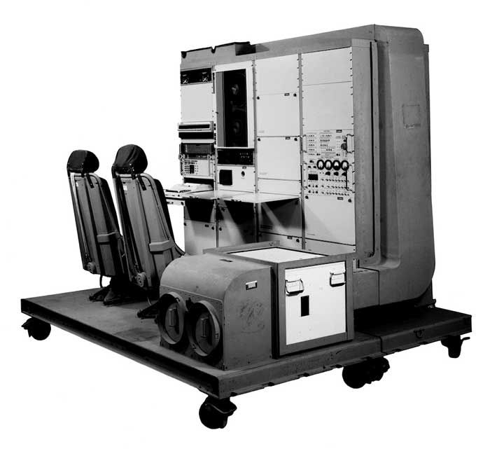
1976: The first military GPS five-channel receiver built in one of several programs that studied the feasibility of GPS. The receiver weighed more than 270 pounds and had seats for two operators. (Photo: Rockwell Collins/Smithsonian)
Like the internet before it, GPS started as a niche technology and became a universally recognized one, though much misunderstood and often taken for granted. Both systems originated in the U.S. Department of Defense (DOD) to support military missions, and then exploded into mass-market civilian technologies. While the internet passed from military to civilian hands very early in its history, GPS is still operated by the U.S. Air Force, making it a unique experience for the DOD: a system for which it is responsible that has orders of magnitude more civilian applications and users than military ones.
GPS has transformed entire professions — most notably, surveying; created new industries — such as ride sharing; boosted innumerable fields of scientific research — from archaeology to zoology; facilitated many aspects of everyday life — such as finding retail outlets and getting there; and given an advantage to U.S. military forces. One application discussed 30 years ago that has not yet lived up to its promised return on investment is precision agriculture.
Challenges and debates that loomed large in the early days turned out to be growing pains —most notably, Selective Availability (SA). In 1990, Javad Ashjaee reflected the attitude of much of the GPS industry and user community when he said, “I can’t think of a word to say how bad it is.” Other debates have proven more persistent — such as the interference threat posed by LightSquared, reborn after bankruptcy as Ligado Networks.
GPS first drew considerable publicity in the wake of Desert Storm, when it became the subject of television features, newspaper reports, and special sections in the pages of recreational catalogs. “Ironically,” Brad Parkinson pointed out in September 1994 in GPS World, “civil companies [such as Garmin] developed most receivers used in Desert Storm, with no help from military sponsorship.” Later that decade, while most people were finally aware of GPS technology, it began disappearing deep into its applications and the systems that use it.
In September 1991 — three and a half years before U.S. Air Force Space Command declared the system’s full operational capability (FOC) on April 27, 1995 — in a speech to the International Civil Aviation Organization in Montreal former FAA Administrator James B. Busey said: “I want to emphasize that we fully support the eventual replacement of [GPS] by other systems — and we are certain that will happen.” That may still happen, in the distant future. However, what Busey did not foresee is that GPS became but an element, though a key one, in a much larger positioning, navigation and timing (PNT) system. This worldwide system includes three other GNSS and two regional ones, several publicly and privately operated augmentation services, and a wide range of complementary and alternative technologies. These include inertial navigation (which has advanced much in the past three decades) and RF signals of opportunity. It may soon include navigation signals from non-GNSS satellites, eLoran, enhanced distance measuring equipment, and Earth-fixed navigation using very low frequency.
I began my current career in geospatial technologies exactly 20 years ago, as this magazine’s managing editor, just a few months after the end of SA increased GPS’ accuracy by an order of magnitude, and equally expanded the number of its potential applications. Yet today, I still marvel at how pervasive this technology has become and how much further it will transform our lives.
I will end with a quote from an early GPS World columnist, Hale Montgomery, who wrote in October 1991, “GPS users show an insatiable appetite for ever more precise data. Give them a mile and they want an inch.”
Seeking back issues: I have the entire collection of GPS World’s print edition, except for the first issue, the 10 issues in the second year (1991), and the September through December 1993 issues. I would be thrilled to receive those missing issues, or facsimiles, from anybody who has them. Email [email protected].
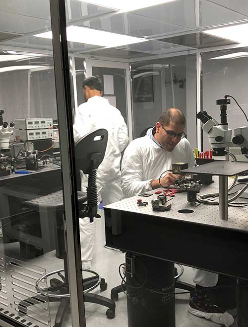
KVH photonics engineers test PICs for validation prior to production. (Photo: KVH)
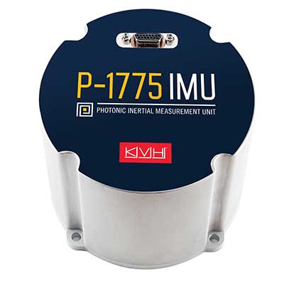
In June, KVH Industries launched the P-1775 inertial measurement unit (IMU), featuring its new PIC Inside photonic integrated chip (PIC) technology.
After developing and testing the technology for more than three years, the company began incorporating it into existing product lines and has shipped the first units.
The PIC technology features an integrated planar optical chip that replaces individual fiber-optic components to simplify production while maintaining or improving accuracy and performance.
The product is designed to deliver 20 times higher accuracy than less expensive micro-electromechanical systems (MEMS) IMUs. It uses modular designs for ease of integration and has outstanding repeatability unit-to-unit, according to the company.
KVH will add the technology to its inertial sensor product line for use across a broad range of applications, from navigation to stabilization and pointing.
KVH’s fiber-optic gyros (FOGs) and FOG-based products are particularly well-suited for the large and growing autonomous market, which includes applications on land, sea and air, such as drones, people movers, trucks and mining and construction equipment.
Moving Components to the Chip
Photo:With PIC technology, KVH’s FOG production process incorporates machine automation for photonics assembly. (Photo: KVH)
The controls on FOGs have an electronics portion and an optics portion. The latter consists of a light source, a detector, couplers, polarizers, a coil (which performs the sensing), and a piezoelectric device for modulating the light, explained Robert Balog, KVH’s chief technology officer.
Until now, the company had fabricated all the products for that optical circuit in its Chicago facility, in a process that was labor-intensive and required much process control. For the PIC, “We’ve taken the couplers and the polarizer sections specifically and moved them onto the chip level,” Balog said.
While KVH manufactures the chip much like any other semiconductor device, rather than passing the light through the fiber KVH is now passing it through wave guides that are contained within that photonics chip, thereby moving the creation of the coupler module into a wafer-level component.
Mass Production and Better Quality
KVH produces the chips en masse on a wafer, then singulates and samples them. Once they are qualified and spot-checked, the chips are incorporated into KVH products.
“This affords us a way to mass produce those components,” Balog said, “and gives us much better quality.”
Photo: KVH
Additionally, it produces a much smaller device than before. The company will not reveal any numbers regarding its performance improvement until it produces and distributes more PICs, but “it is already producing better results than the manually produced components.”
The production process is intimately linked to the overall performance of the sensor. “The tighter your process control, the more reliable you can make the product,” Balog said.
The new process also improves the device’s field reliability because it contains fewer discreet components. The improved performance specifications on each individual FOG improve the overall performance of the IMU or the inertial navigation system (INS) because the bias is more stable and repeatable.
The Future
What is in the technology’s future?
“The next step is integrating the light source and the detector and potentially a modulator into that chip as well,” Balog said. “So, our ultimate technology road map is to continue condensing what would have been discrete components in traditional gyros all within that chip. As this technology progresses, it will get smaller, tighter, and better. Then you will see big leaps in performance.”
Thirty years ago, more than a decade before most people had even heard of GPS, receiver manufacturers and surveyors were already improving on it by providing and using correction services to compensate for errors in the system—including clock drift, orbit errors, signal errors, atmospheric errors and multipath.
Today, dozens of public and commercial correction services enable users to achieve accuracies of decimeters, centimeters or even millimeters. Also, many GNSS processing services correct measurements taken in the field using data from reference points. Increasing positioning accuracy has become the cornerstone of modern GNSS practice.
The current boom for correction services is driven mostly by the demand for high accuracy from the automotive industry (including the development of self-driving cars), as well as smart consumer devices and various forms of automation. Automotive companies and telecoms are deploying infrastructure around the globe to provide centimeter-level positioning. GNSS satellites also can transmit corrections directly, as the Japanese CLAS service from the QZSS constellation does, and Galileo’s High-Accuracy Service (HAS) soon will. To compensate for receiver-side issues — multipath, jamming and spoofing — some GNSS receivers also incorporate advanced positioning algorithms.
Clock and orbit errors are specific to each satellite; they do not depend on the position of the receiver. But atmospheric errors are introduced when the signal travels from the satellites to the user. Reference stations (base stations) of GNSS receivers installed at fixed and precisely surveyed positions provide corrections that compensate for both sets of errors to the rovers carried by field crews. When connected, reference receivers spread over a geographic area form reference networks, such as that of continuously operating reference stations (CORS). Achieving maximum accuracy requires initializing the receiver, which can take a few seconds to several minutes, depending on the type of corrections.
Established and new methods
Two established methods have been used for decades.
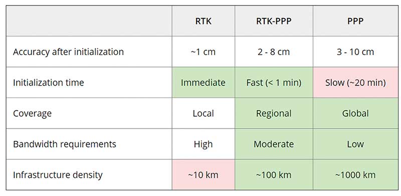
Real-time kinematic (RTK). In RTK, a receiver obtains correction data from a single base station or a local reference network in the same area.
Precise point positioning (PPP). While accessible from anywhere in the world, receiver initialization for PPP can take up to 30 minutes. Also, a few PPP correction services only provide corrections for satellite clock and orbit errors and not for atmospheric errors, limiting users to a lower accuracy level than with RTK.
Hybrid PPP-RTK. In recent years, new methods have emerged. Hybrid PPP-RTK combines near-RTK accuracy and quick initialization times with the global access of PPP. It relies on a network of reference stations within about 150 kilometers of each other. The stations collect GNSS data and calculate both satellite and atmospheric correction models. The network then broadcasts these corrections via internet, satellites or cellphone towers to subscribers, who can use them to achieve sub-decimeter accuracy.
Each of these methods has advantages and disadvantages (see table 1). RTK, which relies on communication between the user and the local correction service, provides centimeter accuracy over small areas. PPP-RTK and PPP broadcast corrections and require a lighter infrastructure, making them scalable for mass-market and industrial applications. The new services are cheaper and more user-friendly than traditional correction services.
TABLE 1: Differences of various correction methods. (Chart: Septentrio)
CORS/VRS
Traditional reference networks — often called CORS or virtual reference station (VRS) networks — have long been a source of differential GPS (DGPS) and RTK corrections, mainly for surveying and mapping applications, which require high accuracies.
“Most CORS in the United States are strictly for providing high-accuracy correction data to GNSS users who need to know their position to less than an inch,” said Alex Ngu, applications engineer at Trimble. “However, some — like Utah’s TurnGPS network and the North Carolina Geodetic Survey (NCGS) — have considered dabbling in using them to double up for weather monitoring.” In some regions, such as Japan and Washington state, CORS are also used to study plate tectonics and provide early warning of earthquakes.
CORS receivers often operate in remote locations and may be powered by solar panels. Therefore, they require low power consumption and the ability to configure, run and update remotely. They also need to archive on-board measurements and withstand harsh environments.
Changes in the market
As the market for GNSS corrections changes, so does the role of CORS networks. They are increasingly used for industrial automation that needs centimeter accuracy, including construction and agriculture. “Now, due to the growth in autonomous systems, such as autonomous cars, people are looking at corrections in a completely different way and with more focus on mass markets,” said Gustavo Lopez, market access manager at Septentrio. Septentrio lets customers choose which correction service to use.
“CORS/VRS networks will keep focus on performance and on adding constellations and signals, but nothing major is expected to happen in these traditional systems,” Lopez said. They will continue to exist because they focus on centimeter-level accuracy for survey, construction, mining, machine control and precision agriculture. “What will really change the market are these new services with 10-cm to 20-cm accuracies, which also offer a new way of delivering the data, namely broadcasting rather than using two-way communication methods.” This helps with adoption by emerging applications, Lopez said.
He predicts that applications needing 10- to 50-centimeter acurcy will migrate to cheaper services, including new consumer applications, advanced driver-assistance systems (ADAS), professional applications such as robotics, UAVs, logistics and internet of things (IoT) applications.
Mobile technologies adopting dual-frequency chipsets also will need correction services. “We will see more and more telecoms interested in providing GNSS corrections as a service, as is already the case in Asia and Europe,” Lopez said. “A few CORS/VRS networks will try to capture part of this emerging applications market by reusing their technology or partnering with other companies to provide a more transparent solution.”
One might think that the rapid expansion of the market for corrections would make it possible for traditional CORS networks to make 1-cm accuracy available at a much lower price. The roadblock is high infrastructure costs, Lopez explained. CORS/VRS networks are expensive to maintain because they require a high density of stations. New services that use broadcasting technology and PPP-RTK positioning modes rely on less dense networks.
New uses for old CORS
A key benefit of a VRS is that performing RTK positioning across the area it covers does not require guarding a separate GPS base station. Using VRS, the CORS network acts essentially as a continuous reference station within the entire network, enabling RTK positioning using a single rover in the field.
Randy Osborne, VRS network manager at Louisiana State University’s Center for GeoInformatics, reports a growth in new applications beyond surveyors. VRS expanded to precision agriculture, and then into applications such as lidar and UAVs. “We are also seeing strange applications that we never thought of. For example, plumbing companies use it to navigate underground from a truck that has a position on the network, and then they vector from the truck underground into pipelines,” Osborne said. Subscribers also include companies performing survey work for fracking and petrochemical projects.
OSR vs. SSR
Most GNSS correction services are based either on the observation state representation (OSR) or on a state space representation (SSR) of the errors. OSR and SSR use different techniques, delivery mechanisms and core technologies.
OSR. Legacy GNSS correction service providers supply OSR correction services; examples are RTK and networked RTK (RTN). They rely on transferring corrected GNSS observations from the nearest reference station to the rover using a standardized format. They focus on a geographic region and target surveying, machine control and precision agriculture, providing centimeter-level accuracy up to about 30 kilometers of the nearest reference station. Because these services require bi-directional communications and large bandwidth, it is hard to ramp them up for mass-market applications.
SSR. By contrast, new players in the market for correction services, as well as some of the larger legacy ones, provide SSR correction services. SSR uses a network of reference stations to model major errors over large areas. They then transfer this model to the rovers, which create local error models and apply them to their GNSS observations. Depending on the service, accuracy ranges from less than 5 cm to 20 cm, convergence times from 10 seconds to 30 minutes, and coverage from continental to global. Because SSR corrections are broadcast, they can be more easily distributed through internet connections and L-band satellite channels. Because all the rovers rely on the same stream of GNSS correction data, SSR services work well for mass-market applications. The growth in SSR technology is driven mainly by the needs of the automotive industry but is sufficiently generic for adoption in other markets.
The challenge of vertical accuracy
A CORS receiver stands atop the Old River Auxiliary Control Structure, a floodgate system in a branch of the Mississippi in central Louisiana. (Photo: Trimble)
While OSR and SSR have comparable accuracies on a horizontal plane, they differ greatly in their vertical accuracy and initialization times, Osborne said. “When we look at CORS for active control and positioning in the National Spatial Reference System, we are mainly trying to get a handle on the vertical part, as it is the hard problem to solve,” he said.
High-precision vertical accuracy is a challenge for any GNSS-based method. Conventional surveying is still the gold standard. With differential leveling, like with digital levels, results in millimeters are possible. Post-processed GNSS, using data from a good geometry of CORS or base data, can yield results under 2 cm vertical, as can real-time OSR methods like RTK and RTN. SSR solutions, like PPP and hybrids, are presently achieving 5 cm at best. An Achilles heel for SSR vertical solutions is the lack of data for localized sources of error, like tropospheric conditions. Semi-dense networks of CORS can feed ionospheric data to speed PPP convergence, but not the level of tropospheric data needed to match the vertical results that OSR and conventional methods can.
Trimble
Trimble GNSS base-station receivers have been used for 40 years on every continent, according to the company. Today, products in use as CORS stations typically are Alloys, NetR9s and NetR5s. The company operates more than 300 networks worldwide, incorporating more than 5,000 CORS receivers.
Trimble offers a full spectrum of solutions, services and subscriptions related to CORS networks. They range from supplying CORS software, hardware and services, to providing network management services to run a secondary backup system for a network, or even operating a network on behalf of its owner. For those who just want a high-accuracy correction to support their surveying, GIS or machine guidance and control work, “Trimble operates one of the largest CORS networks in the world to which users can subscribe — Trimble VRS Now, Trimble RTX and OmniSTAR services,” Ngu said.
Feature photo:
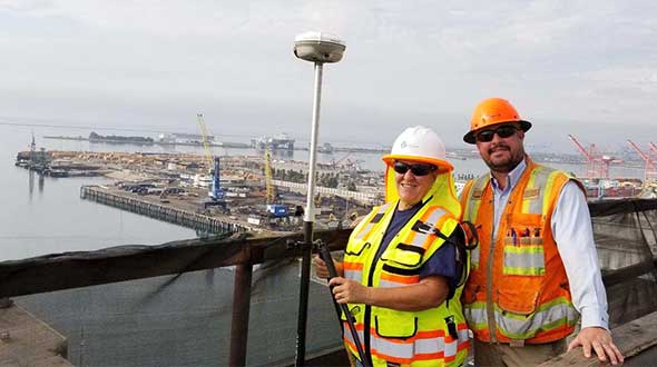
In Long Beach, California, correction services support the 250-foot-high Gerald Desmond Bridge project. Trevor Rice (left), president of D. Woolley & Associates, joins Kimberley Holtz, director of survey, Port of Long Beach. (Photo: Trimble)
There are many ways to navigate. For most applications, none surpass the accuracy, affordability and convenience of satellite navigation.
However, given the threats to GNSS from spoofing and jamming, and the possibility that GNSS satellites could be destroyed accidentally by space debris or intentionally during a war, the search is on for alternative sources of positioning, navigation and timing (PNT) data.
Potential alternative PNT (APNT) approaches include computer vision, terrain contour matching (TERCOM, which was used to guide cruise missiles in the 1970s and 1980s), and using magnetic anomalies (MAGNAV).
Diverse animals — such as sea turtles, spiny lobsters, and birds — use magnetoreception for orientation and navigation. However, while animals likely perform wayfinding using the direction of the magnetic field, similarly to how humans use a compass, high-resolution maps used in conjunction with atomic instruments enable us to perform absolute positioning to tens of meters, explained Major Aaron Canciani.
Canciani, an assistant professor of electrical engineering at the Air Force Institute of Technology, has been designing algorithms for MAGNAV flight testing for several years.
Earth’s crustal magnetic field varies from location to location as much as topographic features do and, like them, it changes very little over time. However, unlike topographic features, which only occur on the third of the planet’s surface covered by land, magnetic variations also occur on the oceans. This makes them potentially very useful as landmarks to the Navy and Air Force. Magnetic variations have the additional benefit that they cannot be jammed or spoofed.
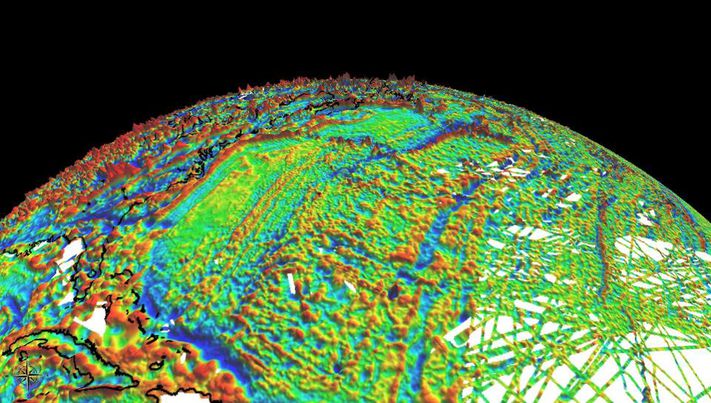
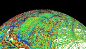
NOAA’s EMAG2 World Digital Magnetic Anomaly Map. (Image: NOAA National Geophysical Data Center)
Just like other features of Earth, magnetic fields can be mapped, using scalar magnetometer sensors to measure their strength and direction. In fact, government agencies and mining companies have been making these maps for many decades, for geological exploration and other purposes, though mostly on land.
Conversely, these maps can be used to navigate by comparing the data from magnetometers to the map, just like cruise missiles used to use on-board radar altimeters to match the contours of the land beneath them to contour lines on a digital map and navigators on vessels in shallow waters compare the depths reported by their fathometers to those marked on a chart.
Before this approach to navigation can be widely implemented, however, magnetic maps need to greatly improve in coverage and quality. In addition to magnetic maps and sensors, MAGNAV also requires sophisticated algorithms and careful calibration, to do such things as subtract errors from space weather and the local magnetic field of the aircraft or ship.
The greater the platform’s speed, the greater MAGNAV’s accuracy, because the magnetometers can collect more varying magnetic information per unit of time of INS drift, Canciani explains. On a platform moving fast and at low altitudes, MAGNAV could achieve 10-meter accuracy. In less ideal conditions and relying on lower quality magnetic maps, the accuracy could be as low as one kilometer — which is sufficient for many missions, such as navigating ships at sea.
Off-the-shelf scalar magnetometers about the size of a quarter have already been flight tested. Corporations, the military and civilian government agencies such as NOAA, NASA and NGA already have suitable magnetic maps, though they need to be improved and expanded, particularly at sea. This would require gathering new data using calibrated sensors on airplanes, ships and submarines.
Could magnetic sensors be installed on thousands of aircraft, land vehicles and sea vessels to collect magnetic data during their routine operations? “With proper calibration, yes, but it should not be downplayed how difficult it is to get 1 nanoTesla measurements on a platform,” Canciani said. “Mapping and navigation are inverse problems so any platform that has been calibrated well enough to navigate could, in turn, also be used for mapping.”
However, he points out, the task is much more complicated than just putting a magnetometer on a platform. “Getting clean data on complex platforms remains the largest challenge for magnetic navigation,” Canciani said, “although we are making excellent progress with projects like the Air Force Accelerated AI program with MIT and Lincoln Lab. In this project we are using state of the art scientific machine learning approaches to calibrate complex magnetic fields on operational platforms. Without excellent calibration algorithms the only sure-fire way to get clean magnetic data is putting a sensor out on a boom or wing-tip, which might not be practical for all use cases.”
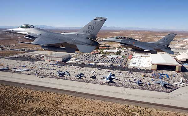
Two F-16 Fighting Falcons fly over Edwards AFB during a 2009 air show. (Photo: U.S. Air Force/Chad Bellay)
Canciani admits that MAGNAV is often met with skepticism but hopes that realistic testing on realistic platforms will lead to more interest and funding for this approach.
While some such testing has already been performed using private survey aircraft, a much more important test will take place in September, when F-16s from the Air Force Test Pilots School will fly MAGNAV sensors and software over a test range next to Edwards Air Force Base in Nevada.
Not just supporting players, alternative positioning, navigation and timing (PNT) systems strengthen, augment and — when needed — replace GNSS. We explore how companies are using alternative PNT, and talk with John Fischer of Orolia and Alexis Guinamard of SBG Systems about their companies’ latest developments.
Since the 1990s, GPS has provided the United States military with a substantial tactical edge. Civilian GPS applications are now deeply embedded in every aspect of our lives. The U.S. Department of Transportation recently reaffirmed that GPS’ positioning, navigation, and timing (PNT) services are critical to the safe and efficient use of the national transportation system, and a Feb. 12 presidential executive order declared that satellite-based PNT services “have become a largely invisible utility for technology and infrastructure.”
It has long been equally well known, however, that GPS is vulnerable to accidental and intentional interference (the latter known as jamming), spoofing, and degradation or denial of signals. Additionally, GPS satellites are increasingly vulnerable to damage or destruction by space debris or intentional attack. The executive order mentioned above declared it U.S. policy “to ensure that disruption or manipulation of PNT services does not undermine the reliable and efficient functioning of [the country’s] critical infrastructure.”
Protecting PNT requires not just strengthening GPS, but also developing alternative sources of PNT data and ways to integrate them into the myriad systems that currently rely on GPS.
The National Timing Resilience and Security Act of 2018 (passed by the U.S. Senate as part of that year’s Coast Guard authorization act), called for “a complement to and backup for” the GPS timing component “to ensure the availability of uncorrupted and non-degraded timing signals for military and civilian users in the event that GPS timing signals are corrupted, degraded, unreliable or otherwise unavailable.” It mandated the procurement of a wireless, terrestrial system that would provide wide-area coverage and be synchronized with UTC, resilient and extremely difficult to disrupt or degrade, able to penetrate underground and inside buildings, and capable of deployment to remote locations.
A report released on April 8 by the Department of Homeland Security (DHS), however, recommends “that responsibility for mitigating temporary GPS outages be the responsibility of the individual user and not the responsibility of the federal government.” It points out that research by one of DHS’ agencies “shows that users can mitigate short-term GPS disruptions (e.g., inability to read a GPS signal) with various strategies, ranging from using local backup capabilities to delaying operations until GPS is restored.” The report then focuses on “mitigation against long-term or permanent disruption or loss of GPS PNT capabilities.” It determines that the PNT functions in critical infrastructure “are so diverse that no single PNT system, including GPS, can fulfill all user requirements and applications” and notes that maximum resilience is found in diversity of solutions. Therefore, it recommends that the federal government “encourage adoption of multiple PNT sources [to expand] the availability of PNT services based on market drivers.”
In the interviews below, I discussed these challenges with John Fischer, vice president of Advanced R&D at Orolia, and Alexis Guinamard, chief technical officer of SBG Systems.
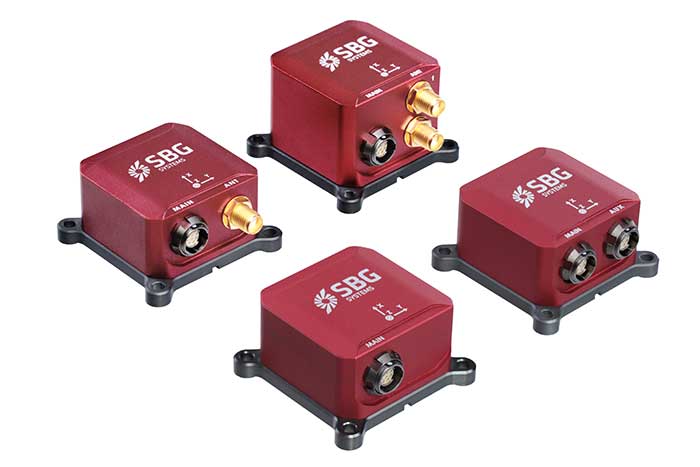
Third Generation of the Ellipse Series of IMUs. Clockwise from top: Models D, E, A and N. (Photo: SBG Systems)
Not just supporting players, alternative positioning, navigation and timing (PNT) systems strengthen, augment and — when needed — replace GNSS. GPS World explores how companies are using alternative PNT, and talks with Alexis Guinamard of SBG Systems about the company’s latest developments.
GPS World: What are the main challenges to GNSS that require developing alternatives?
Alexis Guinamard: GNSS technology can be easily disturbed by a wide variety of factors. Urban canyons or foliage environments can obstruct GNSS signals or cause multipath effects. Intentional and unintentional jamming and spoofing are also a big concern for PNT users.
Alternative technologies are developed to add robustness to GNSS positioning and useful features like orientation tracking (inertial + GNSS), or ultimately to work in pure GNSS-denied environments (SLAM).
GPS World: What is your range of products?
AG: We develop and produce GNSS-aided inertial navigation systems, but also provide a post-processing software (Qinertia). Our latest innovation is the third generation of the Ellipse series — our best-selling product — which is an industrial-grade INS. Based on the same inertial core, we integrated cutting-edge technologies, such as a multi-frequency GNSS receiver and RTK capability, within a miniature form factor.
A multi-constellation, multi-frequency receiver is much harder to jam or to spoof, which makes the Ellipse-N very robust and able to operate despite interference.
Finally, the new Ellipse-D, which provides dual-antenna heading capability, has been drastically improved in terms of size, weight and power.
Our post-processing software is compatible with all our INS products. So, we can post-process these data to obtain centimeter precision in a PPK mode. Qinertia is running a tightly coupled navigation filter to obtain the best navigation performance in post-processed applications.Thanks to the raw data output of the Ellipse’s sensors, it’s really straightforward to do post-processing with Qinertia PPK software and obtain the highest level of accuracy.
We worked hard to make the user experience as easy as possible. The latest version of Qinertia allows the customer to process either INS systems with GNSS or purely GNSS data.
GPS World: What are primary uses of your systems?
AG: We have many advanced robotics applications, including UAV, driverless cars, and agricultural robots. We divide them into mapping applications, remote-sensing applications and control applications.
Inertial sensors can help a lot for the control applications because we are able to reject false GNSS measurements in both loosely and tightly coupled schemes. We can also use them to provide a precise heading, which is required by many of these applications. So, I would say that advanced robotics is one of the major growth areas for us.
Not just supporting players, alternative positioning, navigation and timing (PNT) systems strengthen, augment and — when needed — replace GNSS. GPS World explores how companies are using alternative PNT, and talks with John Fischer of Orolia about the company’s latest developments.
GPS World: What are Orolia’s latest advances and products regarding alternative PNT?
John Fischer: Regarding timing, which we have been doing for decades, our big alternatives to GNSS are internal atomic clocks and network-based timing, such as precision time protocol (PTP). Regarding positioning and navigation, the two areas on which we focus are IMUs and getting updates from GNSS, so that, when you lose GNSS momentarily, you have something on which to coast. The breakthroughs in MEMS technologies are astounding —they are getting better and cheaper every day. That shows wonderful promise.
The other area is doing satellite navigation using low Earth orbit (LEO) satellites, which are much closer to the Earth than GNSS ones and give you 30 dB or more of signal strength. We are focused the most on the Satellite Time and Location (STL) signal because it is available today. Supplementing your navigation system with updates from LEO satellites provides you some great non-GNSS navigation capability.
GPS World: The positions of LEO satellites are not monitored as closely as those of GPS satellites. Is that an issue?
JF: That is correct. You are losing accuracy by using what is available today because you do not know the positions of those satellites as well as you know those of the GNSS satellites and maybe you do not have the best geometry. All the GNSS satellites are in medium Earth orbit (MEO) because they have much better geometries for a small constellation. With just 24 satellites in MEO orbit, you get great geometries. When you go lower, you need an increasingly greater number of satellites.
The first generation of LEO satellites, the Iridium STL, are a much larger constellation, with 66 satellites, but still not enough to give you the good geometries. Today, you are getting less accuracy, but there are all kinds of new satellites being launched and the capability to track them will improve. We expect to be able to use signals from hundreds, if not thousands, of LEO satellites, so the geometry problem will start to go away and there are other things we can do to improve the accuracy. Meanwhile, we can get rather good performance with what we have today.
GPS World: What are some of your most recent advances, releases or products?
JF: On the timing side we have what we call a mini-Rubidium, the mRO-50, which we launched on June 4. Smaller, better, cheaper atomic clocks are coming out very soon.
GPS World: Do you have any comments on the recent executive order on resilient PNT?
JF: We coined the term “resilient PNT,” so we are glad to see it in use. We fully support those efforts.
GPS World: What about other alternative sources of PNT data, such as radar, lidar and signals of opportunity?
JF: Yes, they are that next level. Loran is ideal because it is so different from GNSS. When you are trying to design a reliable system, you want a lot of diversity, because if two systems have the same kinds of failure modes you have not gained in redundancy. Loran is literally at the other end of the spectrum from GNSS: It is a low-frequency microwave system. Instead of being space-based, it is land-based; instead of being low power, it is high power. However, there still are no stations up. It requires big equipment, so it will take some time.
When it comes to what you can do today, Loran does not contribute much. We support efforts to implement Loran very much, because we do need non-GNSS ways to make things resilient. Prior to GPS, we had to depend only on Loran. Today, with modern digital signal processing (DSP) techniques and receivers, I think we can expect the new Loran system to have much better accuracies than we had in the bad old days of the first generation of Loran.
The auto industry is doing a marvelous job of doing navigation using lidar or cameras. They are pretty much navigating driverless cars the way that humans drive, by just using visual cues. Those things have promise in certain unique areas.
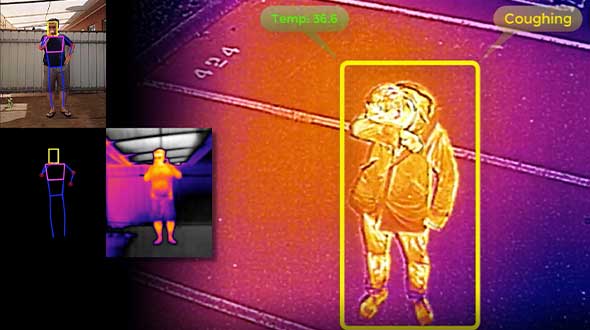
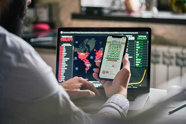
As part of the effort to combat the spread of COVID-19 in the United States, UAV company Draganfly has partnered with Australia’s Department of Defense (DOD), the University of South Australia (UniSA) and Vital Intelligence, a company that collects and analyzes healthcare data, to remotely detect and monitor people with infectious and respiratory conditions.
Draganfly’s UAVs will be fitted with a specialized sensor and computer vision system that can monitor people’s temperature, heart rate, and respiratory rate, as well as detect people sneezing and coughing in crowds. The collaboration, called The Vital Intelligence Project, utilizes technology developed with help from the DOD’s Science and Technology Group. Draganfly was selected as the exclusive integration partner on March 25, with an initial budget of up to $1.5 million to commercialize and deploy the technology.
The UAV uses u-blox LEA-M8S GNSS modules integrated into the company’s own interface printed circuit boards.
In late January, recalled Draganfly’s CEO Cameron Chell, the company began to consider what kinds of health data it could collect and analyze that could help public officials and private-sector managers flatten the pandemic’s curve. It then contacted Javaan Chahl, a UniSA researcher who had been a customer for 20 years, to discuss the use of UAVs for this mission.
The technology was originally designed to be deployed on helicopters in disaster relief operations, to measure the vital signs of survivors. It was then adapted to measure the health of wildlife populations, such as herds migrating or threatened by drought or fire, and in hospital neonatal wards to monitor the vital signs of newborns.
To provide core temperature readings as well as measurements of heart rate and respiratory rate, the technology uses RGB and thermal cameras, both fixed and mounted on UAVs. “The public sector and the private sector are both interested in this technology, but are approaching it very differently,” Chell said.
The system’s capabilities include detecting people who are coughing, not wearing masks, or clustering in violation of social-distancing rules. The objective is to provide population health information to public agencies to help them make better decisions by measuring the effectiveness of their COVID-19 policies in real time, rather than react to past information. The system, Chell stressed, does not record data on individuals but reports such figures as “84% of the people are socially distancing 24% of the time.”
“Based on what I see unfolding with the measurement and data industry as it relates to health technology,” Chell said, “six or eight months from now you are likely to see health measurement reports the same way that you see weather reports. Eventually, it will be broadcast to the consumer. That is our objective.” People, he predicts, will use these reports to make decisions about where and when to travel.
To obtain accurate core temperatures, Draganfly’s thermal sensor needs to be about 20 feet away from its subject, and uses software to zoom in on the tear ducts. To obtain heart and respiratory rates requires about 25 seconds of footage with at least a 4K camera, magnification to detect body micromovements, and machine vision to detect skin tone biometric measurements. The system also picks up movements — such as of the shoulders, lumbar area and upper torso — that indicate coughing, Chell points out. “The results certainly have been promising in terms of having real quantitative data,” he said.
The scenario is somewhat different in the private sector, which typically relies more on fixed-based cameras for entranceways — for example, to monitor workers entering a warehouse, a factory or a shipyard to guard against people who are infectious or have a respiratory disease. “We have seen several announcements by companies that they are using thermal cameras to do this,” Chell said. People pass through the company’s fixed system, which uses both thermal and RGB cameras, in less than three seconds, according to Chell, which is good for such facilities as parks, office buildings and convention centers. Private organizations can then ask people who exhibit certain symptoms to consent to a secondary screening in exchange for access.
Additionally, Draganfly will provide UAV services for disinfecting outdoor facilities.
Find out how more companies are helping fight COVID-19.
Contact tracing can help stem the spread of the COVID-19 pandemic. It involves tracking the movement and interactions of infected individuals to identify others at risk.
National and regional responses to the COVID-19 pandemic have included containment through quarantine and restriction of movement. When properly implemented, these solutions limit spread of the contagion to prevent it from overwhelming healthcare and emergency management systems.
According to the World Health Organization, the Centers for Disease Control and Prevention, and virtually all medical professionals, any effective strategy to return the world to normal requires three components: testing, contact tracing and isolation.
While testing to find the people who are infected is the absolute top priority, contact tracing is vital for stopping a disease from spreading out of control. It involves tracking the movement and interactions of infected individuals to identify others at risk. Any positive test without contact tracing is bad public health — it misses an opportunity to reduce the spread of the virus.
While the concept of contact tracing has just entered popular consciousness, it has been a standard public health tool for a century. For example, in the 1930s, Great Britain used it to contain the incidence of sexually transmitted infections. In the 1960s and 1970s, South American, African and Asian countries used it to eradicate smallpox. Additional diseases for which contact tracing is performed include tuberculosis, measles, HIV, Ebola, bloodborne infections, serious bacterial infections and novel infections.
What Is Contact Tracing?
The World Health Organization describes three basic steps:
Contact identification. Those who have been in contact with someone who has been confirmed to be infected are identified, by asking about their activities and those of the people around them.
Contact listing. All persons who have had contact with the infected person are informed of their status and told to receive early care if they develop symptoms.
Follow-up. Contacts are monitored for symptoms and tested for signs of infection.
In some cases, quarantine or isolation is required for high-risk contacts.
The enormous dimensions of the current pandemic, however, challenge traditional models of contact tracing, which are very resource intensive. In search of a technological assist, several Asian countries already have been taking advantage of the functionalities of smartphones to scale up contact tracing to match the pandemic’s rate of growth, such as the Trace Together app built by the Singapore government. Companies and organizations around the world are following suit, including Britain’s National Health Service, a pan-European initiative, and an unprecedented joint venture by Apple and Google.
Automating Contact Tracing
A study published on March 31 in Science concluded that “viral spread is too fast to be contained by manual contact tracing but could be controlled if this process [were] faster, more efficient and happened at scale.” A contact-tracing app that memorizes close contacts and immediately notifies users if they have had contact with infected individuals, prompting them to self-isolate, could control the pandemic without need for mass quarantines if enough people used it, the study argues.
Privacy versus Protection. A similar app has been deployed in China, where people are required to use it to be allowed to move beyond their neighborhood, enter public spaces, or use public transport. A central database collects data on each user’s movement and coronavirus diagnosis, artificial intelligence analyzes these data, then the app displays a red, amber or green code that determines the user’s freedom of movement. This app has been credited with significantly helping China suppress the pandemic, but has been criticized for its disregard for data protection and privacy.
Relying on fundamental epidemiological principles and common smartphone functionality, the Science study authors designed a simple algorithm to replace manual contact tracing. “Coronavirus diagnoses are communicated to the server, enabling recommendation of risk-stratified quarantine and physical distancing measures in those now known to be possible contacts, while preserving the anonymity of the infected individual.” Symptomatic individuals could use the app to request testing, and everyone could use it to access COVID-19-related health services, information and instructions, or even to request deliveries of food or medicine during self-isolation.
Public trust in the app and how the gathered data are used would be critical to its success. The study’s authors lay out a series of requirements for its ethical implementation, then point out that “the algorithmic approach we propose avoids the need for coercive surveillance, since the system can have very large impacts and achieve sustained epidemic suppression, even with partial uptake.”
The authors of a similar article in the journal JMIR mHealth and uHealth write that a contact-tracing system can limit any central coordination to notifying users who have been in contact with an infected person. Their core idea is that it does not matter where someone contacts an infected person, only that they were in close enough contact to risk infection. Particularly sensitive location data, such as GPS or phone cell data, “is actually neither necessary nor useful.” No one learns who the user is because the app is not linked to an identity, and it neither records nor stores location data.
The authors argue their proposed app is the most effective epidemiologically because it would determine which people were in close proximity, and it would receive user cooperation. “Only if people trust a system — because it does not spy on them — will the system find broad support in the population.”
GPS, Bluetooth or Both?
Technologically, the concepts of location and proximity are embodied in two standard smartphone components: GPS receivers and Bluetooth transceivers. GPS-derived location data makes it possible to map and analyze the movements of individuals and of large numbers of people; for example, it is how we know that many in this country have begun relaxing social distancing rules ahead of the lifting of legal mandates. Bluetooth’s use of low energy, generally a drawback, becomes an advantage here because it can tell us whether two or more people have been within 1.5 to 2 meters of an infected person for at least 10 to 15 minutes — when the risk of infection is highest. This knowledge can enable newly infected, pre-symptomatic people to self-isolate and not infect others.
Numerous companies are developing and proposing smartphone-based contact tracing apps.
Vesedia Mobile Technologies proposes that people who test positive to COVID-19 be asked to provide information about public places they visited in the preceding days and at what times, using their phone location history for verification. The information would be anonymized by healthcare officials, and entered into a database that would be publicly accessible via a website and mobile app.
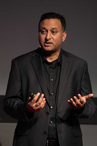
Ramesh Raskar. (Photo: MIT/John Werner)
Intersections. The COVID Safe Paths phone app and the Safe Places browser tool for contact tracers were created by Ramesh Raskar and other researchers at the MIT Media Lab. If a user tests positive and consents, his or her data is uploaded, redacted by healthcare authorities to remove any personally identifiable information, and downloaded by the app.
The app then performs “intersections” — it identifies and notifies people with whom the infected person has crossed paths. By clicking on intersections, users can display their timeline for the past 14 days, in a calendar view, which tells them how many intersections have occurred each day.
The app also provides news reports from authorized local news channels, based on each user’s position or if they tap the URL for their local healthcare authority, said Abhishek Singh, the program’s tech lead, who is helping with the app’s development.
“We are also building an interoperable architecture,” Singh said. “Because there are many contact tracing apps already in the wild, we want to make sure that they have some common standards and guidelines that enable them to utilize data from other apps securely and through consent.” More than 1,200 people are voluntarily contributing to the project. “It is being led by the open-source community, and all our source code is out there and anybody can contribute,” Singh said.
Safe Places is helping health authorities by making the data and insights visible, enabling them to make the right decisions such as targeting resources to areas that need them most, helping them impose restrictions such as lockdowns, or reopen the economy. “The economy will not reopen in a single burst, but step by step.” Singh said. “A dashboard that allows them to monitor where the infection is spreading and where it has been contained helps them decide where to take which steps.”
The GPS Advantage. The uptake required for GPS-enabled contact tracing to be successful is generally lower than for Bluetooth-based contact tracing, Singh argues, citing an Oxford University simulation. “With GPS, you do not need people to have the app already downloaded for it to be effective,” he points out. A person who tests positive for the virus can use the Safe Place web tool to manually create a GPS trail and help healthy people. This is one of the biggest advantages of GPS compared to Bluetooth, because the latter requires exchanging information directly through the hardware, which cannot be done after the fact.
Because the app is open source, any government can deploy it using its own IT infrastructure. However, a government that wants to adopt Safe Paths must sign a letter that commits it to complying with privacy and ethical guidelines. Preventing authoritarian governments and nosy employers from requiring people to use this app and reveal their data requires stringent guidelines as to how it is deployed and who can access the data, Singh said.
Apple and Google Join Forces
Apple and Google have joined in an unprecedented alliance to develop a system for notifying people who have been near others who have tested positive for COVID-19. Eight out of 10 people in the United States own smartphones, and the two companies’ operating systems run more than 99% of them. Apps built directly into iOS and Android, especially if interoperable, could dramatically increase the reach of public health authorities (the only organizations that would receive the data). To avoid fragmentation and encourage wider adoption, Apple and Google will allow only one app per country to use their system, but will allow U.S. states to use it and support countries that opt for a state or regional approach.
The system will use Bluetooth signals from phones to detect encounters rather than GPS location data. It will not run ads, will require users to opt-in, be decentralized, and use randomized IDs not tied to a user’s actual identity to communicate potential contacts with individuals with a confirmed positive COVID-19 diagnosis.
With GPS, you do not need people to have the app already downloaded for it to be effective.
API Coming. On May 20, Apple and Google released an API to developers. Next, they will issue a system update to build in contact tracing at the OS level. Should a user’s phone notify them of a possible contact, they will be prompted to download and install a public health app from their local health authority to obtain trusted instructions.
Developers of coronavirus-related apps for several U.S. states have argued that GPS location data is vital to identify infection hotspots and track outbreaks. However, for various technical reasons, workarounds designed to bypass the decision by Apple and Google and collect GPS data in connection with their contact tracing system would work poorly.
Ethical and Equity Concerns
“The work that we are doing for COVID-19 is pretty similar to work that we do on a routine basis with other reportable communicable diseases,” said Lisa Ferguson, nursing supervisor for Communicable Disease Investigations and Case Management for Multnomah County, Oregon, which includes the city of Portland. Most commonly, her unit is notified of illnesses by the state database, which receives electronic lab reports. “We assign that as a case to somebody on our team, and they call the person, interview them, ask some questions about their illness, their symptoms and where they could have possibly been exposed,” Ferguson explained. “Then, they talk about who that person might have exposed and where they were from two days before they became sick up until the time of the interview or the time that their symptoms were resolved.”
The Multnomah County, Oregon, Disease Detection Team. (Photo: Multnomah County, Oregon)
How could technology — such as smartphone location data — best help Ferguson’s team conduct contact tracing for COVID-19? “In the public health world, we are not used to having access to technology in that way,” she said. “We need to have some ethical discussions before we are prepared to utilize something like a technology that can track people.” Also, unlike tracking measles, which requires knowing whether someone was in an airspace and who was there after them, “We do not automatically consider someone to have been exposed if they were in the same airspace as someone who tested positive.”
If the privacy concerns could be adequately addressed, receiving a list of all the people who were less than six feet away for at least 10 minutes from someone who had tested positive could help her team scale up, Ferguson said. Her team would then reach out to those people, using such language as “You may have been exposed,” and “Please watch yourself closely.”
Ferguson’s team always has “equity concerns,” fearing they might under-identify groups that do not have access to the technology. “It is a supplemental tool, but it certainly would not replace the work that we are doing,” she said.
Help Wanted
Safely reopening the United States will require a new workforce of at least 100,000 contact tracers, according to a report from the Johns Hopkins Center for Health Security and other experts. Any technological assist to contact tracing does not diminish this need. For example, smartphone alerts can help filter out those at low or no risk so that human tracers can focus on genuine cases, people at higher risk, or those who are harder to contact.
Two out of 10 people in the United States do not own a smartphone, and only 42% of those above the age of 65 — who suffer 80% of the deaths from COVID-19 — do, according to a 2017 Pew Research Center poll. Hardly any homeless people own a smartphone. Among those most vulnerable to the pandemic are immigrants who do not speak English and are fearful of efforts to collect their personal information, strengthening the need for this to be done in person by trusted community members.
Finally, even if Google and Apple’s automated service is widely adopted and works well, it will require many thousands of health workers to conduct tests and follow-ups.
In the United States, trucking companies and the Army are both developing systems to automate moving groups of trucks. While trucking companies are mostly interested in “platoons” of trucks drafting off of each other to save fuel, the Army wants its “convoyed” trucks to be hundreds of meters apart to improve their chances of surviving an enemy attack.
Battlefield challenges
While the biggest danger for platoons of commercial trucks is crashing, military convoys can be threatened by attacks with improvised explosive devices (IEDs) or rocket-propelled grenades.
Civilian truck drivers also benefit from a robust infrastructure, said Bernard Theisen, division chief for Ground Vehicle Robotics at the U.S. Army’s Ground Vehicles Systems Center (GVSC). For example, nearly all platooning trucks are limited to using roads and highways that have been mapped at centimeter-level resolution with lidar, can communicate over 3G or 4G networks, and have excellent GNSS signals. “I would love to have all that information,” Theisen said, “every time I send a robotic convoy vehicle out there.”
By contrast, the military must design a system that assumes “no comms, no prior data, and no infrastructure,” Theisen explained. “Sometimes a bridge that used to be there has been blown up or we may have put a new bridge across the water overnight. A building that was there yesterday got blown up and is now blocking the road. You cannot pre-plan that in the map and expect it not to change.”
Nevertheless, the civilian and military efforts share some challenges, Theisen acknowledged, including “perceiving the world, understanding it, processing the data, and making the right decisions.” Unlike robots, humans are very good at coping with the unexpected. “You can only train a robot so much, there will always be situations that it does not know how to handle.”
In a military convoy, every fourth or fifth truck may have a mounted gun to protect the convoy. The convoy will typically include one or more ambulances, wreckers and fuel tankers. “It is a different application than for Amazon or FedEx to send a couple of trucks down the highway,” Theisen said.
Leader-follower
In leader-follower applications, GVSC installs the same hardware on all its trucks. “This facilitates software maintenance, because you don’t need to have different versions,” Theisen said. If the convoy’s leader is disabled from a mechanical or battlefield issue, it is easy for a soldier on the next truck to authorize his truck to take over as the convoy’s new leader. “We have also created cases where the leader takes that road months ahead of the followers,” said Alberto Lacaze, co-founder and president of Robotic Research. “So, the leader does not need to be a part of the convoy.”
Rough terrain doesn’t affect navigation, except that in hilly terrain trucks might have more side-to-side drift than in a flat area. “We often use a three-axis IMU [inertial measurement unit] instead of a two-axis IMU, which might be all you need for a commercial application on flat roads,” Theisen said.
“The commercial problem is almost like carrying a group of trailers that are not mechanically connected,” Lacaze said. It is crucial to be able to tie in the vehicles’ low-level controls so that they maintain a very short separation. If those vehicles were trying too hard to maintain those very close distances by frequently accelerating and decelerating, the fuel-savings advantages from drafting would go away. By contrast, for military applications the exact distance between the trucks doesn’t matter much, but their side-to-side error does. “You would like all vehicles to be driving within one tire width of the lead vehicle’s tracks,” Lacaze said. “That has many advantages — for example, if that road has been demined.”
While commercial and military software largely overlap, their sensor requirements are fundamentally different. “Most commercial vehicles are not checking to see whether there is a crater in the middle of the road,” Lacaze said. Military vehicles need to detect such damage to the infrastructure and respond quickly.
Still, the military is interested in “the gigantic amount of mapping of the available infrastructure” being done by private companies, Lacaze said, because most military convoys are not in war-torn areas, but delivering materiel to bases in areas with some infrastructure.
Robotic modes
GVSC purchases commercial off-the-shelf (COTS) systems and integrates them into its trucks, Theisen explained, producing five robotic modes:
Warning, which consists of “idiot lights” and buzzers alerting human drivers that, for example, they are straying out of a lane or are about to hit something
Driver assist mode, which helps drivers brake, accelerate and steer
Teleoperation, which consists of driving the truck from a remote location
Waypoint navigation, which uses a GNSS waypoint path that can either be pre-programmed or pre-driven and then replayed
Leader-follower, in which the first vehicle leads and potentially any number of vehicles follow.
Regarding the driver assist mode, Theisen pointed out that “all these features are very common in high-end cars and you are seeing them coming into many Class 8 trucks. We don’t do any development in the Army from that standpoint.” Regarding the leader-follower mode, the first truck can be driven in any of the other four modes.
GVSC is the lead system integrator for 30 robotic palletized loading systems (PLSs) that the Army has at Fort Polk, Louisiana, and another 30 at Fort Sill, Oklahoma. Nevertheless, a human driver usually leads the robotic convoy. The driver determines the best route, assesses the situation, and is normally followed by three unmanned systems. “That is why we call our system semi-autonomous,” Theisen said.
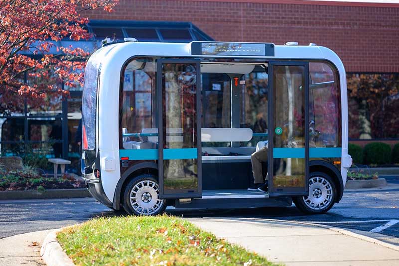
The role of GNSS
The Olli shuttle, equipped with Robotic Research’s AutoDrive kit, is deployed on busy boardwalks, campuses and public roads. (Photo: Robotic Research)
For both commercial platooning and military convoying, GNSS signals are used for redundancy but not as the primary source of measurement of the distance between the trucks. “None of the systems that we have deployed on the commercial side — for example, with Local Motors vehicles (the Olli shuttle) — rely on GNSS,” Lacaze said, though they will use those signals if available. The high accuracy of their inertial systems make it hard to spoof or jam GNSS receivers, because the system would detect any changes in the GNSS solution and the vehicles would continue running on inertial navigation if the GNSS signal were jammed.
“We assume that we will not have GNSS information because sometimes we are jamming ourselves or are being jammed or the enemy could be spoofing us,” Theisen said. Most of GVSC’s systems use “nav boxes” sold by multiple vendors that enable vehicles to navigate for long periods without GNSS signals. They typically combine one or two GNSS receivers, an IMU or several smaller ones, a combination of wheel encoders or ground sensors to determine ground speed, and a digital compass.
GVSC’s trucks also use lidar to generate voxel maps of their current surroundings, and then share them with the other trucks in the convoy. Each vehicle tracks the vehicle in front of it and can just follow it, if it has insufficient position information or good visual cues.
GVSC looks for the highest possible GNSS accuracy, whether using civilian GNSS receivers or military Selective Availability Anti-Spoofing Module (SAASM) units. “We also take advantage of the future M-code,” Theisen said. “We do have capabilities that the civilian marketplace does not have.”
Remaining obstacles
The remaining bottleneck in the development and implementation of convoys of autonomous military vehicles is the approval process, Lacaze said. “Currently, if we make changes to the autonomy systems, the testing parts of the government are asking us to drive hundreds of thousands of miles before providing approvals. It is still a challenge to figure out at what point these vehicles are safe enough to provide to the soldiers and what the cost of doing so is.”
For these systems to take off, better processors, sensors (cameras, radars and lidars) and algorithms are required, Theisen said. “There is way more sensor data that you can collect and process in real time.”
Featured photo, provided by Robotic Research: Army convoys can stretch for miles. The U.S. Army’s Autonomous Ground Resupply trucks shown here are connected with Robotic Research’s autonomous technology.
A new system, called WarLoc, makes it possible to locate warfighters and first responders in GPS-denied environments.
Created by Robotic Research, a manufacturer of autonomy and robotic technology, the system provides localization and positioning data for teams entering underground facilities and traveling inside buildings and in urban canyons.
According to the company, multiple systems — including, besides WarLoc, robotic systems, UAVs and manned vehicles equipped with its technology — collaborate to enhance accuracy and maintain the localization of teams.
Its system, the company said, is unique in that “it has very small 3D position error in such a small package” and its filtering algorithms, rather than being centralized, are “distributed and opportunistic in nature to provide the best solution given the communications available.”
In January, Robotic Research received a $16.5-million order for WarLoc from the U.S. Army Product Manager Sets, Kits, Outfits and Tools (PM SKOT) to support forward-deployed U.S. military personnel. The company will deliver the WarLoc units to equip four deployed U.S. Army Brigade Combat Teams. The first batch has been shipped. The procuring organization, PM SKOT, provides Army and Joint Services oversight of the lifecycle for all sets, kits, outfits and tools used by U.S. soldiers.
Distributed System
A self-contained localization system typically relies on GNSS signals, when available, complemented by inertial navigation. By contrast, the WarLoc is a distributed system meant to work as a team, said Alberto Lacaze, Robotic Research’s co-founder and president. The problem, he explains, is how to filter these devices. Centralized approaches, in which every device sends its information to a central computer that does all the filtering, “work very well for an incident commander with a group of first responders going into a building, where the distances are relatively small.” However, he pointed out, they do not work when communications go down.
The alternative approach is to filter the information opportunistically, in a distributed fashion, which is what WarLoc does. In GPS-denied environments, “there is a process that synchronizes all the nodes once the communications have been established,” Lacaze said. “However, if you have, for example, two team members that are each in their own radio bubble, their solutions will continue to be optimized and other team members might be in their own bubbles, so their solution is also being optimized. If these two teams get in contact, their information will get synchronized and collectively optimized.”
The system, he adds, is “heavily reliant on the inertial solution and dead reckoning.” The more units can communicate and share data, the more accurate the navigation solution is. “In a relatively small package, we can achieve better than 1% error of distance traveled for a single unit,” said Lacaze. “Once you have multiple units communicating and measuring with each other, the solution gets significantly better.”
WarLoc, which contains all the required hardware and software, connects to a system used by first responders and the Department of Defense’s Android Tactical Assault Kit (ATAK) also being used in GPS-enabled areas. “Our system can be used not only for tracking humans, but also for tracking animals and other devices, such as robotic systems or vehicles,” Lacaze said.
Relative Localization
On the commercial side, the company has created a kit for autonomous shuttles and is deploying it in about 20 cities around the world. Like WarLoc, this device also works in GPS-denied areas, such as on an underground shuttle on a university campus. “We just won a contract to automate the busses that go through the Lincoln Tunnel,” Lacaze said.
Busses or shuttles using Robotic Research’s system “learn landmarks in the area that they are traversing and use them as an aid in localization, in conjunction with inertial units,” Lacaze said. “The vehicles learn their surroundings.” They don’t care about their absolute position, he explained, only about their relative position with respect to those areas. This is similar to pre-GPS directions like “Make a left at the post office, then a right at the gas station.” They can also use a common landmark. “If the first vehicle is seeing a certain building and knows its lat/long and the second vehicle saw that building some time ago, it can measure its distance from it using its own inertial system.”
While warfighters communicate their position information via their personal tactical radios to ATAK, which then shares it through its current radio infrastructure, vehicles on the road communicate it through dedicated short-range communications (DSRC) radio, a cell network, or some other network.
Other Robotic Research Programs
Robotic Research’s technology supports a range of robotics and autonomous vehicles in GPS-denied environments, including shuttles and buses for public transportation, hybrid unmanned aerial and ground vehicles (UAVs and UGVs), and trucks in the U.S. Army Autonomous Ground Resupply (AGR) Expedient Leader-Follower program.
The company is the prime contractor on several Army programs, including AGR, which consists of robotic trucks that the Army will begin to deploy. “We have delivered close to 100 of those trucks,” said Lacaze. “So, for example, if you are in a convoy and you need to know whether your warfighters are inside or outside a truck, WarLoc can tell you.”
Robotic Research’s AutoDrive autonomy kit, which can be retrofitted to vehicles of all sizes, provides autonomous functionality on surfaces ranging from urban-improved roads to off-road terrain, while the vehicle collects and analyzes data. The technology provides automation to one of the largest international shuttle providers as well as to the largest U.S. manufacturer of commercial buses, according to the company.
In February, the company announced it will begin testing totally unmanned, fully autonomous, low-speed shuttles in the second quarter of this year. It will initially involve attendants in fixed on-site locations, then will aim to move attendants to an offsite safety-monitoring facility.
Small businesses, including many surveyors, are being hit particularly hard by the current economic situation caused by the measures required to fight the COVID-19 pandemic because most of them do not have large cash reserves.
The CARES Act, signed into law on March 27, contains $349 billion to keep small businesses afloat. The funds are administered by the Small Business Administration (SBA) through participating banks.
Hundreds of thousands of borrowers have been approved for, or received, aid under the so-called Paycheck Protection Program, meant to give small businesses loans that would be forgiven if they were used to pay employees, rent, or mortgage principal. The program is one of four that the SBA is administering as part of the CARES Act.
The other three are the Economic Injury Disaster Loan (EIDL) loan advance, which will provide up to $10,000 of economic relief to businesses that are currently experiencing temporary difficulties; the SBA Express Bridge Loans, which enables small businesses who currently have a business relationship with an SBA Express Lender to access up to $25,000 quickly; and the SBA Debt Relief, which provides a financial reprieve to small businesses during the pandemic.
These programs — an unprecedented challenge for the SBA, which is already struggling with a surge in coronavirus-related loan applications through other programs such as its disaster loan program — were marred by technical and logistical glitches from the start.
On April 16, while many small-business owners were desperately trying to apply for loans, the SBA ran out of the relief money. Its website’s COVID-19 page announced: “SBA is unable to accept new applications at this time for the Paycheck Protection Program or the Economic Injury Disaster Loan (EIDL)-COVID-19 related assistance program (including EIDL Advances) based on available appropriations funding. EIDL applicants who have already submitted their applications will continue to be processed on a first-come, first-served basis.”
As of press time, Congress and the White House are negotiating the possible release of additional rescue funds.