Averna has acquired 100 percent of Europe-based Test & Measurement Solutions for an undisclosed amount. Averna is a developer of test solutions and services for communications and electronics device-makers worldwide.
Averna’s main shareholders, Tandem Expansion and Caisse de dépôt et placement du Québec (CDPQ), both helped finance the acquisition. For CDPQ, the investment is consistent with its objective to further the international expansion of high-performing Quebec companies.
T&M Solutions develops multidisciplinary solutions to test, measure, inspect, assemble and validate products in nearly all segments of the production industry. Headquartered in Belgium and with offices in the Netherlands and Poland, T&M Solutions is a National Instruments Gold Alliance Partner and has 100 employees, including 70 engineers with almost 50 NI certifications.
The acquisition increases Averna’s global reach as well as provides a strong local presence in Europe, according to an Averna press release. It will enable Averna to enter the market with a well-established and respected solution provider while giving it a springboard for further European deployments. In addition, T&M Solutions brings unique expertise in semiconductor testing, vision inspection systems and precision assembly.
T&M Solutions’ management, including current owners Roel Geraerts and Kurt Hensen, will continue to play key roles in operations and expansion plans for the European market.
“This major expansion into Europe signals Averna’s strategic positioning to accelerate growth and become a truly global Test Engineering powerhouse. Test & Measurement Solutions and Averna share complementary solution portfolios, clients and partners, so this is a real win-win arrangement for everyone,” said François Rainville, vice president of sales and marketing for Averna. “We are proud to welcome T&M Solutions’ customers and employees while providing all our customers with additional expertise and increased worldwide presence.”
André Gareau, Averna’s president and CEO, added “We’re building a strong track record of successful acquisitions and are motivated by our robust pipeline of opportunities in Europe and around the world. These are exciting times for Averna and the industry as our leading test expertise, rapid processes and global support continue to demonstrate that we are a strategic-value partner for our clients’ ongoing product quality and market goals.”
“We are very excited to become part of Averna, a leading player in our field. This transaction creates a unique strategic opportunity as we combine T&M Solutions’ mature European presence and respected expertise with Averna’s expansive global footprint and renowned products and solution delivery capabilities,” said Kurt Hensen, CEO of Test & Measurement Solutions. “As part of Averna, our portfolio will deliver even greater value as we remain focused on our strengths and customers.”
Geomatics specialist Larry Tinney won the $50 gift card in our January drawing among takers of the Reader Poll, and you can win, too! Take the poll below by March 21 to answer the question: What is the “killer app” for drones? What UAV market sector will most powerfully drive adoption and influence new regulations for unmanned aerial vehicles? All poll takers who fill out their contact information in the second question and submit by March 21 will be entered in a drawing for a $50 gift card.
Create your free online surveys with SurveyMonkey , the world’s leading questionnaire tool.
Virtually all unmanned systems, from drones to autonomous vehicles, use GPS location technology and advanced mapping. As systems evolve, and enemy threats become more sophisticated, new requirements are emerging. The U.S. military is out in front of this trend, developing unmanned autonomous systems at an even faster pace, with more ambitious goals, than the civilian market. This is borne out by several recent tests and announcements, all profiled individually at env-gpsworld-integration.kinsta.cloud. This month’s column rounds up their essential details for a skyview of the burgeoning field.
Publisher’s note: Defense PNT columnist Don Jewell will return next month.
An unmanned Black Hawk delivers an autonomous ground vehicle to a remote site in a demonstration for the U.S. Army of a joint robotic air-ground mission.
Carnegie Mellon University and Sikorsky Aircraft used an autonomous helicopter and an autonomous ground vehicle to demonstrate that ground and air robots can perform complex, cooperative missions. In an October 2015 demo, an unmanned Black Hawk helicopter picked up an unmanned ground vehicle (UGV), flew a 12-mile route, delivered the UGV to a ground location and released it.
The drop-zone collaboration promises to keep warfighters out of harm’s way. For example, this type of robotic mission could avoid warfighters’ exposure to hazardous conditions, such as chemically or radiologically contaminated areas.
The Black Hawk was equipped for autonomous operation by Sikorsky, a Lockheed Martin Co. It delivered a Land Tamer autonomous unmanned ground vehicle from Carnegie Mellon’s National Robotics Engineering Center to a remote site, where the vehicle performed environmental monitoring for potential contamination.
“We were able to demonstrate a new technological capability that combines the strengths of air and ground vehicles,” said Jeremy Searock, NREC technical project manager. “The helicopter provides long-range capability and access to remote areas, while the ground vehicle has long endurance and high-precision sensing.”
Once the helicopter lowered the vehicle to the ground, the Land Tamer drove itself off its transport platform to commence its leg of the mission. The vehicle, equipped with sensors for detecting chemical, biological, radiological or nuclear contamination, then found and surveyed several potentially contaminated sites, autonomously traversing six miles in the process. When the vehicle sensors detected potential contamination, operators were able to switch the vehicle from autonomous operation into a tele-operated mode for a more detailed exploration of the site.
A JPADs pallet lands on target, followed by several others still in the air, during recent testing. (Photo: US Army)
The U.S. Army’s Joint Precision Airdrop System (JPADS) has developed a new capability with a navigation alternative to GPS. In recent tests, JPADS were dropped from planes, and immediately determined their location using optical sensors to compare local terrain with commercial satellite imagery. The new system demonstrated navigation to its intended point, using nothing but imagery to guide it.
JPADS, largely guided by GPS, has already proven its importance in supplying troops with necessary materials and equipment, relying less on vulnerable convoys. However, the new JPADS also works with little knowledge of the aircraft’s location at the drop point.
Dropping critical supplies from the air has allowed the U.S. military to rely less on easily-ambushed truck convoys and helicopter resupply. Exposure to improvised explosive devices (IEDs) and ambushed convoys resulted in more than 3,000 causalities in Afghanistan and Iraq through 2007.
JPADS has proven to be an important tool in the Army’s logistics chain in many scenarios to supply troops with material and equipment in adverse terrain and remote locations when ground lines of communication are not possible or deemed too high a risk.
“This is a huge step forward for aerial resupply,” said Chris Bessette, Draper’s JPADS program manager. “By enabling the system to operate using imagery alone when dropped as high as 25,000 feet above Mean Sea Level and upwards of 20 miles away from the target depending on winds, we can ensure that JPADS is even more versatile so troops receive supplies like fuel, ammunition, food, and water in the safest manner possible.”
In August, U.S. Army Gray Eagle unmanned aircraft took part in manned-unmanned teaming exercises in South Korea, including streaming video and metadata to an AH-64 Apache helicopter while in flight. The MQ-1C Gray Eagle proved its ability to conduct operations in diverse weather condition, according to manufacturer General Atomics Aeronautical Systems (GA-ASI). The Gray Eagle is used by the Army for reconnaissance, surveillance, communications, convoy protection, IED detection and precision weapons delivery.
During the exercise, the Gray Eagle UAS streamed video and metadata via a line-of-sight data link directly to the helicopter from extended distances. The Apache then retransmitted the imagery to a One System Remote Video Terminal (OSRVT), allowing field commanders within the Tactical Operations Center (TOC) to receive both live Gray Eagle streaming video and retransmitted video sent by the Apache. Once the Gray Eagle was airborne, U.S. ground forces passed contact reports and target coordinates to operators in the aircraft’s ground control station. The operators were then able to direct the Gray Eagle’s sensors to positively identify and track the targets.
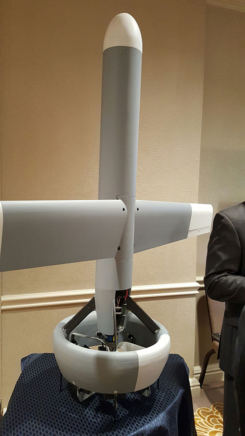
A V-Bat UAV from Martin UAV. Applications include aerial mapping, border patrol, shipboard operations and others.
Worldwide threats will make robotic and autonomous systems’ development important for decades, according to officials speaking at the Unmanned Systems Defense conference late last year.
GPS World’s contributing editor Kevin Dennehy wrote, “Because America has been at war for more than 14 years, unmanned technology has been developing at a rapid rate, perhaps even faster than emerging autonomous commercial systems. The replacement of even manned aircraft has some in the military establishment wary, but others know it’s only a matter of time before most vehicles, surface ships and aircraft are unmanned.”
The Secretary of the Navy said its current manned fighter plane, scheduled to see activity from now until 2037, may be its last to carry an actual human pilot.
The Navy’s Kraken drone munitions delivery system begins its mission underwater,then explodes past the surface to operate in the air. The Air Force also is developing small drones that can be launched and recovered by a larger aircraft after a mission is complete.
An Army initiative called Leader Follower includes rudimentary autonomous convoy operations capability with GPS and base mapping systems, autonomous steering and braking. Army program managers say the program is in staffing, but should be approved in a few months. A full-blown Automated Convoy Operations capability would allow any manned system, including tanks and mobile artillery, to operate autonomously. Last year, the Army and Lockheed Martin successfully demonstrated a driverless line-haul convoy with seven military trucks at speeds up to 40 mph.
Talking about a new generation
Lt. Gen. Michael Williamson, U.S. Army deputy to the assistant secretary of defense for acquisition, said the service is divesting its aging robotics and drone systems, which means future contracts for defense companies. “In 14 years of war, we have rode this equipment pretty hard,” he said. “We believe in modernization, but also looking to buy new systems, which is a new shift in order to gain a competitive advantage over our enemies, who are leveraging unmanned systems.”
The Defense Department recently established the Defense Innovation Unit, based in the San Francisco Bay area, to take advantage of rapid autonomous developments in the Silicon Valley.
Virtually all unmanned systems, from drones to autonomous vehicles, use GPS location technology and advanced mapping. As systems evolve, and enemy threats become more sophisticated, new requirements are emerging.
A surrogate LDUUV is submerged in preparation for a test to demonstrate the capability of the Navy’s Common Control System at the Naval Undersea Warfare Center Keyport in Puget Sound, Washington. (U.S. Navy photo)
In December 2015, the U.S. Navy tested its newly developed Common Control System (CCS) with a submersible unmanned vehicle in underwater missions in Puget Sound, Washington. The CCS successfully demonstrated its capability to provide command and control to a surrogate Large Displacement Unmanned Undersea Vehicle (LDUUV) — an underwater UAV destined for reconnaissance and surveillance missions.
CCS is a software architecture with a common framework, user interface and components that can be integrated on a variety of unmanned systems. It will provide common vehicle management, mission planning and mission management capabilities for the Naval unmanned systems portfolio. Operators used the CCS to transmit pre-planned missions via radio link to the LDUUV’s autonomous controller. In turn, CCS displayed actual vehicle status information to the operators. The vehicle was able to maneuver to the target areas and collect imagery.
“These tests proved that operators could use CCS from a single global operations center to plan, command and monitor UUVs on missions located anywhere in the world,” said Capt. Ralph Lee, who oversees the Navy’s CCS program at Patuxent River, Maryland. “This event also showed us that CCS is adaptable from the UAV (unmanned aerial vehicle) to UUV missions.”
CCS is intended to be compatible across all domains — air, surface, undersea and ground. The Navy initially plans to deploy the CCS on unmanned air vehicles. It will provide common vehicle management, mission planning and mission management capabilities for the Naval unmanned systems portfolio.
By Martti Kirkko-Jaakkola, Stefan Söderholm, Salomon Honkala, Hannu Koivula, Sonja Nyberg, and Heidi Kuusniemi, Finnish Geospatial Research Institute (FGI), National Land Survey of Finland
Our real-time kinematic (RTK) implementation, the Public Precise Positioning (P3-Service) project, has achieved horizontal positioning accuracy of 0.5 meters using relatively inexpensive equipment: a commercial off-the-shelf (COTS) low-cost GNSS receiver. The project used FinnRef, the Finnish national GNSS network.
With inter-station baselines on the order of 200 kilometers, FinnRef is relatively sparse in comparison with commercial RTK networks. We used FinnRef as the RTK base station, either in single-base or network RTK mode. Although FinnRef’s main purpose is to maintain the national coordinate system, it is also capable of delivering DGNSS and network RTK data over the NTRIP protocol.
Transport Applications. Horizontal position accuracy of 0.5 meters or better, achieved for more than 90 percent of the time with small, low-cost devices, could be useful in various applications, particularly in intelligent transportation systems.
Current consumer-grade GNSS solutions routinely offer a positioning accuracy in the order of 5 meters, and satellite-based augmentation systems (SBAS) such as WAAS and EGNOS can improve the accuracy to the order of 1 meter. However, this is not adequate for all use cases; in particular, intelligent transportation systems (ITS) require better positioning performance. For instance, a horizontal accuracy of 0.5 meters is needed to reliably identify the lane in which a vehicle is driving. Maintaining inventory of machines, road signs and other infrastructure would also benefit from sub-meter accuracy.
Sub-meter or even sub-decimeter positioning accuracies can be attained with a relatively good reliability in real time if a dual-frequency GNSS receiver and a physical or virtual base station are available. However, such receivers and virtual base station services are currently too expensive to gain popularity in the mass market. Recently, precise point positioning (PPP) has demonstrated that comparable accuracies can be attained without a base station using real-time precise correction data, but its drawback is a long convergence time. In contrast, differential methods utilizing raw base-station observations, such as RTK, converge much faster.
Horizontal position estimation results from a low-cost COTS receiver (right); the green triangle marks the reference position solution.
Network RTK Test. Network RTK performance was tested in a static scenario with the closest physical base station 63 kilometers from the rover receiver. Network corrections were delivered in the PRS representation, and data were logged for 20 minutes at a rate of 1 Hz. The plot above shows the resulting horizontal position errors. The dashed red circle with a radius of 0.5 meters centered at the reference location (green triangle) contains 90.4 percent of the position estimates.
For a full account of the experiments and results described here, see the paper “Low-Cost Precise Posioning Using a National GNSS Network,” presented at ION GNSS+ 2015.
The new DPS 432 combines decimeter accuracy with high integrity and availability of GNSS data.
Kongsberg Maritime has introduced a new position reference system that integrates all available GNSS and all possible correction services. The new DPS 432 combines full decimeter accuracy with high integrity and availability of GNSS data, supporting the safety and efficiency of offshore operations that rely on advanced dynamic positioning (DP) systems.
The DPS 432 integrates signals from GPS, GLONASS, BeiDou and Galileo, and regional correction signals including SBAS (WAAS, EGNOS, MSAS, GAGAN), in addition to the new G4 services from Fugro, to ensure high flexibility for DP operations globally.
Because DPS 432 exploits available combinations of GNSS signals, it is suited to complex operations in challenging environments. The system increases satellite availability, improves integrity monitoring and enables more precision under challenging signal tracking conditions, Kongsberg said.
The new DPS 432 will be part of the Kongsberg DPS portfolio of products that meet requirements for operations in any geographical region.
“DPS 432 expands our established and field-proven portfolio of position reference systems for DP operations, ensuring that we can offer a highly reliable solution for any DP vessel or operating region,” said Vidar Bjørkedal, VP sales and customer support, Kongsberg Seatex. “The system is based on the same architecture as other DPS products, which means it features a highly intuitive HMI [operator interface], while the ability to integrate all available GNSS and corrections provides integrity and availability of the position data needed for safe operations.”
The DPS 432 features the sophisticated DPS NAV Engine used in all DPS solutions, which runs critical computations independent from the DPS HMI to ensure continuous and reliable operation. The DPS NAV Engine runs in a safe mode, protected from unintended user operations, while several DPS HMIs can be connected to the same DPS NAV Engine in a networked architecture.
Straightforward operation to enhance DP operations safety further was a key design goal during development of DPS 432. The system can integrate multiple layers of information, giving the DP operator opportunities for a customized visual presentation, including electronic charts, seabed maps, well-head positions, static targets and Automatic Identification System (AIS) target information.
IRNSS-1F, the sixth satellite in the Indian Regional Navigation Satellite System (IRNSS), launched at 4:01 p.m. IST on March 10 from the Sriharikota rocket port in Andhra Pradesh.
After PSLV-C32 lift-off from the Second Launch Pad with the ignition of the first stage, the subsequent important flight events, namely, strap-on ignitions and separations, first stage separation, second stage ignition, heat-shield separation, second stage separation, third stage ignition and separation, fourth stage ignition and satellite injection, took place as planned.
After a flight of 19 minutes 34 seconds, IRNSS-1F satellite was injected to an elliptical orbit of 284 kilometers by 20,719 kilometers inclined at an angle of 17.866 degrees to the equator (very close to the intended orbit) and successfully separated from the Polar Satellite Launch Vehicle’s fourth stage.
Lift-off of IRNSS-1F (Photo: ISRO)
After separation, the solar panels of IRNSS-1F were deployed automatically. The Indian Space Research Organization’s (ISRO’s) Master Control Facility (MCF) at Hassan, Karnataka, took over the control of the satellite.
In the coming days, four orbit maneuvers will be conducted from MCF to position the satellite in the Geostationary Orbit at 32.5 deg East longitude.
IRNSS-1F is the sixth of the seven satellites constituting the space segment of the Indian Regional Navigation Satellite System. IRNSS-1A, 1B, 1C, ID and IE — the first five satellites of the constellation — were successfully launched by PSLV on July 2, 2013; April 04, 2014; October 16, 2014; March 28, 2015; and Jan. 20 respectively. All five satellites are functioning satisfactorily from their designated orbital positions.
The entire IRNSS constellation of seven satellites is planned to be completed in this year. The seventh satellite, IRNSS-1G, is expected to be launched in the second half of this year. The full system comprises nine satellites — seven in orbit and two on the ground as standby.
Acoustically aided inertial navigation technology will enable a specialized sea vessel maintain dynamic positioning through GNSS disruptions in challenging environments.
Sonardyne Inc.‘s dual Ranger 2 Pro DP-INS systems aboard the ultra-light intervention vessel Brandon Bordelon will track remotely operated underwater vehicles (ROVs) during inspection, repair and maintenance activities, providing an independent position reference for the ship’s Marine Technologies Class 2 dynamic positioning system.
The Lodestar motion sensing instrument platform (attitude and heading reference system, or AHRS) is tightly integrated with Sonardyne’s acoustic positioning components, providing power and control of surface and subsea transceivers as well as instruments such as Doppler velocity logs. The seamless integration of acoustics and inertial technologies exploits the long-term accuracy and precision characteristics of acoustic positioning with the continuous availability and fast update rate from high-grade inertial sensors.
Specialized vessels such as this normally rely on GNSS and ultra-short baseline (USBL) acoustics as their primary sources of dynamic positioning reference data. However, a vessel’s station-keeping capability can be compromised if the USBL is affected by noise or thruster aeration and the GNSS signal is simultaneously interrupted. GNSS signal interruption is particularly common around Equatorial regions and during periods of high solar radiation.
Wideband Acoustic. The integrated acoustic-inertial system addresses this vulnerability, exploiting the long-term accuracy of Sonardyne’s Wideband 2 acoustic signal technology with inertial measurements.
The resulting navigation output can ride through short-term acoustic disruptions and is completely independent from GNSS.
The equipment includes Sonardyne’s ship-mounted inertial navigation sensor and two HPT 7000 acoustic transceivers. The HPTs have been installed on the Brandon Bordelon through hull deployment poles and are optimized for tracking and dynamic positioning in ultra-deep water.
The equipment includes three ring laser gyroscopes that measure the angular rate and three accelerometers that measure the specific force of the moving platform. The INS output is low noise and accurate in the short term, but degrades over time. Therefore, it must be seamlessly aided with complimentary acoustic positioning observations.
Ranger 2 DP-INS uses a tightly coupled integration of range and bearing measurements from seabed transponders to aid the INS and control integration drift.
Industry effort pushes beyond-LOS UAV flight
At the International Lidar Mapping Forum in February, two organizations announced an industry consortium to push for removal of barriers to use of drones in long-distance inspections.
The presentation by Sharper Shape and Edison Electronic Institute made the point that UAVs — specifically, lidar-equipped UAVs — offer potential for more frequent and more affordable inspection and data capture for overhead assets such as power lines. Currently, Federal Aviation Administration (FAA) regulations restrict commercial operations to visual line of sight (VLOS). The EEI Sharper Utility project will advocate for beyond visual line of sight (BVLOS) flights.
The presentation explored such issues as:
Types of information obtainable during UAV inspections and how that information can be used to improve infrastructure and asset management programs.
How UAVs provide a cost-effective alternative to traditional inspection methods, and the critical factors contributing to cost-efficiency.
Why industry-wide coordinated effort is required to institute change.
Steps and the key principles to enable commercial-scale drone operations for the electricity industry.
Identification of stakeholders and the regulators.
The anticipated date of permitted BVLOS drone flights in U.S. utility inspections.
The Eyes of Texas. In related news, Xcel Energy announced a UAV flight research and development mission that traveled beyond the operator’s line of sight during survey of a transmission line in the Canadian River Breaks region north of Amarillo, Texas, in early February. Two contractors piloted the lidar-equipped Vapor 55 drone. Xcel began using unmanned aircraft to visually inspect substations in 2015, and is the first utility to receive and use the FAA’s certificate of authorization to perform a mission for research and development purposes beyond visual line of sight.
Xcel Energy inspects 320,000 miles of electricity and natural gas infrastructure, including more than 1,000 substations, gas regulator stations and dozens of major power plants in eight states. GPS World will carry further news of this flight in a subsequent issue.
Indoor Nav at Vast Mobile World Congress
Add Infrared Aiding in Retail Show
A scalable indoor positioning hybrid technology from Pole Star of Toulouse, France, combining GPS, Wi-Fi, Bluetooth Low Energy beacons, and motion sensors, and MOCA of Barcelona, Spain, with a location-based mobile engagement platform, provided show navigation, guidance and tracking for the GSMA Mobile World Congress in February.
The joint solution delivers three service levels that combine users’ geolocation with other data to provide expanded contextualized messages. As many as 95,000 show attendees — iOs and Android users alike — were guided through the 240,000 square meters (2.6 million square feet) of the FiraBarcelona, receiving personalized notifications from an intelligent recommendation system based on proximity.
Using geofencing, the 2,200 exhibitors could interact with attendees and attract them to theirs booths. Finally, indoor location analytics enabled the event organizers to visualize and correlate behavior and preferences of attendees.
Infrared. Pole Star also announced at the Retail Big Show in New York in January that it is integrating its NAO Campus indoor positioning technology with the Pricer Product Location solution based on Infrared trilateration. The combination will enable shoppers, once inside a store, to optimize their shopping route and be guided to the products and promotions they are looking for. Hyper-local targeting for shoppers and Indoor location-based analytics for retailers and brands are among the benefits touted.
Pricer, based in Uppsala, Sweden, offers in-store automated product positioning using infrared (IR) communication, combined with tracking algorithms to calculate the position of its electronic shelf labels (ESLs). A typical Pricer label response signal is seen by multiple points in the communication network reading different signal strengths depending on the distance from the label.
Automated in-store product positioning in retail is a “holy grail” for retailers, according to the company. By mapping in real time where the products are placed on the sales floor using the IR technology, companies can engage customers in the aisles, help customers find products and manage product placement compliance.
7-inch display has visibility in any lighting condition
The Mesa 2 rugged tablet runs on Windows 10 and has a 7-inch display. The tablet provides users with access to a broad range of software options for data collection and is powerful enough to use in place of a desktop computer when in the office. It is designed to perform reliably in harsh environments, and is IP68-rated, providing protection against water and dust, maintaining a seal while its ports are in use. The IllumiView display provides visibility in any lighting conditions; the chemically-strengthened Dragontrail glass touchscreen provides durability, reducing haze from surface scratches and cracks normally caused by accidental impact. The battery provides users with 8–10 hours of runtime. Users can purchase an optional expansion battery that provides an additional 4–5 hours of runtime plus hot-swap capabilities.
Connects high-precision GNSS receivers to IOS devices
The NMEA-BT is a Bluetooth iOS adapter that enables any high-precision GNSS receiver with a serial port to connect to an iPad or iPhone. The small, weatherproof device solves the problem of connecting non-iOS GNSS receivers and other field sensors to iOS devices. It connects wirelessly using the native Bluetooth built into the iOS devices. By replacing the iOS device’s internal GPS location information with the location information from the intrinsically more accurate external GNSS devices used by mapping and survey professionals, NMEA-BT allows users to pair external GNSS devices to their location-enabled iPhone or iPad app, helping preserve the user’s investment in sub-meter and centimeter GNSS receivers and other sensors while users migrate their workforce to iOS devices. Users also can connect to laser rangefinders, resistographs, underground cable locators and commercial weigh scales that output NMEA-formatted data.
For the surveying, mapping and GIS professional using MAGNET
The SHC500 is a compact handheld with a 4.3-inch touchscreen, readable even in bright conditions. The SHC500 is designed for the professional operating MAGNET Field, Site and Layout software. It works with all Sokkia GNSS receivers and total stations, and meets or exceeds all field application requirements. Built rugged, it is MIL-STD 810G and IP68 certified. Options include a 5 MP digital camera with built-in LED flash, and 3.5G cellular modem. The modem allows operators to send and receive data through the MAGNET software suite. Additional features include Bluetooth and Wi-Fi connectivity, 23 control buttons with numeric input and a capacitive-touch interface.
Links a GNSS receiver with the Esri ArcGIS platform
PinPoint-GIS enables data collection without expensive additional software, turning GNSS data collected by Septentrio receivers such as the Altus NR2, Altus GeoPod and the AsteRx-U into actionable GIS data. Height and other project parameters are available directly in the ArcGIS workflow without additional steps. Pinpoint GIS makes ArcGIS accessible through existing hardware — consumer commercial and ruggedized device, tablet or even smartphone — regardless of operating system, from a standard web browser or from an Android app. The Android app works with Esri’s Collector for ArcGIS and provides an accuracy widget that confirms horizontal and vertical accuracy in a highly visible way. Downloadable from Google Play or the Arc-GIS Marketplace.
The TW125B wideband 28-dB inline amplifier is low cost, rugged, waterproof, low noise and low current/low voltage. It is designed to amplify all GNSS frequency signals, from GPS L5 (1164 MHz) to GLONASS G1 (1610 MHz) and beyond. The TW125B provides for longer cable runs from antenna to receiver for applications such as mast-mount, large vehicle and timing systems, without degradation of system sensitivity. Its low loading allows for both the antenna and the TW125B to be powered by the GNSS receiver. The amplifier adds just 12 milliamperes of load on the circuit, well within the capabilities of most GNSS receivers on the market. The TW125B passes DC supply to the antenna, not requiring additional hardware. The amplifier is available with TNC, N-Type or SMA connectors, and is REACH and ROHS compliant.
The Multi Micro Spider (ORG4033) has a fully integrated and highly sensitive multi-GNSS module with support for GPS, GLONASS, BeiDou and Galileo. It is designed for applications that require quick movement, minimal power consumption and ultra-small form factors, ranging from wearables to drones. The module uses MediaTek’s MT3333 chip and its onboard flash memory to achieve a rapid update rate and positioning speed of up to 10 Hz. Features include dimensions of 5.6 x 5.6 millimeters, with a height of 2.65 mm; a sub-one second time to first fix (TTFF); sensitivity of –165 dBm for two simultaneous constellations; a developer-friendly design that allows for seamless migration from GPS to GNSS pin-to-pin compatibility; and easy integration with OriginGPS’ miniature GNSS antenna solutions.
Live map gives drivers awareness of the road ahead
The HERE HD Live Map is an advanced cloud-based map asset commercially available for vehicles. Ready to be deployed in connected vehicles in North America and Western Europe, HD Live Map creates a highly detailed and dynamic representation of the road environment, enabling a vehicle to effectively “see around corners” beyond the reach of its on-board sensors. The integrated offering consists of multiple layers of data delivered in a map-tile format. It is designed to enhance both Advanced Driver Assistance Systems (ADAS) and automated driving functionality, making driving more comfortable and enjoyable.
Images projected on windshield keep eyes on the road
The Navion device sits on a car’s dashboard.
Navion is an augmented reality navigation system that projects holographic GPS imagery and driver notifications onto the windshield of a car. Navion is placed on a car’s dashboard and projects a virtual route into the regular focal range of the driver. The driver sees the navigation signs laid out directly on the road ahead of the moving vehicle, while the driver’s eyes are safely focused on the road at all times. No additional eyewear or headgear is needed to see the image. Navion’s interface provides the driver with clear route indicators even in bright sunlight, and responds to simple hand gestures and voice control.
The Snapdragon 820 Automotive family of processors offer a scalable next-generation infotainment, graphics and multimedia platform with machine intelligence and a version with integrated LTE (long-term evolution)-Advanced connectivity. The modular design enables a vehicle’s infotainment system to be upgradable through both hardware and software updates. Sensor integration provides cognitive awareness and vehicle self-diagnostics, supports Advanced Driver Assistance Systems (ADAS) features for improved vehicle safety systems, and provides location and navigation through GNSS and dead-reckoning technologies.
CES 2016 Innovation Awards Honoree in Vehicle Intelligence
Magellan’s DashCam Navigator family is designed for safety-conscious drivers who want to record traffic incidents, as well as scenic and unusual events. The three models come with Magellan navigation features such as landmark guidance, junction view, parking mode and red light and speed camera warnings from PhantomALERT for improved driver safety. They also include a fully integrated DVR and software interface for recording, viewing and deleting videos and photos; a lane-departure warning system; and front collision avoidance. The flagship model, RoadMate 7670T-LM, also includes dual HD cameras for a 340-degree field of view.
With a 30-degree vertical field of view and a range of 100 meters, Puck LITE builds on the success of Velodyne’s VLP-16 lidar Puck. The Puck LITE matches the features and specifications of the VLP-16 with equal performance and lower weight. Its patented 360-degree surround view captures real-time 3D lidar data that includes distance and calibrated reflectivity measurements. Features include dual returns, 16 channels, a 100-meter range, 300,000 points per second, low power consumption and a protective design.
The AgEagle RX60 UAS captures aerial maps of crop health in a field, identifying areas of stress before they can be seen by the naked eye. By providing real-time, easy-to-acquire data to growers, agronomists and other service providers, AgEagle helps pinpoint areas where nutrients or chemicals need to be applied. The aerial maps are automatically created and georeferenced, and the images are easy to import and use with many agricultural software platforms. The AgEagle RX60 launches, flies and lands by itself. Two GPS receivers offer more satellite options and a better flight experience. The aerial maps are automatically created and georeferenced. Industrial cellular components offer the best possible connectivity and reliability, but the RX60 can be flown and images captured without cellular connectivity.
Anatum Field Solutions (AFS) has launched a nationwide BYOD (Bring Your Own Device) submeter GNSS and centimeter (RTK) GNSS receiver rental program. With the explosion of smartphones and tablets in recent years and the availability of universal Bluetooth submeter and real-time kinematic (RTK) GNSS receivers, high-accuracy GNSS data collection is available to everyone.
AFS rentals target high-accuracy users in GIS, UAV, environmental, engineering, surveying, agriculture, electric/gas/water utilities, pipeline, forestry, mining, transportation, construction, architecture, and federal/state/local government markets.
AFS offers all mobile GIS devices including Apple iOS, Android, Windows and Windows Mobile/EHH. It also stocks various GNSS receivers such as Eos Arrow (submeter and centimeter), SXBlue (submeter and centimeter), Trimble R1 (1 meter) and BadElf (1-3 meters) in a variety of configurations.
“We intend to make centimeter and submeter accuracy GNSS receivers available to everyone, even if you only need it for a couple of days,” said Matt Alexander, Vice President at AFS. “Our full rental systems come complete with GNSS receiver, tablet with cellular data, data collection software and accessories. You can literally be collecting centimeter-accurate data within minutes of opening the box, no matter what your experience level is.”
AFS can accommodate a wide variety of mobile GIS software solutions with its systems, including Esri’s ArcGIS Collector, Survey123 and ArcPad; iCMTGIS; TerraGo; AmigoCloud; Avenza PDF Maps; Fulcrum; and tMap. AFS provides the software tools and technical support to turn mobile GIS software into centimeter or submeter-accurate data-collection systems.
AFS offers three different rental configurations:
Complete systems including GNSS receiver, tablet computer with cellular data plan, mobile GIS software and accessories. Ready to map.
GNSS receiver and tablet computer with cellular data plan (user logs into their own mobile GIS account).
GNSS receiver (centimeter or submeter) only. Ready to connect to your mobile device.
All rentals come with a return shipping label so the user can leave the box at a FedEx pick-up location, hotel counter, office counter or anywhere that Fedex picks up.
The countdown for the launch of of a rocket carrying Indian Regional Navigation Satellite Sytem-IRNSS-1F began at 9:30 a.m. local time at the Sriharikota rocket port in Andhra Pradesh, reports the New Indian Express.
The Polar Satellite Launch Vehicle (PSLV) is expected to blast off around 4 p.m. on Thursday, March 10, following a 54-hour 30-minute countdown.
“Like the countdowns for the flight of many other earlier rockets, the countdown is progressing smoothly,” a senior official of the Indian Space Research Organisation (ISRO) told the newspaper.
IRNSS-1F will be India’s sixth navigation satellite. It has a design life of 12 years and carries two payloads. The navigation payload will be operating in L5-band and S-band; the ranging payload consists of a C-band transponder (automatic receivers and transmitters of radio signals), which facilitates accurate determination of the range of the satellite.
A highly accurate Rubidium atomic clock is part of the navigation payload of the satellite. IRNSS-1F also carries Corner Cube Retro Reflectors for laser ranging.
To date India has launched five regional navigational satellites (IRNSS-1A, 1B, 1C, ID and 1E) as part of a constellation of seven satellites to provide accurate position information service to users across the country and the region, extending up to an area of 1,500 km.
The entire IRNSS constellation of seven satellites is planned to be completed in this year. The seventh satellite, IRNSS-1G, is expected to be launched in the second half of 2016. The full system comprises nine satellites — seven in orbit and two on the ground as standby.
The first satellite IRNSS-1A was launched in July 2013, the second IRNSS-1B in April 2014, the third In October 2014, the fourth in March 2015, and the fifth in January of this year.
According to ISRO, with the operationalisation of five IRNSS satellites, the proof of concept of an independent regional navigation satellite system over India has been demonstrated for the targeted position accuracy of better than 20 meters, 24 hours a day.
A: Spoofing is normally associated with the creation of false signals in order to generate a position error, but the same technique may be used to distort a timing solution. With GNSS timing systems being used in critical infrastructure, like power supply, financial transactions and data network synchronization, disruption of timing solutions could have catastrophic implications. GNSS simulators can be used to test the vulnerability of current timing systems and also the effectiveness of potential mitigation techniques.
A: An expanded set of tests for anomalous conditions. The growing number of GNSS signals offers attractive performance benefits, but also multiplies exposure to GNSS errors and interference. Functional requirements are clear to the developer and are naturally developed first. Defining response to anomalies is a less clear task, which too easily becomes a secondary concern. To ensure coverage of the larger test space, multi-GNSS development now requires that anomalous cases be addressed earlier, at priority on par with core functional requirements.
A: Multi-Constellation performance. Using two or more constellations can significantly increase coverage under adverse, limited-sky-view situations. Using two or more frequency bands will combat interference and jamming, and deriving a PNT solution from multiple constellations is a great way to detect spoofing. Integrators/ developers should be using a simulator to verify how the system/receiver behaves under loss of sky view, jamming or spoofing when tracking any combination of multiple constellations.
A: The recent explosion of wearable technology has led to a proliferation of devices being used in “edge-case” situations, with receiver performance being put under greater pressure to perform in a multitude of potential scenarios. A record and replay simulator gives you real signals as opposed to modeled ones, allowing for GNSS product development to be conducted with absolute realism, resulting in greater robustness within the market.
A: The threat of intentional broadcasting of a fake GNSS signal is dangerously growing. GPS spoofing is real and not a military-only concern. The proliferation of SDR and open-source code make spoofing accessible to malicious people even without extensive knowledge in the field of GNSS. Most GPS receivers, as tests show, are vulnerable to spoofing, and no warnings are generated when it happens. Test engineers should definitely consider spoofing attack detection in their test plans.
The U.S. Coast Guard has published guidance that allows mariners to use electronic charts and publications instead of paper charts, maps and publications.
“After consultation with our Navigation Safety Advisory Committee, the Coast Guard will allow mariners to use official electronic charts instead of paper charts, if they choose to do so,” said Capt. Scott J. Smith, the chief of the U.S. Coast Guard’s Office of Navigation Systems. “With real-time voyage planning and monitoring information at their fingertips, mariners will no longer have the burden of maintaining a full portfolio of paper charts.”
The Coast Guard published Navigation and Vessel Inspection Circular, NVIC 01-16, on Feb. 5 to provide uniform guidance on what is now considered equivalent to chart and publication carriage requirements.
Combining the suite of electronic charts from the U.S. hydrographic authorities and the Electronic Charting System (ECS) standards published in summer 2015 by the Radio Technical Commission for Maritime Services, the Coast Guard believes official electronic charts provide mariners with a substitute for the traditional official paper charts.
Electronic technology will also allow mariners to take advantage of information and data to enhance situational awareness during voyage planning and while underway.
“Mariners have been requesting the recognition of this capability for some time,” Smith said. “When you combine the new expanded Automatic Identification System carriage requirement and the capability that an ECS provides, it should provide a platform to move American waterways into the 21st century.”
The new guidance applies to vessels subject to U.S. chart, or map, and publication carriage requirements codified in Titles 33 and 46 CFR and provides a voluntary alternative means to comply with those requirements.
“Together, with our industry and international partners, we are leveraging modern technology to contribute to the safety, security and prosperity of our nation,” Smith said.