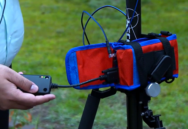
Navman Wireless is launching an integrated vehicle tracking and camera technology product aimed at helping businesses manage risk, improve road safety, and reduce insurance costs. The product, labeled “360 Degree,” integrates telematics, vehicle tracking technology and in-cab safety camera equipment to create what Navman calls a “seamless umbrella of preventive and protective technology.”
The system is designed to help mitigate poor driving, reducing on-the-road risk. “Prevention is better than cure, and using data from telematics and vehicle tracking software to help mitigate poor driving significantly reduces on-road risk, but when you are on the road you need 360 degrees of protection,” said Hutchins.
Navman Wireless describes the in-cab safety camera equipment, supplied by Smart Witness, as a safety net. “It’s a last line of defense for drivers and fleet businesses in those unfortunate circumstances beyond their control,”said Scott Hutchins, VP sales UK and Ireland, Navman Wireless. “The introduction of in-cab camera technology not only protects the driver and business from not-at-fault claims, but also enables us to offer a complete proactive and preventative solution that has the potential to deliver measurable improvements in terms of accident and cost reduction.”
“It’s about prevention and protection. Telematics technology is integral to a successful preventive safety strategy because it can be effectively utilized to assess drivers and ensure safety and quality,” Hutchins said.
LoJack is introducing at NADA 2015 its Fleet Management Lite offering, a new version of the service designed to be an affordable, turnkey SaaS (software as a service-based) telematics solution. Fleet Management Lite will enable business owners with small- to medium-sized fleets to realize the benefits of an advanced fleet telematics system, LoJack said. The can be quickly deployed, making it a good choice for loaner vehicle fleets in many of today’s dealerships, the company said.
Another location-based program is LoJack Pre-Install, which enables automotive dealerships to pre-load vehicles in their inventory with the LoJack Stolen Vehicle Recovery System before the vehicle is sold to the customer.
“Our commitment to LoJack’s dealership network is at the center of who we are as a brand and a company,” said Randy Ortiz, president and CEO of LoJack Corporation. “Through a combination of strategic partnerships and corporate research and development, we’re fully invested in our mission to deliver sophisticated and reliable connected car and telematics solutions to the dealership community. Our goal is that each of these solutions enables dealerships across the country to increase revenue and improve operational efficiencies while effectively serving customers.”
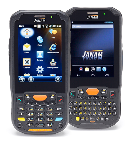
The Janam XM5 series has both Windows and Android OS.
Janam Technologies LLC, a provider of rugged mobile computers that scan barcodes and communicate wirelessly, today announced the launch of its XM5 family of rugged mobile computers. Designed to maximize the mobility investments of enterprise and government organizations, the new XM5 has high-sensitivity GPS and Assisted GPS, and supports Windows Embedded Handheld 6.5 and Android operating systems on the same hardware.
Having both OS enables customers to choose the OS strategy and application migration schedule that best meet their mobility requirements, Janam said.
The XM5 provides the power and flexibility required by mobile workers in field sales, field service, public safety, direct store delivery and transportation and logistics markets, Janam said. Customers can choose between integrated, best-in-class, 1D/2D imager or 1D laser scanner for instant decoding of the hardest-to-read barcodes. Embedded RFID and NFC reading capabilities ensure more efficiency and accuracy in a variety of applications including inventory management, asset tracking, personal identification and mobile point of sale.
“Janam’s XM5 is one of the few rugged mobile computers that allows a customer to migrate from Windows to Android without purchasing new hardware,” said Harry B. Lerner, CEO of Janam. “Packed with all the features that enterprise requires, built to exacting standards of quality and available at an attractive price point, the XM5 catapults Janam to the lead position among hardware providers that not only listen to what customers need, but deliver to those requirements.”
The XM5 comes with either a QWERTY or Numeric keypad and a specially-fortified 3.5-inch VGA display that withstands heavy-duty use. It also offers 802.11a/b/g/n dual-band WLAN and 4G-ready UMTS/HSPA+/HSDPA/HSUPA/GSM WWAN communications for access to high-quality and reliable voice and data inside and outside the four walls.
Built to withstand the rigors of everyday use in the enterprise, the XM5 is sealed to IP65 standards, can withstand five foot drops to concrete and is UL-certified for hazardous environments. In addition, the XM5 ships with a 4000mAh rechargeable Li-ion battery, providing extended battery life as a standard feature, not an optional one.
XM5 Features
Android 4.2 and Microsoft Windows Embedded Handheld 6.5 operating systems
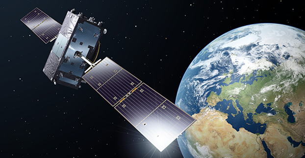
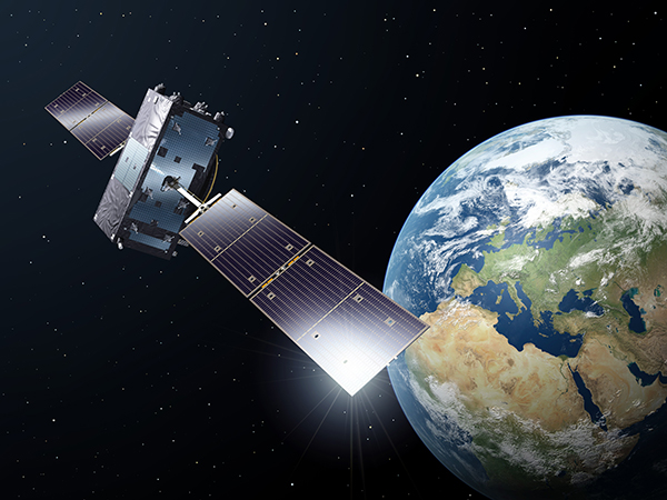
At a press conference on Jan. 16, Director General Jean-Jacques Dordain of the European Space Agency (ESA) announced that the second errant full-operational capability (FOC) satellite, launched in August, had started its orbital change maneuver the previous day. He anticipated that the orbital change would be completed and the final orbit — “albeit somewhat lower in height than the one into which it was supposed to go” — achieved in “a few weeks.” He confirmed that both in-orbit FOCs are working well, fully operational, and providing excellent “on specification” positioning data.
The first errant Galileo satellite is now pointing toward Earth.
Two more FOC satellites are ready for launch, and a third has undergone thermal vacuum testing at ESA’s European Space Research and Technology Centre (ESTEC) facility in the Netherlands. Dordain said four would be available to launch soon, and he anticipated up to six FOCs being ready for launch during 2015.
The previous plan had called for four for 2015, but the year’s anticipated total now includes the two that were held back from launch during a December 2014 window, so the total number is the same. The actual launch schedule and launch vehicles are still under discussion, according to Dordain, and he said the European Commission (EC) would make a decision at the end of January on this issue. He refused to be drawn out on what ESA would recommend to EC on this front.
Jean-Jacques Dordain
“As you know, Soyuz did not place the first two FOC satellites in the right orbit. They only achieved very low orbits. This led and is still leading to delays in the deployment of the Galileo constellation. However, it’s not all bad news, because the two FOC satellites are working perfectly,” Dordain said.
“One of the two has already had its orbit changed, last November, and once in its new orbit, we ran all the new payload tests, and all the data that we have show that the FOC payload is the best in orbit today of the Galileo satellites. We were able to achieve on-spec positioning with the first FOC and the IOV satellites. It provides us with highly accurate positioning data,” Dordain said.
“Once we have both FOCs in their final orbits, not their nominal orbits, it’s true, but they are orbits that mean they will be usable for a long time, because they no longer go through the Van Allen belts.”
A video of the news conference is available here. The Galileo portion of the 2-hour video begins at 11:45. The event took place at ESA-HQ, Paris, France.
Six Galileo satellites are scheduled to be launched this year, European Space Agency (ESA) Director General Jean-Jacques Dordain said on January 16.
“The launch of six satellites is scheduled for 2015. The [European] Commission will determine the terms of the launches at the end of January,” Dordain said at a press briefing. The satellites will be put into orbit by Ariane 5 and Soyuz carrier rockets.
The Galileo project is jointly implemented by the European Union and the ESA.
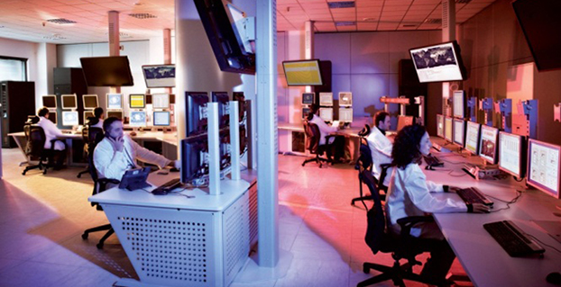
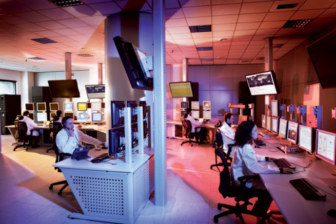
Operators of Galileo’s Ground Mission Segment at the Galileo Control Centre in Fucino, Italy. These operators oversee the navigation services of the Galileo constellation. Photo: Galileo
Galileo’s navigation messages will shortly stop being updated to enable the migration of a new release for Galileo’s ground mission segment, announced the European Space Agency.
Although the actual navigation signals will continue to be transmitted, the generation and uplink of the navigation message — which renews the contents of the signal — will be interrupted during the last week of January for about five weeks.
The accuracy of the navigation message received by users will slowly degrade, or in case of a reset in the satellite signal generator the message content will be dummy material. The users will be informed accordingly through a warning flag in the disseminated message, or through the online Notice Advisory to Galileo Users.
“The main benefits of this migration from V1.2 to V2.0 of the Galileo Ground Mission Segment are better overall performance and availability, increased robustness and improved operability,” explained ESA’s Martin Hollreiser, who is overseeing the mission segment’s development with Thales Alenia Space France as prime contractor. “The latter is achieved through enhanced operator interfaces, increased access to performance data and the automation of procedures.
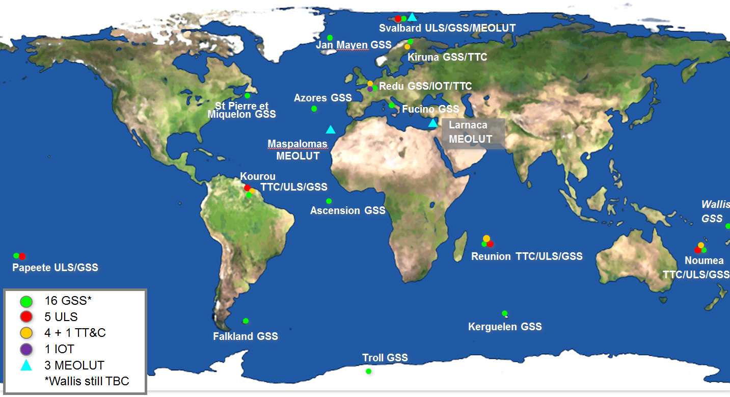
“Various ‘non-conformances’ identified by operators over time have been fixed, while overall security has been further strengthened through treatment plans,” Hollreiser said. “This is in particular true for the Public Regulated Service, or PRS, the most secure Galileo class of signal. Finally, the number of Galileo Sensor Stations will increase from 12 to 15 worldwide and the number of Galileo Uplink Stations from four to five.
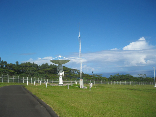
“The new Sensor Stations will be on Santa Maria in the Azores, Ascension Island in the mid-Atlantic and Kiruna in the Swedish Arctic. The additional Uplink Station will be on Papeete, in French Polynesia. Such system improvements have always been part of our planning since the contract began in 2011.”
Galileo’s worldwide ground mission segment is one of the most complex developments ever undertaken by ESA, with twin European Galileo Control Centres and a network of sensor and uplink stations deployed on remote sites across the world. They are all interconnected via a robust satcoms realtime network.
While satellite control and housekeeping are performed by Galileo’s Ground Control Segment in Oberpfaffenhofen, Germany, the Ground Mission Segment that provides the navigation and timing services and related performances is operated from a separate centre in Fucino, Italy.
Galileo’s ground segment encompasses twin European Galileo Control Centers and uplink stations on remote sites across the world. They are all interconnected via a robust satcom network. It includes Galileo Sensor Stations (GSSs) to provide coverage for clock synchronization and orbit measurements; uplink Stations (ULSs) to uplink navigation and integrity data to the Galileo satellite navigation payloads for rebroadcast to users; Telemetry, Tracking and Command Stations (TT&Cs) to manage the satellite platforms; an In-Orbit Test (IOT) site at Redu for satellite payload testing and a trio of Medium-Earth Orbit Local User Terminals (MEOLUTs) for search and rescue activities.
A user’s satnav receiver needs signals from at least four satellites. It actually measures the time the signal takes to reach its antenna from the satellites, then converts time into distance to compute its spatial position as the intersection of the four resulting spheres. To reach sufficient level of precision, the time synchronization of the overall system clocks must stay accurate to a few billionths of a second, and any drift in satellite orbits must be corrected for.
This is the task of the Ground Mission Segment in the control center, which continuously receives signal measurements from the sensor stations around the world. Based on these measurements, it computes exact satellite orbits and time synchronization for the satellites’ onboard atomic clocks.
These corrections are incorporated into the ephemerides included in an updated navigation message, which is uplinked to the satellites for dissemination to the user. The updated ephemerides information in the navigation signal provides to the user receivers the information required to compute their exact position.
The new Papette Uplink Station in Tahiti, French Polynesia, used for uplinking navigation messages for rebroadcast to users from Galileo satellites. Photo: Galileo
A kickstarter campaign has launched for an NMEA dongle that connects any existing GPS receiver to iOS devices. The device connects and communicates with high-accuracy GPS/GNSS devices and other field sensors that emit NMEA data to iOS devices over Bluetooth, allowing users to collect data on an iPad or iPhone using one or more sensors in the field.
Primary functions include:
overriding the internal GPS on iOS device with the location data coming from the external GPS so all existing apps using internal location services can benefit from the increased accuracy without any changes to the app.
providing the ability to connect with other field sensors that emit NMEA-format data (such as underground cable locators, lasers, resistographs, and audiographs) simultaneously with a GPS so data from multiple sensors can be incorporated into the data-collection application.
Garg explained the need for the dongle on his Kickstarter page: “The accuracy and precision of the internal GPS on iPads and iPhones is highly unreliable — it works fine for navigational purposes but fails miserably for mapping and asset management applications. The accuracy varies in range from a few meters to a few hundred meters depending on operating conditions, and there is no easy way to reliably ascertain that. Tests have proven that the accuracy rating on the location data returned by Apple is more of a general estimate than a reliable metric.”
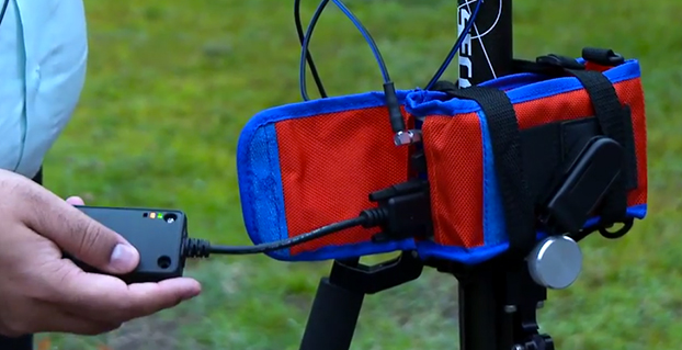
The NMEA dongle is business-card-sized, and has an internal battery and a long-range Bluetooth. The dongle plusg into an existing GPS receiver’s serial port or connects via bluetooth to transmit the GPS data to the iPad. This allows users to feed RTK/NTRIP data to their iOS device.
“We have tested our solution with most of the leading brands of GPS receivers available in U.S., including Trimble, Topcon, John Deere, Altus, Geneq, EOS, CHC,” developer Sharad Garg told GPS World, “on most of the popular networks that we could get access to, including the Leica, Trimble, MyWayRTK, a few state-run networks and of course Unavco. Our solution is compatible with all of them, so its a very generic product at this point compatible with just about all the different solutions out there.”
Garg said his team also designed the dongle so that it allows users to connect to sensors such as laser range finders, valve exercising machine, Resistographs or agricultural sensors that emit data in NMEA format. The National Marine Electronics Association (NMEA) specification defines the interface between various pieces of marine electronic equipment, a standard that permits marine electronics to send information to computers and to other marine equipment.
“We have actually improved the design very significantly to be very modular and be compatible with all sorts of GPS connections that might be offered by the different vendors out there,” Garg said.
This YouTube video shows the dongle’s RTK functionality.
GPS World published general articles on NMEA and RTK in Innovation:
The United States Army is soliciting information for eLoran receivers for the warfighter, either stand-alone or integrated with GPS.
The Jan. 14 Request for Information (RFI) provides an outline for the potential use of the receivers in Army and other Department of Defense (DoD) maritime, aviation, or vehicular platforms and for position and timing purposes.
“As part of the Assured Positioning, Navigation and Timing (APNT), program effort, the Army is investigating the potential benefits from utilizing eLORAN ‘signals of opportunity’ to aid in developing PNT solutions for the warfighter. Thus, the Army is interested in leveraging the recent technology development efforts in the industry mainly for adding eLoran capabilities into Army APNT solutions,” the RFI reads.
Primary technical areas the Army is interested in include the receiver specifications; its use for maritime, aviation, vehicles, and timing; SWaP-C considerations for an integrated GPS and eLoran receiver; potential benefits of one-way messaging capabilities using the eLORAN data channel; signal tracking where GPS is unavailable (indoors, under water, in urban environments); and how quickly a demonstration could be held.
The assumption is for an order quantity of 50,000 units after a five-year development effort. The Army hopes to determine industry interest in developing such a receiver if the DOD “were to consider eLoran as a PNT source/signal of opportunity.”
L-3 Communications has been awarded an $8.5 million modification to the Military GPS User Equipment (MGUE) contract to accelerate the MGUE program. The goal is to speed delivery of upgraded, more powerful GPS receivers to warfighters.
L-3 Communications has been providing hardware for the Air Force in related contracts since 2012 for the GPS user equipment program, reports Defense Systems. The next phase of L-3’s project includes procurement of pre-prototype receiver card deliveries as well as test support activities. The receiver card deliveries will greatly increase the fielding of Military Code (M-code) capable GPS receivers to soldiers.
MGUE is a joint service program to develop a modernized set of military GPS receivers delivering improved capabilities to allow for accurate and reliable positioning, navigation, and timing service where current receiver performance might be compromised or unavailable.
Work will be performed in L-3 Communications’ Anaheim, California, location, with an expected completion date of Sept. 30, 2016. Fiscal 2015 research, development, test and evaluation funds in the amount of $1,814,560 are being obligated at the time of award.
The Space and Missile Systems Center, Los Angeles Air Force Base, California, is the contracting activity.
Professor Terry Moore explores “Where next for GNSS? ” in the Anderson Memorial Lecture at the Royal Institute of Navigation on March 2. Moore is the associate dean for infrastructure and director of the Nottingham Geospatial Institute, Faculty of Engineering, at the University of Nottingham.
Moore will review the current status and proposed modernization of GPS with an emphasis on the benefits that the developments and new signals will bring to a variety of user domains. In a similar manner, the Russian GLONASS will also be described documenting the evolution to the system’s current status and the planned developments.
The new European Galileo and Chinese BeiDou systems also will be described along with consideration of the international efforts directed towards interoperability of all the global systems. Other nascent and proposed systems will be introduced, such as IRNSS and QZSS.
The lecture is presented by the Royal Institute of Navigation in conjunction with the RAF Cranwell Branch of the Royal Aeronautical Society. There is no charge for RIN or RAeS members, but RIN members who would like to attend should book through [email protected] to be informed of the security and entry arrangements. The lecture will be held at Whittle Hall, RAF Cranwell, Sleaford, Lincs, U.K.
A member of the GPS World Editorial Advisory Board, Moore holds a B.Sc. degree in Civil Engineering and a Ph.D. degree in Space Geodesy from The University of Nottingham. He is a Fellow of the Royal Institute of Navigation, a former vice president and a member of its council. He is a member of the European Space Agency GNSS Scientific Advisory Committee and a member of the UK Space Agency Telecoms and Navigation Committee. He is also a member of The Institute of Navigation and a Fellow of the Royal Astronomical Society.
CNN has entered into a Cooperative Research and Development Agreement (CRDA) with the Federal Aviation Administration to advance efforts to integrate unmanned aerial vehicles (UAVs) into newsgathering and reporting.
The cooperation arrangement will integrate efforts from CNN’s existing research partnership with the Georgia Tech Research Institute (GTRI). Coordination between and among CNN, GTRI and the FAA has already begun. The FAA will use data collected from this initiative to formulate a framework for various types of UAVs to be safely integrated into newsgathering operations.
“Our aim is to get beyond hobby-grade equipment and to establish what options are available and workable to produce high quality video journalism using various types of UAVs and camera setups,” said CNN Senior Vice President David Vigilante. “Our hope is that these efforts contribute to the development of a vibrant ecosystem where operators of various types and sizes can safely operate in the US airspace.”
“Unmanned aircraft offer news organizations significant opportunities,” said FAA Administrator Michael Huerta. “We hope this agreement with CNN and the work we are doing with other news organizations and associations will help safely integrate unmanned newsgathering technology and operating procedures into the National Airspace System.”
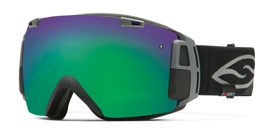
Sporting goods maker Smith Optics is offering I/O Recon goggles for winter sports enthusiasts, which combine Smith’s premium anti-fog lenses with GPS and Bluetooth technology. A heads-up display is integrated into the frame design, allowing users to log and view information without taking their eyes off the powder.
According to Smith Optics, the frame design maximizes field of view. With the heads up display, skiiers and snowboarders can see the speed they’re going, the height of their jumps, and track and follow their friends on the slopes. The Bluetooth allows connection to a smartphone.