Author: GPS World Staff

  • EGNOS to Gain Satellite with Scheduled Launch

    EGNOS to Gain Satellite with Scheduled Launch

    The ASTRA 5B is installed in preparation for launch Friday, March 21. (Photo credit: Arianespace)
    The ASTRA 5B is installed in preparation for launch Friday, March 21.
    (Photo credit: Arianespace)

    The launch of the satellite ASTRA 5B, which will become part of the European Commission’s European Geostationary Navigation Overlay Service (EGNOS), is scheduled for Friday, March 21, according to satellite company SES. It will be launched into space from the European Space Centre in French Guiana on board an Ariane 5 ECA rocket between 19:05 p.m. and 20:02 p.m. local time (23.05 – 00.02 CET; 18.05 – 19.02 EDT).

    ASTRA 5B will carry a hosted L-band payload for EGNOS. It will also extend transponder capacity and geographical reach over Eastern Europe and neighboring markets for DTH, direct-to-cable, and contribution feeds to digital terrestrial television networks.

    ASTRA 5B was built by Airbus Defence and Space (formerly Astrium) in Toulouse, France, using a Eurostar E3000 platform. The multi-mission satellite will be located at 31.5 degrees East.

    “The launch of ASTRA 5B will be the 39th launch of an SES satellite on board a European Arianespace launch vehicle,” said Martin Halliwell, chief technology officer of SES. “Our long-standing relationship is based on this proven track record and shows the continuous confidence we have in Arianespace and our commitment to Ariane as a launch vehicle. We look forward to a successful mission with this longstanding launch partner.”

    The launch will be streamed online at the Arianespace site and at the SES YouTube channel.

    Also follow the launch and the launch preparations on:
    www.ses.com: http://en.ses.com/4243715/blog
    Twitter: https://twitter.com/SES_Satellites
    LinkedIn: http://www.linkedin.com/company/9157?trk=tyah
    Facebook: https://www.facebook.com/SES.YourSatelliteCompany

  • Are You Master of the Galileo Universe?

    Are You Master of the Galileo Universe?

    Klixon
    2013 Galileo Master KINEXON offered a precise tracking and monitoring solution for sports and healthcare.

    The European Satellite Navigation Competition (ESNC) is looking for services, products, and business innovations that use satellite navigation in everyday life. Prizes will be awarded by some of the most relevant institutional GNSS stakeholders, such as the European GNSS Agency (GSA) and the European Space Agency (ESA). In addition, partner regions from all over the world are hosting regional challenges.

    The competition officially kicks off at the European Navigation Conference in Rotterdam on April 15, but submissions are being accepted from April 1 to June 30.

    The prize pool of ESNC 2014 is expected to value about 1 million euros. Awards include cash prizes, business incubation, business coaching, patent consulting, technical support, access to testing facilities, prototype development, publicity, marketing support, feasibility studies, access to experts and public funding, and more.

    In 2013, 25 partner regions offered prizes, and seven special prizes were provided by leading European industry and research partners. Entries will be assessed by the expert panels of the regions and special prize partners.

    The overall winner — the Galileo Master — will be selected from among all regional and special prize winners by an international panel of high-ranking experts. The Galileo Master will be revealed at an awards ceremony in Munich, Germany, in October, and will receive an additional cash prize of 20,000 euros as well as the chance to realize the winning idea as part of a six-month incubation program in the region of his or her choice.

    For full details, visit the competition website.


    ESNC Hosts at CAPIGI

    The ESNC is hosting a session at the CAPIGI conference in Amsterdam on April 3, jointly with the Copernicus Masters. The conference is dedicated to space technology for agriculture, focusing on the European Flagship programs Galileo and Copernicus. CAPIGI, the Community on Agricultural Policy Implementation and Geo-Information, is a network for geo-information experts active in agriculture.

  • Google’s 3D Mapping Phones Head to Developers

    Google’s 3D mapping project, Project Tango, is putting prototypes into developers’ hands.

    Google has been collaborating with universities, research labs, and industrial partners in nine countries, to concentrate the past 10 years of research in robotics and computer vision into a mobile phone. “We now have prototypes ready to put into the hands of eager development partners that can help us imagine the possibilities and to transform those ideas into reality,” Google said on its Project Tango website.

    Google’s Advanced Technology and Projects group (ATAP) heads the project, which aims to make it possible to create a 3D model of the space around a smartphone. For instance, a user can map an area, such as a home, by walking around with the phone.

    Creation of 3D maps in this way would make it easy to navigate through buildings such as offices and supermarkets. Maps of a user’s home could also be used in games. As Google said on its website, “Imagine playing hide-and-seek in your house with your favorite game character, or transforming the hallways into a tree-lined path. Imagine competing against a friend for control over territories in your home with your own miniature army, or hiding secret virtual treasures in physical places around the world.”

    The current prototype is a 5-inch Android phone containing highly customized hardware and software designed to track the full 3D motion of the device as a user holds it, while simultaneously creating a map of the environment. These sensors allow the phone to make more than a quarter million 3D measurements every second, updating its position and orientation in real time, combining that data into a single 3D model of the space. The mapped space is matched to the phone’s internal gyroscopic systems and more general location data from GPS.

    Check out the Project Tango video:

  • Yandex Acquires KitLocate, Israeli Geo-Location Developer

    The Israeli startup KitLocate, developer of energy-efficient cloud location technology for mobile devices, is joining the Yandex mobile search team.

    KitLocate’s technology, packed into a developer-friendly SDK, provides location capabilities, including geo-fencing, motion detection and social location, for location-based apps on the user’s iOS or Android smartphone. While doing that, it lowers battery power consumption to less than 1% per hour. KitLocate’s algorithms allow location-based apps to request the device’s geographic coordinates less frequently without losing precision, which considerably extends the phone’s life between charges.

    The Israeli team’s technology has already been successfully implemented in a mobile app, which helps drivers to find available parking spaces in their immediate vicinity. Popular in Israel financial service, Isracard uses KitLocate’s technology to deliver its offerings to users’ phones based on their current location.

    Yandex’s mobile products that don’t need continuous GPS synching, such as its location-based search, will be augmented by KitLocate’s smart solution. With KitLocate’s technology, Yandex will be able to deliver search results, as well as product or service offers, on the user’s mobile phone or tablet, relevant not only to a specific user, but also to their current location. The cloud solution looks especially promising for location-based recommendation apps, Yandex said.

    Yandex’s previous experience working with a startup from Israel was investment in a facial recognition technology developer, Face.com, which was later acquired by Facebook. After joining Yandex, KitLocate’s team, based in Tel Aviv, will continue to be available for implementation in other location-based apps that don’t require continuous geo-tracking.

  • Exelis GPS Threat Detection Helped Safeguard Super Bowl XLVIII

    Signal Sentry 1000, an Exelis product that detects and locates GPS interference sources in 3D by using longitude, latitude and altitude, was deployed during Super Bowl XLVIII at the MetLife Stadium in East Rutherford, New Jersey.

    During the Super Bowl, GPS devices were used extensively to track and monitor the location of team members and officials. GPS was also used to ensure that event organizers and security knew the exact location of team vehicles en route to the stadium. If a vehicle were to break down delaying the arrival of a team or game staff to the event, logistics and scheduling could have been adjusted accordingly.

    “Signal Sentry 1000 helped our law enforcement officials keep thousands of fans in attendance safe during one of the most exciting nights for millions of Americans,” said Mark Pisani, vice president and general manager of positioning, navigation and timing for Exelis Geospatial Systems. “Protecting critical GPS infrastructure is extremely important for public safety.”

    Signal Sentry 1000 was designed to collect actionable intelligence for law enforcement and to protect GPS signal-dependent critical infrastructures. At the Super Bowl, Exelis deployed eight Signal Sentry sensors positioned in an array pattern to detect and locate the jamming source. Threats are detected through a network of sensors, which is part of a centralized server executing Exelis-developed proprietary location algorithms.

    In addition to national special security events like the Super Bowl, sensors can also be used around different types of critical infrastructure, such as utilities and government facilities, to automatically sense and locate any intentional or unintentional source of GPS jamming. Once a threat is detected, users receive specific information regarding the location of the threat in order to stop or mitigate the interference.

  • ENC GNSS 2014 Program Now Online

    The European Navigation Conference (ENC) will be held April 15-17, 2014, in the World Trade Center in Rotterdam, The Netherlands. The conference aims at technology, innovation, and business in the PNT domain (positioning, navigation, and timing). The conference program is now available for review online.

    Satellite navigation and positioning, using current operational systems like GPS and GLONASS, will be major topics. The conference will also highlight recent developments on emerging GNSS like the European Galileo and the Chinese BeiDou.

    More than 100 presentations will be given at ENC GNSS 2014. Here are a few highlights:

    Keynote speeches

    • Prof. Bradford Parkinson (Stanford University): Assured PNT – assured world economic benefits.
    • Prof. Erik Theunissen (Netherlands Defence Academy): So you think you are safe.

    Invited lectures

    • Prof. Cathryn Mitchell (University of Bath): Space weather effects on GNSS.
    • Ignacio Fernández-Hernández (European Commission): The Galileo commercial service: current status and prospects.
    • Jaron Samson (European Space Agency): An introduction to interference in GNSS bands.
    • Prof. Peter Teunissen (Curtin University/Delft University of Technology): Multi-GNSS: combining GNSSs for precise positioning and navigation.
    • Prof. Frank Van Graas (Ohio University): Disruptive technologies and GNSS aircraft landings.
    • Prof. Qile Zhao (Wuhan University): Positioning performance and precise applications of Beidou navigation satellite system.

    Special sessions

    • The European Space Agency will organize a dedicated session on Galileo IOV results.
    • Anwendungszentrum GmbH Oberpfaffenhofen (AZO) will chair the kick-off meeting of the European Satellite Navigation Competition 2014.

    Prior to the conference, on April 14, there will be a Resilient PNT forum and a meeting of the European Maritime Radio Forum (EMRF).

    To register, go to the ENC GNSS 2014 website.

  • You Can Help Find Missing Malaysia Airlines Plane


    DigitalGlobe, Inc., has launched a crowdsourcing campaign that will allow anyone to help look for the missing Malaysia Airlines flight MH370 by combing through satellite images for clues of its whereabouts.

    The search drew so many participants on its first day March 17, that it crashed the company’s website, with 500,000 visitors wanting to help find the missing Boeing 777. Anyone can begin searching the satellite images, tagging anything that looks suspicious. Each pixel on a computer screen represents half a meter on the ocean’s surface.

    The Longmont, Colorado, company said two of its commercial satellites have already collected images comprising roughly 1,988 square miles at the confluence of the Gulf of Thailand and the South China Sea, where the Beijing-bound aircraft mysteriously went missing on Saturday. The company is continuing to update the images to reflect new information about the search area provided by the Malaysian government.

    To help, go to DigitalGlobe’s crowdsourcing website, Tomnod.com.

  • Get a Galileo Position Fix? ESA Wants to Give You a Prize

    Get a Galileo Position Fix? ESA Wants to Give You a Prize

    First_Galileo_position_fix-W
    Javier Benedicto, ESA’s Galileo Project Manager, looks on as Europe’s own satellite navigation system performs its historic first position fix of longitude, latitude and altitude. The position fix took place at the Navigation Laboratory at ESA’s technical heart ESTEC, in Noordwijk, the Netherlands on the morning of March 12, 2013, with an accuracy between 10 and 15 meters — expected taking into account the limited infrastructure deployed so far. Horizontal accuracy reached as high as 6 m. The left-side screen shows the position fix while the right side screen shows the position of the four Galileo satellites and their current signal coverage.

    Did you get a fix on four Galileo satellites? Then there could be a certificate in it for you! ESA will recognize Galileo pioneers with commemorative certificates to the first 50 entities who document their achievement of a past or present fix. Details of how to apply are provided here.

    To mark the first anniversary of Galileo’s historic first satnav positioning measurement, ESA plans to award certificates to groups who picked up signals from the four satellites in orbit to perform their own fixes.

    In 2011 and 2012 the first four satellites were launched — the minimum number needed for navigation fixes.

    Europe’s Galileo satnav system.
    Europe’s Galileo satnav system.

    On March 12, 2013, Galileo’s space and ground elements came together for the first time to perform the historic first determination of a ground location — the Navigation Laboratory of ESA’s Technical Centre in Noordwijk, the Netherlands.

    From this point, generation of navigation messages enabled full testing of the entire Galileo system — not just by ESA and its industry and institutional partners but also by any entity with a customized satnav receiver.

    ESA’s Galileo team has heard about position fixes carried out by organizations and companies all over Europe and beyond, including as far away as Vietnam.

    A year after the first fix, ESA is recognizing these Galileo pioneers with commemorative certificates to the first 50 entities who document their achievement of a past or present fix.

    Applicants should send in their name, address, details of the receiver they used, the start and end time of their fixes in Universal Time Coordinated (UTC) and a plot of their latitude/longitude position fixes overlaid on a map, such as Google Earth. Submissions should be sent to [email protected] within the next two months. Certificates will be sent out after May 12, along with an online results update. See details of how to apply here.

    The first Galileo services are scheduled to begin later this year, as more satellites are delivered into orbit. The next launches will occur in the second half of this year, each with two satellites aboard a Soyuz ST-B. They will take place in close succession to build up the constellation.

    Many satnav receiver chips are already technically Galileo ready, requiring only software upgrades from their manufacturer to begin working with Galileo signals along with GPS and other international satnav systems.

    Dual-frequency Galileo positioning performance during the In-Orbit Validation phase: positioning accuracy is an average 8 m horizontal and 9 m vertical (95% of the time). Its average timing accuracy is 10 nanoseconds on average. Plot courtesy of ESA.
    Dual-frequency Galileo positioning performance during the In-Orbit Validation phase: positioning accuracy is an average 8 m horizontal and 9 m vertical (95% of the time). Its average timing accuracy is 10 nanoseconds on average. Plot courtesy of ESA.


  • PNT Advisory Board Hears Air Force CNAV Plan


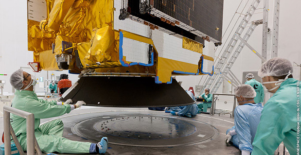
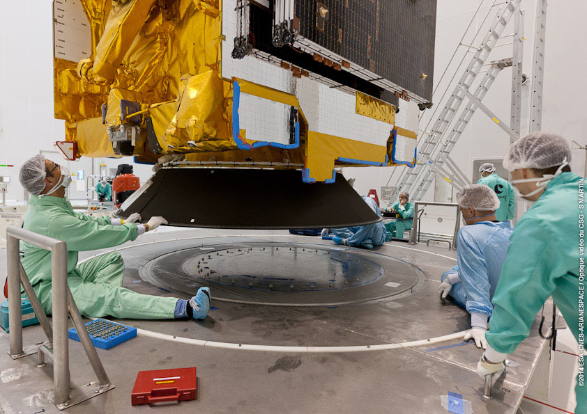
    The U.S. National Space-Based Positioning, Navigation, and Timing (PNT) Advisory Board has published the minutes of its December 4–5, 2013, meeting, opening with a quote from Albert Einstein, “We cannot solve our problems with the same thinking we used when we created them,” courtesy of Board Chair Dr. James Schlesinger. Among many other topics addressed, the Board heard a report from Major General Martin Whelan, Director of Requirements, Air Force Space Command, on the road ahead for implementation of the GPS Civil Navigation (CNAV) message on L2C and L5. The subject has stirred some controversy of late, particularly between the U.S. Departments of Transportation (DoT) and Defense (DoD), and DoT is currently seeking public comments on the plan.

    The meeting minutes relay the gist of General Whelan’s CNAV remarks as follows:

    “While sequestration is having various impacts on DoD budgets, thus far GPS quality, service and refresher plans are unaffected. The FY15 budget is under development.

    “CNAV has been under discussion for a considerable time. Currently, L2C and L5 signals are being transmitted, but without a navigation message. AFSPC is working hard to activate these messages as soon as possible. One of the reasons for the delay is that additional time was needed to complete testing prior to activation. Testing began in late summer 2013 and, based on initial test results, a “way ahead” has been plotted. Gen William Shelton, AFSPC commander, wished to assure the Advisory Board of his unwavering commitment to providing full-time broadcast CNAV messaging capability on L2C and L5 as soon as possible.

    “The CNAV capability will add diversity and robustness for dual frequency users. Gen Shelton intends to provide details plans to the NCO and a report to the next EXCOM meeting. Current plans are to begin initial broadcasting in the spring of 2014. CNAV uploads will occur twice weekly. The signal will meet GPS Standard Positioning System (SPS) standards, but may not achieve current accuracy levels until full implementation in late 2014.

    “CNAV live sky testing occurred in June and was conducted in cooperation with civil, industry, and international partners. The two-week test series included independent assessment and verification. The tests identified four errors that required action. The first, which was addressed in real time, related to implementation of the test series. The second required improvement to the tools suite, which should be totally integrated into the ground segment by December 2014. The third and fourth errors required patches to satellite software. All four issues are now regarded as closed.”

    The meeting minutes report this further discussion of CNAV.

    “Dr. Schlesinger raised the topic of sequestration and how, based on his early career in budgeting, no budget item is sacrosanct. GPS has enjoyed protection from Deputy Secretary of Defense Ashton Carter, but he is now stepping down and his replacement not yet known. This could provide an opportunity for “the men with the green eyeshades” to come forward to eliminate things.

    “Gen Whelan said he agreed that with sequestration, everything – including GPS – is on the table. However, AFSPC continues to strive to avoid any degradation in service. He also welcomed the continued support of the Advisory Board.

    “Dr. Schlesinger quoted from a 2006 document: “Our position is to continue to provide the best space-based positioning, navigation and timing service in the world.” The Chinese are now “moving up” on GPS. How is GPS going to stay ahead?

    “Gen Whelan said AFSPC is aware of China’s steps in capacity and signal diversity. This, however, does not alter his confidence that GPS remains the “Gold Standard” of world GNSS systems. AFSPC is committed to maintain GPS leadership. However, because of sequestration and budget cuts, this position could not be the position of some people outside of the Air Force.”

    A subsequent presentation from the Department of Transportation given by Karen Van Dyke, Director for PNT, DOT Research & Innovative Technology Administration (RITA), did not directly mention CNAV, according to the meeting minutes, but did include this update on civil signal monitoring, taken from the meeting minutes.

    “DOT is responsible for performance monitoring of GPS civil signals. She called attention to the International Committee on GNSS’s (ICG’s) transparency principle that “Every GNSS provider should publish documentation that describes the signal and system information, the policies of provision, and the minimum levels of performance offered for its open service.” Currently, this is only done on GPS L1 C/A signals. Performance standards for L2C and L5 have not yet been established. The crucial function of signal/service monitoring is to verify that commitments to GNSS performance are being met. Additionally, monitoring improves the situational awareness for GNSS operators, and provides assurance that any civil service failure is detected and resolved promptly. All these factors support the GPS performance history that has made it the world’s Gold Standard.

    “The DOT “GPS Civil Monitoring Performance Specifications” (CMPS) document defines the measurements required to show if performance standards for monitoring GPS’ signals/service are met. The document’s first version was developed in 2005 and listed 193 requirements, covering performance monitoring, signal monitoring, non-broadcast data requirements, and reporting and archiving requirements. The document was later updated to align with the 2008 GPS SPS Performance Standard. The most current CMPS was completed in April 2009 and is available at GPS.gov. Since 1999, DOT has published quarterly reports providing analysis of SPS performance for the Federal Aviation Administration (FAA).”

    Further Topics

    Other reports delivered to the Advisory Board, and available in the the full meeting minutes, available here,  include the following. In addition, many PDFs of the individual reports  are available through the meetings Agenda page.

    Global Differential GPS System as a Civil Monitoring Utility
    Dr. Yoaz Bar-Sever, Manager, Global Differential GPS System, NASA Net Propulsion Laboratory

    Automated Driving & Safety Considerations (collision avoidance warning, vehicle-to-vehicle communications, and driverless automobiles)
    Russell Shields, PNT Board Member, founder of Ygomi LLC

    GPS Disruptions: Efforts to Assess Risks to Critical Infrastructure
    The Government Accountability Office’s (GAO) Report on Enhancing Interagency Actions
    Eli Albagli, senior analyst, GAO

    2013 National Infrastructure Protection Plan (NIPP)
    Department of Homeland Security Implementation
    Robert Kolasky, Director Strategy and Policy, DHS Office of Infrastructure Protection

    Economic Impacts of GPS on Key Sectors in the U. S. Economy
    Dr. Nam D. Pham, economist/managing partner, NDP Consulting Group

    GNSS Signal Capability – Multi-Constellation Management
    Cross-Correlation of Existing & Evolving C/A System Signals
    Dr. A. J. Van Dierendonck, AJ Systems

    How Far to Take GNSS Interoperability/Interchangeability?
    Ken Hodgkins, Office of Space & Advanced Technology, Department of State.


  • Veripos Upgrades Reference Stations with Septentrio GPS/GLONASS/Galileo/BeiDou Receivers

    Veripos Upgrades Reference Stations with Septentrio GPS/GLONASS/Galileo/BeiDou Receivers

    The Septentrio PolaRx4 reference receiver.
    The Septentrio PolaRx4 reference receiver.

    Veripos, a global provider of precise satellite positioning solutions to the international offshore and marine industries, is concluding the upgrade of its global network of GNSS reference stations with high-performance multi‑frequency GPS/GLONASS/Galileo/BeiDou receivers from Septentrio.

    Veripos owns and operates a network of more than 80 reference stations worldwide that is used to determine estimates of the orbit and clock errors of multiple GNSS satellite constellations. Veripos uses these estimates to calculate corrections which are then broadcast to end users to significantly improve the accuracy of positioning. At the heart of the network is Septentrio PolaRx4, a full-featured reference receiver that provides high-quality tracking and measurement of all available and upcoming GNSS signals.

    The upgrade of the Veripos global network of reference stations with the latest Septentrio reference receiver technology is an outcome of the multi-year collaboration between the two companies. Septentrio also supplies Veripos with multi-frequency GNSS and heading receivers for its marine business, including the LD series of integrated mobile units that deliver the complete range of Veripos augmentation services to its customers worldwide.

    “Septentrio reference stations are renowned for their excellent data-quality and robustness,” commented Bobby Johnson, Chief Technical Officer of Veripos. “Septentrio technology enables us to provide a full range of services and to remotely manage and upgrade the hardware to enhanced features, which is crucial for managing a worldwide reference network, where the equipment is often not easily accessible.”

    “We are delighted to see continued positive outcome from the technical and commercial relationship we have established with Veripos over the years and that has developed into Septentrio enabling Veripos to deliver a variety of solutions with high-quality and robust industrial performance everywhere on the globe to the benefit of a multitude of users in one of the most demanding industries,” said Jan Van Hees, head of sales and business development at Septentrio.

  • Hemisphere GNSS Vector Products Now Have GLONASS Functionality

    Hemisphere GNSS has announced that all professional-level Vector products — including the V103, V113, VS131, and VS330 — now include the ability to utilize the GLONASS system along with GPS in the navigation solution. The tracking of the additional GLONASS signals provides a more robust solution, especially in challenging environments, the company said.

    Vector Technology processes L1 GPS and GLONASS signals to deliver precise heading, greater positioning reliability, and improved performance in challenging environments. Hemisphere GNSS’ patented Vector technology computes the heading and pitch or roll angle while stationary or in motion allowing for heading accuracy of up to 0.01 degrees depending upon the product selected. A variety of differential correction methods also make it possible for Vector products to provide sub-meter to centimeter level RTK position accuracy.

    Professional marine industry organizations can maximize performance by integrating Hemisphere GNSS Professional Vector technology into their systems for hydrographic and bathymetric surveys, autopilots, dredging, and buoys. For land applications, Vector Technology is designed for the alignment of cameras, antennas, and projectiles, and for machine control applications in agriculture, construction, and mining.

  • TomTom Integrates Indoor Mapping with Micello Partnership

    TomTom has begun a strategic partnership with indoor-mapping company Micello Inc., extending its range of mapping products to include indoor venues.

    Integrating Micello’s maps and venue content gives TomTom’s business customers access to accurate pedestrian friendly indoor maps with points of interest data in venues worldwide.

    “The indoor mapping functionality means that step-by-step guidance can be integrated into daily life for a wide variety of venues, including shopping malls, airports and retail stores,” said Charles Cautley, managing director, TomTom Maps. “By partnering with Micello our customers can now develop smarter apps and locations-based services helping users navigate with ease in and out of the car.”

    “We’re excited to be partnering with TomTom, the global leader in navigation.” added Ankit Agarwal, CEO of Micello. “Our agreement means that TomTom’s business customers can use our indoor venue maps and incorporate the content into their automotive, online, or mobile solutions.”