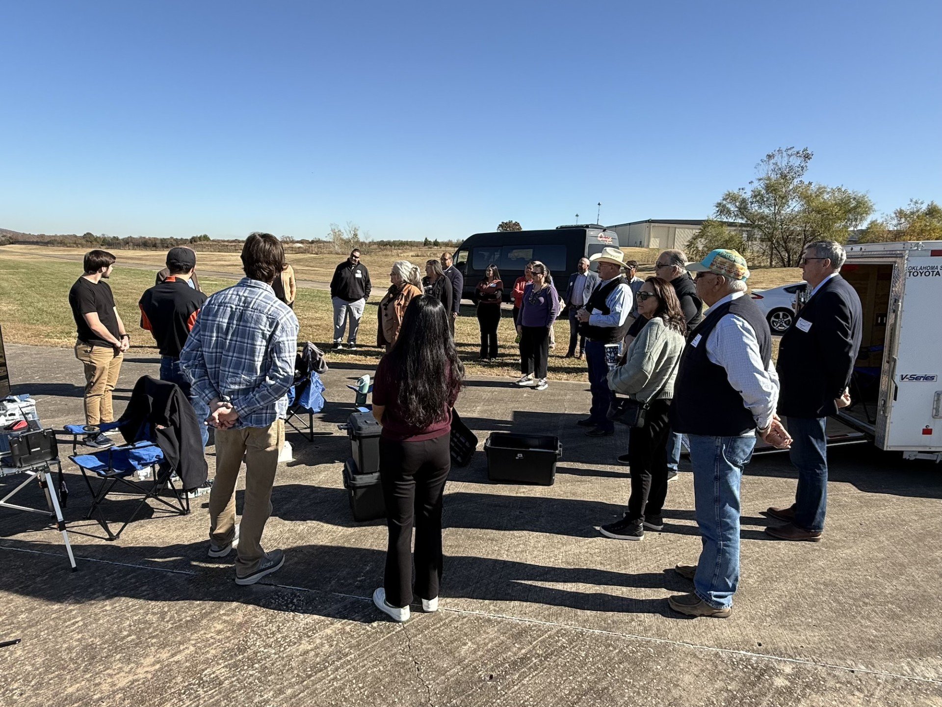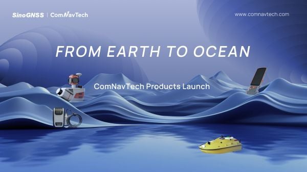
At a recent product launch event, ComNav Technology unveiled a new technological ecosystem for surveying. Under the theme “From Earth to Ocean,” the company presented a suite of next-generation innovations engineered to advance the frontiers of geospatial and hydrographic intelligence.
ML300 mobile laser scanning system
Precision surveying in complex environments
The ML300 mobile laser scanning system is designed for large-scale surveying projects and complex environments. It incorporates multi-mode fusion positioning technology, integrating GNSS, IMU, DMI and laser SLAM, providing a new approach to 3D scene reconstruction.
This system is designed for environments where GNSS signals are limited or entirely lost, such as tunnels, urban canyons, and densely built-up areas. In these challenging environments, traditional surveying methods often fail to deliver the required precision, but with ML300’s intelligent multi-mode positioning, we ensure accurate 3D scene reconstruction regardless of the conditions.
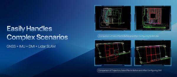
The core advantages of the ML300 lie in its high precision and flexibility. By combining Laser SLAM and DMI technologies, it can operate effectively without GNSS signals, eliminating errors and improving modeling accuracy. This breakthrough offers new solutions for large-scale land surveys, urban infrastructure monitoring, and smart city planning, among others.
Designed for operational efficiency, the ML300 boasts a modular and highly flexible design. It can be customized with various sensors, including road cameras, Ladybug 6 panoramic cameras, and wheel encoders, making it adaptable to a wide range of project needs. Additionally, with up to 6 hours of battery life and external power source support, the ML300 ensures stable performance during long working hours.
Whether for highway surveys, urban power line inspections, dynamic forestry management, or smart transportation system development, the ML300 provides precise and efficient data support, facilitating digital transformation across various industries.
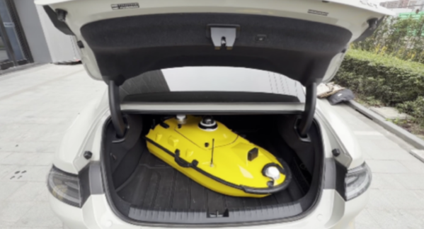
SV300 unmanned surface vessel
Intelligent underwater surveying
The SV300 unmanned surface vessel was designed specifically for intelligent underwater surveying. This autonomous vessel is optimized for operation in complex aquatic environments, integrating high-precision GNSS positioning, AI technologies, and autonomous navigation capabilities, enhancing both the efficiency and accuracy of hydrographic surveys.
Its design focus on making underwater exploration smarter, safer and more efficient. Its ultra-light design (28 kg) and compact hull (less than 1 meter in length) enable single-person operation. The SV300 can be stored in the trunk of a small vehicle.
Equipped with a high-performance single-beam bathymetric measurement system, the SV300 can measure depths up to 200 meters, ensuring reliable data. Its streamlined hull and powerful motor enable a top speed of 7 meters per second, accelerating survey speeds without compromising accuracy.
The intelligent features of the SV300 enhance measurement efficiency and ensure the safety of personnel. Whether used for river, lake or ocean surveys, or in emergency response and pipeline inspections, the SV300 adapts to complex environments inunderwater exploration.
HYD10 portable echo sounder
Compact and precise
The HYD10 is a lightweight, high-precision echo sounder designed for modern surveying tasks. Weighing 0.3 kg for the main unit and 1.5 kg for the transducer, its portability means a single operator to carry and operate. Its compact design and Bluetooth capability allow it to function seamlessly in tight spaces and complex environments, removing the need for cumbersome cables.
With a measurement depth range of 0.3m to 200 m, the HYD10 provides high-precision readings with accuracy ±1 cm + 0.1% of water depth and 1 cm resolution. The 200 kHz depth module and narrow 6° beam angle ensure precise, clear data, while an adjustable sound speed range (1300-1700 m/s) adapts to different water conditions.
For greater operational flexibility, the HYD10 integrates with Survey Master software, supporting real-time monitoring, data processing and wireless connections through Wi-Fi and Bluetooth. It is compatible with a variety of positioning devices, including the P6H and P8H tablets, as well as a wide range of RTK receivers. The P6H provides centimeter-level positioning accuracy, while the P8H offers flexible antenna adjustments for various field conditions.
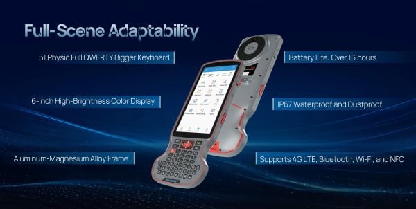
R80 GNSS data collector
Precision in surveyors’ hands
The R80 GNSS data collector is designed to improve field technology, engineered for demanding tasks in construction, mining, surveying and GIS. The R80 has an octa-core processor, delivering rapid CAD and map loading to ensure smooth operation and boost productivity. The ergonomic design with an 18-degree grip angle maximizes one-hand comfort, reducing fatigue during long hours of operation.
The R80 features ultra-wide mechanical keys with tactile feedback, offering precise control with a 0.8 mm travel and pressure sensing. It includes custom quick-measure keys for easy access to measurement functions. The 51-key backlit keyboard and a 6-inch 1080P display ensure clear visibility even in direct sunlight. With a 9000 mAh battery, it supports more than 16 hours of continuous operation. It holds an IP67 rating for water and dust resistance and has passed a 1.5-meter drop test.
It supports 4G LTE, Bluetooth, Wi-Fi and NFC, and has a 13MP autofocus camera for high-definition imagery. Survey Master software, integrated with a CADX engine, enables instant opening of large drawings and ensures smooth field operations.