The northernmost Joint Polar Satellite System Common Ground System station in Svalbard, Norway. (Photo: Raytheon)
Newest version of Raytheon’s Joint Polar Satellite System Common Ground System is now operational
Raytheon’s next-generation Common Ground System for the Joint Polar Satellite System (JPSS CGS 2.0) is now operational, supporting 11 polar-orbiting satellites and delivering observations to NOAA’s National Weather Service almost 50 percent faster than before.
Svalbard, Norway, is the location of the northernmost Joint Polar Satellite System Common Ground System station.
JPSS CGS 2.0 was designed to support the upcoming NASA launch of NOAA’s JPSS-1 satellite on Nov. 14.
“The new ground system significantly improves the mission capabilities of the JPSS program,” said Matt Gilligan, vice president of Raytheon’s Navigation and Environmental Solutions. “It can handle even more data from the full constellation of satellites now and in the future.”
Developed by NASA for NOAA, the JPSS CGS collects and disseminates observations from polar-orbiting weather satellites from the United States, Europe and Japan.
The polar orbiters provide critical weather and environmental data to ensure meteorologists and forecasters have robust, reliable information to make timely and accurate weather predictions that help save lives, protect property and decrease the devastating economic impact caused by severe weather.
Harris Corporation has completed development of its fully digital Mission Data Unit (MDU), which is at the heart of its navigation payload for Lockheed Martin’s GPS III satellites 11 and beyond.
The current Harris payload for GPS III space vehicles (SVs) 1-10 includes a greater than three times reduction in range error, up to eight times increase in anti-jamming power, added signals — including one compatible with other Global Navigation Satellite Systems (GNSS) — and greater signal integrity.
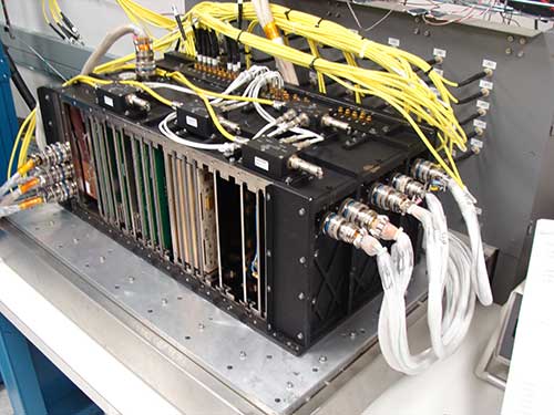
The fully digital Mission Data Unit (MDU) will create precise civil and military timing navigation signals for GPS III satellites 11 and beyond. Pictured here is the advanced MDU on navigation payloads being delivered for GPS III Space Vehicles 1-10. (Photo: Harris)
Harris’ GPS III SV11+ fully digital navigation payload will further improve on performance for the U.S. Air Force by providing more powerful signals, plus built-in flexibility to adapt to advances in GPS technology, as well as future changes in mission needs.
“This design is fully mature — an Engineering Development Model, not a prototype — and is ready to be inserted into GPS III SV11+,” said Bill Gattle, president, Harris Space and Intelligence Systems. “The payload has the flexibility to serve the warfighter over the entire mission life and can be upgraded incrementally over its mission life due to built-in adaptability.”
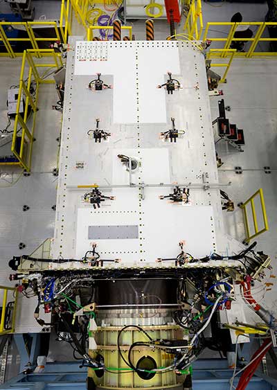
Harris navigation payloads are already integrated in the second GPS III space vehicle, pictured here, and the first GPS III satellite, declared available to launch in 2018. (Photo: Lockheed Martin)
The payload design also ensures flawless atomic clock operations, providing the reliable GPS signal that millions of people — including U.S. soldiers — and billions of dollars in commerce depend on every day, the company said. It also will provide the clock signal for a new GPS III Search and Rescue (SAR) payload.
Beyond flexibility and reliability, the new Harris SV11+ navigation payload offers a smooth transition to the Air Force’s GPS OCX ground control segment. The Harris payload for the first ten GPS III satellites already has been verified for OCX compatibility, and this will allow Harris to seamlessly port the Harris SV11+ design, minimizing integration risks and associated costs.
Analog Devices has produced a series of five high-performance inertial measurement units (IMUs) for industrial applications that address the navigation- and safety-related needs of industrial applications in several emerging markets, while also reducing their system complexity and cost.
The IMUs provide six-degree-of-freedom (DoF) sensing via triple-axis MEMS-based accelerometers and gyroscopes, and are focused on the demands of the industrial “internet of moving things” and its need for precise geolocation.
The ADIS16470, ADIS16475 and ADIS16477 IMUs have standard surface mount assembly. The three models are optimized to provide a range of performance, cost and application-suitability needs.
The ADIS16465 and ADIS16467 IMUs offer similar performance advantages in a more ruggedized enclosure option.
Together, the products bring a previously unavailable performance-for-cost ratio to unmanned aerial vehicle (UAV) applications where designers have previously struggled with costly, risky and sub-par performance solutions from integrating consumer-grade sensors, which also fell short of reliability goals.
These new IMUs bring the same benefits to autonomous machine applications in fields such as smart agriculture, where the demands of such rugged equipment previously forced a choice between cost-challenged, highest-grade sensors or performance-limited commercial sensors.
All of the IMUs provide six degree-of-freedom (DoF) sensing via triple-axis MEMS-based accelerometers and gyroscopes, and are focused on the demands of the industrial “Internet of Moving Things” and its need for precise geolocation. Their performance allows systems to characterize motion accurately despite turbulence, vibration, wind, temperature and other environmental disturbances, resulting in more accurate navigation and guidance and instrument stabilization.
The ADIS1646x and ADIS1647x IMUs are specifically designed to reject what are otherwise significant error sources, such as ‘g’-influence, cross-axis sensitivity and temperature and mechanical stress-related drifts.
Esterline CMC Electronics and NovAtel Inc. have entered a new strategic partnership, extending their collaboration in GNSS positioning technology that started in the late 1990s.
The partnership will see NovAtel’s GNSS measurement technology integrated into a new Esterline CMC-designed multi-constellation, multi-frequency chipset for certified aviation use.
The DO-254 Level A certified chipset will allow both companies to develop new GNSS receiver solutions for use in a variety of safety critical applications, including DO-178C Level A certified products designed for commercial aviation, military and unmanned aerial systems (UAS).
Combining the capabilities of NovAtel’s GNSS expertise with Esterline CMC’s aviation and certification experience will allow the companies to bring innovative solutions to the market, meeting the requirements of new and evolving industry standards as the modern age of multi-constellation, multi-frequency GNSS positioning in aviation is ushered in, the companies said.
NovAtel and Esterline CMC plan to combine their resources to deliver competitive solutions with a new standard for excellence in this application space.
“Esterline CMC and NovAtel have a highly successful and growing relationship built on the strengths of both companies often described as ‘1+1 yields 3,’” said John Studenny, director, aviation GPS products at Esterline CMC. “While Esterline CMC Electronics is an acknowledged industry leader with its reliable, dependable, DAL-A certified CMA-5024 and CMA-6024 landing system receivers, our company will usher in a new generation of high-performance Multi-Constellation-Multi-Frequency (MCMF) GNSS products certified to the highest levels, supporting current and new aircraft GNSS precision approach.”
“We are proud to extend our long-standing and successful collaboration with Esterline CMC Electronics,” said Jonathan Auld, vice president of engineering and safety critical systems at NovAtel. “We believe that this partnership will strengthen the technology portfolio of both companies. NovAtel is a major supplier of precise GNSS technology to mission-critical military and civilian UAS, for example, and with this new, certified chipset we will extend our solution portfolio with assured positioning solutions to meet the emerging industry standards.”
VectorNav’s new Tactical Series includes the VN-110 IMU/AHRS, the VN-210 GPS/INS and the VN-310 dual-antenna GPS/INS.
VectorNav Technologies, a provider of inertial navigation solutions, has received accreditation for the AS9100 Rev. D international aerospace standard for its Dallas headquarters.
Based on ISO 9001 standards, the AS9100 standard is a set of quality requirements established by the aerospace industry to satisfy DOD, NASA and Federal Aviation Administration quality requirements.
Founded in 2008, VectorNav is an innovator of miniature, high-performance micro-electro-mechanical systems and GPS/GNSS-based inertial navigation systems.
Recent releases include VectorNav’s surface mount VN-100 IMU/AHRS, VN-200 GPS/INS and VN-300 dual-antenna GNSS/INS, in a new tactical-grade line of inertial navigation systems.
The AS9100 accreditation marks VectorNav’s achievement in demonstrating the highest level of manufacturing, quality and customer service standards. The certification represents the company’s ability and commitment to deliver to its customers worldwide the highest quality miniature inertial navigation systems, from rapid procurement during testing and development to high-volume capacity for integration and production, the company said.
“Earning the AS9100 designation for our Dallas facility demonstrates that we are a highly capable supplier to the global aerospace industry,” said Scott MacDonald, process and quality engineer at VectorNav. “Operating to the highest standards of quality has always been a core principle for us, and this certification reflects our continued commitment to ensure our processes and systems deliver products and services that exceed our customers’ quality, cost, and speed expectations.”
VIA Technologies has launched of the VIA SOM-9X20 system-on-module (SoM) powered by the Qualcomm Snapdragon 820 embedded platform.
The VIA SOM-9X20 module
The VIA SOM-9X20 is designed to make the power of Snapdragon available in an ultra-compact SoM that will help developers quickly create new commercial internet of things (IoT) systems, scenarios and use cases.
The VIA SOM-9X20 is an ultra-compact SoM that harnesses the performance and low power consumption of the Snapdragon 820 embedded platform to provide a flexible solution for enabling the rapid development of a variety of enterprise IoT and embedded system applications ranging from human-machine interface, surveillance and digital signage to robotics, cameras and video conferencing, the company said.
The module provides a full set of advanced wireless connectivity features including GPS.
“Combining cutting-edge computing, graphics, and video capabilities with advanced wireless connectivity and low power consumption, the Snapdragon 820 meets the exacting performance and power efficiency requirements of next-generation Enterprise IoT and embedded devices,” said Richard Brown, vice president of international marketing, VIA Technologies. “The VIA SOM-9X20 is designed to enable our customers to accelerate the development of groundbreaking new products with stunning 4K video capabilities for rapidly emerging applications such as machine intelligence, computer vision, and augmented and virtual reality.”
“The Snapdragon 820 embedded platform provides the performance, energy efficiency, and connectivity required in cutting-edge Enterprise IoT devices,” said Jeffery Torrance, vice president, business development, Qualcomm Technologies. “We are delighted that VIA is making the power of Snapdragon available in an ultra-compact SoM that will help developers quickly create new and exciting commercial IoT systems, scenarios, and use cases.”
The VIA SOM-9X20 module measures 8.2 x 4.5 centimeters and features 64-GB eMMC Flash memory and 4-GB LPDDR4 SDRAM on board. It offers rich I/O and display expansion options through its MXM 3.0 314-pin connector, including USB 3.0, USB 2.0, HDMI 2.0, SDIO, PCIe, MIPI CSI, MIPI DSI and multi-function pins for UART, I2C, SPI and GPIO.
The module also provides a full set of advanced wireless connectivity features including GPS, BT 4.1 and Wi-Fi 802.11 a/b/g/n/ac through an integrated combo module featuring two antenna connectors. A multi-I/O evaluation carrier board is available to accelerate system development. Customers can also utilize VIA’s extensive technical support and design assistance services to develop a custom baseboard.
The VIA SOM-9X20 comes with a BSP that features Android 7.1.1 as well as the VIA Smart Embedded Tool Kit comprising a number of APIs, including Watchdog Timer for safeguarding against system crashes, GPIO access, RTC for auto-power on and a sample app.
A full set of hardware and software customization services that speed up time to commercialization and minimize development costs is available. A full turnkey development service can also be provided for interested customers.
A conference aimed at military and government agency decision-makers is scheduled for Feb. 6–8.
AUVSI Unmanned Systems – Defense. Protection. Security. (USDPS) will highlight what’s next for the defense, protection and security industries. The conference has been reimagined to include more opportunities to learn from industry and government thought-leaders and shop for the latest technology, said AUVSI.
Expanded focus beyond the military includes government agencies such as Homeland Security, Interior, Justice, Energy, the FBI and NOAA, as well as other public safety agencies.
Thought leaders and subject matter experts from the military, government agencies and public safety outlets will provide details and insight on investments, innovation and sustainment, including what’s next with artificial intelligence and cybersecurity.
More than 50 companies will be on site to provide military and government agencies with an inside view of new technologies and trends.
In addition, a public safety educational lineup defines how to best use unmanned systems for explosive ordinance disposal and HAZMAT applications, addresses the counter-UAS threat at home and abroad, and provides insight on how disaster and emergency responders are using unmanned systems.
The conference will take place at the Gaylord National Resort & Convention Center in National Harbor, Maryland. Those registering before Nov. 19 can take advantage of advanced rates.
IFEN GmbH’s Titan GNSS simulator has up to 256 channels (and 1024 multipath channels) and up to 4 RF outputs per chassis, providing flexibility and outstanding performance, according to IFEN.
The extra complexity and cost of using multiple signal generators is avoided, improving reliability without compromising on functionality, IFEN said in a news release.
The innovative design of the NCS Titan allows users configure channels for any GNSS signals and allocate those channels to any of the RF outputs fitted. This flexibility enables the same simulator hardware to be used for an extensive range of tests, for all types of GNSS applications.
The NCS Titan GNSS simulator by IFEN.
The NCS Titan sets new standards in the field of GNSS Simulation, in terms of fidelity, accuracy, dynamics, iteration rates and reliability, the company said.
“The launch of our brand new NCS Titan GNSS Simulator represents another milestone for our NCS GNSS simulator products,” explained Günter Heinrichs, head of customer applications at IFEN. “This shows clearly once again our commitment to ongoing product enhancement and dedication to providing our customers with best GNSS test equipment on the market.”
The NCS TITAN GNSS Simulator has been developed in cooperation with WORK Microwave GmbH, Germany.
Cloudstreet and Roger-GPS have successfully delivered a demonstration of the ability to enable any 4G/LTE network to support mission-critical connectivity for public safety.
Cloudstreet calls itself a “network slicing company.” Network slicing allows multiple virtual networks to be created on top of a common shared physical infrastructure. Roger-GPS, a Nokia spin-off, is a GNSS repeater company.
The two Finland-based companies presented the live proof-of-concept before a gathering of 50 public safety organizations participating in the Critical Communications Broadband Group’s plenary session hosted by Nokia at the Critical Communications Finland Conference on Oct. 27.
The demonstration marks a watershed in critical communications proving the ability to support life-critical connectivity for public safety through “local control“ functionality, Cloudstreet said.
Building toward this proof-of-concept, Cloudstreet has been working closely with the U.S. government’s Public Safety Communications Research (PSCR) group overseeing FirstNet, a critical communications initiative in partnership with AT&T established following the tragedy and communications system failures of Sept. 11, 2001.
Looking for a solution to the limitations of TETRA-style dedicated networks for public safety PSRC and Cloudstreet drew up a blueprint for local control functionality as an essential component of next-generation critical communications networks.
Enabled by Cloudstreet’s Application-Aware Network Slicing platform, Local Control in the mobile network context provides public safety and critical communications operatives the ability to secure guaranteed, fail-safe connectivity to meet the demands of any data or communications applications required in the field.
Coupled with Roger-GPS’s government-grade GNSS repeater, it allows signal base synchronization across limitless base stations, providing end-to-end QoS-adjusted mobile radio throughput for essential life-saving public safety applications.
“We’re pleased to unveil this solution that is sure to become a critical platform for future public safety networks,” said Mika Skarp, founder and CTO of Cloudstreet. “The importance of delivering local control functionality for critical communications cannot be overstated. Leveraging our dynamic application-aware network slicing platform along with key radio signal support and synchronization gives public safety operatives the guaranteed service levels they need to meet their life-saving mandates. Together with our partners and a wave of innovative product developers, applications like real-time body camera video capture and situation analysis over unified commercial mobile networks suddenly become a reality, and these are but the tip of the iceberg. We’re proud to be playing our part in making this possible.”
China successfully launched a new pair of BeiDou navigation satellites on Sunday, Nov. 5, reports NASAspaceflight.com.
Beidou-3M1 (Beidou-24) and Beidou-3M2 (Beidou-25) went aloft aboard a Long March-3B/YZ-1 rocket at around 11:45 UTC from the LC2 Launch Complex of the Xichang Satellite Launch Center, Sichuan province.
The launch, previously scheduled for July, was delayed until now due to a partial launch failure with the previous launch of this rocket during the Zhongxing-9A (ChinaSat-9A) mission, which resulted in the satellite being lofted to a lower than planned orbit.
The satellites are using a new bus that features a phased array antenna for navigation signals and a laser retroreflector.
The Beidou Phase III system includes the migration of its civil Beidou 1 or B1 signal from 1561.098 MHz to a frequency centered at 1575.42 MHz — the same as the GPS L1 and Galileo E1 civil signals — and its transformation from a quadrature phase shift keying (QPSK) modulation to a multiplexed binary offset carrier (MBOC) modulation similar to the future GPS L1C and Galileo’s E1.
The GPS Operational Control System’s launch and checkout system will control launch and early orbit operations and the on-orbit checkout of all GPS III satellites. (Image: Raytheon)
The Space and Missile Systems Center announced that the United States Air Force has accepted delivery of the GPS Next Generation Operational Control System (GPS OCX) Launch and Checkout System (LCS) baseline from Raytheon Intelligence and Information Systems.
Also known as Block 0, LCS demonstrated conformance through test and analysis with all contractual requirements. OCX Block 0 is the foundation for Raytheon’s future Block 1 and 2 delivery, slated for delivery in 2022.
LCS is a fully modernized cyber-secure ground system complete with the computing hardware, operations center workstations, and mission application software necessary to launch the first GPS III satellite into orbit and perform initial on-orbit testing.
LCS forms the basis for the full system delivery, referred to as Block 1, which will provide higher accuracy and globally deployed modernized receivers, to ensure anti-jam capability for military users. It will also provide control of both legacy and modernized satellites and signals, including the new international L1C and modernized Military Code.
Currently, mission operators are utilizing LCS as part of the GPS III Mission Readiness Campaign. The ground system is performing as expected during the rehearsals and space vehicle checkout, giving the Air Force confidence in its readiness to support launch and on-orbit operations.
OCX has had numerous challenges delaying the delivery of this critical capability, and this delivery marks a significant program milestone providing the Air Force with a cyber-hardened ground system to support the launch and on-orbit checkout of the GPS III satellites.
“This is a major milestone for the program, and it keeps the U.S. Air Force on track to launch the first modernized GPS satellite into space next year,” said Dave Wajsgras, president of Raytheon Intelligence, Information and Services. “We have strong forward momentum on the program, and we will deliver the full capability in 2021.”
The first launch of a GPS III satellite is scheduled for 2018.