iXBlue, a navigation and positioning company, is providing 70 Marins M7 to equip 35 Royal Navy major surface ships and submarines as part of the Navigation Compass Programme.
The decisions to equip both the Queen Elizabeth-Class Aircraft Carriers and the fourth Astute-Class nuclear-power submarine with iXBlue’s Marins inertial navigation system (INS) were the first steps made by the UK Ministry of Defense toward the adoption of iXBlue fiber-optic gyroscope technology.
The ministry awarded a five-year contract awarded to Lockheed Martin UK, iXBlue’s strategic partner, for iXBlue’s inertial technology.
The 70 Marins M7 INS will replace the obsolete gyro systems on board the Royal Navy ships which include Type 23 Frigates, Hunt and Sandown Class mine countermeasure vessels and submarines. They will be integrated by Lockheed Martin UK within the compass system installed on board.
“We conducted a detailed assessment of all available possible partners along with their proposed technologies,” said Robert Kramer, vice president of Lockheed Martin UK – Integrated Systems. “By precisely understanding the Royal Navy expectations and assessing their views on the industry leading suppliers, it clearly appeared that iXBlue’s solutions best fitted the needs in terms of performance, capability and cost.”
The Marins family of military-grade FOG INS (M3, M5 and M7 models) are the latest additions to iXBlue range of naval products. They offer performances and reliability that meet the requirements of the demanding navies. Marins M7 model offers a drift of less than 1 nautical mile in 72 hours of surface GNSS-denied or submarine-dived navigation.
“We are very grateful to the Royal Navy for such a decision that demonstrates through a fair and open competition iXBlue’s INS excellence in terms of performance, reliability, lifecycle costs and versatility. This success relies on iXBlue core values: innovation, excellence and a strong commitment to the user,” said Olivier Cervantes, iXBlue vice president for sales and marketing.
Such a milestone contract opens up bright prospects for iXBlue in the field of military inertial solutions, Cervantes said.
The U.S. Senate Armed Services Committee withheld the full amount requested by the Pentagon for Fiscal Year (FY) 2017 for OCX, the Next-Generation Operational Control System (ground control) for GPS, heretofore deemed necessary to operate the next generation of satellites, GPS III. The Pentagon had asked for $394 million in the upcoming funding cycle, to enable Raytheon to continue work on the program.
If allowed by Congress to continue, OCX may cost as much as $5.3 billion, and there is no certainty that the bill will not rise further.
The Senate committee will not release the $394 million until the Defense Department complies with the requirements of the Nunn-McCurdy Act governing defense programs. Otherwise, Congress could act to terminate OCX.
The terms of the Act now require the Secretary of Defense conduct an in-depth review and then state that the program is essential to the national security, is more important than other programs that will have to be cut to accommodate its cost overruns, and that there are no acceptable alternatives.
From the Defense Department point of view, the new GPS III satellites are essential because of, among other things, their signals’ improved resistance to jamming and cyberattack, an oft-cited peril in the modern global security scenario.
How GPS III could be launched — the first satellite is scheduled for sometime in 2017 — and operated without OCX is not entirely clear, although in February, Lockheed Martin received a $96 million contract to provide contingency control operations for the first GPS III satellites upon launch because OCX won’t be ready.
Raytheon and the U.S. Air Force announced a month ago that OCX “successfully passed the first formal qualification test milestone” needed to check out the system and for the early monitoring of satellites in orbit. That “validates the maturity of the OCX launch and checkout system,” according to a statement by Bill Sullivan, Raytheon’s OCX program director.
Raytheon won the OCX contract in 2010 with a bid somewhat more than $1.5 billion. The Air Force recently made its FY 2017 budget request for $393 million as part of an overall anticipated program cost of $4.82 billion. However, a Bloomberg news report states that the total cost may have risen to $5.3 billion.
Geointelligence Insider’s Art Kalinski is reporting live from the GEOINT 2016 Symposium, which is being held May 15-18 in Orlando, Fla.
Hosted and produced by the United States Geospatial Intelligence Foundation (USGIF), a non-profit, non-lobbying educational organization, the annual GEOINT Symposium is the nation’s largest gathering of industry, academia and government to include defense, intelligence and Homeland Security Communities as well as commercial, federal/civil, state and local geospatial intelligence stakeholders.
Mayflower Communications Company Inc. will develop a small security-certifiable GPS module for the United States Air Force’s Modernized GPS User Equipment (MGUE) Program.
The Mayflower NavAssure 125a GPS receiver.
Mayflower was awarded a Phase III SGUE (Small GPS User Equipment) contract with the U.S. Air Force Research Laboratory sponsored by the Space and Missile Systems Center/GPS Directorate (SMC/GPSD).
Under the contract, the company will develop a small SWaP (Size, Weight, and Power) security certifiable Common GPS Module (CGM).
Mayflowers’ small SWaP GPS receiver technology will allow the Department of Defense (DoD) and its agencies to benefit from increased competition, enhanced capability and reduction in overall program costs to DoD program managers and prime contractors in upgrading their navigation systems to the modernized M-code receiver.
Mayflower’s SGUE program is aimed at the development of advanced GPS receiver technology to support future military GPS requirements. The goal of the program is to develop a NAVWAR (Navigation Warfare) compatible CGM form factor that will support SWaP-constrained military users.
The SGUE CGM development effort will expand Mayflower’s military GPS receiver product line to include modernized NavAssure-M product offerings so that current customers will have a form-fit-function upgrade path from SAASM to MGUE.
“Mayflower is a leader in small SWaP and miniaturized military GPS receiver and anti-jam products,” said Triveni Upadhyay, Mayflower founder and CEO. “I am confident in the quality and innovation expertise of our GPS engineering team to successfully develop the SGUE CGM. The development of small SWaP MGUE form factors, enabled by SGUE CGM, will have a significant impact in the M-Code market, providing secure modernized GPS signals to the warfighters and lowering total ownership costs on many military programs.”
“The Air Force is very pleased to see innovative GPS technology developed under its SBIR Program to find commercialization opportunity in the MGUE market. Mayflower has performed well and we are confident of the SGUE program success,” said Dana Howell, Air Force Research Laboratory (AFRL) program manager.
“The AFRL/GPSD objective in the SGUE Program is to advance MGUE technology and make it affordable to the warfighter,” said Eddy Emile, chief of the Advanced Technology and International Branch, GPS Directorate. ”
The SGUE Program fits the need and will lower the cost to the user by increased competition enabled by the SGUE Program.”
According to Mayflower, the NavAssure-M MGUE receiver form factors, focused toward small SWaP GPS receiver applications, will be backward compatible to SAASM, therefore, lowering the platform integration cost and total life-cycle cost.
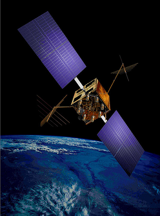
An artist’s concept of a GPS IIR-M satellite in orbit (courtesy of Lockheed Martin).
For more than 41 years, many of us who were there in the beginning have been discussing the attributes, capabilities, enabling features and shortcomings of GPS and other space-based PNT (position, navigation and timing) systems. You have likely heard most of them; historically they go something like this:
The signal is weak.
The signal is easily jammed.
The signal can be spoofed.
The signal is subject to atmospheric perturbations.
The signal doesn’t penetrate buildings.
The signal doesn’t penetrate dense canopies (urban or natural).
I am sure you have heard most of these. Now, allow me to update the situation with some of the developments enabled by modern signals, new techniques, and multi-frequency, multi-GNSS (Global Navigation Satellite System) “all-in-view” receivers. All of the above bulleted statements are still true, but to a lesser extent, virtually each day. As some well-known pop musicians once sang, “It’s getting better all the time.”
Today, multi-GNSS signals in a fully modern multi-GNSS receiver can to some degree resist interference — intentional (jamming) or unintentional — and spoofing. It is extremely difficult for a jammer or spoofer to disrupt GPS, GLONASS, Galileo and BeiDou all at the same time. And more help is on the way.
Today, multi-GNSS signal corrections remove a large amount of error due to atmospheric perturbations and can sometimes deliver centimeter and millimeter accuracy in real time (in the case of short-baseline real-time kinematic (RTK) using only L1 carrier-phase as data, and/or in some other special situations.)
Today, multi-GNSS signals and augmentation signals show some improvement in penetrating dense canopies and canyons by virtue of their multiplied numbers and dispersed geometry.
Today, new ground-based technologies show promise at penetrating buildings to provide indoor location. When combined with GPS/GNSS, this is starting to get us closer to the Holy Grail, the ubiquitous PNT solution.
Debate
The future looks bright for PNT solutions, ground and space-based. I know it all sounds like a debating society, and you may have heard some of these arguments before. My point, my premise if you will, or bottom-line-upfront in military parlance, being: the GPS (space-based) limitations of the past are gradually giving way to the improved multi-GNSS capabilities of today and the combined ground-based and space-based PNT technologies of the present and rapidly arriving future.
Unfortunately, there are many uninformed so-called PNT pundits who love to posture for the press — and who are living in the past. The future is right in front of them, or in many cases in their hands, and they cannot or will not acknowledge its existence.
It’s all in the numbers
Current estimates are that more than 4 billion users depend on PNT daily for position, navigation and timing, or the multitude of services each of these resources enables. More than half of that number is attributable to smartphone users, which means, at a minimum, more than 2 million PNT users have a two-way communications device incorporated into their PNT receiver/sensor.
Let’s look at current high-end smartphones as examples of commercial multi-frequency, multi-GNSS “all signals available” devices. The user has a true multi-GNSS device incorporating:
GPS — Global Positioning System, United States government
GLONASS — Globalnaya Navigazionnaya Sputnikovaya Sistema, the Russian space-based PNT system
BeiDou — the Chinese BeiDou Navigation Satellite System, a regional system now, soon to be global (2020 the advertised date).
with augmentations such as
WAAS — U.S. Wide Area Augmentation System
EGNOS — European Geostationary Navigation Overlay Service
Other SBAS — additional Satellite-Based Augmentation System signals by region
Wi-Fi — Signals compatible with a set of broadband wireless networking standards.
The latest high-end smartphones incorporate an inertial system, a digital compass, a rate gyro, and a pressure sensor integrated with pedometer software that keep track of position, heading and velocity when external signals are lost. Add cellular tower and network-enabled positioning and timing technology, and you have a two-way communications and PNT-based multi-GNSS sensor that, as long as it has power, is never lost.
Atomic numbers
The rubidium-based (atomic-reference system) timing signals from GPS satellite vehicles (SV) are among the most stable timing frequencies ever broadcast from space. The true accuracy of the signal in space is classified, but approaches an accuracy 10 times better than what was once thought to be adequate for our warfighters.
The best clocks in any current GNSS system are the passive hydrogen masers of Galileo. Thus a PNT set-up that adds Galileo to GPS improves in more ways than one.
Ephemeris numbers
Twenty-five years ago, the U.S. military kept track of GPS satellite orbit locations (known as the ephemeris of the satellite) using actual GPS measurements at the control segment tracking stations. The GPS satellite ephemeris was known to a much lesser degree of accuracy than now. At the time, that accuracy was considered good enough.
Today, the ephemeris is known much more precisely, and this can be on the order of some centimeters. This has to do with not only the location of the satellite’s center of mass (c.o.m.), but the actual location from which the signal is broadcast. The position of the satellite’s broadcast antenna is known reasonably well most of the time, by very high-end users, after correcting for the arm lever between the c.o.m. and the antenna phase center. The c.o.m. itself can vary by some centimeters over time because of depletion of onboard expendables, but here we are getting into very high-order minutiae.
Suffice it to say that certain multi-GNSS scientific high-precision receivers today are used to measure tectonic movements on the order of centimeters over the course of a full year.
Number of signals
Just recently, with the addition of certain QZSS signals (the Japanese Quasi-Zenith Satellite System) along with the Indian (GAGAN) and Russian (SDCM) equivalents of WAAS and EGNOS, the number of multi-GNSS PNT signals available to a truly international multi-GNSS receiver exceeds 200. For example, one set of global commercial receivers routinely receive and process more than 190 PNT signals in a six-hour period. The receivers are both static and dynamic, and they are networked. The static receivers know their actual location to within millimeters, and use this location as a truth set from which all other signal data is compared.
Accuracy numbers
For our example (and all parameters are software-defined and user-programmable), the location parameter may be set at 10 centimeters, meaning that any position derived from PNT signals or augmentations that differ by more than 10 centimeters from the “truth set” are immediately rejected, and that data is broadcast on the systems network, which keeps the dynamic receivers in sync as well.
The individual receivers each contribute to their own and a networked website with metadata usable by Kalman filters to which other users may choose to subscribe. This makes the multi-GNSS receivers not only receivers, but system and PNT monitors and sensors that can detect jamming, interference and spoofing attempts, which are reported.
This monitoring and tracking system is constantly evolving and incorporating new technologies while becoming more secure everyday. This is not a totally new concept, as the core system is a mature enterprise system that has been in operation and commercially viable for more than seven years.
This should be comforting information for those of you who stay up at night worrying about the safety of autonomous vehicles on land, sea and in the air.
Don’t let me give you the impression that GPS is just waiting around for other GNSS to come to its aid. GPS is aggressively modernizing itself. In Air Force parlance, “GPS III space vehicles will introduce new capabilities to meet higher demands of both military and civilian users.” As stated by GPS III contractor Lockheed Martin, the modernized system will:
• Deliver signals three times more accurate than current GPS spacecraft.
• Provide military users up to eight times improved anti-jamming capabilities.
Augmentations and improvements
The bottom line is that a greatly increased number of space-based PNT platforms — along with quantum improvements in computing power, cheap non-volatile memory and software-defined capabilities — have produced a multi-GNSS PNT capability that increases availability via sheer numbers, with more security and reliability on the way.
A pair of LocataLite transmit antennas overlook a section of the White Sands Missile Range blanketed by the Locata high-precision ground-based positioning system.
We are rapidly developing a PNT system that goes far in countering the naysayers. It takes advantage of augmentations and complimentary systems such as newer versions of Loran, (Long-Range Navigation System) and local PNT implementations such as Locata, just to name a couple of examples.
These ground-based systems are critical to the future of PNT, and have very strong signals. For instance, eLoran is extremely difficult to jam, if not actually unjammable. If a monstrous sunspot were to temporarily knock out the majority of space-based systems, the ground-based systems would more than likely still be available, if — big if here — they are fully developed. At the moment, this is not a sure thing. It is a work in progress.
Ground-based augmentations and complimentary/backup systems can in the future add a level of security for GPS and other space-based PNT systems: Why bother trying to knock out these space-based systems when there is a suitable and readily available ground-based system as a backup?
The U.S. government maintains a number of monitor stations around the globe. However, it has not historically taken advantage of the incredible capabilities of multi-GNSS receivers and sensor technology. Although NASA and other U.S. non-military agencies have been involved with multi-GNSS — specifically the Russian GLONASS — for the past 20 years or so, the use has not been widespread. Fortunately, recent changes now permit multi-GNSS receivers for government users, including the military, in certain non-targeting activities, and the government would do well to take advantage of the changes. The good news is that the majority of the capability is in the receiver design, a capability on which the current director of the GPS Directorate at the Space and Missile Systems Center (SMC) “made his bones.”
To all those critics who take every opportunity to denigrate space-based PNT, both inside and outside the government, I say: Pay attention to multi-GNSS. Stop your diatribes, because the future is arriving. Secure space-based PNT systems are here to stay.
They continue to improve and become more secure as they incorporate space- and ground-based augmentations, new PNT technologies, software-defined capabilities, multi-GNSS signals, and enhanced computing. “It’s getting better all the time.”
Allow me to repeat myself all over again. Space-based PNT is here to stay.
Until next time, happy navigating, and remember: GPS is brought to you free of charge by the United States Air Force.
Arcturus UAV reports the Mexican Navy has deployed its T-20 Jump fixed-wing vertical take-off and landing (VTOL) UAV for unspecified operations in Mexico. The customer took delivery of the VTOL system in March.
The T-20 Jump is a VTOL variant of Arcturus UAV’s catapult launched T-20 platform. It operates without any special launch or recovery equipment. Gross payload capacity is 60 pounds.
The Mexican Navy configuration with an electro-optics and infrared (EO/IR) sensor has approximately 15 hours of endurance and a 75-mile data-link range. An EO/IR and EW capable version offers 11 hours of endurance. Mexico has operated a fleet of catapult launch T-20s since 2014.
Arcturus has proposed the T-20 Jump VTOL platform for MEUAS III, the United States Special Operations Command‘s (USSOCOM’s) worldwide UAS services contract. Arcturus has also proposed a heavy fuel version of the T-20 Jump for the Royal Australian Navy’s Tactical Unmanned Aircraft Program.
The U.S. Navy’s Naval Air Systems Command and Raytheon have deployed advanced mission control for the MQ-8 Fire Scout, an unmanned helicopter, aboard the Littoral Combat Ship USS Coronado, which is now underway. Navy control hardware and Raytheon control software were combined for robust, flexible command and control of Fire Scout missions in littoral waters.
The USS Coronado is one of the Navy’s newest Littoral Combat Ships, designed to operate close to shorelines. Coronado’s deployment of Fire Scout extends the fleet’s situational awareness.
The Fire Scout, developed for the U.S. Navy by Northrop Grumman, is designed to provide reconnaissance, situational awareness, aerial fire support and precision targeting support for ground, air and sea forces. (Photo: Creative Commons, CC BY-SA 2.5 NL)
“Raytheon’s UAV ground controls help support Navy missions without putting sailors’ lives at risk,” said Todd Probert, vice president of Mission Support and Modernization at Raytheon IIS. “Our innovative technology is helping the U.S. military evolve standards of performance and reliability as they accomplish their critical missions more efficiently and effectively.”
Navy hardware and Raytheon’s software are built with an open architecture, maximizing flexibility to add new technology as needed. Under a related effort, the Navy’s Common Control System, or NCCS, will be able to control any air, ground, surface and subsurface vehicles as they deploy with the fleet. Built on the flexible foundation of Fire Scout MCS, that capability will reduce Navy-wide implementation costs and training requirements for unmanned systems.
“Our new Fire Scout MCS enables Fire Scout to bring more mission to more areas,” said Captain Jeff Dodge, U.S. Navy, Fire Scout program manager. “Fire Scout is a proven capability in dynamic littoral environments, and now provides the potential for multiple platforms to be controlled from a single MCS aboard the ship.”
USS Coronado is the first Littoral Combat Ship to use this upgraded Fire Scout MCS operationally, after logging 600+ hours of testing.
The USS Coronado is a Littoral Combat Ship, designed to operate close to shorelines. (Photo: U.S. Navy)
There were well over 100 presentations and speeches given at the 32nd Space Symposium in Colorado Springs, Colo., last week. However, I only want to speak about one of them briefly. While there were many presentations that were absolutely newsworthy, one presenter had something special and significant to say about the future of space and warfare.
Gen. John Hyten is generally known for his role as the Commander of Air Force Space Command. In truth, he wears many more hats — official and unofficial. Fortunately, his role as the commander of AFSPC works perfectly for our analysis.
Commander AFSPC – Gen. John Hyten (Courtesy of the USAF)
I have known and respected John Hyten for more than 20 years and have seen him grow and mature in his role as leader, mentor and prophet in all things space. He has grown in his ability to speak his mind in a clear and cogent fashion. This has not always been the case, and he and I butted heads for about 30 seconds one day years ago, with the result that I respect him now more than ever.
John Hyten is and has always been an ardent supporter of GPS not only for the military and joint warfighter but also as a free gift to the world, of incalculable value, courtesy of the United States Air Force.
For those who did not notice, let me say that Gen. John Hyten’s Space Symposium Keynote Address was given without him looking at one note. He barely glanced at his slides or his video — all because John Hyten is not only clear and certain with his message, but he is passionate in his beliefs and he speaks from knowledge and experience as well as from the heart. John Hyten lives and breathes “space” as a domain and as a vision.
Now we get to the prophet part of John Hyten. John is not only an articulate spokesman for space, cyber-space and airmen, he is a true visionary for what is to come. He thinks problems through and is not afraid to question conventional wisdom when it is not truly wisdom. John is not afraid to take on the establishment when conventional thinking puts our warfighters in harm’s way.
In his presentation, John makes a curious and I think debatable distinction. He says:
“…a lot of people think that I’m a warfighter. I’m not; I’m with the organize, train and equip command. The warfighter is Lieutenant Gen. David Buck. He works for the Commander of Strategic Command — that’s where we do operations. My job in Air Force Space Command is to lead the 36,000 men and women — organize, train and equip forces so I can present forces to Gen. Buck — so he can actually do the missions he needs to do. That’s the way it works.”
So now the general and I are going to butt heads gently once again. Gen. Hyten and his organize, train and equip forces are warfighters in their own right. After all, the first tenet of organize, train and equip is “train like you fight.” And interestingly, this is the very point John makes in his insightful and prophetic presentation. We have undoubtedly the best warfighters in the world, bar none, but they and the environment they fight in and through can be better. John makes the point that he is not a space warfighter bringing space to the fight, but a warfighter bringing to bear all the forces and assets that space enables, whether they originate there or merely pass into, through and out of that venerable, heretofore peaceful domain.
John makes the point that we don’t want to go to war in space, but if we must, we will prevail. To do so, we must think in a multi-domain fashion. We must have a space enterprise vision and execute Battle Management Command and Control, all without regard to how the threat is mitigated and ultimately defeated. To ultimately succeed, it is paramount we accomplish this first in training long before it happens on the battlefield, wherever that may be. To train a warfighter, you must first be a warfighter.
So yes, Gen. John Hyten is a warfighter, a visionary, and a prophet when necessary. But the question still remains: Does the corporate Air Force truly recognize his abilities and his prescience? Will he be regarded as Joseph, the cupbearer or the baker? Only time will tell. Regardless, Gen John Hyten is a leader and a valuable asset to this nation. We have been blessed to have him as the Commander of Air Force Space Command and as the steward of GPS.
Until next time, happy navigating. Remember, GPS is brought to you free courtesy of the U.S. Air Force and all the warfighters at Air Force Space Command.
Don Jewell reports from the 32nd Space Symposium, April 11-14, Colorado Springs, Colorado. (See Monday’s blog here.)
Tuesday, April 12
There are few Holy Grails in space. Today’s announcements from several different companies made it clear that a couple of these Holy Grails are hopefully about to be realized.
This morning, Orbital ATK, in conjunction with its customer Intelsat, announced they are entering the home stretch for a viable and hopefully profitable space payload Mission Extension Service/Vehicle (MEV). Indeed, they actually announced they are fully funded and open for business. Intelsat as the inaugural customer was on hand to support Orbital ATK and explain why this is a necessary mission.
David W. Thompson, Orbital ATK’s president and CEO, put the mission in perspective by stating, “There is a vital need to service fully functional but aging satellites in both commercial and government markets.”
Yes, this is the Dick Tracy comic strip capability we have seen for years, where a space vehicle comes alongside another and refuels, replenishes and otherwise reconstitutes another on-orbit satellite vehicle. We have been doing this for years in a sense with the International Space Station with human involvement (a more analog version, if you will).
But the Orbital ATK capability is a true remote in-space servicing and repair capability extending the life of geosynchronous satellites by as much as 15 years. The in-space ability provides a satellite vehicle with batteries, solar panels and propulsion systems that take over for aging satellite subsystems and possibly payloads.
Currently, the first launch of an MEV to service and extend the life of an Intelsat SV is scheduled for 2018. The MEV will launch to support an aging GEOStar spacecraft heritage bus platform on orbit today. Currently Intelsat is utilizing 10 such on orbit assets with the GEOStar bus.
Displaying critical flexibility the 2,000-pound MEV can be dual launched with another GEO asset, making it much more cost effective. The MEV uses an electric propulsion system for both transit, rendezvous and on orbit operations.
The MEV will dock with the subject and/or aging satellite by grappling onto a thruster port. Then the MEV can take over and significantly extend the life of a functional satellite. The MEV can even provide attitude control and, when finished, with one “save” the MEV can use the same electric propulsion system to move to another GEO SV needing replenishment services, even if the move to another platform occurs years later.
“The impossible is fast becoming a reality,” said Stephen Spengler, chief executive of Intelsat. Indeed, over the next five years Orbital ATK expects to launch a fleet of five MEV satellites that will refuel, replenish and provide robotic repair to an ailing/aging space vehicle, and eventually provide on-orbit assembly and repairs.
You may think this is merely a commercial version of the NASA Goddard “Restore L” program. Actually, the Orbital ATK capability is much more aggressive in nature — refueling is merely one of many on-orbit capabilities.
Note that Orbital execs were quick to point out that this is not an offensive weapons capability as it is not made to work with uncooperative satellites. But is by design a life-extension capability for GEO satellites.
I asked Orbital CEO David Thompson about using the MEV capability for boosted GPS satellites that still have a viable capability. While he did not discount the idea, he clearly stated that the GPS missions would have to wait until the capability is proven as economically viable in GEO, which is a much more forgiving environment both for radiation and distances between assets.
The other Holy Grails for space: launch and return, robotic arm
Jeff Bezos also spoke today and showed a video of his Blue Origin spacecraft returning to Earth and landing successfully from a suborbital mission for the third time without an engine change.
This is an incredible capability and, of course, just a couple of days ago Elon Musk and SpaceX demonstrated a similar landing capability. The SpaceX Falcon 9 rocket landed on a drone ship at sea — the first time the company has been able to pull off an ocean landing after four previous attempts ended in failure.
The robotic arm is capable of being mounted on any suitably-sized space vehicle, that — contrary to the Orbital ATK MEV — can be used both for replenishment and defensive purposes.
So, it appears the Holy Grail of SV rendezvous’ is about to be realized.
The Defense Advanced Research Projects Agency (DARPA) has awarded HRL Laboratories $4.3 million to develop vibration- and shock-tolerant inertial sensor technology that enables future system accuracy needs without utilizing GPS.
While GPS provides sub-meter accuracy in optimal conditions, the signal is often lost or degraded due to natural interference or malicious jamming.
HRL Laboratories, based in Malibu, California, is a corporate research-and-development laboratory owned by The Boeing Company and General Motors specializing in research into sensors and materials, information and systems sciences, applied electromagnetics and microelectronics.
“The ATLAS project will deliver a comprehensive approach to breaking performance and cost, size, weight and power barriers in inertial sensor technology that prevent robust, GPS-independent, military positioning, navigation, and guidance,” said Logan Sorenson, principal investigator and research staff member in HRL’s Sensors and Materials Laboratory.
ATLAS will combine intimate locking of a micro-electro-mechanical systems (MEMS) Coriolis Vibratory Gyroscope (CVG) sensor with an atomically-stable frequency reference in order to exploit the intrinsic accuracy of the atomic hyperfine transition frequency.
“The engineering challenge lies in developing a system architecture to transfer the stability from the atomic reference to the CVG sensor without introducing unintended noise,” Sorenson said. “We are very excited to explore this novel approach to addressing long-standing precision navigation need faced by the U.S. military.”
It never fails. Invite 11,000-plus of your closest acquaintances for a week in the Rocky Mountains in April, and you have one — make that several — weather related events.
I have attended 30 of the 32 Space Symposiums and it always rains buckets, snows a blizzard, hails in biblical amounts or is a combination of all three interspersed with incredible mountain vistas and bright sunshine.
To those of us who live here it is part of the charm of the Rocky Mountains, but to visitors… fortunately it seems not to matter at all, as 11,000 or more people show every year. And thank goodness they do, as this is indeed the premier space event of the year, every year, bar none.
This year the Space Foundations’ 32nd Space Symposium kicks off on Monday, April 11, and runs through Thursday evening at the Lockheed Martin Exhibition Center at the Five Star Broadmoor Resort. There are several post-symposium-events scheduled for Friday and through the weekend as well, not to mention all the ski trips starting on Friday in Breckenridge, Vail, Keystone (which has night skiing) and Aspen. The party and business ventures continue on the slopes.
Space Symposium and Cyber 1.6
Commander AFSPC – Gen. John Hyten (Courtesy of the USAF)
In conjunction with the Space Symposium is Cyber 1.6, or the 7th annual Cyber symposium, which is happening today at a highly classified level. This super-secret meeting brings together the “who’s who” of the cyber world. Due to classification levels, that’s about all I can say about that.
I have attended five of the seven cyber symposiums, and I can tell you it is a tremendously productive meeting that just gets better and — more importantly — more relevant every year. If cyber is your thing, and of course it affects us all, make plans now (if you have a SECRET clearance that is) to attend Cyber 1.7 next year.
International Event
The Space Symposium is truly an international event, featuring ambassadors, governors, congressmen, generals, agency directors (including the NASA administrator) and many more —too many to name, of course — from around the world.
Jeff Bezos, founder and CEO of Amazon, will be a keynote speaker, as will Gen. John Hyten, who will speak at both the Cyber and Space Events as the commander of U.S. Air Force Space Command.
Jeff Bezos, founder and CEO of Amazon and Blue Origin.
Back to Jeff Bezos for a moment. In addition to being Amazon’s Founder and CEO, Jeff has a real interest in space. He is also the founder of aerospace company Blue Origin, which is working to lower the cost and increase the safety of spaceflight so that humans can better continue exploring the solar system.
Jeff says his interest in space began long before he graduated summa cum laude, Phi Beta Kappa, in electrical engineering and computer science from Princeton University in 1986, and was named Time magazine’s Person of the Year in 1999. I can’t wait to hear what plans Jeff has for Blue Origin and space in general. Amazon already ships to m0re than 190 countries. Can space be far behind?
The Blue Origin logo.
Trivia Alert: I wonder if any astronauts have ever ordered from Amazon while on orbit on the International Space Station; they do have Internet, after all. Why not? Maybe we will find out. And yes, I realize it is one thing to order from Amazon while on the International Space Station and quite another for Amazon to deliver there, but from what I hear, Jeff is working on that problem as well. Will that make the Space Symposium an Intergalactic event?
Exhibitors
This year there are more than 160 exhibitors in the Lockheed Martin Exhibit Center and the Exhibit Center Pavilion. It’s more than you can visit in just four days, but I try every year to at least spend a minute or two at every exhibit. If you do nothing else but visit the exhibits, it is an experience.
Activities
Tonight, the 32nd Space Symposium kicks off with a welcome address from Colorado Governor John Hickenlooper, several key industry awards and the opening of the exhibit hall with food and drink. About five hours later, the evening’s festivities end with a huge fireworks display over the lake of the Broadmoor. The symposium offers something for everyone, and we will keep you up to speed right here on GPSWorld.com.
Note: Trimble kindly sent me its latest GPS/PNT-enabled 10.1-inch Windows 10 based rugged tablet named the Kenai to help commemorate the event. I will be utilizing this incredible tool all during the Space Symposium to take pictures, record events, type my short articles and transmit them all on the fly to GPS World. I’ll let you know how it fares. Hint: Thank goodness it is a rugged tablet — someone has already knocked it out of my hands and onto a hard floor, with no ill effects.
Stay tuned. We are expecting significant announcements concerning OCX, GPS III, GPS Next, MGUE and all sorts of international input from GLONASS, Galileo, Beidou and QZSS, just to name a few.
On April 7, the U.S. Department of State issued a notice about the recent jamming experienced in South Korea.
Korean Peninsula GPS Jamming Notice
A continuing series of incidents have been reported in the general location of Incheon, Republic of Korea and the surrounding Gyeonggi and Gangwon provinces out to approximately 100 nautical miles beginning on or about 0000Z31March16.
The nature of the events appear to be Global Positioning System (GPS) jamming emanating from the Democratic People’s Republic of Korea causing signal disruptions to airplanes, ships, and buoys in the area.
Exercise caution when transiting this area. If appropriate, further information may be forthcoming. Vessels experiencing disruptions in the area are urged to report them to the point of contact (POC) below.