Carnegie Mellon University and Sikorsky Aircraft researchers have used an autonomous helicopter and an autonomous ground vehicle to demonstrate for the U.S. Army that ground and air robots can perform complex, cooperative missions, the university announced Jan. 20.
During the Oct. 27 demonstration, an unmanned Black Hawk helicopter picked up an unmanned ground vehicle (UGV), flew a 12-mile route, delivered the UGV to a ground location and released it. The drop-zone collaboration promises to keep warfighters out of harm’s way, enabling them to perform missions more effectively.
An unmanned Black Hawk delivers an autonomous ground vehicle to a remote site in a demonstration for the U.S. Army of a joint robotic air-ground mission. (Photo: CMU)
The Black Hawk was equipped for autonomous operation by Sikorsky, a Lockheed Martin Co. It delivered a Land Tamer autonomous unmanned ground vehicle from Carnegie Mellon’s National Robotics Engineering Center (NREC) to a remote site, where the vehicle performed environmental monitoring for potential contamination, the type of robotic mission that could prevent warfighters’ exposure to hazardous conditions, such as chemically or radiologically contaminated areas.
“We were able to demonstrate a new technological capability that combines the strengths of air and ground vehicles,” said Jeremy Searock, NREC technical project manager. “The helicopter provides long-range capability and access to remote areas, while the ground vehicle has long endurance and high-precision sensing.”
The demonstration took place at Sikorsky’s Development Flight Center in West Palm Beach, Florida, for the Army’s Tank Automotive Research, Development and Engineering Center (TARDEC).
Once the helicopter lowered the vehicle to the ground, the Land Tamer drove itself off its transport platform to commence its leg of the mission. The vehicle, equipped with sensors for detecting chemical, biological, radiological or nuclear contamination, then found and surveyed several potentially contaminated sites, autonomously traversing six miles in the process.
When the vehicle sensors detected potential contamination, operators were able to switch the vehicle from autonomous operation into a tele-operated mode for a more detailed exploration of the site.
The helicopter delivered the Land Tamer, Carnegie Mellon’s unmanned ground vehicle. (Photo: CMU)
“The teaming of unmanned aerial vehicles and unmanned ground vehicles, as demonstrated here, has enormous potential to bring the future ground commander an adaptable, modular, responsive and smart capability that can evolve as quickly as needed to meet a constantly changing threat,” said Paul Rogers, TARDEC director.
NREC has developed the unmanned Crusher off-road vehicle for the Defense Advanced Research Projects Agency (DARPA), the Advanced Platform Demonstrator for TARDEC and a tactical unmanned ground vehicle, called Gladiator, for the U.S. Marines, as well as advanced off-road autonomous driving technology. NREC was also part of CMU’s Tartan Racing Team that won the $2 million 2007 DARPA Urban Challenge robot race with its autonomous SUV called Boss.
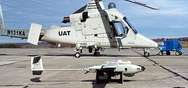
The Black Hawk helicopter used in the demonstration was a UH-60MU model, equipped for “fly-by-wire” operation. Sikorsky installed its Matrix technology, which it has been developing since 2013.
In the demonstration, a Black Hawk helicopter equipped with Sikorsky’s Matrix autonomy kit flew NREC’s Land Tamer all-terrain vehicle, slung beneath the aircraft in a specially designed cage, to a remote area.
The U.S. Army’s Joint Precision Airdrop System (JPADS) has developed a new capability with a navigation alternative to GPS.
In recent tests, JPADS were dropped from planes, and immediately determined their location using optical sensors to compare local terrain with commercial satellite imagery. The new system demonstrated navigation to its intended point, using nothing but imagery to guide it.
The new JPADS also works with little knowledge of the aircraft’s location at the drop point.
JPADS, largely guided by GPS, has already proven its importance in supplying troops with necessary materials and equipment, relying less on vulnerable convoys.
Dropping critical supplies from the air has allowed the U.S. military to rely less on easily-ambushed truck convoys and helicopter resupply. Exposure to improvised explosive devices (IEDs) and ambushed convoys resulted in more than 3,000 causalities in Afghanistan and Iraq through 2007.
JPADS has proven to be an important tool in the Army’s logistics chain in many scenarios to supply troops with material and equipment in adverse terrain and remote locations when ground lines of communication are not possible or deemed too high a risk.
A JPADs pallet lands on target, followed by several others still in the air, during recent testing. (Photo: US Army)
The Army life cycle manager, Product Manager Force Sustainment Systems (PM-FSS), continues to improve the JPADS capability with technology enhancements being led by the Army’s Natick Soldier Research, Development and Engineering Center (NSRDEC), including making JPADS more robust and versatile to environment, terrain and other factors. Investments are focused on significant increased accuracy, lower cost and lower retrograde weight/volume of the reusable JPADS at all weight classes.
The U.S. Army NSRDEC, with Draper and numerous other partners, recently began testing a new version of the JPADS guidance system that takes advantage of Draper’s technology to navigate precisely to its intended ground impact point using imagery alone, and having minimal knowledge about the aircraft’s location when the package is dropped. The accuracy is critical, as payloads that stray even slightly off course can force troops to expose themselves to enemy fire, or can tumble down mountainsides in rugged terrain, explained Chris Bessette, Draper’s JPADS program manager.
“This is a huge step forward for aerial resupply,” Bessette said. “The guided airdrop system is keeping U.S. forces from the danger that has killed thousands of their fellow troops. By enabling the system to operate using imagery alone when dropped as high as 25,000 feet above Mean Sea Level and upwards of 20 miles away from the target depending on winds, we can ensure that JPADS is even more versatile so troops receive supplies like fuel, ammunition, food, and water in the safest manner possible.”
Draper’s JPADS software autonomously flies the cargo-carrying parafoil to land at a user defined location, adapting in real-time to local environmental conditions, such as varying wind. The company’s work on JPADS takes advantage of its expertise in applying position, navigation, and timing algorithms to combine the outputs of precision instruments to enable highly accurate, long-duration navigation solutions.
The recent testing demonstrated the ability to accurately navigate JPADS to a pre-selected user position, using imagery alone, with almost no information about where the package was released from the plane. During testing in Arizona, the payloads were dropped from planes, and then JPADS immediately determined their own location by comparing terrain features spotted using optical sensors with commercial satellite imagery of the area.
The Army is also supporting Draper in developing upgrades to the vision-aided navigation system to address current limitations, including cloud cover, which degrades the system’s ability to correlate vision sensor inputs with satellite imagery.
The military can leverage the same technology to help guide military free fall paratroopers and unmanned aerial vehicles utilizing imagery data alone, Bessette said.
The Defense Advanced Research Projects Agency (DARPA) is holding a Proposers Day on Feb. 1 to inform potential contractors about the Atomic Clock with Enhanced Stability (ACES) program.
ACES is a potential $50 million program that seeks to develop battery-powered atomic clocks that work to provide warfighters with synchronization and precision timing capabilities during navigation, communications, electronic warfare and reconnaissance missions in the event of a GPS shutdown.
The registration deadline for the Proposers Day is 5 p.m. EST on Jan. 25. The Proposers Day will be held Feb. 1 from 9:30 a.m. to 5 p.m. EST at the DARPA Conference Center, 675 N. Randolph Street, Arlington, Virginia 22203.
The host is Robert Lutwak, ACES program manager at DARPA. In 2012, GPS World awarded Lutwak its Leadership Award for Products.
The meeting will provide information and promote additional discussion on the ACES program, address questions from potential proposers, and provide an opportunity for potential proposers to share their capabilities and ideas for teaming arrangements.
The ACES Proposers Day will include overview presentations by government personnel, technical presentations by potential proposers and collaborators, and an open poster session to facilitate interaction and teaming.
According to the Department of Defense (DoD), “Precision timing and synchronization is essential to DoD communications, navigation, reconnaissance, and electronic warfare systems. The requirements for timing precision and stability have grown increasingly demanding as DoD systems have evolved towards distributed engagement and surveillance architectures, and this trend is expected to continue for the foreseeable future.
“The ACES program aims to develop portable, battery‐powered atomic clocks with stability, repeatability, and environmental sensitivity approaching that of laboratory‐grade cesium beam frequency standards. This will be accomplished through research, development and integration of reduced SWaP components and technologies for advanced atomic physics interrogation techniques. These include, but are not limited to, laser‐cooled and magneto‐optically trapped atomic samples, and RF‐trapped ion samples, as well as interrogation of less environmentally‐sensitive microwave and optical transitions.”
Northrop Grumman Corporation has been awarded an order to support embedded GPS/inertial navigation system (INS) pre-Phase 1 modernization efforts.
The Military GPS User Equipment (MGUE) program is developing M-code-capable GPS receivers, which are mandated by Congress after fiscal year 2017 and will help to ensure the secure transmission of accurate military signals.
Under the cost-plus-fixed-fee order valued at $4.8 million from the Joint Service Systems Management Office, Northrop Grumman will evaluate new GPS receivers’ modes of performance, including M-code and Selective Availability Anti-spoofing Module (SAASM).
Additionally, the company will perform trade studies, assess the state of development of MGUE for upcoming applications, and contribute to architecture development for next-generation GPS/inertial navigation systems.
“We are honored to help shape the next generation of navigation systems that will modernize the GPS infrastructure and keep our warfighters safer,” said Bob Mehltretter, vice president, navigation and positioning systems business unit, Northrop Grumman Mission Systems. “We are committed to using our navigation systems expertise to develop a solution that offers dependable and accurate positioning, navigation and timing information.”
The updated GPS/inertial navigation system will also comply with the Federal Aviation Administration’s NextGen air traffic control requirements that aircraft flying at higher altitudes be equipped with Automatic Dependence Surveillance-Broadcast (ADS-B) Out by January 2020.
ADS-B Out transmits information about an aircraft’s altitude, speed and location to ground stations and to other equipped aircraft in the vicinity.
The modernized system is expected to be available for platform integration starting in 2018.
Featuring an exclusive interview with Astronaut Scott Kelly from aboard the International Space Station
This month, we discuss sailplanes of all sorts and conduct a brief on-orbit interview with Astronaut Scott Kelly concerning his time piloting the space shuttle — actually a supersonic glider. We touch on the role GPS played in making it a safer rocket glider. Kelly also gives us an update on his time aboard the International Space Station (ISS), nine months and counting.
When you think of gliders — or more accurately sailplanes — you probably think of long flexible wings, slow flight, bubble canopies, pristine white aircraft gleaming in the sunlight and tow requirements. For most aviators, the holiday picture of the beautiful Schleicher Model 32 sailplane below typically comes to mind.
AS (Schleicher) Model 32. (Courtesy of AS GMBH)
However, there are certainly some World War II combat glider pilots living today, heroes all, although unfortunately fewer and fewer everyday, that think of gliders in a very different way. They think of and remember huge green, tan and camouflaged wooden and cloth flying machines that carried 10 or more troops, who — if they lived through the experience — were able to wear glider rather than paratroop badges.
Army General William C. Westmoreland said of the heroic combat glider aviators, “Every landing was a genuine do-or-die situation . . . it was their awesome responsibility to repeatedly risk their lives by landing in unfamiliar fields deep within enemy-held territory, often in total darkness. They were the only aviators during World War II who had no motors, no parachutes, and no second chances.”
Graphic: Glider Pilot’s Wings from WWII.
Graphic: Glider Infantry Badge WWII.
The venerable wooden and cloth combat gliders of World War II were about as far removed from soaring sailplanes as a glider can be. Once released, they glided or, more accurately, careened to Earth. They were versatile and rugged enough to carry combat vehicles behind enemy lines and land in rugged terrain. but they most certainly did not soar.
The courageous flight crews did not have the luxury of GPS. Navigating for the short time after the tow vehicle — typically a transport, cargo (C-24) or bomber aircraft (like the B-24) — dropped them off at altitude, almost always below 10,000 feet, was a very hit or miss affair. There were only four very basic flight instruments on the glider’s rudimentary control panel, which most of the pilots completely mistrusted and ignored.
Glider flying in World War II was strictly VFR, or visual flight rules. Veteran glider pilots tell me that finding your landing zone (notice I did not say runway) was frequently haphazard. Often they had to make do with any decent-sized farmer’s field as a landing zone. Frequently, these landing were made in broad daylight, behind enemy lines, amid a hail of bullets, so they were fraught with danger in many ways, including not knowing their exact location when they finally landed. Glider infantrymen and glider pilot casualties reached 40 percent for some missions. What would they have given for a GPS?
The venerable WACO gliders were the most common versions. By war’s end, more than 13,900 CG-4A gliders had rolled off the production lines of several companies mass producing the same design for approximately $15,000 per copy — although one company charged as much as $50,000 per unit. It is estimated that less than one tenth of 1 percent of the gliders survived to fly after conflict ceased in 1945.
According to the Silver Wings National World War II Glider Pilots Association, “Over 6,000 individuals were trained as combat glider pilots and earned their silver wings with MOS (military operational specialty) 1026. Approximately 150 glider pilots and Troop Carrier Veterans still participate in the group’s activities, although their numbers are declining with ages in the 89- to 96-year group.
Author Michael MacRae, writing on the ASME (American Society of Mechanical Engineers) webpage in an article titled “The Flying Coffins of WWII,” describes the WACO CG-4A as America’s first stealth aircraft, but also as an aircraft expendable by design: “The CG-4A fuselage was 48 feet long and constructed of steel tubing and canvas skin. Its honeycombed plywood floor could support more than 4,000 pounds, approximately the glider’s own empty weight. It could carry two pilots and up to 13 troops, or a combination of heavy equipment and small crews to operate it. The nose section could swing up to create a 5 x 6-foot cargo door for Jeeps, 75-mm howitzers, or similarly sized vehicle. With a wingspan of 83.5 feet, the Waco maxed out at 150 mph when connected to its tow plane. Once the 300-foot length of 1-inch nylon rope was cut, typical gliding speed was 72 mph.”
Gliders first appeared in U.S. combat operations in the 1943 invasion of Sicily. They flew on D-Day into Normandy, June 6, 1944, and in other important airborne operations in Europe such as Operation Market Garden, the Battle of the Bulge, and crossing the Rhine, as well as in the China-Burma-India Theater.
After World War II, the gliders participated in U.S. military exercises in 1949, but glider operations were deleted from the U.S. Army’s capabilities on Jan. 1, 1953. Today, only special forces use gliders for silent, small-scale insertion.
Sailplanes
In contrast, a modern-day open competition glider built by the world-famous Alexander Schleicher (AS) company, for example, can soar to more than 50,000 feet with a supplemental oxygen supply, cruise at 280 kph or 170+ mph with a glide ratio of up to 80:1, with flight durations lasting more than 50 hours. Most modern sailplanes today fully incorporate GPS into their avionics suite that rivals any powered aircraft cockpit.
Contrast this with the World War II combat gliders that careened Earthward with somewhere between a 16 to 30:1 glide ratio at 70+ mph on a trajectory that typically lasted 10-15 minutes max. Sad to say, most of the operational versus training flights during World War II were one-time affairs and one-way trips, but they delivered the goods, including some very expensive firewood once the gliders were abandoned. Certainly, the WACO CG-4A glider was the last of its genre. Mothballed at war’s end, fewer than a dozen restored gliders exist today.
Rocket Gliders
Now to the heart of the matter. Gliders have evolved in ways that are difficult to imagine. Many of the aircraft that have broken world altitude and speed records are actually gliders, although we don’t typically think of them as being among that genre.
Messerschmitt Me 163B at the National Museum of the United States Air Force. (U.S. Air Force photo)
Typically a rocket-powered glider consumes fuel at a rapid rate, so most glide in for a landing. Examples include the German Messerschmitt Me 163 rocket-powered interceptor seen above, as well as the American series of research aircraft starting with the Bell X-1, which first flew and glided in for an unpowered landing in 1946. Examples of the type include the North American X-15, which spent much more time flying unpowered than under power.
In the 1960s, research and development or test vehicles now known as unpowered lifting bodies such as the X-20 Dyna-Soar space project vehicle were all the rage, and even though the X20 was eventually cancelled, the R&D led directly to the development of the U.S. space shuttle.
U.S. space shuttles: The world’s highest flying and fastest manned gliders
NASA’s now-famous and retired space shuttle first flew on April 12, 1981. The shuttle, which was a powered rocket during liftoff and cruise, re-entered as the fastest glider known to man at Mach 25 at the end of each spaceflight, landing entirely as an unpowered glider that, ironically, created its own sonic boom when it re-entered the atmosphere.
The U.S. space shuttle and its Soviet equivalent, the seldom-seen Buran shuttle, were by far the fastest aircraft ever to fly and, by a wide margin, the fastest gliders ever to fly in space and in the atmosphere.
NASA astronaut Scott Kelly floats aboard the International Space Station after the hatch opening of the Soyuz spacecraft Mar. 28, 2015. (Photo: NASA)
One of the more well known space shuttle command pilots is Commander Scott Kelly, who as I write this is well into his ninth month aboard the International Space Station (ISS). He has three more long months to go before he returns home to a hero’s welcome and a battery of medical tests to determine how longevity in space affects the human body by comparing him to his astronaut twin who remained Earth-side during the same 12-month period. You know Einstein’s general theory of relativity, divided by telomere length and all sorts of quantum mechanics and medical technology. Talk about being poked and prodded.
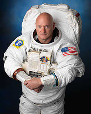
Scott Joseph Kelly (born Feb. 21, 1964) is an American astronaut, engineer and a retired U.S. Navy Captain. A veteran of three previous missions, Kelly was selected in November 2012 for a special year-long mission to the International Space Station, which began in March 2015.
Scott Kelly is interesting for one more record he created during his time as a shuttle commander and shuttle command pilot. He flew the first-ever space shuttle GPS approach on Aug. 21, 2007, on STS-118. When I first heard about this feat, I thought it would be interesting to talk with Scott about it, and I made plans to do so upon his return from the ISS in March 2016.
However, through the marvels of instant messaging and the good graces of my friend Joe Rolli at Harris Corporation (nee Exelis, nee ITT) I was put in touch with Scott Kelly.
We conducted our brief interview electronically with nary a glitch even though Scott is hurtling around the Earth in low Earth orbit at a speed of approximately 17,150 miles per hour (about 5 miles per second). This means that as Scott orbits the Earth, he experiences a sunrise once every 92 minutes for a total of 5,634 sunrise events during his year on orbit.
Relatively, however, compared with the speed of electrons or light, which travel at 670,616,629.4 mph in the vacuum of space, Scott and I — who are traveling at a differential of 17 orders of magnitude compared to electrons — are essentially standing still. So the seemingly huge speed differentials makes little or no difference. Again Einstein, Newton, Schroedinger and probably his cat, if alive, would beg to differ on a technicality, but for our intents and purposes, I stick by my statement.
Here’s how that interview went. I want to publicly thank Scott for taking the time out of an incredibly busy schedule to talk with us about the importance of GPS and the space shuttle. Scott currently serves as Commander of the ISS on the one-year mission. In October 2015, he set the record for the total amount of days spent in space by an American astronaut — 382. As this article goes to press, Scott has spent more than 445 days in space.
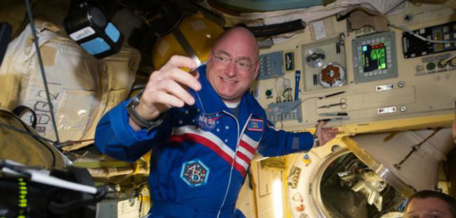
NASA astronaut Scott Kelly has been aboard the International Space Station since March as part of an endurance mission to test the effects of long-term exposure to space. In this July 12, 2015, photo he poses for a selfie in the “Cupola” of the ISS. (Photo: NASA)
(Don: Don Jewell, GPS World Defense Editor; Scott: Astronaut Scott Kelly)
Don: Scott, thanks for taking the time out of your busy schedule for our questions concerning GPS and the first space shuttle approach made using that technology, which you flew several years ago now.
Scott: This was eight years ago and I don’t have notes here, so this is my best quick effort.
Don: Why did NASA decide to approve GPS approaches for the space shuttle, and why were you chosen to fly the first one? I would assume that your experience, safety, approach options and flexibility would play a part here.
Scott: TACAN was going away. I wasn’t assigned to STS-118 because of this. This was a secondary DTO or Developmental Test Objective.
Don: Was a GPS approach after that first landing always an option?
Scott: GPS approach is kind of a misnomer. We incorporated GPS into the navigation state [for the space shuttle] from about Mach 5 [five times the speed of sound] until we transitioned to a microwave landing system on final.
Don: Were the certified and validated GPS approaches unique, or did they mimic current approaches such as ILS or VOR/DME?
Scott: Actually, Don, they have little to do with the GPS approaches aircraft fly.
Don: Were there both precision and non-precision GPS approaches? Do you remember the approach speeds and critical points in the approach? Can you discuss them? Since some of the alternates around the globe are in fairly primitive locations, did GPS make them more accessible and actually provide more alternates?
Scott: Again, GPS was used to update our navigation state. On an approach to a runway without an MLS (Microwave Landing System), GPS would have been our primary navigation source to the ground, but its not like we would be looking at an approach plate.
Don: What were the minimums for a GPS approach, before you could start a descent profile for a GPS (aided) approach and landing?
Scott: Actually, Don, our weather minimums were pretty restricted before we could start the de-orbit burn [while still in orbit]. Ceilings of 5,000 feet I think.
Don: At what point in your descent profile were you or NASA required to make a decision about your landing location and alternates? And, related to that, was there a typical point during the descent profile where you were committed to a landing location and could not choose an alternate? How far was that from your landing site nominally?
Scott: Legally you could re-designate after the de-orbit burn to an alternate [landing] site, but this would be in a very critical situation and was never done. Basically, when we did the de-orbit burn, we were essentially committed to landing at the chosen airfield.
Don: In an emergency, were you able or authorized to land at an alternate that did not have an advance NASA team in place, and were you able to fly the space shuttle totally manually or were computers always involved for stability?
Scott: Yes, and computers were always involved.
Don: Many modern fighters are inherently unstable. When the last computer fails, ejection is the only option. How did this apply to the space shuttle?
Scott: We were [essentially] fly by wire…the shuttle can’t fly without at least the backup flight control system (FCS) computer. Nominally, we have four FCS computers online.
Don: Since aerodynamically you were essentially flying the world’s fastest and highest flying glider, at what point were you committed to a landing site? What discretion as the Pilot in Command did you have, or was it all up to NASA headquarters?
Scott: When you did the de-orbit burn, you were committed to a landing attempt somewhere. If you had communications with the Mission Control Center (MCC), they decided where you would land. [With] no communications, it is up to the commander in an emergency.
Don: The space shuttle exceeded the speed of sound by a factor of 25 in the Earth’s atmosphere (Mach 25) on approach. What were the handling characteristics when this occurred? While there was obviously a sonic boom, where there any handling anomalies that required manual inputs from the pilot in command?
Scott: There was a little buffeting — sort of like running off the road in a pickup truck.
Don: Speaking of alternates, if your landing gear failed to deploy, or you had an indication that there was a gear malfunction, where you able to land on alternate surfaces such as grass or sand? Most importantly, in your opinion, would the shuttle and crew have survived a water (ocean or lake) landing? And were these alternate landing sites planned for or simulated to any high degree of fidelity?
Scott: The simple answer is you would try and bailout, but of course crash, if you had no choice.
Don: Finally, your comments. What was it like to pilot the space shuttle, and what did having a GPS approach available mean to you?
Scott: It was a privilege. GPS allowed us to continue to fly the space shuttle as legacy systems like TACAN were retired.
Don: Thank you so much for your time. If you have some comments concerning your current one-year experiment aboard the ISS, that would be great.
Scott: Sure, Don. I am currently a little over 270 days into my one-year flight aboard the ISS and going strong. Plus, to bring this all back to GPS, I can definitely say that GPS is working well on the International Space Station. We also have a Garmin GPS in the Soyuz, which we would break out in an emergency situation, and use a handheld satellite phone if we had an off-nominal landing, to tell people where we were.
The International Space Station. (Photo: NASA)
Space Station and GPS
It is a good thing the GPS receivers on the ISS are working as well as they are. Since 2002, they have been the primary means for determining attitude, position, speed and universal coordinated time reference on the ISS. The GPS position of the ISS, which moves at five miles per second, is accurate to within 10 meters and is updated continuously.
Previously, according to NASA, the station’s position was determined using ground tracking and other techniques. That information was considered to be adequate if not overly accurate, as it was updated just once a day. Just before an update, the actual and propagated position of the station, the ephemeris, could differ by as much as 10,000 meters.
Specifically, the ISS uses the GPS position and velocity solution as the ISS navigation state. The ISS’s attitude determination filter combines the GPS receiver attitude information with ring laser gyro data available from the ISS rate gyro assembly (RGA) to produce the ISS attitude solution.
Today, continuous accurate knowledge of the space station’s location also keeps it safely out of the path of wayward space debris.
So now you know something about sailplanes, combat gliders, the U.S. space shuttle, the ISS, Astronaut Scott Kelly and how they are all affected by GPS. Even more importantly, I hope this column reinforces for you the ubiquity of the Global Positioning System.
GPS is the world’s time keeper and primary global time distribution system. GPS time synchronizes networks, computers, communications and any number of other devices, from Apple iWatches to undersea navigation, to systems used by private pilots, airlines, spacecraft and astronauts in deep space. You name it: If it uses time, chances are GPS time is the provider, with an incredible stability of 1E-14.
Indeed, you should think of GPS as an enabler. It enables so much of our technology today that it would be difficult to imagine living without it. Contrary to popular belief, even in the U.S. government, GPS is robust and reliable and becoming more so every day. Just think about it: GPS tells us when and where we are, how to get where we are going, and whether or not we are late. An amazing system, brought to you free of charge by the United States Air Force.
Microsemi Corporation, a provider of semiconductor solutions differentiated by power, security, reliability and performance, today announced its SyncServer S6xx series of Network Time Protocol (NTP) servers.
The new SyncServers provide a highly secure, accurate and flexible timing and frequency platform for synchronizing network elements and mission-critical electronics systems in enterprise information technology (IT) applications such as Internet protocol telephony and physical security, and government instrumentation applications such as satellite communications and defense operational infrastructure.
“Microsemi’s new SyncServer series is a rock-solid enterprise level time server, interoperating easily with our Domain Time II software,” said Jeffry Dwight, president of Greyware Automation Products, the leading provider of time synchronization, management, and auditing software for Windows. “The new SyncServer raises the bar for accurate time synchronization with hardware-based time stamp support, which we found significantly reduced jitter and latency in time served, without losing accuracy. Installation was also much more flexible than any other GPS/GNSS unit we’ve tested. Anyone needing dependable high-quality NTP timestamps should consider Microsemi’s new SyncServer series.”
The new series features SyncServer S600, a security-hardened NTP time server with Microsemi’s NTP Reflector technology for robust security, accuracy and reliability of network time services, and the SyncServer S650, a highly versatile timing and frequency system with the company’s FlexPort technology for multiport, user definable output signal configuration.
The SyncServer S600 is designed for enterprise IT customers managing corporate networks in industries such as financial services and healthcare, while the SyncServer S650 is designed for electronics system engineers synchronizing mission-critical, system-level instruments.
“Robust security, system agility and flexibility of time services are essential for modern IT networks,” said Sri Purisai, vice president of timing and synchronization business, at Microsemi. “Our innovative SyncServer S6xx series timing platform makes significant advances in the security hardening of timing ports, as well as adaptability to various network topologies and flexibility of timing output configuration. This next-generation offering from Microsemi provides our customers a simple migration path to meet future requirements for faster, more agile and scalable network operations.”
According to the 2014 U.S. State of Cybercrime Survey, organizations use a gamut of security technologies to protect network operations. Time plays a vital role in determining the critical “when” of several key security technologies. Survey respondents cited intrusion detection (62 percent), log monitoring to identify intrusion attempts (49 percent) and security event analysis (40 percent) as technologies used for network protection. Without accurate time synchronization to UTC across the network, the effectiveness of these tools in securing the network becomes marginal.
SyncServer S600
Microsemi’s SyncServer S600 is a network time server with security-hardened NTP Reflector technology, supporting extremely high-capacity and ultra-accurate NTP server operations in a multiport, dedicated network time appliance. Easily integrated into existing, future and cloud network topologies, including software-defined networking (SDN), the SyncServer is designed for IT network administrators and architects who are heavily reliant upon server log files for network management.
SyncServer S600 comes with four 1 Gigabit Ethernet (GbE) local area network (LAN) ports, each port equipped with hardware time stamping, multiplying the network configuration possibilities. All ports are equipped with high-resolution hardware time stamping, and the S600 is NTP and precision time protocol (PTP) ready in a multiport PTP configuration.
A simple software update and license purchase/installation will be available in a future software release. Other benefits include interoperability, ease-of-use, extensive security choices and a modern web interface, Microsemi said.
Additional features:
NTP hardware time stamping standard, with nanosecond accuracy
NTP reflector technology for improved security, NTP throughput and accuracy
Comprehensive suite of security protocols
SyncServer S650
As a superset of Microsemi’s SyncServer S600, the SyncServer S650 provides all the features of the SyncServer S600, as well as additional offerings. Leveraging the company’s FlexPort timing technology, it delivers flexibility in precise time and stable frequency synchronization in a price competitive commercial off-the-shelf (COTS) solution.
FlexPort timing technology efficiently and cost-effectively adds innovative “any signal, any connector” technology through software configuration, eliminating the wasted space inherent with legacy-style fixed-signal modules with fixed-signal types.
Specially designed for system and instrumentation engineers in the electrical, system, metrology, communications and defense markets looking to easily output a variety of accurate and stable time and frequency signal types in a cost-effective manner, the device provides network-based timing features with software upgrades to completely security-harden the system.
The GPS referenced SyncServer S650 is built for modern electronic systems and networks that require synchronization performance adaptable to a wide range of applications. Microsemi’s FlexPort configurations eliminate the need for distribution chassis, saving time and costs, in addition to providing an easy-to-use system, Microsemi said. Other benefits include high accuracy and signal quality, as well as environmental design robustness.
In addition to the features of the SyncServer S600, the SyncServer S650 has:
Clock accuracy typically better than 10 nanoseconds to universal time
Standard timing I/O card that meets most popular timing output requirements, eliminating the need to purchase multiple plug-in modules
FlexPort technology option for any signal, any connector flexibility.
An illustration of Tern, Northrop Grumman’s next-generation unmanned system for maritime ISR and strike. (Image: Northrop Grumman)
The Defense Advanced Research Projects Agency (DARPA) and the Office of Naval Research have awarded Northrop Grumman the third phase of the Tern unmanned systems program. Phase three plans include final design, fabrication and a full-scale, at-sea demonstration of the system.
Tern seeks to develop an autonomous, unmanned, long-range, global, persistent intelligence, surveillance, reconnaissance (ISR) and strike system intended to safely and dependably deploy and recover from small-deck naval vessels with minimal ship modifications.
Designed to operate in harsh maritime environments, Tern aims to enable greater mission capability and flexibility for surface combat vessels without the need for establishing fixed land bases or requiring scarce aircraft carrier resources.
According to DARPA, Tern would use smaller ships as mobile launch and recovery sites for medium-altitude long-endurance (MALE) unmanned aircraft (UAVs). Named after the family of seabirds known for flight endurance — many species migrate thousands of miles each year — Tern aims to make it much easier, quicker and less expensive for the Department of Defense to deploy persistent airborne intelligence, surveillance and reconnaissance (ISR) and strike capabilities almost anywhere in the world.
Ideally, Tern would enable on-demand, ship-based unmanned aircraft systems (UAS) operations without extensive, time-consuming and irreversible ship modifications. It would provide small ships with a “mission truck” that could transport ISR and strike payloads to very long distances from the host vessel. The solution would support field-interchangeable mission packages for both overland and maritime missions. It would operate from multiple ship types and in elevated sea states.
Northrop Grumman’s Tern solution seeks to provide an innovative system that integrates mature and advanced technologies, including a distinctive propulsion solution designed to help expand global persistent ISR/strike capabilities for small-deck naval surface vessels.
“We intend to highly leverage our Unmanned Systems Center of Excellence to develop and demonstrate this type of demanding unmanned systems capability to advance the Navy’s mission,” said Chris Hernandez, vice president, research, technology and advanced design, Northrop Grumman Aerospace Systems. “We believe our unique ship-based unmanned systems experience, expertise, and lessons learned from programs including our MQ-8B/C Fire Scout, MQ-4C Triton, X-47A Pegasus and X-47B UCAS, is critical to the success of the Tern.”
“Using an innovative design that integrates vertical take-off and landing transitioning to an efficient flying-wing for cruise, our team is creating a system that we believe would achieve Tern’s revolutionary performance objectives in support of our combatant commanders,” said Ralph Starace, director, advanced design, Northrop Grumman Aerospace Systems. “Our full-scale demonstrator system is highly traceable to our operational concept to burn down risk, resulting in a compelling step forward for this game-changing, multi-mission capability,” said Bob August, Tern program manager, Northrop Grumman Aerospace Systems.
The Northrop Grumman Tern team includes its wholly owned subsidiary Scaled Composites, as well as General Electric (GE) Aviation, AVX Aircraft Company and Moog.
Northrop Grumman has been selected by the New Zealand Ministry of Defence to provide navigation suite upgrades to the two Royal New Zealand Navy’s ANZAC Class Frigates.
The suites will replace existing MK49 inertial navigation units with fourth-generation MK39s.
The new units feature an embedded data distribution system, reduced weight and size, and autoselect features that ensure the highest quality data is made available to the ship.
Data distribution capabilities include secure network communications capable of transmitting time-corrected data with low senescence to significantly improve the warfighter’s ability to react to potential threats and increase safety at sea.
The Spanish navy is using UAVs for intelligence operations on the northern and eastern coasts of Somalia to locate possible illegal activities. This past summer, the navy used the Scan Eagle unmanned air system during Operation Atalanta, a European Union mission combating piracy in the Indian Ocean.
The Scan Eagle system, deployed from the amphibious assault ship Galicia, produced valuable intelligence for the Naval Force of the European Union (EUNAVFOR). The system consists of four aircraft, one of which is designed to acquire night images.
The New Spanish Armada: Sailors onboard Galicia in the Indian Ocean prepare to launch a Scan Eagle on a surveillance mission. (Photos: Spanish Ministry of Defense)
The Scan Eagle is launched via a catapult, and lands by means of a pole, into which the aircraft is “locked.” A set of antennas sends and receives information between the control station and the UAV.
The system can operate continuously for more than 18 hours at a stretch, collecting data, images and video both day and night.
During Operation Atalanta, the Scan Eagles completed more than 175 flight hours, collecting imagery for more than 11 hours without being detected and providing command with real-time images of possible targets.
The UAV system was also deployed in Afghanistan, where it operated from the advanced support base of Qala i Naw until the withdrawal of the Spanish contingent in 2013.
The mission represents a milestone for the Spanish navy — the first remotely piloted aircraft operating successfully from a navy vessel.
Night eyes: One of the four UAVs deployed was equipped for night imagery. (Photo: Spanish Ministry of Defense)Control Station: From the ship’s hangar, the UAV is controlled by operators of the new 11th aircraft squadron of the Spanish Navy. (Photo: Spanish Ministry of Defense)
In August, U.S. Army Gray Eagle unmanned aircraft took part in manned-unmanned teaming exercises in South Korea, including streaming video and metadata to an AH-64 Apache helicopter while in flight.
Exercise support was conducted from Kunsan Air Base, South Korea, and represent a milestone for the MQ-1C Gray Eagle, proving its ability to conduct operations in diverse weather condition, according to manufacturer General Atomics Aeronautical Systems (GA-ASI).
During the exercise, the Gray Eagle UAS streamed video and metadata via a line-of-sight data link directly to the helicopter from extended distances. The Apache then retransmitted the imagery to a One System Remote Video Terminal (OSRVT), allowing field commanders within the Tactical Operations Center (TOC) to receive both live Gray Eagle streaming video and retransmitted video sent by the Apache. Once the Gray Eagle was airborne, U.S. ground forces passed contact reports and target coordinates to operators in the aircraft’s ground control station. The operators were then able to direct the Gray Eagle’s sensors to positively identify and track the targets.
The Gray Eagle is used by the Army for reconnaissance, surveillance, communications, convoy protection, IED detection and precision weapons delivery.
Lockheed Martin has demonstrated its ability to integrate unmanned aircraft system (UAS) operations into the National Airspace System (NAS) using its prototype UAS Traffic Management (UTM) capabilities.
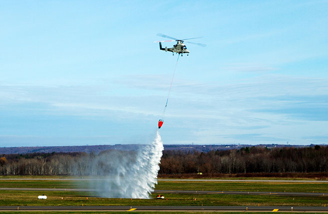
During the demonstration on Nov. 18, the Stalker XE UAS provided data and a precise geolocation to the unmanned K-MAX cargo helicopter, which conducted water drops to extinguish a fire, while the UTM tracked the UAS operations and communicated with Air Traffic Control in real time.
The Stalker UAS directs the unmanned K-MAX cargo helicopter to conduct water drops at a precise location to extinguish a fire. (Photo: Lockheed Martin)
“This demonstration represents the path forward for flying UAS in the NAS using Flight Service-based UTM capabilities to extend the technology and systems that air traffic controllers know and understand,” said Paul Engola, vice president, Transportation & Financial Solutions. “We were able to successfully modify the existing K-MAX and Stalker XE ground control software to connect to the UTM services and conduct the firefighting mission.”
For more than 80 years, manned aircraft have supported firefighting missions during daylight hours. Because unmanned K-MAX can fly day and night, in all weather, its insertion into firefighting operations offers the potential to triple the amount of time ground firefighters can receive aerial support.
The Stalker XE UAS worked in tandem with K-MAX to identify hot spots and fire intensity with its electro-optical, infrared camera. Its stable, high-definition imaging capabilities enable day and night operations. Powered by a ruggedized solid oxide fuel cell, Stalker XE achieves more than eight hours of flight endurance.
The Stalker and K-MAX operated in collaboration with a prototype UAS Traffic Management (UTM) system, which provides essential capabilities to enable safe UAS operations. (Photo: Lockheed Martin)
The late, great, oft-quoted Yogi Berra, in an interview shortly before his passing, was quoted as saying “I never said most of the things I said.” For our purposes, let’s concentrate on one of his most famous quotes: “When you come to a fork in the road, take it.”
On to GPS. I use the term GPS in a ubiquitous PNT (position, navigation and timing) sense for simplicity, because most people today use the term in a universal sense, similar to how we say “Google It” no matter which search engine we’re actually using.
Today, GPS is indeed at a crossroads, and there are multiple paths or avenues to follow — or Courses of Action (COA), as the government likes to say. Fortunately, most of you reading this fully realize GPS is so much more than just an atomic reference system in MEO, or Medium Earth Orbit. Let’s review the various GPS programs and see how they’re faring.
GPS III
Let’s be conventional and start with the hardware, the actual satellite bus (vehicle) being built by Lockheed Martin Space Systems in its Waterton facility in the beautiful foothills of the Rocky Mountains in Littleton just west of Denver, Colorado.
In an October 2015 speech before the International Astronautical Congress in Jerusalem, Israel, LMCO Chairman, President and CEO Marillyn Hewson stated the following in a marvelous speech entitled “There are No Borders in Space: International Cooperation Will Drive the New Space Age:”
“We must focus on three priorities for the future of space. The first is space as an instrument to create global industrial partnership. Second is space as a driver of economic growth. And third is space as an opportunity to inspire the next generation of innovators.”
Chairman Hewson concentrated on the future of space, as are we, and probably due to her venue, she naturally chose to focus on international cooperation. She went on to say this about GPS specifically:
“GPS III, the next-generation of the U.S. Air Force’s Global Positioning System, will share a new, common civil signal with other international navigation satellites like Galileo and GLONASS. That means people around the world will have more accurate and reliable positioning data and connectivity from a truly global positioning constellation.”
Speaking about space capabilities and opportunities in general, she said:
“Space-based technologies are ubiquitous today. Want to find an address? Find out the weather forecast? Talk to someone on the other side of the world? The fact is, space is already an enabler of economic growth. And with today’s innovations combined with the power of international partnerships, it has the potential to drive magnitudes more.
“Today, the space sector represents about 1 percent of global economic activity. Yet, I could argue that without space, the other 99 percent wouldn’t be nearly as effective or efficient. Partners are developing commercial satellites that connect people around the world, enable distance learning and fuel job growth in many sectors of the global economy.”
You really can’t fault any of Chairman Hewson’s statements about space and GPS in particular. Indeed, it is an excellent presentation as it embodies the essence of motherhood and apple pie for space-faring nations.
However, she has glossed over one of the most pressing problems, not only for GPS III, but for all potential U.S. space-based assets still to be launched: access to space. How are we going to actually lift the satellites into orbit? Where are the launch vehicles?
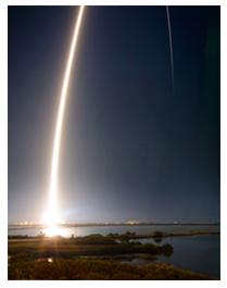
United Launch Alliance
ULA launch. (Courtesy of United Launch Alliance)
Many of you may have seen the latest GPS III launch services announcement by United Launch Alliance (ULA), a consortium of Boeing and LMCO launch companies taking advantage of the synergies each company brings to the launch arena. Officially, ULA is described as a 50-50 joint venture between Lockheed Martin and The Boeing Company, formed in 2006 to provide reliable, cost-efficient access to space for U.S. government missions.
Just a few weeks ago, ULA — the consortium that has launched all GPS satellites since 2006 with more than 90 consecutive government launches without a single failure, a world record — made what many consider to be a startling, albeit carefully worded, announcement regarding the latest and what many consider to be unduly restrictive government GPS III RFP (Request For Proposal) for launch services.
“ULA wants nothing more than to compete, but unfortunately we are unable to submit a compliant bid for GPS III-X launch services. The RFP requires ULA to certify that funds from other government contracts will not benefit the GPS III launch mission. ULA does not have the accounting systems in place to make that certification, and therefore cannot submit a compliant proposal.
“In addition, the RFP’s Lowest Price Technically Acceptable (LPTA) structure allows for no ability to differentiate between competitors on the basis of critical factors such as reliability, schedule certainty, technical capability and past performance.
“Further, under the restrictions imposed by the 2015 National Defense Authorization Act (NDAA), ULA does not currently have any Atlas engines available to bid and therefore is unable to submit a timely proposal.
“ULA remains fully committed to supporting America’s national security missions with world-class launch services. We look forward to working with the Air Force to address the obstacles to ULA’s participation in future launch competitions to enable a full and fair competition.”
A separate ULA press release states ULA will continue with development of its Vulcan launch vehicle, which they bill as a next-generation launch system. So it appears that it is merely the restrictions and caveats that pose a problem for ULA and GPS III launches, not technology or timelines.
“With the introduction of the Vulcan, ULA’s next-generation launch system (NGLS), ULA is transforming the future of space launch — making it more affordable, accessible and commercialized — and innovating to develop solutions to the nation’s most critical need: reliable access to space,” ULA said.
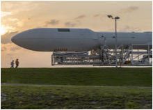
The Falcon .9 (Courtesy of SpaceX)
SpaceX
With ULA out of the picture, at least temporarily, for GPS III launches, this leaves the door open for Elon Musk, recently of Big Bang Theory fame, and his Space Exploration Technologies Corporation better known as SpaceX to step in and fill the void presumably with a variation of their heavy lift Falcon 9 rocket.
SpaceX promotes itself as the largest private producer of rocket engines worldwide, and no doubt that is true. SpaceX has demonstrated the capability for both successful launches and spectacular failures. That is almost to be expected for a new rocket engine and a new company, which only came about in 2002. However, where human lives are concerned, failure is not an acceptable option.
SpaceX is very much aware that a launch failure resulting in lives lost might well spell the end of SpaceX. With that as a given, SpaceX recently delivered its 100th Merlin 1D engine, nine of which form the basis for the first stage of the Falcon 9 launch vehicle. Indeed, SpaceX touts unparalleled redundancy — with nine Merlin 1D engines on the first stage, it could actually overcome a failure of any one of the Merlin engines and still have a successful launch.
Merlin ID engines all in a row. (Courtesy of SpaceX)
Only time will tell, however, and this scenario leaves the U.S. government with very few options as long as the current guidelines regarding the Russian RD-180 core are in place. Other companies such as Moog, Orbital Sciences, Aerojet Rocketdyne, Blue Origins and ATK, to name a few potential contenders, could separately or as a team bid on the next-generation launch vehicle for GPS III.
However, that would mean storing the GPS III satellites and payloads for inordinately long periods of time, which is both expensive and risky. Expensive in dollars, since each GPS III space vehicle (SV) would cost approximately $1 million per year — not an official figure, but a best guess from several sources, to store, and expensive and risky from an operational point of view in that the federal government and LMCO would have no idea if the GPS III SVs and payloads really worked as advertised.
They would have no idea if there were any major flaws or anomalies, and once the production line at LMCO space systems was shut down, it would be prohibitively expensive to restart, if that were even possible. Remember, three GPS III SVs are being constructed currently, and today there are only eight confirmed orders for GPS III SVs.
As for major anomalies, just think back to the GPS IIF launches where the first four each revealed a major and separate anomaly for IIF SVs that had to be corrected on all future SVs and payloads before further launches occurred.
My sources at LMCO in Littleton assure me the first GPS III SV with a complete payload, built by Harris nee Exelis, nee ITT, will be ready for delivery to the government in mid-2016, possibly earlier. With a 90-day checkout the first GPS III SV could be ready for launch as early as late fall 2016.
The problem at that point becomes — and actually is a problem right here and now — there is no evidence that the government currently has a viable certified program to launch, control or maintain the GPS III satellites and payloads. But that is another story with many twists and turns.
The Road Less Taken
Apparently, there are numerous options for the government where GPS programs are concerned, and for a change many of those options, while being considered outside the box, actually appear to be the smarter choice.
As that great American poet Robert Frost once famously wrote:
“I shall be telling this with a sigh
Somewhere ages and ages hence:
Two roads diverged in a wood, and I—
I took the one less traveled by,
And that has made all the difference.”
Until next time, Happy Holidays, Happy New Year and Happy Navigating on that road less traveled by.