Category: Mobile

  • Engaging data for scooters, cars and trains

    Engaging data for scooters, cars and trains

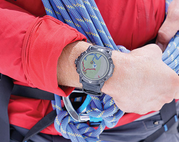
    Swift Navigation designs, manufactures and integrates GNSS receivers, as well as providing the Skylark wide-area GNSS corrections service. Its markets are automotive, transportation (last mile delivery, commercial trucking, rail), robotics/machine control (construction, mining, precision agriculture, landscaping), UAVs, micromobility and mobile devices and applications.

    The company’s technology is compatible and interoperable with most major GNSS receivers for multiple markets. Its Starling positioning engine and Skylark corrections “are scalable to bring precision to legacy low-cost single-frequency receivers, all the way to the most sophisticated state-of-the-art triple-frequency multi-constellation systems,” said Joel Gibson, Swift’s executive vice president of Automotive. “By working with a multitude of receiver vendors for different applications, Swift leverages all constellations and all signals and maximizes the performance required for the application.”

    The most accurate and reliable navigation system for every application would take advantage of all available GNSS signals, as well as all available corrections, dead reckoning and fused data from other sensors, such as cameras, lidar and radar. However, of course, that is not possible due to cost, size, weight and power considerations. Swift’s approach to the trade-offs required depends on each use case.

    Micromobility

    In the area of micromobility (such as scooters), the main constraints for implementing a positioning solution are cost and power, coupled with the challenge of satellite signal outages and multipath in dense urban environments where these vehicles primarily operate, Gibson explained. “Cost-effective dual-frequency GNSS receivers are now showing up in micromobility architectures. Pairing them with our Starling positioning engine, which integrates inertial sensor data and wheel ticks, and augmenting them with Skylark corrections data, makes it possible to meet such compliance requirements as geofencing and limiting sidewalk use.”

    Additionally, by achieving decimeter-level positioning, Swift’s micromobility solution makes it easier for both users and service staff to find scooters, which increases the scooter companies’ revenues.

    Photo: Swift Navigation
    Photo: Swift Navigation

    Automotive

    In the automotive industry, inertial sensors and wheel odometry are ubiquitous and pair naturally with GNSS to mitigate satellite signal outages, Gibson pointed out. Likewise, cameras and radar — cornerstones of ADAS — are very complementary to GNSS for safety applications, and lidar further complements GNSS in feature-rich environments such as dense urban areas.

    Rail

    Rail applications, such as Positive Train Control, have traditionally needed an accuracy of one or two meters, coupled with ruggedized hardware. “Swift’s precise positioning solution is deployed across continental rail systems today, and we are now engaging rail OEM and operator programs requiring sub-meter accuracy to ensure track-to-track accuracy and safety requirements in support of the transition to more autonomous rail operations,” said Gibson. “Leading rail companies are also looking for operational efficiencies by transitioning away from the high operational costs of maintaining reference base stations along track routes, instead moving to the more cost effective, reliable and seamless Skylark corrections coverage.”

  • ISRO partners with OPPO on NavIC messaging app

    ISRO partners with OPPO on NavIC messaging app

    logoThe Indian Space Research Organization (ISRO) and India’s Department of Space have signed a memorandum of understanding (MOU) with OPPO India to strengthen the research and development of the NavIC messaging service to provide a convenient and user-friendly platform.

    The MoU will pave the way for future collaborations between ISRO and OPPO India to develop indigenous solutions by incorporating the NavIC short-messaging feature into smartphones released by OPPO India.

    The MoU will enable ISRO and OPPO India to exchange technical information on the NavIC messaging services. This will enable the building of rapid, ready-to-use, end-to-end application-specific solutions that integrate the NavIC messaging service with OPPO’s mobile handset platform, with Indian end-users in mind.

    The MOU also aims to help fulfill “Atmanirbhar Bharat,” which translates to “self-reliant India.” Atmanirbhar Bharat is a phrase used and popularized by Indian Prime Minister Narendra Modi and the Government of India in relation to the country’s economic development and vision.

  • Nestwave geolocation added to Sequans IoT platform

    Nestwave geolocation added to Sequans IoT platform

    Nestwave is collaborating with Sequans to deliver accurate and efficient GNSS positioning for low-power internet of things tracking

    The Nestwave IP provides the latest Sequans LTE-M/NB-IoT platform with geolocation. (Photo: Sequans)
    The Nestwave IP provides the latest Sequans LTE-M/NB-IoT platform with geolocation. (Photo: Sequans)

    Nestwave has announced that its technology has been selected by Sequans Communications S.A., provider of 5G/4G cellular internet of things (IoT) connectivity solutions. Specifically, Nestwave’s technology will add GNSS positioning to the Sequans Monarch 2 LTE-M/NB-IoT platform.

    Integrated into the Sequans Monarch 2 GM02SP module, the Nestwave GNSS solution offers Sequans’ IoT customers accurate positioning with ultra-low-power consumption while minimizing component count, cost and size by removing the need for an external positioning chipset.

    This makes the Sequans platform suitable for a wide variety of intermittent, power-limited tracking use cases including personal trackers, parcel and pallet location, and fleet trackers, as well as car, bike and scooter location and theft recovery. Cosmo Connected, a leader in urban mobility solutions, has already adopted the Monarch 2 GM02SP solution to reduce the cost and power consumption of its tracker products.

    Nestwave’s technology allows geolocation to be added to existing IoT chipsets by implementing a GNSS receiver using the chip’s existing radio and computing capabilities. This eliminates the need for an external GNSS chipset and product redesign.

    “Nestwave’s technology provides the smallest, most power efficient, and lowest component count solutions for IoT geolocation,” said Nestwave CEO Ambroise Popper. “Our strategic partnership with Sequans addresses the challenge of integrating accurate geolocation into compact, often battery-powered, low-cost IoT nodes and allows Sequans customers to benefit from higher performing, lower cost tracking solutions.”

    “Leveraging Nestwave’s innovative technology to provide low-power GNSS on Monarch 2 widens its capabilities and makes many types of IoT tracker use cases more affordable because there is no need for additional positioning chips or modules,” said Georges Karam, Sequans CEO.

    Nestwave IP has been integrated into a variety of chip architectures and on various DSP/CPU cores. In combination with Nestwave cloud services, this IP enables a very short time-to-first-fix, which allows for much lower power consumption in tracking use cases, without compromising on sensitivity or accuracy. The company’s technology roadmap includes the addition of 5G/4G cellular-based hybrid location functionality and solutions that will improve the accuracy of indoor tracking.

  • Telit launches GNSS module with 2G fallback for Latin America

    Telit launches GNSS module with 2G fallback for Latin America

    Photo: Telit
    Photo: Telit

    Telit, a global enabler of the internet of things (IoT), has launched the LE910S1-ELG, a new LTE Cat 1 module designed for IoT applications in Latin America (LATAM) that need a combination of performance, affordability, voice support and 2G fallback in a compact form factor.

    With an embedded GNSS receiver, the cost-optimized LE910S1-ELG is suitable for tracking applications such as fleet management, stolen-vehicle tracking and recovery, and other mobile IoT applications that need to maintain a reliable connection when moving around in a country, region or multiple regions.

    The LE910S1-ELG is the latest member of Telit’s flagship xE910 module family, whose unified form factor and electrical and programming interfaces spanning 2G, 3G and 4G products enables developers to implement a “design once, use anywhere” strategy. The module supports LTE Cat 1 with single-antenna reception, providing downlink speeds of up to 10 Mbps and uplink speeds up to 5 Mbps. Its streamlined configuration, compared to LTE Cat 1 devices with two antennas, helps significantly reduce cost and complexity.

    Supporting 2G fallback, the LE910S1-ELG is suitable for applications that require full mobility throughout the LATAM regions, including areas that have not upgraded to 4G yet. It also supports both circuit-switched voice and VoLTE for those applications that require making phone calls, such as healthcare mobile personal emergency response systems (mPERS), connected elevators, alarm systems and more. The power-saving embedded GNSS receiver enables the use of GNSS positioning even when the cellular modem is switched off.

    “The LE910S1-ELG is a great option for migrating customers that use legacy 2G and 3G modules in Latin America, especially where nationwide LTE-M and NB-IoT coverage does not yet exist,” said Marco Stracuzzi, head of product marketing, Telit. “Our all-in-one cellular and GNSS module covers all LATAM 4G and 2G bands, as well as mainstream bands used in Europe and Asia, which makes it well-suited particularly for high-performance tracking across intercontinental deployments.”

    The LE910S1-ELG is sampling now, and will be commercially available during the first quarter of 2022.

  • Harxon debuts embedded helix antenna

    Harxon debuts embedded helix antenna

    Photo: Harxon
    Photo: Harxon

    Harxon has introduced the HX-CUX005A to its family of helix antennas.

    The HX-CUX005A is an embedded helix antenna designed for high-precision positioning. It offers superior satellite signal tracking, including GPS, GLONASS, Galileo and BeiDou as well as L-band correction service.

    Upgraded with Wi-Fi and Bluetooth tunable (BT) for better integration, the HX-CUX005A is designed to be an all-in-one solution for surveying, unmanned aerial vehicles (UAVs), personnel and vehicle monitoring, and many more applications.

    The powerful antenna has Harxon’s patented D-QHA technology and multi-point feeding technology. It is able to provide reliable and consistent signal tracking with centimeter-level accuracy by exhibiting a stable phase center, 2.5-dBi high gain with ultra-low signal loss, wide beam width and exceptional low-elevation satellite tracking.

    In addition, the HX-CUX005A is optimized in circuit layout and equipped with robust pre-filtered low noise amplifier that guarantees excellent out-of-band rejection performance and strong multipath reduction capacity. In this way, unwanted electromagnetic interference is restrained for improved signal filtering over all GNSS frequency bands.

    The integration of Wi-Fi and Bluetooth (2.4 GHz/5.8 GHz) provides 1-dBi gain (typical value) to enable easy connection and configuration for mobile device users. Its highly integrated design simplifies development process and reduces costs for device engineers, Harxon said.

    Key Features of the HX-CUX005A

    • Comprehensive GNSS support: GPS, GLONASS, Galileo, BeiDou and L-band correction service
    • Centimeter phase-center repeatability, high gain at low elevation
    • Improved signal filtering and excellent multipath rejection
    • Weighs 10 grams in small form factor to facilitate integration
    • Integrated with Wi-Fi and Bluetooth tunable (2.4 GHz/5.8 GHz).
  • Handheld launches new version of its ultra-rugged PDA, the NAUTIZ X9

    Handheld launches new version of its ultra-rugged PDA, the NAUTIZ X9

    Handheld Group, a manufacturer of rugged mobile computers, has announced a new version of its NAUTIZ X9 PDA: an ultra-rugged enterprise handheld built for fieldwork in the most challenging outdoor and industrial environments.

    With an upgraded platform, the Nautiz X9 Android rugged handheld runs Android 11 and is Android Enterprise Recommended (AER). The device, which has a sturdy magnesium casing, is targeted for mobile computing and data collection in industrial and field applications.

    The Nautiz X9 ultra-rugged PDA offers:

    • MIL-STD 810G ruggedness for drops, vibrations, humidity, and broad operating temperature
    • IP67 rating for waterproof, dust-tight performance
    • a sunlight-readable 5-inch multi-touch display with glove and rain mode
    • a high speed 8-core MediaTek processor with 3 GB RAM and 32 GB storage
    • the Android 11 operating system with GMS
    • 4G/LTE, dual band 802.11 a/b/g/n/ac wireless LAN, low-energy 5.0 BT and NFC
    • built-in GPS/GLONASS/Galileo capabilities as standard
    • dual cameras including 13-megapixel rear-facing, and 5-megapixel front-facing
    • optional high-quality, high-speed 2D imager
    • multiple enterprise-focused accessories
    • maxGo software to quickly apply custom settings to larger deployments

    The new version of the Nautiz X9 is expected to start shipping this month.

  • DJI’s new Mavic 3 has longer flight time, obstacle sensing

    DJI’s new Mavic 3 has longer flight time, obstacle sensing

    DJI Mavic 3 has better sensor, dual-camera system, omnidirectional obstacle sensing, smarter flight modes and longer flight times

    Mavic 3 drone. (Image: DJI)
    Mavic 3 drone. (Image: DJI)

    The new DJI Mavic 3 is an update of the company’s folding camera drone, providing comprehensive improvement and boosting performance for aerial photography.

    The Mavic 3 has improved navigation and obstacle sensing systems. A powerful positioning algorithm improves hovering precision with signals from GPS, GLONASS and BeiDou satellites. This enables Mavic 3 to lock onto multiple satellite signals faster. The increased positioning precision also makes the drone less likely to drift in the air and more stable when shooting long exposures and time lapses.

    For its obstacle sensing system, Advanced Pilot Assistance System (APAS) 5.0 combines inputs from six fish-eye vision sensors and two wide-angle sensors, which seamlessly and continuously sense obstacles in all directions and plan safe flight routes to avoid them, even in complicated environments.

    The obstacle-sensing system also enables more intuitive subject tracking with the upgraded ActiveTrack 5.0. Previous iterations of ActiveTrack enabled the camera to follow a subject as it moved directly toward and away from the drone while remaining largely stationary as well as fly alongside a moving subject. ActiveTrack 5.0 allows Mavic 3 to move with the subject as it moves forward, backward, left, right and diagonally, and fly alongside as well as around a moving subject.

    If the subject moves too fast and temporarily goes out of frame, visual sensors on the aircraft will continue to track and frame the subject intelligently and pick it back up when it reappears. These new directions enable much more fluid and diverse drone and camera movement while using ActiveTrack.

    Other safety features include geofencing, which alerts drone pilots when they fly near sensitive locations; altitude limits to ensure pilots are aware of altitude restrictions; and the AeroScope Remote ID system that allows authorities to identify and monitor airborne drones in sensitive locations.

    Mavic 3’s integrated AirSense system, first widely introduced in DJI Air 2S, warns drone pilots of nearby airplanes and helicopters transmitting ADS-B signals, so they can quickly fly to a safer location.

    Hasselblad camera

    Mavic 3 has a 4/3 CMOS Hasselblad camera and 28x hybrid zoom camera. Omnidirectional obstacle sensors have a 200-meter range, and redesigned batteries provide up to 46 minutes of flight time.

    Upgraded hardware and software can process 5.1K video at 50 frames per second and support 4K/120 fps for high-quality results for slow-motion footage. An enhanced Mavic 3 Cine edition offers Apple ProRes 422 HQ encoding for richer video processing, with an internal 1TB SSD onboard for high-speed data storage.

    DJI Mavic 3’s customized L2D-20c aerial camera embeds a professional-grade 4/3 CMOS sensor with a 24 mm prime lens in a sleek and compact form. Rigorous Hasselblad standards for hardware performance and software algorithms allow it to shoot 20-MP still images in 12-bit RAW format and videos in 5.1 K at 50 fps and 4 K at 120 fps. The higher video definition creates smoother footage and more generous cropping possibilities and allows for slow-motion video at 120 fps.

    The larger image sensor gives Mavic 3 higher video resolution and dynamic range and more effectively suppresses noise in low-light environments. A native dynamic range of 12.8 stops helps retain more details in highlights and shadows, preserving rich visual information with a greater sense of depth and elevating imagery to a professional level. An adjustable aperture of f/2.8-f/11 is available to meet the needs of aerial photographers in a wide variety of lighting scenarios to get sharper and clearer images.

  • Taoglas and u-blox partner on positioning for Cowboy e-bike

    Taoglas and u-blox partner on positioning for Cowboy e-bike

    Photo: Cowboy
    Photo: Cowboy

    Taoglas and u-blox showcased their positioning solution for the Cowboy electric bike at Mobile World Congress Los Angeles 2021. taking place Oct. 26-28.

    The Cowboy e-bike solution provides riders with high-performance, real-time GNSS accuracy, enabling them to map their own paths and those of the cities they live in.

    The Cowboy e-bike uses smart road-companion applications to ensure riders get precise information, regardless of the route they travel. The positioning component uses Taoglas’ Accura GVLB258.A, a multi-band GNSS L1/L5, high-performance stacked patch antenna, in conjunction with u-blox’s SAM-M8Q GNSS positioning module. The combination allows for extremely low power and high accuracy.

    The solutions works with “micromobility” services offered by Cowboy, such as Easy Rider for theft detection, bike insurance, and crash detection notifications.

  • CGI to develop 5G for UAV positioning for ESA

    CGI to develop 5G for UAV positioning for ESA

    Image: KENGKAT/iStock/Getty Images Plus/Getty Images
    Image: KENGKAT/iStock/Getty Images Plus/Getty Images

    CGI has been awarded a contract by the European Space Agency (ESA) to develop a proof of concept to enhance the navigational capabilities of airspace users in areas where traditional navigation systems alone cannot provide sufficient performance.

    Future aircraft, such as UAVs and innovative air mobility solutions, will need to safely operate beyond visual line of sight (BVLOS) within cities and other built-up areas, where GNSS signals  are often disrupted.

    The concept being developed by CGI and its partners leverages 5G networks, alongside traditional navigation systems, to provide hybrid-positioning solutions. In addition to secure communications for command and control of vehicles, and delivery of high-quality streaming video for BVLOS operations, 5G networks can also be used as a source for navigational data that will improve the accuracy, integrity and availability beyond that which satellite navigation systems alone can provide. The service will also offer greater resilience against natural or intentional disruption of positioning, navigation and timing (PNT) services.

    “The UK is a leading innovator in aerospace and GNSS technology. It’s great to see the team developing resilient PNT solutions for aerospace leveraging existing communication infrastructure,” said Andy Proctor, UK Lead Delegate to the ESA Programme Board for Navigation & PNT Innovation lead at UK Research and Innovation (UKRI). “The 5G-PNT project will enable and promote future aviation applications in the UK and globally, especially in the fast-growing future air mobility sector that will enable wider economic growth in many key sectors.”

    “This exciting project brings together PNT and mission-critical systems integration expertise to advance the enabling technologies for future navigation applications,” John Hanley, Senior Vice President for UK & Australia Secure and Assured Space Solutions at CGI said. “The challenges posed by PNT service disruption have become a significant concern for operators and regulators and this project will help improve navigation capabilities to support both this challenge and further development of the aerospace sector.”

    CGI will work with ESA, u-blox, the Advanced Communication, Mobile Technology and IoT (ACMI) Research Centre at the University of Sussex and air navigation service provider NATS, to define use cases and system requirements for a 5G-based complement to existing GNSS receivers. This hybrid navigation solution will be targeted at installation on any air vehicles intended to operate within the coverage of commercial 5G networks.

    The project will culminate in a real-world demonstration of the technology, comparing its performance to that offered by GNSS alone.

  • Launchpad: Smartwatch, 5G platform

    Launchpad: Smartwatch, 5G platform

    A roundup of recent products in the GNSS and inertial positioning industry from the October 2021 issue of GPS World magazine.


    MOBILE

    Smartwatch

    Provides dual-frequency and topo maps

    Photo: Coros
    Photo: Coros

    The Vertix 2 GPS “adventure watch” is equipped with a dual-frequency GNSS chipset for high accuracy. It communicates with all global navigation satellite systems simultaneously, and has a battery life of 140 hours while using GPS — otherwise, the battery extends to 60 days. Global offline maps include landscape, topography and hybrid views. The watch includes an Insta360 action camera and has 32 GB of internal storage.

    Coros, Coros.com

    Asset Tracking Platform

    Tags, locates and monitors assets

    Photo: Link Labs
    Photo: Link Labs

    AirFinder helps companies locate, monitor and manage business assets indoors and outdoors. The quickly deployable, massively scalable platform does not require an IT infrastructure or extra components or hardware. Rather than using an internal Wi-Fi system, AirFinder operates on Link Labs’ patented and secure Symphony Link network. Location data from each AirFinder device securely flows to the AirFinder web app or directly to customer databases via extensible APIs, which enable users to monitor assets in real time, analyze asset history, add rules and alerts, establish geofences and more.

    Link Labs, link-labs.com


    OEM

    Network Timing Platform

    Provides boundary clock functionality at the edge

    Photo: Orolia
    Photo: Orolia

    The EdgeSync network timing platform provides NTP and PTP grandmaster and boundary clock functionality for real-time edge applications. High performance, scalability, ease of use and manageability make EdgeSync suitable for data centers, finance, mobile edge computing, enterprise, smart grid, industrial IoT, process control and telecommunications. EdgeSync uses a multi-GNSS receiver (GPS, Galileo, GLONASS, BeiDou and QZSS), PTP and Synchronous Ethernet (SyncE) as input references and generates PTP, SyncE, NTP and timing signals (10 MHz, 1 PPS and time-of-day message) as outputs. It features dual 1-GbE ports for both copper RJ45 and optical network timing connections. EdgeSync also can provide IEEE 1588-2008 (PTP) grandmaster and boundary clock functionality.

    Orolia, orolia.com

    Hardened Compass

    Real-time MIL-SPEC location and direction

    Photo: DroneShield
    Photo: DroneShield

    CompassOne provides real-time military-grade location, orientation and direction sensing for deployed static and on-the-go assets. It receives all GNSS, ensuring uninterrupted operation. The device can be used both in counter UAV operations and general situations requiring satellite navigation. With a strong focus on durability and ruggedness, CompassOne is suitable for installation and operation in harsh environments. Military-grade connectors and high-end stainless-steel hardware ensure uninterrupted connection and protection from the elements, while the aluminum underside provides exceptional impact resistance and rigidity while keeping overall weight low. CompassOne can operate alone or be integrated with DroneShield’s DroneSentry system.

    DroneShield, droneshield.com

    5G Platform

    Provides dual frequency to consumer smartphones

    Photo: Qualcomm
    Photo: Qualcomm

    The Snapdragon 888+ 5G mobile platform is expected to power commercial smartphones from ASUS, Honor, Motorola, vivo and Xiaomi in the second half of this year. Satellite systems supported include all four constellations (GPS, BeiDou, Galileo, GLONASS) with dual-frequency GNSS. Additional systems supported include NavIC, QZSS and SBAS. Snapdragon 888+ provides AI-enhanced gameplay, streaming, photography and premium connectivity. Compared to its predecessor (the 888), Snapdragon 888+ provides an increased Qualcomm Kryo 680 CPU Prime core clock speed at up to 3.0 GHz and the sixth-generation Qualcomm AI engine with up to 32 TOPS AI performance, an improvement of more than 20%.

    Qualcomm Technologies, qualcomm.com

    Software-Defined Simulation

    Supports latency of 5 milliseconds

    The Skydel Real-Time Performance graphs illustrate the software-defined engine’s low latency during a GNSS simulation. (Screenshot: Orolia)
    The Skydel Real-Time Performance graphs illustrate the software-defined engine’s low latency during a GNSS simulation. (Screenshot: Orolia)

    A new real-time performance capability, now standard on all Skydel-powered GNSS simulators, achieves an ultra-low latency of 5 milliseconds. Skydel’s software-defined architecture is designed to meet the demanding GNSS simulation testing requirements in the automotive, military, space and other high-tech industries. Skydel also supports hardware-in-the-loop simulations without sacrificing ultra-low latency and high-end performance. A dashboard shows real-time performance graphs and enables users to grade the simulator’s performance, interpret data, diagnose inefficiencies, and optimize scenarios on the fly. As the system reaches its limits, it remains stable and fully operational, preserving the integrity of the simulation.

    Orolia, orolia.com


    SURVEYING & MAPPING

    Utility Locator

    Software with GNSS receiver enables mapping

    Photo: ProStar
    Photo: ProStar

    PointMan software is now integrated into the Vivax Metrotech vLoc3 with a GNSS real-time kinematic (RTK) receiver to create a utility-locate device. Using the RTK-Pro internal cellular module with 4G LTE capabilities, the operator can connect to the NTRIP RTK caster that provides RTCM 3 corrections. With the integration of PointMan with the vLoc3 RTK-Pro, critical buried infrastructure can be captured, recorded and displayed at survey-grade accuracy without additional external equipment or post-processing. The integration provides centimeter accuracy of the precise location of buried utilities in real time. Data collected includes the type of utility, the depth of cover and the utility’s precise location.

    ProStar Holdings, prostarcorp.com

    GIS Platform

    Geospatial and location intelligence for smart cities

    Screenshot: Hexagon Geospatial
    Screenshot: Hexagon Geospatial

    M.App Enterprise 2021 is a significant update to the platform for creating geospatial and location intelligence applications. The latest release features new browser-based 3D capabilities and enhanced visual effects, plus the ability to create and configure custom applications more easily. It allows users to access LuciadRIA’s 3D features with support for panoramic imagery, shading, ambient occlusion and other visualization effects to build browser-based solutions. It also features a new browser app configurator that makes it easier to create spatio-temporal dashboards, or Smart M.Apps. Feature Analyzer now allows users to add and manage multiple datasets on the fly and set up workflows.

    Hexagon Geospatial, hexagongeospatial.com

  • Hexagon acquires Jovix material tracking company

    Hexagon acquires Jovix material tracking company

    Photo: Jovix
    Photo: Jovix

    Hexagon AB, a global leader in digital reality solutions, has acquired the Jovix software and services business from Atlas RFID Solutions LLC of Birmingham, Alabama.

    Jovix is a material tracking software developed specifically for the construction industry, providing project decision-makers with real-time, actionable data regarding material status and location.

    The cloud-based and mobile configurable workflow platform offers visibility and traceability into the status and location of materials throughout the engineering, procurement and construction (EPC) lifecycle. This streamlined process, coined “material readiness” by Jovix, ensures construction crews have required materials without delay to complete their work according to plan. This is achieved by fully digitizing the supply chain to provide real-time, geo-contextual, and relational visibility from fabrication to installation.

    Jovix combines web-based server software with information from multiple types of sensor tags and readers to automate previously manual, paper-based data-collection workflows about the status and location of material as it moves throughout the construction supply chain.

    The software has been deployed in 25 countries on more than 650 job sites, including multibillion-dollar oil and gas and chemical construction projects. There are more than 7,500 Jovix users worldwide.

    “The acquisition supports our continued expansion into the procurement, fabrication, and construction market,” said Hexagon President and CEO Ola Rollén. “By removing impediments to productivity that result from material management issues intending to reduce material wait times to zero, Jovix provides value for owner-operators, EPC firms, contractors, fabricators, and suppliers.”

    Jovix will be fully consolidated as of Oct. 1, operating within Hexagon’s Project Portfolio Management division. The acquisition has no significant impact on Hexagon’s earnings.

  • Robotic ‘white cane’ helps visually impaired navigate indoors

    Robotic ‘white cane’ helps visually impaired navigate indoors

    News from the National Institutes of Health

    Study author Lingqiu Jin tests the robotic cane. (Photo: Cang Ye, VCU/NIH)
    Study author Lingqiu Jin tests the robotic cane. (Photo: Cang Ye, VCU/NIH)

    A new robotic cane can help the visually impaired navigate indoors. The cane is equipped with a color 3D camera, an inertial measurement sensor, and its own on-board computer.

    When paired with a building’s architectural drawing, the device can accurately guide a user to a desired location with sensory and auditory cues, while simultaneously helping the user avoid obstacles like boxes, furniture and overhangs.

    Development of the device was co-funded by the National Institutes of Health’s National Eye Institute (NEI) and the National Institute of Biomedical Imaging and Bioengineering (NIBIB). Details of the updated design were published in the journal IEEE/CAA Journal of Automatica Sinica.

    “Many people in the visually impaired community consider the white cane to be their best and most functional navigational tool, despite it being century-old technology,” said Cang Ye, Ph.D., lead author of the study and professor of computer science at the College of Engineering at the Virginia Commonwealth University, Richmond. “For sighted people, technologies like GPS-based applications have revolutionized navigation. We’re interested in creating a device that closes many of the gaps in functionality for white cane users.”

    While cellphone-based applications can provide navigation assistance — helping blind users stay within crosswalks, for example — large spaces inside buildings are a major challenge, especially when those spaces are unfamiliar.

    Earlier versions of Ye’s robotic cane began tackling this problem by incorporating building floorplans; the user could tell the cane where he or she wished to go, and the cane — by a combination of auditory cues and a robotic rolling tip — could guide the user to the destination. But when used over long distances, the inaccuracies in the user’s location could build up, eventually leaving the user at an incorrect location.

    To help correct this issue, Ye and colleagues have added a color-depth camera to the system. Using infrared light, much like a mobile phone’s front-facing camera, the system can determine the distance between the cane and other physical objects, including the floor, doorways and walls, as well as furniture and other obstacles. Using this information, along with data from an inertial sensor, the cane’s onboard computer can map the user’s precise location to the existing architectural drawing or floorplan, while also alerting the user to obstacles in their path.

    “While some cell phone apps can give people auditory navigation instructions, when going around a corner for example, how do you know you’ve turned just the right amount?” said Ye. “The rolling tip on our robotic cane can guide you to turn at just the right point and exactly the right number of degrees, whether it’s 15 or 90. This version can also alert you to overhanging obstacles, which a standard white cane cannot.”

    There are still a few kinks to be worked out before the system will be market-ready — it’s still too heavy for regular use, for example, and Ye’s team is looking for a way to slim down the device.

    Nevertheless, with the ability to easily switch between its automated mode and a simpler, non-robotic “white cane mode,” Ye believes the device could provide a key independence tool for the blind and visually impaired, without losing the characteristics of the white cane that have stood the test of time.

    The study was funded by NEI and NIBIB through grant EB018117.

    Reference: Zhang H, Jin LQ, Ye C. “An RGB-D camera based visual positioning system for assistive navigation by a robotic navigation aid,” IEEE/CAA J. Autom. Sinica. 2021. 8(8):1389-1400. doi:10.1109/JAS.2021.1004084