Category: Mobile

  • Ericsson verifies 5G coverage with Rohde & Schwarz drone

    Ericsson verifies 5G coverage with Rohde & Schwarz drone

    Photo: Rohde & Schwarz
    Photo: Rohde & Schwarz

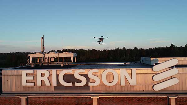
    Test and measurement specialist Rohde & Schwarz has supplied mobile network testing tools used in drone-based network coverage, performance and operation tests managed by Ericsson, a global leader in network infrastructure.

    Testing mobile coverage. A project team based in Jorvas, Finland, and led by Ericsson’s 5G Readiness Program RAN Technical Lead Richard Wirén, has developed— together with Centria University of Applied Sciences — a novel system for testing cellular mobile network coverage.

    The new system uses mobile network-testing scanners and smartphones from Rohde & Schwarz mounted on a drone that can be programmed to execute automatic tests with considerable flexibility, for example for precise route selection and drone speed control.

    This solution is especially valuable for industrial use cases. It also has the advantages over traditional walk and drive tests by providing unprecedented repeatability and positional accuracy with the ability to verify beamforming and map coverage in 3D.

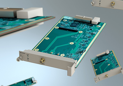
    Drone-mounted scanner. The R&S TSMA6 network scanner is mounted on a drone and is able to simultaneously verify important LTE and 5G NR coverage metrics such as reference signal received power (RSRP) and signal-to-interference-plus-noise ratio (SINR) in accordance with 3GPP standards.

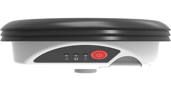
    When combined with the R&S QualiPoc Android smartphone-based optimizer, IP trace, application quality of service (QoS) metrics such as serving cell parameters are possible. The solution currently uses LTE user equipment (UE) but will soon be further developed to include 5G UEs such as the Samsung S10 5G.

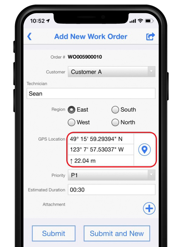
    The drone can be programmed to follow an exact three-dimensional route.

    Repeatable tests. More than 20 successful measurement flights conducted so far have shown the solution procedure and results to be extremely repeatable. The drone flights were of various duration, altitudes and routes, depending on the test case.

    Control, authentication and air traffic control are considerable challenges to the development of robust drone-based solutions. In this new system they are conducted over cellular networks, eliminating the requirement for line-of-sight connection between the drone and its pilot.

    The unique procedure enables unprecedented 3D accessibility, positional accuracy and repeatability of the testing.

    It also opens up new possibilities to ensure end-user QoS for demanding 5G use cases such as industry 4.0, automotive and public safety, Rohde & Scwarz said.

    5G New Radio. The deployment of 5G New Radio (NR) brings new applications of cellular networks for subscribers, government and industry. It also makes the verification of the correct coverage, performance and operation of networks more critical, increasing the demand for accuracy and accessibility in traditional field network tests.

    “For 5G to realize its promise, field verification of operation and quality is essential, and this development is a pioneering way to ensure our customers receive the network performance they require,” said Richard Wirén, 5G Readiness Program RAN Technical Lead from Ericsson. “We are delighted to utilize test solutions from Rohde & Schwarz that have proven themselves very reliable and are excited that we now have access to solutions based on commercially available 5G NR UEs such as the Samsung S10 5G.”

    “We are delighted to combine our industry-leading mobile network testing know-how with Ericsson’s long tradition of network innovations to ensure the delivery of end-user Quality of Experience as 5G NR becomes a reality,” said Hanspeter Bobst, vice president of mobile network testing for Rohde & Schwarz.

    Ericsson and Rohde & Schwarz are collaborating with Tampere University and Centria University of Applied Sciences, and the project forms part of the Business Finland 5G FORCE program.

    Future developments will focus on testing critical 5G applications such as public safety and machine-type communications for Industry 4.0, extending the frequency to extremely high frequencies of the mmWave bands and testing in an urban environment.

  • Research Roundup: Soft information for IoT positioning

    Soft information for IoT positioning

    The billions of interconnected devices and sensors embedded in other devices, vehicles and even humans that collectively constitute the much-heralded internet of things (IoT) collect and share data used in myriad applications. This requires them to know their location, which is a challenge in GPS-denied environments, such as most indoor locations, tunnels and urban canyons.

    A new approach helps networks of smart devices cooperate to find and communicate their positions in such environments. This “localization of things” could be helpful in applications ranging from autonomous vehicles to asset tracking, from supply-chain monitoring to smart cities and real-time mapping.

    Traditional network localization methods estimate a single value for each geospatial variable, such as the distance between two nodes. Therefore, accuracy drops sharply in environments where multipath, a limited view of the sky, and other problems severely degrade GNSS and wireless signals. A paper by researchers at four institutions outlines a system to capture location information even in these challenging environments by fusing positional data of various kinds as well as digital maps.

    The new method fuses data from various sensing measurements — such as radio, optical and inertial signals — and analyzes features of each signal — including its power, angle of arrival, and time of flight. It uses machine-learning techniques to weigh this “soft information” — the researchers call it that because their method does not favor any single “hard” number — to create a probability distribution of distances, angles and other metrics.

    It also exploits contextual information from digital maps, dynamic models and node profiles to verify what is possible. For example, two nodes could not be 20 meters apart if they are both in an area with a maximum dimension of 10 meters.

    To reduce the complexity and size of the data that it must collect to function, the new method identifies the most and least useful aspects of the received waveforms for the purpose at hand on the basis of a “principal component analysis.”

    In simulations of challenging scenarios, full of reflections and echoes, the new system’s performance significantly surpassed that of traditional ones and consistently approached the theoretical limit for localization accuracy, while the accuracy of traditional systems dropped dramatically.

    Citation:Soft Information for Localization-of-Things” by A. Conti, S. Mazuelas, S. Bartoletti, W. Lindsey and M. Win, Sept. 9, 2019, Proceedings of the IEEE.


    Algorithm helps civil aircraft fight spoofing

    Evolution in civil aviation foresees a greater role for GNSS in onboard navigation systems as opposed to traditional terrestrial navigation aids. This will require improvements in managing the threat posed by RF interference.

    Fortunately, the availability of more GNSS constellations and two carrier frequencies now enables GNSS equipment used aboard civil aircraft to not only detect and monitor spoofing, but also determine from which direction it is coming.

    A recent paper details a procedure to do this. It consists of a detection module that employs an algorithm to identify which signals tracked by the receiver are counterfeit, if any, followed by a direction-finding module that implements an efficient direction-of-arrival (DOA) estimator. The procedure requires three GNSS antennas and the same number of receivers, time-synchronized with a common clock, plus a signal processor that implements the detection and DOA estimation algorithms. The paper presents the design of the chain of algorithms and their preliminary tests in a laboratory setup, with the simulation of several spoofing attacks, assumed realistic in a civil aviation scenario.

    Citation:  “An Algorithm for Finding the Direction of Arrival of Counterfeit GNSS Signals on a Civil Aircraft” by G. Falco, M. Nicola, E. Falletti and M. Pini, presented on Sept. 20, 2019, at the ION GNSS+ conference in Miami, Florida.


    Joint Galileo/GPS Project on the ISS

    The European Space Agency (ESA) and NASA conducted a joint Galileo/GPS space receiver experiment aboard the International Space Station (ISS). The objectives of the project were to demonstrate the robustness of a combined Galileo/GPS waveform uploaded to NASA hardware already operating in the challenging space environment — the SCaN (Space Communications and Navigation) software defined radio (SDR) testbed (FPGA) — on-board the ISS.

    The activities included the analysis of the Galileo/GPS signal and on-board position/velocity/time (PVT) performance, processing of the Galileo/GPS raw data (code and carrier phase) for precise orbit determination, and validation of the added value of a space-borne dual GNSS receiver compared to a single-system GNSS receiver operating under the same conditions. A recent paper provides a general overview of the experiment (called GARISS) and describes its design, test, validation, and operations. It also presents the various analyses conducted in the context of this project and the results obtained, with a focus on the (Precise) Orbit Determination results.

    Citation: “The joint ESA/NASA Galileo/GPS Receiver onboard the ISS – The GARISS Project” by W. Enderle, E. Schönemann, F. Gini, M. Otten, P. Giordano, J. Miller, S. Sands, D. Chelmins, O. Pozzobon, presented on September 20, 2019, at the ION GNSS+ conference in Miami, FL.

  • GSA announces 2019 winners of MyGalileoApp competition

    GSA announces 2019 winners of MyGalileoApp competition

    First place winners ARGEO accept their prize. (Photo: GSA)
    First place winners ARGEO accept their prize. (Photo: GSA)

    News from the European GNSS Agency

    The winners of this year’s MyGalileoApp competition were announced at a ceremony held at the European GNSS Agency (GSA) headquarters in Prague on Nov. 7.

    First prize of EUR 100,000 went to ARGEO, a mobile app based on geolocation, augmented reality and blockchain that allows users to discover content such as prizes, coupons and shopping cards geo-located around the streets of a city.

    Second prize, worth EUR 50,000, went to the Tractor Navigator app, which provides guidance for farmers driving tractors, enabling them to visualise their position and trajectory in an open field. Finally, the EUR 30,000 third prize went to Ready Park, an app that makes parking easier by pairing drivers leaving a spot with users looking for one.

    The 10 finalists from eight countries made their pitches to a panel of jurors throughout the afternoon of Nov. 7, after which the jury reached its decision on the winning apps.

    Welcoming the competitors to the finals, GSA Executive Director Carlo des Dorides noted that the 10 finalists had been selected from a total of 150 competing teams, representing more than 35 nationalities.

    “The MyGalileoApp competition is the largest app development competition ever organised within the Galileo programme. After reaching 1 billion smartphones equipped with Galileo earlier this year, the next big challenge is to develop applications that will make best use of the Galileo differentiators,” des Dorides said.

    Following the pitches was an investors’ panel, with presentations by experts from various institutions, including venture capital firms and accelerators, providing information on how apps can bridge the gap between great ideas and viable business opportunities.

    “Private and public investors will have an opportunity today to expand their investment portfolio with the Galileo apps generated by the competition, helping to transform the apps into commercial successes,” des Dorides said, adding that the goal of the MyGalileoApp competition was not just to make beautiful apps, but to create jobs and generate economic growth. For a full agenda of the day’s events, click here.

  • ADVA introduces multi-band GNSS receiver for 5G timing accuracy

    ADVA introduces multi-band GNSS receiver for 5G timing accuracy

    Pluggable line card enables easy transition to precise ePRTC (enhanced primary reference time clock) and PRTC-B based synchronization

    Adva has launched a modular multi-band GNSS receiver for ePRTC and PRTC-B synchronization, bringing increased precision timing to 5G networks.

    The new solution is engineered to overcome ionospheric delay variation that causes timing inaccuracy, enabling communication service providers (CSPs) and enterprises to deliver nanosecond precision.

    Previously, this was achieved with expensive, rubidium clocks.

    Installed synchronization infrastructure can be installed to increase accuracy and reliability. The multi-band, multi-constellation GNSS receiver card plugs into Adva’s OSA 5430 and OSA 5440, advanced core grandmaster clocks able to support PTP, NTP and SyncE over multiple 1Gbit/s and 10Gbit/s Ethernet interfaces.

    This enables network operators to meet the requirements of the ITU’s stringent PRTC-B specifications and support advanced 5G applications.

    “What we’re offering the market is an entirely new route to high-precision UTC-traceable network timing that doesn’t require significant investment. Our future-proof technology gives businesses and CSPs a way to boost synchronization performance and meet the ITU’s tight PRTC-B specifications without resorting to expensive alternatives.”

    Photo: Adva
    Photo: Adva

    “Our new multi-band GNSS receiver is a major milestone for network synchronization. For the first time, operators can harness a solution with multi-band GNSS capabilities combined with our core devices, which can deliver line rates up to 10Gbit/s and support ePRTC levels of timing accuracy,” said Gil Biran, general manager, Oscilloquartz.

    “Our modular technology offers a way to enhance equipment in the field, achieve PRTC-B levels of timing and improve the timing accuracy of ePRTC. All that’s required is a simple antenna upgrade. Then our multi-band solution can be plugged into the available slot of our OSA 5430 or OSA 5440 for the nanosecond accuracy that will be key to the services of tomorrow. And, as enhanced availability is also essential for emerging applications, the new technology features unrivalled jamming and spoofing detection capabilities combined with our centralized AI-powered GNSS assurance suite.”

    Today’s launch answers the urgent demand for improved precision in GNSS-based timing. Currently, most synchronization networks rely on single-band receivers, which can only be accurate to a limited degree as delay between satellites and receivers is affected by space weather. This creates delay variations leading to time information being out of step by up to several tens of nanoseconds.

    Adva’s Oscilloquartz multi-band technology receives GNSS signals in several frequency bands, enabling it to use the delay differences between them to calculate delay variation and compensate for it. This method is more cost-effective than other techniques, such as deploying GNSS receivers with a filter implemented by a costly high-stability rubidium oscillator. The OSA 5440 can utilize two multi-band cards, providing ultimate hardware redundancy.

    “What we’re offering the market is an entirely new route to high-precision UTC-traceable network timing that doesn’t require significant investment. Our future-proof technology gives businesses and CSPs a way to boost synchronization performance and meet the ITU’s tight PRTC-B specifications without resorting to expensive alternatives,” commented Nir Laufer, senior director, product line management, Oscilloquartz. “Combined with our OSA 5430 and OSA 5440 core grandmasters, the technology creates a scalable, fully hardware-redundant solution. Its built-in security also guarantees the most sophisticated detection of malicious attacks. By supporting GPS, GLONASS, BeiDou and Galileo, our multi-band, multi-constellation line card offers a versatile and resilient solution for migrating from legacy to next-generation timing. Simply put, there’s no other technology available today that can match the accuracy, redundancy, capacity and price point of our core devices combined with our new multi-band GNSS cards.”

    The new multi-band GNSS receiver will be officially launched this week at ITSF and can be viewed on Oscilloquartz’s stand Nov. 4-7.

    A supporting solution brief is also available.

  • CHC Navigation introduces LT700H GNSS RTK tablet

    CHC Navigation introduces LT700H GNSS RTK tablet

    CHC Navigation has launched its LT700H RTK Android tablet, designed to increase efficiency and productivity of the mobile field workforce in applications requiring centimeter-to-decimeter positioning accuracy.

    Photo: CHC Navigation
    Photo: CHC Navigation

    Portable, rugged and versatile, the LT700H enables precision GIS data collection, forensic mapping, construction site layout, environmental surveys, landscaping and earthmoving jobs.

    Powered by 184-channel high-performance GPS, GLONASS, Galileo and BeiDou module and a superior tracking GNSS helical antenna, the LT700H provides position availability in demanding environments. Its integrated 4G modem ensures seamless communication from field-to-office and robust connectivity to GNSS real-time kinematic (RTK) networks corrections.

    “With the LT700H RTK Tablet, we are offering a professional and accurate GNSS solution to any mobile applications requiring high-portability,” said George Zhao, CEO of CHC Navigation. “The LT700H enables further use of GNSS technology, from single operator to companies with large field crew.”

    Combined with CHCNAV Landstar 7 field data-collection software, the LT700H has a vibrant 8-inch IPS sunlight-viewable screen that perfectly displays GIS data tables, vector and raster maps or high-resolution pictures.

    The LT700H Google GMS certification guarantees compatibility with any common GIS and mapping Android applications.

  • Flowfinity and Leica Geosystems streamline high-precision GNSS data collection workflows

    Flowfinity and Leica Geosystems streamline high-precision GNSS data collection workflows

    Photo: Leica Geosystems
    Photo: Leica Geosystems

    Flowfinity Wireless Inc. has released new functionality that allows field users to collect highly precise GNSS location data via external Leica Zeno GG04 plus Smart Antennas in Flowfinity applications.

    This powerful new capability assists organizations in the engineering, environmental consulting, construction and public utilities sectors that use custom mobile data collection apps built with Flowfinity to survey and inspect work sites.

    The Zeno GG04 plus is a rugged, flexible and easy-to-use smart antenna from Leica Geosystems, part of Hexagon. It uses RTK technology and Precise Point Positioning (PPP) to make high-accuracy data collection possible in real-time even in demanding locations without the need for a mobile data connection.

    Photo: Flowfinity
    Photo: Flowfinity

    The combination of state-of-the-art Zeno GNSS technology with the workflow automation features in Flowfinity Actions is a game-changing update that will save hours in the field while providing location data accurate to five decimal places for analysis in the office.

    “This is an exciting update for any organization that needs to record accurate site survey data as part of their digital mobile workflows,” said Larry Wilson, VP Sales & Marketing, Flowfinity. “Field users in engineering and related industries can now collect some of the most precise GNSS readings possible and have that info available in their existing Flowfinity applications. This opens up significant opportunities to become more efficient on-site.”

    All Flowfinity applications deployed on Android and iOS devices can now leverage the Leica Geosystems antenna to achieve 5 decimal place accuracy for GNSS location data.

    For example, if an environmental consulting firm needs survey quality GNSS data to be collected and submitted during site inspections, they can now deploy field workers with Leica GG04 plus Smart Antennas to record data directly into their Flowfinity mobile applications, rather than performing manual data entry or relying on much less precise data from internal mobile device sensors.

    Flowfinity is used across industries including environmental services, engineering, construction, municipal governments and utilities for driving efficiency and streamlining operational workflows.

    Go here for complete list of new features.

  • 3GPP approves NaVIC for global commercial use

    3GPP approves NaVIC for global commercial use

    Disy Informationssysteme GmbH, www.gis2go.com
    Photo: Gis2Go

    Global mobile wireless standards body 3GPP has given its approval to the regional navigation system created by the Indian Space Research Organization (ISRO), known as NaVIC, reports The Times of India.

    The approval was given for the system’s use in Rel-16 LTE and Rel-17 5G NR specifications, paving the way for wider commercial adoption of NaVIC and allowing it to be integrated with 4G, 5G and internet of things technology (IoT).

    Once these specifications are adopted by Telecommunications Standards Development Society, India (TSDSI), IoT devices in India can make a switch from GPS to NaVIC.

    Electronics companies can start designing and building integrated circuits and mass manufacture other products created to be compatible with NaVIC.

  • Polte and Altair embed location services on cellular IoT chipset

    Polte and Altair embed location services on cellular IoT chipset

    Altair Semiconductor integrates Polte’s Cloud Location over Cellular (C-LoC) technology with Altair’s ALT1250 dual-mode CAT-M& NB-IoT chipset.

    Photo: Altair
    Photo: Altair

    Polte Corp. and Altair Semiconductor have collaborated to integrate Polte’s cellular-based location technology with Altair’s ALT1250 cellular Internet of Things (IoT) chipset.

    The ALT1250 is Altair’s dual-mode CAT-M & NB-IoT solution, a small, highly integrated cellular IoT chipset with ultra-low power consumption, GNSS location positioning, a hardware-based security framework and an RF front-end supporting all commercial LTE bands.

    Enabling miniature module sizes of less than 100 square millimeters, the ALT1250 is suitable for a range of industrial and commercial IoT applications.

    Polte’s patented location-as-a-service (LaaS) solution leverages ubiquitous 4G and 5G cellular networks and cloud computing to enable highly accurate location data indoors and outdoors.

    Business processes, customer self-service automation, and better decision making insights enable consumer, commercial and industrial businesses to capitalize on location.

    “With the explosive demand for smaller and low powered IoT devices, Polte’s C-LoC technology is a great complement to the integrated GPS and GNSS capabilities of our dual-mode ALT1250 chipset,” said Oded Melamed, CEO of Altair Semiconductor.

    “Location is a key function in numerous IoT applications, such as smart meters, telematics and trackers, where low power and small form factor are crucial,” Melamed said. “We look forward to the opportunity of working with Polte to offer our customers the best solutions to meet their needs.”

    “Polte is poised to disrupt the location services market. As more and more IoT use cases demand indoor, outdoor and everywhere in between location, Polte’s software-only solution embedded on Altair’s dual mode ALT1250 chipset delivers location services — at lower cost, using less battery, more securely,” said Polte CEO Ed Chao. “We are excited about the opportunity to bring the power of Polte’s location services platform to Altair’s leading Cellular IoT chipset.”

  • Apple warns old iPhones, iPads could hit GPS rollover problem

    Apple warns old iPhones, iPads could hit GPS rollover problem

    iPhone 4s. (Photo: Apple)
    iPhone 4s. (Photo: Apple)

    Anyone who owns an older model Apple iPhone or iPad could experience a device-breaking problem on Nov. 3, according to Apple.

    The issue could affect iPhone and iPad models introduced in 2012 and earlier.

    “If you don’t update to the newest version of iOS available for your device before November 3, some models might not be able to maintain an accurate GPS position. And functions that rely on the correct date and time—such as syncing with iCloud and fetching email—might not work,” Apple said in a blog post.

    The problem is because of the GPS time rollover on April 6. Affected Apple devices won’t be impacted until just before 12 a.m. UTC on Nov 3.

    The iOS update will solve the problem, enabling the device to maintain accurate GPS location and keep the correct date and time.

    Devices affected include iPhone 4s and 5, third and fourth-generation iPad, iPad mini and iPad 2. Learn specifics of affected models and how to update the operating system on the Apple website.

    If not updated, these devices might not be able to maintain accurate GPS position or perform functions that require accurate time, such as properly syncing with iCloud or fetching email. The devices also might not be able to receive over-the-air software updates. As a result, the only way to update the device will be to restore it via iTunes or Finder through a tethered connection.


  • OriginGPS and Broadcom introduce L1 + L5 chip at MWC19 Los Angeles

    OriginGPS and Broadcom introduce L1 + L5 chip at MWC19 Los Angeles

    OriginGPS has collaborated with Broadcom to create a new miniature module with L1 + L5 support provided by the BCM47758 chip, enabling ultra-accurate GNSS positioning. The module was developed for solutions requiring super-precision GNSS and a dual-frequency combination.

    Photo: OriginGPS
    Photo: OriginGPS

    The ORG4600-B01 is OriginGPS’ first dual-frequency GNSS module. The module enables customers to build solutions with sub-1-meter accuracy without implementing external components.

    Measuring 10 x 10 mm, the ORG4600-B01 module supports L1 + L5 GNSS reception with one RF port, enabling the use of a low-cost, dual-band antenna delivering sub-1-meter accuracy performance in real-world operating conditions.

    Alternate Build. An alternate build option allows for separate L1/L5 RF outputs when dual antennas are required. The ORG4600-B01 is suitable for solutions requiring ultra-accurate positioning, such as telematics, the Internet of Things (IoT) and auto OBD applications.

    When GPS World reported that dual-frequency chips were about to hit the mass market in December 2018, OriginGPS stated in a press release, it was clear that long-awaited dual-frequency infrastructure support had arrived. ABI Research predicted that dual-frequency chips would account for more than a billion chipset shipments in 2023.

    “This year has seen several satellites launched into orbit every month, most of them fitted with L5/E5 capabilities, and the Chinese and European Union governments plan to have their satellite constellations fully operational by 2020.” said Haim Goldberger, CEO of OriginGPS.

    Developing the ORG4600-B01 module with the BCM47758 GNSS receiver chip by Broadcom Inc. was the fastest and surest way to add a high-quality dual-frequency module to our portfolio and meet our customers’ increasing requirements for ultra-accurate GNSS modules,” Goldberger said.

    “Size is a crucial parameter in GNSS dual-frequency solutions,” said Prasan Pai, product marketing director for the Wireless Communications and Connectivity Division at Broadcom. “The collaboration with OriginGPS has created the industry’s smallest dual-frequency module with ‘no compromise’ quality. For our customers seeking an ultra-accurate GNSS solution in a compact form factor, the ORG4600-B01 fits the bill. The collaboration enables Broadcom to reach new markets, such as precision agriculture, security, children tracking and fleet management.”

    “OriginGPS is interested in additional partnerships to enable bringing advanced solutions to market quickly,” said Haim Goldberger, CEO of OriginGPS.

    OriginGPS is presenting its products with real-life demonstrations at MWC 2019, Los Angeles, Oct 22-24, Booth S2938.

  • GSA releases 2019 GNSS Market Report

    GSA releases 2019 GNSS Market Report

    Image: GSA
    Image: GSA

    The new GSA GNSS Market Report is now available for download. The report provides a comprehensive overview of the GNSS market and the global industry, as well as a focus on EGNSS differentiators and synergies with Copernicus, according to the publisher, the European GNSS Agency (GSA).

    Areas covered include:

    • A general overview of the GNSS market and a global industry overview.
      Analysis of macro-trends affecting GNSS, including climate change and the circular economy, big data, artificial intelligence, the silver economy, cyber security and the sharing economy.
    • A review of the main GNSS market segments in detail, including trends and developments, forecasts for future shipments, revenues and the GNSS installed base, and a look into GNSS user requirements.

    GNSS in Space. This year, the report features the “Editor’s Special: GNSS for NewSpace,” a section that introduces GNSS receivers in satellites and their relation to the evolving space sector.

    GNSS market monitoring is a key activity of the GSA. Market monitoring supports GNSS stakeholders in their planning and decision-making, and offers a clear tool to understand GNSS trends and evolutions.

    Since its launch in 2010, the GSA GNSS Market Report has become the go-to-source for information on the dynamic, global GNSS market segments and applications.

  • Quectel achieves 5G data call over 5G mmWave module

    Quectel achieves 5G data call over 5G mmWave module

    Photo: Quectel
    Photo: Quectel

    Quectel Wireless Solutions has completed a data call over its 5G millimeter wave (mmWave) module that fully complies with 3GPP Release 15 5G NR standards.

    The 5G data call on Sept. 25 was made over a Quectel RM510Q-GL 5G module based on Keysight’s 5G testing device in a lab, paving the way for the upcoming 5G mmWave field tests and commercial deployment of 5G internet of things (IoT) projects.

    In addition, the move is a testament to Quectel’s leadership in 5G research and development capability and IoT innovations.

    Tailored for IoT/eMBB (enhanced mobile broadband) applications, Quectel RM510Q-GL features the Snapdragon X55 5G modem and supports mmWave and sub-6 GHz frequencies in both 5G standalone (SA) and non-standalone (NSA) operations.

    The M.2 module covers nearly all the mainstream carriers worldwide. Designed backward compatible with LTE-A and 3G networks, RM510Q-GL integrates multi-constellation GNSS receiver, eSIM, as well as high-speed interfaces such as USB 3.1 and PCIe 3.0, which make it suitable for globally deployed mobile devices including Always Connected PCs (ACPC), industrial PDAs, mobile gateways and more.

    AsusTek Computer Inc., a Taipei-based multinational computer company, is planning to use RM510Q-GL for its next-generation 5G mmWave laptops, according to Quectel. Leveraging its industry leading 5G modules and local technical support, Quectel will accelerate the time-to-market for AsusTek to enhance its competitiveness in the 5G era.

    Quectel will showcase commercial 5G modules at the Qualcomm 5G Summit in Barcelona, Oct. 14-16, and MWC Los Angeles (Booth 1236), Oct. 22-24.