Google’s 3D mapping project, Project Tango, is putting prototypes into developers’ hands.
Google has been collaborating with universities, research labs, and industrial partners in nine countries, to concentrate the past 10 years of research in robotics and computer vision into a mobile phone. “We now have prototypes ready to put into the hands of eager development partners that can help us imagine the possibilities and to transform those ideas into reality,” Google said on its Project Tango website.
Google’s Advanced Technology and Projects group (ATAP) heads the project, which aims to make it possible to create a 3D model of the space around a smartphone. For instance, a user can map an area, such as a home, by walking around with the phone.
Creation of 3D maps in this way would make it easy to navigate through buildings such as offices and supermarkets. Maps of a user’s home could also be used in games. As Google said on its website, “Imagine playing hide-and-seek in your house with your favorite game character, or transforming the hallways into a tree-lined path. Imagine competing against a friend for control over territories in your home with your own miniature army, or hiding secret virtual treasures in physical places around the world.”
The current prototype is a 5-inch Android phone containing highly customized hardware and software designed to track the full 3D motion of the device as a user holds it, while simultaneously creating a map of the environment. These sensors allow the phone to make more than a quarter million 3D measurements every second, updating its position and orientation in real time, combining that data into a single 3D model of the space. The mapped space is matched to the phone’s internal gyroscopic systems and more general location data from GPS.
The Israeli startup KitLocate, developer of energy-efficient cloud location technology for mobile devices, is joining the Yandex mobile search team.
KitLocate’s technology, packed into a developer-friendly SDK, provides location capabilities, including geo-fencing, motion detection and social location, for location-based apps on the user’s iOS or Android smartphone. While doing that, it lowers battery power consumption to less than 1% per hour. KitLocate’s algorithms allow location-based apps to request the device’s geographic coordinates less frequently without losing precision, which considerably extends the phone’s life between charges.
The Israeli team’s technology has already been successfully implemented in a mobile app, which helps drivers to find available parking spaces in their immediate vicinity. Popular in Israel financial service, Isracard uses KitLocate’s technology to deliver its offerings to users’ phones based on their current location.
Yandex’s mobile products that don’t need continuous GPS synching, such as its location-based search, will be augmented by KitLocate’s smart solution. With KitLocate’s technology, Yandex will be able to deliver search results, as well as product or service offers, on the user’s mobile phone or tablet, relevant not only to a specific user, but also to their current location. The cloud solution looks especially promising for location-based recommendation apps, Yandex said.
Yandex’s previous experience working with a startup from Israel was investment in a facial recognition technology developer, Face.com, which was later acquired by Facebook. After joining Yandex, KitLocate’s team, based in Tel Aviv, will continue to be available for implementation in other location-based apps that don’t require continuous geo-tracking.
DigitalGlobe, Inc., has launched a crowdsourcing campaign that will allow anyone to help look for the missing Malaysia Airlines flight MH370 by combing through satellite images for clues of its whereabouts.
The search drew so many participants on its first day March 17, that it crashed the company’s website, with 500,000 visitors wanting to help find the missing Boeing 777. Anyone can begin searching the satellite images, tagging anything that looks suspicious. Each pixel on a computer screen represents half a meter on the ocean’s surface.
The Longmont, Colorado, company said two of its commercial satellites have already collected images comprising roughly 1,988 square miles at the confluence of the Gulf of Thailand and the South China Sea, where the Beijing-bound aircraft mysteriously went missing on Saturday. The company is continuing to update the images to reflect new information about the search area provided by the Malaysian government.
To help, go to DigitalGlobe’s crowdsourcing website, Tomnod.com.
TomTom has begun a strategic partnership with indoor-mapping company Micello Inc., extending its range of mapping products to include indoor venues.
Integrating Micello’s maps and venue content gives TomTom’s business customers access to accurate pedestrian friendly indoor maps with points of interest data in venues worldwide.
“The indoor mapping functionality means that step-by-step guidance can be integrated into daily life for a wide variety of venues, including shopping malls, airports and retail stores,” said Charles Cautley, managing director, TomTom Maps. “By partnering with Micello our customers can now develop smarter apps and locations-based services helping users navigate with ease in and out of the car.”
“We’re excited to be partnering with TomTom, the global leader in navigation.” added Ankit Agarwal, CEO of Micello. “Our agreement means that TomTom’s business customers can use our indoor venue maps and incorporate the content into their automotive, online, or mobile solutions.”
The Mobile World Congress in Barcelona has turned into a mini Consumer Electronics Show. The term “Internet of Things” is the new hot buzz word this year. The show had an estimated 75,000 attendees spread across two sites and eight football-field-sized exhibit halls. While the connected car continued to have high visibility, other technology such as location-enabled advertising and indoor positioning received buzz.
BARCELONA — Fueled by connected car popularity, automakers and vendors converged on the Mobile World Congress here to assess the market in a continent that has not fared well economically. Some say the European market for location products is slower than that of North America — others say it is doing fine.
In this climate, a few automobile analysts have indicated they were worried that a large player such as Google or Apple will swoop in and take control of the connected car market — and tell automakers what to put in a vehicle. Last month, Google even formed its own group, the Open Automobile Alliance, with GM, Honda, Audi, Hyundai and chipmaker Nvidia.
Jorg Brakensiek, Car Connectivity Consortium chair of technical work group and Nokia principal architect, smart devices, doesn’t believe that Google will tell automakers what to do when it comes to connected vehicles. “Android is a consumer electronic device. Completely different than what we do,” he said. “Certainly, there are complimentary applications. We are not dominated by a single partner.”
At MWC, the Car Connectivity Consortium, or CCC, rolled out MirrorLink Developer Fast Track to allow developers to gain MirrorLink certification, an industry standard for car-smartphone interoperability, for their connected car applications. “We believe in standardization of the technology. But also do not put restrictions on business models and feel we allow a very open ecosystem [for members],” Brakensiek said.
Several industry analysts have said that the connected car market will eventually drive the autonomous vehicle movement, also championed by Google. Brakensiek said people still have to make the decisions — driverless cars initially will not be fully autonomous. “People have to make the judgment whether to hit the kid, or drive into a car next to them. Will that decision be made entirely by a car? I hope not,” he said.
CCC said that Coyote, Glympse and Parkopedia are the first developers admitted to the program. CCC said developers will have access to technical support, social media and press inclusion, promotion of the application among members and other benefits.
At an MWC developer’s conference, CCC said that Peugeot Citroen will roll out two MirrorLink-enabled vehicles, the C1 and 108, at the Geneva International Motor Show.
One company, Cincinnati-based RacoWireless, has been working with a number of overseas wireless carriers as well as automakers to power connected vehicles. The company recently signed a deal with AT&T Mobility to connect the Audi A3 line to LTE. As GPS World reported, AT&T had announced its LTE commitment to Audi at CES.
“We want to have our customers get the connectivity they need. We have signed dozens of carriers [worldwide], but now we are looking at more strategic partnerships,” said John Horn, RacoWireless president, who also says the Latin America is a growing market, working with its carrier partner, Telefonica, there.
At MWC, RacoWireless said it would integrate Inmarsat’s M2M service into its Omega Management Suite. The OMS is a cloud-based dashboard that helps to enable RacoWireless’ network of more than 1,000 providers. The deal could be significant as satellite connectivity services, required in remote areas, are growing in the M2M market.
Magellan Boss Outlines Strategic Vision
One of the companies trying to establish deep roots in the connected vehicle market is Magellan. Peggy Fong, Magellan president, said the company’s strategic focus is now in two areas: Wearables and connected vehicles.
“We have set a clear direction for the company in next few years. Our focus will be the cloud connected car, which is not traditional navigation,” she said. “Our other focus will be wearables. We saw that market coming when we identified that [portable navigation device] sales were declining five years ago.”
Magellan’s first foray into the wearable/smartwatch market wasn’t a success. The new product, Echo, was launched at CES, works with a smartphone. “The first product built a foundation. We are focusing on the sports watch market, which is different than the fitness market,” Fong said.
In addition to Magellan’s rollout, Garmin teamed up with Sony at MWC to offer navigation on a smartwatch. The app has speed warnings, traffic tracking, social media capability. The unit, launching later this spring, has a monthly service charge.
Fong believes that navigation on a watch won’t catch on because consumers are already carrying a smartphone with that capability. “We don’t believe navigation is the best use for a watch,” said Fong, who indicated that the company was working on other applications for its own wearable product.
Garmin also is offered its Navigon, Streetpilot navigation units for iPhones, iPad, Android and Windows phones at MWC. Its Head-Up Display Plus was getting a lot of buzz at the Showstoppers event the day before the conference.
Established Location Companies Exhibit at MWC
Telecommunication Systems’ two location entities — one based in California and the other in Washington state — displayed location-based services and navigation systems at MWC.
TCS rolled out its DopplerNav embedded weather overlays at the show. The company is also trying to establish a foothold with European wireless carriers with its Gokivo 2.0 location-based technologies for both Android and iPhone smartphones.
“Users can see real-time weather and be able to adjust routes around it. The released version of the product is scheduled for April, but we are rolling it out in Europe,” said Michael Loo, TCS senior marketing manager, of the new DopplerNav unit.
The company’s Seattle unit, which was made up of former Autodesk employees, is seeing inroads in Latin American markets. Europe, however, has been a tough nut to crack as carriers haven’t signed up for its white label locater product.
“Our Family Locater and Workforce Locator products are doing well in Latin America. We are trying to gain a foothold here in Europe,” said Javier Ferraez, TCS senior product manager, location applications.
Overall, TCS was one of the companies that had been hurt by Google’s free maps and navigation, but is now seeing growth in niche LBS and navigation areas.
Also at MWC, Nokia’s Here unit had a few product announcements such as a mapping product with CNN; Here maps and turn-by-turn navigation integration into the parent company’s first Android-based phone, Nokia X (which doesn’t incorporate Google maps and navigation); Here Auto Cloud that powers Volvo navigation; and even location-based games.
Where’s Indoor Positioning?
Some of the usual industry players had displays on indoor positioning, but there were no big announcements. Such companies as SK Telecom displayed beacons with centimeter-level accuracy that leverage Bluetooth, Wi-Fi and UWB technology.
“We have indoor and outdoor beacons. The outdoor beacons can last three years without a battery change,” said John Kwon, Idolink CEO, who was displaying a system that is not on the market to assess European carriers’ interest.
SK Telecom displayed its augmented reality platform, also not yet on the market, which allows users to point a camera at an object, have it identified, mapped/located and described. The company says it will allow the development of many business-to-business and business-to-consumer augmented reality services and content by third-party developers. This may open the door to several markets such as advertising agencies, education and publishing companies.
In other Mobile World Congress news:
ALK Technologies showed off its free CoPilot GPS app, which has turn-by-turn navigation. The app has a new feature called CommuteMe, which learns a driver’s daily commute routing, tracking streets and freeways they frequently use. ALK was another company that focused on enterprise markets, particularly when Google invaded the market with free maps and navigation.
Is the Mobile World Congress outgrowing Barcelona? Seems as if it is almost as hard to get a hotel room, flight and other travel as it is to the Consumer Electronics Show in Las Vegas. One attendee said he found great lodging near the conference, but obtained it in October. Others in the industry believed that the enormous trade show is getting too expensive — and too far away — to realistically attend and market products and services.
There were many more meeting rooms this year than at previous MWCs. Many companies are opting in on these private venues to talk with customers and potential customers.
Mark Zuckerberg came out in his trademark short sleeved T-shirt and jeans. He promoted Internet.org, an effort to get the web into underdeveloped countries. Of course, he was talking to a room of wireless executives and others who would have to build/pay for that capability. He also said he was done acquiring companies for now — does that mean there will be no $19 billion Whatsapp pay day for a location company?
Last week, the FCC proposed to update 911 regulations to require carriers to be able to locate 911 calls that are made indoors. The current rules were made in 1996 and only required carriers to locate outdoor calls. Then, the outdoor-only rule made sense. We used wireline indoors, and complex indoor technology wasn’t in sight. That is no longer the case. Nearly 73 percent of 911 calls in California are made from wireless phones. The FCC wants to start small; in the near term, wireless carriers would need to identify the building, as well as the floor, from where the call is being made. I’ll get to the proposed long-term rules in a bit.
How do I think this will play out? Dialing back in time to the turn of the century, you will recall that the carriers were stomping their feet in outrage over FCC rules that required carriers to send the location of an outdoor 911 call to dispatch centers. The word onerous was used generously by the carriers. K Street filled its pockets lobbying the FCC to water down location accuracy requirements and reporting. There were certainly some challenges complying with the FCC rules, but they were greatly overstated.
Back then, I served two terms on the board of the E911 Institute, which supported a caucus in Congress devoted to promoting emergency response. The board included wireless carriers, vendors and public safety professionals. While, on the face of it the carriers were providing support for E911, at the same time, they were working hard to take teeth out of the implementation. We will see how the carriers respond this time.
So let’s look at the FCC’s proposed rules for the long-term. The commission is proposing more detailed indoor location accuracy standards that would require identification of the specific room, office or apartment where a wireless 911 call is made. Imagine a call being placed from a college dorm or arena and the value is clear. And with regard to the technology, my retailer in the mall can trace my location throughout the mall, before and after I enter their store. As usual, the commercial arena has showed us what’s possible. Let’s see what the carriers say this time about stricter rules on location.
Anritsu Company is launching an internal atomic clock option for its MS2720T Spectrum Master handheld spectrum analyzer that allows users to acquire excellent frequency accuracy, including in environments in which the GPS cannot be used.
Integrating the atomic clock inside the MS2720T provides field engineers and technicians with a durable, handheld spectrum analyzer that can deliver the extremely high accuracy necessary to prove regulatory compliance.
By using the atomic clock, users can acquire a very accurate frequency reference without the need of the GPS. Calibration accuracy of the atomic clock is 1×10⁻⁹. The MS2720T can be configured with the GPS receiver and the atomic clock to achieve both high-frequency accuracy and GPS location stamping of measurements.
Because the atomic clock module mounts inside the instrument, there are no loose cables that can potentially snag on branches, antennas or other extensions prevalent in the field environments in which the MS2720T is used, the company said. The atomic clock is automatically used once it is installed.
The Spectrum Master MS2720T series features the highest performance handheld spectrum analyzers on the market, the company said. Providing field technicians and engineers with performance that rivals a benchtop spectrum analyzer, the MS2720T features a touchscreen and best-in-class performance for dynamic range, DANL, phase noise, and sweep speed, providing unprecedented levels of spectrum monitoring, hidden signal detection, RF/microwave measurements, and testing of microwave backhauls and cellular signals.
Continuous frequency coverage from 9 kHz to 20 GHz is provided by the MS2720T with the option 1 internal atomic clock. An improved sweep mode allows users to set resolution bandwidth from 30 kHz to 10 MHz with minimal effect on sweep speed. Because the sweep speed with a 30 kHz bandwidth is nearly the same as a 10 MHz RBW, sensitivity can be selected without the need for long sweep times.
The MS2720T has dynamic range of > 106 dB in 1 Hz RBW, DANL of -163 dBm in 1 Hz RBW, and phase noise of -112 dBm @ 10 kHz offset at 1 GHz. These best-in-class specifications are complemented by unprecedented measurement capabilities. A burst detect sweep mode function allows emitters as short as 200 microseconds to be captured every time, allowing the MS2720T to detect bursty signals that can lead to finding intermittent or bursty emitters. The burst detect sweep mode increases sweep speed more than 1,000 times in a 15-MHz span.
The internal atomic clock has a U.S. price of $5,900 and is available in 6 to 8 weeks.
Three additional companies — Qualcomm, Red Bend and QuickPlay — have signed on to work with the connected car industry at the AT&T Drive Studio, a connected car center for innovation and research in Atlanta, Georgia.
“This is an exciting ecosystem and we are committed to leading the way to take the connected car to the next level for auto manufacturers and their drivers,” said Glenn Lurie, president, AT&T Emerging Enterprises and Partnerships, AT&T Mobility. “That’s the essence of the AT&T Drive Studio, to bring together the best players in the auto industry ecosystem to collaborate and create the future faster.”
The AT&T Drive Studio will now include support from the following companies:
Qualcomm Technologies, Inc., intends to showcase its newly announced Qualcomm Snapdragon Automotive Solutions for infotainment and telematics at the AT&T Drive Studio. Qualcomm Technologies plans to integrate these solutions with AT&T’s Drive portfolio, including AT&T’s global SIM, bifurcated billing, voice recognition, and the nation’s most reliable 4G LTE network.
AT&T has selected Red Bend Software to be a solution provider to remotely manage automotive software in the new AT&T Drive Studio. Hosted in the AT&T cloud, the Red Bend Software Management Center is an OMA-DM standard-based platform designed for car manufacturers to manage in-vehicle software and applications over the air with reliability and efficiency. Red Bend’s comprehensive software management platform significantly reduces the time and cost for automotive OEMs to manage the lifecycle of all in-vehicle software, from head units to map content and ECUs.
AT&T has selected QuickPlay Media to develop an in-vehicle video service. The offering will be powered by QuickPlay’s OpenVideo platform and will deliver Live Linear TV and streaming video on demand services to automotive manufacturers collaborating in the AT&T Drive Studio. QuickPlay’s solution will enable AT&T to provide in-car “infotainment” by delivering secure streaming of hundreds of live linear TV channels and hours of premium VoD content. The solution includes a configurable, customizable client application, support for adaptive streaming, complete content protection with DRM solutions like Microsoft PlayReady, user entitlements, dynamic advertising, banner ad support, multi-language support and featured content.
Opened in January 2014, the AT&T Drive Studio is a dedicated facility for connected car innovation and research. Located in Atlanta, the more than 5,000-square foot AT&T Drive Studio features working garage bays, a speech lab, and a full showroom to exhibit the latest innovations. The AT&T Drive Studio integrates AT&T solutions across multiple companies and serves as a hub where AT&T can respond to needs of automotive manufacturers and the auto ecosystem at large.
SGP Technologies, a joint venture of Silent Circle and Geeksphone, has unveiled the Blackphone, a smartphone that places privacy and control directly in the hands of its users. The smartphone was launched at Mobile World Congress being held this week in Barcelona.
Blackphone includes a unique combination of operating system and application tools that offer unparalleled security and privacy to information workers, executives, public figures, and anyone else seeking privacy, the company said. Blackphone’s PrivatOS, built on Android and combined with a full suite of privacy-enabled applications, “allows users to regain control over their communications activities. No longer will the use of a smartphone demand acceptance of unauthorized surveillance, commercial exploitation of activity data, and the loss of privacy, security and fundamental human rights,” the company said in a press release.
Blackphone is powered by a >2 GHz quad-core SoC and features a full set of premium features, including GPS, a 4.7-inch HD IPS screen, LTE, HSPA+, 2GB DDR3 RAM, 16GB of storage, >8MP primary camera with flash and 1.3MP front camera, Bluetooth 4.0, and 802.11n WiFi.
Blackphone comes unlocked and features several pre-installed privacy tools, including the Silent Circle suite of apps (Silent Phone, Silent Text, and Silent Contacts); anonymous search, private browsing, and VPN from Disconnect; and secure cloud file storage from SpiderOak. In addition, Blackphone ships with the Smart WiFi Manager from Mike Kershaw, Chief Architect for SGP Technologies, and a powerful remote-wipe and device recovery tool.
Blackphone is available for pre-order to individuals and enterprises as an unlocked device with a starting price of US$629, and will also be available through selected partner carriers from launch, including KPN Mobile, the inaugural launch carrier for Blackphone serving European regions including Belgium, the Netherlands, and Germany. Customers will always have the option of buying direct rather than through a carrier if that is their preference.
Blackphone is scheduled to ship to the first end users in June 2014, and testing units will be provided to partner carriers in the April timeframe.
Broadcom Corporation today introduced a GNSS system-on-chip (SoC) that will enable wearable location devices to operate with less power and more accuracy, Broadcom said. The Broadcom BCM4771 GNSS SoC is designed for low-power, mass-market wearable devices such as fitness trackers and smart watches. Broadcom will showcase its mobile innovations at Mobile World Congress in Barcelona, February 24-27.
The Broadcom BCM4771 GNSS SoC with on-chip sensor hub enables consumers to more accurately track and manage their health and well-being by delivering precision activity tracking and location data while consuming less power than traditional architectures. This enables location intelligence and the extended battery life needed by the growing wearable market.
Wearable wireless device revenues are projected to exceed $6 billion in 2018 with sports, fitness and wellness as the largest segment with 50 percent share of all device shipments1.
“Today’s wearables like fitness trackers have surged in popularity, but often miscalculate speed and distance,” said Mohamed Awad, Broadcom director of the Marketing, Mobile and Wireless Group. “As the largest supplier of discrete GNSS solutions, Broadcom brings its location expertise to deliver more precise fitness and health measurements to the accelerating wearable market.”
Broadcom’s new chip constantly monitors user activity levels and location history to improve accuracy while adding advanced features such as location batching. In addition, Broadcom’s BCM4771 significantly reduces power consumption and board area by combining its location capabilities with an integrated sensor hub, contextual awareness, and GNSS. The SoC is complimented by Broadcom’s Wireless Internet Connectivity for Embedded Devices (WICED) Smart and WICED Direct software development kits (SDKs) to provide additional wireless connectivity to the platform.
Key Features. Designed in 40 nanometer (nm) process technology, the BCM4771 GNSS SoC includes a sensor hub that integrates sensor inputs for its on-chip algorithms to detect the user’s context, accurately compute speed and distance traveled, and provide fitness applications with the GNSS track. Power savings and advanced accuracy are achieved by intelligently leveraging context detection through the tight coupling of sensor inputs and GNSS on a single SoC. Broadcom’s BCM4771 also realizes a lower overall bill of materials (BOM) cost through the integration of a multipurpose sensor hub, the company said.
The BCM4771 will be sampling by the end of Q1 2014.
WASHINGTON, D.C. – The Federal Communications Commission today proposed rules to help emergency responders better locate wireless callers to 911. The proposed updates to the FCC’s Enhanced 911 (E911) rules respond to Americans’ increasing use of wireless phones to call 911, especially from indoors, and take advantage of technological developments that allow for more accurate location information to be transmitted with 911 calls.
The FCC’s current E911 rules require wireless providers to automatically transmit information to 911 call centers on the location of wireless 911 callers within certain parameters for accuracy. These rules, which were adopted in 1996 and underwent their last major revision in 2010, enable wireless providers to meet this accuracy standard based solely on the performance of outdoor wireless 911 calls.
However, many Americans are replacing landlines with wireless phones, and calling patterns are changing. For example, reports indicate that nearly 73 percent of 911 calls in California are made from wireless phones, and approximately 80 percent of all smartphone use occurs indoors.
In light of these trends, the FCC today proposed changes to its E911 rules to include indoor location accuracy — particularly location accuracy in challenging indoor environments such as large multi-story buildings, where first responders are often unable to determine the floor or even the building where the 911 call originated. Determining the location of indoor wireless callers is more challenging than determining an outdoor location, but innovation and technological developments in this area are making it easier to locate mobile devices wherever they are, the FCC said.
The FCC proposes in the near term that wireless providers meet interim location accuracy metrics that would be sufficient to identify the building for most indoor calls. The FCC also proposes that wireless providers deliver vertical location information that would enable first responders to identify the floor level for most calls from multi-story buildings.
In the long term, the FCC seeks to develop more granular indoor location accuracy standards that would require identification of the specific room, office, or apartment where a wireless 911 call is made, according to the statement by the FCC. These standards would rely on the advancing capabilities of indoor location technology and increasing deployment of in-building communications infrastructure.
The FCC also proposed additional steps to strengthen its existing E911 rules to ensure delivery of more timely, accurate, and actionable location information for all wireless 911 calls. In addition, the FCC is seeking comment on whether to revisit its timeframe for replacing its current handset- and network-based location accuracy standards with a single standard in light of technological developments.
While seeking comment on its proposals, the FCC also encouraged industry, the public safety community, and other stakeholders to work collaboratively to develop alternate proposals for its consideration. The FCC emphasized that its ultimate objective is that all Americans – whether they are calling from urban or rural areas, from indoors or outdoors – receive the support they need in times of emergency.
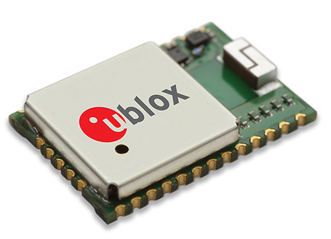
u‑blox has introduced the CAM-M8Q GPS/GLONASS/BeiDou/QZSS antenna module. The module integrates a u-blox M8 satellite receiver IC plus SAW filter, LNA, TCXO, RTC, passives and a pre-tuned GNSS chip antenna in an ultra-small 9.6 x 14.0 x 1.95 mm package. The new module requires only a power source for reliable and accurate satellite positioning anywhere in the world.
Combining low power consumption with high-sensitivity, high jamming immunity and concurrent GNSS operation (GPS/GLONASS, GPS/BeiDou, or GLONASS/BeiDou) the surface-mount CAM-M8Q provides a drop-in solution for satellite positioning in an ultra-small form factor, u-blox said.
“Our u-blox CAM-M8Q is perfect for customers designing highly compact products who want to speed up product development while freeing resources for core activities,” explains Thomas Nigg, vice president of product marketing at u-blox. “The CAM-M8Q is a pre-tuned, performance and cost optimized module providing satellite positioning on an extremely small footprint. It is literally an ‘instant’ positioning solution.”
The u-blox CAM-M8Q module is designed for a wide range of applications such as personal locators, handheld navigators, and wearable electronics as well as vehicle telematics systems used for emergency call, anti-theft, insurance and road pricing. Consistent omni-directional antenna performance helps ensure excellent performance regardless of module orientation.
In addition, the CAM-M8Q allows the internal chip antenna to be used as a backup antenna if the design incorporates an external antenna. This benefits companies where there is a risk that the primary external antenna may malfunction or suffer damage, for example in vehicle tracking systems where damage is possible to the external antenna.
The CAM-M8Q module uses the latest u-blox M8 GNSS receiver chip qualified according to AEC-Q100 and is manufactured in ISO/TS 16949 certified sites. Qualification tests are performed as stipulated in the ISO16750 standard: “Road vehicles – Environmental conditions and testing for electrical and electronic equipment.”
The CAM‑M8Q is form-factor compatible to predecessor modules UC530 and UC530M, allowing the upgrade of existing designs with minimal effort.