Category: Mobile

  • BlackBerry Launches Z10 and Q10, Maps App Questionable

    BlackBerry Launches Z10 and Q10, Maps App Questionable

    BlackBerry (formerly RIM) has announced the release of its highly anticipated BlackBerry 10 operating system, as well as its first BlackBerry 10 smartphones, the Z10 and Q10, which come outfitted with assisted, autonomous and simultaneous GPS and with a Blackberry Maps application preloaded. One reviewer, however, has said the Blackberry Maps application is “worse than Apple Maps.”

    Issues listed include lack of street view or satellite view, lack of public transit directions, and no way to look up news and reviews of venues based on Yelp, Zagat, or a similar service. Another reviewer said, “Although full details of BB10’s map app have yet to be revealed, early reports are mixed. Although it now includes turn-by-turn directions, those who have had an opportunity to try it describe it as basic and underwhelming.”

    A TIME magazine review said, “The consensus among BlackBerry Z10 reviews is that its Maps app is subpar. The Verge complained about inaccurate data, and said the software couldn’t reliably find local businesses. CNet bemoaned a lack of features, such as walking directions, transit maps and street views. Apparently the software doesn’t even let you jump into the Maps app by tapping on an address or map in the web browser. That’s just basic stuff. At least the Maps app includes voice-guided turn-by-turn directions.”

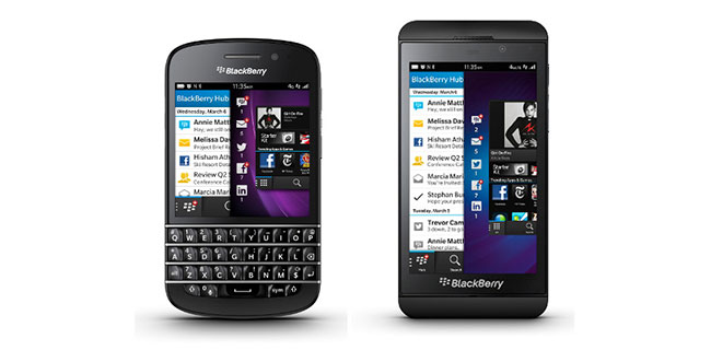
    The Z10 is equipped with a 4.2-inch touchscreen and the Q10 has a 3.2-inch handset with a Blackberry’s physical keyboard. Besides GPS, the phones have 4G connectivity, Bluetooth Smart and NFC connectivity. The use of Bluetooth Smart in the BlackBerry 10 platform will open it up developers who will be able to take advantage of a growing market of connectable devices such as health and wellness monitors and sports and fitness monitoring equipment, in addition to other devices such as home automation equipment that also uses Bluetooth Smart. According to the IHS study “Wireless Opportunities in Health and Wellness Monitoring – 2012 Edition,” more than 69 million Bluetooth low energy health and sports monitors will ship between 2012 and 2017.

    Phillip Maddocks, market analyst at IHS, states, “By incorporating Bluetooth Smart into the BlackBerry 10 platform, BlackBerry will be able to provide a platform that is renowned for its enterprise use, in addition to meeting casual users needs who might want to use their device to monitor their health or sports performance, or in some instances, turn a light off inside their house using their phone. Several sports and fitness vendors such as Nike, Polar, Garmin and Wahoo Fitness have already either released or announced products that utilize Bluetooth Smart.”

    BlackBerry has followed a trend set by other smartphone manufacturers on the hardware side by providing up-to-date connectivity, in addition to providing 4G support and support for future mobile payment platforms. Near Field Communication was previously included within the BlackBerry Bold 9900/9930 and enabled users to make payments using their smart phone. Other platforms such as Android have also been offering the same functionality, utilizing Google Wallet on NFC enabled phones. According to IHS, more than 75 million NFC enabled cellular handsets were shipped in 2012, and with today’s announcement, and the expectation that other major phone manufacturers incorporate the technology, this will continue to grow.

    BlackBerry’s announcement brings its handsets in line with where the industry is heading, despite being delayed, and later to the market than expected.

  • Symmetricom Delivers Precise Time to Next-Generation Smart Grid

    Symmetricom, Inc., a precision time and frequency technologies company, today announced a new timing solution that meets the stringent microsecond accuracy requirements of Smart Grid substations. Specifically designed for substation operations, such as wide area measurement systems, traveling wave fault locators and sampled values, the Symmetricom SyncServer SGC-1500 Smart Grid Clock offers power utility companies accurate, secure and reliable timing and synchronization for their mission-critical operations. This means companies like Pacific Gas & Electric (PG&E) will be able to mitigate outages with real-time monitoring for grid stress, frequency instability, voltage instability and reliability margins.

    The Smart Grid has brought about power technology advancements that fundamentally change substation operations. Power equipment and their data networks are shifting from simple, reactive control and reporting to proactive, real-time management and operations control, making advanced synchronization and timing more critical than ever, according to Symmetricom. The SGC-1500 Smart Grid Clock is designed to address this need, enabling power equipment to operate more efficiently and closer to its operational limits. For example, one microsecond accuracy is required by the phasor measurement unit (PMU) for real-time network situational awareness and overall operational efficiency. Without accurate time stamps, PMU data has limited value. For power utility companies, that translates into enhanced network utilization rates as well as smarter management and mixing of renewable and traditional power sources.

    “Power and utility companies are increasingly looking to source the latest technology innovations in order to modernize their infrastructure,” said Greg Neichin, executive vice president, Cleantech Group. “Over the past three years, we have tracked more than $700 million in venture investment committed to companies developing smart grid products. These are all data-intensive applications that will rely heavily on precise timing and synchronization, as well as more advanced analytics to process these vast streams of new information.”

    “The Smart Grid architecture and related standards require a new approach to timing distribution across the overall network,” said Manish Gupta, vice president of marketing and business development for Symmetricom. “Symmetricom brings extensive experience in delivering precise time to the communications, government, and enterprise markets. Serving the power utility telecom network over the past 10 years, Symmetricom is ideally positioned to meet the emerging timing requirements of the Smart Grid.”

    The SyncServer SGC-1500 meets key requirements of Smart Grid substations, including:

    • Microsecond accuracy and resiliency — referencing GPS satellite signals, the Symmetricom Smart Grid Clock distributes timing with microsecond accuracy over the local area network (LAN) using the IEEE 1588 v2 Precision Time Protocol (PTP) Power Profile or IRIG-B time code.
    • IEC 61850 — the International Electrotechnical Commission’s (IEC) standards for the design of electrical substation automation, which requires microsecond timing to identify and mitigate a potential fault condition in real time. This standard also identifies important electrical hardening requirements for substation environments.
    • NERC CIP ― the North American Electric Reliability Corporation (NERC) reliability and security standards for Critical Infrastructure Protection (CIP), which calls for high strength security protocols.

    The SyncServer SGC-1500 comes with additional industry leading capabilities such as a built-in IEEE 1588 v2 Telecom Profile input option. This enables the Smart Grid Clock to derive time from the communications wide area network (WAN), thus eliminating the need to have GPS at every substation and PMU. The Rubidium atomic clock option offers holdover capability in the event of GPS disruption. These options result in a highly cost effective and resilient solution for power utilities.

  • MediaTek Announces Multi-GNSS Receiver SoC Solutions Supporting Beidou

    MediaTek Inc., a fabless semiconductor company for wireless communications and digital multimedia solutions, today announced the availability of its MT3332/MT3333, a 5-in-1 multi-GNSS receiver system-on-chip (SoC) that support the Beidou Satellite Navigation System. The Beidou system has been commercially operational since the end of 2012, and can identify a user’s location to 10 meters (33 feet), their velocity to within 0.2 meters per second, and clock synchronization signals (one-way) to within 10 nanoseconds.

    The MediaTek MT3332/MT3333 can discover GPS, Beidou, GLONASS, Galileo and QZSS constellations. Featuring a multi-GNSS receiver design, the MT3332/MT3333 can reduce the cumulative distance and positioning error accumulated over time/multiple hops, and significantly improve navigation/positioning accuracy, MediaTek said. The MT3332/MT3333 also comes with excellent signal acquisition and tracking sensitivity, which efficiently enhances signal quality within dense cities, tunnels and multi-storey car-parks, while delivering a better user experience, the company said. Moreover, because of its highly integrated, low-cost and ultra-compact system architecture, the MT3332/MT3333 enables multi-GNSS receivers with the same reference board for mobile, industrial and automotive navigation applications.

    “The proliferation of LBS (location-based services) using mobile applications over wireless networks such as social check-in or nearby service recommending is driving demand for greater satellite navigation performance and coverage beyond existing technologies. This will also lead to the rapid adoption of multi-GNSS receiver solutions in smartphones, tablets and automotive vehicles because LBS is now an indispensable way for people to interact/communicate with each other on a daily basis,” said SR Tsai, general manager of the Wireless Connectivity and Networking Business Unit at MediaTek. “We believe the market for Beidou-compatible multi-GNSS receivers in China will accelerate in the coming years. MediaTek will deliver new products that offer high value and are capable of meeting the evolving needs of our customers in the Beidou navigation system market through continuous product innovation. The MT3332/MT3333 [models] are designed to accelerate the realization of satellite navigation services anytime, anywhere, in a seamless fashion.”

    The MT3332/MT3333 also incorporates MediaTek’s unique “AlwaysLocate” technology that can identify the state in which the user is (regardless of on-the-go or sleeping) and automatically adjust the satellite signal receiving modes for more accurate and reliable navigation services, and to save the battery power of the navigation system.

    The MediaTek MT3332/MT3333 is now in mass production stage and being designed into major satellite navigation systems and mobile communication platforms worldwide.

  • GPS Vibrating Belt Guides Cyclists

    A new vibrating navigator belt guides cyclists by tickling them with buzzes and with directional nudges, according to a report by NDTV Gadgets.

    The “vibrobelt,” proven successful in early tests, uses vibrating actuators that indicate left, right, backward and forward turn directions. Developed by Haska Steltenpohl of the Intelligent Systems Lab at the University of Amsterdam, the Netherlands, the system aims to give cyclists a “heads-up” navigator, allowing them to keep their eyes on the road after they have chosen their destination on a GPS smartphone.

    The researchers plan to reveal their system and research results at the annual Intelligent User Interfaces conference in Santa Monica, California, in March.

  • u-blox 3G module certified by Korean’s SK Telecom

    u-blox, the Swiss positioning and wireless chip and module company, has received approval for its LISA-U110 UMTS/HSPA wireless module from SK Telecom, Korea’s largest mobile telecom operator with more than 50 percent market share. SK Telecom provides multimedia services and connectivity to 24 million customers throughout South Korea.

    The certification allows the LISA modem to be used in a wide range of consumer and M2M applications operating over SK Telecom’s nation-wide 3G network including vehicle infotainment, supply chain management, industrial automation, metering, security, and location-based services.

    “We are very pleased that SK Telecom has chosen to work with us on this 3G approval. Our compact and high-speed LISA 3G module is a perfect fit with their strategy to provide converged wireless services supporting entertainment, business and financial applications. Our local support in Korea was a key factor in obtaining this certification” said Samuel Ji, u-blox Country Manager, Korea.

    The LISA-U110 is an embedded wireless UMTS/HSPA module delivering high data rates in 3G networks intended for consumer, automotive and industrial applications. For telematics applications, the series provides easy integration with u-blox GPS, GLONASS and QZSS receivers.

    LISA modules come in SMT form factor and have a very small footprint, allowing easy mounting on any application board. The LISA form factor enables easy manufacturing, u-blox said, as well as simple migration from u‑blox’ GSM/GPRS modules. Support for A-GPS and u-blox’ CellLocate positioning technology is embedded to facilitate advanced telematics applications including indoor positioning.

    Features include compatibility with quad-band GPRS/EDGE, low power (idle mode less than 2 mA) and operating temperature -40 to +85 deg. Celsius. RIL software for Android and Embedded Windows is available free of charge.

    LISA modules are manufactured in ISO/TS 16949 certified sites and are fully qualified according to ISO 16750 — Environmental conditions and electrical testing for electrical and electronic equipment for road vehicles to provide high durability and reliability.


  • CES Continues to Showcase Connected Car Products

    Kevin Dennehy
    Headshot: Kevin Dennehy

    CES is big, loud and happens every year. For the past three or so years, the largest tradeshow in the United States has become a showcase for automobile manufacturers’ product rollouts…which is a far cry from the traditional car stereos and mega-huge flat-screen TVs you see walking the several football field-sized show floors. CES may not be everyone’s idea of a good time — hotels are expensive, you can’t get a cab as lines are a quarter-mile long, and much of the action for location may not even be in the show itself anymore. But it would be hard to say it’s a boring week.

    The Consumer Electronics Show in Las Vegas had lot of everything: 150,000 people, nearly 3,300 exhibitors and almost 2 million square feet of exhibit space. What it didn’t have was a ton of location-based services news.

    Most of that action came at off-site meetings such as the AT&T Developer’s Summit and other venues. Still, a lot of auto manufacturers, partnered with the wireless carriers, use the nation’s largest trade show as a launching pad for infotainment units that feature two-way connectivity.

    This connectivity will be important for hybrid navigation, both automotive and fleet management users and service providers who want the best of both worlds, said Kim Fennell, deCarta president and CEO. “[This means] off-board search and navigation to get real-time content, traffic, search along a route for current information such as parking spaces near a theater, as well as proper on-board capabilities when no wireless connection is available,” he said. “Companies ‘talk’ a good story, but the ability to do real hybrid is difficult technologically and so this conversation will gain prominence [this year].”

    Ford and GM both touted their developer programs at CES. Ford’s developer program allows users to work with SYNC and AppLink application programming interface. GM plans to offer developers an SDK.

    At CES, not a lot of new handsets were launched, as many manufacturers use their own events or other trade shows for launch. One of the biggest trends of 2013, Fennell believes, is the movement by handset manufacturers to launch their own LBS apps and services. “Of course, Apple made a mess of it — and the result is that companies now recognize that geospatial is hard to do…well,” he said. “This will get some companies to back off doing their own, while it will get others to continue, but with more care and attention to what it takes to do it right.”

    CES always announces what companies think is going to be the next big thing. Unfortunately, consumers sometimes don’t always agree. A year ago, the big deal was Ultrabook computers, which were supposed to be the one-up to tablets and smartphones, but lackluster sales have diminished that fledgling market.

    Two years ago, the big thing was 3D TV, which turned out to be expensive and lacked content. “3D is overblown. Not at scale yet,” Fennell said.

    Maybe the PND Isn’t Dead Yet

    The lag in portable navigation sales and the rise of the smartphone as the navigation platform of choice signaled that maybe the end was near for PNDs. In fact, many companies said consumers would rather pay the extra money for manufacturer-installed infotainment products with two-way connectivity than a PND.

    This means that PNDs couldn’t traditionally receive current traffic, weather or new driving information on roads, restaurants and other services.

    To start competing with the auto manufacturers, at CES such companies as Magellan rolled out PND models with Bluetooth that connects to a customer’s smartphone. The $249 SmartGPS uses a consumer’s cell phone data connection to receive social and LBS. It will soon offer Foursquare alerts and Yelp restaurant reviews.

    Another PND giant, TomTom, partnered with Telenav at CES to provide its Live Traffic service to Telenav, which makes Scout, an application for iPhone, Android and Windows mobile devices.

    In other CES news:

    • Garmin rolled out the K2 platform, a customizable unit that offers digital displays, voice control, infrared buttons, and smartphone integration. The unit features navigation, vehicle diagnostics, music and real-time information.
    • Subaru introduced Starlink, a new in-car connectivity product. The unit includes Aha by HARMAN integration that allows drivers to access tens of thousands of stations of Web-based content, from radio stations, podcasts, and weather sites to social media feeds.
    • Chrysler upgraded its Uconnect infotainment system with dealer-activated navigation, which allows Chrysler Group dealers to activate the navigation functions in vehicles equipped with certain systems.
    • One question mark at CES was the absence of Microsoft, which didn’t exhibit for the first time in years. In years past, reporters would stand in line to listen to Bill Gates, who usually opened the conference with a speech or product roll-out the day before.

    End of an Era

    One of the pioneer companies to integrate GPS into wireless devices, as well as take a big chunk of the enterprise market has been sold. As GPS World reported, Princeton, N.J.-based ALK Technologies was purchased by Trimble for an undisclosed figure.

    ALK’s transportation, logistics and mobile workforce products are going to Trimble’s Transportation and Logistics division. No word about what is happening to ALK’s consumer products.

    ALK’s two flagship products, CoPilot and PC Miler were sold in North American and overseas. Approximately 64 percent of North American for-hire motor carriers use ALK products, the company said.

    ALK Technologies founder and long-time industry veteran, Alain Kornhauser, said last year that location markets had been good for the company. The company’s CoPilot Live had been seeing good sales in Europe, he said.

    Kornhauser was a dynamic speaker at the GPS-Wireless conference for 13 years, informing and enraging attendees alike with his great quotes. One favorite:  “Telematics is a Stalinist term.”

    Barry Glick, former MapQuest executive who was hired in 2011 as CEO, ran the company’s day-to-day operations. In December 2012, ALK established a new group, Enterprise Solutions, which combined its PC Miler, CoPilot Truck and CoPilot Live Professional Product lines plus supporting map data, software tools and professional services.

  • GPS Pill Bottles to Be Placed in NYC Pharmacies

    Take two in the morning and we’ll catch up with you.

    Pill bottles fitted with GPS trackers are going to be used by the New York Police Department to combat the theft of painkillers and other addictive prescription medicines, according to the Associated Press. Pharmacies will be asked to hide the GPS bottles amid the legitimate supplies on their shelves. If stolen, the “bait bottles” could help investigators track stolen drugs and locate suspects.

    The plan will be unveiled today at a La Quinta, California, conference on health issues hosted by former President Bill Clinton’s foundation, the AP reports.

    The GPS bait-bottle initiative is an effort to curb crimes associated with the black market for prescription drugs. Similar attempts to track prescription drugs on a limited basis have been undertaken before, but the NYPD said this would be the first widespread effort.


  • Connectivity and In-Vehicle Apps Highlights of CES

    Consumer Electronics Show 2013 (CES) was all about the hot pursuit of the in-vehicle dashboard by mobile advertising, content, and electronic providers. In the race to distinguish their models by adding more apps and connectivity, automakers are making it easier for apps to talk to cars. Automakers also showcased autonomous vehicles, including a self-driving car; and Inrix has made finding parking spaces easier. But CES isn’t the only place making news. The mapping battles, of course, continue, and the European Parliament is considering privacy measures that would make it difficult for digital content and service providers to subsist on ad revenue.

    CES wasn’t about the wireless carriers or the handset makers. Not wanting to be left in the dust of the Google driverless car, Audi jumped on the bandwagon and is focusing on piloted driving and parking technology. Audi introduced self-driving car technology that it claims will enable a car to seek out a parking space in a garage and park, all without a driver. Audi received the second license from the State of Nevada to test autonomous vehicles on the state’s public roads. Google was the first company to obtain a license, and Audi has acquired the first license by a car maker. Toyota is taking a different tack and is focused on providing intelligent pre-collision systems, and not a car that drives itself, but may eventually do so.

    Park your car? INRIX, known for traffic data, announced a parking service that provides real-time information on the number of available spaces at off-street parking locations, as well as current parking fees. The parking database includes more than 18,000 parking facilities in North America and 42,000 in Europe (36 countries). The data are sourced from ParkMe (formerly Parking in Motion) and Parkopedia.  Kenwood will include INRIX parking in new in-dash DVD entertainment receivers, along with INRIX real-time traffic information, fuel and weather services.

    Have you programmed a Ford Lately? Ford continues to lead in-vehicle mobile connectivity. The company has further opened up APIs to make it easier for developers to access in-car controls and the vehicle display. Those that want to share from the road are in luck. Ford has also added a location-sharing app from Glympse. With the Glympse smartphone app and Ford SYNC AppLInk, drivers can share their whereabouts or estimated time of arrival via a real-time dynamic map. Glympse also has a partnership with Mercedes Benz.

    Bump in the road for contextual advertising? Companies that depend on mobile and online advertising in the European Union (EU) may be in for a tailspin. EU Europeans may have the strongest control of their online identities if a bill is passed by the European Parliament to overhaul data protection laws. Web tracking and profiling would not be allowed without consumer consent. With app and content providers depending on personalized advertising to provide revenue, alternate means of revenue would be needed as many consumers will be reticent. We’d see a return to a more subscription-based world and a smaller industry. The proposal, if approved, would create a European Union agency charged with enforcing a full series of privacy measures to give Internet users greater control of online information. The agency would be empowered to levy fines of up to two percent of a company’s revenue.

    Update on the patent wars.  Industry is falling over itself in pursuit of intellectual property. Although it is about the quality and not size, patent numbers are revealing. IBM was granted more patents in 2012 than any other company, the 20th year the company has taken first place.  Archenemies Google and Apple posted the biggest increases in 2012, but were trounced by another rival, Samsung, who was second to IBM with more than 5,000 patents granted last year. Apple was awarded 1,236 patents in 2012, 68 percent more than the preceding year. Google posted a 170 percent jump in patents granted in 2012, with 1,151 patents. Google and Apple will continue to rocket fuel their intellectual property collection with acquisitions.

    Turn at which Starbucks?  Garmin unveiled a range of new personal navigation devices (PNDs).  The new products include Natural Guidance from Navteq, re-branded as “Real Directions.” Directions include recognized landmarks, buildings, traffic lights and stop signs. On some models, traffic information and alternate routes are provided by voice.

    Mapping skirmish. Google has been reportedly blocking Windows phones from using Google Maps from Microsoft’s Internet Explorer (IE) browser in a ploy to convert IE users to Google Chrome. Microsoft cried foul and Google provided a flimsy excuse of compatibility issues and reversed course.

  • Intersec and Alcatel-Lucent in Geo-Targeting Partnership

    Intersec, which provides software for mobile and integrated operators, has signed a global partnership agreement with Alcatel-Lucent for the creation of a geo-marketing service that will enable mobile operators to connect brands and retailers to consumers via mobile devices, based on their permission, preferences and location, to drive in-store traffic.

    Intersec’s IGLOO collects and aggregates “anonymised” network data (circuit switch, packet switch, Wi-Fi, indoor location) in real time to provide proximity detection of all opt-in subscribers at a defined moment of the day. Alcatel-Lucent’s Optism then gathers and analyzes the location data to provide customers with relevant offers to drive in-store traffic. The companies say the cross-operator solution will enable multiple brands and retailers in several countries to deliver walk-in rewards, location-based targeted coupons and deals and post shopping surveys. Optism is deployed in 10 markets.

    “In order to expand to geo-based offers and coupons, we were looking for a device-agnostic solution that was able to aggregate all of the location data that the network was seeing, both passive and active sources, both for in-store as outdoor proximity campaigns,” said Thomas Labarthe of  Alcatel-Lucent. “By integrating Intersec IGLOO into Optism, brands and retailers can leverage all the existing Optism tools to define their campaigns including location as qualification criteria.”

  • Magellan Personal Nav Integrates Cloud, Social Media, Real-Time Location Data

    Magellan has announced the Magellan SmartGPS, a GPS device based on navigation integrated with social, local and mobile content, including Yelp and Foursquare, through Magellan’s cloud-enabled Smart Ecosystem. The Magellan SmartGPS navigation device wirelessly syncs the user’s navigation data, such as favorite places and contacts, with a smartphone or personal computer. The device intelligently delivers stored and dynamic location-based information to the GPS display that is personalized to the driver’s locale.

    “Magellan pioneered the GPS navigation industry, and in today’s socially driven world, we recognize that consumers want and need a much more comprehensive navigation solution that surpasses what traditional GPS devices and smartphones can offer,” said Peggy Fong of MiTAC Digital Corporation. “We engineered our cloud-based Smart Ecosystem and SmartGPS device from the ground up to deliver an innovative SoLoMo experience to consumers who desire discovery, relevance and local awareness combined with navigation. Additionally, the Smart Ecosystem is architected to integrate with automotive infotainment and mobile network service platforms.”

    The Magellan SmartGPS communicates with Magellan’s custom-built Smart Ecosystem, a cloud platform for a database of constantly-updating, location-relevant social media and navigation content that is automatically pushed to the SmartGPS display to create a unique driving experience, the company said.

    Magellan SmartGPS users can simultaneously view maps, navigate, and see reviews, tips and offers from Yelp and Foursquare for nearby restaurants, stores and services, plus navigate to those locations without needing to use an additional device or application. As a vehicle progresses on its route, the SmartGPS accesses the cloud-based Smart Ecosystem to deliver a variety of location-relevant information “squares” that are displayed on the SmartGPS screen and graphically flip between service establishments in the vicinity. When the user taps on a square, detailed profile information is displayed including the address, phone and any available special offers or consumer reviews, plus an icon to navigate to their selected destination. In addition, the SmartGPS delivers current gas prices in the vicinity, weather, traffic events and speed camera warnings.


  • Skyhook, Philips Lifeline Develop Location Platform for Emergency Response

    Skyhook and Philips Lifeline have announced a collaboration to incorporate Skyhook’s hybrid location positioning platform into Philips’ Lifeline GoSafe mobile personal response services. Skyhook’s hybrid location service will be part of a suite of locating technologies used with the new GoSafe system and designed to help provide the call center with the location information needed to support locating of users in the event of an emergency.

    “Accurate location information is of critical value to ensuring the quick dispatch, arrival and delivery of what is often life-saving assistance,” noted Rob Goudswaard of Philips Home Monitoring. “After reviewing the market, we concluded that Skyhook’s location network and technology capabilities were consistent with our requirements for enabling timely and accurate response.”

    “If an individual experiences a fall or other emergency, quickly getting help to the right location is of vital importance,” said Michael Shean of Skyhook. “Skyhook is proud to partner with Lifeline, the leading medical alert service, in order to enhance the safety and care that Lifeline provides to all of its customers.”

  • GPS Plotter iPhone App Enables Quick Plotting

    GPS Plotter makes it easy to plot longitude and latitude coordinates using iPhone, according to app developer Make It Digital. Using the mobile phone’s in-built GPS system, users can plot their current location at the touch of a button. Multiple sessions can be used to create maps plotting anything, and easy export of longitude and latitude coordinates is made possible by utilizing the universal CSV data format.

    GPS Plotter is designed for:

    • Orienteering
    • Outdoor wayfinding
    • Tracking unmarked trails
    • Detailing longitude and latitude on the move

    The app is available for 69p ($0.99 US) in the App Store and is compatible with iPhone 4, 4S and 5 running iOS 5 or later.