Radius Telematics has seen a big increase in the thefts of commercial vehicles since the coronavirus lockdown. With many offices, factories and construction sites unattended, thieves appear to be taking advantage of unattended locations.
According to Radius, vehicles and plant not equipped with GPS security devices that detect and track unauthorized movement are especially vulnerable as the thefts may go unreported for many days or even weeks.
Radius Telematics acquired two companies in 2019 that had a substantial proportion of their business in vehicle and plant security — both are reporting significant spikes in thefts.
Radius Telematics encompasses telematics brands Kinesis, UK Telematic, Plant-I, Sure-Track, CyntrX and Key Telematics. Altogether, Radius companies track more than 250,000 vehicles across the globe, with security devices fitted to 27,000 assets ranging from generators to vans, mini-diggers and earth moving trucks.
Many are equipped with Theft Recovery Trackers, small covert wireless devices with movement and tamper alarms. Once activated, the asset is automatically tracked to ensure that stolen assets are recovered quickly and efficiently.
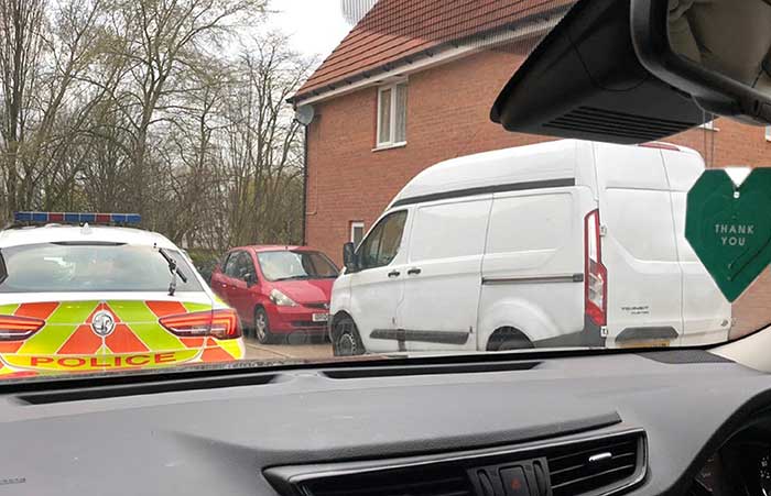
“From security tracker alerts, we have seen a doubling in plant and van theft since the lockdown began,” said said Greville Coe, managing director of Radius Telematics. “It’s incredible that when we are all self-isolating and worrying about a deadly virus, crime is being committed while people and organizations are so vulnerable.”
Photo: Radius Telematics
One particularly disturbing theft was of a van stolen from a hospice for the terminally ill. The incident in Coventry, UK, saw a property belonging to a hospice ransacked and the theft of a hospice van. Fortunately, the vehicle was fitted with a Sure-Track tracker previously donated by Radius Telematics and the vehicle was safely recovered after three days. The Wireless Theft Recovery Tracker allowed the Radius nationwide finder network to accurately track the movements and whereabouts of the stolen vehicle.
“It’s shocking that thieves would target a charity caring for the terminally ill in what is an exceptionally difficult time,” Coe said. “Radius Telematics tracking services remain fully operational irrespective of the travel and business restrictions imposed due to the Coronavirus crisis. We hope we can help to ensure that essential services can be delivered with minimal disruption.”
Radius Telematics is a newly branded group formed within Radius Payment Solutions. The new telematics division incorporates a number of telematics-related businesses including their own Kinesis-branded vehicle tracking and previous acquisitions including Plant-i, UK Telematics and Sure-Track.
In times of global crisis, the world relies on the trucking industry to transport essential items across the country. From medical supplies to restocking the shelves at local grocery stores, truck drivers play an integral role in maintaining the supply chain.
To keep these essential items moving during the COVID-19 crisis, the U.S. Department of Transportation (DOT) has suspended most of the Hours of Service (HOS) regulations for trucks that are transporting these essential goods.
Commercial truck drivers have had their driving hours extended from 11 to 14 hours depending on the goods being carried. With so much going on and so many depending on trucking and freight transportation organizations during this global crisis, fleet managers and owners need to be extremely organized to handle current and future industry needs.
With that in mind, here are a few ways in which you can keep track of your fleet during a time of heightened demand and uncertainty.
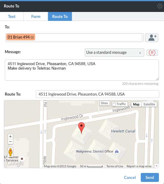
The “Route to” feature in Director. (Photo: Teletrac Navman)
Communication is key
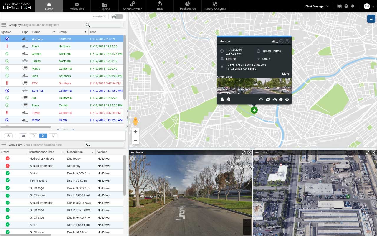
The visibility that essential telematics technology brings can be incredibly helpful. Being able to stay in constant communication with your drivers via messaging and dedicated contact forms — as well as knowing their locations at all times — allows fleet managers to make informed decisions. With things being so hectic right now, knowing where your assets are, who is available for the next load, who is nearest to the depots, and who has encountered longer detention times is critical in a time when efficiently maintaining your fleet on the road is more important than ever.
Most likely due to shelter-in-place orders reducing the traffic overall, many of the states experiencing the highest level of COVID-19 spread are seeing a reduction in travel times for drivers. According to the American Transportation Research Institute (ATRI), freight trucks are clocking faster times overall in these areas, particularly in regularly congested areas.
That being said, because of additional route changes, border regulations and detention delays, freight is taking much longer to transport. Having access to accurate telematics and open lines of communication with drivers will be key in planning and tracking routes.
Documentation should continue
While logs are not mandatory to be kept while under the Federal Emergency Declaration, continuing to make notes and annotate the daily log with the reason for non-compliance is a good practice. This will make sure that logs are current when the Emergency Declaration is lifted. It’s a good idea to integrate a route planner or add-on the service if it isn’t included by your telematics provider to facilitate the planning of loads and tasks. With so much on the fleet manager’s plate and the additional hours drivers are logging, any opportunity for automation should be embraced.
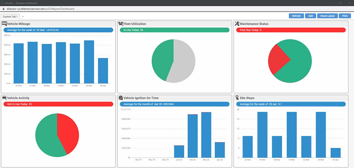
The Dynamic Dashboard of Director. (Photo: Teletrac Navman)
Driver safety
For all fleet managers, the safety of your drivers should be the top priority. DOT HOS regulations are there for a reason. The guidelines, of course, are there to make sure that drivers are not being overtaxed, reducing the possibility of accidents. Giving your team ample time to rest before taking the next load is imperative.
And while its required that drivers receive at least 10 consecutive hours off if they let their company know they need immediate rest, they may be inclined to push themselves given the current situation, feeling a responsibility to their fleet manager and the community at large.
Plus, with people practicing social distancing, it’s likely there will be an uptick in eCommerce purchases, adding additional strain to fleet capacity. A fleet tracking tool will allow managers to review driver’s time, how often they have completed a 14-hour shift, and allow for properly scheduled rest periods to avoid exhaustion and potential accidents.
Tracking rig maintenance
While drivers are putting in the extra miles, so are their rigs! Keeping track of oil changes, tire rotation and other regular maintenance items can keep your drivers and trucks safely on the road. While you may think a global crisis is not the time to stop for regular maintenance, these quick care items are much easier and more cost effective to complete than larger complications they could cause going unaddressed.
An oil change can help engines run more efficiently and reduce a fleet’s cost per mile. Taking time to examine tires could reveal a small leak or puncture which could lead to a popped tire on the road, leaving your driver stuck for hours or even cause them to lose control of the truck from the blowout. Addressing these regular maintenance items will boost efficiency and save time in the long run.
Invest in add-ons
During times of global crisis, the supply chain can change at a moment’s notice. Add-ons such as a brokerage provider integration can help keep the lines of communication open with your customers and help you keep track of where the loads are and when they will arrive. With demand high, and lives on the line while carrying freight like medical supplies, these up-to-the-moment notices can be key in providing your team and customers with the proper support.
Driving demand
There’s no doubt about it: the trucking industry is a key player in combating this global crisis. Delivering everything from medical supplies, to food to other eCommerce purchases for those in quarantine, the country is demanding quite a bit from our fleets.
By staying organized and using helpful telematics tools, fleet managers and owners will be able to meet this challenge with the knowledge they need to make smart decisions. Staying in constant communication with drivers and customers will also help manage expectations and make sure everyone is on the same page.
Marco Encinas, Senior Product Manager at Teletrac Navman, plans the product strategy and roadmap releases globally for all of Teletrac Navman’s software platforms. He gains industry insights from customers, integration partners and R&D to improve current Teletrac Navman product features and tools, and drive development of new product requirements. Before joining the Teletrac Navman team, Encinas planned product strategy and roadmap releases for both commercial and consumer product lines, developed sales training tools and product curriculum at Magellan GPS and Mitsubishi.
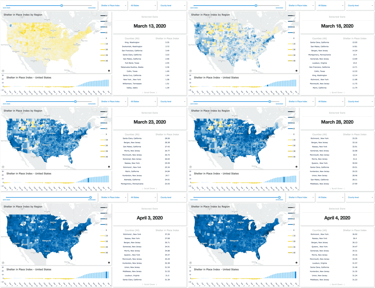
SafeGraph has launched a Shelter in Place Dashboard that enables users to visualize stay-at-home behavior for every county in the United States.
Image: SafeGraph
SafeGraph has also created and released two new datasets:
Weekly foot-traffic patterns
Social Distancing Index
The data is being provided at no cost to non-commercial entities.
“We currently have over 550 researchers, non-profits and government agencies in a Slack group using these new datasets,” said Evan Barry, vice president of marketing, SafeGraph. Academic and industry research articles based on the data are now published on the SafeGraph site.
New series of free webinars for construction, geopositioning and agriculture facilitate learning
Topcon Positioning Group is launching a free webinar program for the construction, geopositioning and agricultural sectors, exploring key topics affecting the industry and providing the latest updates and project management solutions.
The Topcon Talks series, consisting of numerous informative webinars, has been created in response to the ongoing COVID-19 pandemic and aims to provide those working from home with valuable educational resources, while maintaining steady communication with Topcon customers, dealers and the wider industry.
The webinars will focus on a range of topics such as improving productivity using digital construction workflows, overcoming barriers to technology adoption, and more practical how-to sessions for customers and dealers on specific Topcon solutions.
The webinars will be delivered by a range of Topcon experts, with input from several other industry specialists, and cover a multitude of topics including:
Always One Step Ahead – an overview of Topcon’s latest product developments, market focuses and acquisitions
State of the Industry series – looking at the barriers to technology adoption in construction, such as attracting talent and bridging the skills gap
Detailed technical sessions showcasing latest hardware, software and web services to get the most out of Topcon solutions
The content series is live on the site, with new sessions taking place regularly over the coming weeks. All sessions are free to attend, and those wanting to participate will first need to register on the Topcon website.
“Everyday life has changed very quickly, and businesses across the world are having to adapt. At Topcon, we are working tirelessly to help the industry weather this storm. We’re aware that at this time, the majority of people are working from home, and we want to continue to support our customers and colleagues as much as possible,” said Ron Oberlander, vice president of global professional services at Topcon Positioning Group. “That’s why we’ve developed this webinar series — to provide an opportunity for continued professional development so that professionals can remain as productive as possible during this challenging time and be in the best position possible to accelerate the industry’s recovery when we come out the other side.”
The webinars are also recorded and uploaded to the site once complete, so those who are unable to attend the session can access the content in their own time.
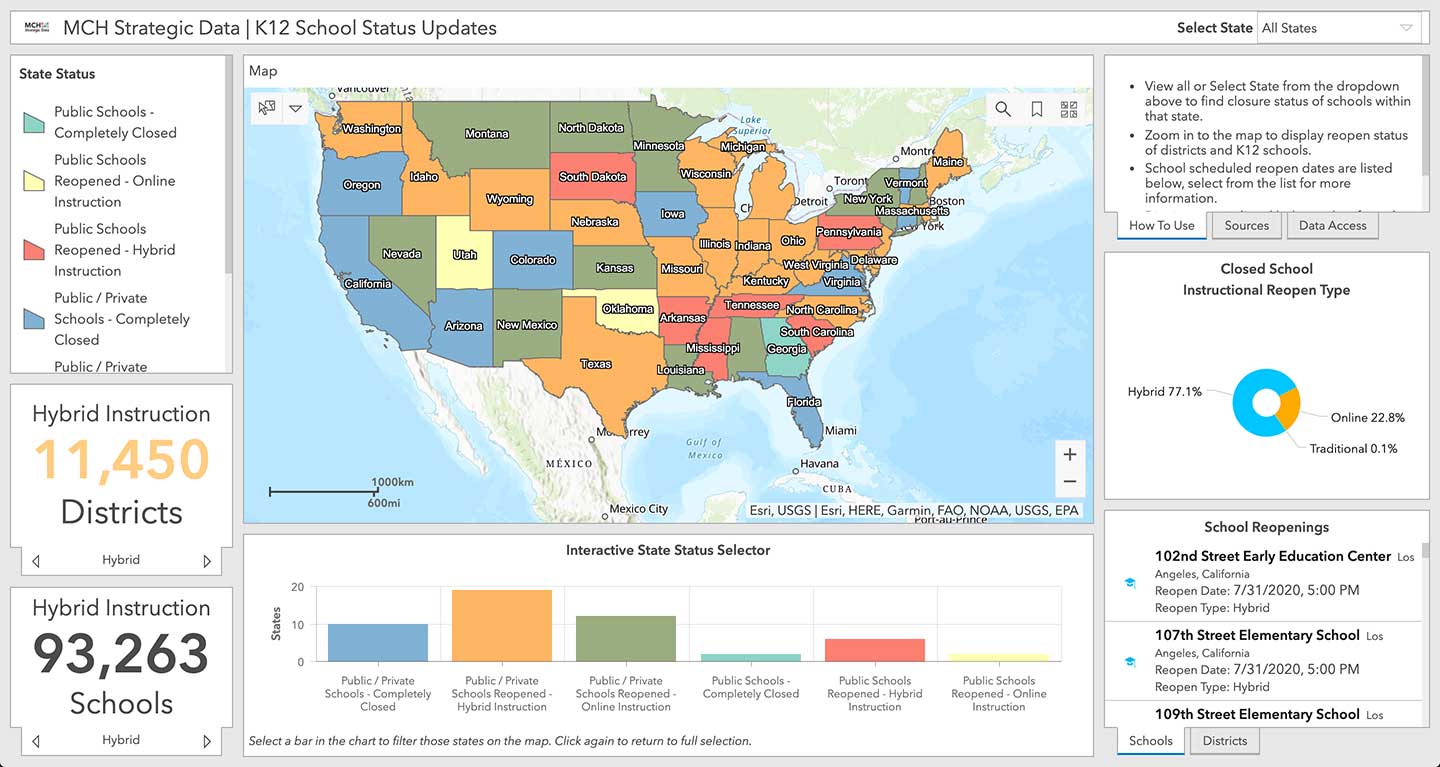
Location intelligence company Esri will be making data layers available on U.S. school closures during the COVID-19 pandemic, through a new partnership with MCH Strategic Data.
To help educational organizations as well as families across the nation better understand the situation in their communities, Esri and MCH have made school closure data accessible from a public dashboard.
Information on K-12 public and private schools include whether they are closed, plans for reopening school buildings, and the type of instruction they are offering during closures due to the epidemic.
MCH Strategic Data compiles and provides institutional information for the education, healthcare, government, and religious sectors.
“These datasets are useful for governments, school officials, and businesses providing leadership, resources, and community programs during the COVID-19 response,” said Ryan Lanclos, Esri director of public safety solutions. “But of utmost importance, this is a source of critical information for the community. It provides transparent and useful information that can help families develop a personal plan when they are feeling their most vulnerable.”
“Our customers depend on us to provide insight to the school market so they can respond effectively and appropriately during this challenging time,” said Kelly Holder, MCH chief information officer. “Our ability to rapidly compile and normalize changing data against our comprehensive U.S. database provides timely insight during an important time in the school planning cycle. This free map and database puts information into the hands of organizations who want to help schools and families now and in the coming months.”
As the COVID-19 outbreak has escalated rapidly across the globe, and with municipalities struggling to respond, MCH and Esri have built out additional resources like the MCH School Status Updates to help organizations quickly visualize and understand the current situation, as well as identify potential community risk areas when schools begin to open back up, and estimate the capacity needed to respond.
The Esri COVID-19 GIS Hub provides much of this essential data, along with case locations and social vulnerability, that communities and health organizations can use to inform their response.
For more information on Esri’s disaster relief support, visit esri.com/disaster.
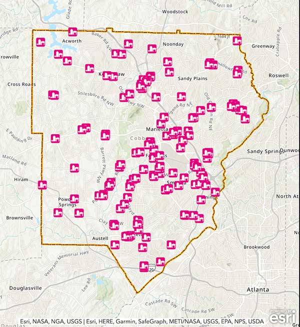
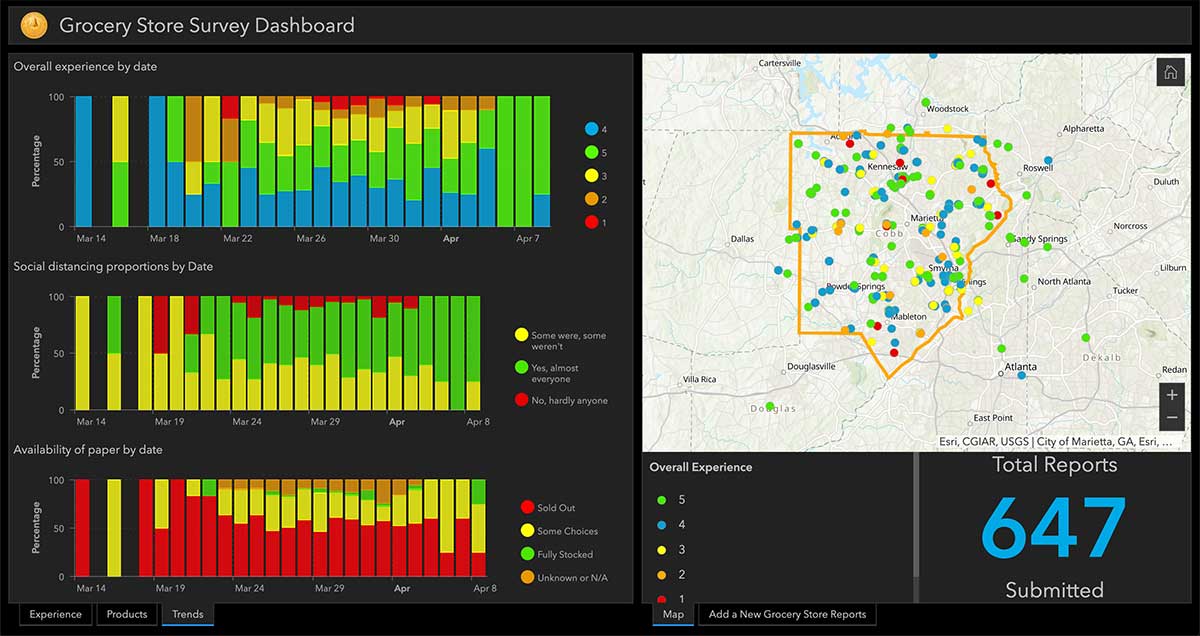
Cobb County, Georgia, is providing its residents with an app that tracks what grocery stores are stocking which essential goods, such as paper products, cleaning items and fresh produce.
The Cobb COVID-19 Grocery Stores and Inventory app gathers input from users, and the data is posted anonymously. Stores can be sorted by distance, senior hours and crowds. Cobb County is a suburb of Atlanta.
The Cobb County Geographic Information System (GIS) department created the app using Esri ArcGIS.
Raytheon Technologies Corporation announced the successful completion of the all-stock merger of equals transaction between Raytheon Company and United Technologies Corporation on April 3, following the completion by United Technologies of its previously announced spin-offs of its Carrier and Otis businesses.
Headquartered in Waltham, Massachusetts, Raytheon Technologies is one of the largest aerospace and defense companies in the world with approximately $74 billion in pro forma 2019 net sales and a global team of 195,000 employees, including 60,000 engineers and scientists.
Raytheon Company shares ceased trading prior to the market open on April 3, and each share of Raytheon common stock has been converted in the merger into the right to receive 2.3348 shares of United Technologies common stock (previously traded on the NYSE under the ticker symbol “UTX”).
Upon closing of the merger, United Technologies’ name has changed to “Raytheon Technologies Corporation,” and its shares of common stock will begin trading today on the NYSE under the ticker symbol “RTX.” United Technologies shareowners will continue to hold their shares of United Technologies common stock, which now constitute shares of common stock of Raytheon Technologies Corporation.
Raytheon Technologies has a large, talented workforce to address the rapidly evolving needs of customers globally. The combined company expects to introduce breakthrough technologies at an accelerated pace across high-value areas such as hypersonics, directed energy, avionics and cybersecurity.
In addition, Raytheon Technologies has a strong balance sheet and cash flows to support critical business initiatives, including company and customer-funded R&D.
“Raytheon Technologies brings together two companies with combined strengths and capabilities that make us uniquely equipped to support our customers and partners during this unprecedented time. We will also play our part in the war on the COVID-19 pandemic, including doing everything we can to keep our employees around the globe safe and well,” said Greg Hayes, CEO of Raytheon Technologies. “As we move forward, Raytheon Technologies will define the future of aerospace and defense through our focus on innovation, our world-class people and our financial and operational strength to create long-term value for our customers and shareowners.”
“Today, we introduce Raytheon Technologies as an innovation powerhouse that will deliver advanced technologies that push the boundaries of known science,” said Tom Kennedy, executive chairman of Raytheon Technologies. “Our platform-agnostic, diversified portfolio brings together the best of commercial and military technology, enabling the creation of new opportunities across aerospace and defense for decades to come.”
Structure and Leadership
Raytheon Technologies has four market-leading segments focused on high-priority areas for
customers. (Note: 2019 net sales are prior to intercompany eliminations.)
Collins Aerospace Systems specializes in aerostructures, avionics, interiors, mechanical systems, mission systems and power controls that serve customers across the commercial, regional, business aviation and military sectors. The segment is led by President Stephen Timm, headquartered in Charlotte, North Carolina, with approximately $26 billion in 2019 net sales.
Pratt & Whitney designs, manufactures and services the world’s most advanced aircraft engines and auxiliary power systems for commercial, military and business aircraft. The segment is led by President Chris Calio, headquartered in East Hartford, Connecticut, with approximately $21 billion in 2019 net sales.
Raytheon Intelligence & Space specializes in developing advanced sensors, training, and cyber and software solutions — delivering the disruptive technologies its customers need to succeed in any domain, against any challenge. The segment is led by President Roy Azevedo, headquartered in Arlington, Virginia, with approximately $15 billion in pro forma 2019 net sales.
Raytheon Missiles & Defense provides the industry’s most advanced end-to-end solutions to detect, track and engage threats. The segment is led by President Wes Kremer, headquartered in Tucson, Arizona, with approximately $16 billion in pro forma 2019 net sales.
Raytheon Technologies’ executive leadership team is comprised of Tom Kennedy, executive chairman, Greg Hayes, chief executive officer, and Toby O’Brien, chief financial officer. Additional leadership biographies are available on the company’s website.
Raytheon Technologies Investor Call
Raytheon Technologies will hold an investor call to discuss United Technologies and Raytheon Q1 results on May 7 at 8:30 a,m. The call details will be provided prior to the results announcement, and the call will be webcast on the Raytheon Technologies investor relations website.
Enables building stakeholders to take accurate measurements based on point clouds
The latest release of the NavVis IndoorViewer 3D building visualization software features a new tool that lets building stakeholders take highly accurate measurements based on point clouds in the realistic 360° image view.
NavVis, global provider of indoor spatial intelligence technology and enterprise solutions, announces the release of NavVis IndoorViewer 2.6. This major software release includes a new measurement tool that lets users take highly accurate measurements based on point clouds in realistic browser-based digital buildings.
This release also makes additional features available to structured e57 point cloud files, including automatically generating highly detailed floor plans and routing.
NavVis IndoorViewer is a popular deliverable among building stakeholders without the technical expertise to work with point clouds and modeling software, thanks to the realistic digital buildings and intuitive interface.
One of the features that has proven to be useful among users across multiple industries is the measurement tool. It enables users to take measurements remotely on any device, saving time otherwise spent traveling to the site.
The release of version 2.6 of NavVis IndoorViewer marks a major advance in the accuracy of virtual measurement tools. The tool has been redesigned to overcome two of the biggest problems with virtual measurement tools – accuracy and usability.
On the one hand, point cloud measurements are quite accurate. But often these software tools are not accessible or even usable for a wide range of building stakeholders who lack the expertise in working with point clouds. If, on the other hand, the tool uses images or even meshes, which are much more user-friendly than point clouds, the tools are usually not reliable enough to produce accurate results.
The new measurement tool in NavVis IndoorViewer combines the best of both worlds, thanks to a patent-pending magnifying feature that appears when taking measurements in the realistic 360° view. The magnifying feature reveals the exact section of the point cloud behind the image and lets users pick the point cloud point as the basis for a measurement while benefiting from the intuitive interface of the fully immersive walkthrough.
“When redesigning the measurement tool in NavVis IndoorViewer, we wanted to make sure that a wide range of stakeholders in every industry that works with built environments could benefit from the accuracy of point clouds when taking virtual measurements,” said Georg Schroth, NavVis CTO. “We are confident that the new magnifying feature in NavVis IndoorViewer achieves our goal. Now even stakeholders that are unfamiliar with point clouds have an easy, intuitive way to take measurements based on this highly accurate real world data.”
In addition to making strides in the accuracy of remote measurements, the interface of the tool has also been fully redesigned. This includes a new slider function that lets users view the 2D floor plan and 3D walkthrough side-by-side or move from one view to the other.
The dual view provides an overview of the entire building so that users can easily locate an asset or area while also viewing the location in the realistic 360° view. The fully immersive walkthrough makes it possible to virtually move through the area being measured or inspect the asset, as if the user were on site. Measurements being taken show up in both views.
The release of NavVis IndoorViewer 2.6 also introduces new feature support for e57 point cloud files captured by static scanners. Previous NavVis IndoorViewer releases have included a popular feature that lets laser scanning professionals upload structured e57 point cloud files and automatically generate realistic, fully immersive 360° walkthroughs that can be published and shared with clients as a web-based link.
With the release of NavVis IndoorViewer 2.6, two popular features that were previously only compatible with scan data captured by NavVis hardware are now available for point clouds uploaded as structured e57 files. The first is the generation of a navigation graph, which makes it possible to turn static scans into a fully immersive indoor routing tool. The second is the automatic generation of highly detailed floor plans. Now point cloud files uploaded as structured e57 files can be turned into digital floor plans in a few clicks.
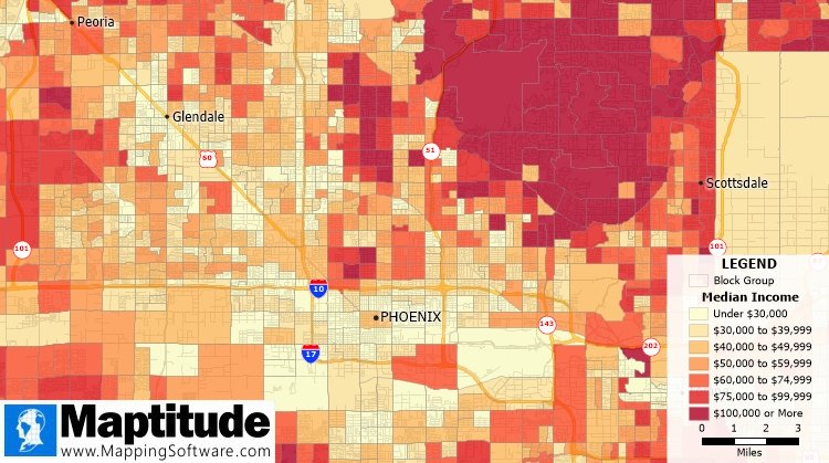
The Maptitude 2020 U.S. Census Blocks Groups data is now available for the entire United States, according to software provider Caliper.
The small-area Census Summary Level is packed with neighborhood information essential for making accurate geography-based decisions. Maptitude users can explore locations by income, income growth, daytime population, age, race, gender, ethnicity, buying power, occupation, employment status, housing characteristics, citizenship counts and more.
The wealth of data can be leveraged by data scientists and market research analysts using Maptitude mapping software, a comprehensive application for data exploration.
The 2020 Block Groups are priced at US$250 on the Caliper Store, and are also available as shapefile, KML, KMZ or GeoJSON for an additional fee. If you have any questions about Maptitude or data availability contact the Maptitude team.
New hardware-in-the-loop application programming interface (API) for GNSS simulators enables greater accuracy, integrity and control for growing sensor fusion testing needs
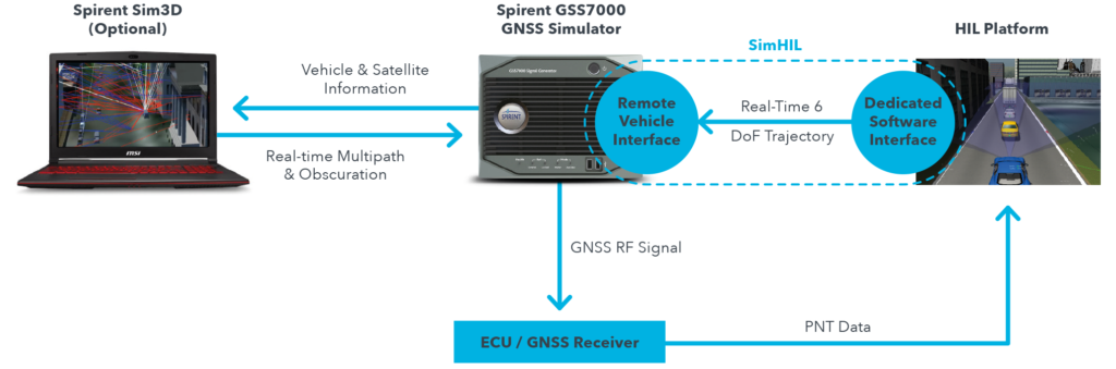
Spirent Communications plc has released SimHIL, an integrated hardware-in-the-loop (HIL) testing software API for Spirent GNSS simulators.
SimHIL brings high-fidelity GNSS signal simulation with low latency to automotive industry HIL testbeds, the company said.
Image: Spirent
Spirent’s SimHIL software has been developed to meet the automotive industry’s growing need for realistic positioning, navigation and timing (PNT) testing for sensor fusion. As customers apply increasing pressure on car manufacturers for more advanced driver-assistance system (ADAS) features and advanced infotainment systems, test labs need to be able to combine Wi-Fi, camera, lidar, radar, inertial and GNSS data that power these advanced automotive systems.
SimHIL helps test engineers bring accurate, controlled and coherent data from GNSS and inertial sensors to their sensor-fusion algorithms within HIL test environments. Facilitating the ultra-low latency, complete control, enhanced realism, and ease of use and setup of Spirent GSS7000 and GSS9000 GNSS simulators, SimHIL is suitable for OEMs and tier-one suppliers developing ADAS, V2X and sensor-fusion engines.
The new SimHIL API enables:
external motion input – real-time direct motion and trajectory data input from simulators
sensor fusion – introducing GNSS signals into sensor-fusion engines
V2X testing – validation and performance benchmarking of V2X applications
infotainment system testing – real-time scenario feedback to system and driver responses
vehicle-in-the-loop (VIL) – final production form product testing
accurate testing – reliable results supported by ultra-low latency simulation. Criticality of ADAS features, such as lane assist and automatic braking, mean that 3+ metres of uncertainty introduced by higher latency systems is not sufficient.
“With our SimHIL software and GNSS simulators, test engineers can bring realistic, controlled GNSS simulation to their HIL testing environments – a vital requirement in a world where ADAS features are relying more heavily and critically on accurate positioning,” said Martin Foulger, general manager of Spirent’s PNT business.
Spirent has worked with leading suppliers to ensure SimHIL is compatible with their HIL platforms, and because of its open API, there’s broad scope for additional custom third-party integrations.
“When used with our GSS7000, SimHIL latency is less than 40 ms from motion command to RF output and supports all GNSS and SBAS signals,” said Ricardo Verdeguer Moreno, product manager for Connected and Autonomous Vehicles at Spirent. “SimHIL is also compatible with all the options and features available in Spirent’s GNSS simulators, including ionospheric and tropospheric modeling, antenna patterns, date and time settings, and obscuration and multipath effects via Sim3D.”
Users can easily configure and control both the GNSS scenarios, and signal generation and vehicle motion from within the HIL simulator graphical user interface — saving time and the possibility of error.
Spirent is also offering three service packages alongside SimHIL to help customers mitigate project risk and reduce the time from delivery to useful deployment.
For more information about Spirent’s SimHIL integrated testing for Spirent GNSS simulators, visit the SimHIL information page.
Woolpert has received the 2019 Google Cloud Specialization Partner of the Year award for location-based services.
Woolpert was recognized for the company’s achievements in the Google Cloud ecosystem, helping joint customers deploy and optimize their location-based services, developing an online customer assistance system and cloud information portal, more than doubling its staff to support customer needs and supporting all location-based data efforts with its extended geospatial team.
The firm, which has been a Google Cloud Partner since 2015, was awarded this honor and the Google Cloud Partner Award for Customer Success in Google Maps Platform in 2018. Woolpert Vice President and Chief Innovation Officer Jon Downey said Woolpert is honored to work with Google Cloud and provide a heightened level of products and services to the teams’ joint customers.
“We thought this would be a natural partnership, joining the world leader in customer-facing location-based services with one of the first global geospatial mapping firms, but it has far exceeded our expectations,” Downey said. “It has given us the ability to create products and provide support specific to our clients’ location-based needs, which has led to a greater than 98% retention rate and more than 100 additional customers in 2019. We look forward to what this partnership will yield in the future.”
“We’re proud to recognize Woolpert’s work on behalf of customers,” said Carolee Gearhart, vice president, Worldwide Channel Sales at Google Cloud. “Woolpert has demonstrated strong expertise and results in providing location-based services for customers over the past year, and we look forward to continuing our partnership to help customers succeed.”
Regulus Cyber, creator of what it calls “anti-virus” software to protect GPS navigation and timing across a wide range of applications, is collaborating with Harman, a connected-car company.
The software-based cybersecurity solution will be part of Harman Shield, the company’s risk-management offering for vehicle manufacturers and mobility companies.
“We are looking forward to joining forces with Harman, a Tier 1 supplier to the automotive industry, a trusted partner to more than 50 global vehicle manufacturers. Coming together with Harman is a great testament to the necessity of GPS protection measures in our industry,” said Yonatan Zur, CEO of Regulus Cyber.
“We’re seeing our OEM customers expand into the digital and mobility spaces, offering added-value services to consumers by leveraging connectivity and mobile applications,” said Asaf Atzmon, vice president and general manager, Automotive Cybersecurity at Harman. “Through Harman Shield, we offer full visibility, analytics and risk management capabilities into cyber threats, and Regulus Pyramid GNSS solution complements our offering with another layer of protection against GPS hacking. We’re excited about the possibilities of this new collaboration with Regulus.”
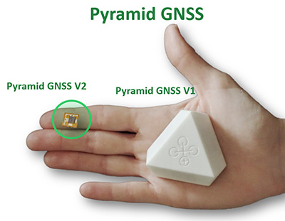
The Regulus Pyramid GNSS is a software solution that uses machine learning to detect spoofing and defend any GNSS receiver, device or chipset against it — ensuring the security and reliability that are essential to safe and accurate navigation. GPS spoofing attacks are becoming more common and are often difficult to detect and protect against.
Pyramid GNSS uses a combination of patented algorithms, developed over years of spoofing experiments to protect against attacks at the firmware, operating system, or application level. This deal is further proof of the market demand for resilient navigation and positioning at a time when GPS hacking is a growing concern.