A team of medical researchers and bioethicists at Oxford University published results in Science that offer further understanding of coronavirus transmission.
The evidence is enabling several international partners to assess the feasibility of developing mobile apps for instant contact tracing in record time.
If rapidly and widely developed, the mobile apps could help to significantly slow transmission rates and support countries emerging from lockdowns as restrictions are gradually eased.
Partners include the Norwegian Institute of Public Health (FHI) and NHSX, a joint unit comprised of teams from NHS England and the UK’s Department of Health & Social Care.
Critically, the researchers suggest a mobile app can help slow the spread of infection until vaccines and antiviral treatments become widely available.
“We need a mobile contact tracing app to urgently support health services to control coronavirus transmission, target interventions and keep people safe,” explained Christophe Fraser, Oxford University’s Big Data Institute, Nuffield Department of Medicine, an a lead author on the Science paper.
“Our analysis suggests that about half of transmissions occur in the early phase of the infection, before you show any symptoms of infection,” Fraser said. “Our mathematical models also highlight that traditional public-health contact tracing approaches provide incomplete data and cannot keep up with the pace of this pandemic.”
The project is co-led by David Bonsall, senior researcher at Oxford University’s Nuffield Department of Medicine and clinician at Oxford’s John Radcliffe Hospital. “The mobile app concept we’ve mathematically modeled is simple and doesn’t need to track your location,” Bonsall said.
Anonymous alerts
“It uses a low-energy version of Bluetooth to log a memory of all the app users with whom you have come into close proximity over the last few days,” Bonsall said. “If you then become infected, these people are alerted instantly and anonymously, and advised to go home and self-isolate.
“If app users decide to share additional data, they could support health services to identify trends and target interventions to reach those most in need,” Bonsall said.
The authors argue that a mobile app can reduce transmission at any stage of the epidemic: in countries or regions where the epidemic is just emerging, at the peak of the epidemic, or to support a safe transition out of restricted movement or lockdown.
It could also help to reduce the serious social, psychological and economic impacts caused by widespread lockdowns. Critically, the researchers suggest a mobile app can help slow the spread of infection until vaccines and antiviral treatments become widely available.
Good citizenship
“A contact tracing app can foster good citizenship by alerting people at risk,” Fraser explained. “It can also help ease us out of confinement if we know we’ve not been in contact with anyone infected we can leave home safely, whilst still protecting our loved ones and avoiding a broader resurgence of coronavirus in our community.”
Given the level of infection across much of Europe, the team believe ongoing development of a mobile app partnership across the union would massively reduce transmission and avoid a resurgence in the number of cases, providing an opportunity for all citizens using mobile contact tracing apps to contribute towards ending the epidemic. An app strategy could also be used by low- and middle-income countries, earlier in the epidemic, to rapidly control transmission and get ahead of the epidemic now.
The Oxford team highlight that the mobile contact tracing app should still be combined with isolation of cases, tracing and quarantine of contacts, physical distancing, scaled-up diagnostic testing, decontamination and hygiene measures.
As Bonsall explains “If the mobile app is widely adopted in any country, and combined with other critical interventions such as physical distancing and widespread testing, our models suggest the epidemic could be brought under control. This app is a tool for each and every person affected to contribute towards protecting their health services, supporting vulnerable people and simultaneously gradually releasing communities out of extended quarantine.”
Rigorous ethical standards
Today’s Science study highlights the importance of rigorous ethical standards underpinning the successful and appropriate use of mobile phone technology in addressing the coronavirus pandemic, including a number of ethical requirements needed to foster well-founded public trust and confidence.
“With transparent and inclusive ethical oversight to ensure genuine public trust, it is possible to both save lives and protect civil liberties,” said Michael Parker, director of the Wellcome Centre for Ethics & Humanities and one of the paper’s authors.
“The app should be opt-in, provide secure data storage and privacy protection, and be informed by public and user engagement at every stage of implementation. With these guarantees and, if widely installed by users across a country or regional bloc, a mobile app could even help to end the epidemic,” Parker said.
Official apps only
As mobile apps launch over the coming weeks and months, the Oxford research team urges people to support official apps, developed by trusted institutions, and their partners, such as the mobile contact tracing apps under advanced assessment in several European countries.
Fraser concludes, “Our hope is to support communities with life-saving information as the pandemic worsens and help to release countries from large-scale isolation. The maths is clear: the more people that use a contract tracing app the better chance we have of getting ahead of this epidemic and eventually stopping it in its tracks. If a country reduces the epidemic growth rate to below zero, the epidemic will rapidly decline and eventually stop. Together we can make this possible.”
Download results
Results of a mobile-app-focused survey from a large representative sample of the UK population (1,055 respondents) conducted March 20-22 are available here. Other country surveys are also available for Italy, Germany and France, currently in each language.
PCCW and Unistrong will collaborate on developing GNSS technologies and services for the telecommunications and aviation industries.
PCCW Global is the international operating division of HKT, a Hong Kong telecommunications service provider. Beijing UniStrong Science and Technology Corporation Limited is a navigation and positioning company.
The collaboration intends to link satellite positioning to 5G mobile networks to provide positioning data accurate to within centimeters. The link will unlock new services for telecommunications providers rolling out new networks to support the internet of things (IoT), smart cities and the aviation industry.
UniStrong’s experience in developing high-precision products, solutions and services will enable PCCW Global to integrate new services with 5G mobile infrastructure, providing high-precision positioning (HPP) accurate down to centimeter levels.
This integration of precision positioning expertise and technologies has the potential to revolutionize industries such as commercial drone operations, autonomous vehicles and transportation, logistics, construction, agriculture and others.
New Airport Technology
The integration of technologies will also enable the provision of smart aviation solutions for airport authorities. Based on high-precision positioning and navigation technology, new airports will be able to leverage smart civil construction works that will facilitate safer and more efficient airport operations.
These aviation technologies will also be able to integrate with a wide variety of IoT sensors, edge-computing capabilities, machine vision and other artificial intelligence (AI) technologies to create intelligent surveillance platforms capable of managing and enhancing many aspects of airport safety and efficiency.
The installed base of GNSS devices in use globally is forecast to increase from 6.4 billion in 2019 to 9.6 billion in 2029, with Asia-Pacific continuing to account for more than half of the global GNSS market.
In terms of global annual GNSS receiver shipments, the market is forecast to grow from 1.8 billion units in 2019 to 2.8 billion units in 2029, according to the 2019 GNSS Market Report by the European Global Navigation Satellite Systems Agency (GSA).
“As a global ICT service provider with extensive high speed fiber networks and cloud services coverage worldwide, we are delighted to cooperate with UniStrong with the aim to offer unique, game-changing solutions in Satellite High Precision Positioning (SHPP) and Continuous Operating Reference Station (CORS) solutions ideally suited to the new era of 5G, IoT and smart cities,” said Benney Cheng, head of Strategic Project and Development, PCCW Global.
“The cooperation between UniStrong and PCCW Global will further promote the development of professional solutions and applications that are oriented towards global users’ needs,” said Jun Shen, corporate vice president and chief scientist of UniStrong. “Based on GNSS technologies, and deeply integrated with communication technologies, Big Data, Industry 4.0, IoT, artificial intelligence and other technologies, these solutions will empower and influence more industries and countries, and promote BDS/GNSS global applications and international services worldwide.”
Photo: Bill Oxford / iStock / Getty Images Plus / Getty Images
The U.S. Department of Transportation (DOT) announced competitive grant solicitation for a new University Transportation Center (UTC) specifically on Highly Automated Transportation Research.
Photo: Resilient PNT Foundation
“People will not be comfortable getting into an automated vehicle or with platooning driverless trucks heading down the highway if they think… their GPS might be spoofed,” according to Diana Furchtgott-Roth, Deputy Assistant Secretary at the U.S. Department of Transportation at a recent presentation. She believes getting robust and resilient navigation right is a prerequisite for success with automated and autonomous systems.
As part of this effort, her office is looking for a U.S. non-profit institution of higher learning to become a University Transportation Center (UTC) focusing on “Highly Automated Transportation Research.” A critical component of this new center’s efforts will be work on resilient positioning, navigation and timing (PNT) services.
From the abstract:
“Progress on the path toward integrating automated systems into the transportation domain for all modes of transportation (surface, aviation, and maritime) will be aided by additional research addressing challenges associated with ensuring resilient Positioning, Navigation, and Timing (PNT) services to support automated systems.
“This University Transportation Center will complement the new Center of Excellence for Highly Automated Transportation Systems being implemented within the USDOT. Among the critical needs is research to support securing cyber resilient PNT receivers for use in automated systems. This UTC will carry out research to support the development of standards and or prototypes and incorporate existing U.S. Government guidance.“
The department is also looking for UTCs for Communications Technology and E-Commerce Effects on Travel Demand; Implications of Accessible Automated Vehicles and Mobility Services for People with Disabilities; and Strategic Implications of Changing Public Transportation Travel Trends.
According to a press release issued March 30, one institution will be selected in each of the four areas. The total initial funding available to is just shy of $5 million.
The European GNSS Agency, based in Prague, is providing on its website a list of location-enabled applications that it considers potentially useful in response to the COVID-19 pandemic.
The applications range from those helping public authorities understand the dynamics of the outbreak to supporting citizens in their everyday lives by checking supermarket lines.
The apps are sorted into four categories:
Tracking the COVID-19 pandemic
Queue management
Response management
Information dissemination
If you are an application developer and you want to add your app to the list, contact [email protected].
GPS IIIF’s M-code can be broadcast from a high-gain directional antenna in a concentrated, high-powered spot beam, in addition to a wide-angle, full-Earth antenna. (Artist rendering: Lockheed Martin)
U.S. Space Force, Lockheed Martin upgrade Operational Control System (OCS) and refresh GPS constellation with new satellites.
The final steps to fully enable the ultra-secure, jam-resistant military code (M-code) signal on GPS are now underway.
As part of the U.S. military’s effort to modernize GPS, the U.S. Space Force has been steadily upgrading its existing GPS Ground Operational Control System (OCS). The Space Force recently announced Operational Acceptance of the GPS Contingency Operations (COps) upgrade, developed by Lockheed Martin.
The Space Force’s M-Code Early Use (MCEU) upgrade, delivered earlier this year, will enable the OCS to task, upload and monitor M-code within the GPS constellation, as well as support testing and fielding of modernized user equipment, prior to the completion of the next-generation ground control systems.
This spring, work will begin to install the components needed to command and monitor the M-Code encrypted GPS signal, which enhances anti-jamming and protection from spoofing, as well as increases secure access for our forces, into the GPS OCS. M-code signals are available on all the on-orbit GPS IIR-M, IIF and III space vehicles.
A key to enabling M-code is a new software-defined receiver Lockheed Martin developed and is installing at all six Space Force monitoring sites. The M-code Monitor Station Technology Capability (M-MSTIC) uses a commercial, off-the-shelf general purpose graphics processing unit (GPU) to cost effectively receive and monitor M-code signals. Operators can monitor the signal as needed. M-MSTIC complements MSTIC’s, which Lockheed Martin developed and fielded to replace aging hardware receivers that were becoming difficult and expensive to maintain.
“Our warfighters depend on GPS signals every day for many critical missions, so anything we can do to make these signals more resistant to jamming and spoofing is extremely important — and available today,” said Johnathon Caldwell, Lockheed Martin vice president of Navigation Systems. “The more powerful GPS III/IIIF satellites coupled with Lockheed Martin’s upgrades to the GPS ground system are making that possible.”
GPS III also provides a new L1C civil signal, compatible with other international GNSS, such as Europe’s Galileo.
Lockheed Martin is contracted to build up to 32 GPS III/GPS III Follow On (GPS IIIF) satellites to help modernize the GPS constellation with new technology and advanced capabilities. The delivery tempo for these modernized GPS satellites will allow for several launches per year. The third M-code enabled GPS III satellite, named “Columbus,” is expected to launch in April, 2020.
Red Dragon Cybersecurity Suite
Cyber defenses across the upgraded GPS system were recently evaluated by a government assessment team and passed the Operational Utility Evaluation. Lockheed Martin delivered the Red Dragon Cybersecurity Suite (RDCSS) Phase III upgrade during the fourth quarter of 2019, dramatically improving Defensive Cyber Operations (DCO) visibility into GPS network traffic.
Other add-ons include user behavior analytics to analyze patterns of traffic and network taps to improve data collections.
“GPS is an attractive target for our adversaries, so it was critical we bring our best cybersecurity defenses to the table,” said Stacy Kubicek, vice president of Mission Solutions Defense and Security. “Since we began sustaining the Ground OCS in 2013, we have systematically upgraded and replaced software and hardware — it’s now a very secure system.”
Lockheed Martin has sustained the GPS Ground OCS since 2013. In November of 2018, the team completed the AEP 7.5 architectural change – replacing the hardware and software to improve resiliency and cybersecurity. In December of 2018, the Air Force awarded Lockheed martin the GPS Control Segment Sustainment II (GCS II) contract to further modernize and sustain the AEP OCS through 2025.
The GPS III team is led by the Production Corps, Medium Earth Orbit Division, at the Space Force’s Space and Missile Systems Center, at Los Angeles Air Force Base. The GPS OCS sustainment is managed by the Enterprise Corps, GPS Sustainment Division at Peterson Air Force Base. 2 SOPS, at Schriever Air Force Base, manages and operates the GPS constellation for both civil and military users.
The U.S. Space Force’s Space and Missile Systems Center’s GPS Next Generation Operational Control System (OCX) program on March 26 instructed Raytheon to replace the computer hardware in OCX prior to system delivery.
The IBM computer product line used in the system was sold to a Chinese company, Lenovo, in August 2014. At the time of the sale, the U.S. government identified this as a major impact to OCX by creating an unacceptable cyber risk. However, the government waited implement a fix until Raytheon showed promising program performance in delivering OCX.
“Over the last two and a half years, since OCX came out of its Nunn-McCurdy breach, Raytheon has been executing as planned, giving us confidence in OCX’s ability to transition into operations,” said Lt. Gen. John Thompson, SMC commander.
Software development was completed in the fall of 2019, and the program is in the integration and test phase. Within a year, Raytheon is expected to deliver a qualified software baseline capable of operating the GPS constellation, Thompson said.
In 2017, the federal government sponsored a hardware trade study with U.S.-based vendors to replace IBM’s hardware. As a result of the study, Hewlett Packard Enterprise (HPE) was selected as the vendor. The program then conducted a pilot project replacing the IBM hardware in the 17 external monitoring stations and four ground antenna sites, resulting in successful HPE replacement.
“This gave us confidence that we had a viable OCX technical solution providing a long term sustainable hardware baseline that meets our stringent cyber security requirements,” said Lt. Col. Thomas Gabriele, SMC’s OCX materiel leader. “As Raytheon continues to track to their contractual commitments, addressing the unsupportable IBM cyber security risk is prudent to do pre-system delivery to the government.
“Although this government-directed change will impact the Raytheon schedule, the government is holding Raytheon accountable to deliver qualified software prior to integrating on the HPE platform and deploying to operational sites,” Gabriele said.
“By executing the fix now we eliminate $150 million in rework and retesting, and ensuring we deliver a system that is capable of transitioning to operations,” said Barbara Baker, SMC Command and Control Division’s senior materiel leader.
Decades-old hardware
Another benefit of the $378 million government-directed contract change is the opportunity to replace the now decade-old IBM hardware. This will improve system performance and increase the OCX program supportability posture.
“OCX is critical to continuing high priority national efforts to modernize GPS with new military and civil positioning capabilities, including enhanced security, precision, reliability, and integrity. OCX will deliver sustained, reliable GPS capabilities to America’s warfighters, allies, and civil users,” Baker said.
The OCX program is part of the GPS Enterprise Modernization. OCX will deliver two times more satellite capacity, modern cyber-secure infrastructure, improved accuracy, globally deployed modernized receivers with anti-jam capabilities, and improved availability in difficult terrain.
“As a high interest program, we will continue to work with our industry partners to deliver a global GPS capability, Gabriele said.
Phase One Industrial has launched a 280-megapixel aerial photogrammetric system, with an image coverage width of more than 20,000 pixels.
The large format enables unprecedented high-quality aerial survey productivity, the company said. Compact and lightweight, the new aerial mapping solution can reduce operating costs and produce better returns on investment than today’s traditional large format systems.
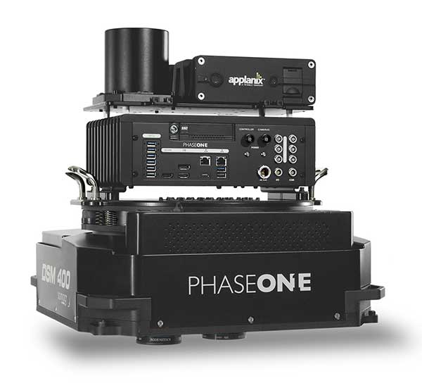
The Phase One Industrial 280MP Aerial Solution consists of an iXM-RS 280F large format camera, Applanix GNSS/IMU receiver (POS AV series), Somag gyro-stabilized mount (DSM 400), Phase One iX Controller and iX Flight Management software.
The system is a large format camera system that easily integrates with the DSM400 gyro-stabilized mount, creating a compact and lightweight system for use in a wide range of aircraft.
At the system’s heart is the iXM-RS 280F, a dual-lens metric camera with 90mm lenses for capturing RGB information, providing precision imaging. Adding a near infrared (NIR) camera generates a 4-band configuration, most useful in agriculture, forestry and pipeline monitoring.
The iXM-RS 280F camera generates a central projection image from two 150MP nadir images with equal ground resolution. The cameras’ backside illuminated CMOS sensor supports very high dynamic range at 83dB. Its high light sensitivity provides superb image quality in challenging low light conditions, enabling operators to take advantage of more flight hours per day and more flight days per year.
“Our 280MP Aerial Solution is a bold and innovative approach to solving customers’ demands for affordable and reliable aerial mapping performance,” said Dov Kalinski, general manager, Phase One Industrial. “Previously, opportunities in the aerial mapping business were restricted due to high cost of equipment and limited aircraft options. While pioneering superior image quality, Phase One Industrial is creating more profitable possibilities in this exciting and important market.”
Through the Notice of Funding Opportunity, DOT intends to fund one UTC in each of the following specific topic areas:
Highly automated transportation systems research
Communications technology and e-commerce effects on travel demand
Implications of accessible automated vehicles and mobility services for people with disabilities
Strategic implications of changing public transportation travel trends.
Only U.S. non-profit institutions of higher education are eligible to apply or to be members of a proposed UTC consortium. Non-profit institutions of higher education may include qualifying two-year institutions.
“Our University Transportation Centers are not only the seeds of our future transportation system, they serve as living labs, bringing research to reality. Four new UTCs will address a variety of important 21st century transportation topics,” said Deputy Assistant Secretary Diana Furchtgott-Roth.
Thee Tier 1 UTCs will support research needs that DOT has identified under two of the FAST Act research priorities (49 U.S.C. § 6503(c)(1)): “Promoting Safety” and “Improving Mobility of People and Goods.”
The Notice of Funding Opportunity (NOFO) is available now. For more information on the UTC program, contact Nancy Wilochka, (202) 366-5128.
Cobham make the anti-jam GPS for the Lynx Wildcat. (Photo: U.K. Ministry of Defense)
Research contract to protect satellite signals from interference
Cobham Aerospace Connectivity will research advanced GNSS anti-jam techniques for the United Kingdom Ministry of Defense (UK-MOD). The research contract was awarded by the Ministry of Defense’s Defence Equipment and Support (DE&S) office.
Under the contract, Cobham will develop means to provide assured and resilient position navigation and timing (PNT) information derived from GNSS. The company has extensive background in advanced antenna technology and sophisticated signal-processing capabilities.
Cobham makes the conformal GPS CRPA for the Eurofighter Typhoon. (Photo: Cobham)
The research is set against a backdrop of increasing reliance on GNSS navigation signals in the nation’s critical infrastructure and national security and the frequent interruptions of the signals either accidentally or intentionally. The more sophisticated interruptions involve the falsification of the navigation signal information for nefarious reasons such as piracy, civil disruption and military advantage.
Cobham’s goal is to take already-developed anti-jam capability and develop a miniaturized system that can provide an advanced means of protection of the navigation signals received from the GNSS multi-constellation network.
Cobham beam-forming anti-jam GNSS digital antenna control unit. (Photo: Cobham)
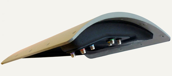
The anti-jam system will combine the use of advanced controlled radiation pattern array (CRPA) antenna technology with intelligent digital signal-processing techniques. It will be designed to ensure reliable and assured navigation information, as well as derive important signal intelligence and domain-awareness information regarding the source and nature of the interference and the best means of mitigation.
“This contract award recognises Cobham’s status as a major UK provider of anti-jam systems as well as our long history and deep experience in the areas of navigation antennas and satellite connectivity,” said Neil Tomlinson, vice president of Sales and Business Development at Cobham. “We look forward to working with DE&S in this initial phase and subsequent work on this exciting project.”
A roundup of recent products in the GNSS and inertial positioning industry from the April 2020 issue of GPS World magazine.
OEM
LPWA module
Collaborative IoT solution
Photo: Quectel
Quectel Wireless Solutions’ LPWA module BG95 is being integrated with Microsoft’s Azure Device software development kit (SDK). The BG95 cellular module is based on the Qualcomm 9205 LTE modem. The integration will provide direct and secure connections to the Azure IoT Hub and provide full support for Azure device management. Customers can connect their BG95 devices to the Microsoft Azure cloud where they can build, manage and deploy internet of things (IoT) solutions at scale, significantly accelerating time to market. The BG95 module is a highly integrated variant supporting integrated GNSS, Cat M1, Cat NB2 and EGPRS (also called edge). The module complies with 3GPP Release 14 and delivers improved capabilities in power consumption, data rates and hardware-based security.
The SARA-R422 product series of LTE-M/NB-IoT and EGPRS cellular modules now include GNSS variants for internet of things (IoT) data, devices and ecosystems. The SARA-R422M8S module is pre-integrated with the u-blox M8 GNSS receiver and a separate GNSS antenna interface. This provides highly reliable, accurate positioning data simultaneously with LTE communications. The module also supports hybrid positioning strategies, in which positioning data provided by satellite constellations is enhanced with data from the u-blox CellLocate service, ensuring that location data is always available everywhere. The SARA-R4 series is designed for a wide range of mission-critical IoT solutions such as connected healthcare, industrial monitoring, point of sale and vending terminals, tracking and telematics devices, as well as smart lighting solutions and building automation.
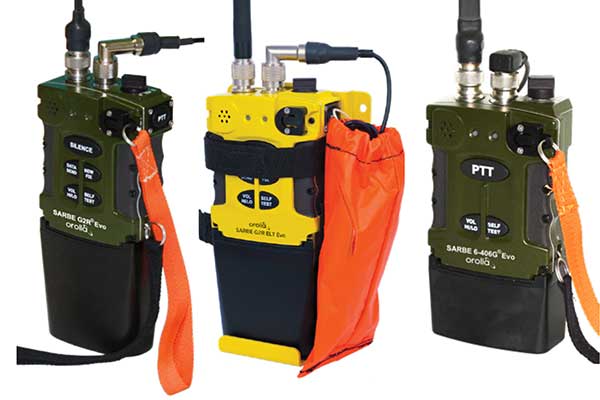
The new line of Sarbe search and rescue beacons. (Photo: Orolia)
Orolia has improved its Sarbe Evo search-and-rescue (SAR) beacon range line to deliver upgraded operational capabilities. The line offers new operational improvements to meet revised Cospas-Sarsat requirements in operating lifetime, location accuracy, voice signal management, integrated protocols, testability and maintenance. Also a focus of the upgrade was more robust and frequent GPS/GNSS position acquisition with the GPS, Galileo and GLONASS satellite constellations.
ADVA’s GNSS assurance solution could help companies dependent on satellite-based timing. (Photo: Business Wire)
ADVA’s GNSS assurance solution helps companies dependent on satellite-based timing. The centralized GNSS monitoring and assurance tool uses artificial intelligence and machine learning for comprehensive predictive maintenance. The customer-owned tool enables users to collect and analyze huge amounts of information from across the network to remotely identify issues and protect networks from GNSS vulnerabilities, including jamming and spoofing attacks. It also helps to identify GNSS obstruction issues, detect blind/poor spots that appear over time, and enable optimal antenna positioning. Built into ADVA’s Ensemble Controller network management suite with Sync Director, the solution enables customers to detect potential problems in advance and maintain the highest quality of network synchronization. It complements the limited distributed approach to GNSS assurance with a centralized global system, providing a boost to critical infrastructure now dependent on satellite-based timing.
The Locosys MC-1612-DG is a single-band multi-system with an ARM-based processor that supports GPS, GLONASS, Galileo, QZSS and SBAS. The embedded micro-electro-mechanical systems (MEMS) sensor is equipped with dead-reckoning software and provides six-axis accelerometer and gyroscope data. The extended Kalman filter algorithm combines GNSS and MEMS sensor data with a weighting function that relies on GNSS signal quality. In adverse GNSS conditions such as urban canyons, tunnels or parking garages, the dead-reckoning features boost accuracy with the software filling the gaps. It supports three-dimensional dead-reckoning and standard NMEA output, and has Flash memory, TCXO, RTC crystal, LNA and SAW filter.
The automotive-grade solid-state RS-LiDAR-M1 family has the performance advantages of traditional mechanical lidar, while meeting requirements for mass-produced vehicles. The RS-LiDAR-M1Smart is embedded with an artificial intelligence perception algorithm that transforms conventional 3D lidar sensors into a full data analysis and comprehension system, outputting semantic-level structured environment information in real time for autonomous vehicle decision making. The RS-LiDAR-M1Smart outputs two redundant channels of data: the original point cloud and the object list. The redundacy provides vehicles with a range of sensing results — dynamic, static, inside and outside the road. Also available is the RS-LiDAR-M1Simple.
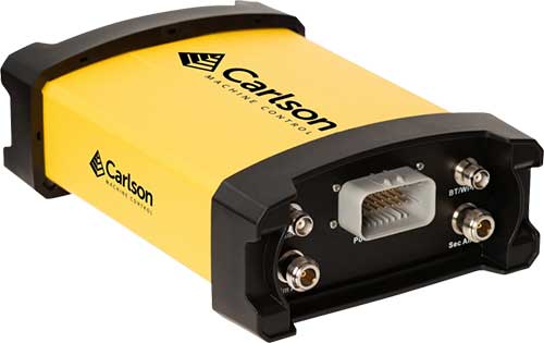
The Vsx7 multi-frequency position and heading receiver is designed specifically for machine control and can be mounted by bolts or with magnets on heavy equipment. Paired with the Carlson A45 antennas, the Vsx7 features high-precision positioning in Athena RTK, Atlas L-band and SBAS and heading accuracy of up to .01 degrees. The whole Vsx7 system is designed to operate in harsh conditions from –40° F to +158° F. The Vsx7 is primarily used in the mining and construction industries, but can be used in similar industries with companion software, Carlson Grade. Field data can be collected and viewed in real time both at the machine with either the MC8 or MC10 control box as well as in the office with Carlson Command.
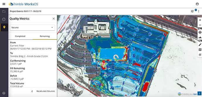
Trimble WorksOS is a new Software-as-a-Service (SaaS) operating system. The cloud-based system will integrate data from Trimble and third-party providers across the entire civil construction project lifecycle, including estimating, scheduling, designs and the field. Currently, site supervisors and project managers jump between multiple systems to keep track of daily production quantities, labor/equipment hours and equipment maintenance schedules. Works OS is designed to bring real-time visibility into jobsite progress, schedule and cost. Users will be able to log into a single application to view real-time visibility of cut, fill, volume and compaction data to maximize jobsite productivity. Site supervisors will see daily volume calculations and compaction quality metrics, and be able to monitor progress and schedules.
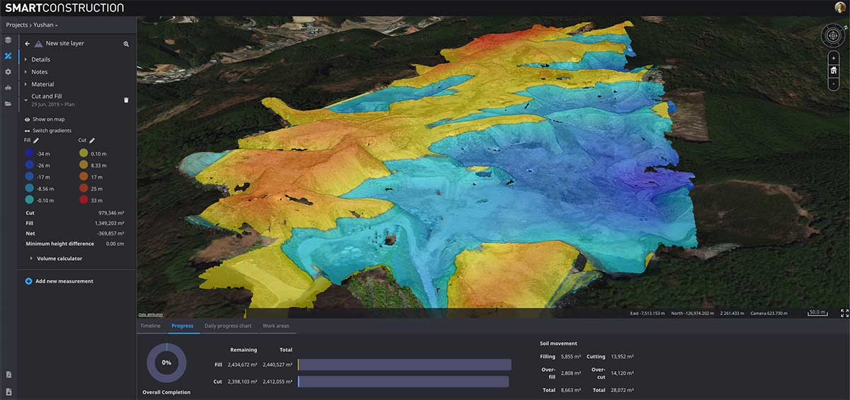
Komatsu’s Smart Construction dashboard includes the 3D visualization power and geospatial accuracy of Cesium, a platform to visualize, analyze and share 3D data. The dashboard enables users to monitor a construction site from anywhere in the world, see how it changes over time, and compare architectural plans with real-world data. It is compatible with data from sensors on construction machines, drone surveys, or computer-generated files like BIM/CAD models . It allows users to visualize projects in a single scene within a web browser, as well as calculate precise measurements for cut and fill, slope, contours and more.
Cesium, cesium.com
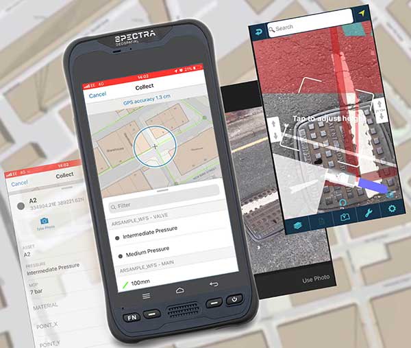
The TopoGrafi app has been updated to allow for display of 3D data in real-world models. With enhanced 3D data-processing capabilities, TopoGrafi is an end-to-end platform for capturing buried asset data and processing it for augmented reality visualizations. Designed to be used alongside apps such as Esri Collector for ArcGIS, the TopoGrafi platform uses GNSS data. It applies near-real-time conversions, transforming the recorded positions to local reference systems and aligning it with high-accuracy mapping including Ordnance Survey MasterMap. The TopoGrafi toolkit also includes functionality to snap 3D features to each other and to other spatially referenced data to create a 3D model that can then be used to create augmented reality visualizations accessible from the desktop or in the field.
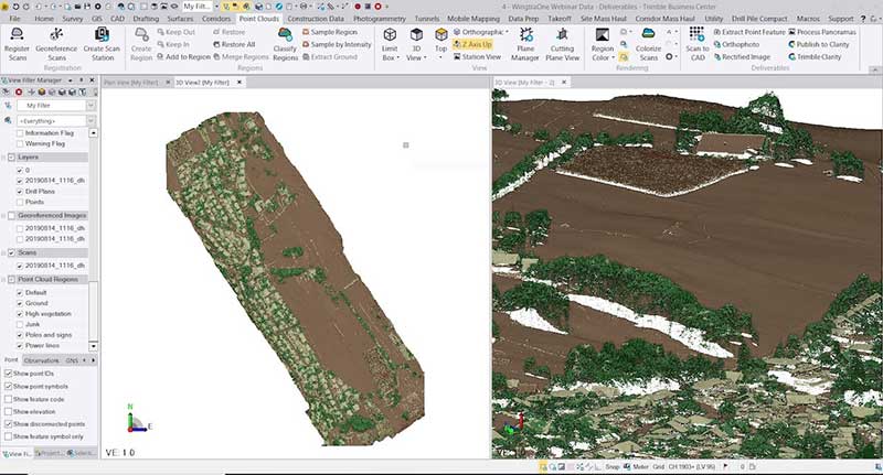
WingtraOne drone data can now be directly imported into the Trimble Business Center (TBC). The new integration combines WingtraOne high-accuracy drone data within TBC, optimizing drone mapping workflows for survey and construction projects within a single software platform. After dragging and dropping the JobXML data file, automated point cloud tools, such as classification and feature extraction, can quickly generate surface models, topographic plans and as-built deliverables. Also new: high-altitude flight capabilities, longer flight times and more intuitive battery-level readings in-flight.
The Snoopy CL-360 lidar scanner. (Photo: Lidar USA)
The Snoopy CL-360 has been meticulously designed for integration on backpack, vehicle and UAV applications. Weighing 5 kilograms fully assembled, the Snoopy CL-360 is capable of delivering highly accurate results, up to +/-0.01 feet on paved surfaces from a vehicle. The system has a scan line rate of 250 Hz with a 500-kHz data rate, giving a uniform result along and across track. The system is easily configurable with multiple scanners (similar to internet of things applications) to avoid occlusions. A UAV deployment achieves scans with usable data as much as 60 degrees off nadir (widths of more than 1,100 feet while scanning at the 400-foot ceiling). The small beam size of 0.3 mrad allows the CL-series to reliably collect ground points (such as on or near the dirt through vegetation) while also providing better detection of fine linear features such as power lines and railroad tracks.
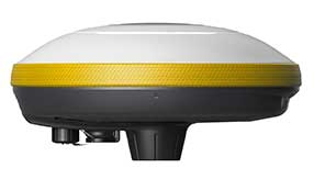
The E300 Pro receiver tracks GNSS with 700 channels and fully supports BDS-3 signals. It supports 31 frequency points, using all GNSS constellations and frequency bands. The E300 interface has a concealed design for better protection. USB type-C charging and transmitting is a two-in-one function. The magnesium-alloy body is rugged, and the battery level can be checked with a unique LED power indicator. The weight of the whole receiver is 940 grams. The E300 Pro supports satellite station differential and satellite chain life, quick connection, intelligent voice and tilt compensation. It integrates multiple sensors including GNSS, an inertial measurement unit (IMU), a magnetometer and a thermometer. With the help of a Kalman filter algorithm, the device can dynamically output position, speed and attitude information. It can measure and make real-time dynamic sampling without the need for leveling. For better radio signal quality, the E300 Pro integrates GNSS, Bluetooth, Wi-Fi, 4G main and auxiliary antennas on the top of the receiver to ensure the best reception in all directions. An RF connector improves connection reliability while reducing loss of gain.
The Nova MS60 MultiStation combines upgraded, fast 3D laser-scanning capabilities, GNSS connectivity and digital imaging with a high-end total station. It features a fast laser-scanning speed of up to 30,000 points per second, optimized scan area definitions, adapted scan managements, and an improved scanning path for zenith scans. Professionals can perform point-cloud analysis in the field. Scan data is combined with traditionally measured points from GNSS receivers to graphically show locations the same day it is collected.
CP Aeronautics, a new division of CP Technologies, has launched integrated turn-key solutions based on unmanned aerial systems (UAS) platforms, payloads, data links, ground control stations (GCS) and communications for defense and civil applications. The systems offer operationally proven solutions for intelligence, surveillance and reconnaissance (ISR) systems requirements. Its broad product portfolio has demonstrated excellent performance and operability in demanding environments, the company stated in a press release. Backed by continuous research and development, the systems are built on three decades of technological and operational experience. Systems include Orbiter 2 Small UAS, Orbiter 3 Small Tactical UAS, Orbiter 4 Small Tactical UAS (pictured), Aerostar Tactical UAS, Dominator XP (medium-altitude long-endurance) and Pegasus 120 (vertical takeoff and landing).
A new flight control system (FCS) fits and leverages multi-mission, multi-domain UAV platforms. Using the FCS, the new Saker-1B Medium Altitude Long Endurance (MALE) UAV performs with fully autonomous online and offline operation, from takeoff to landing. Testing included more than 500 hours of day and night test missions under various weather conditions, including extremes of dust and heat. A total of 1,000 hours of take-off and landing test missions were successfully performed, with long-endurance flights lasting up to 19 hours. The Saker-1B is equipped with a satellite communication data link for beyond-visual-line-of-sight (BVLOS) operation. The FCS provides sustainability to jamming attacks and advanced data security.
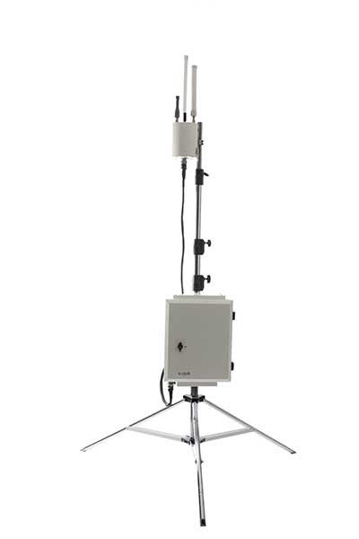
VigilAir is an RF-based system of deployed sensors able to accurately detect, geolocate and track commercial drones and their operators in different environments, including dense urban environments. VigilAir provides extremely sensitive detection and highly accurate geolocation and tracking over very large areas, with virtually zero false-alarms. Being a passive, receive-only system, VigilAir can easily be installed and operated without regulatory or legal limitations. The VigilAir version 2.0 C-UAS (counter unmanned aerial system) is certified by the United Kingdom Center for the Protection of National Infrastructure (CPNI) under the CPNI’s Counter Unmanned Aerial Systems Detect, Track and Identify (DTI) testing and evaluation standard. VigilAir generates a comprehensive drone situational awareness which enables users to proactively and intelligently match correct mitigation actions with actual drone threats, on time and with minimal collateral effects.
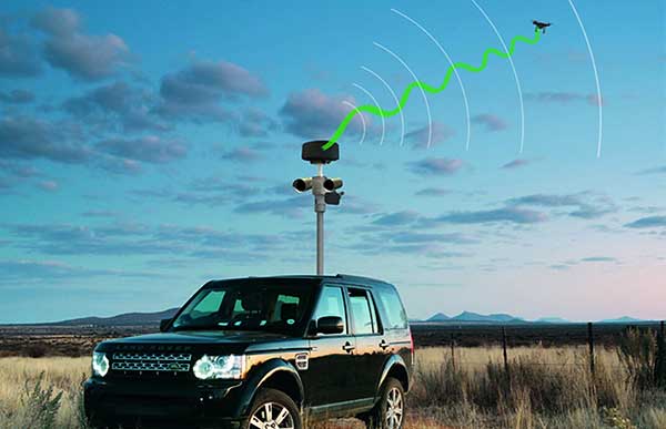
Xpeller Rapid — the mobile version of the counter UAV solution Xpeller — uses a combination of radar, electro-optical sensors, rangefinders and jammers to protect against threats posed by over-the-counter drones. Xpeller Rapid is either integrated into a vehicle (mast solution) or comes in transport boxes and can be easily set up on tripods. Based on the Xpeller toolkit, the components follow the detect, identify, control and act workflow, defeating hostile drones at ranges up to several kilometers. The system can locate and classify even small hobby drones at a range of several kilometers. High-resolution cameras make it possible to decide whether there is a serious threat so that it can be countered with appropriate countermeasures.
Kinetica simplifies active analytics with Kinetica Cloud
Kinetica, provider of the Kinetica Active Analytics Platform, has unveiled the Kinetica Cloud. Enterprises can use the full capabilities of the Kinetica platform in an optimal cloud environment, which includes historical data analytics, streaming data analytics, location intelligence and machine learning.
Kinetica Cloud was adopted by the San Francisco Estuary Institute (SFEI), which used the platform to detect trash in San Francisco Bay.
“The San Francisco Estuary Institute uses Kinetica Cloud for high-performance computing and to manage thousands of high-definition images of the landscape, which our machine learning algorithm studies to detect trash,” said Tony Hale, program director for Environmental Informatics, SFEI.
Photo: Thinkstock/Stockbyte/Getty Images
“With this more systematic way of monitoring when trash enters the landscape in uncontrolled ways, cities and governments that really care about the environment gain a remarkable resource to help them very quickly and effectively make decisions,” Hale said.
“With Kinetica Cloud, organizations across industries gain invaluable business flexibility and agility to direct their mission-critical initiatives,” said Paul Appleby, CEO, Kinetica. “Kinetica Cloud gives customers the ultimate flexibility in a hybrid, multi-cloud environment, empowering them to determine where it is optimal to deploy Kinetica.”
Organizations can use the Kinetica Active Analytics Platform on Kinetica Cloud without the complexity and wait times of deploying hardware systems and software.
“As customers adopt active analytics, they want to start their initiatives quickly to gain insight from their data,” said Karan Batta, senior director, Product Management, Oracle Cloud Infrastructure. “We are very pleased that Kinetica Cloud is available for Oracle Cloud, allowing organizations to shift their focus away from infrastructure and towards bringing smart analytical applications to market faster.”
Draganfly Inc., a leading North American-based commercial drone company, is partnering with Windfall Geotek to develop drone-based solutions for landmine detection.
Windfall Geotek is a Quebec-based technology services company and a leader in the use of artificial intelligence (AI) and advanced knowledge-extraction techniques in the mining sector.
The companies will work to develop an artificial intelligence (AI) driven unmanned aerial systems solution for landmine detection in the defense, humanitarian and other sectors in which the companies have expertise.
While landmines have been used since World War I, their deployment proliferated from the 1960s onwards. To this day, many unexploded devices are killing and maiming people who step on or trigger the bombs unintentionally.
About 60 countries and territories are still contaminated with anti-personnel mines, and more than 120,000 people were killed or injured by landmines between 1999-2017, according to research by Landmine Monitor.
Terms of the agreement include joint research, development and engineering support, drones and equipment o further commercialize an AI driven drone solution for the detection and elimination of landmines, unexploded ordnance and.improvised explosive devices (IEDs).
In 2018, governments and nonprofits allocated nearly US$700 million in combined international
and national support for mine action in 2018. The economic impact of landmines is estimated at $100 billion.
“We have been evaluating drone solutions for nearly a year, and after an exhaustive analysis of the market and providers, it is exciting to select Draganfly as our first drone systems partner for this worthwhile initiative,” said Dinesh Kandanchatha, chairman of Windfall Geotek.
“Windfall Geotek is the industry leader in AI-based digital exploration for mining. When they approached us on this project, it seemed like a natural fit to partner our engineering and drone capabilities, with their proven software and AI expertise,” sid Cameron Chell, CEO, Draganfly. “The two companies share a mission of saving lives through technology. We expect this partnership to generate new and expanded revenue streams for both companies in the defense sector, public safety and other markets where both companies have expertise.”