Facebook’s Open Cellular group is developing a cost-effective, software-defined, wireless-access platform to improve connectivity in remote areas of the world, the company said.
The TW2643POC employs Tallysman’s Accutenna technology in a magnet mount, passive right-hand circularly polarized antenna for the reception of all of the GNSS constellations (GPS L1/GLONASS G1/ Galileo E1/ BeiDou B1) plus Iridum: 1559 to 1626.5 MHz frequency band.
According to Tallysman, it is certified and specially designed to maximize the performance of Iridium Voice and Data Modems plus the upper GNSS band (1559–1606 MHz).
The TW2643POC is housed in an IP67 compliant housing and is REACH and RoHS compliant.
DigitalGlobe released satellite imagery of Houston after Hurricane Harvey hit.
Hurricane Harvey slammed into the Gulf Coast of Texas — just southwest of Houston — on Aug. 25. According to DigitalGlobe, the hurricane packed sustained winds at more than 130 miles per hour and has been identified as the largest single rainmaking event in continental U.S. history.
The images show downtown Houston, George Bush Intercontinental Airport and the interstate highways, which are relatively dry. Significant flooding remains in towns east and north of Houston, including Kingwood, Highlands and Channelview, the company says.
Telit has launched the LM940, a global Full PCI Express Mini Card (mPCIe) module for the router and gateway industry supporting LTE Advanced Category 11 (Cat 11) with speeds of up to 600 Mbps.
The internet of things (IoT) module is available with various mobile network operator approvals in the fourth quarter of 2017, the company said.
The module includes quad-constellation integrated GNSS and is in an mPCIe form factor to support Cat 11 with the Snapdragon X12 LTE modem. The industrial-grade LM940 delivers significant flexibility and a competitive edge to original equipment manufacturers (OEM) looking to quickly deploy next generation products.
Today, customers of router and gateway OEMs demand additional bandwidth and near instant network response times as applications like high definition video streaming with digital signage, commercial and enterprise failover needs and pop-up stores are becoming increasingly sophisticated.
“This industrial-grade module from Telit supporting LTE Cat 11 with global coverage will be very attractive for equipment manufacturers looking to deploy the latest solutions now, especially in the router and gateway market supporting high-bandwidth dependent applications like digital signage,” said Sam Lucero, senior principal analyst for IHS Markit, a global information provider. “As detailed in our June 2016 report on the industrial cellular IoT gateways market, IHS Markit anticipates gateway shipments will rise from nearly two million shipped in 2016 to more than six million shipped in 2021. The value of these industrial cellular IoT gateways shipped in 2021 will slightly exceed USD $1.6 billion.“
“Telit extends its leadership again by delivering customers the latest releases in LTE Advanced technology that they can take to market today,” said Manish Watwani, vice president of global product marketing for Telit. “The LM940 is the only global product for the router and gateway segment that allows OEMs to immediately leverage the 3x carrier aggregation and the higher order modulation of the 256 QAM capabilities currently available amongst most mobile operator networks. Combined with an exceptional power efficiency platform, this is by far the ideal solution to enable commercial and enterprise applications in the router industry, such as branch office connectivity, LTE failover, digital signage, kiosks, pop-up stores, vehicle routers, construction sites and more.”
“The Snapdragon X12 LTE modem with LTE Advanced technologies providing peak download speeds of 600 Mbps, defines a new level of service for emerging applications,” says Gautam Sheoran, director of product management for Qualcomm Technologies, Inc. “We are pleased with our ongoing collaboration with Telit to bring technologies that enable emerging applications like 4K video, virtual reality and cognitive computing to the global market.“
Additional technical features include:
LTE Category 11 LTE Cat. 11 DL / Cat. 5 UL Rel.10
3x Carrier Aggregation leverages extended capabilities of the network for increased coverage and bandwidth
Up to 600 Mbps DL w/3x Carrier Aggregation and 256 QAM
Hurricane Harvey is hitting Texas with wind speeds of at least 111 mph. Widespread flooding is a risk for Texas and neighboring states as public safety groups and communities prepare.
Public Information Map — identifies the current and recent location of Harvey as well as forecast positions and probable track; additionally, the shaded area is called the “cone of uncertainty,” the likely path of the center of Harvey.
Impact Summary Map — shows the storm surge by identifying locations most at risk for life-threatening inundation from storm surge; accordingly, to Esri’s data, the total population at risk is 248k people, 99k households, and 10k businesses.
Forecast Precipitation Map — forecasts the amount of rain expected within the next 72-hour period.
The webinar is free (register here) and focuses on applications in the electric utility/telecom sector, such as site inspections, drones and geographic information systems (GIS) mapping in general. Participants will learn how to maximize reach and capabilities using various sensors and technologies integrated with GPS aboard unmanned autonomous vehicle (UAV) platforms.
Agresta leads the U.S. marketing effort including customer use cases for Nearmap across industries.
Nearmap provides instant access to high resolution aerial imagery including ortho, oblique and now 3D — at scale. Today, this imagery is used for site locate analysis, planning and tracking change over time. The webinar presentation will review the different forms of imagery, how they are captured, managed and delivered in the cloud and used inside ESRI and AutoDesk.
Nearmap provides cloud-based subscription access to up-to-date 2-D orthomosaic aerial imagery. Using its patented HyperCamera2 technology, Nearmap is applying the same access model to the oblique aerial imagery market.
Screen capture from a Nearmap 3D fly-through of Austin, Texas, rendered from Nearmap oblique Imagery.
Because this new camera system provides a high degree of overlap from different angles, Nearmap can reconstruct the real world in stunning detail, producing not only high-resolution orthomosaic and oblique imagery, but also surface and terrain models, natural-color point clouds and textured 3-D meshes.
Other Speakers on the Panel
Jeff Fagerman, Lidar USA
Jeff Fagerman. Fagerman, a professional surveyor and certified photogrammetrist, is founder and owner of Lidar USA. He holds a master’s degree in photogrammetry from Purdue University. During his tenure with Intergraph from 1985 to 1999, he worked as a photogrammetric software developer on that company’s innovative photogrammetric workstations. In 1999, he started Fagerman Technologies, now known as Lidar USA. In 2010, the main corporate focus became mobile lidar aboard UAVs.
Lidar USA provides solutions for GIS, surveying, civil engineering, agriculture, forensics, BIM, heritage mapping — all things 3D and beyond. In addition to UAV-based mapping and surveying, the company has developed ground—based lidar, building an economical mobile mapping system called ScanLook, incorporating scanning, imaging, and navigation. The company has provided client services in survey/mapping, agriculture, law enforcement, military, archaeology, and education.
Chris Lund, Honeywell
Chris Lund, Honeywell Corporation. Lund will focus on inertial sensors as the centerpiece of any robust industrial positioning solution. Given they can’t be interfered with, inertial sensors are the glue that binds the information from all the other sensors together to reveal the desired insights and maximize operator uptime/efficiency.
Lund is a senior director of product marketing for Honeywell’s Navigation and Sensor business. He has experience running product lines for inertial measurement units as well as for surface and marine navigators. Previously, he had engineering roles as a researcher, project lead and technical manager. Lund has an M.S. in the management of technology. He has been working on navigation-related technologies since the late 90s, holds multiple patents, and has co-authored several conference papers and presentations.
Derrick Reish, LTI
Derrick Reish, Laser Technology Inc. (LTI). (LTI) started working with the U.S. government more than 30 years ago by designing lasers that measured distances between two planes in-flight for a de-icing exercise. The company then won a contract with NASA to build a custom laser that could measure both distances and speeds for space docking missions. Its first professional measurement device was a hand-held reflector-less total station launched the GPS laser offset sector.
LTI addresses real world needs and applications, including forestry, mining, utilities and surveying, among others. The company focuses on facilitating data collection and GPS/GNSS mapping for professionals, with innovative solutions aboard Android and UAV platforms.
Rockwell Collins new generation GPS-4000-100 receiver
It’s still exceptionally difficult to qualify GNSS receivers for airborne use so there are only a few existing suppliers.
They include CMC Electronics with its line of OEM and enclosure products, Rockwell Collins with a new generation of airborne receivers just entering the market, Thales in Europe continuing to offer ARINC standard and multi-mode packaged receivers, Garmin still leading the panel-mount market for business aviation, Trimble/Ashtech continuing to promote its GPS/GLONASS airborne receiver, and newer entrants including Aspen/Accord with the NexNav GNSS line, and Avidyne with a home-grown embedded receiver in its flight management systems.
It’s been a while since we reviewed the status of certified airborne receivers, and I was prompted to do so by news that Rockwell Collins has a new generation of receiver which has just received Technical Standard Order (TSO) approval from FAA.
Rockwell Collins has fielded GPS products for 20+ years, and the GPS-4000S — with SBAS capability — has been fielded for more than 8 years, so parts obsolescence may become an issue. With new constellations, and with more countries implementing Space Based Augmentation Systems (SBAS), the 10 channel + 2 SBAS design needed an update. So Rockwell Collins undertook a bold step to develop and certify a radically new architecture for airborne applications — a software defined receiver.
Some Members of the Rockwell Collins Navigation Center of Excellence, in Melbourne FL (L-R); Jeremy Kazmierczak – Senior Systems Engineer; Eyal Wilamowski – GNSS Project Engineer; De Yao – Senior Electrical Engineer; Angelo Joseph – GNSS Architect, Technical Project Manager; and Principal Systems Engineer Vikram Malhotra – Senior Systems Engineer
A multi-frequency prototype first came together during two years of intense work by a couple of individuals, led by Angelo Joseph, an ex-NovAtel Aviation Group engineer with 15 years of GNSS design experience. When this proof-of-concept receiver demonstrated the required capability, a new GNSS receiver team was put together in Melbourne, Florida, to develop a fully qualified receiver, designed and built to stringent airborne standards.
Over the next six years, hardware was proven to meet performance, environmental, electrical, safety, high-integrity and reliability standards, and software was carefully developed and tested to meet the highest aviation qualification requirements — referred to as “Level A.”
In the process, a number of patents were generated — two have so far been approved in the United States:
Low-cost high integrity integrated multi-sensor precision navigation system, US 9513376 B1
Universal channel for location tracking system, US 9702979 B1
The universal-channel technique enables the new receiver to be configured to track any satellite navigation signal on all 14 + 4 SBAS channels (ultimately, this GNSS engine is anticipated to be able to track 100+ GNSS satellite signals), so the receiver is ready for when other constellations are approved for airborne navigation — for instance, European approval for Galileo use may be high on the list of new capabilities.
CMA-6024 GPS/SBAS/GBAS sensor
The new receiver is capable of LPV (localizer performance with vertical guidance) precision approaches to CAT I (down to ~200ft height in ~1/2 mile visibility). It features combined Required Navigation Performance (RNP) and approach capability, 10-Hz deviation output computations (20-Hz outputs), plug-and-play replacement for existing Rockwell Collins GPS receivers. It is Automatic Dependent Surveillance (ADS-B) compliant and has fast cold-start (<2 mins @ low SNR).
With production spooling up in Melbourne, Florida, it is available now for installation on business and regional aircraft.
An additional TSO application is underway to enable anticipated installations on Airbus and Boeing commercial transport aircraft. Work on the Rockwell Collins Next Generation Multi-Mode Receiver, the GLU-2100, is well advanced with an estimated availability at the end of this year.
In Europe, Thales markets the TopStar-C certified GNSS receiver solution for aircraft and helicopter navigation and approach, providing LPV, RNP and ADS-B, with Ground Based Augmentation System (GBAS) capability promised in the near future. Compliant with all these latest navigation functions, TopStar-C is available as both standard fit (installed as basic fit on a new aircraft) and for retrofit on aircraft and helicopters alike.
CMA-4124 GNSSA Precision Approach Receiver
The Thales Multi-Mode Receiver (MMR) is part of the TopFlight Line, which includes comprehensive solutions for communication, navigation and surveillance. The MMR is configured with GNSS landing system (GLS) and navigation capability, Instrument Landing System (ILS) and Microwave Landing System (MLS) receivers in one package.
ILS still provides Cat III precision landing system (effectively 700 ft visibility of the runway down to 50 ft) capability at a few key airports where severe weather can really disrupt scheduled airline operations. Nevertheless, ILS may encounters integrity problems due to FM interference and multipath reflection, which may degrade landing capabilities under low-visibility conditions — just when its most needed. MLS can provide Cat. III B (effectively 600 ft visibility of the runway down to 35 ft) landing alternative to ILS, but is fielded at very few airports.
Meanwhile, GLS is part of the international strategic plan to provide precision approach capability worldwide to an increasing number of runways. So airlines may soon have a number of precision-landing options at airports around the world — ILS, MLS or GLS — and the Thales MMR provides all three capabilities.
Garmin GTN-650 panel-mount Nav/Comm System
CMC Electronics introduced the CMA-6024 GPS Satellite Based Augmentation System and Ground Based Augmentation System (SBAS/GBAS) CAT-l/ll/lll Precision Approach Solution at the National Business Aircraft Association show in November 2016. CMC has been in the business of supplying certified GPS receivers for commercial air transport, business aviation and helicopter markets, either directly or through Honeywell and other partners for over 35 years — almost as long as GPS has been around! The CMC family of airborne receivers also has another connection with NovAtel — they were developed as a collaborative effort with NovAtel and incorporate patented Narrow Correlator signal tracking technology.
The CMA-6024 aviation GPS/SBAS/GBAS sensor has an embedded VHF Data Broadcast (VDB) receiver and an integrated GPS navigation sensor, is self-contained, and fully certified Precision Approach and navigation GBAS/GLS solution, certified to Design Assurance Level A.
Garmin GPS/Nav/Comm/Multi-Function Display.
The CMA-6024 provides a navigation solution that is fully compliant with Automatic Dependent Surveillance-Broadcast (ADS-B) and Required Navigation Performance (RNP). It comes with SBAS Localizer Performance/Localizer Performance with Vertical Guidance (LP/LPV) and GBAS Global Navigation Satellite System Landing System (GLS) GAST-C/D Precision Approach guidance for all aircraft. And it meets or exceeds the most stringent environmental requirements set out in RTCA/DO-160G, meeting additional requirements for specific aircraft, such as higher vibration levels for helicopters.
CMC’s family of GPS products includes the CMA-5024 GPS Landing System Sensor that meets the requirements for Instrument Flight Rules (IFR), civil certified GNSS, and also the CMA-4124 OEM GNSSA receiver card for embedded applications.
An SBAS/WAAS-certified, 15-channel GPS with 5-Hz outputs is embedded in the Garmin GTN-650 Nav/Comm unit, enabling GPS-guided LPV glide-path instrument approaches down to 200 ft. The system also includes VHF navigation capabilities, with a 200-channel VOR (VHF Omnidirectional Range) and ILS receiver for approaches with ILS localizer and glideslope. VOR navigation using the extensive ground VOR beacon system uses radial direction and distance to each VOR beacon within receiver range.
FreeFlight FMS/GPS
In addition, course deviation and roll steering outputs may be coupled to compatible autopilots so that IFR flight procedures may be flown automatically. And, when coupled with a flight display and compatible autopilot, the aircraft can fly fully coupled missed approaches, including heading legs as well as holds and search and rescue patterns.
In 2015, Aspen Avionics acquired Accord Technology, an Indian company which claims to have developed the first GPS WAAS airborne sensor to be authorized under US FAA TSO-C145c. These receivers are now marketed as the ‘NexNav’ product line. This receiver was apparently the first to comply with FAA AC20-165A for ADS-B GPS position source and is also sold as an OEM GPS SBAS card-level receiver authorized to TSO-204.
There are currently three NexNav receiver versions:
Mini (TSO-C145c SBAS Class Beta-1 only)
Max (TSO-C145c SBAS Class Beta -1, -2, -3) and
Micro-i GPS SBAS for TSO-C199 TABS for aircraft and experimental aircraft.
SBAS/GNSS (WAAS/GPS) 1201 Sensor
All NexNav GPS WAAS receivers are compatible with other SBAS systems around the world, including the European EGNOS, Japanese MSAS and Indian GAGAN.
FreeFlight also markets two GNSS sensors and a suite of aircraft avionics.
The 1203C sensor houses a high-performance 15-channel GPS engine with advanced interference protection and quick update rates, and is designed for business, regional, airline transport and heavy rotary-wing aircraft. The 1203C is certified to TSO-C145c and meets position source requirements for ADS-B and Required Navigation Performance (RNP) and other L-NAV operations. Another 1201 Sensor GNSS is specifically for General Aviation aircraft.
Bendix/King KSN 770 Flight Information Management System
Bendix/King GNSS navigation capability, like other General Aviation avionics suppliers, is often buried within a cockpit display system that serves to tune radios, and display information from weather radar, Enhanced Ground Proximity Warning System (EGPWS), XM Datalink Weather, Terrain awareness and warning System (TAWS) and Traffic Collision Avoidance System (TCAS).
Nevertheless, the KSN 770 features Wide Area Augmentation System (WAAS) and Localizer Performance with Vertical Guidance (LPV), and is specified as a “WAAS GPS enroute and approach navigation system.”
Ashtech, now a Trimble subsidiary, still lists the venerable GG12 OEM GPS/GLONASS receiver on its website, now somewhat updated to include SBAS as the GG12W.
Ashtech is careful to describe its OEM receiver as “capable of being qualified” within a TSO-ed FMS systems — presumably the approach has been to provide all the required qualification data to integrator companies, who include this receiver within the FMS as the GNSS navigation and approach receiver. The integrator then submits the Ashtech data to FAA to support their system TSO application.
Avidyne now integrates its own in-house-developed GNSS receiver into its line of cockpit mount FMS and related GNSS navigation and approach systems. And here there is another connection with Angelo Joseph — his work at Avidyne before he went to Rockwell Collins was to develop this Avidyne receiver to replace a bought-out embedded OEM GNSS receiver. The FMS has been certified using this new receiver to TSO-C146d — Stand-Alone Airborne Navigation Equipment using GPS augmented by WAAS, including Airborne Supplemental Navigation Equipment using the Global Positioning System (GPS) — Gamma 3.
Avidyne IFD540 display
There are clearly other companies who supply avionics for GA and Commercial Air Transport aircraft, but this article has attempted to capture a cross-section of GNSS offerings. Other notables include Sagem/Safran in France, Universal Avionics in Tucson, and quite possibly several others that we will no doubt hear about shortly!
As aviation agencies move towards adding the use of other constellations beyond GPS into approved, international navigation standards, there surely has to be significant change across the board for aviation as a whole as improved integrity and availability provide more options and capability. The existing avionics suppliers should be able to maintain market by offering more capability, and there might even be more opportunity for new entrants to come into the market with disruptive products, but for sure the future looks good for the industry.
Wyzelink Systems’ IoT workflow-automation application, WyzeTask, is now available in the Geotab Marketplace. WyzeTask is the newest application in the marketplace and is a complement to the MyGeotab platform, which serves more than 14,000 Geotab customers.
WyzeTask maximizes employee productivity by automating task tracking and job completion processes, freeing workers from paperwork and manual data entry. Automation also maximizes record accuracy by avoiding the errors that come with manual entry.
The WyzeTask solution includes the WyzeBeacon, a wearable device that uses Bluetooth Low Energy (BLE) to transmit data to a nearby BLE scanner, which can be a Geotab IOX-BT hub or a smartphone/tablet running the WyzeTask application. Employees simply click a button on their WyzeBeacon to have it log and share information such as their task status, time and GPS location.
Designed for field workers in public works, construction and manufacturing, WyzeTask leverages Geotab’s IOX-BT hub to reliably transmit data even when they’re away from their smartphone or IOX-BT-enabled vehicle.
WyzeTask includes an easy-to-navigate Geotab webAdd-in with an interactive map that allows administrators to view task progress and other key information. A mobile app also lets supervisors assign and change worker’s tasks from the job site or remotely.
“Wyzelink creates intelligent solutions for workforces outside of a typical office building with wireless IoT technology, smart sensors and wireless applications,” said Brian Barry, Wyzelink Systems CEO. “By closely tracking workforce tasks, businesses can cut through the tedious paperwork process and focus on core responsibilities while improving efficiency, productivity and workplace safety.”
“The addition of Wyzelink provides increased IoT capability as we continue to create an impressively connected ecosystem for Geotab’s Marketplace customers,” said Joey Marlow, Geotab executive vice president of U.S. operations. “Through Geotab’s IOX Bluetooth hub, telematics tracking and data collected from WyzeTask, management now has the ability to collect and analyze workforce data to deliver business intelligence.”
The Geotab Marketplace provides an extensive ecosystem of valuable business focused applications and Add-Ons, helping customers add value to their Geotab fleet management solution. Launched in 2015 as a complement to the MyGeotab platform, the marketplace is used by more than 14,000 Geotab customers.
PCTEL Inc. is offering a new multi-band LTE/Wi-Fi/GNSS antenna with a sub-inch profile. The antenna combines PCTEL’s high rejection multi-GNSS technology for precision timing and location tracking with high performance multi-band data connectivity.
The antenna is also rugged and easy to install, making it suitable for covert public safety operations, precision agriculture and the industrial Internet of Things (IoT).
“Complex, high performance antennas are critical for modern public safety communications, as well as for commercial applications such as mobile asset management,” said Rishi Bharadwaj, senior vice president and general manager of PCTEL’s Connected Solutions group. “However, vehicles and autonomous systems have limited space for antenna installation. PCTEL’s sub-inch antenna addresses these space limitations while delivering high performance multi-band coverage. PCTEL also offers external and embedded antenna system design services for customers with more severe antenna size constraints or other specialized requirements.”
Within its ruggedized ultra-low profile housing, PCTEL’s new antenna supports multi-band LTE MIMO and dual-band 2.4/5 GHz Wi-Fi for data connectivity, as well as GPS, GLONASS, BeiDou and Galileo GNSS satellite technologies.
All GNSS elements feature PCTEL’s proprietary high rejection technology to ensure reliable satellite connectivity in the presence of LTE signals or other interference. The antenna has been fully tested for use in extreme environments and on heavy agricultural equipment.
PCTEL will display its new multi-band LTE/Wi-Fi/GNSS antenna along with other antenna solutions for public safety communications at APCO 2017 in Denver Aug. 14-15, in booth #1943. The antenna can be ordered using part number GNSMB-COV beginning Aug. 15.
Jeff Fagerman, a professional surveyor and certified photogrammetrist, has joined the panel of speakers on the Aug. 31 webinar, “Integrated Technologies for Industrial Positioning.” The webinar is free (register here) and focuses on applications in the electric utility/telecom sector, such as site inspections, drones and geographic information systems (GIS) mapping in general. Participants will learn how to maximize reach and capabilities using various sensors and technologies integrated with GPS aboard unmanned autonomous vehicle (UAV) platforms.
Also joining the panel for the Aug. 31 webinar is Chris Lund from Honeywell Corporation. He will focus on inertial sensors as the centerpiece of any robust industrial positioning solution. Given they can’t be interfered with, inertial sensors are the glue that binds the information from all the other sensors together to reveal the desired insights and maximize operator uptime/efficiency.
Fagerman is founder and owner of Lidar USA. He holds a Master’s degree in photogrammetry from Purdue University. During his tenure with Intergraph from 1985 to 1999, he worked as a photogrammetric software developer on that company’s innovative photogrammetric workstations. In 1999, he started Fagerman Technologies, now known as Lidar USA. In 2010, the main corporate focus became mobile lidar aboard UAVs.
Chris Lund, Honeywell
Chris Lund is a senior director of product marketing for Honeywell’s Navigation and Sensor business. He has experience running product lines for inertial measurement units as well as for surface and marine navigators. Previously, he had engineering roles as a researcher, project lead and technical manager. Lund has an M.S. in the management of technology. He has been working on navigation-related technologies since the late 90s, holds multiple patents, and has co-authored several conference papers and presentations.
Lidar USA provides solutions for GIS, surveying, civil engineering, agriculture, forensics, BIM, heritage mapping — all things 3D and beyond. In addition to UAV-based mapping and surveying, the company has developed ground—based lidar, building an economical mobile mapping system called ScanLook, incorporating scanning, imaging, and navigation. The company has provided client services in survey/mapping, agriculture, law enforcement, military, archaeology, and education.
Derrick Reish, Laser Technology, Inc.
Laser Technology Inc. (LTI) started working with the US government more than 30 years ago by designing lasers that measured distances between two planes in-flight for a de-icing exercise. The company then won a contract with NASA to build a custom laser that could measure both distances and speeds for space docking missions. Its first professional measurement device was a hand-held reflector-less total station launched the GPS laser offset sector. LTI addresses real world needs and applications, including forestry, mining, utilities and surveying, among others. The company focuses on facilitating data collection and GPS/GNSS mapping for professionals, with innovative solutions aboard Android and UAV platforms.
Register here for the free August 31 webinar. A final speaker expert in aerial photography will be announced soon.
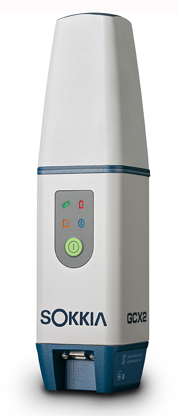
TerraGo Magic now offers advanced integration and support for the Sokkia line of GNSS receivers, including the new GCX3.
TerraGo Magic is a zero-code platform-as-a-service that enables customers to build their own custom mobile apps without writing any code by choosing from a menu of available, field-tested features.
Featuring advanced constellation tracking and longer range base to rover communication, the GCX3 offers lightweight, compact and ergonomic benefits — along with centimeter-accurate positioning — now with expanded satellite tracking capabilities.
“The GCX3 features the new second generation POST2 integrated antenna – adding BeiDou, Galileo, SBAS, QZSS, and GAGAN satellite tracking in addition to GPS and GLONASS to provide users with the best positioning availability,” said Jason Tuck, branch manager at Topcon Solutions. “With TerraGo Magic, users can build their fully customized apps, tailored for their specific industry requirements and capture high-precision data in real-time from the receiver.”
“TerraGo Magic custom apps combined with the Sokkia GCX3 receiver is a superior solution for our partners and customers in utility, energy and other industries that require high-accuracy data collection,” said John Timar, vice president of worldwide sales at TerraGo. “Our integration makes it possible to capture the full fidelity and GPS data record with a user experience and modern mobile features unmatched by legacy GPS data collectors.”
In the July and August issues of the magazine, the “Out in Front” editorials held forth on the perfection or lack thereof in the GPS signal and service.
Now it’s your turn!
Give us your opinion at gpsworld.com/17augustpolland we’ll publish the results in the September issue. And you’ll gain entry to a random drawing for a $50 gift card.
The question is: How close to perfect is GPS performance?
And your choices are:
Absolutely perfect. 100 percent.
Nearly perfect. The space segment functions flawlessly. The only problems are with jamming and user equipment.
Almost nearly perfect. There have been a few hiccups in space, then there’s jamming, and user equipment weaknesses.
Not nearly close enough to perfect — but pretty good. The (admittedly rare) operator miscue, jamming, spoofing, and other exploitable user equipment weaknesses.
Fair, but a long way to go. All the above cited problems, plus lack of signal reception under canopy, urban canyons, indoors.
Not a passing grade. But it’s the best I have, so I grit my teeth and use it.
Pretty poor if you ask me. It just does not meet my requirements.
Other (please specify)
For background and two different views on the controversy engendered by a U.S. Air Force public release on this subject, see:
It’s almost September. For the GPS World staff, this means scramble time. We have two important industry events to attend: The venerable ION GNSS+ conference and the huge Intergeo trade show.
ION GNSS+ is the Institute of Navigation’s largest technical meeting and showcase of GNSS technology, products and services. Hundreds of papers are shared by experts in the field, in presentations and panels.
The show has changed over the years to broaden its focus to applications, and added a “+” to its name to incorporate all the positioning, navigation and timing (PNT) technology that aids GNSS in location, much as we have also done in providing a new subtitle to our magazine.
New this year are Short Courses, aimed at bringing your non-technical staff up to speed on the technology behind the industry, no matter their background. For instance, one course is “GNSS 101: An Introduction.”
Intergeo, which is held each year in different city in Germany, comes to Berlin. The huge show, attended by about 17,000 people, is a conference and trade fair (emphasis on trade fair) for the fields of geodesy, spatial data, surveying, UAVs and land management.
A hot topic at Intergeo continues to be Geospatial 4.0, the massive transformation where big data, mobility and cloud solutions are driving a new global digital economy.
Other buzzed-about topics include photogrammetry, building information modeling (BIM) and smart cities.
One important and timely topic is the need for infrastructure that ensures data security and protection. Once again, the Interaerial Solutions show for UAVs will take place as part of Intergeo.
 Facebook has selected Tallysman’s TW2643POC GPS/Iridium antenna for the Facebook Open Cellular Platform.