The 2017 Esri User Conference, the mecca of geographic information systems (GIS) in the U.S., is taking place July 10-14 in San Diego, California. This year, the theme is “The Science of Where.”
The conference is designed to give attendees practical advice and hands-on experience with GIS tools from Esri and other companies, as well as share ideas and best practices for improving our world through maps.
The event encompasses 16,000 GIS users, managers and developers; 300 moderated sessions; 450 hours of technical training; and 300 software vendors.
The Expo Hall at the Esri User Conference. (Photo: T. Cozzens)A wall in the SDCC lobby is dedicated to tracking the upcoming full eclipse across the U.S. (Photo: T. Cozzens)
Advanced GPS navigation app Sygic has released its new augmented reality (AR) feature. More than 200 million Sygic users worldwide can engage with AR for an improved navigation experience on the road.
Sygic’s new AR feature uses a smartphone’s GPS and camera to implement its augmented reality-powered GPS navigation system. With the AR feature, the driver no longer needs to follow a map on their phone. Instead, they’re guided by a virtual path on the smartphone camera preview.
The AR feature is not only intuitive, but is also safer than traditional navigation apps. Drivers can rest assured they won’t miss anything crucial on roads or highways, as the real-time camera preview enables them to check conditions on the screen without impacting driving safety.
“We are so pleased to make Sygic’s AR feature available to users around the world. We understand the value of bringing the latest technology features into Sygic GPS Navigation, and to bringing smart life to your device,” said Michal Stencl, CEO of Sygic. “However, our new AR capability isn’t just a shiny new tool. Whether you’re in the car with your loved-ones, friends or by yourself, the AR featured is designed promote the highest form of road safety.”
The AR feature called Real View Navigation is available for all Android and iOS users as in app purchase for 9,99 EUR.
Sygic posted a video clip of the new feature on its Twitter account.
According to a 2015 Pew Research Center study, 67 percent of smartphone users surveyed said they occasionally use their phones for turn-by-turn navigation while driving. Even more, 31 percent said they frequently use navigation apps.
Sygic was described as one of the world’s most successful apps by the BBC.
“Sygic’s philosophy is to explore the boundaries of navigation, and we look forward to bringing more revolutionary tools and features to users later in 2017,” Stencl said.
The Trimble Catalyst software-defined GNSS receiver for Android devices is now available through Trimble’s global distribution network.
Trimble Catalyst DA1 antenna attaches to a smartphone running a Catalyst-enabled app.
Through Catalyst and a special antenna, customers can access positioning-as-a-service to collect geolocation data with Trimble or third-party apps on smartphones, tablets and mobile handhelds.
When combined with a plug-and-play digital antenna and subscription to the Catalyst service, the receiver provides on-demand GNSS positioning capabilities to turn consumer Android devices into centimeter-accurate data-collection systems.
Catalyst requires only a few components:
Any location-enabled mobile app.
A Catalyst subscription, with accuracy options ranging from one meter to centimeter level.
Trimble’s small, lightweight DA1 antenna that plugs directly into Android smartphones and tablets.
“Our goal has always been to extend the accessibility of high-accuracy positioning to a broader base of geospatial and non-geospatial professionals,” said Ron Bisio, vice president of Trimble Geospatial. “Trimble Catalyst represents a new era of GNSS technology by making high-precision positioning a reality for new user segments around the world. With economical on-demand service, it puts high-accuracy in the palm of anyone’s hand — it’s revolutionary.”
Both Trimble and third-party development teams have produced a range of Catalyst-enabled applications for geographic information system (GIS) data acquisition, cadastral land management, topographic mapping and ground control for unmanned aircraft systems (UAVs).
Also, the Trimble Catalyst solution includes a software development kit (SDK) for building mobile applications with integrated professional workflows.
“Trimble is enabling us to deliver better solutions for our customers thanks to the level of integration that the SDK provides,” said Paul Brodin of Korec Group. “It allows us to provide sophisticated solutions that are innovative, easy to use and remove the technical complexity associated with high-accuracy workflows.”
Trimble Catalyst service subscriptions and the Catalyst DA1 antenna are now available through Trimble’s Authorized GIS Distribution Network. Catalyst availability, pricing, subscription and accuracy may vary by region. Catalyst-enabled apps for Android can be found in the Google Play Store.
Esri has released Esri CityEngine 2017 with a variety of new features.
This latest version of Esri’s 3D modeling software offers new features that let planners and architects compare different scenarios and visualize them with dashboards to view how each would affect the same geographic area — all in real time.
Image: Esri
With the updates available in the new version of CityEngine, users can make changes to specific features — such as adjusting the size of windows or adding a balcony — in a model without affecting the entire structure.
Before this, planners would have to create two entirely different projects to understand the consequences of a proposed building’s design variations.
“With this release of CityEngine, we focused on the needs of urban planners, designers and architects,” said Pascal Mueller, director of Esri R&D Center Zurich AG, where CityEngine is developed. “We are proud to introduce a groundbreaking new-tool concept for the scenario-based planning in a 3D application.
The software team also implemented long-awaited user requests such as measurement tools and computer-generated architecture (CGA) neighborhood queries, Mueller said. Also, the graphical user interface has been completely revamped with a fresh, modern look and improved ease of use.
The new CityEngine also introduces procedurally generated 3D city content. This means that planners can automatically create unique design features on buildings without manually rendering them. This feature saves time that urban planners and architects would otherwise spend generating details themselves.
“Smart cities of the future will be designed more transparently, and the design process will engage citizens,” said Dominik Tarolli, head of 3D geodesign business at Esri. “With CityEngine 2017, smart city scenes can be created in minutes and shared via the web or Esri’s ArcGIS 360 VR app in a single click.”
The latest version of CityEngine is available for Windows, Mac and Linux platforms. A free 30-day trial with full export capabilities can be downloaded.
Major changes have been added to the ArcGIS Web AppBuilder in its June 2017 update, in the form of new widgets. For those who use the AppBuilder for creating applications rather than using ArcGIS for Developers, widgets serve as a mainstay for mapping application projects.
For the summer update, eight new core widgets are now available for users. Here’s a quick overview of what’s new.
GIS developers focused on aesthetic aspects of the new update will find a lot of use out of the new basemap gallery widget. Rather than the standard set of initial maps that Esri provides, organizations are now capable of setting up a variety of basemaps of their own. This could work concurrently with the design aspects of ArcGIS for Photoshop and Illustrator.
An infographic feature also provides graphic templates that allow for greater data visualization, with a variety of graphs spanning from simplistic number representations to more complicated charts.
Additionally, the new “dashboard” theme can take widgets such as the basemap gallery and infographic widgets and display them simultaneously, with the added ability for users to format the size and arrangement of how they’re displayed.
A screenshot of the ArcGIS infographic widget.
For GIS professionals working more with data analytics, a conversion widget enables users to input coordinates in one system and output to another. Some of the coordinate conversions listed:
Global Area Reference System (GARS)
Degree-based formats (DDM, DMS, and DD)
Military Grid Reference System (MGRS)
United States National Grid (USNG)
World Geographic Reference System (GEOREF)
Universal Transverse Mercator (UTM)
The new suitability modeler also helps analysts visualize location susceptibility based off of available data, and can project the likelihood of future occurrences in selected areas.
An in-depth overview of all eight widgets, alongside some general enhancements for the ArcGIS summer 2017 update, is available here.
Olivia Harne is a writer, researcher and geographer.
senseFly will showcase how to integrate drone imagery into current workflows at the Esri User Conference, which takes place July 10-14 in San Diego. senseFly is hosting a series of workshops designed for surveying, mapping and GIS professionals.
As a producer of mapping drones and an Esri Silver Partner, senseFly will present the innovative ways in which its drones are being used with Esri’s Drone2Map for ArcGIS software to deliver on-demand high-resolution imagery and robust GIS projects.
Drone Surveying 101 – Wednesday, July 12
This workshop will be led by Francois Gervaix, surveying project manager, and is aimed at visitors wanting to know more about drone mapping and surveying. He will explain how senseFly solutions can be used as a surveyor’s own imagery sourceanytime, anywhere — as well as how Esri’s Drone2Map for ArcGIS makes the creation and integration of drone imagery into workflows even easier.
The session takes place 12-1 p.m. in room 30 B of the San Diego Convention Center. Refreshments will be provided. To register, go to https://dronesurveying101.eventbrite.com.
senseFly User Meeting – Thursday, July 13
With the geospatial market needing specific and integrated solutions, Briton Voorhees, sales engineer, will give existing senseFly customers an in-depth look at its latest features. This includes senseFly Corridor, a new platform enhancement that vastly simplifies the drone mapping of linear sites, for applications such as utilities monitoring, as well as the newest release of eMotion 3.
Briton will also speak at the pre-conference Imaging and Mapping Forum on the various sensors available to senseFly users and detail how they can apply to imaging applications.
senseFly’s drones offer full compatibility with Esri’s Drone2Map for ArcGIS mapping and spatial analysis software.
senseFly is also exhibiting at the UC Expo and encourages visitors to stop by booth 2126 to speak to its team of experts.
Tersus GNSS has launched what it calls a new generation GNSS RTK system with multi-technology integrated for surveyors: the NeoRTK System.
NeoRTK System is a high-performing GNSS RTK system applied with a multi-constellation and multi-frequency GNSS engine and various communication protocols. It aims at providing high performance and stable signal reception satisfying surveyors’ demands.
With a high-end GNSS antenna inside, NeoRTK can speed up the time to first fix (TTFF) and improve the capability of anti-jamming.
The 16G internal storage and up to 32G external SD card, along with the built-in large capacity battery for 10-hour field work, unleash surveyors’ productivity in their daily practice. The radio module in the package makes long distance operation more convenient, Tersus said.
With a smart personal digital assistant, which offers high readability, access to essential functions and modes becomes easier and faster. An adjustable measurement rod with automatic tilt compensation ensures efficiency in working.
With all the features, the NeoRTK System enables surveyors to keep up with the latest advancements, leading to a more convenient working mode, which will enhance surveying experience providing exceptional productivity, Tersus said.
Technology has improved the scientific community’s ability to measure in many ways that our ancestors would have trouble believing. From obtaining measurements across galaxies down to the tiniest of atom splitting, our ability to measure is exceedingly robust. The land surveying profession has benefitted from this ongoing technological revolution in many ways (GPS World March 2017) and has advanced our work in many new directions never thought possible. Substantial increases in precision through these advancements allows the land surveyor to perform various tasks, including topographic surveys, construction layout and volumetric surveys with increased confidence.
Accuracy and precision are two factors that go into our measurement procedures. While accuracy and precision are considered to be the same thing by a large portion of the population, it couldn’t be more from the truth. Accuracy is defined on how well a measurement or reading is in relation to a known value or benchmark. Precision, on the other hand, is how closely a measurement is repeated yet has no relation to any given value or benchmark.
The introduction of GNSS technology along with total stations with locking electronic distance measuring (EDM) mechanisms in the 1980’s brought more precision into the hands of the surveyor. These innovations reduced the amount of human error in our measuring procedures when used in an appropriate manner as well as allowing greater distances to be covered. The implementation of various real-time networks (RTN) on several continents also continues to increase our range of high-precision location and measurements worldwide. However, as we develop our next generation of surveyors through educational programs and apprenticeships, we are making a terrible mistake in replacing many fundamental land surveying principles and legal precedents with more emphasis on precision and less on legal accuracy based upon precedents.
Surveyors and the role of measurement
In ancient civilization, the primary role of the land surveyor was to help establish and maintain property boundaries. Measurement devices included knotted rope, the Gunter chain and the compass, all used is varying manners and precisions. Paramount to the surveyor’s effort was the establish of monuments at corner points of the tracts they were measuring. These points were held as the ultimate dividing point and superior to associated measurements and secondary tie points. This simple guide for all surveyors has been a core principle of property owner’s rights and upholding those rights in the name of the law. By placing of monuments, the landowner has relied on the surveyor to physically define the property being established and conveyed.
Let’s ask Washington, Jefferson and Lincoln…
For example, in early days of the United States during the late 1700’s/early 1800’s, once an original survey was completed, notes of each survey were preserved by various means. Most governmental surveys of the early 1800’s were transcribed onto large township sheets in order to perpetuate and preserve the work performed by the Land Office surveyors. The establishment of states and local governments brought forward land and records offices in which these government patent lands were further subdivided for conveyance to settlers of the new lands. In each of these cases, corners of various types were set to distinguish boundaries between property ownership. Wooden posts, rock mounds, and other materials were used to physically mark the locations of the corners, with notes, documentation and deeds for conveyance coming after the determination of the property. Regardless of any variation from the notes/plats/deed descriptions, property rights were held to the physical locations of the markers set during the course of the survey.
The American dream of land ownership
As more people moved westward and parcel subdivisions became more prevalent, planned developments began to be based upon pre-calculated figures. Before calculators and computers, the surveyor would determine the location of new parcel corners by hand derived calculations (usually in the field) and use a transit and chain to stake each parcel corner. Notes were carefully kept during the lot creation process and transferred to a final plat for filing at the county recorder’s office. These plats were typically post-survey with the detailed notes being drawn on the plat with specific dimensions to all points set.
As plane geometry and coordinate systems caught on (GPS World November 2016), the movement toward pre-calculated subdivisions became more common. Couple this method of calculation with increased capability of high precision theodolites and the World War 2 postwar boom, the economy and environment was ready for more time efficient surveys. Now large parent parcels were being subdivided on paper before any additional surveying was performed to establish the new lotting configuration. Surveyors began to stake parcel corners by means other than “running the lines”, i.e. physically occupying the outer boundary and setting internal points for new parcels. Add to this environment of “faster” surveying the invention of the EDM, digital total station, computer programming and analysis along with GNSS, and now we have a recipe for the most precise and accurate surveying ever performed. Or do we?
These are not your father’s (or grandfather’s) survey methods anymore
Regarding topographic, volumetric, bathymetric and aerial surveys, I would agree that technology has advanced our profession to greater heights. These tasks have benefited greatly by increased data collection, remote location and sensing and computing power. The surveyor’s ability to provide an extremely detailed set of data for varying surfaces and site conditions is at an all-time high with more technology continually being developed. But how has technology affected our primary role of boundary line expert? While in many ways as technology has helped the boundary survey, it has also taken away from the surveyor’s responsibility and duty as expert measurer. The intent of the surveyor is mostly clear when retracing a prior survey or creating new parcels from existing ones but execution, along with mistakes/errors/blunders, throw ambiguity into the fold. Not knowing where to find a random error within a prior survey leads many practitioners down a long and frustrating path. In a perfect world, the math would all work out and everything fits together like a glove. However, due to many variables and errors that randomly and systematically happen during our work, this condition is near impossible to attain. This quote is from the “Illinois Boundary Law” book written by land surveyor/attorney Jeff Lucas in 2012 sums it up well:
“There is an irresistible urge on the part of many surveyors to trust math and measurements over their understanding of boundary law principles. When this misplaced trust is coupled with the confusion over the land surveyor’s duties and responsibilities, the land surveyor is free to ignore clear-cut doctrines of law when precision expectations come into conflict with the realities that are found on the ground.”
So, what does this mean? Many of the legal descriptions surveyors have been charged with to perform a boundary survey were created using equipment, techniques and simple math far inferior to today’s standards. For example, a survey in downtown Chicago may be based upon a plat from the early 1800’s, (if the record happened to survive the Great Fire of 1871) and was depicted in chains and links. We now have surveyor who show all dimensions to the 1/1000th of a foot on these boundary and land title surveys. Considering that most of the surveys from that era only had a precision of one link (0.66 ft.), it could be considered overkill to need to be that precise. I’m in agreement that the survey must depict the current conditions and properly define where boundary rights are physically located, but to show that many significant figures is careless and unnecessary.
For surveys on larger parcels and in rural areas, GNSS use (and abuse) now comes into play much more often. As I’ve written previously (GPS World May 2016) GNSS implementation is the single greatest advancement of surveying technology in my opinion. The ability to survey significant areas with great precision still impresses me and I wouldn’t trade it for anything. But notice I stated “precision” and not accuracy and this is where many surveyors get off track; hence, the statement from Mr. Lucas.
“First, the surveyor can, in the first instance, lay out or establish boundary lines with an original division of a tract of land which has theretofore existed as one unit or parcel. In performing this function, he is known as the “original surveyor” and when his survey results in a property description used by the owner to transfer title to property that survey has a certain special authority in that the monuments set by the original surveyor on the ground control over discrepancies within the total parcel description and, more importantly, control over all subsequent surveys attempting to locate the same line.
Second, a surveyor can be retained to locate on the ground a boundary line which has theretofore been established. When he does this, he “traces the footsteps” of the “original surveyor” and locating existing boundaries. Correctly stated, this is a “retracement” survey, not a resurvey, and in performing this function, the second and each succeeding surveyor is a “following” or “tracing” surveyor and his sole duty, function and power is to locate on the ground the boundaries corners and the boundary line or lines established by the original survey; he cannot establish a new corner or new line terminal point, nor may he correct errors of the original surveyor. He must only track the footsteps of the original surveyor. The following surveyor, rather than being the creator of the boundary line, is only its discoverer and is only that when he correctly locates it.”
The surveyor’s role in boundaries, period
To further illustrate the surveyor’s role in each type of survey, let’s examine the recent publication of “Boundary Retracement Processes and Procedures” by Donald A. Wilson, a long-time land surveyor and prolific writer of surveying manuals. Don’s book delves deep into all things concerning the role of the land surveyor in completing a property retracement survey. While surveying does rely heavily on good measurement techniques, it goes along with a handful of other talents as well. Don’s book revisits a 1985 Vermont Society of Land Surveyor’s publication “Cornerpost” (VSLS Cornerpost) that contained an article titled “What does a land surveyor do?” written by George F. Butts. In the article, George lists in detail that besides the prerequisite surveying knowledge, the surveyor must also have some aspect of skills for the following disciplines: archaeologist, astronomer, cartographer, computer specialist, dendrologist, detective, engineer, farmer, forester, geologist, handwriting expert, historian, hydrologist, lawyer, logger, judge, juror, photogrammetrist, writer, and expert witness. Notice that George didn’t include mathematician or statistician, both disciplines that rely heavily on the study of formulas, figures and data. While surveying computations relies heavily on geometry and trigonometry, the first order of business in data analyzation is how it relates back to the “original survey.” This brings us back to the primary role of the land surveyor – “following the footsteps.” As Don quotes; “…following the footsteps of the original surveyor is the legal standard adopted by the courts in all jurisdictions, and for very good reason.” The intent of the retracement surveyor is to uncover the past through all necessary information and bring to life the original survey. How the surveyor gets there, through the muddied use of technology, often leads us down the wrong path. He also adds from the 1818 South Carolina court case of Bradford v. Pitts (2 Mills. Const. Rep 115); “Blind devotion to a rule may lead to infinite failure.”
Back to the Stone Age?
So, what is the answer? Do we throw out all the electronic tech and time-saving methods in order to retrace all surveys with compass and/or transit and chain? Of course not. I do ask that all surveyors look at what the profession has charged them with and how they use their tools to get there. For instance, I am thankful for all the medical breakthroughs in the past 100 years, especially when it comes to technology. Imaging machines, robotic laser procedures for internal surgeries and more come to mind, but let’s remember that doctors still look at the human element and not just what a computer spits out as a diagnosis. How many times have you looked up your symptoms on WedMD and decided you were dying from that rash? Surveyors are doing the same thing with analyzing data from the mathematics view and not from the boundary law principles view.
It’s not all just about the location data
High-precision GNSS locations (and conventional data) we collect as surveyors needs to be included with the analyzation of the historical data from the legal side of the survey. If we didn’t find the original points, did we find ones that were substantially close to where the originals were? Were any of the original conditions at the time of the survey still intact? Bearing trees? Buildings? Any reference ties? What most surveyors tend to forget well is that all measuring devices (and I do mean ALL) are not the same, no matter how close they are manufactured and calibrated. Couple that with mistakes/errors/blunders I spoke of earlier, and here is your recipe of inconsistencies between surveys. You will say your instruments and devices are in top condition, so your data is right and the previous surveyors obviously messed something up. The unfortunate thing is that almost every surveyor makes that statement and we all are wrong to some degree. The bottom line is that while we may collect a ton of data with the upmost precision, it may not be accurate with the intent of the project, which is to retrace the original survey to the best of your ability. I’m not advocating that we dump our fancy robots, our very handy RTN networks or my shiny new UAV; instead, let’s get back to the basics. As Don Wilson notes in his preface of the new book; “One of the biggest differences between the surveyor relying on principles and court relying on precedent is that courts continually revisit the reason for the rule, or the decision in the previous case, to ensure that it applies, and fits the issue.” What I am advocating is that we remember the duties of our role and utilize the necessary tools to perform and deliver to the best of our abilities. I’ve had mentors and teachers that relied heavily on the math and not so much the true legal definitions. That means we need to brush up on the law and precedents that have been established for various situations and reasons. It will be through continuing education of our everchanging profession that will open more surveyor’s eyes to what the role of the surveyor was truly meant to be. With no disrespect to the GIS world, surveyors don’t aspire to be a map makers or database managers. We are professional land surveyors and our duty to our clients includes professionalism and the completion of an accurate land survey through precision measurement and analysis. Just as long as we follow those footsteps…
Avineon Inc. has launched a new portion of the Avineon Innovation Lab dedicated to articles, white papers and videos highlighting the impact of Esri’s Network Management System in the ArcGIS Platform. Avineon is a provider of geospatial, information technology and engineering support services.
The new section focuses on Avineon’s contributions, expertise and partnership with Esri on the next evolution of GIS Network Management: the Utility Network.
Part of the ArcGIS platform, the Utility Network is available on any device.
GIS services and solutions have been a part of Avineon’s success for the last 25 years, which is keeping pace with evolving technology and the impact GIS has on companies in the utility and telecommunications industries.
The Utility Network lets users create, manage, and share electric, water, wastewater, gas, district heating, and telecommunications asset data. The beta release of the Utility Network comes with base data models for electric, gas and water networks.
The technology is capable of supporting other networks — such as district heating, telecommunication and wastewater — but, for now, users need to build their own data models or rely on partners. Esri will provide base data models in some of these areas in later releases.
“Avineon has been a valuable partner and contributor to Esri’s Utility Network throughout the early adopter program, providing valuable feedback to our product teams,” commented Bill Meehan, Director of Utility Solutions for Esri. “The resulting Network Management System in the ArcGIS Platform will support utility and telecommunication companies as they execute their business plans for innovation, digital transition and transformation, sustainability, and smart ecosystems (smart grid, smart buildings, smart transportation, smart cities, etc.). We believe Avineon’s partnership with Esri and offerings like Avineon’s Head Start program, as well as observations into the practical applications of the Utility Network, through their Innovation Lab, will help industries understand the strategic and tactical pathway to maximize the value of their GIS now and into the future.”
Joel Campbell, Avineon’s vice president of Commercial Systems, added, “As an Esri business partner, it is exciting to support our customers and contribute to Esri’s vision of the ArcGIS Platform. These new capabilities serve as the foundation for delivering a new generation of business applications leveraging web and services patterns as well as evolved network management capabilities. We at Avineon look forward to utilizing our Innovation Lab as an outlet to share the lessons learned, best practices, and case studies around the newest evolution of GIS and its impact on the utility and telecommunication industries.”
Northrop Grumman Corporation has been awarded a contract from the U.S. Air Force for technology maturation and risk reduction in support of next-generation navigation systems.
Under the $49 million contract from the Air Force Life Cycle Management Center, Northrop Grumman will provide the preliminary hardware and software architecture design for the Embedded GPS/Inertial Navigation System (INS)-Modernization, or EGI-M, technology. The modernized system is expected to be available for platform integration starting in 2019.
Northrop Grumman’s EGI-M will be based upon modular, open systems architecture to support the rapid insertion of new capabilities and adaptability based on unique platform requirements. Additionally, EGI-M will incorporate M-code-capable GPS receivers, which will help to ensure the secure transmission of accurate military signals.
“We are dedicated to ensuring mission success and the safety of warfighters by providing an EGI-M solution that offers robust, accurate and reliable positioning, navigation and timing [PNT] information, even in GPS-denied conditions,” said Dean Ebert, vice president, navigation and positioning systems business unit, Northrop Grumman Mission Systems.
EGI-M technology is designed for compatibility with current systems on legacy aircraft, allowing ease of integration and rapid adoption of new capabilities.
EGI-M will also comply with the Federal Aviation Administration’s NextGen air traffic control requirements that aircraft flying at higher altitudes be equipped with Automatic Dependence Surveillance-Broadcast (ADS‑B) Out by January 2020.
ADS-B Out transmits information about an aircraft’s altitude, speed and location to ground stations and to other equipped aircraft in the vicinity.
Applanix is collaborating on advanced research for autonomous vehicle guidance and control systems with the University of Waterloo Centre for Automotive Research (WatCAR) in Ontario, Canada. Applanix is a Trimble company.
Applanix will provide WatCAR with its positioning and orientation system for testing autonomous guidance and control systems in real-world conditions. Applanix will also provide the Trimble GNSS-inertial board set for integration with car systems and sensors to enable precise positioning.
The Applanix POS LV is a robust, reliable and repeatable positioning solution for on- and off-road vehicles. Applanix technology will be used by WatCAR to assess the performance of the guidance and control systems on board their autonomous vehicles.
The testing will take place in challenging weather conditions and environments including on roads under repair, with lane reductions and closures, are wet or covered in snow, and where there is poor visibility.
An SUV in an anechoic chamber at WatCAR.
Applanix will also provide WatCAR with Trimble on-board GNSS-inertial board set designed for high-performance, high-volume original equipment manufacturer applications. These products, currently used in a variety of autonomous vehicle programs, include the Trimble AP GNSS-inertial board set that includes a high-precision inertial measurement unit.
Small, rugged and low powered, the AP board sets provide the precise positioning needed for autonomous vehicle applications as they navigate their environment. Designed for use on all sizes and types of vehicles, the AP boards feature Trimble’s high-performance precision GNSS receivers and Applanix’ IN-Fusion GNSS-inertial integrated technology that produces uninterrupted position, roll, pitch and true heading measurements of moving platforms. Integrating easily with vehicle sensors, the AP board sets provide precise vehicle control when interacting with a constantly changing environment.
The relationship with WatCAR will aid in improving the core technologies that deliver high-end systems capabilities for a variety of Trimble markets.
The Waterloo Centre for Automotive Research in Canada conducts advanced research to further automotive innovation and competitiveness. From active safety to automated driving through lightweighting and advanced powertrains, 130 faculty researchers comprise the largest university-based automotive activity in the country. Leading-edge studies for industry partners around the world enhance vehicles, components and their materials with new approaches and integration of innovative technologies.
“We are excited to collaborate with the University of Waterloo and WatCAR on this leading research in autonomous vehicle technology,” said Louis Nastro, director of land products at Applanix. “Applanix has been committed to meeting the needs of autonomous vehicle manufacturers for more than a decade, as first demonstrated in the early days of the DARPA Grand Challenge. And today, we are also part of many autonomous vehicle programs deployed worldwide in commercial applications.”
“The Trimble AP products, first introduced in 2009, are designed for use in small, mass market vehicles where size, weight and cost factors are important,” Nastro said. “They have also been designed to easily integrate with the industry’s leading sensors, making them an ideal solution for autonomous vehicle navigation systems and sub-systems.”
“We welcome the opportunity to work with Applanix, a leader in reference systems. Their technology identifies, with very high accuracy, the exact location of our vehicle at all times,” said Ross McKenzie, managing director at WatCAR. “Applanix is a valued industry partner and their team is great to work with. Going forward we anticipate a solution that will enable autonomous vehicles to traverse the real world reliably and safely.”
Orolia, through its Spectracom brand, has introduced built-in scenarios for testing eCall In Vehicle Systems compliance to the GNSS requirements of the regulation as an option with its latest Spectracom GSG simulator products.
In an initiative to bring life-saving rapid assistance to motorists involved in a collision, European Union (EU) regulation 2015/758 requires new vehicle types of M1 and N1 anywhere in the EU to be equipped with eCall in-vehicle systems as of March 31, 2018.
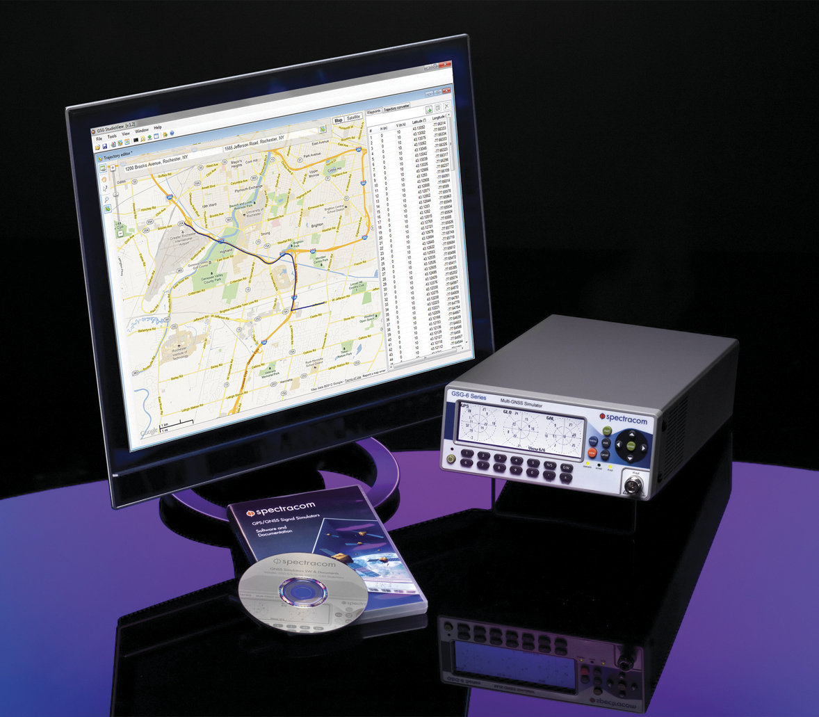
Spectracom’s GSG-6 Simulator with monitor.
In case of a crash, eCall systems automatically call the nearest emergency centre while sending the exact location, dramatically reducing response times. EU member states that do not comply will be refused EC type-approval for new types of motor vehicles.
Spectracom is providing options to ensure that automotive manufacturers who plan to continue selling into this market are equipped with the right tools for testing the eCall regulatory compliance of their equipment.
The Spectracom GSG line of GNSS simulators efficiently simulate all the major GNSS constellations needed for testing compliance of critical signal receiving equipment in a variety of eCall scenarios including:
Positioning accuracy under different conditions
Time-to-first-fix
GNSS receiver sensitivity
Re-acquisition performance following signal outages
Playing specific static and dynamic trajectory scenarios
Changing RF transmit power level manually or remotely sequenced as required by standard
“The eCall regulations require significant effort on the part of the auto industry to comply, and we are pleased to be including standard eCall scenarios as an option for our popular line of Spectracom GSG simulators,” said Lisa Perdue, GSG product manager at Spectracom. “We work in partnership with our automotive industry clients and will continue evolving the simulation product line to meet their needs for compliance testing with life-saving regulations.”