GNSS Survey & Engineering, a 238-page primer for the professional user, has just been published by Geomares. Four opening chapters deal with the general layout of GNSS, its errors and its practical use. Geared to the everyday professional GNSS user, this section does not give in-depth theoretical background. The second group of four chapters discusses topics such as geodesy, satellite signals and positioning theory. Filling in the background of subjects in the first part, this section is aimed at the more specialized professional user or student who needs an in-depth knowledge of GNSS positioning.
This is the second edition of the book by Huibert-Jan Lekkerkerk. The book is based on lectures the author has written for Skilltrade, an online training site, as well as a series of articles on satellite navigation systems. Lekkerk has bachelor’s degrees in hydrographic surveying and maritime electronics and a Master’s degree in geographic information management. He works in hydrography and on the standardization, analysis, processing and dissemination of geographic data for the Dutch government.
The solution also features configurable software, allowing the addition of support for GNSS and sensing.
According to the companies, Dragonfly NB1 leverages Ceva’s long heritage of low power DSPs and modem design and Astri’s experience in RF and IC design technologies. Dragonfly NB1 has the ability to reduce the time taken to get NB-IoT products certified and also provides low-power wide-area SoC designers with a flexible, software-upgradeable platform with key benefits in terms of die size and power consumption, the companies added.
The Dragonfly NB1 solution is enabled by a Ceva-X1 IoT processor and incorporates highly power-efficient multi-standard RF with embedded PA, LNA, DC-DC and DCXO technology for NB-IoT and GNSS (GPS and BeiDou). It is specifically designed to operate with embedded flash by incorporating an optimized low latency memory subsystem with a dedicated cache controller.
“In the coming years, NB-IoT will become the dominant technology for low power wide area connectivity,” said Michael Boukaya, vice president and general manager of Ceva’s Wireless Business Unit. “For most companies, understanding how to develop this technology is a daunting task. To overcome this, we have worked relentlessly with ASTRI to develop a complete solution from the ground up, that removes the design burden and allows SoC designers to add NB-IoT connectivity to their product designs. We’re extremely excited to announce this solution and demonstrate our leadership in IP for NB-IoT.”
Ceva and ASTRI have also teamed up with GMV, a major player in navigation systems and solutions, to offer an integrated GNSS solutions for smart devices with location tracking of logistics, assets, wearables and more. According to the companies, the GNSS IP is available as an add-on software that runs on the Ceva X1 together with the NB-IoT and leverages ASTRI’s GNSS RF IP that is embedded in the solution.
In early January, a new U.S. Department of Homeland Security (DHS) document appeared: “Improving the Operation and Development of Global Positioning System (GPS) Equipment Used by Critical Infrastructure.”
The document focuses on receivers used in critical infrastructure, with an emphasis on timing receivers. It provides owners, operators, researchers, designers and manufacturers with information to improve the security and resilience of PNT equipment across the spectrum of equipment development, deployment and use.
Specifically, its recommendations address:
installation and operation strategies that can be implemented for current equipment,
strategies that can result in more robust and resilient new and/or improved products based on existing technology and knowledge,
research and development that can lead to improved future capabilities.
It introduces clear definitions of different categories of threats and hazards, including the new term “data spoofing.” It recommends some creative ways to install receive antennas, such as using decoy antennas and obscuring the location of the actual antennas being used, presumably to foil some spoofing attacks. It also points out that modern GNSS receivers are computers, and need to be operated and maintained with good cyber hygiene, just like other computers.
The extensive list of recommended development strategies will challenge manufacturers while informing purchasers about the features they can seek in new equipment.
Implementing these recommendations will lead to increased competence — that is, equipment that is better able to accommodate imperfect or faulty inputs, intentional or not.
The document reflects the recognition that many reported problems or difficulties with GPS could be prevented or mitigated by improvements in GPS user equipment and how it is installed and operated. It is encouraging to see DHS taking steps to remedy this situation, and important that manufacturers of timing receivers, as well as critical infrastructure owners and operators that use timing receivers, follow through on these recommendations.
The document is posted on the website for DHS’ National Cybersecurity & Communications Integration Center, National Coordinating Center for Communications-Computer Emergency Readiness Team.
The Federal Aviation Administration (FAA) today released an updated list of pilot, air traffic controller, law enforcement and citizen reports of potential encounters with unmanned aircraft systems (UAS). The latest data cover February through September 2016.
Reports of possible drone sightings to FAA air traffic facilities continued to increase during FY 2016. There were 1,274 such reports from February through September last year, compared with 874 for the same period in 2015.
Although the data contain several reports of pilots claiming drone strikes on their aircraft, to date the FAA has not verified any collision between a civil aircraft and a civil drone. Every investigation has found the reported collisions were either birds, impact with other items such as wires and posts, or structural failure not related to colliding with an unmanned aircraft.
Safely integrating unmanned aircraft into the national airspace system is one of the FAA’s top priorities, and the agency wants to send a clear message that operating drones around airplanes and helicopters is dangerous and illegal. Unauthorized operators may be subject to stiff fines and criminal charges, including possible jail time.
The FAA wants operators to know where it’s legal to fly their drones. For current information on where unmanned aircraft can be flown safely, the FAA offers the B4UFLY app, available for iOS and Android smartphones. The app is free and can be downloaded from iTunes and Google Play.
TerraGo has entered a partnership with Duncan-Parnell, a provider of geospatial solutions to the surveying, construction and other infrastructure industries in Delaware, Washington, D.C., Georgia, Maryland, North Carolina, South Carolina, Tennessee, Virginia and West Virginia.
“Our customers depend on Duncan-Parnell to provide innovative, reliable solutions for their geospatial and infrastructure management needs,” said York Grow, MGIS Solutions Manager at Duncan-Parnell. “Because TerraGo apps provide direct integration with Trimble receivers, they can help us deliver the best of both worlds for customers with an easy-to-use field app and proven Trimble accuracy.”
“Duncan-Parnell provides the expertise and level of service that complements our mobile technology to help our customers complete projects on time and on budget,” said John Timar, vice president, Worldwide Sales, TerraGo. “The latest Trimble GPS and positioning technology combined with our user-customizable apps means they get their field work done faster and cheaper, with the precision they already know and trust.”
Duncan-Parnell specializes in providing high quality hardware, innovative software, and invaluable services to make projects successful. With 13 locations to serve customers, Duncan-Parnell is an authorized reseller of TerraGo Edge and TerraGo Magic products in addition to Trimble, Esri and other leading geospatial technologies.
The companies are hosting a webinar at 12 p.m. ET on Tuesday, March 14 that includes a live demonstration of mobile GIS and GPS solutions available from TerraGo and Duncan-Parnell.
The GPS Insight Hours of Service solution has a feature set designed to streamline fleet management. Photo: GPS Insight
GPS Insight, a technology provider of GPS vehicle and asset tracking solutions for commercial and government fleets, launched a new electronic logging device (ELD) solution on Feb. 1.
The GPS Insight Hours of Service solution has a feature set designed to streamline fleet management and ensure Federal Motor Carrier Safety Administration (FMCSA) compliance.
Hours of Service bundles an Android tablet hardwired to a GPS tracking device. The ruggedized ELD tablet features an intuitive user interface to ensure ease of use for all drivers. The management portal is web-based, secure and accessible via PC, tablet and smartphone.
In addition to the functionality required by the FMCSA, GPS Insight offers key ELD features that, together, create a powerful fleet management solution:
Messaging: Drivers and dispatch can now message each other between the tablet and the web-based interface. This capability will reduce the number of phone calls made and streamline communication with individual drivers or the entire fleet.
Navigation: Navigation is built into the ELD tablet. Management can dispatch audible and visual directions for each job to drivers using designated truck-specific routes.
GPS Tracking: The ELD solution combines e-logs with the GPS monitoring, alerting and reporting solution.
The GPS Insight Hours of Service Solution offers a simple alternative to paper logs and provides many benefits beyond compliance. Although it is an easy-to-use interface, GPS Insight understands this new mandate is a paradigm shift for the industry and is offering its customers hands-on training, augmented by on-demand training videos, to make the transition from paper logs to e-logs as seamless as possible.
“Implementing the GPS Insight ELD solution was really easy,” said Richard R., GPS Insight customer and owner of Rivers Transport Services. “We just hit the road running. The training videos for the drivers made it that much easier for them. It takes the headache of paper logs away.”
On Feb. 11, the European Union (EU) celebrated 112 Day in honor of the single European emergency phone number. The 112 system uses Advanced Mobile Location (AML) to receive location information from mobile phones.
Photo: 112 SOS
Every year, about 300,000 people who call the emergency services cannot describe their location because they may not know where they are, because they are too young to say or they are too injured to communicate. In these situations, knowing the exact location of the caller can help emergency services react quickly and save lives, according to the European Commission.
Europeans can dial 112 for free in any EU country if they need to contact emergency services, thanks to EU legislation introduced in 1991. Today’s mobile and smart devices are able to provide emergency services with accurate caller location via an SMS or data channel using GNSS or Wi-Fi capabilities.
An EU-financed project — HELP 112 — looked into how GNSS can improve caller location using the AML solution. It was tested in the United Kingdom, Lithuania, Italy and parts of Austria.
A new report shows significant improvement for caller location in several EU countries. Lithuania upgraded its network-based location solution to ensure significantly more accurate caller location. The United Kingdom and Estonia deployed the AML handset-based caller location solution that can locate a person to within 100 meters.
Currently, AML handset-based caller location for emergency services is available only on Android phones.
The system has already saved lives. On Jan. 10, an emergency call was received by the Klaipeda Public Safety Answering Point in Lithuania. The caller was an 8-year-old boy who reported he had found his father unconscious or dead, probably struck by electricity. He told the operator that he didn’t know his address or the telephone number of any of his relatives.
Although the boy unaware of his address, cell-ID location information received by the emergency services had a radius of 14 kilometers. Fortunately, around one minute after the call was received, the operator received the location via Android Emergency Location (Advanced Mobile Location), with a radius of 6 meters.
The police and ambulance services were dispatched, and emergency responders provided acute medical care to the man who had suffered an epileptic seizure.
In Austria, a woman riding a horse fell on her head and was unable to describe where she was. GNSS provided emergency services with her exact location within seconds, so she could be rescued.
Galileo increases accuracy
“Satellite navigation is crucial in determining the precise location of the 112 caller and saving lives,” says Commissioner Elżbieta Bieńkowska, responsible for internal market, industry, entrepreneurship and SMEs. “Galileo, Europe’s own satellite navigation system, will be able to locate the caller with much greater accuracy. The launch of Galileo’s initial services and first Galileo smartphones available on the market show how space data is making a difference in daily lives of EU citizens.”
In addition to funding research, the commission is also improving EU rules on 112. In September 2016, the commission proposed an update of EU telecom rules in the form of an Electronic Communication Code. The commission wants to enhance the relevant provisions of the Universal Service Directive to facilitate the use of handset-based caller location as complement to network-based location data.
According to the proposal, member states will be obliged to ensure that caller location, be it network based (provided by the mobile operator) or handset based (retrieved from a GNSS or Wi-Fi enabled phone), arrives in a timely manner to the public safety answering point that handles emergency calls.
Whichever technology is used, caller location will be free for citizens and the public safety answering points.
The GPSdome anti-jammer was developed for civilian applications. It aims to curb situations in which civilian vehicles are stuck “off the grid.” It combats electromagnetic warfare by using null steering, a method of spatial signal processing through which a transmitter can nullify communication jamming. In particular, the product was developed to address the requirements of autonomous cars, drones and unmanned aerial vehicles, all of which depend heavily on GPS to function. Several carmakers have expressed interest in integrating the anti-jammer in their autonomous cars, including Daimler-Mercedes, Ford, Toyota, Hondand BMW and others.
The Aaronia GPS Logger is a six-parameter datalogger designed for recording the position and orientation of RF antennas (such as the Aaronia HyperLOG X, HyperLOG EMI and Magnotracker series) during field investigations. It also is useful for a wide range of non-RF applications where position and movement logging is required. It has sensors in a very small form factor, with a fast data-capture rate of up to 35 logs/second. The logger with built-in battery is 4 x 1.7 x 0.9 inches and weighs 3 oz. The logger starts up in about 30 seconds and features a 66-channel GPS sensor with built-in antenna, offering a position accuracy of six feet, maximum velocity measurements of up to 350 mph and altitude up to 60,000 feet, with a signal sensitivity of –165 dBm. The logger can be used to create an RF heat map including frequency, direction and strength of an RF source with a 360-degree view. All sensor data can be captured at up to 35 readings per second on to a microSD card or via USB streaming. The real-time indication of data makes the Aaronia GPS logger useful for instantly assessing position-variable information.
For consumer GPS processing and smartphone indoor positioning
Photo: Focal Point Positioning
S-GPS is a smartphone-based sensor fusion, machine learning and signal processing suite designed to provide satellite positioning capabilities in urban environments and indoors. With its multipath-mitigation process, S-GPS improves the performance of existing radio-based positioning systems. The fully software-defined solution is aimed at system-on-chip silicon architecture and smartphone receiver front ends. A software upgrade for existing receivers, it requires no extra hardware, dongles or infrastructure to operate. The computational load of S-GPS is comparable to that of existing GNSS processing. The higher sensitivity of S-GPS allows signal tracking to be maintained in traditionally difficult environments, such as deep indoors, where standard devices would fail. This reduces the time spent in acquisition mode in urban areas, leading to significant improvements in battery life in like-for-like tests with standard A-GPS technologies.
The u-blox LARA-R3121 is a single-mode LTE Category 1 modem and a GNSS positioning engine. It is designed for Internet of Thigns (IoT) applications including smart utility metering, connected health and patient monitoring, smart buildings, security and video surveillance, smart payment and point-of-sale systems, as well as wearable devices, such as action cameras. It comes in a land grid array (LGA) package for easy manufacturing, and offers easy migration from u‑blox LTE, UMTS, CDMA and GSM/GPRS modules.
NTS units can detect difference between real and spoofed signals
Photo: OnTime Networks
OnTime Networks has added advanced anti-spoofing technology to its Blueberry and Cloudberry CM-1600 network time server (NTS) product lines. OnTime Networks’ proprietary anti-spoofing algorithms and technology provide not only an alert that GPS is been spoofed, but also the protection that the GPS timing signal is moved over to a highly stable free-running clock, as long as the detected GPS spoofing attack is in progress. Power grids are particularly vulnerable to spoofing, and are increasingly implementing GPS technology to more accurately meter allocations of electricity across the grid. Being even 10 microseconds off could cause power generators to shut down or get damaged.
The GNSS tracking engine of the K708 OEM board with 496 channels is capable of tracking all working and future constellations. Compared with the K5 series OEM boards, the K708 uses an application-specific integrated circuit (ASIC) chip that improves data quality and reduces power consumption. It is designed with strong compatibility and built-in functions, including high-accuracy position, velocity and time (PVT) output, long baseline RTK and reserved webserver service. The K708 is designed for CORS, deformation monitoring systems and related high-accuracy GNSS positioning applications. Signals received include GPS L1 C/A, L2C, L2P, L5; BeiDou B1/B2/B3; GLONASS L1C/A, L1P, L2C/A, L2P; Galileo; and QZSS.
Monitor, manage and evaluate monitoring data, optionally trigger alarms
Photo: Topcon Positioning
The Delta Solutions deformation monitoring system uses several software and hardware components — Delta Link, Delta Log, Delta Watch, Delta Sat and the Topcon MS AXII total station — to provide accurate and reliable monitoring measurements and associated reporting for asset protection. Delta Watch delivers accurate and reliable data in a variety of reporting formats to fit a project’s needs. Data from the total station, GNSS receivers, leveling devices and sensors can be processed and analyzed individually or as a network-adjusted solution. Delta Watch’s optional Delta Sat GNSS processing module allows for stand-alone GNSS monitoring or combined GNSS and total-station network adjustments. Delta Link provides hardware support communication for autonomous operation in the field, managing each power source to maximize system availability, while Delta Log provides an intuitive interface to manage observations, target types and measurement scheduling.
GPS data collector for utilities, mining, forestry, agriculture
Photo: Geneq
The SXPad 1000P is an affordable, rugged handheld GPS data collector specifically designed for mobile GIS users in applications such as water, electric and gas utilities, transportation, mining, agriculture and forestry. The high-performance 1000-MHz device is designed to give professionals the power needed to work with maps and large data sets in the field. It has an IP67 waterproof seal and can survive 5-foot (1.5-meter) drops to concrete. Its 3.7-inch color touchscreen (full VGA) is sharp and is sunlight readable. Standard features include a battery life of more than 10 hours on a charge, 8-GB internal storage, and slots for MicroSD cards and SIM cards as well as Windows Mobile 6.5. The SXPad 1000P also offers a 3.5G cellular modem, Wi-Fi, Bluetooth, video capture and a 5-megapixel camera. It is optimized for GPS/GIS field data collection using its 1-to-3-meter accuracy internal GPS receiver or one of Geneq’s high-performance SXBlue GPS receivers for sub-meter and centimeter-level accuracy.
Glean and share insight from big data, internet of things
Esri ArcGIS 10.5 offers next-generation analytics technology by helping organizations glean insight from enterprise data, big data and the Internet of Things (IoT) and share that insight in intuitive ways. It includes improved capabilities for handling large-scale analytics and big data; a drag-and-drop interface that streamlines the creation of spatial analysis through maps, charts and graphs; and collaboration features to connect and analyze information across the enterprise. The new release is powered by Esri ArcGIS Enterprise, a significant evolution of the technology formerly known as ArcGIS for Server. ArcGIS Enterprise has been updated with improved power to process and analyze large, disparate datasets.
Entry-level device for construction, public safety
Photo: Faro
The Faro FocusM 70 is an entry-level laser scanner for construction building information modeling (BIM) and public safety forensics. Features include an IP54 rating for use in high particulate and wet weather, high-dynamic-range imaging, an acquisition speed of almost 500,000 points per second and extended temperature range. Data captured can be used with various third-party software packages. The Faro FocusM 70 is specifically designed for both indoor and outdoor applications that require scanning up to 70 meters and at an accuracy of +/– 3 millimeters.
PingNav ADS-B OUT GNSS navigation unit. Photo: uAvionics
PingNAV is a small, light ADS-B OUT compliant navigation source. ADS-B (Automatic Dependent Surveillance – Broadcast) helps aircraft operators sense and avoid possible collisions. ADS-B is mandated by the FAA for all aircraft in the U.S. National Airspace by 2020. PingNAV supports GPS, GLONASS, Galileo and QZSS, and has a battery backup for quicker position initialization. Dual static ports forpressure altimeter readings and integrated security and integrity technologies include receiver autonomous integrity monitoring (RAIM) and satellite-based augmentation system (SBAS) to detect and correct errors improving accuracy, reliability and availability.
The Ping200S is a small, light, FCC-approved full range mode C and mode SAutomatic Dependent Surveillance-Broadcast (ADS-B) transponder. At 50 grams, power consumption is low enough to be powered by battery pack for 2 hours, yet is powerful enough to provide visibility to other aircraft and UAVs up to 200 miles away, at which point it implements sense and avoid for drone operations in the national airspace. The ping200S is designed to meet the requirements of TSO-C199 as a Class A Traffic Awareness Beacon System.
Defense-proven to disrupt and neutralize hostile UAVS
Photo: Liteye Systems, Tribalco
The AUDS counter-UAS defense systemhas been field proven to detect, track and defeat malicious and errant unmanned aircraft systems (UAS) or drones. The fully integrated system has achieved TRL-9 status following the successful mission deployment of the AUDS system with the U.S. military. TRL-9 is the highest technology readiness level that a technology system can attain. The AUDS system — developed by Blighter Surveillance Systems, Chess Dynamics and Enterprise Control Systems — can detect a drone six miles (10 kilometers) away using electronic scanning radar. It tracks the UAV using precision infrared and daylight cameras and advanced video tracking software before disrupting the flight using a non-kinetic inhibitor to block the radio signals that control it. The detect, track and defeat process typically takes 8–15 seconds. Using AUDS, the operator can effectively take control of a drone and force a safe landing. The AUDS system works in all weather, day or night, and the disruption is flexible, proportional and operator controlled.
For UAV manufacturers to add flight time, extend battery life
Photo: Texas Instruments Sample build.
Two circuit-based subsystem reference designs can help manufacturers add flight time and extend battery life to quadcopters and other non-military consumer and industrial drones used to deliver packages, provide surveillance or communicate and assist at long distances. The 2S1P Battery Management System (BMS) reference design transforms a drone’s battery pack into a smart diagnostic black box recorder that accurately monitors remaining capacity and protects the Li-Ion battery throughout its entire lifetime. Designers can use the drone BMS reference design to add gauging, protection, balancing and charging capabilities to any existing drone design and improve flight time. A second reference design helps manufacturers create drones with longer flight times and smoother performance. It helps electronic speed controllers achieve the highest possible efficiency with performance for speeds more than 12,000 rpm (> 1.2 kHz electrical) including fast-speed reversal capability for more stable roll movement.
The CMA-5024 GPS landing system sensor meets the requirements for an instrument-flight-rules civil-certified GNSS. The European Geostationary Navigation Overlay Service (EGNOS) augments GPS to provide an extremely accurate navigation solution that will support all flight operations from en route through localizer performance with vertical guidance (LPV) CAT-l equivalent approach. The CMA-5024 is compliant with and completely supports EGNOS/SBAS, from departure, en-route navigation and all EGNOS/SBAS LPV precision approaches, and complies with published Communication Navigation Surveillance/Air Traffic Management (CNS/ATM) navigational mandates.
A new variant of Qualcomm’s connected car reference platform uses its gigabit-class Snapdragon X16 LTE modem to help car manufacturers deliver high-speed, high-quality and reliable connectivity for advanced telematics and connected vehicle services. It supports peak download speeds up to 1 Gbps. The reference platform allows carmakers to integrate additional wireless and networking technologies, including Wi-Fi, Bluetooth, Bluetooth Low Energy and GNSS, with optional support for dedicated short-range communication (DSRC) and cellular-V2X. The platform includes a module reference design for the Snapdragon X16 LTE modem to help automotive suppliers accelerate development. The reference platform integrates quad-constellation GNSS and 3D dead-reckoning location solutions, and is designed to manage concurrent operation of multiple wireless technologies using the same spectrum frequencies.
RAK equipment records video and tracks GPS coordinates of distressed roads. Photo: RAK
Red Hen Systems Inc. is offering a way to accurately categorize road conditions and linear miles.
The Road Assessment Kit (RAK) can be installed and operated for assessing roads, bridges, curbs, sidewalks, signs and more.
The all-in-one system uses real-time video geotagging with Red Hen’s patented video mapping system, the VMS-333. The VMS-333 connects to a GPS receiver and camera or video recorder to automatically geotag photos, videos and audio notes with GPS coordinates.
The data can then be analyzed in Google Earth with isWhere, Red Hen’s geospatial media mapping software, which provides a track log of the route traversed. Data can also be mapped in Esri ArcMap.
A screenshot of isWhere. Photo: RAK
The survey hardware can be moved from one vehicle to another in 30 minutes or less and is suitable for routine vehicle operation in between annual road surveys.
Using GoPro cameras, the kit can capture up to four views with GPS data points in a single data collect.
The Belgian dredging, environmental and engineering group DEME relies on the accuracy and reliability of the AsteRx family of precise GNSS positioning solutions from Septentrio.
DEME is using Septentrio’s AsteRx GNSS receivers to obtain centimeter-level accuracy for all its dredging and marine construction operations worldwide. These receivers are specifically designed to operate in difficult conditions, from dredging a few meters from the coastline to constructing wind turbines kilometers out at sea.
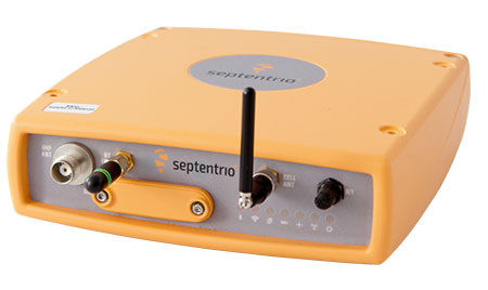
AsteRx-U dual-antenna receiver.
DEME began using Septentrio’s solutions more than 10 years ago. While dredging in the Belgian town of Oostende, DEME was unable to obtain a reliable RTK position from their GNSS equipment because of interfering radio signals from a local radio tower.
Septentrio worked with DEME to identify the source of the interference and modified a standard RTK receiver with special firmware to address the jamming problem. This case, along with others faced by Septentrio’s customers in the field, encouraged the development of a dedicated interference mitigation technology called AIM+, which is now standard in Septentrio’s GNSS solutions.
Septentrio’s AsteRx GNSS receivers have been deployed on DEME’s ships around the world. They have been vital to DEME for the success of projects such as the creation of Gateway Port in London, U.K.; the construction of Deurganckdok in Antwerp, Belgium; the Pearl Qatar City; the Thornton Bank Offshore Windfarm in Belgium; the extension of the Suez Canal in Egypt; and many more.
“’Creating land for the future’ is the slogan here at DEME and this is thanks, in part, to the accuracy and robustness of the solutions offered by Septentrio,” says Lorentz Lievens, head of the survey department.
“Jamming is a concern which DEME has seen more and more all over the world,” Lievens says. “Septentrio’s receivers are unique in that they continue to provide an accurate solution even in areas of high radio and ionospheric interference allowing DEME to deliver projects on time and on budget. Septentrio’s precise positioning solutions will remain vital for DEME to deliver quality and cost-effective operations around the world for many years to come.”
Rolls-Royce and VTT’s vision of futuristic land-based control center, known as the Future Operator Experience Concept or oX. (Concept: Rolls-Royce)
Rolls-Royce and VTT Technical Research Centre of Finland Ltd. have signed a strategic partnership to design, test and validate the first generation of remote and autonomous ships.
The partnership, established in November 2016, combines and integrates the two company’s expertise to make such vessels a commercial reality.
Rolls-Royce is pioneering the development of remote controlled and autonomous ships and believes a remote controlled ship will be in commercial use by the end of the decade. The company is applying technology, skills and experience from across its businesses to this development.
VTT is an expert in ship simulation and the development and management of safety-critical and complex systems in demanding environments such as nuclear safety. It combines physical tests, such as model and tank testing, with digital technologies, such as data analytics and computer visualization.
They will also use field research to incorporate human factors into safe ship design. As a result of working with the Finnish telecommunications sector, VTT has extensive experience of working with 5G mobile phone technology and wi-fi mesh networks. VTT has the first 5G test network in Finland.
Working with VTT will allow Rolls-Royce to assess the performance of remote and autonomous designs through the use of both traditional model tank tests and digital simulation, allowing the company to develop functional, safe and reliable prototypes.
Two remote-controlled ship prepare to pass. (Artist’s concept: Rolls-Royce)
“Remotely operated ships are a key development project for Rolls-Royce Marine, and VTT is a reliable and innovative partner for the development of a smart ship concept,” says Karno Tenovuo, vice president of ship intelligence for Rolls-Royce. “This collaboration is a natural continuation of the earlier user experience for complex systems (UXUS) project, where we developed totally new bridge and remote control systems for shipping.”
“Rolls-Royce is a pioneer in remotely controlled and autonomous shipping. Our collaboration strengthens the way we can integrate and leverage VTT’s expertise in simulation and safety validation, including the industrial Internet of Things, to develop new products and in the future, enable us to develop new solutions for new areas of application as well,” says Erja Turunen, executive vice president for VTT.
Ship Intelligence will make greater use of ship systems and sensors to enhance both crew and vessel operating efficiency. (Rolls-Royce)

 The document focuses on receivers used in critical infrastructure, with an emphasis on timing receivers. It provides owners, operators, researchers, designers and manufacturers with information to improve the security and resilience of PNT equipment across the spectrum of equipment development, deployment and use.