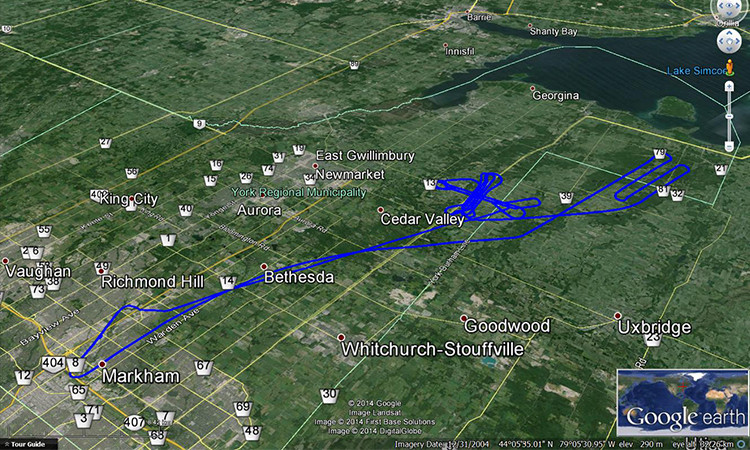
NovAtel introduced its RTK Assist service at the Intergeo show, held this week in Hamburg, Germany.
RTK Asssit is a subscription-based service that provides users with satellite-delivered correction data to seamlessly continue centimeter-level accuracy during real-time kinematic (RTK) correction outages caused by communication disruptions. Users are able to maintain RTK level performance for up to 20 minutes, reducing any associated downtime and optimizing solution productivity.
RTK is a well-established method of achieving cm-level accuracy with GNSS. However, if the RTK correction data link to the receiver is interrupted, performance degrades quickly. RTK ASSIST subscribers are able to maintain the accuracy of their positioning solution during these interruptions, avoiding any down-time. RTK ASSIST is best suited for applications where there are potential obstructions, dead spots or baseline limitations that would cause RTK network correction losses for short periods of time.
Neil Gerein, Portfolio Manager for NovAtel stated, “Combining NovAtel’s long history of expertise in RTK positioning with correction data delivered directly to the receiver via satellite allows for a continuous centimeter-level solution that is globally available 24/7.”
Raytheon has reached another milestone in its development of the U.S. Air Force’s Global Positioning System Next Generation Operational Control System, known as GPS OCX. This new system offers significant improvements to the GPS on which the U.S. military and millions of civilians rely, including enhanced availability, accuracy and security.
OCX’s development is delivered in “blocks,” with Block 0 comprising the Launch and Checkout System to take GPS III satellites into early orbit. Block 1 is built on Block 0 and delivers the full OCX capability, which allows the Air Force to transition from its current GPS ground controls to the modernized and secure GPS OCX master control station.
Raytheon recently completed a series of Risk Reduction functional checkouts of OCX Block 1 capabilities, with a focus on OCX software. This latest development activity integrated iteration 1.5 of the OCX Block 1 Master Control Station with the GPS System Simulator and ran operational scenarios, representing the first end-to-end integration of available Block 1 capabilities. The testing included GPS constellation management and sustainment, demonstrating OCX’s abilities for precision navigation and timing capabilities in a fully cyber-hardened environment.
The test included running Kalman filters and generating GPS satellite navigation uploads. The completion of the Risk Reduction functional checkout informs and benefits future OCX development efforts. Future development will add to the existing capability and expand capability to include both the civil and military modernized signals.
The U.S. Air Force-led GPS Modernization Program will yield new positioning, navigation and timing capabilities for both the U.S. military and civilian users across the globe. GPS OCX is being developed by Raytheon under contract to the U.S. Air Force Space and Missile Systems Center, which is replacing the current GPS operational control system.
GPS OCX provides a number of significant modernized capabilities for GPS users, including robust cybersecurity and deployment of jam-resistant, operational military code, or M-code. The OCX Launch and Checkout System provides an early delivery of much of the overall block 1 OCX capability, and will support the GPS III satellite launches.
A team of researchers at the University of California, Riverside has developed a highly reliable and accurate navigation system that exploits existing environmental signals such as cellular and Wi-Fi, rather than GPS.
The technology can be used as a standalone alternative to GPS, or complement current GPS-based systems to enable highly reliable, consistent, and tamper-proof navigation. The technology could be used to develop navigation systems that meet the stringent requirements of fully autonomous vehicles, such as driverless cars and unmanned drones.
Led by Zak Kassas, assistant professor of electrical and computer engineering in UCR’s Bourns College of Engineering, the team presented its research at the 2016 Institute of Navigation Global Navigation Satellite System Conference (ION GNSS+), in Portland, Ore., in September. The two studies, “Signals of Opportunity Aided Inertial Navigation” and “Performance Characterization of Positioning in LTE Systems,” both won best paper presentation awards.
Most navigation systems in cars and portable electronics use the space-based GNSS. For precision technologies, such as aerospace and missiles, navigation systems typically combine GPS with a high-quality on-board inertial navigation system (INS), which delivers a high level of short-term accuracy but eventually drifts when it loses touch with external signals.
Despite advances in this technology, current GPS/INS systems will not meet the demands of future autonomous vehicles for several reasons: First, GPS signals alone are extremely weak and unusable in certain environments like deep canyons; second, GPS signals are susceptible to intentional and unintentional jamming and interference; and third, civilian GPS signals are unencrypted, unauthenticated and specified in publicly available documents, making them spoofable. Current trends in autonomous vehicle navigation systems therefore rely not only on GPS/INS, but a suite of other sensor-based technologies such as cameras, lasers and sonar.
“By adding more and more sensors, researchers are throwing ‘everything but the kitchen sink’ to prepare autonomous vehicle navigation systems for the inevitable scenario that GPS signals become unavailable. We took a different approach, which is to exploit signals that are already out there in the environment,” Kassas said.
DJI and Datumate have begun offering a drone, software and app package that fully automates and expedites site surveys.
Tailored for professional surveying jobs, the DJI-Datumate Site Survey Solution simplifies the surveying and mapping processes, while maintaining superior accuracy. Shenzhen-based DJI is the world’s top aerial-imaging company. Israel based Datumate is a leader in automated “field-to-plan” surveying solutions.
The DJI-Datumate Site Survey Solution is a comprehensive and professional package of imagery and mapping tools that help surveying, construction, inspection and infrastructure companies quickly generate a working model, site visualization, analytics and plan.
The solution includes “Triple D” bundles of DJI Drone, DatuFly tablet app for an automated and expeditious aerial photography, as well as DatuGram 3D photogrammetry software that converts aerial and ground images to high-precision, geo-referenced 2D maps and 3D models.
“New drone regulations expedite the adoption of drones in a wide range of surveying related applications,” said Paul Xu, DJI’s director of enterprise solutions. “We believe that DJI-Datumate Site Survey Solutions offer a professional and cost-effective end-to-end solution for the surveying, infrastructure-mapping and inspection markets.”
DatuFly software generates a flight and image-taking plan for the DJI Drone, based on the best practice requirements of DatuGram 3D photogrammetry, ensuring survey-grade accuracy, high quality and quick results.
“We are excited to partner with DJI to automate and digitize the entire field-to-plan process. Our mutual solution brings site visualization and analytics quickly to the office, keeping field and office work effortless and safe,” said Datumate CEO Tal Meirzon. “DJI-Datumate Site Survey Solutions are an important step forward in professional surveying, construction infrastructure-mapping and assets inspection.”
DJI-Datumate Site Survey Solutions are available globally from the DJI online store, as well as through DJI and Datumate dealers.
Global mapping company Esri is partnering with Waze to make it easier for governments to begin building intelligent transportation systems in their communities.
Waze enables users to share and harness the power of anonymous, aggregated data to promote greater transportation efficiency, deeper insight into travel conditions, and safer roads.
Governments already using the Esri ArcGIS platform can quickly and easily exchange data through the Waze Connected Citizens Program, a free two-way data share of publicly available traffic information.
Governments that have not already subscribed to Esri technology or joined the Waze Connected Citizens Program can sign up online to start sharing road closure alerts and other information with their citizens right away.
Waze Esri Traffic Alerts.
“Municipalities can now leverage real-time reports without having to invest in sensor networks or an Internet of Things infrastructure,” said Andrew Stauffer, manager of civic technology at Esri. “Waze allows local governments to share open data with a purpose — in an application that is already popular with constituents, commuters, and tourists.”
The data feeds allow local governments to merge information into existing enterprise systems, such as emergency dispatch and street maintenance systems, to make their communities operate smarter and safer.
The partnership also enables communities to extend the reach of the data they map and manage by sharing it with Waze, which has more than 65 million monthly active users worldwide. The public-private partnership allows greater government transparency and collaboration with citizens to help people better navigate their streets and highways.
“The Waze Connected Citizens Program empowers municipalities to harness real-time driver insight to improve congestion and make better informed planning decisions,” said Paige Fitzgerald, head of new business development and data acquisition for Waze. “With 100 partners worldwide, Waze provides each partner with the same set of free, data-driven tools and resources to foster collaboration and communication between all partners. Working with Esri allows Waze to further scale the program and creates additional opportunities for our partners to collaborate, helping each other incorporate the power of crowdsourced data into their traffic management strategies.”
In 2014, Waze pioneered data standards for road closure and incident reporting, which are embedded within customized data feeds provided to each partner. Established as a two-way data share, Waze provides partners with real-time, anonymous, Waze-generated incident and slowdown information directly from the source: drivers themselves. In exchange, partners provide real-time, government-reported construction, crash, and road closure data to Waze to return one of the most thorough records of current road conditions.
Applanix introduced at Intergeo 2016 the POSPac MMS 8, its latest GNSS-aided inertial post-processing software for georeferencing data collected from cameras, lidars, multi-beam sonars and other sensors on mobile platforms.
POSPac MMS 8 uses the Trimble CenterPoint RTX subscription service to deliver these benefits for mobile mapping from land, air, marine and UAV platforms:
Achieve centimeter-level accuracy within one hour after data collection with just an internet connection — no need to wait for delivery of public-domain ephemeris data, providing productivity gains
Map inaccessible regions that have no existing Continuously Operation Reference Stations (CORS) without the cost of deploying local base stations
Attain consistent and reliable uptime using Trimble’s private network
Automatically survey in dedicated base stations direct from POSPac – streamline map production workflow
POSPac MMS 8 also includes several new features to make deployment simpler and more efficient:
Avoid rework using the “know before you go” Quality Control software– POSPac 8 now includes a separate QC software that can be commuted to the field for running Quality Control on the GNSS observations to ensure accuracy specifications can be met before leaving the project area
Single floating software license provides increased flexibility by setting up any computer to act as a server, share a single license across a network or between computers
Faster throughput with 64-bit processing
POSPac MMS 8 is expected to be available worldwide in the fourth quarter of 2016.
TerraGo demonstrated at Intergeo the latest capabilities of its line of GeoPDF products as well as survey-grade, mobile GPS and GIS data collection with its TerraGo Edge and TerraGo Magic platforms geospatial collaboration and mobility software.
GeoPDF products enable free, lightweight GIS applications, helping organizations get more value from their current investments in GIS and imagery platforms.
TerraGo Edge and TerraGo Magic are GPS data collection devices combining high-accuracy, survey-grade GPS with advanced mapping and mobile collaboration on Android and iOS devices. With TerraGo Magic, customers and partners can build their own mobile apps, fully customized with their branding and features, without coding.
TerraGo Edge v3.9.6 includes sample code for all REST API end points, automated note name options, enhanced cloud-based publishing of maps and forms and high-volume imagery and map to mobile processing. It includes:
New tools to support ArcGIS and enterprise integration: ArcGIS and enterprise integration using the TerraGo Edge REST API with the addition of sample code for every Edge REST endpoint via Postman API utility.
Automated note names with custom form fields: Configure the one-click QuickNote in any notebook to name notes by a specific form field, enabling speed in the field and user-friendly data management and searching.
Attach maps and forms to multiple notebooks simultaneously.
Import multiple GeoPDFs and GeoTIFFs at the same time: Select or drag & drop many GeoPDFs/GeoTIFFs at the same time for user-friendly, high-volume parallel processing of aerial imagery or offline basemaps.
New media filenames to help associate media to projects, includingnotebook name, note name, and a time and date stamp, to identify, search and sort media files.
GeoPDF. The latest Version 7 of TerraGo GeoPDF includes tools for publishing GeoPDF, including TerraGo Publisher for ArcGIS, TerraGo Publisher for ArcGIS Server, TerraGo Composer, TerraGo GeoPDF Platform Toolkit, TerraGo Publisher for Raster and TerraGo Toolbar.
Features in this release include:
PubPy: Extends and enhances integration into ArcGIS ArcPy to enable on-demand web services and GIS portals.
OpenGeoPDF: Adds Open Geospatial Consortium (OGC) GeoPackage to GeoPDF documents to enable GIS-Lite applications using TerraGo Toolbar Version 7.0.
Mobile: Extends and enhances its support of TerraGo Edge and private-label apps created from TerraGo Magic with capabilities to create notebooks, maps, and applications for mobile workflows.
Advanced Layer Control: Implements of a number of features to improve flexibility and ease of use in production contexts.
Remote Desktop: Enables end users to access TerraGo Publisher and TerraGo Composer on their desktop from remote location.
Compatibility: Supports the latest versions of ArcGIS including the recently released ArcGIS 10.4.1.
Licensing: Implements a new license management system to reduce the complexity and burden of license management, especially in enterprise software management.
SenseFly introduced the eBee Plus, its newest fixed-wing system for survey-grade photogrammetric mapping, at Intergeo 2016.
senseFly eBee Plus S.O.D.A. results
For photogrammetric-quality mapping, upgradeable RTK/PPK functionality and flight time of almost an hour, the UAV is designed for professionals working in fields such as surveying, construction and GIS who require efficient data collection with survey-grade accuracy.
The eBee Plus offers
built-in RTK/PPK functionality, activated immediately or later on demand, for survey-grade accuracy that the operator controls;
the new senseFly S.O.D.A. RGB camera developed specifically for drone photogrammetry work, featuring a 1-inch sensor and global shutter, capable of capturing images with a spatial resolution of 2.9 centimeters.
eMotion 3 flight and data management software, featuring a full 3D flight environment, mission block flight planning, cloud connectivity and free updates.
High Precision on Demand (HPoD) describes the drone’s built-in upgrade path to real-time and post-processing correction (RTK/PPK) functionality. Once activated by the user, this paid enhancement boosts the system’s achievable horizontal/vertical absolute accuracy to 3 centimeters/5 centimeters without the need for ground control points—dramatically reducing expensive, time-consuming field work.
Last year at InterGeo 2015, UAVs ruled, for at least the second year in a row, although some of its newest-thing gloss seemed to be wearing off. This year, sensor integration in both hardware and software is a dominant theme — and one with broader implications and applications.
GNSS positioning technology, aided in many cases by laser scanning, other imaging sensors, total stations, Lidar and camera systems, all collaborating as inputs to mobile mapping systems or machine-control systems, together form a durable platform for many present and future applications.
NavCom booth at InterGeo.
Among the GPS/GNSS companies exhibiting here: CHC Navigation, ComNav Technology, Eos Positioning Systems, Hemisphere GNSS, Navcom Technology, NovAtel, Septentrio, and Tallysman.
“I think it’s a must for every surveyor to participate and get updated with all the developments,” said Chryssy Potsiou, president of the International Federation of Surveyors (FIG), “to try to make the best combination of tools and software so that we can have the best output, in order to provide reliable services at affordable prices, in short time. The world needs solutions, cheap and fast.”
Smart Cities. Along with the roar of the four connected exhibition halls where many new products are being rolled out on this premier world stage, there is a lot of talk — a lot of talk — in the presentation auditoriums about vision, and smart cities, and connectedness in it many forms, electronic and otherwise.
The international trade fair for geodesy, geoinformation and land management, InterGeo can be overwhelming, with roughly 550 exhibits from 33 countries, and 16,000 visitors from 92 countries. It spans everything from surveying, geoinformation, remote sensing and photogrammetry to complementary solutions and technologies, processing, using and analyzing geodata over the Internet and exploring new applications and solutions — it’s all here. Themes include mobility, energy supply, climate protection, and liveable cities and rural areas. Citizen involvement, data protection, data security and e-government all play a key role in future developments. This year, the conference published a pre-show report on geodata and what it calls Business World 4.0.
Host city Hamburg, an economically strong, vibrant city and one of the top three shipping ports in Europe, embraced digital strategy at an early stage. Sustainable city planning, climate protection, an intelligent mobility concept and IT-controlled port management are all aspects of the city that could not work without geodata.
Making Connections. “Our [geospatial] industry is now more and more related, more and more embedded with many other disciplines,” said Nigel Clifford, CEO of Ordnance Survey UK, who gave one of the conference keynotes. “One of the key questions we are facing is: What skills will the workforce of the future need to have, in order to flourish in this interconnected world?
“Some of the more obvious ones are digital capability, looking at data sciences. Also we spoke about some of the softer skills: the ability to look across disciplines, the ability to work with different functions, and really importantly, the ability for our industry to explain its value and be part of the decision-making which is going on around us all the time.
“We’re beginning to see the first fruits of the Internet of Things. There may be some inflated expectations at this point. It’s our job to test that. I’m confident there are some brilliant use cases developing over the next five years in the fields of health, transport, and community engagement. Making a city more efficient, more livable, more secure, and more business-friendly, to draw tax dollars into the equation. What we’re able to do today is so much more data-rich, so much more connected, than we’ve ever been able to do before. ”
He cited pilot public-private partnership projects in Manchester and another unnamed UK city going forward in this regard, with involvement from Cisco, Siemens, and British Telecomm along with Ordnance Survey. “It’s a mixed economy coming together, because there isn’t one answer.”
Looking into the future, he said “Developing nations in particular require a fundamental geospatial fabric in order to boost themselves. I hope there will be a broadening of the focus from what we can do absolutely at the cutting edge of technology with reasonably affluent societies, to thinking about how we can take that into the less affluent societies, and raise all boats through the efforts of this great industry.”
Gorillas Enter Room. Intel has taken a stake in the commercial drone space with its new Falcon UAV. “Predominantly, we are looking at inspections, construction, agriculture, as well as 3D modeling.” The company was joined by Oracle and Autodesk as first-time exhibitors at the show, and they did not enter timidly; big stands.
UAV über Deutschland. In moves shadowing those in the United States, the German Minister for Transport spoke about introducing regulations to govern civil and commercial use of UAVs. The newly published draft foresees the introduction of mandatory registration for unmanned aerial systems. Pilots will need a valid license to fly drones above 100 meters.
Hexagon’s technologies span the geospatial information life cycle from data capture to information delivery. Its portfolio includes land and airborne sensors as well as GNSS receivers, complemented by software applications for data processing, interpretation and analysis. These tools not only display the world as it is, but model the world as it will be.
The company is making a range of presentations at Intergeo 2016, held Oct. 11-13 in Hamburg, Germany. Hexagon is focusing on delivery of geospatial information to facilitate mission- and business-critical decision making.
On the opening day of Intergeo 2016, Cathy Hayes — director of Building Information Modeling (BIM) technology for architecture, engineering and construction (AEC) at Intergraph — spoke on the company’s Smart Build program.
While construction companies have accelerated adoption of information technologies to help manage the complexity of multi-year planning efforts for million- and billion-dollar projects, many of these efforts have proven to be costly, complicated and more disruptive than helpful.
Smart Build is an application for the construction industry to improve profit margins and help complete projects safely, on time and on budget. Hayes presented background and case study material from some of the world’s largest and most challenging industrial projects.
432 Park Avenue, New York
Recent major construction projects involving Hexagon-owned Leica have included using GPS for high-accuracy monitoring and alignment of the 432 Park building in New York (tallest residential structure in the City), a similar project on the Lotte World Tower, a super-tall skyscraper in Korea, and using GPS to align the Gerald Desmond Bridge in Long Beach.
Other Hexagon presentations at Intergeo include:
GNSS and the Value of More Satellite Systems
The rapid evolution of the current and future state of GNSS and how it will affect the geospatial industry.
Digital Realities for Infrastructures
Mobile mapping is supporting the reality capture of critical infrastructures above and below ground for better city management.
IGNITE Your M.App Experience
A new approach to solving business-critical problems. Harnessing the power of the cloud and a community of developers, we can create a better map (and M.App) experience.
Airborne Urban Mapping Made Easy
Best practices for 3D city modeling with the new Leica CityMapper.
Digital Reality Management
Updates on the latest point cloud software.
Centralizing All Monitoring Information to a Single Server for Fast Decisions
Leica’s GeoMoS platforms.
MediaTek has announced the availability of the LinkIt 2523 Hardware Development Kit (HDK) for developers looking to create advanced wearable products. Based on the MediaTek MT2523G chipset, the HDK — produced by Silicon Application Corp (SAC) — offers dual-mode Bluetooth, comprehensive GNSS standards support and industry leading performance in terms of time-to-first-fix, accuracy and power consumption.
The HDK is designed for developers looking to create sophisticated wearables such as smartwatches, fitness trackers, health monitors, emergency locators and more.
MediaTek LinkIt 2523 HDK.
This new HDK — the second for the LinkIt Development Platform for RTOS — takes advantage of the platform’s common tool chain and set of APIs. It offers developers the ability to create a range of IoT devices using a common software development kit, the MediaTek LinkIt SDK v4. With the HDK launch, the SDK has also been updated to include a new smaller, more efficient Bluetooth stack and various improvements to support the MT2523 chipset variants.
The goal of the LinkIt Development Platform for RTOS is to make it easy for developers to create code that powers a range of wearables and IoT devices. The new HDK puts MediaTek leading technology in the hands of professional developers to create exciting and compelling wearable products.
The LinkIt 2523 HDK is developed by SAC, one of MediaTek’s value-added resellers of chipsets and modules, using a hardware board reference design from MediaTek. The HDK provides an easy-to-use IoT development board for the design, prototyping, evaluation and implementation of commercial wearables projects.
The board offers developers a range of essential features to ensure devices are market ready. Key features of the board include:
Robust connectivity with support for dual-mode Bluetooth 2.1 + EDR and Bluetooth 4.2 Low Energy with integral antenna.
Fast, low-power, high-precision positioning with integral HDK antenna for GPS and SMA connector for GLONASS, Galileo and BeiDou.
Integrated display and versatile peripheral options, including I2C, master and slave SPI, master and slave I2S, PCM, UART, 12-bit ADC and PWM which can be used for a broad range of wearables, including smartwatches, fitness trackers and wristbands incorporating various sensors.
Low power consumption achieved by highly integrated SoC using 55nm ultra-low power (ULP) technology from TSMC with Power Management Integrated Circuit (PMIC), and multiple frequency and voltage modes.
Flexible power options for external battery and USB (5V) charger.
Additional onboard memory (eMMC) or the option to use a microSD card.
Key features of the LinkIt Development Platform for RTOS include:
Based on the popular FreeRTOS with additional open-source modules (source code available).
Supports chipsets based on the ARM Cortex-M4 architecture, offering high performance, low power connectivity.
Supports multiple chipsets/hardware, including the MT7687F Wi-Fi SoC and the MT2523 Bluetooth/GNSS chipset family.
Development and debugging in ARM Keil μVision, IAR Embedded Workbench and GCC.
Eos Positioning Systems has announced its most advanced high-accuracy Bluetooth GNSS receiver, the Arrow Gold. The Arrow Gold is the first high-accuracy iOS, Android and Windows Bluetooth GNSS receiver to implement all four constellations (GPS, GLONASS, Galileo, BeiDou), three frequencies (L1, L2, L5) and satellite-assisted RTK.
The Arrow Gold provides 1-cm real-time accuracy in more places, and on all iOS, Android, and Windows devices. The palm-sized Arrow Gold works with any data-collection app designed for iOS, Android or Windows, which means that apps like Esri Collector, Esri ArcPad, Survey123 and others work with Arrow Gold right out of the box.
The Arrow Gold introduces an innovative RTK feature for poor cellphone coverage areas — SafeRTK. The SafeRTK feature uses satellite corrections to fill in when the user’s RTK network connection is lost. Even in populated urban areas, wireless connectivity has dead spots. For traditional RTK receivers, this is a deal-breaker. For the Arrow Gold, SafeRTK takes over when wireless coverage fails, allowing users to continue working with centimeter accuracy for up to 20 minutes, free of charge.
Another pioneering feature of the Arrow Gold is 8-cm real-time accuracy anywhere in the world, at a revolutionary price point. On all iOS, Android and Windows devices, the Arrow Gold Basic delivers 8-cm real-time accuracy anywhere in the world using all four satellite constellations and the Atlas satellite correction service.
The Arrow Gold is built for tough environments. It is palm-sized, waterproof, dust-proof and weighs under one pound. It works in the rain, dust, dirt and in rugged environments. The user can mount the Arrow Gold on a range pole or slide it in a vest pocket. The Arrow Gold’s long-range, rock-solid Bluetooth radio stays connected to your mobile device up to 1,000 meters away, and it’s field-replaceable rechargeable battery pack lasts all day.
Owing to its support of all global satellite constellations (GPS, GLONASS, Galileo, BeiDou) and all planned satellite signals, the Arrow Gold will provide cutting-edge, high accuracy for the next decade, providing a return on investment (ROI) that will serve its users for years to come, Eos Positioning said. It doesn’t matter if user decides to switch from iOS to Android to Windows during the same project or years from now, the Arrow Gold has universal Bluetooth compatibility that supports all mobile devices for the forseeable future.
The Arrow Gold is targeted at high-accuracy applications such as GIS, environmental, agriculture, electric/gas/water/telecom utilities, surveying, machine control, and federal/state/local government.