Category: Applications

  • Crafting a GNSS curriculum for the future geospatial workforce

    Crafting a GNSS curriculum for the future geospatial workforce

    The Spatial Sciences Institute (SSI), part of the Dornsife College of Letters, Arts and Sciences at the University of Southern California (USC), is a national leader in geospatial research and education. Founded on July 1, 2010, SSI has been educating students and professionals with both the theoretical foundation and hands-on technical training to advance spatial thinking and geospatial technologies. 

    Graduates solve complex problems across diverse industries and domains such as environmental sustainability, geodesign, public health, human security and geospatial intelligence. Education and training with GNSS are integral to SSI’s mission.

    Addressing the Generation Gap 

    Despite its fundamental importance, the GNSS workforce is facing a growing generational gap as many experienced professionals near retirement, and fewer young individuals enter the field.  This decline in incoming talent poses a critical challenge for industries that rely on high-precision positioning, from infrastructure development and environmental monitoring to national security and disaster response. 

    Part of the challenge stems from a lack of early exposure and awareness among younger generations about the relevance and applications of GNSS technology. Many students encounter the topic only indirectly, if at all, in traditional STEM or Geography curricula. 

    To preempt this generic approach, SSI has invested in high-accuracy GNSS receivers, RTK-enabled UAVs and immersive virtual/augmented reality visualization equipment to provide students the capability to translate the theoretical lessons in geodesy, spatial data acquisition, data analysis and integration into technical skills that result in actionable information. 

    Additionally, SSI has developed a range of experiential learning opportunities in GNSS to bridge the gap between classroom instruction and real-world GIS applications. While completing their coursework, students often solve the same real-world challenges as many industry professionals. 

    Engagement Through Experimental Learning

    One such example is the undergraduate course SSCI 220L: Spatial Data Collection Using Drones, taught by Yi Qi, Ph.D., an associate professor with expertise in remote sensing and geospatial artificial intelligence. “When young students are introduced to imagery and geospatial technologies, one of the first questions they often ask is how the positions of real-world features are measured — and how accurate those measurements need to be for applications like building construction or urban tree mapping,” Qi explained. “This presents a great opportunity to introduce students to more advanced industry practices such as real-time kinematic (RTK) correction.” 

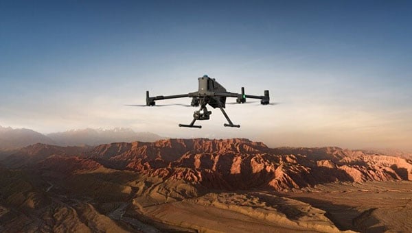
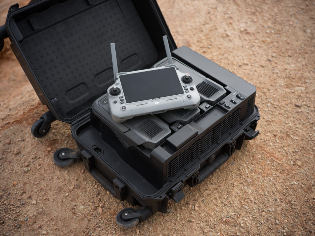
    Qi added, “We use the RTK-enabled DJI Mavic 3M drone for field data collections, which is often a highlight of the class.” One memorable field activity took place at the historic Los Angeles Memorial Coliseum, where students participated in drone flights alongside faculty. Before takeoff, they helped establish communication between the drone’s RTK system and the California Real-Time Network (CRTN), learning how to configure the system for centimeter-level accuracy. Later, they processed the imagery into high-resolution 2D orthophotos and 3D models. “This class benefits undergraduates by providing early exposure to GNSS,” Qi said. “This foundation is important for students to imagine their pathways in the geospatial industry and choose other advanced courses.” 

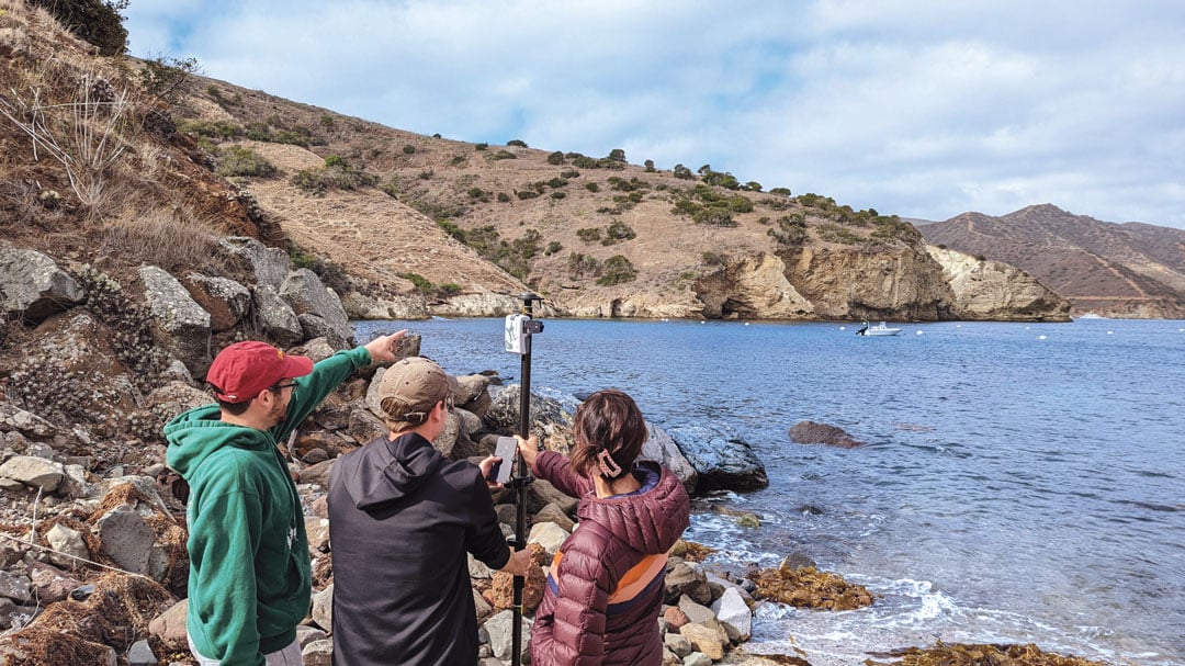
    At the graduate level, as part of the SSCI 587: Spatial Data Acquisition course, students are required to participate in a week-long intensive-learning field experience at the USC Wrigley Institute for the Environment and Sustainability campus on Catalina Island. Laura Loyola, Ph.D., assistant professor in SSI with specialties in ecological physiology and field data collection, has led this course for many years and acknowledges that, “Catalina offers the ideal location for rugged terrain data collection, practice with online or offline mapping, and incorporates spatial data collection utilizing the RTK-enable UAV and high-accuracy GNSS receivers, with spatial analysis and visualization methods.” 

    While on Catalina Island, students meet with industry partners, such as Isaiah Mack, the owner of Eclipse Mapping and GIS, and an alumnus of USC, who bring professional experiences and the latest technology from industry. “The question now facing industry is whether the added investment in both hardware and training of personnel on high-accuracy GNSS receivers for spatial data collection is viable and needed for everyday uses, especially with RTK and satellite-based augmentation systems (SBAS) available,” Mack said. “The answer is overwhelmingly yes, with many mapping and GIS professionals utilizing centimeter-level RTK accuracy, so I feel it is important to share with students the growing market for these careers.” 

    Students quickly learn that without a viable connection, such as Wi-Fi or Starlink in remote areas, RTK capabilities in the UAV are limited. This requires the ability to incorporate high-accuracy ground control points into their collection workflows for georeferencing the drone imagery. As students work through the image processing and integration workflow, they gain firsthand experience in how GPS accuracy influences final image quality. Loyola noted, “In remote environments where WiFi connectivity is limited or non-existent, smartphone positional accuracy is decreased even more from the standard 30 cm to 50 cm, forcing students to work offline and with external GNSS receivers.” 

    Lastly, in certain field scenarios where students are unable to physically reach the survey target, they have learned to apply alternative methods to ensure accurate data collection. One effective technique involves using a laser rangefinder to measure the distance to the remote object. By combining this distance measurement with GNSS-derived position and bearing data, students can use in-app tools to calculate the location of otherwise inaccessible features. These experiences not only demonstrate their problem-solving abilities in challenging environments but also reflect a practical understanding of integrating complementary technologies to achieve high-precision geospatial results.

    GNSS also has been integrated into the geodesign programs at SSI. Guoping Huang, Ph.D., is an associate professor with specialties in landscape planning and geodesign. “High-accuracy GNSS has become increasingly important in the architecture, engineering and construction sector due to the growing adoption of geospatial workflows,” he said. “These workflows span the entire project lifecycle — from spatially-enabled design tools that help create context-aware and environmentally responsive plans, to precision construction, where GNSS-integrated technologies such as sensor networks are used to monitor construction activities in real time.” 

    This integration ensures that construction adheres closely to the original design intent, minimizes costly deviations, and helps avoid damage to critical infrastructure. As a result, high-accuracy GNSS supports not only greater efficiency and accuracy but also enhances safety and sustainability in complex construction environments.

    Empowering the Next Generation  

    By integrating GNSS into education programs and engaging students through practical fieldwork, faculty in the spatial sciences spark interest and develop the next generation of geospatial professionals. These efforts are essential to sustain the workforce and fuel innovation in a field increasingly critical to smart cities, climate science, autonomous systems  and beyond. The experiential learning has inspired young generations to enter the geospatial workforce and make immediate, transformative impacts on existing practices. 

    Student Evelyn Vega commented, “The concepts and hands-on experience from course SSCI 220L helped me understand and appreciate GPS technology.” Recent graduate Yimiao Wang, who now works with the County of Riverside, California, has directly applied the GNSS data collection and processing techniques learned in course SSCI 587 to her work in roadway deterioration detection with RTK-enabled drone imagery. Her ability to leverage high-accuracy GNSS not only enhanced the quality and efficiency of her team’s outputs but also led to her career development success. These examples illustrate how GNSS education can empower students to drive innovation and advancement in the public sector and beyond. 

  • CyArk launches virtual tour of Mount Rushmore

    CyArk launches virtual tour of Mount Rushmore

    CyArk, a nonprofit organization focused on digital documentation of cultural heritage, has introduced a new virtual experience of the Mount Rushmore National Memorial in the United States. The 15-minute 3D tour — accessible via web, mobile or tablet — offers users an immersive perspective of the monument, highlighting its engineering achievements, artistic significance and the complex cultural narratives associated with the Black Hills region.

    The virtual experience allows visitors to virtually ascend to the summit of Mount Rushmore, offering a close-up view of the faces of former presidents George Washington, Thomas Jefferson, Theodore Roosevelt and Abraham Lincoln. From this vantage point, visitors can better understand the intricsye artistry and scale of the carvings, aspects that are not easily observed during an in-person visit. The tour also includes access to the Hall of Records, a chamber situated behind the memorial, and the Sculptor’s Studio, where a 1/12 scale model of the original design — featuring full busts of the presidents — reveals sculptor Gutzon Borglum’s initial vision for the site.

    “Mount Rushmore is one of the most recognized memorials in the world, but its story is far more layered than many people realize,” John Ristevski, CEO of CyArk, said in a news release. “We are proud to share this experience in a way that both highlights the engineering and artistry of the site, and acknowledges the deeper histories of the land on which it stands. Our goal is to bring the complexity of this place to light and make it accessible to new audiences.”

    Photo:
    Laser scan of Mount Rushmore (Credit: CyArk)

    Culture and Collaboration

    A key element of the project is the inclusion of multiple voices that offer diverse perspectives on the memorial. Along with the historical context provided by museum professionals, the experience features commentary, music, and dance from Indigenous cultural interpreters who share their personal reflections on the significance of the land commonly known as the Black Hills.

    The virtual tour is based on a highly detailed 3D digital twin of Mount Rushmore, created using advanced documentation methods such as terrestrial lidar scanning and high-resolution photogrammetry. The model incorporates data from the 2010 Scottish Ten project — a collaboration between the Scottish Government, the Glasgow School of Art and CyArk — as well as imagery from a 2016 CyArk expedition. These datasets were combined to reconstruct the memorial with millimeter-level precision, capturing both the prominent sculptures and lesser-known features like the Hall of Records and the Sculptor’s Studio. CyArk collaborated with local partners, historians and Indigenous cultural interpreters to shape the narrative and included archival photos from the memorial’s construction.

    3D model of Mount Rushmore (Credit: CyArk)
    3D model of Mount Rushmore (Credit: CyArk)
  • ESA moves forward with Moon mapping study

    ESA moves forward with Moon mapping study

    SFL Missions joins a team led by NUVIEW GmbH, which the European Space Agency has contracted to conduct a Pre-Phase A study for the Moonraker lunar mapping mission. This study launches under a new initiative for Small Exploration Missions. The Moonraker satellite will carry a laser scanner to create a detailed elevation map of the Moon’s surface.

    The Moonraker mission will deploy a single orbiter in a low-altitude polar orbit around the Moon. The orbiter will host a lidar payload to capture highly accurate elevation points of the terrain. The team will use these data points to generate three-dimensional elevation models, which will guide the assessment and selection of future lunar landing sites.

    Moonraker’s lidar data also seeks to advance broader scientific research. The mission will scan permanently shadowed regions to search for water ice and provide new insights into the Moon’s geology and internal composition. The Moonaker lidar will operate in two modes: one for broad-area scanning of the lunar polar regions and another for high-resolution surveys of specific areas of interest.

    SFL Missions shared in a statement that Mission analysts are evaluating potential launch options and trajectories to efficiently enter lunar orbit. They are also studying how operational orbit parameters affect spacecraft design and payload data collection. The system design team focuses on accommodating the payload, configuring the spacecraft layout, and sizing subsystem components. They are designing the propulsion system to carry enough fuel for the transit phase and to maintain the operational orbit, compensating for disturbances from the Moon’s irregular gravity field. The team is developing detailed mission and system requirements to guide future design phases.

    NUVIEW GmbH, based in Berlin, leads the Pre-Phase A study team, which includes several partners alongside SFL Missions. NUVIEW GmbH, a wholly owned subsidiary of NUVIEW Inc., is developing the world’s first commercial space-based LiDAR constellation for three-dimensional mapping of Earth.

  • DJI launches UAV for long-endurance aerial missions

    DJI launches UAV for long-endurance aerial missions

    DJI has unveiled the Matrice 400, designed for a range of applications, including emergency response, power line inspections, large-scale mapping, engineering and construction. The UAV offers a maximum flight time of 59 minutes and can carry payloads weighing up to 6 kg. It is equipped with a lidar and millimeter wave radar-based obstacle sensing system, enhancing its ability to navigate complex environments.

    The Matrice 400 features an IP55 protection rating, allowing it to operate in harsh conditions and withstand extreme temperatures ranging from minus 20°C to 50°C, according to DJI. The company also states that the drone is capable of taking off from stationary vessels and landing on moving ships, making it suitable for offshore operations such as wind turbine inspections and maritime patrols.

    The UAV offers power-line-level obstacle avoidance, which allows it to detect and avoid buildings and mountains while flying at speeds up to 25 m/s. It uses O4 Enterprise Enhanced Video Transmission technology, which supports image transmission up to 40 km. This is achieved through a 10-antenna system on the aircraft and a high-gain phased array antenna on the remote controller. A built-in video transmission relay module allows operators to use one Matrice 400 as a relay drone, providing signal support for another unit.

    The drone is designed for automated operations, featuring multiple intelligent functions to improve efficiency. It supports up to seven payloads simultaneously through four external E-Port V2 ports, with options for single or dual downward gimbals and compatibility with a third gimbal connector on the underside. DJI has also incorporated a range of privacy controls to address the data security needs of enterprise users.

    Photo:
    DJI Matrice 400 drone platform (Credit: DJI)
  • Leidos uses quantum technology to thwart GPS jamming

    Leidos uses quantum technology to thwart GPS jamming

    Susceptibility to jamming is a significant military vulnerability of the GPS signal. Through a Defense Innovation Unit contract, Leidos is developing an alternative navigation technology that measures variations in the Earth’s magnetic field and harnesses the quantum properties of nitrogen in diamonds. 

    “With magnetic navigation (MagNav) there’s no signal to jam,” said Aaron Canciani, manager of the Leidos Transition of Quantum Sensing (TQS) team and a former U.S. Air Force scientist who is a pioneer of the technology. “The one thing MagNav does need is a very sensitive magnetometer, which is where quantum comes in.”

    Quantum sensing uses microscopic particles that can simultaneously exist in multiple states to more accurately detect aspects of geophysical properties like magnetic fields. Leidos has been doing quantum work for years, applying it to a variety of cyber security and sensing applications. 

    “Quantum magnetometers have the potential to greatly increase position and attitude accuracies in magnetic navigation systems,” Canciani said. “Nitrogen vacancy-diamond magnetometers use the crystal structure of a diamond to define a sensing axis in which quantum measurements of the complete vector field can be known to exquisite accuracies.”

    The sensor is being developed by Frequency Electronics Inc. under subcontract to Leidos and in collaboration with MIT Lincoln Lab.

    Compared to classic magnetometers, which tend to drift due to reliance on relative measurements, Canciani added, “These quantum measurements are linked to the magnetic field through fundamental physics-based constants.” 

    Ultimately, Leidos intends to fly a MagNav system with the new magnetometer. If successful, the technology has the potential to significantly advance navigation technology for military use.  

  • InfiniDome successfully resists jamming in test

    InfiniDome successfully resists jamming in test

    Security company InfiniDome has partnered with one of Israel’s largest vehicle tracking and fleet management companies to simulate a real-world car theft scenario.

    The test recreated a scenario in which criminals deploy in-car GNSS jammers to disable location reporting systems. Two identical tracking units were installed: one protected by OtoSphere-Lighthouse (80×78.5x28mm, 180g), infiniDome’s newest anti-jamming module for commercial use, and one left unprotected.

    Credit: InfiniDome
    Credit: InfiniDome

    As jamming began inside the vehicle, the unprotected tracker quickly lost GPS signal and failed to transmit location. In contrast, the protected unit maintained full functionality, continuously reporting real-time data throughout the test.

    The trial demonstrated the reliability of infiniDome’s technology in commercial environments, the company said. The OtoSphere-LightHouse module was developed to deliver advanced anti-jamming protection for critical applications. As GPS has become essential across industries — from logistics to emergency service — so have the risks.

    InfiniDome’s presence at the International Drone Show in Denmark June 18–19, comes at a time when European stakeholders are actively seeking solutions to protect UAVs, maritime, and fleet operations from GNSS disruption — a risk that’s no longer theoretical.

  • 13 EU member states demand action on GNSS interference

    13 EU member states demand action on GNSS interference

    13 member states of the European Union have called on the European Commission to respond to interference with GNSS in EU countries.

    The interference originates in Russia and Belarus, as a result of the ongoing war with Ukraine.

    The ministers for transport from 13 countries urged immediate and coordinated action in response, reports the Baltic Times. The joint letter was signed by the ministers of Lithuania, Latvia, Estonia, Germany, Slovakia, Finland, Slovenia, the Czech Republic, Italy, the Netherlands, Spain, Denmark and Romania.

    In the joint letter, the ministers emphasize that since 2022, two types of interference to GNSS — jamming and spoofing — have been observed in the airspace of the Baltic Sea Region, posing a threat to various modes of transport, particularly civil aviation and maritime navigation.

    The General Secretariat of the Council of the EU responded to the joint letter with an outline of potential actions.

    1. Evaluate and coordinate the possibility to suspend the right to Russia and Belarus in the ITU to register the use of radio resources while GNSS interference is in progress. The lack of procedural legislation cannot be an excuse for deliberately contravening the spirit of the ITU Constitution and its general principles, endangering public health and life, without suffering any consequences.
    2. Based on good practice of EU and NATO cooperation on critical undersea infrastructure, enhance civil-military coordination mechanisms among Member States for shared monitoring, data exchange, and possible response to GNSS interference. Explore the benefits of dual use of various equipment and measures to combat the risks caused by GNSS interference.
    3. Intensify RFI monitoring by eligible national organizations and bodies, e. g. national regulator, police and military, and aggregate non-classified information on observed RFI to a publicly available near real-time monitoring and alert service on European level.
    4. Accelerate the deployment of interference resistant GNSS services, especially the antispoofing features that are part of the Galileo program, e. g. authentication and/or encryption of signals exchanged between stations and user equipment.
    5. Reassess the current reliance on GNSS-based navigation and develop resilient Positioning, Navigation and Timing (PST) services by deploying alternative or complementary systems, including ground-based legacy solutions. Simultaneously, upgrade and modernize conventional navigation infrastructures to serve as robust backups.
    6. Promote industry-manufacturer collaboration for mitigation tools and updates. Support operator-level reviews of backup system readiness, ensuring non-GNSS alternatives are usable and practiced. 2 TREE2B 9198/25 EN
    7. Draw the attention of critical infrastructure operators and unmanned system manufacturers to the risks that may arise from interference with GNSS.
    8. Develop action plans for different domains (space, aviation, maritime, telecommunications) to avoid potential duplication of efforts and coordinate short-term and long-term measures at EU and national level.
    9. Continue cooperation with all relevant stakeholders (ITU, ICAO, IMO, EASA, EMSA, IATA, EUROCONTROL). These actions, among others, could contribute to building the overall resilience of the critical infrastructure and strengthening safety and security in Europe.

    The letter highlights the urgent need to accelerate the deployment of interference-resistant GNSS services, enhance the overall resilience of critical infrastructure, and strengthen safety and security across Europe.

    “The current security environment demands a unified response to hybrid threats posed by hostile regimes, as well as close cooperation to strengthen Europe’s preparedness and resilience,” said Lithuanian Transport and Communications Minister Eugenijus Sabutis.

    “Disruptions to GNSS signals have a direct impact on strategic sectors such as transport, energy, and telecommunications. To prevent potential incidents, we must act swiftly and decisively at the European Union level — not individually, but in a coordinated manner,” Sabutis said.

    The interference is not random incidents but a systematic, deliberate action by Russia and Belarus, which can be used as a hybrid attack on strategic radio spectrum, essential for modern technology, regional safety and security, particularly in transportation.

    Furthermore, the ministers call on the EU to increase diplomatic efforts to address the interference and apply pressure on the responsible parties, including legal action against responsible individuals and entities involved in the deliberate interference with GNSS signals, to enhance European safety and security.

    “So far, the attempts by several Member States to address the problem have not brought any more tangible results,” the EU General Secretariats said. “Therefore, it is necessary to increase diplomatic efforts to address the interference and put the pressure on the responsible parties.”

    The ministers propose intensifying radio frequency monitoring and enhance civil-military coordination mechanisms among Member States for shared monitoring, data exchange and possible response to GNSS interference. They also advocate for accelerating the deployment of interference-resistant GNSS services, particularly the anti-spoofing features of the Galileo program, and for upgrading and modernizing conventional navigation infrastructure.

    Reports of increased interference include:

    • Lithuania: starting from 556 cases in March 2024 to 890 in October 2024 and 1185 in January 2025
    • Latvia: 790 cases in October 2024 to 1288 cases in January 2025
    • Estonia: 1150 cases in October 2024 and 1085 cases in January 2025
    • Poland: 1908 cases in October 2024 to 2732 cases in January 2025.

  • Lithuanian port hit by GNSS interference

    Lithuanian port hit by GNSS interference

    Russia’s war with Ukraine continues to affect GNSS signal availability in the Baltic Sea, reports LRT News. Aircraft and ships near the Lithuanian seaport of Klaipėda are losing signals becausse of Russia’s efforts to shield its Kaliningrad exclave from potential airstrikes, said Saulius Skvernelis, speaker of the Lithuanian parliament.

    “The Russians are protecting the Kaliningrad region from potential air attacks,” Skvernelis told LRT TV. “This is not specifically intended to disrupt or harm our aircraft flying to Lithuania. It’s just that the protection zone extends beyond the Kaliningrad region’s borders, and the threat, the interference, is affecting our territory as well.”

    Skvernelis warned that this problem will persist across the region as long as the Kremlin continues its war in Ukraine.

    Thirteen European Union member states have called on the European Commission to respond to interference with GNSS in EU countries. In a joint letter, the countries stressed that GNSS interference cases are not random incidents but systematic and deliberate action by the Russian and Belarusian regimes aimed at destabilizing regional infrastructure, especially in the transport sector, reports LRT.

    “We can appeal to all EU countries and any institution, but it won’t help as long as Russia uses this kind of electronic protection for its military sites to defend itself against Ukrainian strikes,” Skvernelis said. “We must force Russia to end the war and then this problem will simply go away.”

  • Silicon Sensing and Kongsberg Discovery partner to develop MEMS gyro technology

    Silicon Sensing and Kongsberg Discovery partner to develop MEMS gyro technology

    Silicon Sensing Systems Ltd and Kongsberg Discovery AS have joined forces to develop next-generation inertial technology. The companies signed the formal agreement June 2 during EXPO in Osaka, Japan.

    The agreement will merge the engineering skills of both companies to speed the evolution of products within each company. Kongsberg will use developments to enhance their next generation of high-performance systems – including attitude and heading reference systems (AHRS) and inertial navigation systems (INS). Silicon Sensing will use these outcomes to benefit its precision micro electro-mechanical systems (MEMS) inertial measurement units (IMUs), gyros and accelerometers.

    The companies are aiming to achieve navigation-grade performance from a MEMS-based gyro. Navigation-grade refers to a highly accurate and stable gyroscope used in inertial navigation systems (INS) to precisely measure angular velocity and rotational motion. 

    Gyro sensors measure changes in rotation angle over time, enabling detection of direction, angle, and vibration. They are used in smartphones, game consoles, car navigation systems, industrial equipment and devices requiring vibration detection, camera shake correction and attitude control.

    “The diverse range of applications for this technology is expected to grow significantly in the future,” said Anders Rønningen, executive vice president, Kongsberg Discovery. “This agreement will foster growth for both companies, as well as for Norway, Japan and the UK. We have established a strong presence in the maritime market and are now venturing into new markets.”

    “For over a year we have been working with Kongsberg Discovery, exploring how best to bring our engineering teams together to move us towards performance goals that will extend the capabilities of our entire product portfolio – bringing real operational benefits across many industrial sectors. This important agreement details how we will achieve those ambitions,” said Satoru Miyamoto, general manager, Silicon Sensing (Japan).

    David Somerville, General Manager at Silicon Sensing (UK), concludes, “This endeavor will fast-track development activities in key areas for both companies, bringing critical performance gains for customers in fields as diverse as satellite control, subsea mapping, industrial robotics, aviation and maritime.”

  • u-blox launches triple-band GNSS module for fast-scaling robotics

    u-blox launches triple-band GNSS module for fast-scaling robotics

    u-blox has expanded its ZED form-factor portfolio with the ZED-F20P, a L1/L2/L5 triple-band GNSS module designed for high precision applications in ground and air robotics.

    The ZED-F20P provides OEMs deploying fleets of ground robots, drone light shows, and other dynamic autonomous platforms with centimeter-level RTK and PPP-RTK positioning, fast convergence times, and integrated security features.

    Within the u-blox high precision receiver family, the ZED-F20P is a dedicated L1/L2/L5 triple-band specialist. It delivers deterministic, centimeter-level RTK and PPP-RTK accuracy tailored to the needs of lightweight and dynamic platforms. Its end-to-end silicon-to-firmware architecture supports 25 Hz update rates, robust security features, and low power consumption in a streamlined design.

    These capabilities combine to deliver industrial-grade reliability and enable smooth scaling from proof-of-concept to high-volume deployment without increasing system cost, power consumption, or integration complexity.

    Compatible with the established ZED footprint and UBX protocol, the ZED-F20P fits directly into existing layouts. The expanded ZED portfolio now covers dual-, triple- and all-band GNSS options, giving developers the flexibility to select the best fit while reusing the same board layout. This enables both flexible design choices and a straightforward upgrade from earlier products.

    The ZED-F20P pairs with the u-blox ANN-MB2 all-band high precision antenna to ensure optimal RF performance, offering a one-stop solution for streamlined evaluation and integration. This consistent design approach accelerates time to market while preserving hardware and software continuity.

    PointPerfect Flex and Live native support:

    When combined with u-blox PointPerfect Flex and Live GNSS correction services, the ZED-F20P becomes a complete, production-ready GNSS solution that delivers centimeter-level accuracy in seconds, without the need for a local base station. The triple-band L1/L2/L5 architecture ensures rapid convergence and resilience in challenging environments, while PointPerfect provides reliable corrections across key regions. This tight integration simplifies development and accelerates time-to-market for mass-market autonomous platforms. 

    “The ZED-F20P delivers the precision and reliability required for today’s ground and air robotics,” said Mårten Ström, director of product management at u-blox. “It strikes a rare balance between performance, integration simplicity, and application-specific focus, enabling engineering teams to move from prototype to fleet deployment with confidence. We’re already seeing strong interest from robotic lawnmower markets preparing for large-scale rollout.”

    Engineering samples of the ZED-F20P are available now. Developers can evaluate the module using the EVK-X20P evaluation kit, with a simple configuration.

  • Russian jamming creates ‘Bermuda Triangle’ in Baltic

    Russian jamming creates ‘Bermuda Triangle’ in Baltic

    Russian jamming of GPS signals is suspected to be the cause behind a new “Bermuda Triangle” of navigation confusion in the eastern Baltic Sea.

    In the Gulf of Finland, ships are disappearing from radar and Russian fighter jets are traveling through NATO airspace, according to Danwatch, a Danish news outlet.

    Ship monitoring service MarineTraffic shows the position of ships in completely different places than their actual positions, currently on land east of coastal city Primorsk, Russia.

    Experts say that not only is GPS being disrupted, but hackers are also manipulating navigation data. They blame Russia for its hybrid activities and attacks, which it carries out both from its mainland territory and from the Kaliningrad enclave, located between Poland and Lithuania.

    Screenshot of MarineTraffic now shows boats traveling in a circle inland from the Baltic Sea.
    Screenshot of MarineTraffic taken June 4, 2025, shows ships traveling in a circle on land, well east of the Baltic Sea.

    Romania also has issues with Russian jamming and spoofing activities. The website Defense Romania quotes Gen. Gheorghiță Vlad, chief of the Romanian Defense Staff, who said jamming and spoofing has occurred on the Black Sea weekly since the start of Russia’s war with Ukraine. Also, Romanian defense forces have discovered 122 floating mines in the sea.

  • Drones at War: Ukraine’s bold attack shows future warfare era

    Drones at War: Ukraine’s bold attack shows future warfare era

    On June 1, 117 drones rose up from wooden boxes inside Russia and attacked bombers parked on runways at military bases. The attack — dubbed Operation Spider Web — startled the world with its audacity.

    Approximately 41 planes were struck at four military bases, including the Belaya Air Base in Siberia hundreds of miles from Ukraine’s borders. In all, the attack destroyed a third of the bombers Russia uses as strategic cruise-missile carriers to destroy targets in Ukraine.

    The drones were smuggled into Russia via commercial trucking transportation.

    According to an analysis by Michael C. Horowitz for the Council on Foreign Relations, the strikes “once again demonstrated Ukraine’s ability to be at the cutting edge of technology and tactics. Ukraine has consistently and successfully leveraged and integrated everything from old military technology and off-the-shelf commercial systems to artificial intelligence (AI) for its military operations. This has been a difference maker in the war since its early days, giving Ukraine new and unexpected vectors to attack Russian forces and territory.”

    The analysis, by Michael C. Horowitz, calls this a new era for warfare — the era of precise mass. “The combination of AI and autonomous weapons, precision guidance, and commercial manufacturing mean that low-cost precision strikes are now accessible to almost any state or militant group,” Horowitz writes.

    Horowitz described the era of precise mass in a feature in Foreign Affairs magazine, November/December 2024.

    The attack demonstrates that countries can be at risk to drone attacks even deep inside its borders, and precision strikes the capability of any actor. Low-cost off-the-shelf drones can be readily used, along with open-source autopilot software and AI code. Drones can supplement or even replace traditional artillery or expensive cruise missiles.

    Read the full analysis here.