Streamer map of the conterminous United States showing water basins, weather radar, and real-time streamflow stations.
Field & Stream called it a “…very cool tool and quite a bit of fun.” MinnPost described it as a “…high-tech illustration of Norman Maclean’s timeless view that, ‘Eventually, all things merge into one, and a river runs through it.” And Popular Science noted that, “There’s something especially satisfying about clicking a stream that…shoots its way across multiple states to empty into the ocean.”
These publications are all describing Streamer, the popular on-line mapping program from the U.S. Geological Survey. Streamer is a powerful, yet easy way to explore our major waterways. With a simple map click, anyone can trace rivers and streams from a starting point all the way downstream to where a stream drains. Even more impressive, they can click on a stream and trace all others that drain to that point. Streamer also produces a report that includes a map and information about the people and places encountered along the streams traced.
Streamer map of an upstream trace from a point on Belle Fourche River in South Dakota extending into Wyoming and Montana. Weather radar and real-time streamflow stations are shown on the map.
As good as Streamer was when it launched last summer, it just got better. Four major enhancements and dozens of small improvements have been made. These include:
A new map layer displays the locations of real-time streamflow stations across the country. Streamer updates this information hourly and symbolizes these stations to illustrate current streamflow conditions compared with each station’s observed mean streamflow on the same day of the year.
You can tell at a glance whether conditions are above, below, or at normal levels at each station.
Links are provided from Streamer directly to selected stations for additional information and data.
Another new map layer has been added that shows weather radar across all 50 States.
Useful improvements to Streamer’s detailed reports have been added. One of these lists the names of waterbodies (lakes, reservoirs, etc.) along the path of your trace.
Congressional Districts encountered along your trace have been added.
A mouse click takes you from the Streamer report to additional information from the Census Bureau about socioeconomic conditions in each District.
Searching for locations on Streamer’s map by place name, zip code, geographic coordinates and more is greatly enhanced.
In its first eight months in service, Streamer users traced more than 2.9 billion river miles.
The USGS announced in February that it is ending production of the National Atlas on September 30, and that some of its products and services would transition to The National Map. With this release, Streamer becomes the first of these National Atlas products and services that The National Map will offer. For cartographers and geospatial information professionals, Streamer’s surface water data is available for download at no cost.
Detail from a Streamer map of an upstream trace from a point on the Arkansas River near Geuda Springs, Kansas, extending into Colorado and New Mexico. Real-time streamflow stations are shown.
CompassData, a worldwide provider of geospatial data and services, has received DO-200A certification by the Federal Aviation Administration (FAA) for collection and processing of survey and ground control data used in the creation of Airport Mapping Database (AMDB) products.
“DO-200A certification enables CompassData to provide Ground Control Points (GCPs) for generation of digital aeronautical products, such as Airport Moving Maps, used by pilots in the cockpit to navigate on the ground at airports worldwide,” said Hayden Howard, CompassData Vice President. “This certification applies to custom ground control collects and to many of the GCPs that exist in our worldwide archive available off the shelf for immediate purchase.”
In addition, CompassData has been approved to use its GCPs and Accuracy Analyst map tool to verify the accuracy of satellite or aerial imagery used in creation of AMDB DO-272C aviation products. This means CompassData may orthorectify a high-resolution DigitalGlobe satellite image, verify that the orthoimage accuracy meets sub one- and five-meter specifications, and provide the image to an aeronautical mapping firm or avionics system developer to generate commercial products.
DO-200A standards were developed by FAA to assure the quality of data used in the preparation of aeronautical mapping, navigation and situational awareness products and systems. Prior to certification, CompassData completed a rigorous examination procedure in which FAA reviewed every step in the firm’s methodologies for collecting, processing and managing GPS-surveyed ground control to ensure the data is accurate, timely, complete, and traceable.
FAA has granted only six LOAs (Letters of Acceptance) in the Denver ACO Region and only 24 globally. CompassData is the first in the world to receive certification for verification of data sets used to create Airport Moving Map data.
In March, CompassData purchased the assets of Spatial Information Solutions (SIS) in Starkville, Mississippi, and announced the continued sale and support of the popular Accuracy Analyst and Topo Analyst Map Accuracy Tools. These software applications are relied upon by geospatial end users to automatically verify the accuracy of orthoimagery and digital elevation data sets, often with CompassData GCPs.
CompassData will discuss the FAA DO-200A certification and demonstrate Accuracy Analyst and Topo Analyst Map Accuracy Tools in booth #2063 at GEOINT 13* being held April 14-17, 2014, in Tampa, Florida.
Trimble announced today comprehensive updates to its powerful suite of geospatial office software, including Trimble Business Center, RealWorks and Trident solutions. Together, these updates provide increased data interoperability between Trimble office software platforms, enabling users to easily combine data generated through traditional survey methods, laser scanning and mobile mapping workflows, to produce richer and more intuitive deliverables, the company said.
“Data interoperability across Trimble software platforms provide users with seamless and efficient workflows and the flexibility to focus first on the output needed for each job,” said Alain Samaha, business area director of GIS and software for Trimble’s Geospatial Division. “Whether it is a stakeout design or a precise as-built model, users can select the best software environment to get the job done right and deliver that information in the most useable format.”
The announcement was made at SPAR International 2014, a conference for 3D data capture, processing and delivery technologies.
Trimble Business Center Version 3.20. Geospatial professionals now have access to an improved processing and analysis experience. With an integrated and powerful new point cloud engine, users can visualize and edit large point clouds while simultaneously working with high- resolution imagery. Combining these rich data sets into a single workflow saves time and potential conversion errors.
Trimble RealWorks Version 8.1. The latest release of Trimble RealWorks provides surveyors and laser scanning professionals with enhanced tools that make it easier to visualize and interpret scan data. Point clouds can now be easily colorized using high-resolution and High Dynamic Range (HDR) images from professional grade external cameras, significantly reducing measurement and modeling times.
Trimble Trident Version 6.1. Mobile mapping professionals can now combine the rich datasets captured using spherical cameras with laser scanner and inertial measurements from the Trimble MX2, to easily determine the location of surveyed features and automatically classify imaged objects.
The new office software versions are expected to be available in April 2014 through Trimble’s worldwide Geospatial distribution network.
Pitney Bowes Inc. has entered into a multi-year partnership with INRIX, Inc., provider of traffic information and driver services, to deliver advanced location intelligence solutions through the company’s traffic intelligence platform.
By integrating location capabilities with traffic analysis, INRIX and Pitney Bowes will enhance the driving experience of today’s connected drivers, the companies said. By delivering this information through INRIX’s mobile app, users are empowered to make better location-based decisions in real-time.
“Pitney Bowes’ location intelligence solutions can add compelling new capabilities to the existing products of mobile-oriented companies such as INRIX,” said James Buckley, Senior Vice President and General Manager, Location Intelligence, Pitney Bowes. “Our products help unearth non-obvious relationships between specific locations to improve the customer experience and drive loyalty.”
INRIX has designed a leading traffic intelligence platform that uses smart data and advanced analytics to solve transportation issues worldwide. The company uses a unique approach called “smart crowd-sourcing” that analyzes real-time traffic speed and incident data from a wide variety of public and private traffic sources ranging from road sensors and up-to-the-minute traffic speeds and community reports crowd-sourced from millions of vehicles and mobile devices throughout the day. Whether through an in-car or smartphone navigation application, a local newscast or the company’s INRIX Traffic app, INRIX offers up-to-the-minute traffic information and other driver services to help more than 150 million drivers save time, fuel and money.
Pitney Bowes Location Intelligence solutions merge organizational data with location data to provide users with the capability to make more informed decisions. For INRIX, this technology compiles and correlates addresses with coordinates from a mobile device to establish real-time location or a desired destination. Combining that with other data such as specific traffic flow, demographics and behavior patterns, users can uncover key points of interest by accessing Pitney Bowes advanced location search. For example, if a consumer is planning to visit a popular department store in a specific region, the technology makes it possible to suggest a relevant restaurant recommendation for lunch, based on the data that is collected about user preferences, convenience, proximity and projected traffic patterns.
“INRIX had a number of compelling reasons to partner with Pitney Bowes,” said Scott Sedlik, Vice President, Product Planning and Market Development for INRIX. “Our customers are looking to make real-time decisions using location data, and Pitney Bowes has the most comprehensive suite of offerings to fulfill that need. Other key reasons for teaming include a strong customer focus and alignment with our own strategic goals and approach.”
“What can we do to reduce the vulnerability [of GPS] and ensure that the expectations of the public are going to be met?” asked Dr. Bradford Parkinson as he opened his presentation this morning (Tuesday, April 15) at the European Navigation Conference, ENC-GNSS 2014 in Rotterdam, The Netherlands.
Parkinson went through his 61-slide, 50-minute briefing on what he called “PTA” — Protect, Toughen, and Augment — a proposal concerning not only GPS but PNT systems globally. An article by Parkinson based on this talk will highlight the special 25th Anniversary edition of GPS World, to appear in conjunction with this year’s July issue.
Brad Parkinson
After briefly overviewing the many worldwide applications of GPS and its penetration and participation in several vital markets, Parkinson stated “If we want to ensure the economic benefits of GPS, there are some essential needs that a user has. The first need is availability, and I’m defining availability in a certain way. It’s at the required accuracy for the application involved, and it has a bound on the random events that happen out there.
“The second required aspect is integrity, as in ‘I know I’m getting this accuracy, the system is not lying to me.’ In many cases, it’s required that the system not lie to you more often than once in 10 to the seventh (10 million) times.”
Parkinson developed his Protect, Toughen, and Augment proposal in part in response to a remark he heard from a high U.S. government official who opined that “GPS is much too vulnerable, we need to replace it.” While agreeing that the system is vulnerable, Parkinson has strived for a more constructive approach to the problem.
At the end of his presentation, Parkinson introduced one of his colleagues in the audience, from his early days on the GPS Program, and stated that if it was not for Hugo Fruehauf’s expertise with atomic reference systems in 1973, there might never have been a GPS program.
Parkinson was among attendees at an ENC event at City Hall hosted by the Mayor of Rotterdam, The Netherlands. From left are Hugo Fruehauf, Mrs. Bradford “Ginny” Parkinson, Professor Bradford Parkinson, Don Jewell — GPS World Defense Editor, Jac Spaans — Chairman of the Organizing Commitee of the ENC, and Adrianna Spaans.
Calling it an “unprecedented and deeply worrying total disruption . . . [that] shook the industry,” Locata Corporation reiterated its call for redundant terrestrial systems to back up GNSS in the wake of the April 1 11-hour GLONASS system outage.
Nunzio Gambale, Locata CEO, said “We have been telling the industry for years that you cannot have a critically important capability like GPS without also having a backup! What is Plan B if the satellite systems fail? What replaces the space signal when there is a problem? If anyone needed a sign to understand why Locata has spent years inventing and developing the world’s first local terrestrial equivalent of the GPS system, then last week’s meltdown of a complete global satellite navigation system is it. This event should terrify every nation, government, and company that depends on navigation satellites for their business or, in some cases, their very lives.”
The navigation and timing functions of the global positioning systems underpin the world’s banking systems, stock exchanges, digital TV and Internet, cell phone networks, and, in some cases, the national electricity supply, Locata pointed out. GPS, in particular, plays a crucial role in transportation, shipping, and logistics, serving as the enabling technology for critical functions like air traffic control. Reliability is therefore not just important; it is essential across all applications. Locata, the Resilient Navigation and Timing Foundation (RNTF) in Washington, D.C., and others have persistently called attention to the need for redundant terrestrial systems that will back up expensive, vulnerable, and aging global satellite navigation constellations while simultaneously providing the local control and resiliency that satellite-based systems cannot deliver.
Professor Chris Rizos of the School of Civil and Environmental Engineering at the University of New South Wales stated that “This catastrophic failure of one of the world’s two global satellite navigation constellations is a wakeup call for all of us. We ignore the possibility of these ‘Black Swan’ events at our own peril.”
The GLONASS disruption was felt around the world, immediately upon its origination, especially in professional applications, such as tractor automation for farming, machine control and robotics in mining and heavy industry, and in the national infrastructure used by surveyors and industry across many countries.
“This shows just how interlinked the physical and cyber worlds have now become,” added Professor Brett Biddington, a space and cybersecurity expert from the School of Computer and Security Science at Edith Cowan University, Australia. “The prospect of a software glitch, whether unintentional or intentional, seems highly likely [as a cause for the failure]. If it was a deliberate attack, however, it points to a changing face of warfare where the real enemy may be impossible to detect and deter until very damaging strikes, such as an attack on the GPS system, have already taken place.
“The vital point here is that this is no longer just a question for scientists and technologists. A locally controlled backup system for this essential signal is a national policy question of the highest order.”
Locata Corporation and other industry authorities have long testified on global satellite navigation vulnerabilities and the need for diverse technology options to strengthen and back up GPS, GLONASS, and other systems. Locata developed a robust solution and has been awarded a sole-source contract by the U.S. Air Force (USAF) to provide its terrestrially based alternative positioning for military applications where GPS has been completely jammed. The first wide-area Locata system is being deployed now at the White Sands Missile Range in New Mexico. The USAF demonstrated that the White Sands Locata network delivers what has been extremely high accuracy over a 2,500-square mile area, positioning aircraft flying up to 35 miles away to an accuracy of better than six inches.
A pair of LocataLite transmit antennas overlook a section of the White Sands Missile Range blanketed by the Locata high-precision ground-based positioning system.
“There is no other technology that can do this, and it’s delivered in the complete absence of GPS,” continued Gambale. “What is being demonstrated at White Sands is that Locata supplies precisely the same function as GPS, even when there is no GPS available. That’s exactly what you need if the satellites fail.
“If this event had been a GPS failure instead of a GLONASS failure – and it could very easily have been – then the entire world would have plunged into a catastrophe. This event is the navigation equivalent of a ‘close call moment,’ and from here on out no one can even question that this is a really serious problem that must be addressed. Another industry expert recently told me, ‘If there was a sustained GPS outage, it would cause a global financial nuclear winter from which it would take us decades to recover.’”
Gambale concluded, “We need action to develop local backups like Locata around places like airports and other strategically important areas – now! We must not wait until we are faced with another seemingly impossible event like a complete satellite constellation failure. We may not dodge this bullet a second time.”
Locata terrestrial positioning technologies complement GPS by setting up ground-based transmitters, called LocataLites, to create a local constellation called a LocataNet. Once properly deployed, Locata’s unique nanosecond-accurate TimeLoc system synchronizes the network, which allows it to replicate the positioning capabilities of GPS, locally. LocataNets operate today in environments ranging from small warehouses to open-cut mines, wide-area aircraft approach-and-landing systems, and wider areas for aircraft and unmanned aerial vehicle (UAV) uses.
Researchers at Telecom SudParis are working on a solution to provide indoor continuity for GNSS positioning. The idea is to deploy a minimal transmission infrastructure in order to allow a standard receiver to measure pseudo-ranges and carrier phases, thus leading to an indoor accurate positioning. The infrastructure consists of a few antennas fed through optical fibers with a GNSS-like signal.
Based in Paris, Telecom SudParis is a part of the Institut Mines-Telecom, an education and research institution in the fields of information and communication technology.
Nel Samama
To achieve positions accurate to a few decimeters, the locations of the various indoor antennas had to be accurately known. This was achieved with the Spectra Precision FOCUS 8 total station in a local reference frame. In addition, in order to calculate the indoor positioning in WGS84 format, to achieve full compatibility with current outdoor GPS, a Spectra Precision ProMark 800 GNSS receiver was used to link the local reference frame and the GPS. “ The accuracies of the FOCUS 8 and the ProMark 800 and their ease of use were invaluable to us,” said Nel Samama, lead researcher and Professor at the Institut Mines-Telecom.
The International Conference on Indoor Positioning and Indoor Navigation (IPIN) 2012 and 2013 published the first results of the research, and the latest results will soon be published in a paper, “Repealite Based Indoor Positioning System Performance.” The papers propose a new approach to indoor positioning: the repealite system. It aims at providing continuity of the positioning service through the use of GNSS-like signals, thus leading to a single technological means: a GNSS receiver, for both outdoors and indoors. A few error sources have been dealt with in order to reach sub-meter accuracy indoors, among which one has to cite multipath and near-far effects. The paper describes a way to reach indoor sub-meter accuracy and the practical current implementation of the system.
A newly issued report by MarketsandMarkets focuses on growth in the location-based services market, and says it will be worth $39.87 billion by 2019.
The report, “Location Based Services (LBS) Market (Mapping, Discovery and Infotainment, Location Analytics, Leisure and Social Networking, Location Based Advertising, Augmented Reality and Gaming, Tracking) — Worldwide Forecasts and Analysis (2014-2019),” provides a comprehensive market and forecast analysis of the overall market, segmented by products, services, technologies, applications, regions, and verticals. The report covers all the major sub segments of the LBS market and provides the quantitative (market size and market growth) and qualitative (trends, analysis, and insights) analysis for those segments.
Included are 99 market data tables, 17 figures spread through 254 pages, and an in-depth table of contents on the LBS market. This comprehensive coverage of the LBS Market provides important inputs such as drivers, restraints, and opportunities in this market, profiles the major players in this market, maps the competitive landscape, and provides the overall perspective on the LBS Market in the various verticals and regions, according to MarketsandMarkets.
LBS is a solution that stands for applications that integrate geographic locations information with business processes, helping in analysis of location information. The location-based information is required in distinct business data sets for relating, comparing, and analyzing relationships in the data. The service also provides an economical alternative to agencies with existing internal GIS resources. As a result of these multidimensional benefits of location information, operators are considering it as an asset, leading to numerous investments being made to extract, use and market it.
SkyTraq‘s new family of high-performance system-in-package (SiP) GNSS receiver modules supports GPS, GLONASS, Beidou, QZSS and SBAS.The modules integrate SkyTraq Venus8 positioning engine, 1MByte Flash memory, LNA, SAW filter, high precision 0.5ppm TCXO, RTC crystal, and other passive components within tiny 10mm x 10mm x 1.3mm package. The smallest configuration requires only antenna and power to have position fix and generate NMEA output.
This new 10mm x 10m sized GNSS module family consists of Venus858F-GL GPS/GLONASS receiver module, Venus858F-BD GPS/Beidou receiver module, and Venus838F GPS receiver module. All three modules support additional QZSS and SBAS signal. The three modules are pin compatible; one application design works for all three models.
Within the consumer and industrial GNSS segment, these modules feature industry’s fastest 50Hz GPS, 20Hz GPS/Beidou, and 20Hz GPS/GLONASS update rate, 29sec cold start TTFF, and better than -160dBm tracking sensitivity.
Module interface includes two UART, four SPI, one 2-wire interface (I2C compliant), and two PWM among the 28 function-multiplexed digital I/O. A customized Arduino IDE can be used to program the modules, making use of the on-chip peripherals and sharing the internal 32bit RISC, IEEE-754 compliant FPU, and memory resources. Venus838F GPS module has roughly 50MIPS + 490KByte Flash + 45KByte RAM available for user programming.
Optimized for lowest bill of material cost, the dime-sized modules are designed for high-volume cost-sensitive GNSS applications. Combined with properly tuned antenna fitted to customer’s application design, it provides optimal performance at lowest system cost.
To lower barrier of adopting latest satellite navigation technology, the traditionally higher-priced GPS/GLONASS and GPS/Beidou receiver modules are offered at same price as the GPS receiver module.
Volume delivery of all three modules to customers begins in May 2014; engineering sample, datasheet, reference design, and evaluation kits are available now.
Last week was spring break (for high school and college) for my kids. We decided to drive to San Francisco and the surrounding area to do a little sightseeing. It’s a beautiful place. This is a view from our 3rd floor room in the hotel, looking over the bay.
Of course, while traveling, I usually manage to work in some GNSS activities.
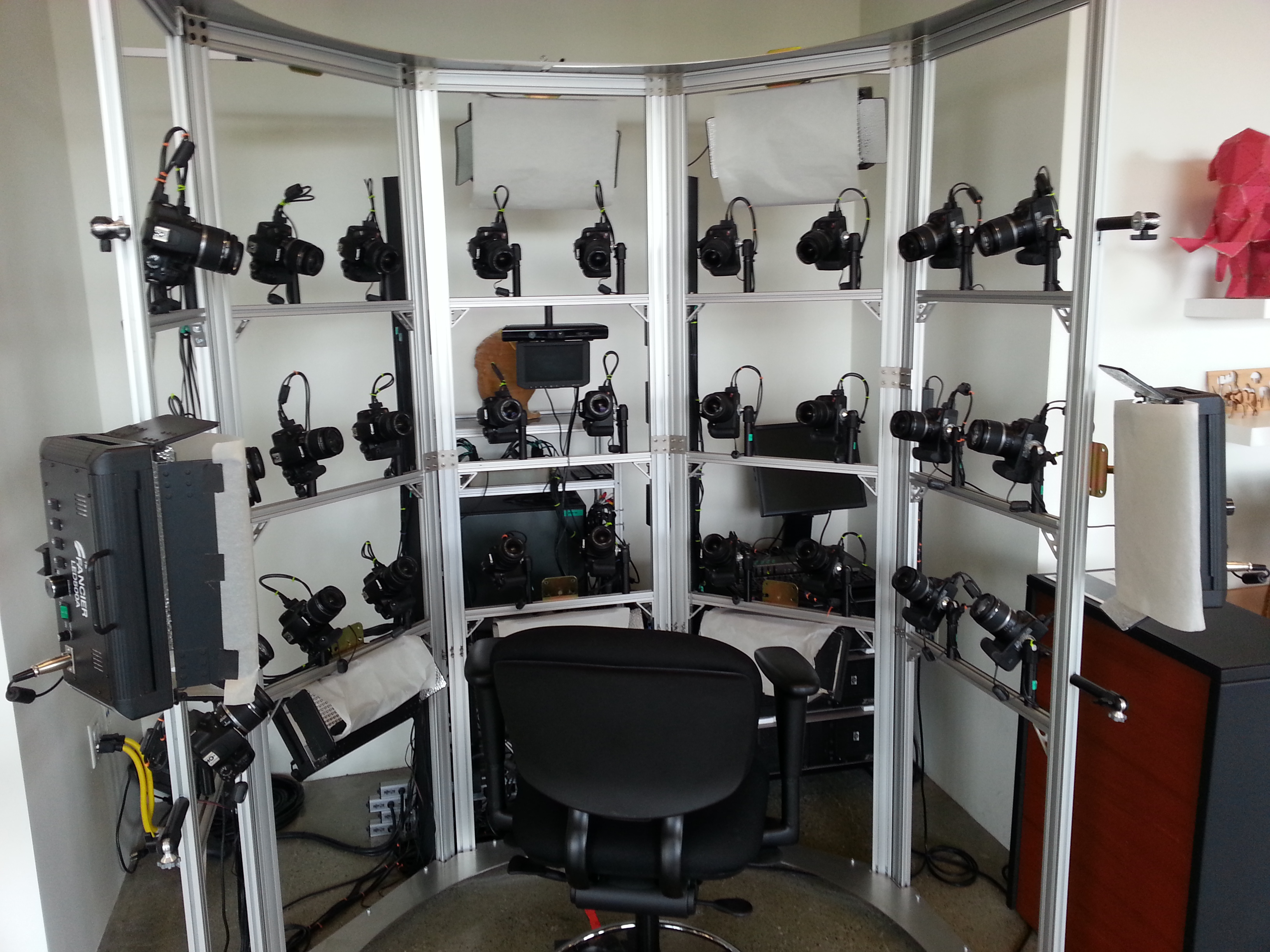
The first stop was Autodesk, the makers of AutoCAD and other engineering, design and visualization software in downtown San Francisco. AutoCAD occupies 100,000+ square feet at One Market St. in downtown San Francisco and another 20,000+ square feet at Pier 9 right on the Bay. How anyone gets work done with an office on a San Francisco Pier is beyond me. It’s buzzing with people and activity, including a shuttle to the famous Alcatraz Prison, which we enjoyed.
The Autodesk meeting is deserving of an article in itself, but I’ll keep it short with bullet points for the purposes of this article:
AutoCAD 2014 includes a datum/coordinate system library for mapping/surveying users. This is new in AutoCAD.
Infraworks (introduced last year) was built from the ground up with a new workflow for engineers and planners (and surveyors). Most people have never heard of it. It can do things that AutoCAD can’t, such as managing surveying data for large-scale projects. Think BIM (Building Information Modeling).
Model Builder (just introduced), is a tool to build quick and dirty 3D visualizations using data from Autodesk’s cloud service.
Autodesk 123. This is a really cool free app you can use to create 3D models using your own images. The images can come from smartphone pictures or images you already have. It’s a really cool app.
Photogrammetry Chair in the Autodesk Gallery at One Market St. in downtown San Francisco.
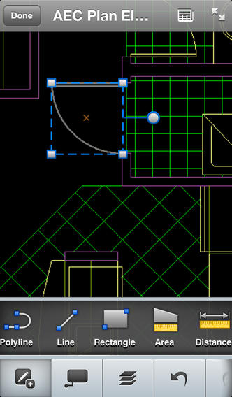
AutoCAD 360 (formerly AutoCAD WS). First of all, any Autodesk product with 360 in the name is a cloud app, whether it’s mobile or desktop. I’ll focus on the mobile apps. There are two AutoCAD 360 mobile apps: one for Android and one for iOS. The mobile apps are free tools that allow you to take AutoCAD drawings in the field. There are also Pro versions available on a subscription basis.
Screenshot of AutoCAD 360 on the Apple iPad.
Last week, I had a chance to use AutoCAD 360 in the field with RTK. It was a last-minute exercise that I hadn’t planned on, so my expectations were set so that even if I couldn’t get it to work, at least it would be a solid learning experience.
The goal was to receive 1-2 cm RTK GNSS positions on an Android smartphone running AutoCAD 360 using a public (free) RTK base station. I knew I could access the free RTK base via PBO real-time streaming because I’ve done that before. However, I didn’t know, or have experience in two areas:
Accessing RTK base data via NTRIP on an Android device.
The ability of AutoCAD 360 mobile app to consume GPS data.
For the Android device, we used a Samsung Galaxy Note. It’s a smartphone, but also a tablet with a 5.7-inch color touchscreen.
Samsung Galaxy Note with a 5.7-inch color touchscreen.
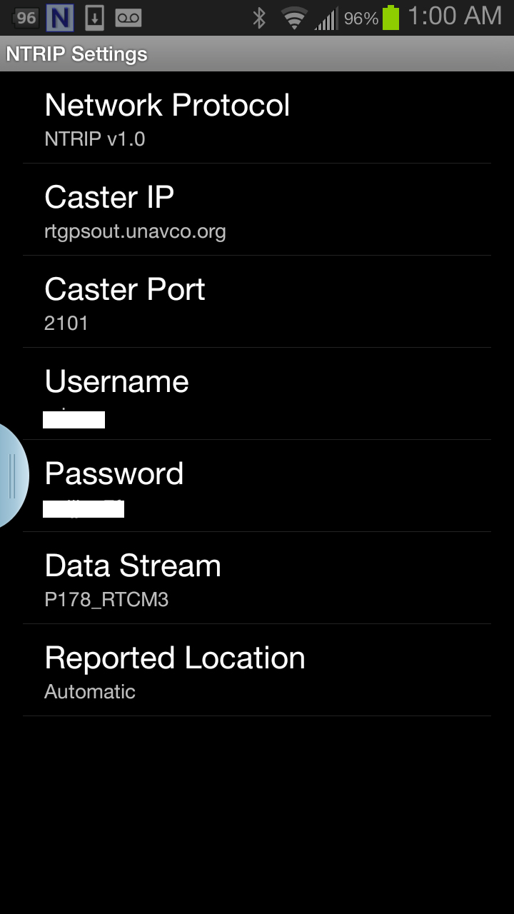
The first challenge was the Android utility software needed to access the RTK base. NTRIP (Networked Transport of RTCM via Internet Protocol). As I’ve written in previous articles, there are lots of free RTK base stations (330+) in California. To access them, all you need is internet connectivity and an NTRIP program to manage the connection to the RTK base. For Windows and Windows Mobile, there are several free NTRIP software programs. For Android, it’s limited (but growing). I found a free Android NTRIP utility on the Google Play store. It’s very easy to install and set up. If you have your RTK base credentials (IP address, port#, login, password), if you have a Bluetooth RTK receiver, you can install the program and be running RTK within a few minutes.
Android NTRIP Utility (Lefebure Design)
Once I entered the RTK login credentials, I was presented with a list of RTK bases. The list of PBO RTK bases are all single-baseline RTK bases (not networked) so I needed to select the closest one to the project site. In this case, it was P178 (see the screen shot above). It was about five miles from the project site. At this point, I can see the RTK base data streaming on the Samsung Note tablet. I didn’t mention before, but I had already Bluetoothed the Samsung to a small RTK GNSS receiver. Once the RTK base data starts streaming, the RTK GNSS receiver goes into FLOAT mode and heading for FIX (1-2cm precision).
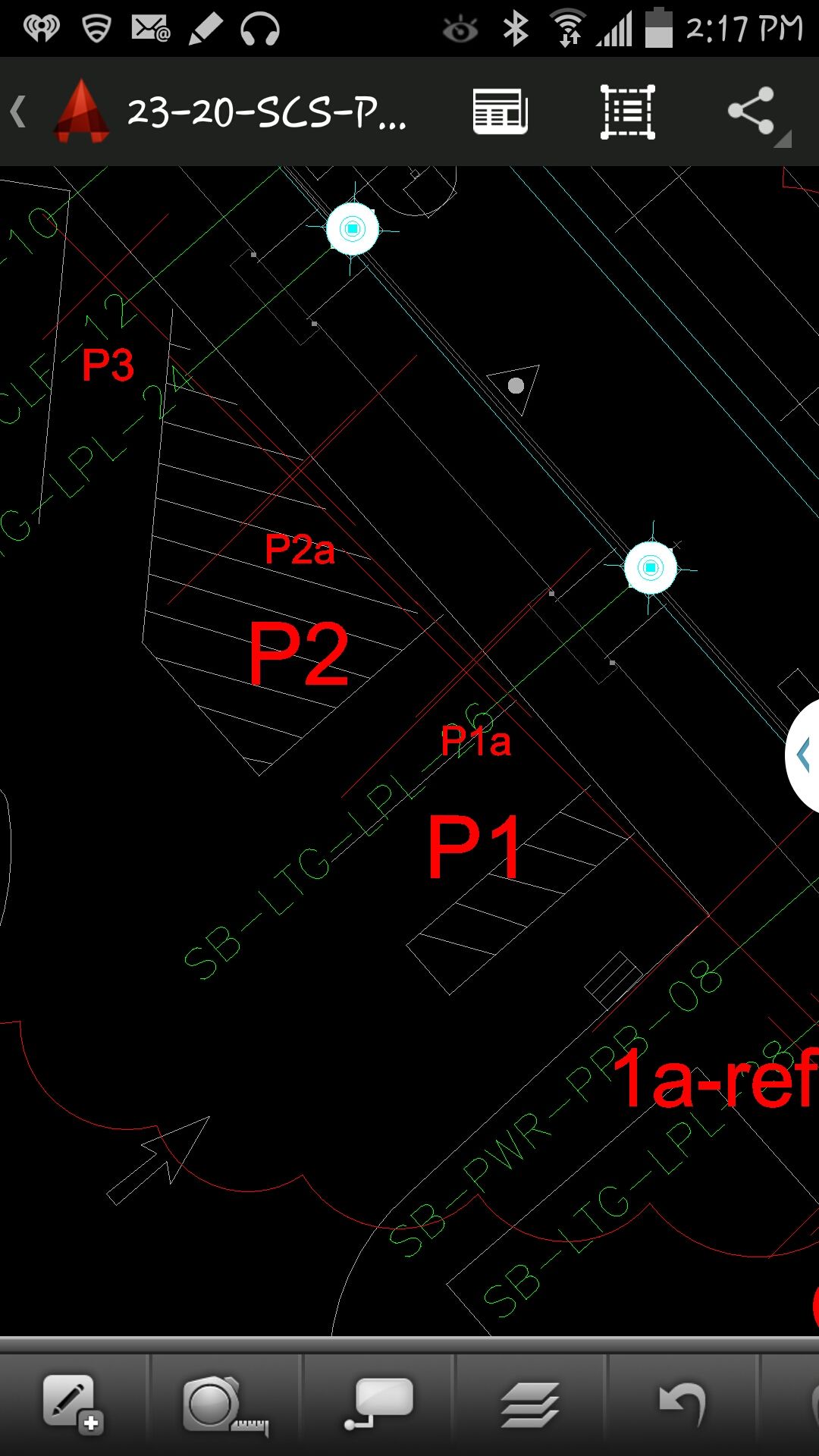
At that point, we (I wasn’t operating AutoCAD 360 on the Samsung) started AutoCAD 360 on the Samsung Note tablet and loaded a drawing that we’d planned to use. Following are a couple of screen shots from our exercise.
AutoCAD 360 running on a Samsung Note Tablet/smartphoneAutoCAD 360 running on a Samsung Note Tablet/smartphone.
It took a minute to figure out how to”turn on” GPS in AutoCAD 360 (we were all newbies), but once we did, our position showed up on the drawing where we expected it. By this time, we were getting an RTK FIX position from the RTK GNSS receiver. We were getting 1-2 cm precision in a native AutoCAD drawing, in real-time, in the field, on an Android smartphone. I was impressed.
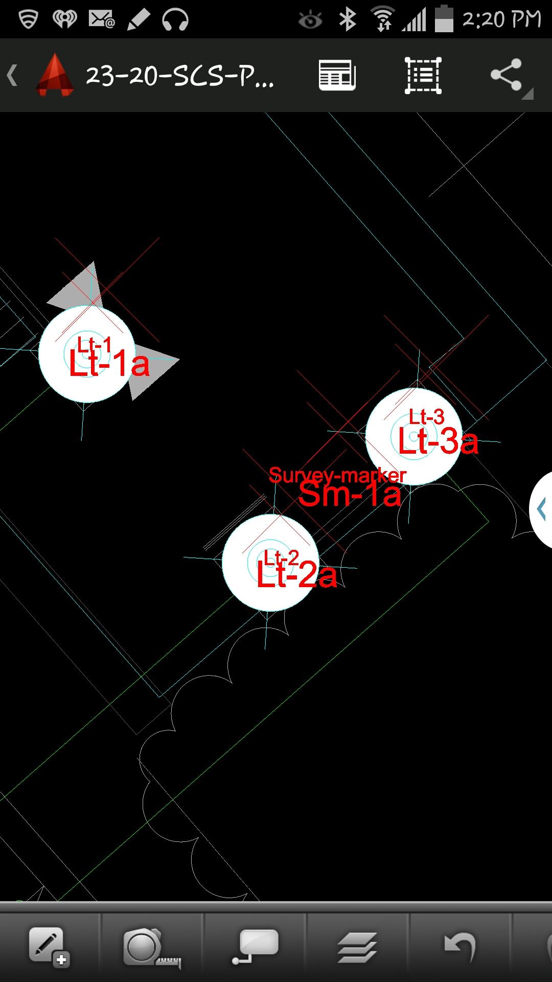
We were ready to start our accuracy testing. Our accuracy testing consisted of two parts:
1. To test precision, take RTK shots on two points and measure the distance between the two with a tape measure. We did this several times.
Lt-1 and Lt-2 were on top of a platform with no substantial obstructions.
Lastly, we took a shot underneath a platform with greater than 50% of the skyview obstructed. It didn’t hold RTK in that environment and I didn’t expect it to. The precision was 5 feet (DGPS).
2. The second test was to test accuracy by taking an RTK shot on a survey marker that had published State Plane Coordinates in NAD83/2007 epoch 2007.0
After recording an RTK FIX shot on the marker (albeit I was holding the antenna so I expected a little slop), we compared our result to the survey marker coordinates. Not good…3.0 feet difference.
My first suspicion was that the RTK base was referenced to ITRF, so there would be significant difference between the two coordinate values. No dice. I adjusted the RTK GNSS coordinate to NAD83/2007 (2007.0) assuming it was referenced to ITRF08. The adjusted coordinate was further than the original (6.95 feet). That wasn’t the problem.
My second thought was to double-check what the PBO folks used for a reference position for there RTK bases. They confirmed ITRF08 current epoch. However, after talking to a few people familiar with PBO sites (RTK Network operator and Mark Silver), they suggested to run an OPUS solution on the PBO RTK base and compare it to the reference coordinate being used by the PBO RTK base. Sure enough, there’s a 6.40 feet difference between the 24 hour OPUS ITRF08 coordinate and the ITRF08 reference coordinate being used by the P178 RTK base.
It still doesn’t reconcile the difference we saw between the RTK GNSS coordinate and the survey mark, but I’m still trying to confirm which epoch date the PBO RTK base is using. In California, tectonic plate movement is significant. In that area, the ground is moving 1.7 cm north and 3.4 cm west each year, so the epoch date of the coordinate is significant, especially if the epoch date is 1997.0 or 2002.0. However, that doesn’t prevent you from using RTK Bases like P178 and “localizing” to NAD83/2007 or whichever datum your data is referenced to.
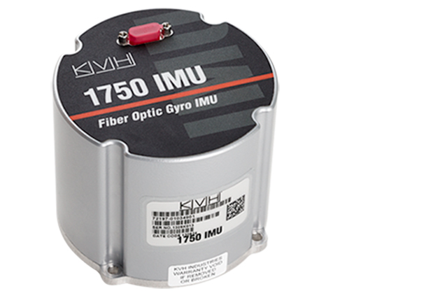
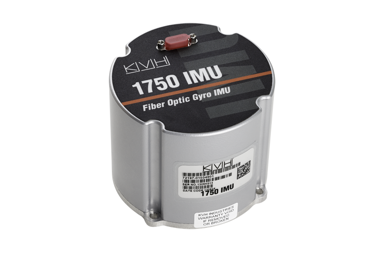
NovAtel, Inc., has added the IMU-KVH1750 as an inertial measurement unit (IMU) option in its SPAN GNSS/INS line of positioning products. The IMU-KVH1750 is a high-performance commercial off-the-shelf (COTS) sensor that offers excellent bias stability and repeatability, NovAtel said. It incorporates KVH’s DSP-1750 precision fibre-optic gyro with very low noise MEMS accelerometers.
Commercially exportable, the IMU-KVH1750 integrates easily with NovAtel’s OEM6 series of receivers to provide a tightly coupled 3D navigation solution, the company said. Offering customers continuous position, velocity and attitude (roll, pitch and azimuth) measurements, a SPAN system is stable and available even through periods when satellite signals are blocked or unavailable.
The IMU-KVH1750 supported SPAN system is designed for mobile and airborne mapping applications as well as hydrographic survey. It can be relied on to provide accurate, continuous performance in harsh environments, and features excellent shock vibration and thermal functionality.