Vatn Systems — a defense technology company specializing in autonomous underwater vehicles (AUVs) for the U.S. military, its allies and commercial clients — has launched its new S12 AUV-torpedo product line. The company also opened a new manufacturing facility in Rhode Island, which is capable of producing up to 2,000 vehicles annually.
AUV-torpedo product line
Vatn Systems’ new 12.75-inch diameter AUV can operate as both a torpedo and an AUV in modular configurations. The Skelmir S12 is designed for deployment from submarines, surface vessels, or aircraft, and can support a range of missions, including torpedo operations, sensor delivery and electronic warfare.
The Skelmir S12, in its AUV configuration, has completed its first exercise. The initial production run has been sold to government customers, with deliveries expected this year. The torpedo variant is scheduled for manufacturing and delivery in 2026.
The company’s new manufacturing facility leverages patent-pending modular design and vertical integration techniques, enabling rapid production at a scale previously unseen in the underwater vehicle market.
Vatn recently partnered with Palantir to digitize its manufacturing process and provide AI-driven insights to accelerate the production of AUVs built in the new facility, which is expected to reach full production capability in July 2025.
Read a roundup of recent products in the GNSS and inertial positioning industry from the May 2025 issue of GPS World magazine.
SURVEYING
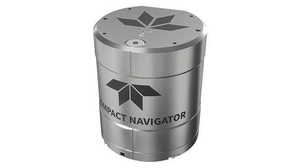
Integrated Navigation Solution Ideal for inspection and survey applications
Photo: Teledyne
Teledyne Compact Navigator is an ultra-compact autonomous integrated navigation system engineered for subsea and surface vehicles. It is ideal for small vehicles, enabling inspection and survey operations on compact platforms. The system is offered in two depth-rated models, one capable of operating at 4,000 m and another at 300 m. The Compact Navigator consumes less than 7 watts of power, extending mission duration by conserving energy. The system operates fully autonomously, eliminating the need for external aiding or operator intervention. Advanced phased array Doppler Velocity Log technology enhances performance while allowing the device to be mounted on an autonomous underwater vehicle or ship hull.
The Compact Navigator supports a broad range of applications, including autonomus underwater vehicles, shallow water surface navigation, operations in GNSS-denied environments and dynamic positioning for surface vehicles. The system provides true North-seeking gyrocompass-grade performance, and its web-based user interface supports integration, operation and troubleshooting. It is factory-calibrated and offers a battery backup option for reliability in demanding conditions. The system operates independently of satellite signals, making it resistant to jamming or signal loss. This capability is significant for shallow water navigation, where GNSS-based systems may be unreliable.
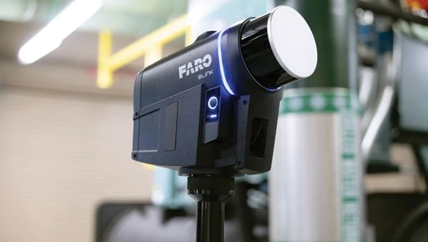
3D Reality Capture Solution Can be used across various industries
Photo: Faro
FARO Blink, a new 3D reality capture solution, is designed to make collecting and utilizing 3D data more accessible and efficient. It centers on software-driven technology integrating advanced visualization and automated workflows through the FARO Sphere XG Digital Reality Platform. This integration aims to simplify operations and deliver faster, more actionable insights for users across various industries.
FARO Blink is tailored for professionals in fields such as surveying and construction. It offers high-quality visualization and can streamline workflows, allowing teams to efficiently capture, view and share 3D data, thereby enhancing project progress and collaboration.
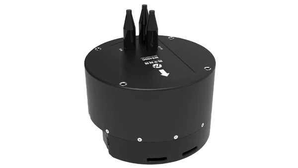
The MS400C is a fully integrated multibeam echosounder designed for uncrewed surface vessels. The new system combines sonar processing, inertial navigation, GNSS positioning and sound velocity sensing into a single unit.
The MS400C seeks to address deployment challenges faced by USV operators during hydrographic surveying. Its compact, lightweight design allows direct mounting on small platforms. Installation involves connecting a few cables to the IPC and power supply and to the primary and secondary GNSS antennas. With preconfigured spatial relationships, operators can deploy and start surveying quickly, reducing configuration errors and ensuring consistent data quality.
Equipped with Auto Survey functionality, the system calibrates parameters based on water conditions, which streamlines pre-survey procedures. Real-time roll compensation and attitude data from the internal measurement unit, combined with sound velocity profiling, ensure high-fidelity depth measurements, even in dynamic conditions. Designed for autonomous and remotely operated survey platforms, the MS400C supports data collection in confined waterways.
The SurveyPod RTK/PPK GNSS system is built for professionals in surveying, agriculture, mining and construction. The system integrates GPS, GLONASS, Galileo and BeiDou signals for improved satellite visibility and accuracy, even in harsh environments.
Powered by a CORS Network, SurveyPod offers real-time, centimeter-level positioning ideal for high-precision applications. The device supports tilt compensation for reliable data collection at angles and boasts up to 16 hours of battery life, making it ideal for extended field operations. With this launch, Nibrus Technologies is expanding its survey equipment portfolio, offering a Made-in-India GNSS solution to the global market.
This MEMS-based north-seeking inertial measurement unit (IMU) operates independently of GNSS. It can achieve a heading accuracy greater than 1° secant latitude without GNSS assistance. When integrated with GNSS and SBG Systems’ navigation algorithms, it can achieve INS heading accuracy greater than 0.01°.
Measuring 52 x 52 x 36 mm and weighing less than 150 g, it consumes only 2 watts of power. It offers long-term reliability in demanding conditions, and its ITAR-free status allows unrestricted global deployment. SBG Systems also has developed a new pure north-finding algorithm capable of rapid initialization in both static and dynamic conditions within one minute, as well as an advanced GNSS/INS fusion algorithm that delivers exceptional single-antenna heading accuracy even in low-dynamic environments.
The IMU is particularly suited for subsea applications, including remotely operated vehicles and autonomous underwater vehicles, as well as geospatial and marine surveying tasks requiring precise single antenna heading accuracy.
The first off-the-shelf solutions are expected to be available by early 2026. SBG Systems
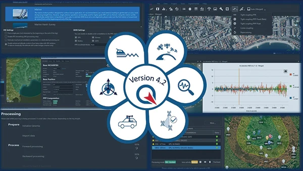
Post-Processing Software With upgraded features
Photo: SBG Systems
Qinertia 4.2 is an updated version of SBG Systems’ post-processing software for GNSS and INS data. One of the notable additions is the beta version of Precise Point Positioning Fixed Ambiguity, which offers centimeter-level accuracy processing without the need for a base station. The update also includes a new RTS smoothing option, the Trajectory Smoother, which enhances INS processing by removing artifacts while maintaining precision. Another feature is the standalone Lever Arm Estimation Tool, now available as a separate application with a simplified interface. The Advanced Virtual Base Station Network Creation has been enhanced with improved base station quality indicators to increase reliability.
It is compatible with the New Ellipse series and supports Teledyne Intrepid INS. The software now offers faster processing speeds, enhanced geodesy functionalities such as base station velocity analysis, and updated tools for assessing processing quality through new status plots. It also supports the latest firmware versions of Ekinox, Apogee, Navsight and Quanta systems. SBG Systems
MACHINE CONTROL
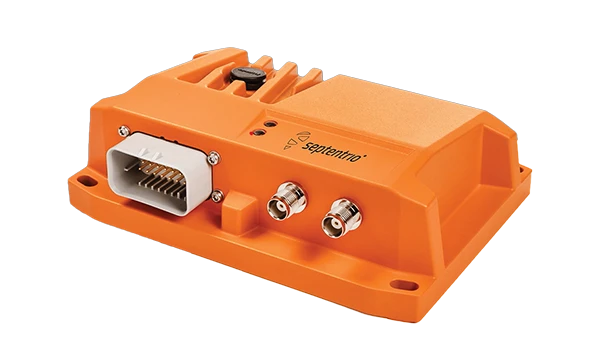
GNSS Receiver and INS System For machine guidance
Photo: Septentrio
The AsteRx RB3 GNSS receiver and the AsteRx RBi3 GNSS/INS system are designed to operate in extreme environments. They feature IP69K-rated housings and components that have undergone ISO-standard testing.
The technology offers durability under heavy shocks, vibrations and challenging environmental conditions, making it suitable for demanding applications such as construction, mining and port automation.
The AsteRx RB3 and RBi3 utilize multi-frequency GNSS technology to deliver precise, centimeter-level positioning even in environments where GNSS signals are typically difficult to maintain. The receivers can be mounted externally on heavy machinery or integrated into chassis systems, offering flexibility in placement and simplifying installation.
The AsteRx RBi3 incorporates FUSE+ technology, which combines a high-performance GNSS engine with an industrial-grade inertial sensor. This integration provides accurate orientation data, such as heading, pitch and roll, alongside reliable positioning. In dual-antenna configurations, the receivers deliver sub-degree GNSS heading accuracy immediately upon initialization. The AsteRx RB3 and RBi3 are ideal for machine guidance in industries requiring rugged equipment to maintain precision under extreme conditions.
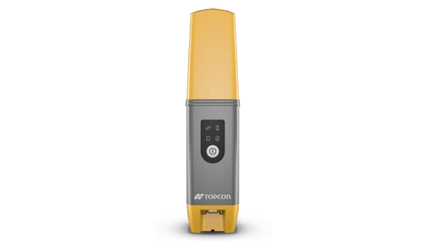
Handheld Reality Capture Solution For maximum mobility
Photo: Topcon Positioning
Designed for mass data solutions, the CR-H1 utilizes PIX4Dcatch, a specialized application with integrated lidar that runs on iPhone devices. It collects images and employs photogrammetry to create detailed, full-color 3D point clouds. The iPhone connects to Topcon’s HiPer CR receiver, enabling the application to collect georeferenced images. The receiver and iPhone are mounted on a specialized handle designed and manufactured by Topcon so that users can capture point clouds without a tripod.
The CR-H1 can be used for utilities and subsurface mapping, construction verification and earthworks, civil engineering and site verification, land surveying and forensics and 3D data capture. Topnet Live subscriptions are available for the CR-H1, providing real-time GNSS corrections that deliver higher-quality point clouds.
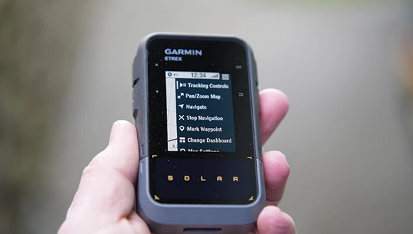
Handheld GPS Device Can provide up to 200 hours of GPS navigation on a single charge
Photo: Garmin
The Garmin eTrex Solar is a handheld GPS device with a built-in solar charging feature. This feature allows for potentially unlimited battery life in optimal sunlight conditions. Even without direct solar input, the device can provide up to 200 hours of GPS navigation on a single charge, making it suitable for extended trips with limited access to power.
The device supports GPS, GLONASS, Galileo, QZSS, IRNSS and Beidou. It features a rugged design, an IPX7 water resistance rating, and a compact, lightweight body that can be attached to a backpack or worn around the neck. Users can import GPX files and navigate to waypoints, courses and geocaches. It also includes a three-axis compass and can store up to a thousand waypoints, 50 courses and 200 activities.
Users can connect the eTrex Solar to their smartphones through the Garmin Explore app, which enables additional features such as geocaching details, weather updates, software updates, trip planning, and cloud storage syncing.
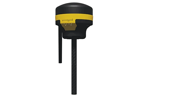
New Product Offerings Now featuring marine GNSS antennas
Photo: Geo-matching
Geo-matching has expanded its product database to include GNSS antennas. The initial marine GNSS antennas featured in this new category are the VP6300 from Calian GNSS, formerly Tallysman, and the AV34 from Trimble.
Geo-matching features detailed information on more than 1,300 products across 63 categories for surveying, navigation and machine guidance. The website is designed to guide users through complex product specifications, offering access to brochures, case studies, product videos and professional reviews. Among the many categories available on Geo-matching.com are hydrographic processing software, GNSS receivers, GIS software, inertial navigation systems, total stations, UAVs, sidescan sonars, imaging sonar and more. The platform encourages users to browse its extensive catalog, upload new products, leave reviews and register their companies to add products to the database.
Mapping UAV With a new “Smart Return-to-Home” feature
Photo: Flyability
Flyability has introduced a “Smart Return-to-Home” (RTH) feature for its Elios 3 UAV, designed to enhance its autonomous capabilities. This feature allows the UAV to return to its take-off point using the shortest available path while avoiding obstacles in real time.
During flight, Smart RTH monitors battery levels through a new flight management gauge, notifying the pilot when it is time to return. The feature is activated via Flyability’s Cockpit flight app, and pilots can take manual control at any point. By automating the return process, the system helps pilots focus on inspections without concerns about battery management or navigation in complex environments. Smart RTH uses lidar scans to generate a flight plan that the UAV executes independently.
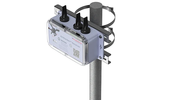
The AirWarden Remote ID Receiver detects and decodes Remote ID signals broadcast by UAVs. It is designed for organizations and authorities that need to monitor UAV activity for safety, security and compliance with regulations.
It decodes the information transmitted by UAVs in accordance with FAA and other regulatory standards. The data it captures includes the UAV’s identification number, its precise location (latitude, longitude and altitude), the takeoff location, operator location if available, timestamps, and other relevant metadata.
The AirWarden can be deployed as a standalone unit or integrated into larger security and monitoring systems. Users interact with the system through a web-based or software interface that facilitates live monitoring, alert management, and data analysis.
Additionally, the AirWarden can integrate seamlessly with other security infrastructure, such as video surveillance and access control systems. This integration seeks to improve how security teams automate responses and coordinate actions when unauthorized or suspicious drone operations are identified.
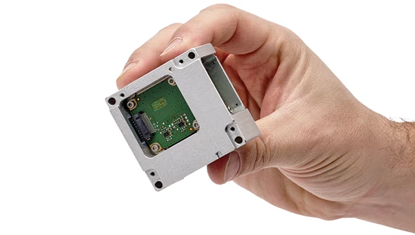
SpacePNT has joined the European Space Agency’s Genesis mission, a navigation satellite project that will be the first to carry all four space-based geodetic techniques on board: GNSS, Satellite Laser Ranging (SLR), Very Large Baseline Interferometry (VLBI) and Doppler Orbitography and Radio-positioning Integrated by Satellite (DORIS).
SpacePNT’s NaviLEO spaceborne GNSS receiver technology was selected for the mission’s critical satellite navigation ranging instrument. Although NaviLEO has flight heritage in low-Earth orbit, it will be adapted for Genesis to operate in medium-Earth orbit at 6,000 km. The system will use a dual-antenna configuration to receive GNSS satellite signals from both zenith- and nadir-looking antennas.
The Genesis mission aims to update the International Terrestrial Reference Frame (ITRF), a global Earth model, targeting an accuracy of 1 mm and long-term stability of 0.1 mm per year. This will provide a precise coordinate system for advanced navigation applications.
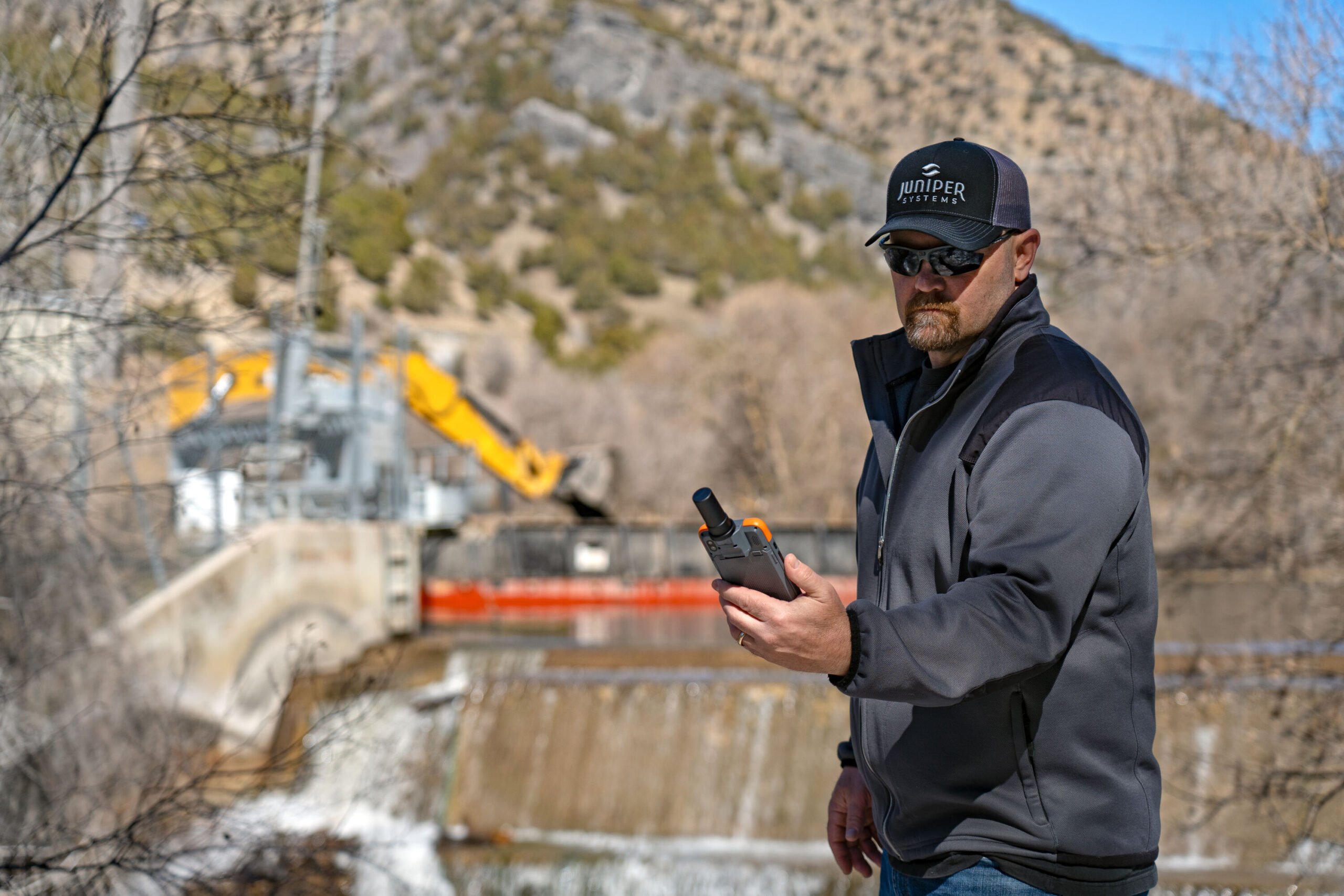
The Archer 4 with GNSS Expansion Pod and RTK connection is now an all-in-one centimeter mapping solution.
Juniper Systems Inc. announces that the GNSS Expansion Pod for the Archer 4 Rugged Handheld is now RTK capable. Juniper Systems is also launching a new application for the Archer 4 called Archer Connect. The Archer 4 with GNSS Expansion Pod and RTK connection is now an all-in-one centimeter mapping solution.
“We are very excited to bring this update to the Archer 4,” said John Florio, senior product manager at Juniper Systems. “The Archer 4 with a GNSS Expansion Pod and an RTK correction is the optimal all-in-one high-precision mapping solution.”
Archer Connect is a utility application that allows users to easily manage their GNSS expansion pod that is attached to their Archer 4. In Archer Connect, users can set up and manage their RTK network connection. Archer Connect is available on the Google Play Store.
The GNSS Expansion Pod attaches and interfaces with the Archer 4 through the Archer’s back contact pads. This allows for a compact one-handed device. The Archer 4 is a rugged handheld device designed to work in extreme environments. Featuring Android 14 and expanded battery options for increased runtimes in the field.
u-blox has introduced PointPerfect Global, its new high-precision GNSS correction service designed for applications that require sub-decimeter positioning accuracy, such as precision agriculture, UAV-based mapping and autonomous outdoor robotics. The service offers global coverage, including remote areas, through both internet and L-band satellite broadcast.
PointPerfect Global is engineered to provide convergence times under two minutes and accuracy of less than 10 cm. It uses Precise Point Positioning with Ambiguity Resolution (PPP-AR) corrections and is optimized for products built on the X20 platform. The u-blox ZED-X20P GNSS receiver will be the first device to support the new service, offering integrated L-band support for use in areas without cellular connectivity.
PointPerfect Global expands the u-blox PointPerfect portfolio, which also includes PointPerfect Live, a regional nRTK service for the most demanding applications, and PointPerfect Flex, the original PPP-RTK service designed for flexible IoT deployments. Together, these services provide scalable, high-performance positioning solutions tailored to a range of technical and commercial requirements.
The broadcast-based architecture of PointPerfect Global allows for scalable deployment across continents without the need for complex regional integration. This approach is intended to simplify logistics and operational complexity for OEMs and solution providers, supporting a variety of sectors including agriculture, robotics, UAVs, industrial automation, and automotive. The service is designed to deliver reliable performance with minimal infrastructure dependency, which is critical for mass-market autonomy and global scalability.
Early access to PointPerfect Global is scheduled for late 2025, with general availability expected in the first half of 2026.
GMV has presented the latest results from its Enabling High-Performance PNT in the Lunar Environment (LUPIN) project, following a series of field tests conducted from April 27 to May 8 in La Oliva, on the Spanish island of Fuerteventura. The LUPIN initiative, developed in collaboration with the European Space Agency (ESA), aims to create a prototype navigation system that simulates the signals lunar surface rovers are expected to receive in the future. The goal is to establish a navigation system for the Moon similar to GPS on Earth, enabling more precise and reliable positioning for lunar missions.
As renewed interest in lunar exploration grows, the need for advanced technologies to support rovers, landers and potential human activities on the Moon has become a strategic priority for the space sector. ESA is pursuing this project under its Navigation Innovation and Support Program (NAVISP), seeking to test new positioning, navigation and timing (PNT) technologies. These technologies will integrate current planetary navigation approaches with distance measurement signals from the future Lunar Communication Navigation System (LCNS), a network of satellites orbiting the Moon that will provide GPS-like signals to the lunar surface. The system is being designed to serve specific lunar regions, including the south pole, the far side and permanently shadowed areas.
Navigation on the Moon currently faces significant challenges. Unlike Earth, the Moon lacks a satellite infrastructure like GPS, forcing spacecraft and rovers to rely on internal calculations and data relayed from Earth, which limits real-time location accuracy. The LUPIN prototype aims to address these limitations by reducing dependence on complex onboard algorithms and optimizing the performance of lunar exploration vehicles. Over the next decade, this technology is expected to transform how astronauts and vehicles operate on the lunar surface, enabling faster and more efficient route planning and reducing the computational burden required for navigation. This advancement means rover speeds will be limited only by lunar surface conditions, not technical constraints, potentially ushering in a new era of automated lunar exploration.
During the recent test campaign in Fuerteventura, the LUPIN system’s real-time navigation capabilities were successfully verified and validated. The tests simulated the LCNS positioning signals that future lunar rovers will use to determine their exact location. Steven Kay, GMV’s manager for the LUPIN project, explained the field tests performed and the corresponding details.
“We were able to successfully compile data over the course of 7 km of travel, and at various speeds, from the conventional 0.2 m per second, up to much faster speeds of 1.0 meters per second, which are the speeds of the future. In addition, we were able to simulate a whole range of lunar conditions and types of environments. This included tests performed at night, using a combination of simulated sunlight to emulate the illumination conditions found on the Moon, as well as tests performed in total darkness, using only the rover’s onboard lighting system to navigate,” Kay said.
The LUPIN project is part of broader efforts by ESA and its partners to develop lunar communication and navigation services, which are seen as essential for future scientific, commercial and human activities on the Moon
On March 27, the Federal Communications Commission (FCC) unanimously approved a Notice of Inquiry (NOI) to explore GPS alternatives, amid escalating threats to security and system resiliency. The move signals growing federal concern about the reliability of space-based navigation and timing infrastructure amid rising global interference and spoofing incidents.
But while the FCC’s broad consideration of alternative technologies is a welcome step forward, its framing also risks weakening one of GPS’s most important defenses: the growing adoption of multi-constellation strategies across the commercial sector.
Rising Threats, Broader Mandates
The FCC’s decision follows the release of the International Air Transport Association’s (IATA) latest safety report, which documented a 175% increase in GPS interference and a 500% rise in spoofing attacks year-over-year. These incidents pose critical challenges to aviation safety, emergency services, telecommunications, and countless other sectors that rely on Positioning, Navigation, and Timing (PNT) services.
Against this backdrop, the Commission’s vote reflects a bipartisan sense of urgency. The NOI invites public comment on a range of technologies that could serve as complements or alternatives to GPS, including low-Earth orbit (LEO) satellites, terrestrial signals, and enhanced end-user devices. This broad framing is encouraging and acknowledges the multifaceted nature of PNT resilience.
A Multi-Layered Approach to PNT
The FCC’s focus on diversification — across space-based, terrestrial, and user-level technologies — is not only prudent, but essential. Enhancing national security and system redundancy requires more than a single backup solution. It demands layered resiliency that integrates complementary modalities into a cohesive ecosystem.
It is very encouraging that the NOI outlines a wide array of candidate technologies that could play a role in improving the U.S. PNT infrastructure. These range from inertial navigation systems and time transfer services to novel terrestrial radio signals and commercial LEO constellations. By casting a wide net, the FCC opens the door to innovation and allows market forces to contribute meaningfully to PNT modernization.
Commercial Reality vs. Government Narrative
However, the FCC’s discussion notably underplays a key reality: few commercial technologies today rely solely on GPS. The commercial PNT landscape has already moved beyond single-source dependency, with the vast majority of systems integrating multiple GNSS constellations (such as GPS, Galileo, BeiDou and GLONASS) alongside additional sensor and signal data to ensure robust coverage and accuracy.
This multi-constellation approach is arguably the single most powerful tool we have to strengthen the resilience of GPS-dependent systems. By allowing receivers to pull data from multiple GNSS sources, users gain spatial and signal diversity, enabling them to cross-check signals, reject spoofed or erroneous data, and maintain accurate position and timing even in degraded environments. It’s important to remember that a device can’t selectively use GNSS networks depending on the user’s geography. If U.S. device makers disable BeiDou and GLONASS, then anywhere in the world that receiver goes it will be less performant and competitive. In recent field tests, we found that disabling the BeiDou constellation decreased a device’s positioning accuracy by 30% to 40%.
This accuracy and resilience are especially important in sectors like aviation, autonomous systems, and emergency response, where signal fidelity and redundancy can be life-saving. Multi-constellation GNSS use isn’t theoretical: it’s already the industry standard.
The International Tightrope
Despite this, key elements of the NOI, as well as comments during the meeting, reflect a growing U.S. government skepticism toward the inclusion of foreign GNSS systems, especially BeiDou and GLONASS. While geopolitical caution is understandable, overly rigid restrictions on international signals could do more harm than good.
These systems are not merely foreign-owned alternatives. They are integral components of the modern GNSS environment. Many U.S. commercial devices — ranging from smartphones to augmented reality, fleet tracking systems, drones, and more — already leverage multiple GNSS sources by default. Future technologies such as autonomous vehicles, robotics and urban air mobility will also require multiple GNSS signals to function. Prohibiting or restricting their use could mean rolling back years of progress in signal resilience, not to mention stymying future technologies, and all for a speculative and largely unquantified national security risk.
While there are some valid concerns about adversarial control over PNT infrastructure, the FCC must weigh these carefully against the real, measurable benefits of an open and interoperable GNSS ecosystem. An overcorrection risks introducing new vulnerabilities in the name of mitigating others. In reality, the more vulnerable elements of the threat surface are GNSS receivers and mobile networks, particularly 5G systems, where user location is actually determined and tracked. Unlike the largely speculative and technically unproven threats tied to adversarial GNSS constellations, there are well-documented cases of compromised receivers and nation-state exploitation of mobile infrastructure – the very reason several countries have banned Chinese 5G providers. The FCC should focus on these clear and active risks, rather than reacting to theoretical scenarios that experts argue are not technically feasible.
Innovation at Risk
There is a significant opportunity at this moment. The NOI rightly identifies emerging technologies that can enhance U.S. resiliency, including advanced chipsets, LEO-based positioning, crowd-sourced signal verification, and next-generation timekeeping tools.
However, that innovation cannot thrive in isolation. If the U.S. limits the ability of domestic systems to take full advantage of all available GNSS sources, it will undermine both resiliency and competitiveness. Even worse, it could widen the gap with foreign alternatives, especially China’s BeiDou system, which is already surpassing GPS in both accuracy and global coverage. GNSS has always thrived on multi-national cooperation and the opportunity of soft power influence. Both of which are diminished by exclusion, which is likely why there have not been bans by other countries to date.
A Path Forward
The FCC is right to prioritize this issue. It is urgent for the U.S. to build a more robust and secure PNT infrastructure in the face of these mounting threats. But its long-term success will depend on whether or not it embraces the full complexity of the PNT landscape.
This means supporting:
Open, multi-constellation GNSS access for commercial users.
A flexible, layered approach that integrates space, terrestrial, and user-level technologies.
Public-private collaboration to accelerate innovation and deployment.
Clear regulatory guidance that balances national security concerns with commercial realities.
The future of secure and reliable PNT lies not in isolating GPS, but in augmenting it through interoperability, diversity, and resilience at every layer of the system.
If the FCC’s inquiry can steer the country in that direction, it will be a pivotal moment not just for GPS, but for the entire space-based infrastructure upon which modern life depends.
Question: What are the main challenges facing GNSS/GPS-based autonomous solutions in terms of signal integrity, jamming and spoofing, and how are these being addressed?
Answer: Outside of the military, interference is the most common threat to GNSS, with the dominant source being cellular transmission harmonics. It is commonly addressed with out-of-band filters. Non-terrestrial networks (NTN), like Global Star uplink at 1.6 GHz, are gaining traction in more mobile and wearable devices to fill gaps in cellular availability. However, it can create coexistence issues for devices for concurrent L1 GNSS reception during NTN uplink.
In military cases, while intentional interference is effective, the increasing number of GNSS bands to cover requires more transmission power. Modernized GNSS signals with wider bandwidth signals require more jamming power, which risks detection by radiofrequency emission satellite systems such as Hawkeye 360. The frequency of spoofing events will likely continue to increase and spill over into civilian domains.
Thanks to the increasing number of test ranges being made available to commercial GNSS developers, anti-spoofing technology is making some gains, at least in the high-end systems used for autonomous GNSS.
Q: What are the most impactful use cases and sectors benefiting from recent advancements in autonomous solutions?
A: Ride sharing and transport are the likely winners in exploiting the cost savings of driverless systems with autonomous navigation. The past 15 years’ investments in the development of augmented navigation systems — mainly lidar and vision-based — are finally paying off as we see Waymo in service, and soon Uber and Tesla in commercial deployments. Still, these systems depend solely on GNSS as the absolute positioning system, used for navigation in non-urban environments, but also fallback in certain cases where the sensors are problematic, as well as system calibration.
Agriculture, being one of the first segments to exploit autonomous solutions, can still see incremental gains as GNSS corrections systems move RTK from local to regional, allowing some monthly service margin improvements. High-precision consumer products like robotic lawn mowers will be enabled with similar infrastructure. Data services are a key part of infrastructure, for communication as well as precision navigation enablement. Companies such as Swift Navigation, Point One Navigation and RxN networks are expanding their networks and competing with the likes of Trimble and Hexagon.
A 2019 RAND report for the U.S. Navy concluded that autonomy could still be in the distant future. The Navy should take care that a number of claimed autonomy applications could be more aspirational than practical, the report stated, with the applications nowhere near to operational capability. The authors wrote that huge investments may be required to achieve autonomous naval weapon systems, not only in autonomy.
Around the world in recent years, most armed forces and many advanced technology companies, along with government agencies, have been investing in AI and automation. Perhaps now, just six years later in 2025, we already are looking foward to unmanned vehicles that display not just fundamental autonomy, but also quite advanced “auto-capability.”
In the world’s water
The U.S. Navy (USN) has been operating a number of unmanned surface vessels (USV) over the past several years. In a 2023/2024 Pacific Fleet exercise, four USV models (Sea Hunter, Sea Hawk, Mariner and Ranger) were mostly operated autonomously. Ranger has a small bridge manned only for harbor maneuvers.
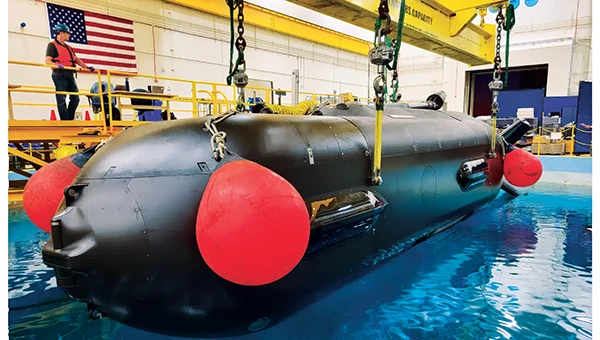
An Orca extra large UUV (XLUUV) is tested in a tank. With a range of 6,500 nautical miles, the submarine can perform long missions. Its navigation system features a Kalman-filtered inertial unit supported by Doppler velocity logs and depth sensors. Photo: Boeing
The USN has unmanned autonomy programs for large, small and underwater vehicles. The Orca submarine program is slated to consist of five 51-foot-long vehicles, and includes variants fitted with an added 30-foot payload section. To operate for several months underwater, it is likely that a similar degree of autonomy has been incorporated. ORCA surfaces regularly and can be given new routing if required.
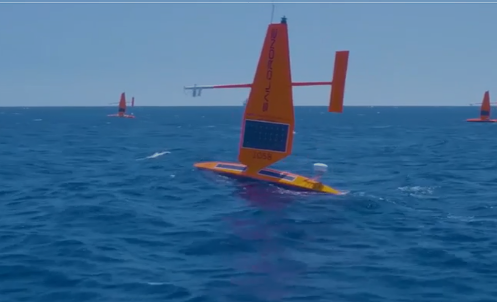
Saildrone’s autonomous research vessel (Photo: Saildrone)
Other types of vessels collect ocean and seafloor data. The environmentally friendly Saildrone can operate independently — we could say autonomously — for more than a year. The Saildrone company, based in Alameda, California, contracts out its USVs, providing its technology to agencies and governments and taking on the risks of ocean surveying to acquire valuable data. Saidrones are equipped with satellite communications, GNSS navigation, weather sensors and sub-surface sensors.
Wheels on the road
Autonomy applications on land are dominated by commercial self-driving cars, Tesla being the leading manufacturer in the U.S. However, full autonomy is still a considerable way from being ready. At the full-autonomy level, known as Level 6 in the auto industry, the vehicle does all the driving, including obstacle avoidance, under all conditions, without any geographic limitation. Nevertheless, we appear to have progressed from basic manual control (Level 0) to somewhere around Level 3, where the vehicle is largely aware of its environment, and does most of the driving. Even so, human monitoring and control are still required.
Tesla’s autopilot technology in its Model S and Model X electric vehicles could be referred to as an advanced driver assistance system — or as Tesla calls it, “Full Self-Driving (Supervised)” — and is reported to handle emergency steering and braking, autonomous steering, lane changing, vehicle following, curve negotiation, and automatic parking. Autopilot sensor inputs are provided by 12 ultrasonic sensors and eight cameras providing a 360° field of view.
Tesla Autopilot intelligence can identify more than 250 traffic signs 50 countries, including turn signs and speed limits. It can identify and interpret traffic lights and road markings, and decide what to do when coming across things such as traffic cones and pedestrians.
Nevertheless, Tesla’s have been involved in quite a few accidents, the cause of which has been analyzed to be mostly a lack of driver attention (supervision), and in a number of cases, a failure of the autonomous system to recognize unusual road conditions.
Another company, Leo Drive, specializes in providing scalable software and hardware solutions, offering an end-to-end, one-stop service for integration of autonomous systems. Its mission is to make autonomous technology more accessible and widely adopted across various industries.
For its autonomous test vehicle, Leo Drive is using the Ellipse-D, a dual-antenna RTK inertial navigation system (INS) from SBG Systems. The company chose the Ellipse-D for its accuracy, reliability, and advanced features — all essential for autonomous vehicle development and testing. The Ellipse-D INS was integrated into Leo Drive’s, a passenger car converted for autonomous operations.
Oshkosh Defense integrated autonomous technology onto Palletized Load System vehicles as part of the Expedient Leader Follower program. Photo: Oshkosh Defense
The U.S. Army has been using automation in its weapon systems for some time. How much autonomous behavior, of which these systems are truly capable, may be difficult to determine. The General Atomics Reaper unmanned aerial vehicle (UAV) is largely controlled over long-distance satellite links by operators in control stations. It’s possible that the same set up is true of most of the Army’s automated weapons — probably motivated by the need to avoid systems independently determining their own targets and firing without human confirmation.
It’s difficult to determine just what army programs are underway, other than to acknowledge that programs have been launched in the past. There doesn’t appear to be any open, clear indication of the degree of autonomy to be included. A couple of programs have produced at least visible hardware, but how much or little human control is involved is unclear.
Taking flight
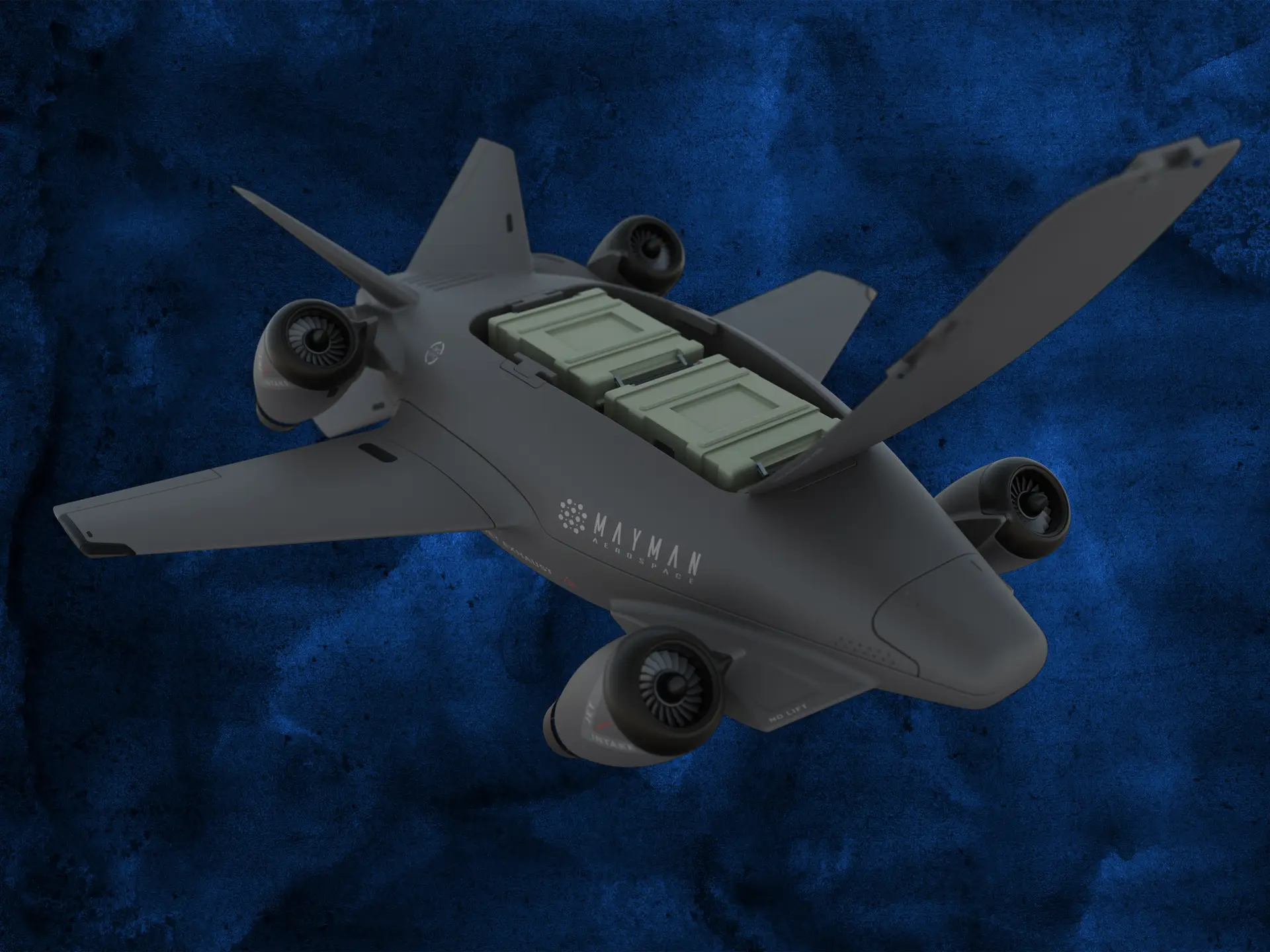
Up in the air, new autonomy contender Mayman Aerospace is offering the Razor, a jet-powered vertical take-off and landing (VTOL) UAV. Development of Razor is funded by private investment and U.S. Department of Defense contracts.
The RAZOR VTOL with gimbled jet pods passed tests at a military base in California in September 2024. Photo: Mayman Aerospace
Razor is imbued with a degree of AI that enables autonomous decision-making, as well as navigation. Its autonomous AI brain — the SkyField flight-control system — navigates independently in a GPS-denied environment, possibly involving ground beacons and eventually integrating with battlefield management systems. With a 5- to 6-foot-long airframe and sculpted shape, the aircraft presents a low radar cross section and has a degree of stealth to assist in the penetration of enemy defenses. Its top speed of 500 mph provides new options for both military and commercial applications, according to Mayman.
Razor also can aid disaster recovery, rescue operations, and the delivery of urgently needed life-saving cargo.
Many VTOL unmanned aircraft have struggled with the transition from vertical to horizontal flight. On its first vertical lift-off and climb-out on four jet engines, Razor paused briefly at altitude. Then its jet pods tilted slightly toward horizontal before the aircraft went directly into horizontal flight. An earlier flying testbed may have assisted the development of transition software, perhaps with a boost from machine learning.
Designed for deliveries, the EHang 216 heavy cargo, 16-rotor unmanned aircraft can carry a payload of 551 pounds over almost 22 miles with a top speed of 80 mph, according to the EHang company. The UAV is fully autonomously operated while being monitored over a 4G/5G data link at a manned control center. The system has an automatic fail-safe mode in which the UAV will return to base if the communications link goes down or if battery power drops too low.
EHang also uses a redundant design, with two GPS receivers and double rotors, ensuring a low likelihood of failure during a delivery run.
More In development
So while land vehicle autonomy is moving forward — with Tesla cars and Army vehicles that apparently can take control with close human monitoring — we still have some distance to go to achieve fully independent autonomous behavior on the road.
The Ehang 216 heavy-cargo UAV EHang 216L is designed for deliveries, including life-saving ones. Photo: Ehang video screenshot
Autonomous applications on the sea are more common, with U.S. Navy applications showing substantial progress. Still, precise navigation in crowded harbors remains under human control. Humans are still watching and monitoring, ready to intervene should military or commercial UAV applications make untoward execution errors.
We will continue to follow developments of significant autonomy programs such as the U.S. Air Force Collaborative Combat Aircraft (CCA), a new type of uncrewed weapon system. The CCA and other programs are maintaining high investment levels, so it’s possible that we may see full autonomy fielded quite soon. Perhaps then our belief in its capability will become fully justified.
Sierra Space, a commercial space and defense technology company, has successfully completed another demonstration of its resilient GPS (R-GPS) technology for the U.S. Space Force. This achievement marks the third major milestone for the program, which is designed to enhance the resilience of GPS infrastructure against threats such as jamming and spoofing. The recent demonstration included early integration of R-GPS satellite technology using FlatSat flight software and hardware subsystem testing, as well as successful communication with ground software systems.
The R-GPS effort is part of a broader initiative by the U.S. Space Force’s Space Systems Command to develop smaller, more cost-effective GPS satellites. Sierra Space was awarded a Quick Start contract in September 2024 to produce design concepts for these satellites, aiming to rapidly bring advanced technology to the national security space sector. The company’s progress comes just six months after the program’s inception, highlighting its ability to accelerate technology development in response to evolving defense needs.
GPS technology is integral to both civilian life and military operations, supporting applications that range from smartphone navigation to critical defense activities. As adversarial threats become more sophisticated, the need for resilient GPS systems has grown. The R-GPS program addresses this by planning to augment the existing GPS architecture with a network of smaller satellites, which would provide additional layers of security and rapid deployment capabilities.
The latest testing milestone demonstrated the flow of commands and telemetry between Sierra Space’s ground software and a ground stations service provider, establishing that the technology can operate effectively between orbit and ground-based facilities. The FlatSat testing format, where satellite components are evaluated while laid out flat, allowed for early integration of flight software and hardware subsystems.
SiTime Corporation has introduced Symphonic, its first mobile clock generator featuring its integrated MEMS resonator, the SiT30100. The device is designed to deliver precise and resilient clock signals for 5G and GNSS chipsets, supporting efficient power consumption in mobile and IoT devices, including smartphones, tablets, laptops and asset trackers. According to SiTime, the Symphonic clock generator combines the functions of up to four separate timing devices, which helps simplify system design and reduces circuit board space requirements.
The integrated temperature sensor in the SiT30100 provides accurate data to compensation algorithms, enabling improved frequency stability. This results in improved GPS accuracy and faster lock times, which are critical for maintaining stable performance in challenging environmental conditions. The device operates within a temperature range of -30°C to 90°C and is engineered for dynamic stability and power optimization, helping to mitigate electromagnetic interference.
Symphonic offers four clock outputs, each capable of delivering 76.8 MHz, 38.4 MHz or 19.2 MHz, suitable for baseband, radio frequency and GNSS applications. The integrated MEMS resonator eliminates the need for an external resonator, resulting in a compact, single-chip solution with an area of 2.22 mm². The device also features a high-precision temperature-to-digital converter with a single-wire UART interface, supporting frequency stability as low as plus or minus 0.5 parts per million.
Canadian scientists recently led their first Antarctic research expedition, using Montreal-made Arrow Gold+ GNSS technology for precise location data in remote and challenging conditions. The mission, which departed in early March 2025 aboard HMCS Margaret Brooke, included experts from multiple Canadian universities and government agencies. Researchers conducted water, sediment, air, and sea-ice sampling to study climate change, glacial retreat and pollution such as mercury and microplastics.
The month-long journey around the South Shetland Islands and the northern Antarctic Peninsula yielded surveys of coastal and oceanic sites. The crew relied on a small, unmanned surface vessel (USV) carrying various equipment for bathymetric surveys including an onboard computer, IMU and multibeam sonar.
In order to find the USV’s precise position in an environment with no land-based RTK infrastructure, the team relied on the Arrow Gold+ GNSS receiver, designed and manufactured by Canadian-based Eos Positioning Systems. The Arrow Gold+ utilized Galileo High Accuracy Service (GalHAS), a free satellite-based PPP correction available worldwide from the European Union’s Galileo Programme.
“There aren’t any RTK networks in Antarctica,” said Kevin Wilcox, Ocean Mapping Group research scientist, who piloted the USV. “That sent us looking for the Arrow Gold+ and GalHAS corrections. When we found these, we realized we had a possible solution.”
While using GalHAS corrections, the Arrow Gold+ provided estimated accuracies of about 10 cm horizontal and 15 vertical to 20 vertical.
“The vertical accuracy was especially important for our bathymetric work,” Wilcox said. “Any vertical error would directly add error to our depth.”
Sites surveyed include Admiralty Bay, Livingston Island and Deception Island, which includes an active, flooded volcano caldera. The resulting, high-accuracy maps will support further scientific and oceanographic research, environmental monitoring, and improvements to marine charts.
By adding high-accuracy locations with an average accuracy of 10 cm to 20 cm horizontal and vertical, the team was able to accurately georeference and further refine the detail of the bathymetry for their map inside the underwater Deception Island caldera. (Photo: Eos Positioning Systems)