The European Union Agency for the Space Programme (EUSPA) along with the European Commission, have published guidelines that specify the baseline applicable to the Galileo Open Service Navigation Message Authentication (OSNMA) receiver service provision phase. The new documents include the OSNMA Signal-in-Space (SIS) Interface Control Document (ICD), and OSNMA Receiver Guidelines.
The OSNMA SIS ICD specifies, among other things, the interface between the Galileo Space Segment and the Galileo User Segment. This document is an addition to the Galileo Open Service (OS) SIS ICD.
The OSNMA Receiver Guidelines provide generic instructions for the user segment implementation of the OSNMA functionality and complement the OSNMA SIS ICD. Additionally, the guidelines explain user capabilities and steps to implement to verify the authenticity of the Galileo navigation message.
Both documents will be used for the upcoming OSNMA Service Provision Phase that will begin after the OSNMA Service Declaration. They have been developed as an evolution of the Galileo OSNMA User ICD for test phase (v1.0) and the Galileo OSNMA Receiver Guidelines for test phase (v1.1). Copies of the documents can be found here.
On Nov. 11, the last Galileo satellite of first-generation series was shipped from ESA’s ESTEC Test Centre, Europe’s largest satellite testing facility. Galileo is Europe’s largest satellite constellation and one of the most accurate satnav systems in the world.
Galileo’s development began two decades ago with two test GIOVE satellites, followed by a series of other operational launches to add to the constellation. The current constellation consists of 34 Full Operational Capability satellites, the initial two GIOVE satellites, and the Galileo In-Orbit Validation satellite. Galileo Second Generation satellites are already in development.
Airbus will install Orolia’s Ultima-DT emergency locator transmitter on its aircraft. (Photo: Airbus)
This fall, Orolia’s Ultima-DT was certified as an emergency locator transmitter with distress tracking (ELT-DT) by Cospas-Sarsat, an international humanitarian search-and-rescue system. Cospas-Sarsat uses space-based technology to detect and locate model 406 emergency beacons carried by ships, aircraft or individuals venturing into remote areas — often inaccessible by GNSS signals. The system consists of a network of satellites, ground stations, mission control centers and rescue coordination centers that work together when a 406 beacon is activated.
I spoke about the certification with Christian Belleux, director, Aviation & Defense Beacons for Orolia.
Matteo Luccio (ML): Has Orolia produced aviation safety products in the past?
Christian Belleux (CB): Orolia has been supplying emergency locator transmitters for aviation since 1995 on a very large number of platforms to OEMs and airlines for use on commercial aircraft — Airbus, Boeing, Embraer and Bombardier aircraft. Orolia is also participating in industry groups creating standards (Eurocae, RTCA, ARINC) or contributing to the progress of the Cospas-Sarsat search-and-rescue satellite system as a member of the Expert Working Group.
ML: What are the key challenges in making an aviation ELT?
CB: With new requirements for lithium batteries and new regulations introducing distress tracking, recent times have been rich in innovation. We were granted the first ETSO certification ever for an ELT-DT and the same product, the Ultima-DT, was also the first ELT to be certified for its lithium battery.
ML: What did Cospas-Sarsat certification of the ELT-DT entail?
CB: The ELT-DT is a new type of beacon with a new communication protocol. The labs performing the certification tests must be approved by Cospas-Sarsat before we can apply. Then the Cospas-Sarsat organization and infrastructure must be updated to receive and consider the new ELT-DT protocol. The Cospas-Sarsat certification of our ELT-DT means that it complies with the performance requirements described in Cospas-Sarsat standards and can communicate with the infrastructure.
ML: What is new about an ELT-DT?
CB: The principle of an ELT-DT is to activate in flight before a crash, as opposed to a legacy ELT that is activated by the shock of a crash. This means that the aircraft and the ELT-DT can analyze the health of the aircraft and its parameters, and activate if a catastrophic event is about to occur. Once activated, the ELT-DT transmits a high-rate distress signal that makes it possible to track the aircraft until it crashes. The ELT-DT contains its own GNSS receiver that is independent the aircraft’s navigation system.
ML: Did you cooperate closely with one or more avionics manufacturers to develop your device?
CB: Orolia was in very close contact with Airbus, which designed the avionics components.
ML: Do you already have contracts with airlines or aircraft manufacturers besides Airbus for the Ultima-DT?
CB: We have several contacts with aircraft manufacturers and airlines interested in the Ultima-DT.
ML: When will the first batch of the ELT-DT / Ultima-DT be operational?
CB: We started flight tests months ago at Airbus and delivered production units. Airbus soon will announce its first delivery of an aircraft equipped with the Ultima-DT.
Sentinel-3 A&B CPOD Precise Platform data (AUX_PRCPTF)
The following new products from Sentinel-3 and Sentinel-6 are now available as well. The Sentinel-6A GNSS RINEX observations include GPS and Galileo data — the first publicly available Galileo data obtained from an orbiting receiver.
Sentinel-3A&B CNES Medium Orbit Ephemeris (SR___MDO_AX)
The GNSS RINEX (AUX_GNSSRD) and Quaternions files (AUX_PROQUA), together with the final orbital products (AUX_POEORB, AUX_PRCPTF, SR___POE_AX, and AX____POE__AX) are available at the beginning of each mission.
The other orbital products (AUX_RESORB, SR___ROE_AX, SR___MDO_AX, AX____MOED_AX, and AX____ROE__AX) are available for at least one month, until the final products are available.
The typical accuracy of the orbital products can be found in the Regular Service Reviews carried out by the CPOD Service quarterly.
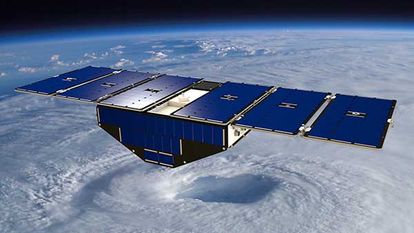
Artist’s concept of one of the eight CYGNSS satellites in orbit. (Image: NASA/University of Michigan)
Since Nov. 26, NASA’s Cyclone Global Navigation Satellite System (CYGNSS) team has not been able to make contact with one of the eight CYGNSS spacecraft, FM06.
The team is still working to acquire a signal and establish a connection.
The other seven spacecraft continue to operate normally and have been collecting science measurements since the FM06 anomaly.
CYGNSS is a constellation of eight small satellites taking measurements of ocean surface winds in and near the eye of the storm throughout the lifecycle of tropical cyclones, typhoons and hurricanes.
If the team isn’t able to reestablish contact, loss of the FM06 satellite would primarily affect the constellation’s spatial coverage. However, the CYGNSS constellation can continue to meet its scientific requirements and objectives.
CYGNSS was launched Dec. 15, 2016, and completed its prime mission science objectives on March 19, 2019. It has been operating in extended mission status since then.
The South African National Space Agency (SANSA) launched the South Africa Space Weather Center at Hermanus in November to provide real-time space weather forecasts. The space weather center detects space weather conditions such as strong solar flares that could disturb Earth’s magnetic field and severely affect ground-based electrical and electronic systems.
The space weather center collects data in real-time from solar satellites and a ground-based instrumentation network which consists of three kinds of sensors: GNSS receivers, magnetometers and an ionosonde system. Space weather conditions are then broadcast to South Africa and the rest of the continent to provide critical 24/7 space weather alerts for airlines, air traffic control agencies, telecommunications companies and satellite operators.
The International Civil Aviation Organization now recognizes the space weather center, as the launch filled the void in global space weather monitoring and 24/7 forecasting coverage.
SANSA received approval for the space weather center in 2019 and overcame many challenges during its development, such as limited funding for research, personnel, and equipment, as well as the COVID-19 pandemic.
The White House is drafting an executive order that would simplify the approval for private launches by clarifying space rules and regulations for private American space companies. This order, which President Biden could sign into law early next year, aims to simplify licensing procedures in accordance with existing federal space laws to routinize space activities, including launching rockets and satellites deployed by private companies. Private space companies such as Elon Musk’s SpaceX and Jeff Bezos’ Blue Origin, are preparing to invest in several projects over the next decade, such as Blue Origin’s Orbital Reef project, which would build a commercial space station in low-Earth orbit (LEO).
Additionally, an online tool is being designed for the Department of Commerce to guide private companies through the licensing requirements from the relevant federal agencies. The order may also include granting certain federal agencies oversight of space activities that are not currently monitored, such as asteroid mining and space junk removal.
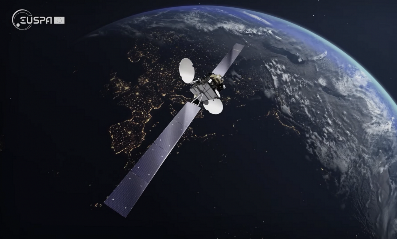
Europe’s regional satellite-based augmentation system (SBAS), EGNOS, has received upgrades to advance the reliability of GNSS positioning information, according to EUSPA.
Historically, EGNOS has provided safe, uninterrupted satellite navigation services to aviators, and some maritime, railroad, and land-based users in Europe. This system upgrade includes extending its service area, adding advanced functionalities, and reinforcing dual-frequency and multi-constellation services.
The EGNOS V242B system upgrade will expand services outside of its service area and enhance availability to users. Additionally, the upgrade ensures aviator access to lifesaving services such as Localizer Performance with Vertical Guidance (LPV)-200. The upgrade also includes more advanced data processing functions to cater to increased issues with peak solar activity and ionospheric phenomena that interfere with EGNOS signals and services.
Dual-frequency and multi-constellation services were also improved in the EGNOS upgrade. The improvements revamped EGNOS Version 2, and reinforced EGNOS services before launching EGNOS Version 3 (V3).
EGNOS delivers two frequencies and has amplified Galileo signals, hence creating a multi-constellation capability. When EGNOS V3 is launched, it will offer additional services and enhance protection against cyberattacks, further advancing EGNOS’ safety-critical applications across Europe.
The private spaceflight company, SpaceX, has undertaken a partner project in addition to its existing space efforts ranging from sending satellites and people to space, to providing a brand of commercial internet connection to remote areas.
The new partner project, Starshield, will join Starlink in providing secure, broadband internet connection to customers. However, there is a stark difference between the partner projects.
Starlink technology has end-to-end user data encryption to secure its network as it was designed for commercial customers. However, the Starshield project is intended for government use in national security efforts. Therefore, it is equipped with an additional high-assurance cryptographic feature to host payloads and process data in a secure way aligning with government national security requirements.
As reported by SpaceX, Starshield has three focus areas including: Earth observation, global communications, and hosted payloads. Starshield’s satellites can integrate with a variety of different payloads and the constellation has a low-Earth orbit (LEO) design making it robust to on-orbit assets.
SpaceX continues to work closely with the United States Department of Defense by providing innovative space technology.
The Ministerial Council of the member states of the European Space Agency (ESA) has pledged 351 million euros to ESA’s board of directors for navigation to aid in multiple satellite navigation endeavors.
This funding helps support ESA’s FutureNAV program, the Navigation Innovation and Support Program (NAVISP), and the Moonlight Initiative, developed for lunar telecommunications and navigation coverage and innovation.
The FutureNAV program is aimed at addressing the rapidly growing need for more ubiquitous, resilient and reliable positioning, navigation and timing (PNT). Its first mission consists of an initial in-orbit demonstration, small constellation of low-Earth-orbit (LEO) navigation satellites. The LEO-PNT satellites will test a multi-layer approach to deliver more accurate and robust PNT services, supplementing Galileo.
The second FutureNAV mission, GENESIS, will map the moving contours of Earth, while enhancing the accuracy of Galileo.
The expanded funding will also be invested in NAVISP. The program has already began working on over 200 projects relating to satellite navigation, PNT research, and backing Member States in research priorities.
Lastly, funding is being delegated to the Moonlight Initiative, a project designed by ESA to extend satellite navigation and telecommunications coverage to the Moon. The advancement and launch of Moonlight infrastructure on the Moon will undertake several missions bolstering future Moon exploration.
SpirentCommunications has revealed its latest low-Earth-orbit (LEO) satellite solution software named SimORBIT, developed in partnership with space-borne receiver developer SpacePNT. The software is designed to aid developers in determining LEO orbits accurately for GNSS/PNT lab testing.
SimORBIT calculates LEO orbits as well as their environments and intricate characteristics to provide an accurate result to developers for testing. The software replicates LEO orbits so that simulations can provide the realistic environment of a LEO satellite, including gravitational and atmospheric impacts the satellite could encounter in space.
SimORBIT was created in partnership with spaceborne receiver developer SpacePNT. “Until now, PNT testing on LEO applications has been limited due to the lack of an integrated solution that could offer realistic LEO orbital data together with GNSS simulation capabilities,” explained Adam Price, Spirent’s vice president of PNT Simulation. “By working in close collaboration with SpacePNT, we have been able to develop the SimORBIT tool to bring a new level of accuracy and realism to LEO application testing by combining the simulation of precise LEO orbits and highly accurate GNSS signals.”
With Spirent’s release of SimORBIT, developers can create non-ICD signals via I/Q injection, or by the Spirent “Flex” feature, generating space-centered PNT signals to be developed in the lab as realistically as possible.
GNSS researchers presented hundreds of papers at the 2022 Institute of Navigation (ION) GNSS+ conference, which took place Sept. 19–23 in Denver, Colorado, and virtually. The following five papers focused on atmospheric effects on GNSS signals. The papers are available at www.ion.org/publications/browse.cfm.
Addressing Scintillation Error
Mitigating the scintillation effect at low latitude is a complex matter: several kinds of experimental data must be collected, realistic models must be developed, and, most importantly, useful real-time indices and alerts must be made available.
The authors introduce a prototype based on a patent owned by SpacEarth Technology to address scintillation error detection and mitigation, supporting precision GNSS-based services at low latitudes in any season and space weather conditions. The patent relates to a method of total electron content (TEC) and scintillation empirical forecasting, in particular short-term forecasting (seconds to minutes). The output of the method is necessary to feed mitigation algorithms aiming at improving accuracy on GNSS precise positioning techniques (RTK, NRTK, and PPP) under ionospheric harsh conditions.
The prototype is designed with a Central Elaborating Facility, which collects the data provided by a network of GNSS monitoring stations detecting scintillation events, and broadcasts foreseen scintillation parameters. Users with a rover mitigation device can apply the parameters from the central facility for scintillation error mitigation.
Vincenzo Romano, INGV and SpacEarth Technology; Claudio Cesaroni, INGV; Luca Spogli, Alessandro Fiorini, INGV and SpacEarth Technology; Marco Fermi, Gter; Lorenzo Benvenuto, Gter and University of Genoa; Tiziano Cosso, Gter; Marcin Grzesiak, SRC/PAS; Joao Francisco Galera Monico, Italo Tsuchiya, UNESP; Gabriel Oliveira, Marcos Guandalini; “Ionospheric Scintillation Mitigation at Low Latitude to Improve Navigation Quality.”
Ring of Fire GUARDIAN
Commonly, natural hazards release energy into the Earth’s atmosphere in the form of acoustic-gravity waves, which propagate up to the ionosphere. The resulting traveling ionospheric disturbances (TIDs) can be detected using GNSS signals, through the computation of the integrated total electron content (TEC) along the lines of sight between GNSS receivers and satellites. The global distribution of ground-based GNSS receivers constantly tracking multiple GNSS constellations (GPS, Galileo, GLONASS, BeiDou, and others) provides excellent spatio-temporal coverage around the world, including in areas of limited coverage by existing warning systems.
The authors present the operational GNSS-based Upper Atmospheric Real-time Disaster Information and Alert Network (GUARDIAN). Based on dual-frequency GNSS data from the Global Differential GPS (GDGPS) network of the Jet Propulsion Laboratory, the GUARDIAN architecture computes slant TEC time series in near real time.
As part of the GDGPS network, 78 stations around the Pacific ring of fire monitor the four GNSS constellations: GPS, Galileo, GLONASS and BeiDou. Cycle slips are corrected and the time series are filtered, both in real time. The resulting data stream is output live to a user-friendly public website, benefitting the general public and the scientific community.
The current GUARDIAN focuses on the Pacific region. However, the architecture can readily be extended to a worldwide coverage.
Léo Martire, S. Krishnamoorthy, L. J. Romans, B. Szilágyi, P. Vergados, A. W. Moore, A. Komjáthy, Y. E. Bar-Sever, A. B. Craddock, NASA Jet Propulsion Laboratory, California Institute of Technology; “GUARDIAN: A Near Real-Time Ionospheric Monitoring System for Natural Hazards Early Warnings.”
Civil Aviation Interference
The authors provide a survey on GNSS receiver architectures with emphasis on new carrier-tracking techniques for mitigating the adverse effect of ionospheric scintillation within the context of civil aviation. The survey is complemented by results gathered from simulations on the impact of ionospheric scintillation in conventional receiver architectures. A review on scintillation mitigation techniques is carried out, covering several “technique families,” highlighting their potential for performance improvement, as well as their shortcomings and challenges in implementation.
A semi-analytical simulation campaign is carried out for different modulations: L1, L5 for GPS, and E1, E5a for Galileo. Here, the performance of a standard receiver tracking a set of GPS and Galileo satellites affected by ionospheric scintillation is analyzed to pinpoint existing vulnerabilities to this effect.
The simulation results show that ionospheric scintillations are responsible for large variations in carrier-to-noise ratio, which in turn can be responsible for losses of lock and large phase variations, increasing phase RMSE and in some cases leading to cycle slips of the phase estimation. Thus, the adopted solution must be robust to signal power fluctuations and the occurrence of cycle slips and able to maintain phase lock.
António Negrinho, GMV-PT Pedro Boto, GMV-PT Marta Cueto, GMV-ES Mikael Mabilleau, EUSPA Claudia Paparini, EUSPA Ettore Canestri, EUSPA; “Survey on Signal Processing Techniques for GNSS Ionospheric Scintillation Mitigation.”
Tonga Eruption Data Analyzed
Extreme natural disasters, such as volcanic eruptions, can create visible pressure waves in the atmosphere and trigger observable ionospheric wave responses that can travel hundreds of kilometers in the ionosphere. The acoustic and gravity waves generated can cause ionospheric TEC perturbations and variations. The TEC determines the GNSS ionospheric delay and can cause significant positioning errors, which may affect the performance of GNSS-based applications.
The researchers processed GNSS data collected from the Hong Kong Satellite Positioning Reference Station Network to analyze the ionospheric activity and positioning performance responding to the Tonga volcanic eruption on Jan. 15, 2022. To detect and repair cycle-slip jumps, the researchers applied theTEC rate and Melbourne Wubbena Wide Lane (MWWL) linear combinations. A Savitzky-Golay low-pass filter with a 30s window was used to improve the TEC accuracy.
The team investigated the changes in TEC, Rate of TEC index (ROTI) and positioning errors in the eastward, northward and upward directions after the anomalous ionospheric propagation to Hong Kong between 11:30 and 14:30. The team found the ionospheric anomaly could generate large changes in the three parameters, with peaks up to three times the calm period. Their prompt research contributes to a better understanding of the coupling of extreme ionospheric activities and dynamics caused by volcanic eruptions.
Xiaojia Chang, Kai Guo, Zhipeng Wang, Kun Fang, Hongxia Wang, Beihang University; Hailong Chen, China Academy of Aerospace Electronics Technology; “Ionospheric Anomaly and GNSS Positioning Responses to the January 2022 Tonga Volcanic Eruption.”
Toolbox for Monitor Network
The MONITORtoolbox is a set of Python-coded software tools to perform automatized large-scale processing of data from the Monitor network of the European Space Agency (ESA). The Monitor network aims to continuously monitor ionospheric scintillation events from multiple ground stations strategically located around the globe. It accommodates a repository with a large number of GNSS measurements containing scintillation events for users to analyze scintillation data or for research purposes.
This paper shows the potential of the MONITORtoolbox for providing access to a large amount of data that otherwise, without a systematic processing, becomes practically useless. The software developed implements the means to collect data and store it in a local database for quick offline access. It detects the presence of scintillation events based on certain conditions and criteria defined by the user and identifies its properties in terms of duration, time of occurrence, intensity and satellite location. It implements the tools to compute relevant statistics, providing insights on ionospheric scintillation phenomena.
Sergi Locubiche-Serra, Alejandro Pérez-Conesa, Diego Fraile-Parra, Gonzalo Seco-Granados, José A. López-Salcedo, Universitat Autònoma de Barcelona, IEEC-CERES; Juan M. Parro-Jiménez, Raúl Orús-Pérez, ESTEC, European Space Agency; “MONITORtoolbox — Software Tool for the Analysis of Ionospheric Scintillation Data from the ESA Monitor Network.”