Category: Survey

  • Trimble Adds Ultra High-Frequency RFID to Juno T41 Rugged Handhelds

    Trimble Adds Ultra High-Frequency RFID to Juno T41 Rugged Handhelds

    Juno-T41_Local-Govt_asset-W

    Trimble has introduced the Juno T41 rugged handheld computer with integrated Ultra-High Frequency RFID capabilities. In addition to high-speed 1D/2D barcode imaging technology, smartphone capability and enhanced, real-time 1-2 meter GPS accuracy, the Juno T41 series now offers new models that provide more functionality and configuration choices for data collection and mobile workforce management, Trimble said.

    “Often the RFID tag is specifically used because the item being tracked is in difficult or harsh environments where a barcode won’t survive,” said Jim Sheldon, general manager of Trimble’s Mobile Computing Solutions Division. “The rugged design of this handheld computer is an ideal solution for reading RFID in outdoor and extreme situations.”

    The RFID capability can be combined with Enhanced GPS and/or smartphone connectivity so customers can choose a specific handheld model that meets their needs.

    The Juno T41 R will automatically recognize tags across a variety of frequencies and work with any size or style of RFID tag that is designed for customized solutions. UHF RFID is an increasingly commonplace technology using the 860 to 960 MHz frequency range.

    Using the latest EPCglobal Gen 2 RFID technology from Trimble’s ThingMagic Division, the device uses two different antenna ranges to read or recognize the unique identification of an asset anywhere in the world.

    • FCC Certified (North America): 902-928 MHz bands
    • ETSI Certified (EU): 865.6-867.6 MHz bands
    • ACMA Certified (AU/NZ): 920-926 MHz bands

    Trimble Juno T41 RFID handheld computers feature a 1-GHz processor and 512-MB RAM and 32-GB onboard storage with either Android 4.1 or Microsoft WEHH 6.5 operating systems. Other standard features include an 8-MP integrated camera, multi-touch capacitive 4.3-inch sunlight-readable display, all-day battery life and 2-4 meter GPS accuracy capability. Other features include:

    • Rapid-read, high-accuracy performance on multiple tags with multiple orientations, even in crowded conditions.
    • Consistent read-range over 3.5 meters for 5 cm2 (2″) UHF tags in unobstructed space.
    • Integrated antenna with the ability to transmit up to +30 dBm (1 Watt) power for demanding applications.
    • >Configurable performance settings and use-case parameters in the pre-loaded Trimble SearchLight application.
    • Software Development Kit to customize all settings including read-range, power-consumption and other features.

    The Juno T41 models are built to meet military-grade standards of ruggedness for drops, temperature, altitude, humidity extremes, vibration, chemical exposure and shock with either an IP65 or IP68 rating for water and dust.

  • Centimeter-Level RTK Accuracy More and More Available — for Less and Less

    Eric Gakstatter
    Eric Gakstatter

    Last month, I started off 2014 with a bang by listing all the public RTK bases available in the United States, most of them being free. I received a lot of positive feedback and some enlightenment. For example, I didn’t know that in California, there are more than 330 RTK public base stations accessible by anyone for free via the California Real Time Network website at the University of California at San Diego! What a tremendous resource for California surveyors and GISers.

    Remember that RTK will give you 1-2 cm accuracy horizontally and twice that for vertical. If you know that and also know that there are 330 free RTK bases in California, why would anyone use post-processing for high-precision (e.g., sub-foot) GIS data collection? RTK technology used to be reserved for people who could spend tens of thousands of dollars on a GNSS receiver. Not any longer. RTK receivers are available for under $7,000, and you don’t need to invest in a RTK base unit if you’re in range of a public one on my list (or a commercial one not on my list).

    I’m pretty sure it was Charlie Trimble (founder of Trimble Navigation) who said “accuracy is addictive.” It sure is. Once you experience real-time centimeter-level accuracy (RTK) in the field, you won’t be satisfied with anything less, and neither will your GIS.

    I’ll keep updating the List of Public RTK Base Stations in the U.S. as people continue to inform me of ones that aren’t on my list. If you know of one, please email me.

    Keeping on the subject of RTK, 2014 might be the year of inexpensive RTK receivers. Whereas today you can find L1/L2 GNSS RTK receivers (in the U.S.) ranging from US$6,500 to US$25,000, there are rumors that some manufacturers are going to break through the US$6,500 price point.

    This is in line with the prediction I made a few years ago, but for a different reason. In 2010, I wrote that RTK receivers would become very inexpensive due to the new L5 signal being introduced, which would increase competition among GNSS receiver designers. I speculated that with more competition, the selling prices would significantly decline. Well, we are still without a usable L5 signal (although making progress) due to the slow deployment of modernized GPS satellites and the delay in Europe’s Galileo system, but we are still seeing a steady decline in the price of RTK receivers. Why is this?

    Even though there are a limited number of designers of RTK GNSS receivers, an increasing number of companies are buying RTK GNSS boards from these designers and making their own finished RTK GNSS receivers that look and perform very similar to receivers available today, for a fraction of the price. This is especially true in China, where there are several manufacturers buying RTK GNSS receiver boards from Trimble, Novatel, Hemisphere et al, making their own finished products and selling them. They were initially selling to very price-sensitive markets such as Africa, but now you see them setting up distribution in North America.

    This “OEM Syndrome” has put tremendous price pressure on existing brand-name RTK GNSS receivers as the Chinese-equivalent products are priced as little as 25% of the equivalent brand-name products. Of course, this drives the leading brand-name companies crazy. They are forced to either drop their price or otherwise convince buyers that their products are worth a significant premium. During these times of tight capital budgets, it’s increasingly difficult to do the latter. When enough satellites are in orbit broadcasting the L5 signal, you’ll really see this effect gain traction because there will be a lot more RTK GNSS designs to choose from, and the result will be better quality. More competition always results in better product quality and performance.

    The fact is that RTK receivers are moving towards becoming a commodity. As much as your local salesperson would like you to think they are selling a better RTK GNSS receiver, the technology gap between leading-brand designers and others is closing and probably unnoticeable to most of you. The major differences end up being the quality and reliability of the finished product (system design, battery, display, antenna integration, power supply, etc.). Having a great RTK GNSS receiver board inside is useless if the system design is unreliable.

    More Real-time PPP Competition

    For the longest time, it’s only been OmniStar (now owned by Trimble) and Starfire (owned by Deere & Co.) in the L-band high-precision correction game. Then, last year, the International GNSS Service announced its free decimeter real-time PPP service.  The catch is that receiver designers must incorporate IGS firmware to make use of the signal and…it’s only an Internet-based service (no satellite communications).

    In the past couple of months, Hexagon (which owns both Leica and Novatel), made a bid for Veripos. Veripos operates an L-band GNSS correction service for the oil and gas industry. Last year, TerraStar, a subsidiary of Veripos, announced its new decimeter service that is very similar to OmniStar and Starfire. It uses satellite communications for a data link. Altus Positioning Systems incorporated the TerraStar service into its receivers. Hexagon is very close to closing the deal with Veripos and just last week announced a partnership with competitor Topcon Positioning Systems. The result is that Leica and Topcon both will start offering high-precision L-band GNSS correction services with their receivers. If you’re an L-band decimeter user, this is probably good news for you. More competition = higher quality and lower price.

    Thanks, and see you next month.

    Follow me on Twitter at https://twitter.com/GPSGIS_Eric

  • Juniper Systems’ Archer Field PC Records Elevation of Remote Himalayan Peak

    Juniper Systems’ Archer Field PC Records Elevation of Remote Himalayan Peak

    Juniper_Archer_on_Mountain
    Photo credit: Mark Fisher at www.fishercreative.com, Instagram: @fishercreative; via Juniper.

    Juniper Systems’ Archer Field PC has beenused to record the elevation of a never-before-climbed peak in the remote Myanmar Himalaya. The peak, Mount Gamlang Razi, has historically been known as the second highest peak in Southeast Asia, but a joint American-Myanmar-led expedition set out on a mission last September to hopefully prove that it is in fact the tallest. Read the whole story on Juniper Systems’ blog.

    Standing at a reported 5,881 meters tall, Mount Hkakabo Razi has long been known as Southeast Asia’s highest peak. In recent years, however, the legitimacy of the elevation of Hkakabo Razi has come into question. Current digital analysis suggests that initial surveys of Mount Hkakabo Razi were overstated and its actual elevation is as much as 100 meters lower than originally believed. At the same time, digital analysis suggests that virgin-peak Gamlang Razi may in fact be the taller peak. This controversy prompted Idaho resident and experienced climber Andy Tyson to lead an American-Myanmar expedition team on a three-week approach through 150 miles of cobra-riddled, mosquito-infested jungle, and from there up to the peak of Gamlang Razi to measure its elevation in person.

    Tyson needed a device that could accurately record the elevation at the summit, while being able to withstand the extreme conditions of the hot, wet jungle and the frozen mountaintop. With this in mind, Tyson requested from Juniper Systems a top-of-the-line rugged handheld. In response, Juniper Systems provided the team with an Archer Field PC with Hemisphere GPS XF101 receiver, along with training to record the GPS data they needed.

    Setting up the Archer Field PC to collect GPS data. Photo credit: Mark Fisher at http://www.fishercreative.com. Instagram: @fishercreative
    Setting up the Archer Field PC to collect GPS data. Photo credit: Mark Fisher at http://www.fishercreative.com/Instagram: @fishercreative/via Juniper.

    After a 35-day journey, Tyson and the team successfully summited Gamlang Razi, with the Archer Field PC in hand. After collecting GPS data at the top, the data was sent via satellite phone to Juniper Systems for analysis. After post-processing the data against terrestrial base stations in Lhasa, Tibet, and confirming the results with Effigis in Montreal, Canada, Juniper Systems concluded that the elevation of Gamlang Razi was 5,870 meters, ±2 meters. This suggests that Gamlang Razi is taller than nearby Hkakabo Razi by approximately 112 meters and should be considered Southeast Asia’s new highest peak.

    However, there are many — particularly natives to Myanmar — who are not ready to accept changes to Hkakabo Razi’s original elevation measurement. This was made apparent in a letter Myanmar’s president, Thein Sein, wrote to Tyson and the team after their successful summit, congratulating them for summiting Southeast Asia’s second-tallest peak.

    Tyson remains firm in his assertion that Gamlang Razi is the country’s highest peak, but some have suggested that the debate may not be over until someone actually climbs Hkakabo Razi and measures it in person. Juniper Systems said they have a handheld for the job, should that time come.

    The expedition team. Photo credit: Mark Fisher at http://www.fishercreative.com. Instagram: @fishercreative
    The expedition team. Photo credit: Mark Fisher at http://www.fishercreative.com. Instagram: @fishercreative/via Juniper.
  • New DX-200 Expands Robotic Working Range, Features Hybrid Versatility

    New DX-200 Expands Robotic Working Range, Features Hybrid Versatility

    DX_200_Application_Sok_1D64Sokkia Corporation is offering enhanced abilities and versatility to its DX series of total stations with the introduction of the DX-200 in the North American market.

    When configured for hybrid positioning, the DX-200 has the ability to use both GNSS positioning and optical positioning data simultaneously. The standard Sokkia Hybrid Robotic System includes the DX, GRX2 GNSS receiver and MESA large-screen tablet controller.

    “The DX-200 is ideal for the professional looking for a mid-range, auto-pointing total station that can become a full-robotic instrument with a simple firmware upgrade,” said Ray Kerwin, director of global surveying products. “Advanced functionality such as hybrid positioning can be added to the robotic unit, making the DX-200 a versatile system for multiple applications.”

    The DX-200 can be used with the RC-PR5 remote controller for increased Bluetooth wireless operating range. “The remote allows for rapid prism search and lock up to 2,000 feet (600 meters) away,” Kerwin said.

    “Hybrid positioning adds a new dimension of versatility,” Kerwin said. “When line-of-sight is blocked, for example, shots can be measured with the GNSS receiver, and the receiver can also be used for quick lock functionality.”

    Standard additional features of the DX series include Direct Aiming auto-collimation technology, TSshield security and maintenance technology, MAGNET integrated software onboard and Sokkia’s patented RED-tech reflectorless measurement system.

    The DX-200 is available in 1, 3 and 5 arc second accuracy models.

  • Applanix Conducts Successful Test Flight of Professional Mapping UAS

    Applanix Conducts Successful Test Flight of Professional Mapping UAS

    Applanix_UAV3

    Applanix Corporation and American Aerospace Advisors have completed a successful series of test flights of AAAI’s RS-16 platform equipped with Applanix’ DMS-UAV aerial photogrammetry payload. This is the first successful mission for a long-endurance UAS (unmanned aerial system) capable of producing professional-grade, directly georeferenced mapping imagery for civilian applications such as pipeline monitoring, power line and emergency response mapping.

    The RS-16 Unmanned Aircraft System equipped with the Applanix Direct Mapping Solution (DMS).
    The RS-16 Unmanned Aircraft System equipped with the Applanix Direct Mapping Solution (DMS).

    Tests were conducted over restricted airspace in the state of New Jersey. A joint team from Applanix and AAAI planned and flew a sequence of missions to evaluate the capabilities of the UAS. These include, critically, the ability to provide highly accurate, directly georeferenced and orthorectified aerial imagery without the need for ground control points or aerial triangulation calculations. The system, consisting of the airframe, its avionics, mobile ground control station and the digital mapping payload, performed according to expectations and successfully produced high-quality imagery.

    “Performing safe and successful missions with long endurance unmanned aircraft in civilian airspace are a challenge that goes far beyond selecting the right aircraft and payload,” said David Yoel, CEO of American Aerospace Advisors. “Working with Applanix, we have produced an integrated system that is designed from the ground up with civilian mapping operations in mind. We believe this system has the capability to transform the aerial mapping industry.”

    The Applanix R16 in flight.
    The Applanix RS-16 in flight.

    The RS-16 DMS is a complete, operational system capable of conducting large area operations within the National Airspace System in the United States, and in other jurisdictions as local regulations allow. Within the USA, AAAI is engaged with several of the recently announced UAS research and test sites, which operate under the auspices of the FAA to develop the certification and operational requirements necessary to safely integrate UAS into the national airspace.

    The GNSS-Inertial systems at the core of Applanix’ DMS-UAV aerial mapping payload uses commercial inertial technologies that are offered globally.

    “The market for airborne imaging systems is in a state of rapid change,” said Joe Hutton, director of Inertial Technology and Airborne Products at Applanix. “Developments in imaging technology, in processing capability, and in the nature of inertial sensors, make a directly georeferenced UAS a reality today, where it would have been inconceivable even a few years ago. Our ability to take our established market-leading manned solutions, and integrate the technology successfully into an unmanned platform, speaks  volumes for the engineering expertise of Applanix and AAAI.”

  • Nine GNSS Frequencies Available through New JAVAD Receiver

    JAVAD_TRE-3
    photo: JAVAD GNSS

    The 864-channel TRE-3 receiver, just announced by JAVAD GNSS, can simultaneously access all current GNSS signals, with room to spare for multiple-channel tracking of select signals, according to the company.  The new product offers many features, including:

    • Three ultra wide-band (100 MHz) fast sampling and processing, programmable digital filters and superior dynamic range. After 12-bit digital conversion, nine separate digital filters are shaped for each of the nine GPS L1/Galileo  E1, GPS L2, GPS L5/Galileo E5A, GLONASS L1, GLONASS L2, Galileo E5B/BeiDou B2/GLONASS L3, Galileo altBoc, Galilee E6/BeiDouB3/QZSS LEX, and BeiDou B1 bands.
    • Each band consists of a combination of a digital cascaded integrator-comb (CIC) filter and a digital finite impulse response (FIR) filter (up to 60-th order) where signal selection is performed.
    • Two types of digital  in-band  anti-jamming  filters  (automatic  80-th  order  and  “user selectable” 256-th order).
    • Multiple channels to acquire and track each satellite signal. For example, 20 channels can be assigned to acquire the GPS L1 signal, each spaced one millisecond apart. Up to 5 channels can be assigned to track each signal, each with different filter parameters and tracking strategies. This supports acquiring and tracking weaker signals in difficult conditions, especially under trees and canopy — potentially using up to the 864 channels available in the receiver! Several patents are pending.
    • 80 dB out-of-band interference  rejections: high dynamic range of wide RF bands and highly rectangular  digital filters make the receiver  much more resistant  to out-of-band jamming.
    • High-speed high-dynamic   automatic   gain  control  (AGC)  to  respond  to interferences and signal variations.
    • Programmable filter width (by commands).
    • Highly stable digital filters (band characteristics do not change with age, input voltages, or temperature).
    • Improved GLONASS  inter-channel  bias performance  (due to a flat digital filter shape).
    • New multipath rejection technique.
    • 60-MHZ-wide Galileo altBoc band takes advantage of the full benefit of this signal. Its multipath resistance is improved even beyond that of the company’s new multipath reduction technique, it asserts.
    • 864 GNSS channels allow tracking all current and future satellite signals.
    • Three wide-band RF sections enable monitoring spectrums and interferences in three 100-MHz-wide bands.
    • TRE-3 can track and decode the QZSS LEX signal messages, making it a unique product on the market in this regard, according to the company.
    • Features for time -transfer applications:  In time sources where the zero crossing of the input frequency defines the exact moment of the time second, the receiver monitors zero  crossings and accurately defines  the  moment  of the  time second. An external time interval measurement  unit is not required to measure zero crossing and 1-PPS offset.
    • Embedded calibrator measures phase and code delays of each of the nine bands in timing applications. External calibration is not required.

    TRE-3 is form, pin-out, and command compatible with the company’s earlier TRE-G3T receiver. It uses 8-Watts of power, compared to 4-Watts of the TRE-G3T


  • Looking for a Few Good Professional Land Surveyors

    JAVAD GNSS has published an invitation to professional land surveyors in the United States to submit resumés for consideration. The company says it seeks “talented” surveyors to advise on its customer support and to participate in evaluating product features and ideas.

    Interested parties should send their resumés to [email protected].


  • Hexagon Enters into Agreement with Topcon for TerraStar Network

    Hexagon AB and Topcon have announced an agreement for Hexagon to purchase Veripos, which operates a network of more than 80 GNSS reference stations through its subsidiary TerraStar.

    The regulatory announcement explains that Hexagon, Topcon Europe B.V. and Topcon Corporation have entered into a memorandum of understanding (MoU) related to Veripos, Inc. Hexagon Acquisition Ltd., an indirectly wholly owned subsidiary of Hexagon, has made an unconditional cash offer for all outstanding shares in Veripos not already owned by Hexagon Acquisition Ltd. Hexagon Acquisition Ltd. owns and has received acceptances and pre-acceptances for a total of 9,980,630 shares, representing 30.1 per cent of the outstanding shares in Veripos.

    Under the MoU, Hexagon would establish a customer agreement between Topcon and Veripos, under which Topcon will act as a reseller of the satellite broadcast correction signal offered by Veripos. This “TerraStar Agreement” between Veripos and Topcon is intended to be an agreement with TerraStar GNSS Ltd., a wholly-owned subsidiary of Veripos and the contractual partner for all resellers and customers of the on-shore services. Under the TerraStar Agreement, Topcon will be entitled to offer the signal to its customers and to make its products compatible with the signal.

    Also under the MoU, Hexagon and Topcon will establish a separate joint venture company on an equal partner basis for the purposes of pursuing joint efforts and cooperation in relation to the future development and direction of the services provided under the TerraStar Agreement.

    GNSS receiver manufacturers who are partners with TerraStar include NovAtel, Altus Positioning Systems, and Septentrio Satellite Navigation.

    The acceptance period for the unconditional cash offer expires on January 29, subject to further extensions but not beyond February 7.

  • Garmin Introduces GPSMAP 64 Series Outdoor Handheld

    Garmin Introduces GPSMAP 64 Series Outdoor Handheld

    Garmin's GPSMAP 64 device.
    Garmin’s GPSMAP 64 device.

    Garmin International Inc., a unit of Garmin Ltd., today announced the GPSMAP 64 series of rugged outdoor handhelds. The GPSMAP 64 series brings a dual GPS and GLONASS receiver, preloaded geocaches and smartphone connectivity for LiveTrack and Smart Notification to its product line for hikers, hunters, and geocachers.

    “Building on the popularity of the GPSMAP series, the new GPSMAP 64 series improves functionality to make a top-notch device even better,” said Dan Bartel, Garmin vice president of worldwide sales. “The GPSMAP 64 is ideal for anyone, no matter if it’s their first handheld, or if they’ve used Garmin for years. It combines trusted Garmin technology with the comfort of a device people know and love.”

    The GPSMAP 64 series has a 2.6-inch sunlight-readable transflective color display and a high-sensitivity GPS and GLONASS receiver with a quad helix antenna for superior reception. With the addition of GLONASS satellites, the time it takes for the receiver to lock on to a position is (on average) approximately 20 percent faster than using GPS alone. This allows users to get their position quickly and precisely even in heavy cover and deep canyon.

    The GPSMAP 64 series features three distinct water-resistant (IPX7) models to suit various activities and interests. The basic GPSMAP 64 includes a built-in worldwide basemap with shaded relief, and supports BirdsEye Satellite imagery and TOPO U.S. 24K maps. The GPSMAP 64s adds a 3-axis electronic compass and barometric altimeter. Additionally, the 64s adds wireless connectivity for data transfer between other compatible Garmin handhelds and mobile apps, and for Smart Notification technology. With this, users can receive emails, texts and alerts on the device (when paired with an iPhone 4S and later). This allows users’ smartphones to be safely protected from the elements. The 64s also comes with a one-year subscription of BirdsEye Satellite Imagery. The GPSMAP 64st includes preloaded U.S. 100K topographic maps. With this, users will be able to search for points of interest by name or proximity to their location and view descriptive details for terrain contours, topo elevations, summits and geographical points.

    For outdoor adventurers, the rugged GPSMAP 64 devices are compatible with BaseCamp, a free software download that allows users to view and organize maps, waypoints, routes and tracks. The 64s and 64st models are compatible with the BaseCamp mobile app for data transfer, and the Garmin Connect mobile app, for features such as LiveTrack. With LiveTrack, users can pair their device with the app, and invite friends and family to follow their activity in real time. This provides peace of mind, especially if users are alone. Through ANT+, the 64s and 64st models are also compatible with external sensors such as an external temperature sensor and heart rate monitor. With ANT+, the 64s and 64st models can act as a remote for the new VIRB and VIRB Elite action cameras.

    Each device comes preloaded with the locations of 250,000 geocaches from Geocaching.com. Devices store and display key information to find the hidden containers including the geocache coordinates, terrain rating, its difficulty, hints and descriptions, so users no longer have to manually enter coordinates or print out geocache info. By going paperless, users are helping the environment, and improving their efficiency. If users would like to continue geocaching beyond the preloaded geocaches, when they register their device they can sign up for the free premium membership trial through Geocaching.com, and download more geocaches. The GPSMAP 64 devices can store millions more, so users will no longer have to pick and choose which geocaches they want to load on their device.

    All of the devices in the GPSMAP 64 series have a dual-battery system, where both standard AA batteries and a rechargeable NiMH battery pack (sold separately) can be used. The devices have internal memory (4GB for 64/64s and 8GB for 64st), and a microSD card slot to store additional data and maps.

    The new GPSMAP 64 series will be available this month. The GPSMAP 64 will retail for $299.99, the GPSMAP 64s will retail for $399.99, and the GPSMAP 64st will retail for $499.99.

  • CHC Offers GNSS Post-Processing Software

    CHC Offers GNSS Post-Processing Software

    CGO Software-CHC

    CHC announced today the availability of CHC Geomatics Office (CGO), a software solution dedicated to post processing static and kinematic GNSS raw data. CGO supports GPS+GLONASS+BeiDou data in various raw data formats and is compatible with major brands, allowing a seamless integration with an existing pool of equipment, the company said.

    “CGO is undoubtedly the most affordable yet powerful GNSS post processing software available in the market.” says George Zhao, CEO of CHC. “In addition, this new product launch reinforces our commitment to provide full GNSS solutions to our customers including post-processing applications.”

    A 90-day fully functional demonstration license is available to enable users to evaluate the CGO’s features before purchasing.

    CHC designs, manufactures and markets a wide range of professional GPS/GNSS solutions in more than 50 countries. Headquartered in Shanghai (China), CHC is a GPS/GNSS manufacturer with a strong international presence and employs more than 500 professionals worldwide.

  • Finally, a list of public RTK base stations in the US

    First of all, let me wish a Happy New Year to all my friends around the world and a prosperous 2014. I’m as excited as I’ve ever been about GNSS technology.

    If I may ask for forgiveness from you if you live outside of the United States, I’d like to start out answering a question I’ve been asked about for several years. The question is:

    Do you have a list of free sources of RTK base station data in the United States?

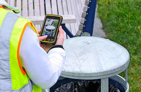
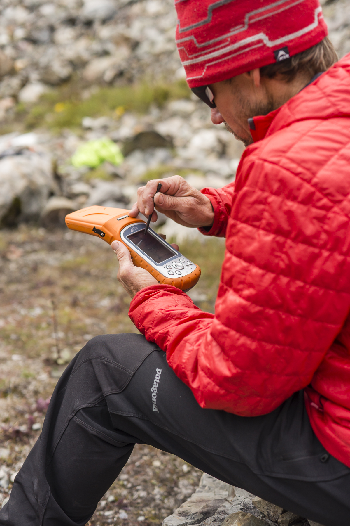
    What is RTK? In a nutshell, RTK is 1-2cm real-time positioning. Some refer to it as “survey-grade”. Historically, RTK users have been required to setup and maintain their own RTK base station. This is expensive and inconvenient. Many federal, state and local government agencies have setup RTK bases to increase RTK efficiency for their employees. Many of them make the RTK base data available to the public for free or for a nominal cost. If you work in an area that offers one, all you need is internet access in the field and a RTK-capable GPS L1/L2 receiver.

    I’ve tried to keep track of the public RTK bases I know of, so I’ll list them here. If I’ve missed one you know of, please feel free to send me a quick email at [email protected] or list it in the Comments section at the end of this article. Furthermore, if you live outside of the U.S., I’d love to hear from you if you know of a source of free RTK base data.

    Please note that in the following list there are four types of RTK bases:

    1. Trimble VRS (network solution).
    2. Leica Spider (network solution).
    3. Single baseline (eg. Plate Boundary Observatory  and CRTN).
    4. Topcon TopNet (network solution).

    I’ve used an RTK rover on all three of these services. Each of them has several mount points supporting different data formats. I typically use RTCM3 format because it’s an open standard and supported by all services I’ve used. For the Leica Spider network, you’ll be presented a choice of iMAX or MAX. Choose iMAX if you’re not running a Leica rover.

    To use any of the services, you’ll need Internet connectivity. In the past, I’ve accomplished this in a few ways:

    1. SIM card inside a data collector.
    2. MiFi device.
    3. Wi-Fi from a work vehicle.

    You can also use a commercial RTK Bridge or Repeater such as Intuicom or Base-n-ABox. Or you can create your own RTK bridge system with a notebook computer that has internet access.

    No matter how you do it, you’ll need a reliable Internet connection (speed is not important).

    You’ll also need some sort of NTRIP software utility. Several data collector software packages have this built-in. For software like ArcPad, DigiTerra, gvSIG, etc. that don’t have it built-in, there are some freeware utilities on the market that run on Windows and Windows Mobile and Android (for example, SXRTN or Lefebure) that handle the NTRIP tasks in the background.

    If you want to read a detailed article about the process of logging in to an RTK base using NTRIP, I wrote one last year while I was in Colorado. Click here to have a look. I also published another article entitled “Sources of Public Real-Time High-Precision Corrections” that you might be interested in.

    Following is a list of RTK bases in each U.S. state, along with the associated website. Please note that I only list the public (government-operated) services. Also note that while most are free, some of the public operators charge a user fee. At one point or another, I’ve used a fair number of these in various states. Once you’ve used one of each (Trimble, Leica, PBO), the rest are pretty much the same.

    The difference between the Trimble and Leica networks and PBO is that the Trimble and Leica networks provide a network solution that utilizes several RTK base stations in the computation. Distance-dependent errors are reasonably modeled so the user can be farther from individual RTK bases. The PBO RTK bases provide a single baseline (like everyone used to use before RTK networks were invented) so the further you are from the RTK base, the more error is introduced into the solution (roughly 1 cm + 1 ppm).

    Lastly, there are a number of commercial RTK networks in most of the states listed. I’ll save that list for another day. Again, these are just the publicly run RTK bases.

    Alabama – Alabama Department of Transportation. Leica network.

    Alaska – Two PBO RTK bases. One in Fairbanks and one in Palmer. Otherwise, no public service.

    Arizona – Arizona State Cartographer’s Office. Leica network. Plate Boundary Observatory (single baseline).

    Arkansas – No public service.

    California – California Real Time Nework (CRTN) (single baseline).  Plate Boundary Observatory. Single baseline.

    Colorado – Mesa County (Trimble network) and Plate Boundary Observatory (single baseline).

    Connecticut – No public service.

    Delaware – No public service.

    Florida – Florida Department of Transportation. Leica network.

    Georgia – No public service.

    Hawaii – No public service.

    Idaho – Plate Boundary Observatory (single baseline).

    Illinois – No public service.

    Indiana – Indiana Department of Transportation. Leica network.

    Iowa – Iowa Department of Transportation. Leica network.

    Kansas – No public service.

    Kentucky – Kentucky Transportation Cabinet. Trimble network.

    Louisiana – Louisiana State University. Trimble network.

    Maine – Maine Department of Transportation. Trimble network.

    Maryland – No public service.

    Massachusetts – Massachusetts Department of Transportation. Leica network.

    Michigan – Michigan Department of Transportation. Leica network.

    Minnesota – Department of Transportation. Trimble network.

    Mississippi – University of Southern Mississippi. Trimble network.

    Missouri – Missouri Department of Transportation. Trimble network.

    Montana – Plate Boundary Observatory (single baseline).

    Nebraska – No public service.

    Nevada – Washoe County. Trimble network. Las Vegas Valley Water District. Leica network.  Plate Boundary Observatory (single baseline).

    New Hampshire – No public service.

    New Jersey – No public service.

    New Mexico – Plate Boundary Observatory (single baseline).

    New York – New York Department of Transportation. Leica network.

    North Carolina – N.C. Department of Environment and Natural Resources. Trimble network. $500 one-time sign-up fee.

    North Dakota – No public service.

    Ohio – Ohio Department of Transportation. Trimble network.

    Oklahoma – No public service.

    Oregon – Oregon Department of Transportation. Leica network. Plate Boundary Observatory (single baseline).

    Pennsylvania – No public service.

    Rhode Island – No public service.

    South Carolina – South Carolina Geodetic Survey. Public but charges a usage fee. Trimble network.

    South Dakota – No public service.

    Tennessee – Tennessee Department of Transportation. Public but charges a usage fee. Topcon network.

    Texas – Texas Department of Transportation. Public but only available to TxDOT employees and TxDOT contractors. Trimble network.

    Utah – Utah Automated Geographic Reference Center.  Public but charges a usage fee. Trimble network. Plate Boundary Observatory (single baseline).

    Vermont – Vermont Geodetic Survey. Trimble network.

    Virginia – No public service.

    Washington – Washington State Reference Network (Seattle Public Utilities). Trimble network. Public but charges a usage fee. Pierce County (Leica Network). Plate Boundary Observatory (single baseline).

    West Virginia – West Virginia Department of Transportation. Trimble network.

    Wisconsin – Wisconsin Department of Transportation. Trimble network.

    Wyoming – Plate Boundary Observatory (single baseline).

    Thanks, and see you next time.

    Follow me on Twitter at https://twitter.com/GPSGIS_Eric

  • CHC Delivers 520 GNSS Receivers in Big Myanmar Contract

    CHC Delivers 520 GNSS Receivers in Big Myanmar Contract

    The X91+ GNSS receiver by CHC Navigation.
    The X91+ GNSS receiver by CHC Navigation.

    CHC Navigation announced today the successful delivery of 520 units of X91+ GNSS receivers to the Settlement and Land Records Department (SLRD), a part of the Myanmar Ministry of Agriculture and Irrigation.

    Awarded as one of the world’s largest GNSS tenders, CHC Navigation successfully delivered 520 units of X91+ receivers within the tight 60-day time frame allowed by the tender.

    “This might be the largest single contract award for RTK receivers I’ve ever heard of,” commented Eric Gakstatter, GPS World’s survey editor.

    The Settlement and Land Records Department activities encompass the collection of agricultural statistics, annual assessment of land revenue, land lease and tenure, and many other agricultural land administration tasks.

    CHC Navigation, in cooperation with its distributor, IGS Company Limited, demonstrated the performance of the X91+ during stringent field technical assessments versus other major GNSS industry players.

    CHC Navigation demonstrates the X91+ during field technical assessments.
    CHC Navigation demonstrates the X91+ during field technical assessments.

    “We are excited about the international recognition of CHC’s GNSS solution by leading governmental organizations. I believe the win highlights our firm commitment to provide high precision, outstanding quality products and more over dedicated support and services,” said George Zhao, CEO of CHC. “The award of this significant tender is a real achievement in CHC international development.”

    The X91+ GNSS receiver is a compact 220-channel GNSS receiver designed for high accuracy and productivity in harsh environments. According to CHC, the receiver has an easy-to-use, efficient and intuitive work flow, and is optimized for efficient RTK positioning.