NAVISP includes projects for autonomous and connected driving. (Image: ESA/F. Bagiana)
Many of the experts that designed and oversaw the Galileo system are now supporting European companies in developing new navigation technologies and services through the Navigation Innovation and Support Programme (NAVISP) of the European Navigation Agency (ESA).
NAVISP supports navigation research and development, such as ways to improve satellite navigation, alternative positioning systems, and new navigation services and applications. Working in partnership with European industry and researchers, more than 200 NAVISP projects have been initiated so far.
NAVISP is divided into three elements.
Element 1 focuses on improving and expanding satellite navigation, as well as establishing novel positioning, navigation and timing (PNT) services.
Element 2 focuses on innovation for competitiveness, developing new PNT products and services.
Element 3 supports European Union Member State priorities, including support for national testbeds and programs.
TomTom and SWARCO have entered a strategic partnership to enable customers to improve their mobility-management operations by using floating car data-based traffic services to complement physical sensor hardware already installed in the field.
The high-quality traffic services from TomTom, generated from millions of anonymously collected GPS data from apps, cars and devices, are now integrated and available for public entities via SWARCO’s urban mobility management suite MyCity. This data source will enable SWARCO to offer a high-value enhancement to the traffic information it already provides to its customers.
Benefits to MyCity customers include:
real-time travel times for user-defined routes
historical reports on travel time to enable data-driven decision making and impact analysis
triggering strategies based on real-time floating car data to automatically adjust signal plans, reroute traffic or take other traffic management actions
filling potential blind spots between existing roadside sensors to get a complete picture of the traffic situation.
The strategic partnership between SWARCO and TomTom also includes a joint thought leadership program to educate the market further, regular alignments about new features and product updates, and intensified collaboration on funded research projects.
Experts from both companies are available to take city officials, traffic managers, consultants and partners on a test drive of the newly available solutions as well as offer free trials.
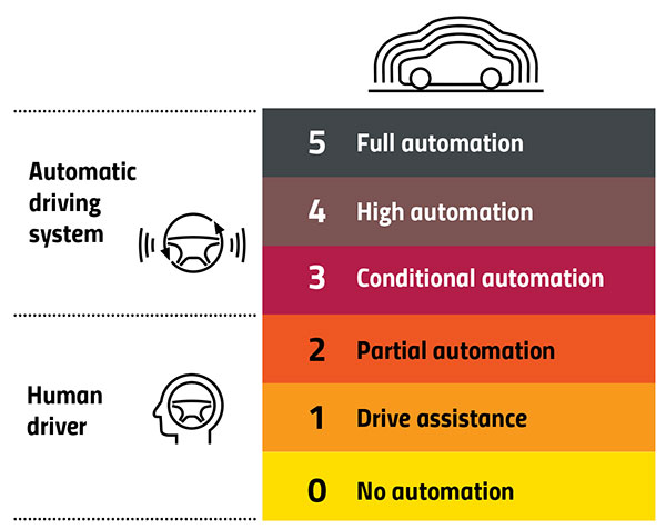
DeepRoute.ai, an international autonomous driving technology company, is offering a Robotaxi fleet equipped with its Level 4 autonomous driving solution, Driver 2.0.
Level 4 autonomous vehicles do not require human interaction in most circumstances, but a driver still has the option to manually override.
Image: GPS World
According to DeepRoute.ai, its advancement in autonomous technology previews the future of Level 4 consumer vehicles.
Composed of 30 SAIC Motor Marvel R SUVs, the Robotaxi fleet will deploy in Shenzhen, China, in the coming months.
Mass Production. Driver 2.0 was engineered for mass production and adoption by automakers. DeepRoute.ai projects mass production of Level 4 autonomous vehicles equipped with Driver 2.0 will begin in 2024 and be available for consumer purchase afterward.
DeepRoute.ai is collaborating with global automakers to achieve series production of Level 4 autonomous driving vehicles and expects to further reduce the current $10,000 cost of the solution by approximately 70%.
Driver 2.0 sensor configurations can be customized to meet automakers’ needs, equipped with two to five solid-state lidar scanners and eight cameras. Its proprietary low-energy consumption computing platform and inference engine combined with Nvidia Drive Orin systems-on-chip will allow the company to meet automotive-grade standards for series production more quickly, the company said.
DeepRoute.ai’s camera-based redundancy perception system guarantees autonomous capabilities should other sensors malfunction, in addition to 5G remote control and network safety redundancy fused into the safety-critical systems.
Level 4 self-driving can first be achieved in areas supported by rich data. Level 4 consumer vehicles on the road operating in a hybrid model will continuously gather additional data, laying the foundation for the scalability of Level 4 autonomous driving in other cities, the company said.
DeepRoute.ai plans to accelerate Level 4 commercialization through technology iterations in data collection and analysis, algorithm improvement, simulation and road testing.
Photo: DeepRoute.ai
With a 360-degree view and 200-meter perception range, the fleet offers high-performance Level 4 autonomous driving in an urban environment. The sensors are designed to be less noticeable and part of the auto’s chassis design.
The entirety of DeepRoute.ai’s Robotaxi fleet across Wuhan, Shenzhen, Hangzhou and Fremont, California, now encompasses a variety of models: GAC Aion, SAIC Motor Marvel R, Lincoln MKZ, Geely, Dongfeng Motors E70 and Ford Mondeo.
Stringent testing on both fixed-wing plane and helicopter proves reliability and performance
Honeywell has successfully demonstrated several advanced alternative navigation technologies intended to help ensure seamless navigation, even when GPS signals are blocked, interrupted or unavailable.
Testing took place on both an Embraer E170 aircraft and an AgustaWestland AW139 helicopter.
Alternative navigation systems use sensors such as cameras, star trackers, radars and radios to augment and or aid inertial navigation systems. These systems correct inertial navigation systems in environments where GNSS are denied.
“Our customers are seeing an increase in both intentional and unintentional navigational disruptions, including jamming for GNSS-based navigation,” said Matt Picchetti, vice president and general manager, Navigation and Sensors, Honeywell Aerospace. “There hasn’t been a single set of solutions that meet all our customers’ operational needs, so we decided to create one. Our modular and scalable alternative navigation technologies are setting a new benchmark in terms of reliability and performance in GNSS-denied environments compared with what is available in aviation today.”
Alternative navigation technologies provide vital position, velocity and heading information in GNSS-denied environments. The successfully demonstrated technologies onboard the E170 and AW139 include:
Vision-Aided Navigation. Honeywell’s vision-aided navigation system achieved GPS-like performance on both the Embraer E170 and AW139 platforms during GPS-denied conditions. Additionally, the technology showed 67% improvement in GPS-denied performance compared with earlier testing in 2021. The system uses a live camera feed and compares it with maps to provide a passive, not jammable, and highly accurate absolute position.
Celestial-Aided Navigation. Honeywell’s celestial-aided navigation system on the Embraer E170 achieved an accuracy of 25 meters circular error probability of 50% (CEP50). This represented a 38% improvement in GPS-denied performance compared with tests in 2021. Most importantly, this is the first time a resident space objects-based (RSOs) navigation solution was demonstrated on an airborne platform, as most competing solutions rely only on star-based navigation. The system uses a star tracker to observe stars and RSOs to provide a passive, not jammable solution with GPS-like accuracy in GPS-denied or spoofed conditions.
Magnetic-Anomaly-Aided Navigation. Honeywell conducted real-time magnetic-anomaly-aided navigation on the Embraer E170 airborne platform. This is a historic milestone, as almost all previous magnetic tests were done in special environments to mitigate electromagnetic noise. Honeywell demonstrated this passive, not jammable, all-weather 24/7 technology on an embedded platform, which measures Earth’s magnetic strength and compares it with magnetic maps to accurately identify the position of the vehicle.
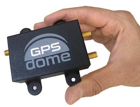
Photo: InifiDome
Additionally, Honeywell demonstrated that inertial navigation systems, when paired with the GPSDome (an anti-jamming device), showed significant improvement in position accuracy and integrity performance in the presence of GPS jamming. The ability of GPSDome to enable tracking of GPS satellites under more aggressive jamming environments reduces performance degradations that come with GNSS-denied conditions.
Alternative navigation prototype systems will be available in 2022, with initial deliveries expected to start in 2023.
S.E.A. Datentechnik GmbH is partnering with M3 Systems on advanced GNSS emulation technology. The new partnership aims to provide high-quality GNSS tools for current and future automotive vehicle-to-everything (V2X) communication and advanced driver-assistance systems (ADAS) applications.
S.E.A. Datentechnik is a developer and system integrator for advanced radio frequency and V2X test and measurement systems, serving chipset vendors, automotive suppliers and OEMs.
The StellaNGC Software Suite by M3 Systems integrates seamlessly into automotive test environments to meet customer needs.
The two companies are leading, well established partners for the National Instruments (NI) platform. The signed partnership ensures the availability of advanced and competitive technology for global test solutions.
“We are sure that the cooperation of our companies provides a high value for customers for the development, validation and production test of actual and future V2X and Connected Car technologies,” said Gerd Schmitz, co-founder, and CEO of S.E.A. “The combination of the deep experience GNSS technology of M3 Systems with S.E.A. V2X products and competence provides tailored test solutions for reasonable cost.”
“M3 Systems is pleased to be working with S.E.A. on V2X and ADAS using the NI platform,” said Marc Pollina, CEO of M3 Systems. “V2X expands the capability of M3 Systems to serve automotive suppliers, chipset vendors and other V2X/ADAS users. V2X is synergistic with M3 Systems’ expertise in GNSS technology and simulation.”
V2X from S.E.A.
Compact, automated turnkey S.E.A. test systems enable the efficient and reliable test of V2X technologies using scalable software and hardware components.
The modular V2X test platform from S.E.A. is based on software-defined radio (SDR) technology and includes all aspects of automated V2X test, including measurements on the physical layer for RF-compliance, protocol or production testing, and integrated V2X traffic scenario simulation for the test of V2X applications.
International V2X standards for North America, Europe and China are supported for scenario-based testing by open-loop or closed-loop hardware-in-the-loop (HIL) systems. Test catalogs for specific test applications such as RF-conformance measurements and V2X Day 1 Use Case testing are available for efficient use of the flexible test systems.
GNSS from M3 Systems
High-quality simulation of GNSS signals for the different constellations — GPS, Galileo, Glonass and Beidou — are required for V2X and ADAS test system applications.
The M3 Systems StellaNGC Software Suite integrates seamlessly into the test environment and fulfills the high demands of customers. The application of the NI PXI platform for GNSS and communication emulation enables the powerful and seamless integration of GNSS as well as other sensor and communication technologies: radar, lidar and cameras for HIL ADAS/autonomous technology test systems.
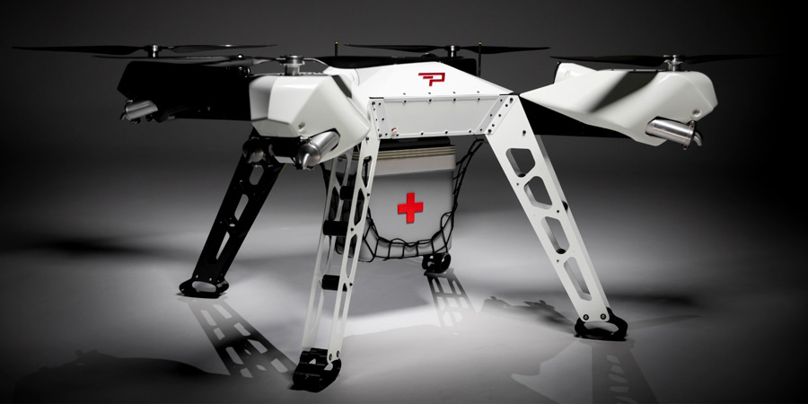
LIFT Aircraft Co. has been awarded a U.S. Air Force contract to continue experimentation and flight test efforts around its HEXA copter.
LIFT Aircraft Co. has been awarded a Phase 3 contract through the U.S. Air Force’s Agility Prime Program to continue experimentation and flight test efforts around HEXA, LIFT’s all-electric, single-seat vertical-takeoff-and-landing (VTOL) aircraft.
Since 2020, LIFT Aircraft has conducted flight testing with the support of the U.S. Air Force under a Phase 2 Small Business Innovation Research (SBIR) contract.
Working with Air Force subject-matter experts, LIFT achieved initial military airworthiness approval (military flight release) and proven transportability by moving the aircraft inside a C-130 military cargo plane. The company also explored a multitude of potential use-cases alongside the Agility Prime Test Team.
The Phase 3 contract will continue experimentation and use-case development through a fast-paced, rigorous flight testing program. The program will begin at Eglin AFB and may expand to other locations. It includes efforts such as flight envelope expansion, acoustics testing and developmental testing of a modular cargo adaptation for the airframe.
The aim is to accelerate and further develop HEXA for public and military applications such as emergency first response, personnel transport, base logistics and search-and-rescue missions. The development effort will also help accelerate the testing required for LIFT’s planned rollout of commercial flight locations.
“This partnership provides continued access to the unmatched expertise of the U.S. Air Force,” said LIFT Director of Business Development, Kevin Rustagi. “We’re excited about continuing to explore and develop a unique capability to the military: an aircraft that offers air mobility at a cost point comparable with ground transportation that, in the future, with mere hours of training, allows any service member to become a pilot.”
Testing will initially be performed at Eglin Air Force Base near Destin, Florida, alongside the 96th Test Wing and with the support of Air Force eVTOL initiative, Agility Prime.
LIFT has already begun coordinating with Col. Doug Creviston of the 96th Operations Group, which has tested systems for the F-15 Eagle, F-16 Falcon and A-10 Thunderbolt.
Photo: Lift
“LIFT is a great example of why Agility Prime exists — to further applications of eVTOL technology for both military and civilian use,” said Lt. Col. John Tekell, Air Force Agility Prime Lead at AFWERX.
Agility Prime has taken a flexible approach to contracting with the Phase 3 SBIR for LIFT. The contract is designed to be as agile as possible — it allows not only the Air Force, but any governmental entity to contract for flight-test activities with LIFT’s HEXA aircraft on an as-needed basis.
“This contract was designed to enable flexible flight test as a service of multiple HEXA aircraft for any government stakeholder, location and desired experiment,” said Sterling Alley, technology transition lead and LIFT program manager at Agility Prime. “We want it to be able to serve as a contract vehicle that accelerates HEXA towards fielding not just for the USAF, but the DOD and USG in general. We have a large number of interested stakeholders looking at use-cases for the aircraft and welcome growing the community even further in the future.”
“LIFT’s Phase III SBIR contract award is a meaningful vote of confidence from the U.S. Air Force,” said Eric Horan, former U.S. Navy government contracting officer and founding partner of Decisive Point, a venture capital firm that invests in dual-use technology startups and has invested in LIFT. “It means the Air Force has determined LIFT’s previous development and testing contracts were successful. This is an important step towards scaling access to LIFT’s HEXA eVTOL aircraft throughout the Department of Defense and federal government at large.”
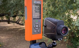
Fixposition, a Swiss technology company providing high-precision positioning solutions, has released a centimeter-level positioning sensor, the Vision-RTK 2.
The low power and compact, industrial-grade device is suitable for autonomous delivery and logistics vehicles, agriculture, mowing and landscaping machines, as well as any other application where precise, uninterrupted positioning must always be available everywhere.
“As vehicles and machines become increasingly autonomous, they must safely and precisely negotiate complex routes, even where GNSS visibility is degraded or blocked,” said Zhenzhong Su, CEO and co-founder of Fixposition. “With Vision-RTK 2, these applications are becoming possible. Our deep sensor-fusion technology combines GNSS technology with advanced computer vision and machine learning.”
“We are using a global optimization-based sensor fusion technique that is much more robust and powerful than traditional Kalman filters,” said Lukas Meier, CTO and co-founder of Fixposition. “Our computer vision-based dead-reckoning technology has clear advantages over purely IMU-based products.”
The Russian military has disrupted flight systems in three regions since the invasion of Ukraine, highlighting the need for robust alternatives, according to a French safety regulator and as reported by Bloomberg.
Airline pilots have reported jamming of satellite navigation systems around the Black Sea, eastern Finland and the Kaliningrad enclave, said Benoit Roturier, head of satellite navigation at France’s civil aviation authority DGAC.
The jamming signals appear to originate from Russian trucks intent on protecting troops and installations against GPS-guided missiles. While the signals are not aimed at civil aviation, however, they force the pilots to deal with distracting alerts.
“Airplanes hit by jamming can continue to fly using inertial navigation systems — that is standard and works with GPS,” Roturier said. “This could be less accurate, but can be used when GPS goes down.” Yet regulators are realizing the potential for massive airspace disruptions, especially as the European Union pushes for increasing reliance on satellite navigation.
A roundup of recent products in the GNSS and inertial positioning industry from the March 2022 issue of GPS World magazine.
OEM
Correction Service
Achieves RTK-level accuracy
Photo: Hexagon
“RTK From the Sky” technology has been integrated into the core of the TerraStar-C PRO corrections service. As a result, TerraStar-C PRO provides centimeter-level accuracy, not just in open-sky environments but also across challenging conditions created by buildings and foliage. TerraStar-C PRO now converges in less than three minutes by utilizing quad-band receiver and antenna technology to leverage modernized BeiDou 3, GPS III and Galileo E6 signals. The resulting process generates state-of-the-art corrections for all GNSS frequencies. The service improvements are accessible through the 7.08.10 firmware release for users of OEM7700, OEM719 and OEM729 cards and their associated enclosures for land and air applications.
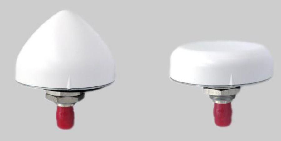
A north orientation mark is being added to the TW3000 family of Accutenna precision antennas and the TW5000 family of smart antennas. The new feature allows customers to align their antennas, standardize radiation patterns, and increase the synchronicity of their azimuth gain readings across multiple devices. The new north mark design has been thoroughly tested to ensure it conforms to or exceeds customer expectations and maintains each antenna’s stringent IP69K rating.
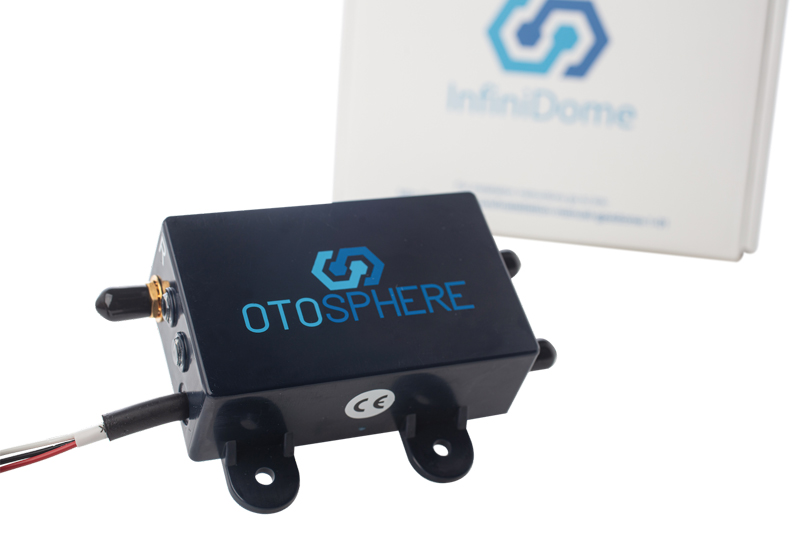
OtoSphere is a small, add-on module to the ViaLite GPS RF over fiber link and any GNSS-based system, providing GNSS protection against GPS jamming attacks, making any receiver more resilient. It ensures continuity of timing and navigation capability and enables normal operation during a jamming attack. According to ViaLite, no other solution that offers such protection is as small, light, affordable, or easy to install. The Otosphere protection module adds resilience to critical GPS timing services.Using OtoSphere, GPS receivers are up to 50 times more resilient to jamming attacks on positioning, navigation and timing (PNT) systems compared with having no protection. The GPS receiver can continue working normally throughout the attack. Timing-critical infrastructures in areas such as defense and cybersecurity can now be protected from these attacks. The Otosphere has a unique interference filtering algorithm that combines patterns from two external omnidirectional antennas that pinpoints the direction of the attack, then directs a null toward the unwanted signal to reject and reduce disruptions.
Infrastructure system for autonomous transportation
Photo: Seoul Robotics
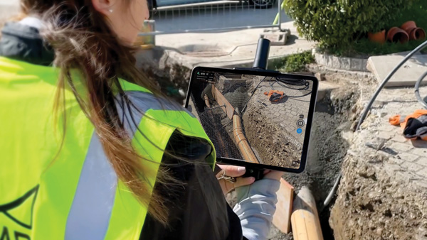
The Level 5 Control Tower (LV5 CTRL TWR)) is a mesh network of sensors and computers on infrastructure that guides vehicles autonomously without requiring that sensors be placed on individual vehicles. The technology is automating last-mile fleet logistics at BMW’s manufacturing facility in Munich. The system has the potential to transform operations for a wide range of business applications, from vehicle distribution centers to car rental companies and trucking logistics.
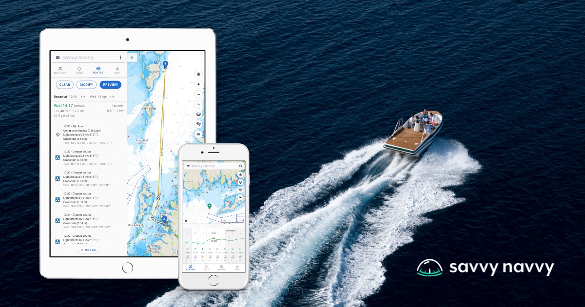
Savvy Navvy provides essential marine information, allowing boaters to cross-check their traditional navigation plans. It integrates plotting charts, weather and tide data, marina details and passage planning into one app. The app reduces the risk of human error as well as the stress of voyage preparation. It is used by boaters in more than 100 countries around the world, with more than 43 million miles plotted. It works on phones or tablets using Android, IOS, PC or Mac.
The Pix4D viDoc RTK handheld rover attaches to iOS devices to bring RTK accuracy to terrestrial scanning on iPhones and iPads. When paired with the PIX4Dcatch mobile app, the viDoc rover can replace survey tools such as RTK GNSS rovers and terrestrial scanners, the company said. The two products create a workflow that turns iPhones or iPads into an accurate terrestrial scanning device, with centimeter-accurate RTK positioning from an existing NTRIP network. The tools can be used to 3D model small areas or structures.
Bad Elf now provides an integrated laser-offset workflow for acquiring high-accuracy field data in GNSS-challenged environments using Esri ArcGIS Field Maps for Android, as well as iOS. The workflow integrates Bad Elf and Laser Tech (LTI) hardware in collaboration with ArcGIS technology from Esri. The Bad Elf Flex connects to any LTI TruPulse rangefinder over a wired or Bluetooth connection to deliver high-accuracy location data to Esri ArcGIS Field Maps. Mobile workers can efficiently complete position and height data collection in access-limited situations, saving time, money and effort.
A free global map created from processed satellite imagery is available. To create the world image, satellite imagery was processed to remove clouds and balance shades and tones, and then carefully stitched together to create a seamless map layer with beautiful colors. The input data is recent, from 2020 and 2021, and rendered as one tiled file with 13 zoom levels 0-13 for use in web applications. It is a viable, up-to-date alternative to Google maps for software developers, without privacy issues.
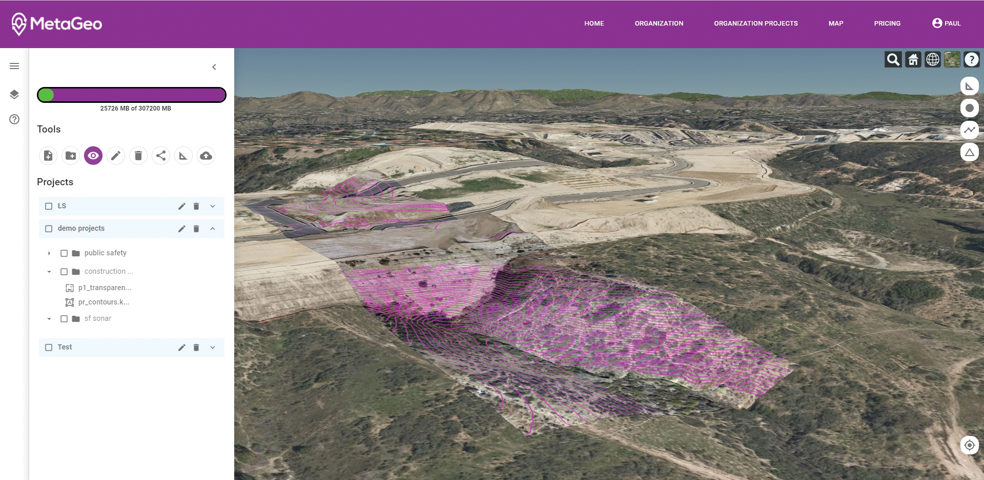
The MetaGeo geographic information system (GIS) platform enables organizations of all sizes to host, analyze, find and share 3D map datasets among any internet-capable devices. The platform processes location-based map or sensor data from the real world, combines it into a single 3D virtual environment, and streams it to any device or mapping platform. The affordable and easy-to-use platform can load data from multiple sources: satellites, drones, mobile devices, public and crowdsourced repositories, internet of things (IoT) sensor data, 3D models and topographic maps. The data is then processed by the MetaGeo platform into a 3D world and streamed to any internet-connected device, enabling live collaboration between the office and field via mobile or augmented reality device. A plug-in software development kit (SDK) allows for third-party tools to scale and fit user needs.
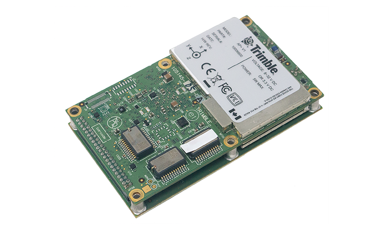
Trimble has launched the Trimble AP+ Land GNSS-inertial OEM platform for accurate and robust position and orientation for georeferencing sensors and positioning vehicles in land mobile-mapping applications. The platform enables users to accurately and efficiently track and monitor fleets and produce high-definition (HD) maps and 3D models. It can also serve as a reference solution for advanced driver-assistance systems (ADAS) testing, even in challenging GNSS environments. The comprehensive Trimble AP+ Land is small enough to integrate into compact mobile-mapping systems. It is compatible with virtually any type of mapping sensor, including single- or multi-lidar systems, video cameras, photogrammetric and panoramic cameras, and similar sensors.
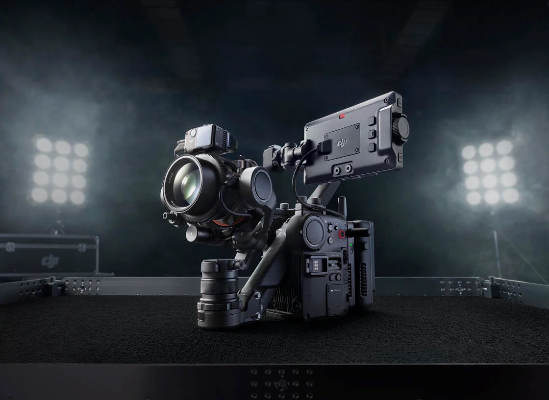
Ronin 4D, a professional cinema camera from DJI, incorporates the full-frame Zenmuse X9 gimbal camera, active four-axis stabilization, lidar focusing, and wireless transmission. Firmware available at launch will allow the remote monitor to view and control the main monitor, interface with mirror control mode, and allow a clean video stream over HDMI and SDI ports on the Remote Monitor Expansion Plate with no overlaid information. It will also support automatic calibration for some third-party auto lenses to realize Lidar Focusing System functions.
Parallel Hybrid Electric Multirotor (PHEM) drone technology improves flight time with a heavy payload, yielding increased efficiency and eliminating the large battery used in other hybrids. It has the potential to extend a UAV’s flight time from 15 minutes to well over an hour and drastically increase range. In the search-and-rescue field, a heavy-lift drone can enhance first responder capabilities by allowing for substantially quicker response times to remote locations. Other applications include military platforms, fighting wildfires, and medical and logistics missions.
A “BeiDou positioning system for subways” began construction March 20 on the Beijing subway capital airport express line. The project will cover a 30-kilometer-long section of the express line, including five stations.
To provide positioning, the BeiDou Navigation Satellite System (BDS) will be combined with 5G for indoor positioning or in areas where the satellite signals are blocked.
The system will improve the positioning accuracy in subways to less than two meters, making it available for vehicle dispatching, passenger transport organization and emergency response. In addition, it allows passengers to use their phones to navigate and position in complex environments in subway stations through three-dimensional navigation.
“We will combine indoor and outdoor positioning in subways, that is, Beidou and its augmented reality technology will be used outdoors to achieve high-accuracy positioning, and indoor positioning technology integrated with 5G will be used to allow users to receive indoor positioning signals,” said Lin Luzhou, vice president of the GNSS and LBS Association of China.
The project is the largest indoor space navigation and positioning system in China, according to ECSN.com, and is expected to be finished within this year.
Expected to be available in the second quarter of this year, Trimble’s RTX service will enable superior location capabilities in premium Android smartphones worldwide.
The integration of Trimble RTX GNSS technology, a correction services platform, with Snapdragon contributes to a higher quality, more accurate location-based user experiences such as car navigation with lane-level guidance.
Coupling the Trimble RTX technology with premium Snapdragon Mobile Platforms will enable smartphone manufacturers, service providers and application developers using Snapdragon to provide mobile users with robust meter-level accuracy (or about 3 feet) when used with a Trimble RTX-based correction service. This represents a five times improvement in location accuracy compared to typical accuracy.
Location information accuracy can significantly improve the smartphone’s user experience when using mapping, driving or other mobile applications. For example, with more accurate positioning for a ridesharing app, both driver and rider can have a better experience when the pick-up destination is more precisely displayed. In addition, lane-level accuracy enables drivers to gain greater map detail and more accurate directions when using real-time navigation applications.
The new collaboration expands Trimble’s existing relationship with Qualcomm Technologies to provide high-accuracy positioning solutions for connected vehicles, advanced driver-assistance systems (ADAS) and autonomous driving solutions to automotive OEMs and Tier 1 suppliers.
“Trimble and Qualcomm Technologies have a history of innovation in mobile location technologies, both separately and collaboratively,” said Lisa Wetherbee, general manager of Trimble Advanced Positioning. “Together, we are boosting premium Android phone functionality, helping mobile applications provide better information about the user’s immediate surroundings.”
“Precise positioning, where accuracies are down to a meter or less, is a necessary capability in next-gen premium Android phones, providing better mapping, more accurate navigation and new exciting services to consumers,” said Francesco Grilli, vice president, product management, Qualcomm Technologies. “Snapdragon is again taking location-based experiences to a new level through this collaboration with Trimble.”
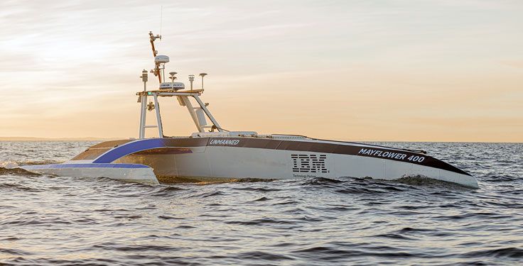
The Mayflower Autonomous Ship (MAS) is set to re-embark on its three-week trans-Atlantic journey in April 2022 equipped with two of Silicon Sensing’s AMU30 inertial measurement units (IMUs). These devices send highly precise motion data to the new ‘AI captain’ that guides the vessel. They also assist in measuring sea surface height as part of detailed scientific analysis of ocean topography.
AMU30 is a micro electro-mechanical system (MEMS) unit with excellent inertial performance, including very good bias stability and low noise characteristics, plus an embedded Kalman Filter-based AHRS (attitude and heading reference system) algorithm. It delivers precise 3-axis outputs of angular rate and acceleration, plus roll, pitch and heading angles, altitude and pressure, and temperature, at 200 Hz — all critical to precise maritime navigation.
“The two AMU30 are used to make real-time, precision measurements of the movement of the Mayflower Autonomous Ship in 6 degrees of freedom (DOF) so that the AI Captain may make minute manoeuvring adjustments to optimise vessel performance in a complex wavefield, while also providing redundant general navigation capability at sea,” said Brett Phaneuf, co-director of the project. “Furthermore, when coupled with optical and RTK (real time kinematics) GPS data, the AMU30 assists the ship in making highly accurate measurements of sea surface height, which are important for studying ocean tides, circulation and the amount of heat the ocean holds.”
The MAS journey across the Atlantic will celebrate the voyage of the original Mayflower some 400 years ago. It is just one element of an extensive scientific data gathering and research programme the vessel will complete in the coming years. The ship is guided by its new AI Captain, built using IBM cloud, artificial intelligence (AI) and edge computing technologies, and uses a hybrid engine that draws on solar power. Working with scientists and other autonomous vessels it provides a flexible platform for deepening understanding of issues such as climate change, ocean plastic pollution and marine mammal conservation. In parallel, the development of marine autonomous systems such as this will transform ocean-related industries such as shipping, oil & gas, telecommunications, security & defence, fishing & aquaculture.