Category: Defense

  • L-3 Demonstrates TruTrak Evolution Type II SAASM GPS Receiver


    L-3 Interstate Electronics Corporation (IEC) conducted an operational demonstration of its new TruTrak Evolution (TTE) Type II Selective Availability Anti-Spoofing Module (SAASM) GPS receiver at AUVSI’s Unmanned Systems North America 2012 conference, held last week in Las Vegas. The demonstration highlighted the new TruTrak receiver’s multi-use capabilities as a high-performing Ground-Based GPS Receiver Applications Module (GB-GRAM) for use on UAS platforms and precision weapons.

    The TTE offers native Inertial Measurement Unit (IMU) and external oscillator interfaces, user processor, reconfigurable input/output (I/O) and front end, and easy roadmap migration from SAASM to NextGen GPS YMCA modernized technology. Its TTE Type II architecture supports the integration of multiple sensors to simplify all-source navigation solutions for GPS-denied environments. The adaptable architecture allows developers to quickly integrate new sensors without a hardware change, while providing industry-leading core GPS receiver performance and easy migration to NextGen modernized GPS.

    “The TTE Type II highlights L-3 IEC’s integrated SAASM/NextGen GPS M-Code roadmap, providing another innovative path in the development of a Common GPS Module,” said Ric Pozo, general manager and vice president of navigation systems at L-3 IEC. “It allows SAASM- based P(Y) and modernized YMCA multichip modules to share a common circuit card assembly, making this a very flexible solution for drop-in GPS receiver replacement and low-risk integration.”

    L-3’s TTE Type II provides features required by multiple applications, including a small form factor, high performance, and both passive and active antennas. The TTE Type II adopts the common GB-GRAM Type II electrical and physical interfaces, but with expandable I/O to support a wide range of requirements for ground, air, weapon, and projectile needs.

  • The System: Fly the Pilotless Skies: UAS and UAV


    Unmanned aerial vehicles and civil aircraft may co-habit the airspace after September 2015.

     As the U.S. Federal Aviation Administration (FAA) moves ahead with plans for unmanned aerial systems/vehicles (UAS/UAV) to have regular access to U.S. airspace by 2015, it has encountered several barriers. For UAVs to be treated like manned aircraft, their systems likley need to be qualified to the same standards as civil avioncs. This is a challenge, as each UAS has largely unique systems. UAS equipment standards are emerging, but threats to GNSS abound, requiring defense/mitigation.

    Demand for UAS has produced many different types flying in a range of applications. With no apparent standard avionics fit or uniform safety standards, each UAS type is basically configured for specific tasks. Commercial UAS applications continue to emerge, and major market growth is anticipated. One forecast indicates that the UAS market could reach $7.26 billion this year alone. The promise of new and better ways to reduce costs, improve safety, and increase operational efficiency feeds market expansion.

    However, in the United States the FAA currently requires each UAS commercial project desiring access to controlled airspace to obtain an FAA-approved Certificate of Authorization. While the FAA has made efforts to speed up approvals, this process slowed widespread commercial adoption of UAS. Nevertheless, opportunities abound in pipeline and transmission line inspection, crop spraying, law enforcement, security, and surveillance, survey/mapping, remote area mail delivery, and hundreds of other applications. The FAA may have felt some pressure to move forward, because Congress has put in place the Modernization and Reform Act of 2012, which calls on the FAA to fully integrate unmanned systems, including those for commercial use, into the national airspace by September 2015.

    UAS in the NAS. Meanwhile, a project called the Unmanned Aircraft Systems Integration in the National Airspace System (UAS in the NAS), undertaken by NASA’s Dryden Flight Research Center, seeks to reduce technical barriers related to safety and operational challenges associated with enabling routine UAS access to the NAS.

    Europe has also launched a study on the integration of UAS in non-segregated airspace for the future Single European Sky. The ICONUS study will be carried out by a consortium within the European air traffic management program called Single European Sky ATM Research Programme (SESAR). The study will drive the definition of the requirements, capabilities, and equipment which UAS will need to operate safely and efficiently in the coming European SESAR environment.

    The U.S. RTCA SC-203 committee is drafting UAS operational requirements, and there has been significant progress towards publishing Minimum Aviation Performance Standards (MASPS), including requirements for navigation. Europe has similar activities underway aimed at improving UAS access to its airspace.

    MOPS. The big picture is that requirements for unmanned aircraft are being brought into conformance with the standards applied to the performance and behavior of manned aircraft. Navigation requirements for UAS are expected to specify that systems will need to be qualified to Minimum Operational Performance Standards (MOPS). This means that on-board electronics, including GNSS systems, will probably need to be FAA Technical Standard Orders (TSO) qualified, just as they are now for manned aircraft.

    Why do we need to investigate certified avionics now? In the scheme of avionics, more than two years breathing space to certify UAS avionics systems is not a long time, not at all, until the September 2015 deadline. FAA airborne software and hardware qualification will take much time and effort to implement, and re-configuration of systems, interfaces, and operating procedures may take even longer.

    For Manufacturers. UAS makers have the option to move forward in stages. For instance, by selecting a few existing airborne-qualified OEM avionics, they could minimize the internal effort to comply. As the first UAS with certified avionics emerge, they will probably get good support from FAA to adopt U.S. operating rules for the NAS. Embedding an existing certified GPS receiver in UAS avionics will reduce the internal work needed and allow more effort for developing commercial market opportunities that look to quickly adopt UAS.

    Meanwhile, efforts are in full swing to change the U.S. and European navigation landscapes over the next few years. So it would be better to be ready with a capable GNSS receiver that is already built to meet the challenges of NextGen and SESAR.

    GPS III and Galileo. The L5 civil GPS frequency may be operational around the time that UAS unrestricted access becomes possible. GPS L1/L5 dual-frequency operations will enable higher navigation accuracy, reliablity, and integrity. The FAA is already developing NextGen WAAS to include L5, and revisions to the GPS MOPS to include L5 should begin shortly, in time for a usable GPS L5 constellation in 2015/2016. The FAA is already preparing for L5 avionics, and industry investigative work is underway. Its possible that GPS L1/L5 may meet the accuracy and integrity requirements for CAT II/III automated landings. In Europe, Eurocae work is expected to gain momentum for the Galileo E1/E5a MOPS as the Galileo satellite navigation system becomes operational.

    The new GNSS environment also includes WAAS/SBAS precision approach (localizer performance with vertical guidance, or LPV) capability: LPV is available now in the United States and will soon be in wider operation in Europe. Automatic Dependendant Surveillance (ADS-B) is rolling out in the United States and around the world. ADS-B is being mandated within the U.S. NAS as the means for air-traffic control to track all aircraft, so UAS avionics will need to include certified ADS-B Out capability.

    In one commercial instance, the Septentrio AiRx2 receiver comes out of the box as a certified L1 GPS with ADS-B and WAAS LVP, but is also ready for GPS L5 and Galileo E1/E5a.

    Even as greater steps forward enhance how GNSS is used in this wider definition of aviation that will soon include UAS, a team at the University of Texas demonstrated how a UAV could be maliciously side-tracked (see article on page 30 of this issue) —  reminiscent of the Iranian downing of a U.S. surveillance drone in December 2011.

    Admittedly the GPS on the vehicle in the UT test was not a qualified airborne receiver, but how could this happen when there was also an inertial sensor and a radio-altimeter on the UAV? A good question, which UAV manufacturers will need to consider when they implement their on-board Kalman filters, knowing that spoofing is now an additional threat to parry.

    Couldn’t we detect that high-power RF spoofing signal at the front-end of the GPS receiver? Even if only to tell the on-board systems that there could be hazardous misleading information about? Or run separate GPS and GPS/inertial position solutions, detect significant divergence, and set the same warning flag? And multi-constellation, multi-frequency receivers, and even controlled radiation pattern antennas — all things to investigate.  More work for the aviation receiver guys who labor tirelessly to improve GNSS integrity.

    Of course if you hijack a UAV with a high-power spoofer, you are also spoofing civil transports operating in the same airspace, so now there is the potential to trigger a Federal investigation. It will probably be easier to detect this stuff with moving airborne sensors rather than the fixed ground equipment used to find jammers on trucks at Newark airport, and lots of pilots likely providing real-time location information on radios if their GPS goes even a little haywire. All would help to quickly locate and shut down any spoofer. Nevertheless, it’s a threat to be mitigated.

    Fatal Crash. In South Korea, the effects of intermittent North Korean jamming of GPS to disrupt seal, land, and air navigation in the South may have contributed to the recent fatal crash of a Schiebel Camcopter S-100 drone, a 150-kilogram rotorcraft capable of 220 km/h flight. It should have coped with loss of GPS as the Camcopter has multiple inertial measurement units that allow safe operation and recovery in the absence of GPS signals. Emergency procedures to ensure a safe recovery in such a situation do not appear to have been correctly and adequately followed, manufacturer Schiebel alleges.

    NovAtel may have found one way to help mitigate spoofing on UAVs; the company released a combined civil/SAASM GPS receiver, the OEM625S, aimed specifically at UAVs. Granted, the idea is to add SAASM anti-spoofing capability to a number of UAVs which currently use NovAtel commercial receivers, mostly in military systems. That may be motivated by the desire to avoid further Iranian incidents!

    BAE Systems has been thinking of giving GPS a back-up for just those situations where jamming or even spoofing is detected. BAE’s Navigation via Signals of Opportunity (NAVSOP) system was just announced at the Farnborough air show in the UK and is still in research phase, but looks extremely promising. It interrogates the radio environment for the ID and signal strength of local digital TV and radio signals, plus air traffic control radars, with finer grained adjustments coming from cellphone masts and Wi-Fi routers. Mapping the location of all these sources might be quite an undertaking, and given that these are all non-safety-of-life commercial signals, the sources are subject to the vagaries of power outages, regular maintenance, and breakdowns. Nevertheless, with such a multitude of signals, NAVSOP could well turn out to be a viable back-up for GNSS.

    So, shared access to civil airspace, wider applications in commercial operations, and changes in equipment qualification, along with potential solutions for GNSS jamming and spoofing: lots to consider for the UAS industry.


    Taking It to the House

    U.S. House of Representatives Committee on Homeland Security; Subcommittee on Oversight, Investigations, and Management; Hearing, July 19, 2012:  Using Unmanned Aerial Systems Within the Homeland: Security Game Changer?

    Testimony by Todd E. Humphreys, Ph.D.; Assistant Professor, Cockrell School of Engineering, The University of Texas at Austin. [Excerpted. Prof. Humphreys is a co-author of the article “Drone Hack” in the August issue of GPS World.]

    The vulnerability of civil GPS to spoofing has serious implications for civil unmanned aerial vehicles (UAVs), as was recently illustrated by a dramatic remote hijacking of a UAV at White Sands Missile Range.

    Hacking a UAV by GPS spoofing is but one expression of a larger problem: insecure civil GPS technology has over the last two decades been absorbed deeply into critical systems within our national infrastructure. Besides UAVs, civil GPS spoofing also presents a danger to manned aircraft, maritime craft, communications systems, banking and finance institutions, and the national power grid.

    Constructing from scratch a sophisticated GPS spoofer like the one developed by the University of Texas is not easy. It is not within the capability of the average person on the street, or even the average Anonymous hacker. But the emerging tools of software-defined radio and the availability of GPS signal simulators are putting spoofers within reach of ordinary malefactors.

    There is no quick, easy, and cheap fix for the civil GPS spoofing problem. What is more, not even the most effective GPS spoofing defenses are foolproof. But reasonable, cost-effective spoofing defenses exist which, if implemented, will make successful spoofing much harder.

    I recommend that for non-recreational operation in the national airspace civil UAVs exceeding 18 lbs be required to employ navigation systems that are spoof-resistant.

    More broadly, I recommend that GPS-based timing or navigation systems having a non-trivial role in systems designated by DHS as national critical infrastructure be required to be spoof-resistant.

    Finally, I recommend that the DHS commit to funding development and implementation of a cryptographic authentication signature in one of the existing or forthcoming civil GPS signals.

    Complete testimony (PDF) covers:

    • The potential vulnerabilities of U.S. national transportation, communications, banking and finance, and energy distribution infrastructure;
    • What does it take to build a spoofer? Buy a spoofer?
    • Range and required knowledge of target.
    • Fixing the problem:

    •    Jamming-to-noise sensing defense;
    •    Defense based on SSSC or NMA on WAAS signals;
    •    Multi-system multi-grequency defense;
    •    Single-antenna defense;
    •    Defense based on spread-spectrum security codes on L1C;
    •    Defense based on navigation message authentication on L1C, L2C, or L5;
    •    Correlation prole anomaly defense;
    •    Multi-antenna defense;
    •    Defense based on cross-correlation with military signals.

  • Geodetics, ITT Exelis Announce SAASM RTK Solutions

    Geodetics Inc., in cooperation with Exelis, has announced the availability of a new Selective Availability Anti-Spoofing Module (SAASM) high-accuracy real-time kinematic (RTK) GPS capability. The new capability is based on a collaborative effort between the two companies.

    It incorporates proven RTK technologies and products from Geodetics integrated with the high-precision and GPS security features of the Exelis SAASM.
    The new Geodetics/Exelis offerings provide high-accuracy GPS capabilities using the military Precise Position Service (PPS) Y-code on both L1 and L2. The Exelis SAASM produces pseudorange and integrated carrier-phase observables at a selectable output rate. These observables are fully integrated into Geodetics' high-accuracy GPS technologies and is compatible with a full line of turn-key positioning and navigation products including inertial navigation (GPS/INS) and relative navigation systems, GPS-based attitude determination, GPS reference network/survey and post-processing tools.

    The result is a cost-effective SAASM capability, integrated with a solution suite designed to support a wide range of positioning and navigation applications for manned and unmanned air, sea, and ground vehicles, the companies said.

    "Geodetics is delighted to be working with Exelis. Our collaboration provides the authorized military user with turn-key solutions providing unprecedented centimeter-level position accuracy with full SAASM compliance," said Lydia Bock, Geodetics president and CEO.

  • Ricoh Unveils New Military-Grade Geotagging GPS Module

    RICOH AMERICAS CORPORATION SE-7 GPS
    Photo: Ricoh

    Ricoh Americas Corporation announced a new module for Ricoh digital cameras that provides the most advanced solution for precise, secure and portable military-grade photo/video geotagging.

    Available in August, the thumb-sized Ricoh SE-7 GPS hardware module bolts on to the ruggedized Ricoh G700SE digital camera. This combination enables users to automatically geotag images with location information immediately useful in navigation, mapping, planning, analysis, strategy, reporting and more.

    “The SE-7 module gives the military and other users important new capabilities for fast, precise and secure geotagging under less-than-ideal conditions,” said Yuki Uchida, Vice President, New Business Development, Ricoh Americas Corporation. “There’s a lot going on in this ultra-compact module to help soldiers and others be more successful in their work.”

    According to the announcement, the module, which sets a new standard in global positioning system (GPS) speed and accuracy, offers a more compact and convenient geotagging solution than traditional systems requiring a laptop-camera combination. The SE-7 also generates location coordinates down to the meter, which is far more precise than consumer-grade products. For even better accuracy, the Ricoh G700SE/SE-7 combination is forward-compatible to 18-satellite GPS processing, a military standard scheduled to take effect in 2016.

    Ricoh reports that the SE-7 module integrates directly with attachable laser range finders, includes a built-in compass for directional data capture, enables barcode tagging, and provides full support for selective availability anti-spoofing modules (SAASMs). SAASMs ensure GPS precision and accuracy even in the presence of malicious jamming and spoofing.

    Tagging

    The camera/module combination supports up to 20 memo fields that are customizable for tagging photographs with valuable data. Example data tags are photographer’s name, operation ID, operation type, unit ID and more. This information, along with GPS coordinates, GPS date and Zulu time, are automatically stored as metadata in each image file on the G700SE.

    Mapping and direction

    The SE-7’s GPS Track-Log feature maps the geographic path by which photographs are collected. An integrated electronic compass allows users to accurately record the direction in which a photograph is taken regardless of the angle at which the camera is held. After images are collected in the field, data is uploaded using the camera’s built-in wireless, Bluetooth or USB connection in preparation for analysis, mapping and reporting.

    Formats

    GPS coordinates collected with the SE-7 module can be displayed in a variety of formats directly on the camera, including LAT/LONG, MGRS, UTM and combinations of each, depending on user requirements. Data is compatible with a broad range of software, and images are plotted as a spatial data layer along with tagged information.

    Laser range finder integration

    Range finder integration allows users to tag not only where the picture was taken, but the location of objects in the distance being photographed.

  • My First-Hand Experience with the Waldo Canyon Wildfire and GPS

    By Don Jewell

    Tuesday, the 26th of June, started off as a beautiful day in Colorado Springs, if you ignored the towering plume of smoke to the west from the Waldo Canyon Wildfire.

    image001

    The wildfire started three days before in the popular Waldo Canyon hiking area in the Rocky Mountains just off Highway 24. While people in the Colorado Springs area were concerned, there were currently eight other wildfires raging in the state of Colorado and over the past month arsonist(s) were suspected of starting up to 20+ wildfires. So, many had become inured to the sight and smell of smoke. Only one serious wildfire was known to be currently out of control in Colorado at the time, so concerns in the Colorado Springs community could be described as moderate.

    Then, at 1630, that’s 4:30 P.M. for my non-military readers, the wildfire displayed its true personality. Driven by what meteorologist later described as “a perfect storm of weather conditions” and howling winds exceeding 65 miles per hour out of the West, the fire spread eastward toward Colorado Springs at an alarming rate.

    image003

    The dark black roiling smoke blotted out the sun, which was suddenly no more than an angry red disc in the sky providing little illumination. The suddenly disobedient wildfire began marching, indeed running and leaping, relentlessly eastward voraciously consuming homes and lifetimes of memories. My wonderful wife of 32 years and I had all of five minutes to leave our comfortable foothills home, amid swirling, stinging, cloying black smoke, flying embers, and flames that danced over 100 feet high. It was simply a terrifying event. As we fled the wildfire with quickly gathered pictures, important papers, and little more than the clothes on our backs, neither of us thought we would ever see our home of 22 years or anything inside intact again.

    image005
    Fox 21 file photo of the Waldo Canyon Fire in Colorado Springs, June 26, 2012.

    Evacuation

    The wildfire and smoke turned a now-indelible drive down familiar streets into an alien landscape. Visibility was limited to less than ten feet and premature night had fallen in a fiery, smoky, unbreathable pall on more than half of Colorado Springs. In the end more than 32,000 people were evacuated, 11,000 homes were threatened in several nearby communities, and approximately 350 homes were lost in the Mountain Shadows neighborhood in the foothills of the Rocky Mountains. Firemen tell me the heat was incredibly intense, and homes that were lost were quickly turned into nothing more than smoky white ash. It was a truly devastating turn of events but without all the capabilities generated by and enabled by GPS, the results could have been much worse. Mayhem was avoided, and I have no doubt that GPS units of various descriptions guided thousands of people to safety that unforgettable day. Thousands of people, who suddenly and unexpectedly found themselves to be evacuees, followed voice and visual commands from small electronic GPS units that eventually led them to safety and safe havens all around the state of Colorado.

    Heroes

    Firefighters and support agencies from around the U.S. responded. When the fire broke out and wreaked havoc in the Rocky Mountain foothills, there were ~423 firemen fighting the fire. After the breakout and at the height of the fire, there were firefighting assets from every source available including the DoD and the National Guard. They totaled more than 1500 in number, and in my book they are all heroes. Case in point, as we were fleeing down the mountain from our home in a billowing preternatural darkness, along with thousands of others just like us that just wanted to get out safely, the brave men and women of Fire Station #12, at the end of our street, were racing up the mountain to confront the fire and save our homes and our neighborhood. In this regard I hold them and all firefighters in the same regard as U.S. Marines, who when shots are fired run toward the sound of gunfire, not away from it. Our courageous local firefighters, joined by a thousand more from across our nation, were running toward the fire, not away from it. Their bravery brought tears to your eyes that had nothing to do with the smoky atmosphere.

    We Survived

    All this occurred less than two weeks ago — as I write this column from my home, which was fortunately spared, albeit with a slightly smoky bouquet. We certainly consider ourselves to be blessed as the fire was stopped just a few hundred feet from our neighborhood.

    When we finally and gratefully returned home and were able to fire up our computers, I discovered several testimonials from readers, first responders, firemen, and GPS users extolling the virtues first of the firemen and then of the GPS equipment that played such an important role in averting a total catastrophe.

    One note from a couple who had only been in the local area for a couple of months described their experience fleeing before the raging wildfire in an only vaguely familiar neighborhood suddenly plunged into darkness, with air that was difficult to breathe and street signs that were unreadable. However, they movingly wrote, “Our brand new Garmin, that led us across country, also led us to safety during the WC wildfire and it was extremely comforting to know that the GPS knew the way…it eventually led us safely to a hotel outside the evacuation area…we had no idea which way to go and were totally dependent on our Garmin…we had a map but in all the confusion and panic it was of very little use…we could not read the map in the sudden darkness…we just listened to that small little voice that said…prepare to turn right in 400 feet…it saved our lives.”

    USAFA under Attack by the Waldo Canyon Wildfire.
    USAFA under Attack by the Waldo Canyon Wildfire.

    Another shining example of bravery in firefighting came from the various agencies and firefighters that joined the firefighters from the United States Air Force Academy (USAFA). A USAF Colonel went on local television and declared that they had evacuated the academy and then established what they hoped was an impenetrable several-mile-long firebreak with bulldozers and heavy equipment, and although their numbers were limited, they would not allow the fire to penetrate the USAFA beyond that line and hold the line they did. These brave men and women were not all trained and certified wildfire firefighters, but they had the courage of their convictions and they held the line. The fire did not penetrate the USAFA beyond that firebreak. There are many more examples of true heroism that are too numerous to mention.

    Firefighters from across the Nation

    I spoke with many first responders — as I said, eventually 1500+ were fighting the fire — from as far away as California and Utah, who knew nothing about Colorado Springs or the Rocky Mountains to the west when they arrived on the scene, but who efficiently navigated the fiery wasteland with their map reading skills and various official and commercial/civil GPS units, both stand-alone and embedded units. And again Garmin units were almost always mentioned in the conversation — from sophisticated Garmins using elaborate forestry and military grid systems used by military and Forest Service first responders, in vehicles and aircraft, to wrist Garmins that simply allowed users to immediately locate their positions on a local area map.

    At the height of the WC Wildfire, which as I write this is 98% contained but most certainly not under control, there were firefighters and first responders from the Forest Service, U.S. Army, U.S. Air Force, National Guard (Army and Air Force), the U.S. Air Force Academy, and numerous federal agencies to include C-130 MAFF (Modular Airborne Fire Fighting System) units from Peterson AFB, in Colorado Springs (the 302nd) and from a National Guard Unit in Wyoming. The majority of the firefighters were not from the local area; consequently, most all of them were using an incredible array of various GPS devices to locate and navigate. And in most all cases there was some reference to an external map. Local television stations, which covered the fire exclusively for the first five days, all had different and multiple maps and many were frankly almost indecipherable. What was interesting is that in almost every case there was a definite and clearly visible unfamiliarity by the participants with both the maps and even the local area. It seems that except for certain branches of the military and those who use maps daily in their profession, map reading and orienting skills have fallen by the way side, if indeed there was ever any initial proficiency. It is a skill we all need to relearn.

    Maps and GPS

    A very close friend and business colleague of mine, Robert Rosenberg (Maj Gen USAF Retired), once ran what was then known as DMA or the Defense Mapping Agency and is now known as NGA or the National GeoSpatial Intelligence Agency. NGA specializes in maps and may be the best in the world at gathering the necessary data and producing them. Indeed, some of the NGA maps are simply amazing and true works of art. However, the sad fact is they are utterly useless if you don’t know how read and utilize them properly.

    Historically, some of the inaccuracies wrongly attributed to the GPS were actually map errors. I personally observed an incident where Dr. Ivan Getting, a possible father of the GPS, whom I have written about previously, determined the exact geographical coordinates of his home from a long integrated GPS position, but which DMA maps showed to be in the middle of a lake. Obviously the map was several hundred meters in error, and this was a common occurrence in the “old” days. However, modern map-making techniques and accuracies today are such that this is no longer the case. But even the best and most accurate map in the world today is useless if we don’t know how to make use of it — we must learn to orient ourselves, accurately locate our position on a map, and generally make use of the features all modern maps provide. It is time to stop blaming the maps and map makers and start learning to use the phenomenal maps and PNT tools at our disposal.

    Now, please don’t misinterpret my comments or take them out of context. After all, this is GPS World magazine and there is not a greater proponent of GPS anywhere than yours truly; however, I have also always been a proponent of developing simple map reading skills as well, which to some seems to be anything but simple.

    Dwindling Skillsets

    Like many of you, I have read passionate and somewhat inaccurate articles bemoaning the use of GPS for the navigation and situational skills that are lost by blindly following GPS dictates, and certainly I have received numerous letters from and responded to those who prefer to navigate using granddad’s old Texaco map in the glove compartment. However, unlike many uninformed critics of the GPS and proponents of map reading skills, I do not believe the two are mutually exclusive. In fact, one of the features I most appreciate about the GPS navigation system in my Audi is the traffic avoidance feature that when potential routes are blocked, or conflicts arise, automatically reroutes, without ever broadcasting that most irritating word “recalculating.” The other feature is the map display zooms out and displays more map features and alternate routes, so if I wish I may manually choose an alternate route. I have, just as you do, the option of blindly trusting the GPS, picking my own route on the map display or, as I most frequently do, using a combination of both map-reading skills and PNT automation.

    In the grand scheme of things, map-reading skills are not difficult to develop and the basics are simple; however, it does take some practice — practice that can be gained every day by choosing different routes to work or common destinations and challenging yourself and your map reading skills when you travel. And here is a novel idea — actually read the instructional/operators manual that came with your GPS — learn all its secrets and built-in capabilities. You might be surprised by what you will learn and the skills GPS can help you develop.

    Plethora of PNT Equipment

    I had the enviable opportunity to speak with representatives from many of the more than 20 agencies that responded to the Waldo Canyon Wildfire and get a brief look at some of their PNT equipment. The equipment in general ranges from high end and highly sophisticated official first responder units with built-in communications capabilities to Garmins, iPhones, and iPads. The Garmins were equally split between vehicle-mounted, aircraft-mounted, and portable units, while the more sophisticated units were large and considered more appropriately as portable units with communication capabilities than as true handhelds. By far the most noticeable and prevalent units, other than Garmins, were Apple iPads, especially the new iPad IIIs with retina displays and ruggedized with Otterbox and Otterbox-like enclosures. There are numerous mapping and GPS/GIS applications that run on the iPad and other portable display devices, and in the future I will be reviewing the best mapping applications to assist you in choosing the one that is best for your situation. However, regardless of the application or device it would behoove us all to learn a bit more about maps and the devices we have on hand to display them, to include becoming familiar with that old Texaco map in the glove compartment, even if it is a last resort.

    Tragically two souls perished in the Waldo Canyon Wildfire, as they were unable to evacuate their home before the fast moving wildfire overcame them. The Waldo Canyon Wildfire is truly a catastrophic event that will long be remembered in Colorado, and from which we can all learn a valuable lesson. And I wholeheartedly believe that many lives were and will continue to be saved by GPS/PNT devices in these types of catastrophes. We simply owe it to ourselves and our loved ones to learn how to best use our GPS/PNT equipment now, so it will be second nature when a catastrophe occurs. Take it from me, you life may depend on it. When you are fleeing for your life, you need all the help and good fortune available — it is not the time to figure our how your GPS/PNT device really functions.

    God bless our firefighters and first responders.

    Until next time, as Tennessee Ernie Ford said, “God willin’ and the creek don’t rise,” happy navigating and remember to read your GPS/PNT equipment owners manual.


  • NovAtel SAASM to See First Action in Aerial Drones

    The new OEM625S Selective Availability Anti-Spoofing Module (SAASM) GNSS receiver from NovAtel, launched in a cooperative effort with SAASM expert L-3 Interstate Electronics Corporation (IEC), will get its first applications in the unmanned aerial vehicle (UAV) sector. NovAtel has brought forth the new product in part to meet requirements of UAV manufacturers who are now mandated to have SAASM onboard as well, for in-theater operations in areas of military activity.

    “The new SAASM regulations meant that integrators were looking at having to incorporate another receiver alongside their NovAtel unit, complicating user interface factors and increasing onboard space requirements,” said NovAtel Product Manager Neil Gerein. “The OEM625S gives our customers a drop-in form factor that easily replaces their existing NovAtel OEM receiver.”

    “NovAtel has supplied UAV integrators on the civil scientific side almost since our inception,” Gerein said, adding, “the military has become more and more involved in this market in recent years for budget and various other strategic reasons.” He mentioned that in its 20-year history selling GPS products, for the last 17 years NovAtel has provided receivers and expertise to U.S. and Canada defense contractors, and to defense research labs in Allied countries. Antcom, a wholly-owned NovAtel subsidiary specializing in antennas and microwave products, makes the majority of its sales into military areas.

    Examples of such products in this area — not necessarily from NovAtel customers, who remain unidentified — include hand-launched mini-UAVs like the Aerovironment RQ-11 Raven and Elbit Skylark I, and runway-capable tactical UAVs such as Textron RQ-7 Shadow, Aeronautics DS Aerostar, IAI Searcher II, and InSitu’s ScanEagle UAV system, quickly evolving into a mainstay with the U.S. Navy and its allies thanks to a partnership with Boeing.

    The InSitu ScanEagle was first developed to track dolphins and tuna from fishing boats, to ensure that fish labeled “dolphin-safe” actually are so. The same characteristics needed by commercial fishing boats — low infrastructure launch and recovery, small size, 20-hour long endurance, automated flight patterns — are key for naval operations from larger vessels, and for battlefield surveillance.

    At present the OEM625S, combining a commercial dual-frequency NovAtel GNSS receiver with an L-3 IEC XFACTOR SAASM, provides single-point positioning with SAASM for authorized defense customers. The SAASM position is provided via a dedicated communication port, as well as through NovAtel’s software command protocol, allowing for maximum flexibility. The small form factor and low power consumption expands range of potential defense applications requiring robust SAASM GPS positioning.

    The OEM625S measures 60 x 100 x 9.1 millimeters, and runs on field-upgradeable software. NovAtel will accept orders for the OEM625S from authorized customers starting in Q3 2012.

  • L-3 Announces First-Ever Successful Gun Firing of Next-Generation M-Code GPS Receiver

    L-3 Communications announced that its Interstate Electronics Corporation (L-3 IEC) business successfully completed multiple test firings of its next-generation Military Code (M-code) GPS receiver technology. The milestone represents a significant breakthrough in GPS receiver modernization and validates the unit’s survivability and performance in extreme, guided munitions environments, according to the company.

    L-3’s gun-hardened, next-generation M-code GPS receiver prototype was fired from a 155-mm howitzer and tracked the M-Prime signal from several modernized satellites to successful target impacts. This represents the first-ever use of the M-code GPS technology in a weapon system, and provides critical validation of the hardware and software performance in a projectile.

    The successful test supports a Congressional mandate to implement M-code technology on all future and existing U.S. Department of Defense (DoD) platforms and their objectives for technical innovations capable of offsetting future threats. L-3’s new design presents a flexible hardware and software configuration for GPS integrators and is capable of tracking legacy and modernized signals. The receiver will be applicable on a variety of host platforms, including guided munitions, unmanned aerial systems, soldier systems and ground mobile systems.

    “Our backward- and forward-compatible next-generation receiver provides a proven, low-cost solution for development programs as well as an upgrade option for current fielded systems,” said Todd Gautier, president of L-3’s Precision Engagement sector. “Our solution supports a seamless technology transition when M-code is fully operational and deployed, and the design meets long-term security and information assurance standards.”

    Based in Anaheim, Calif., L-3 Interstate Electronics Corporation has a long history in GPS receiver and translator-based products currently in use on multiple aircraft, missiles and precision-guided weapons. L-3 IEC also produces C4ISR hardware and software systems for military and government applications and has been a long-term supplier of critical navigation, test instrumentation and missile tracking systems for the U.S. Navy’s Fleet Ballistic Missile (FBM) weapon systems, including the Trident submarine.

  • JNC Live Coverage: SAASM and M-Code Receiver Test

    News from the ION Joint Navigation Conference.

    NovAtel and L-3 Receiver Slated for UAV

    The new OEM625S Selective Availability Anti-Spoofing Module (SAASM) GNSS receiver from NovAtel, launched in a cooperative effort with SAASM expert L-3 Interstate Electronics Corporation (IEC), will get its first applications in the unmanned aerial vehicle (UAV) sector. NovAtel has brought forth the new product in part to meet requirements of UAV manufacturers who are now mandated to have SAASM onboard as well, for in-theater operations in areas of military activity.

    “The new SAASM regulations meant that integrators were looking at having to incorporate another receiver alongside their NovAtel unit, complicating user interface factors and increasing onboard space requirements,” said NovAtel Product Manager Neil Gerein. “The OEM625S gives our customers a drop-in form factor that easily replaces their existing NovAtel OEM receiver.”

    “NovAtel has supplied UAV integrators on the civil scientific side almost since our inception,” Gerein said, adding, “the military has become more and more involved in this market in recent years for budget and various other strategic reasons.” He mentioned that in its 20-year history selling GPS products, for the last 17 years NovAtel has provided receivers and expertise to U.S. and Canada defense contractors, and to defense research labs in Allied countries. Antcom, a wholly-owned NovAtel subsidiary specializing in antennas and microwave products, makes the majority of its sales into military areas.

    Examples of such products in this area — not necessarily from NovAtel customers, who remain unidentified — include hand-launched mini-UAVs like the Aerovironment RQ-11 Raven and Elbit Skylark I, and runway-capable tactical UAVs such as Textron RQ-7 Shadow, Aeronautics DS Aerostar, IAI Searcher II, and InSitu’s ScanEagle UAV system, quickly evolving into a mainstay with the U.S. Navy and its allies thanks to a partnership with Boeing.

    The InSitu ScanEagle was first developed to track dolphins and tuna from fishing boats, to ensure that fish labeled “dolphin-safe” actually are so. The same characteristics needed by commercial fishing boats — low infrastructure launch and recovery, small size, 20-hour long endurance, automated flight patterns — are key for naval operations from larger vessels, and for battlefield surveillance.

    At present the OEM625S, combining a commercial dual-frequency NovAtel GNSS receiver with an L-3 IEC XFACTOR SAASM, provides single-point positioning with SAASM for authorized defense customers. The SAASM position is provided via a dedicated communication port, as well as through NovAtel’s software command protocol, allowing for maximum flexibility. The small form factor and low power consumption expands range of potential defense applications requiring robust SAASM GPS positioning.

    The OEM625S measures 60 x 100 x 9.1 millimeters, and runs on field-upgradeable software. NovAtel will accept orders for the OEM625S from authorized customers starting in Q3 2012.


    L-3 Announces First-Ever Successful Gun Firing of Next-Generation M-Code GPS Receiver

    L-3 Communications announced  that its Interstate Electronics Corporation (L-3 IEC) business successfully completed multiple test firings of its next-generation Military Code (M-Code) GPS receiver technology. The milestone represents a significant breakthrough in GPS receiver modernization and validates the unit’s survivability and performance in extreme, guided munitions environments, according to the company.

    L-3’s gun-hardened, next-generation M-Code GPS receiver prototype was fired from a 155-mm howitzer and tracked the M-Prime signal from several modernized satellites to successful target impacts. This represents the first-ever use of the M-Code GPS technology in a weapon system, and provides critical validation of the hardware and software performance in a projectile.

    The successful test supports a Congressional mandate to implement M-Code technology on all future and existing U.S. Department of Defense (DoD) platforms and their objectives for technical innovations capable of offsetting future threats. L-3’s new design presents a flexible hardware and software configuration for GPS integrators and is capable of tracking legacy and modernized signals. The receiver will be applicable on a variety of host platforms, including guided munitions, unmanned aerial systems, soldier systems and ground mobile systems.

  • NovAtel SAASM to See First Action in Aerial Drones

    The new OEM625S Selective Availability Anti-Spoofing Module (SAASM) GNSS receiver from NovAtel, launched in a cooperative effort with SAASM expert L-3 Interstate Electronics Corporation (IEC), will get its first applications in the unmanned aerial vehicle (UAV) sector. NovAtel has brought forth the new product in part to meet requirements of UAV manufacturers who are now mandated to have SAASM onboard as well, for in-theater operations in areas of military activity.

    “The new SAASM regulations meant that integrators were looking at having to incorporate another receiver alongside their NovAtel unit, complicating user interface factors and increasing onboard space requirements,” said NovAtel Product Manager Neil Gerein. “The OEM625S gives our customers a drop-in form factor that easily replaces their existing NovAtel OEM receiver.”

    “NovAtel has supplied UAV integrators on the civil scientific side almost since our inception,” Gerein said, adding, “the military has become more and more involved in this market in recent years for budget and various other strategic reasons.” He mentioned that in its 20-year history selling GPS products, for the last 17 years NovAtel has provided receivers and expertise to U.S. and Canada defense contractors, and to defense research labs in Allied countries. Antcom, a wholly-owned NovAtel subsidiary specializing in antennas and microwave products, makes the majority of its sales into military areas.

    Examples of such products in this area — not necessarily from NovAtel customers, who remain unidentified — include hand-launched mini-UAVs like the Aerovironment RQ-11 Raven and Elbit Skylark I, and runway-capable tactical UAVs such as Textron RQ-7 Shadow, Aeronautics DS Aerostar, IAI Searcher II, and InSitu’s ScanEagle UAV system, quickly evolving into a mainstay with the U.S. Navy and its allies thanks to a partnership with Boeing.

    The InSitu ScanEagle was first developed to track dolphins and tuna from fishing boats, to ensure that fish labeled “dolphin-safe” actually are so. The same characteristics needed by commercial fishing boats — low infrastructure launch and recovery, small size, 20-hour long endurance, automated flight patterns — are key for naval operations from larger vessels, and for battlefield surveillance.

    At present the OEM625S, combining a commercial dual-frequency NovAtel GNSS receiver with an L-3 IEC XFACTOR SAASM, provides single-point positioning with SAASM for authorized defense customers. The SAASM position is provided via a dedicated communication port, as well as through NovAtel’s software command protocol, allowing for maximum flexibility. The small form factor and low power consumption expands range of potential defense applications requiring robust SAASM GPS positioning.

    The OEM625S measures 60 x 100 x 9.1 millimeters, and runs on field-upgradeable software. NovAtel will accept orders for the OEM625S from authorized customers starting in Q3 2012.

  • NIST and Metrology

    I must govern the clock, not be governed by it.
    — Golda Meir

    The Question

    A few months ago at a speaking engagement, I took questions from the audience after my presentation. The audience was made up of GPS enthusiasts, GPS equipment vendors, and evidently GPS neophytes as well, because the last question was asked by a young lady, from a large well known government user segment, who was intrigued by but obviously knew little about the inner workings of GPS. Her question so stunned me and the audience that it brought the questions to an abrupt end. Thank goodness no one actually laughed out loud, and frankly I was so incredulous that I almost gave an impertinent answer that would not have served any purpose other than to embarrass the young lady and expose some insensitivity on my part. No, fortunately, after recovering from the initial shock due to the naiveté of the question, I answered her with a straight face, because it seemed to be an honest and sincere question.

    Allow me to set the stage. My talk was on the Perfect Handheld GPS Transceiver and how the PHGPST could be aided by a Symmetricom Chip Scale Atomic Clock (CSAC).

    The young lady’s comment and eventual question was exactly as follows: “I came here this afternoon because I was intrigued by your columns in GPS World and I wanted to know more about the Perfect Handheld GPS Transceiver and possibly learn how I could even purchase one or more for my organization. However, most of your comments have been focused on the benefits of atomic clocks. Frankly, I am a bit disappointed. So where can I buy a PHGPST and what do atomic clocks have to do with GPS anyway?”

    Retrospective

    I have had a few months to think about that episode, and although all ended well, with no one being overly embarrassed, despite some good-natured ribbing, it was a little unsettling. It also takes me back to a previous theme in several of my columns concerning educating users about the Global Positioning System. Not just what GPS can do for you — certainly that is well covered in GPS World, other publications, and on the Internet. Indeed, just type the acronym “GPS” into any search engine and you will be rewarded with the rather daunting number of 1,670,000,000 hits — yes that’s 1 billion, 670 million hits.

    A Daunting Perspective

    Considering that the average person today, who has reached my advanced age, my will probably live to be approximately 80 years of age or more, the obvious question is does anyone actually have the time to peruse ~1.6B websites on GPS?

    You don’t have to be a professional metrologist or an expert mathematician to determine the logical answer, but if you are really concerned about time it might help. Consider the following answers — yes, plural — to the question posed, which assumes that a person would spend one minute or 60 seconds at each website — which begs the question, just how many minutes are there in an 80-year life span anyway? Of course, this answer assumes the hopefully unlikely event that one would come out of the womb Googling “GPS.”

    Calculations

    By the nominal quartz clock on the wall, and using the Gregorian calendar, and not considering leap years, 80 human years equates to 42,048,000 minutes.  If we utilize the Julian calendar and add leap years, it equates to 42,076,800 minutes. By a standard years definition it equates to 42,075,936 minutes. By SI, international system of units, or true metrology standards, 80 years equates to, 42,075,901.3 minutes. The differences have to do with metrology and atomic reference systems versus the nominal unaided quartz clock. And although we say GPS runs on atomic clocks, the true answer is GPS runs on highly stable (accuracy is not a relevant term to be used here) atomic reference systems — noble gases and all that.

    Now stay with me and allow me to explain the 80-years-in-seconds answers (and you naively thought there was only one answer) in terms a metrologist (the guys and gals who really care about time and frequency) at NIST, the National Institute of Standards and Technology in Boulder, Colorado, would use:

    80 Years by the Calendar and Clock

    For an entire block of 80 years, containing 20 leap years, the number of minutes would be the same as in 80 Julian calendar years of 365.25 days.

    The number of minutes as calculated by calendar and clock is 42,076,800 — 80 years x 365.25 days/year x 24 hours/day x 60 minutes/hour = 42,076,800.

    Or 80 times the number of minutes in a year, which is calculated as 525,960.

    SI or Leap Years

    Now, when we approach the question from an SI perspective, the answer is slightly but significantly different. The definition of a year is 31,556,926 standard seconds, while the standard leap year calculation is equal to 365 days, 5 hours, 49 minutes, and 12 seconds (31,556,952 seconds). Instead of 525,960 clock minutes, you have 525,949.2 (standard) minutes. For 80 years, the results equal 42,075,936 minutes.

    The variation between clock/calendar minutes and the measured length of the year only becomes important to those unfortunate enough to be born on the 29th of February. That’s when the two calculations and calendars diverge by enough to subtract an entire day from the normal leap year system, hence the varying length of February, on the Gregorian calendar, every four years. However, to metrologist and GPS experts, who define an SI second as the duration of 9,192,631,770 periods of the radiation corresponding to the transition between the two hyperfine levels of the ground state of the Caesium 133 atom, the differences are astronomical (pun intended).

    Caesium, Rubidium, Hydrogen…

    At this point many GPS/PNT cognoscenti are probably saying, wait a minute, there are also Rubidium and hydrogen maser clocks on orbit today, so why use the Caesium standard for the SI second?

    The Standard Tale

    The Caesium standard for the SI second was established in 1960 when it was decided that it was time to abandon the astronomical or ephemeris, revolution of the Earth around the Sun, basis for the second. Indeed Louis Essen from the National Physical Laboratory (NPL in Teddington, England) and William Markowitz of the United States Naval Observatory (USNO in Washington, D.C.) determined the relationship between the hyperfine transition frequency of the Caesium atom and the ephemeris second. Using a common-view measurement method based on the received signals from radio station WWV  (operated by NIST and broadcast continuously from Boulder, Colorado) they determined the orbital motion (ephemeris) of the Moon about the Earth. From this data they inferred the apparent motion of the Sun, in terms of time as measured by an atomic reference system, in this case Caesium. They determined a second of ephemeris time (ET) to be equal to 9,192,631,770 ± 20 cycles of the atomic Caesium frequency. Consequently, in 1967 the 13th General Conference on Weights and Measures formally defined a second of atomic time in the International System of Units as the duration of 9,192,631,770 periods of the radiation corresponding to the transition between the two hyperfine levels of the ground state of the Caesium-133 atom.

    So, since 1967 the Caesium atom has determined and supplied the atomic time reference for the globe. Caesium clocks have certainly undergone numerous refinements, and companies like Symmetricom in the U.S. still build Caesium reference systems that are used globally to determine the SI second and hence coordinate both International Atomic Time (IAT) and UTC or Coordinated Universal Time. And just how accurate is Caesium as a standard? The Swiss have built a continuous cold Caesium fountain atomic clock in Switzerland that started operating in 2004 at an uncertainty of one SI second in 30 million years.

    Numbers Can Be Deceiving

    Now while that sounds and is very impressive, the fact of the matter is one SI second is a long duration when it comes to atomic clocks — notice I avoided saying a “long time.” Indeed, today metrologists routinely speak in terms of 18 orders of magnitude less than an SI second. That is 18 places to the right of the decimal place, a very small number, destined to become even smaller.

    Unit

    Size

    Notes

    yoctosecond 10−24 s
    zeptosecond 10−21 s Future of optical reference systems
    attosecond 10−18 s Shortest time uncertaintyin present measurements
    femtosecond 10−15 s Pulse time of ultrafast lasers(100 as = 0.1 fs) – Hydrogen Maser
    picosecond 10−12 s
    nanosecond 10−9 s Time for molecules to fluoresce
    microsecond 10−6 s Think millionths of a second
    millisecond 0.001 s, 10E-3 Think thousandths of a second
    second 1.0 s SI base unit

    We are speaking of incredibly short measures of duration (time) and they keep getting smaller.

    So What?

    Now many of you may be thinking, this is all very well and good, possibly even interesting, but so what? OK, here is the “so what.” Asking what GPS and all the incredible technology it enables has to do with atomic clocks is like asking what gas or electricity, as the case may be, has to do with my automobile. Atomic clocks, and the increasingly minute measurements of time they define, fuel our global economy today. And if you doubt the veracity of that statement, think about all that GPS/PNT enables in around the globe. All of our critical national infrastructure depends on a coordinated time, and the primary distribution system for that time for the last 20+ years has been GPS.

    While there are academically numerous definitions of time and several so-called standards, primarily today the world runs on UTC (Universal Coordinated Time) distributed by GPS and other PNT systems with the requisite corrections.

    System

    Description

    UT1

    UTC

    TT

    TAI

    GPS

    UT1

    Mean Solar Time

    UT1

    UTC = UT1 – DUT1

    TT = UT1 + 32.184 s + LS – DUT1

    TAI = UT1 – DUT1 + LS

    GPS = UT1 – DUT1 + LS – 19 s

    UTC

    Civil Time

    UT1 = UTC + DUT1

    UTC

    TT = UTC + 32.184 s + LS

    TAI = UTC + LS

    GPS = UTC + LS – 19 s

    TT

    Terrestrial (Ephemeris) Time

    UT1 = TT – 32.184 s – LS + DUT1

    UTC = TT – 32.184 s – LS

    TT

    TAI = TT – 32.184 s

    GPS = TT – 51.184 s

    TAI

    Atomic Time

    UT1 = TAI + DUT1 – LS

    UTC = TAI – LS

    TT = TAI + 32.184 s

    TAI

    GPS = TAI – 19 s

    GPS

    GPS Time

    UT1 = GPS + DUT1 – LS + 19 s

    UTC = GPS – LS + 19 s

    TT = GPS + 51.184 s

    TAI = GPS + 19 s

    GP


    Note: In June 2012, GPS will add another leap second.


    NIST and Metrology

    What then is time? If no one asks me,
    I know what it is. If I wish to explain

    it to him who asks, I do not know.
    — Saint Augustine
    Now, just how do you learn about atomic time and frequency, GPS, UTC, clock errors, ephemeris errors, and all the other multitude of errors that affect the GPS time we all, meaning the world, depend on every day?

    Obviously there are many routes to that knowledge, but for me, and I have been involved with GPS since 1978, the best resource I have experienced to date was the annual week-long Time and Frequency Metrology Seminar that has been held at NIST in Boulder, Colorado, for the last 37 years.

    I was kindly invited by Dr. David Howe, the seminar chair and group leader of the Time and Frequency Metrology Physics Measurements Laboratory, Time and Frequency Division at NIST, to attend this year’s seminar, and it was an eye-opening experience. Not only for the knowledge gained, but for the people met and the networking opportunities as well.

    The Metrology Seminar

    The seminar is billed as a course on understanding clocks, oscillators, atomic frequency standards, RF (radio frequency) and optical synchronization, optical oscillators, quantum information, optical cooling and heating (think lasers); making precise frequency, time, phase-noise, and jitter measurements; and establishing measurement accuracy and traceability. I am convinced the four-day course is the most comprehensive available anywhere today.

    The June 2012 seminar included extremely informative presentations by Judah Levine, David Howe and David Allan (Ph.D.s all) — David Allan is the author of the Allan Variance — and 23 other presenters in subjects as diverse as direct-digital PM (phase modulation) noise measurements, how to specify frequency uncertainty, oscillator needs for new radars and surveillance systems, GPS vs. other global navigation satellite systems, photonic (laser-based) oscillators, chip-scale atomic clocks, femtosecond laser dividers, active PM-noise reduction techniques in oscillators, millimeter-wave applications and noise measurements, and ultra-low noise amplifier design techniques.

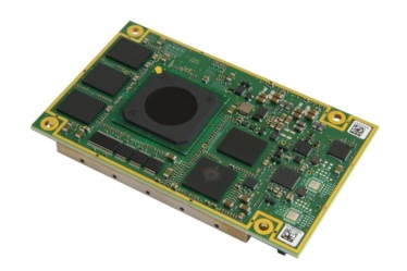
    As the seminar descriptor says it is comprehensive in nature and there is no wasted time. One day the presentations lasted from 8 a.m. until 9 p.m. that evening. So it is an intensive metrology seminar filled with incredible learning opportunities. This year’s activities included an enjoyable and educational evening with Symmetricom, a forward-looking company that I sincerely view as the last true major commercial atomic reference builder in the United States. Symmetricom produces Hydrogen, Cesium (the ubiquitous 5071A), and Rubidium atomic reference standards, as well as high-end quartz oscillators with superior spectral purity and short-term frequency stability that support more military communications, satellite ground stations, and test and measurement applications than any other precision frequency references in the world today. Plus the incredible Symmetricom Chip-Scale Atomic Clock (CSAC), the world’s smallest atomic reference, has achieved historic breakthroughs in size, weight and power consumption — you can and I have balanced a CSAC on the end of my little finger. It is tiny yet powerful, and supports reference requirements as small as 1x10E-12 for specified periods of time. Indeed, this is the device that has the potential to revolutionize the Perfect Handheld GPS Transciever (PHGPST), but that is the subject for another column. As are the interviews I conducted with Judah Levine, who I refer to as “Father Time,” a Fellow at NIST, and David Allan, the originator of the Allan Variance and Allan Deviation, which allows the GPS Kalman Filter to work wonders and assures a GPS position accuracy of less than 1 meter possible for us all, with the right equipment of course.

    The Right Equipment

    Which leads me to my closing comments for this month’s column. While it is true that you can now routinely utilize GPS for real-time centimeter accuracy, since GPS does have the best atomic reference systems of any PNT system in orbit today, without monitoring systems and excellent GPS receivers you can’t depend on those parameters — the integrity is just not guaranteed without adequate signal monitoring, corrections, and augmentations.

    Consequently, to ensure the best possible results, the receivers in the GPS global monitoring stations, of which there are hundreds more than those sanctioned by the U.S. government, tend to be high end and of stellar quality. And a majority of those receivers, according to my sources are, NovAtel receivers. Certainly NIST has a good number of NovAtel reference receivers, even though they are not allowed to specify or recommend a reference-grade receiver. I have also noticed large numbers of NovAtel receivers at FAA facilities around the U.S., and NovAtel’s reference receivers are at the core of national aviation ground networks around the world.

    Recently NovAtel announced the development of a new receiver card known as the OEM625S Selective Availability Anti-Spoofing Module (SAASM) Global Navigation Satellite System (GNSS) receiver, which is actually a collaborative effort between NovAtel and L-3 Interstate Electronics Corporation (IEC). Since this is designated an OEM card, it is primarily for system integrators. However, since many users worldwide have come to rely on the centimeter-level positioning accuracy of real-time kinematic (RTK) GPS receivers, this may be a card you want to specify in your next high-end GPS receiver purchase or upgrade.

    PPS Accuracy

    Since defense users routinely rely on access to the Precise Positioning Service (PPS) for single-point positioning and this is certainly available with the OEM625S, it should be of special interest to those users. The card combines a commercial dual-frequency NovAtel GNSS receiver with an L-3 IEC XFACTOR SAASM in a single card solution, reducing overall size and power requirements for user applications. The new card maintains the OEMV-2 form factor, meaning it should be a drop-in replacement with backward compatibility for existing users.

    NovAtel has promised to ship me a card to review in depth at the end of the third quarter of this year, so more on the new NovAtel/L3 card at that time. It promises real-time centimeter level accuracy and I can’t wait to see how it performs.

    Make Your Reservation

    Meanwhile, give Dr. David Howe a call at NIST and sign-up for the 38th Annual Time and Frequency Metrology Seminar — you will be glad you did.

    I hope to see you all at ION JNC (Institute of Navigation – Joint Navigation Conference) in Colorado Springs, June 12-15, 2012! The classified Warrior Panel promises to be the hit of the show. Don’t miss it!

    Until next time, Happy navigating.


  • Live Blogging from U.S. Joint Nav Conference

    Alan Cameron, publisher and editor, and Don Jewell, contributing editor for defense, will be blogging live from the 2012 JSDE/ION Joint Navigation Conference. The conference will be held June 12-15 in Colorado Springs, Colorado. Cameron and Jewell will be blogging twice a day with all the news from the defense-oriented conference.

    Among many other matters, we’ll be taking a close-up look at NovAtel’s and L-3’s new SAASM receiver. This is a classified piee of hardware, of course, but we should be able to glean some details on this and other new defense products and services being rolled out at the exhibit accompanying the conference.

    In addition, we’ll have a top-level view of the Warfighters’ Panel on June 15. A similar session was the undisputed highlight of the GPS Partnership Council in late April, and we expect more of the same here. GPS World columnist Don Jewell is organizing this panel.

    According to organizers, JNC 2012 will be the largest U.S. military navigation conference of the year with joint service and government participation. The event will focus on technical advances in positioning, navigation and timing (PNT) with emphasis on joint development, test and support of affordable PNT systems, logistics, and integration. From an operational perspective, the conference will also focus on advances in battlefield applications of GPS, critical strengths or weaknesses of fielded navigation devices, warfighter PNT requirements and solutions, and navigation warfare.

    Watch the home page Top Story for the blogs, beginning Tuesday, June 12.