The Ecole Nationale de l’Aviation Civile (ENAC) and the French Space Agency’s “Satellite Positioning and Timing” Technical Skills Community (CNES CCT PDS) will hold the second edition of the International Technical Symposium on Navigation and Timing on Nov. 16-17, 2015, at the ENAC premises in Toulouse, France.
The event is based on the following key elements:
Technical presentations on hot topics related to navigation and timing.
All presentations given by invited international guest speakers recognized worldwide for their expertise.
Round tables to facilitate discussions between the audience and the guest speakers.
Registration to this symposium is free of charge. The number of seats is limited, so register as early as possible.
Program
This year, the symposium is composed of three sessions: “Positioning in Challenging Environments” , “GNSS Signals and System Design” and “Air Navigation.”
Invited guest speakers are:
Martin Haueis – Head of Localisation and Data Management, Daimler AG, Germany
Christopher J. Hegarty – Director for CNS Engineering and Spectrum, MITRE Corporation, USA
Mikael Mabilleau – Navigation Services Manager, Egis Avia, France
Mitch Narins (Invited) – Chief Systems Engineer for Navigation Programs, Federal Aviation Authority, USA
Oscar Pozzobon – Founder and Technical Director, Qascom, Italy
Mark L. Psiaki – Professor, Cornell University, USA
John F. Raquet – Director of the Autonomy and Navigation Technology (ANT) Center, US Air Force Institute of Technology, USA
Lionel Ries – Head of the Navigation/Location Signals Dept, CNES, France
Francis Soualle – Navigation System Engineer, Airbus Defence and Space, Germany
Morton Stakkeland – Development Engineer, Indra Navia, Norway
A. J. Van Dierendonck – AJ Systems, USA
Lauri Wirola – System Architect, HERE, Finland
Zheng Yao – Ass. Professor, Tsinghua University, China
The Institute of Navigation (ION) GNSS+ conference is scheduled for Sept. 14-18 this year, just down the road in Tampa, Fla. It’s just over an hour’s drive for me, so I’ll be there again this year.
The reminders from ION have started to show up in my inbox, touting issues like PNT privacy, a new UAV session, a return of the popular indoor navigation demonstrations with a significantly larger group of companies demonstrating, an update on what’s happening in indoor navigation regulation-land, and with a number ways to find out what’s happening on social media. So most GNSS industry people will now have their reminder to register, get a hotel room and choose the sessions they want to attend for their week in Tampa.
GPS World will be there as usual with our full team, including our market-sector editors, along with near-real-time coverage of the show on GPSworld.com and on Twitter. The exhibition floor looks to be almost full, so if you were sitting on the fence thinking about exhibiting, its probably time to make a decision — there only appear to be a few booths still open.
GPS World will also video record the indoor navigation demonstrations, and portions will be posted online at the GPS World YouTubechannel.
Also, come by the GPS World booth during the exhibit hall reception Wednesday evening to film a video-selfie with Mary Ann, our August cover great white shark. The video-selfies give you 30 seconds to tell us about yourself, and will be posted to our YouTube channel.
The CGSIC (Civil GPS Service Interface Committee) meets and tutorials will be held on Monday and Tuesday, but the week basically gets going with the plenary session on Tuesday evening.
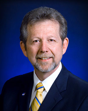
James L. Green, director of Planetary Science for NASA.
This year, ION has called on Dr. James L. Green, director, Planetary Science at NASA, to give an insight into NASA’s interplanetary exploration over the last several years. He plans to take us “on a journey navigating our way through the Solar System showing you new worlds and new discoveries through the eyes of our planetary spacecraft.” In the last several years alone, the understanding of the origin and evolution of the solar system has changed dramatically. He’ll demonstrate how our foundations of knowledge have literally been reestablished.
Technical papers and applications sessions get rolling bright and early on Tuesday morning.
Then the exhibit hall opens up at 10 a.m. on Wednesday, with more than 50 GNSS and related exhibitors from around the world showing their new products and innovations. Exhibitors range from GNSS systems manufacturers to simulation, timing, engineering and system integrators, chip and receiver manufacturers, antenna and RF component suppliers, test-solution suppliers, indoor location experts, inertial navigation companies, government and R&D agencies, military and commercial GNSS suppliers, satellite system and component providers, survey-systems suppliers, and a smattering of Internet of Things (IoT) proponents. The exhibit floor runs Tuesday through Thursday in parallel with the applications presentations and panels and technical papers.
The show floor at ION-GNSS 2014.
Key application presentations for me to catch include the indoor location demonstrations on Wednesday afternoon, and the new UAV navigation session on Thursday morning. But there are around four parallel presentations on systems and applications and four sessions of technical papers each morning and afternoon Tuesday through Friday, so there are enough topics on a huge range of GNSS and related navigation technologies that would satisfy almost anyone in the industry or anyone wanting to learn about the industry.
Indoor Location Demonstration
The list of vendors who plan to demonstrate at the indoor location demonstration session is lengthy:
Nokia
InvenSense
RX Networks
Indoor.rs
Samsung
CSR
Combain
Pole Star
ByteLight
Microsoft
That’s about twice as many participants as last year, when the audience was treated to a number of demos that worked, and some which basically didn’t. So, this is an opportunity to redeem themselves for those who had problems, time to update and show improvements over last year for the ones who demonstrated successful indoor navigation, and for the newcomers, we shall see what they have to offer. Hopefully, companies will have recognized that it’s essential to a have a large-screen display replicating handhelds for a large audience to follow what’s going on.
UAV Session
The UAV session appears to concentrate on alternate navigation and other sensors for unmanned airborne vehicles. Papers include modeling and calibration to remove magnetic biases coming from other devices on the platform; a kind of indoor navigation for micro-UAVs entering buildings for assistance in disaster conditions; navigation using optical imaging with and without GNSS; Stanford’s JAGER jammer detection project using DME and ADS-B signal navigation; and integrity requirements for UAV sense-and-avoid systems. Another panel session on Friday discusses integration of UAVs into the U.S. National Airspace System.
If these couple of topics don’t fire you with enthusiasm, don’t worry – there are masses of other great topics to pick from in the extensive technical program at ION GNSS+. Right now, pre-registration for ION GNSS+ is running 26 percent ahead of where it was last year, so we could have 1,300-1,400 technical attendees this year.
So, come on down to Florida – yes, it’s warm (the Convention Center is air conditioned), but its not too warm — even for a guy like me from the frozen North!
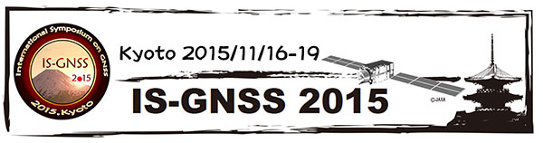
Registration is now open for the International Symposium on GNSS (IS-GNSS 2015), which will be held Nov. 16-19 in Kyoto, Japan. The early bird registration deadline has been extended and closes Aug. 31, and regular registration is Sept. 1-Oct. 31.
The International Symposium on GNSS is designed to bring together experts engaged in PNT and GNSS technologies — including industry professionals, practitioners, academics and researchers — to disseminate their latest research results and allow cross-disciplinary exchange of knowledge to further advance the fields.
Brad Parkinson will deliver the keynote address. Besides keynote addresses, the conference will feature oral presentations, interactive poster sessions, panel sessions, open interactive forums and an informative trade exhibition.
The Asia and Pacific Rim meeting of the CGIC (Civil GPS Service Interface Committee) will be co-located with ISGNSS 2015 to help improve understanding of world trends in developing and deploying GNSS.
Kyoto is the ancient capital of Japan and a top tourist destination, organizers said, with the conference scheduled during the best sightseeing season.
Registration will open April 1, along with a hotel booking page. The logistic information will be announced later.
A student scholarship is being offered to the student with the most promising paper. “If you have students, please encourage them to apply,” said Akio Yasuda, president of Institute of Positioning, Navigation and Timing of Japan.
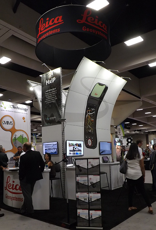
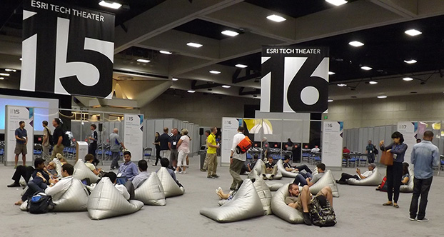
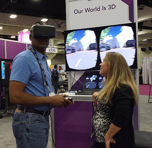
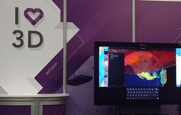
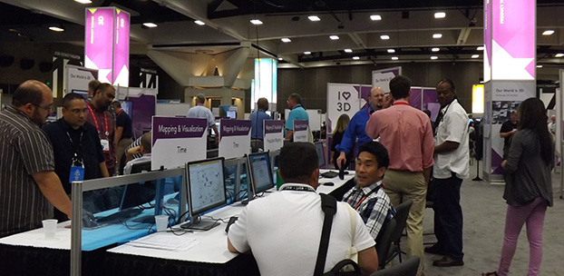
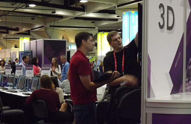
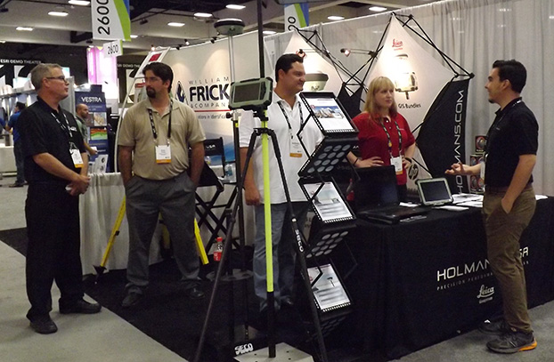
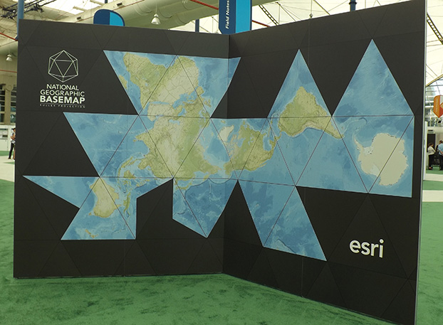
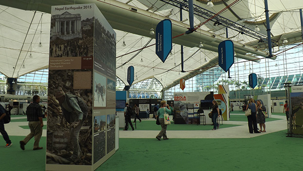
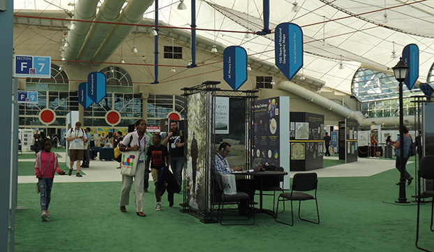
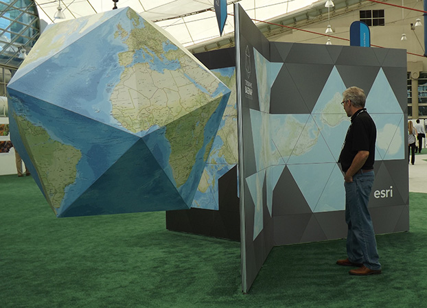
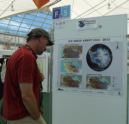
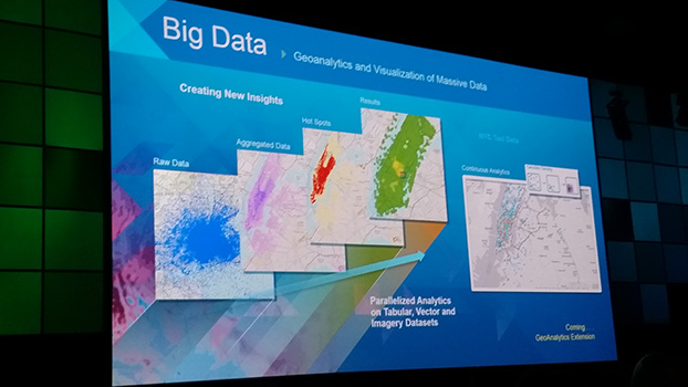
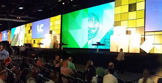
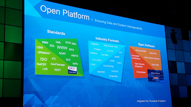
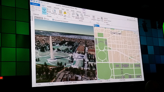
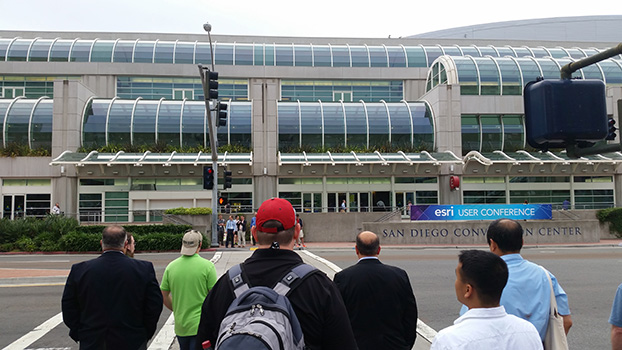
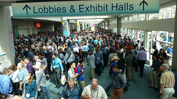
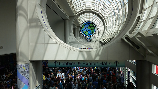
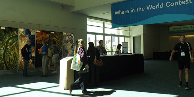
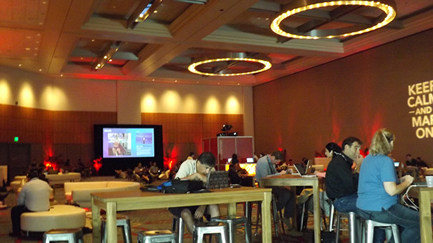
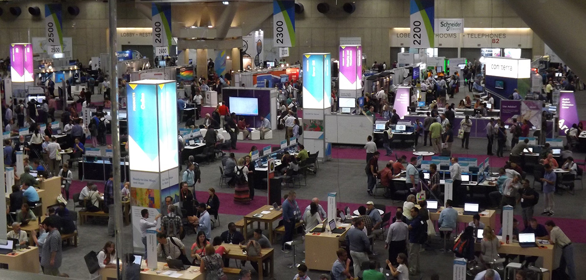
The Esri 2015 Exhibit Hall. (Photo: Tracy Cozzens)
More than 16,000 people from 120 countries around the world are expected to converge in San Diego, Calif., this week to discuss the power of maps and applying geography at the 2015 Esri User Conference (Esri UC). The Esri UC and related events are taking place July 18–24, featuring a variety of speakers from a presidential candidate to global first responders. Attendees will share ideas and best practices for improving our world through maps.
GPS World/Geospatial Solutions staff is on site, and we will be posting news, photos and videos live from the show on this page. Also follow us on Twitter at @GSS_NCM and @GPSWorld.
Two of the Institute of Navigation’s (ION’s) conferences — the International Technical Meeting (ITM) and the Precise Time and Time Interval (PTTI) Meeting — will be co-located for 2016. One registration fee gives attendees access to both technical events and a commercial exhibit. The co-located conferences will take place Jan. 25-28, 2016, at the Hyatt Regency Monterey in Monterey, Calif.
Abstracts are due Oct. 2, 2015. Submission requirements have changed, and depend on the session the abstract is submitted for. Review the call for abstractsfor more information.
This year’s joint ITM/PTTI Plenary Session is “Autonomous Vehicles – Beyond the Navigation Technology.” The session will address issues outside of navigation technology, including legal issues, regulatory challenges, transitional periods, markets enabled by autonomous operation and similar topics beyond the core navigation technology.
ITM is ION’s winter meeting, which features peer-reviewed technical papers related to positioning, navigation and timing, and includes the ION Fellows and Annual Awards presentations.
PTTI is the annual technical conference designed to disseminate and coordinate PTTI information at the user level, review present and future PTTI requirements, inform government and industry engineers, technicians and managers regarding precise time and frequency technology and its problems, and provide an opportunity for an active exchange of new technology associated with PTTI.
The co-located 2016 ITM and PTTI meetings will feature a technical exhibit and showcase of products and services related to positioning, navigation and timing. For more information on exhibiting, contact ION or go to www.ion.org.
The deadline for abstract submission has been extended from May 15 to May 21. Since 2007, the worldwide scientific community has met every two years to discuss the scientific possibilities of Galileo and other Global Navigation Satellite Systems (GNSS).
This colloquium will bring together members of the European scientific community and their international partners involved in the use of GNSS signals in their research, specifically Galileo signals. Major academic players will meet with institutional and industrial executives to share innovative ideas and influence the future evolution of Europe’s own GNSS.
The colloquium focuses on four major areas of research:
Scientific applications in meteorology, geodesy, geophysics, space physics, oceanography, land surface and ecosystem studies, using either direct or reflected signals, differential measurements, phase measurements, radio occultation measurements, using receivers placed on the ground, in aircraft or on satellites.
Scientific developments in physics, dealing with future GNSS, particularly in testing fundamental laws in astronomy and in quantum communication. Relativistic reference frames and relativistic positioning will be addressed — also taking into account the scientific opportunities in tracking the first two Galileo Full Operational Capability satellites in their elliptical orbits.
Aspects of metrology such as reference frames, onboard and ground clocks, and precise orbit determination.
Scientific aspects of satellite navigation and positioning such as signal propagation, tropospheric and ionospheric corrections and the means to model and mitigate multipaths and interference.
The various possibilities to use navigation satellites such as Galileo for scientific purposes will be reviewed, and the contribution of scientific applications to making the most of the present systems and defining their evolution will be scrutinized.
For those interested in submitting papers, online submission of abstracts opens May 15 through the colloquium website, where other details of the event can also be found.
Annual Conference Renamed Xponential to Reflect Innovative and Expanding Industry
The Association for Unmanned Vehicle Systems International (AUVSI) today announced the rebranding and evolution of its premier global industry event for unmanned systems, drones and robotics, the AUVSI Unmanned Systems show, taking place this week in Atlanta, Ga. With nearly 600 exhibitors and 8,000 attendees, AUVSI’s event attracts leaders in all aspects of the industry, from manufacturers to end users.
GPS World is covering the AUVSI Unmanned Systems show this week from Atlanta. See our coverage here.
“Xponential encapsulates the tremendous growth and innovation in the unmanned systems industry, as well as the broad societal benefits of the technology,” said Brian Wynne, president and CEO of AUVSI. “Xponential will help the world understand the potential of this industry by providing a single gathering place where people can see and interact with the technology and systems that will soon become part of our everyday lives.”
Xponential will continue to serve as the experience hub for business and investment for this $48 billion industry, AUVSI said. This technology is already being used by farmers, first responders and firefighters to help save time, save money and save lives.
Over the next few weeks and months, AUVSI will be working to expand the event offerings to bring a new level of community to the growing industry it serves. Many of these new programs were launched this year, including advanced educational tracks and innovative experiences that bring together the industry’s leading experts and organizations.
The GPS/GNSS International Symposium was first held in 2000 in Seoul and has been held annually ever since, rotating among Korea, China, Japan, Australia, Malaysia and Taiwan. The 2008 meeting in Tokyo attracted 428 attendees, including 179 foreign delegates, and 188 papers were presented. The 16th Symposium will be held in Kyoto, a beautiful historic city and the ancient capital of Japan.
Important dates for paper submission:
June 30 : Abstract Submission for Scholarship application and Refereed Papers
July 31: Full paper Submission for Scholarship application and Refereed Papers
August 15: Abstract Submission for Regular Papers
September 15: Acceptance Notification
October 15: Full Paper Submission.
Registration dates:
Early-bird registration: April 1 – August 18
Regular registration: August 19 – October 31
Session tracks include:
Global Satellite Navigation Systems (GPS, GLONASS, Beidou, Galileo)
QZSS and Regional Systems
Augmentation Systems (SBAS, GBAS, etc.)
Next-Generation GNSS
Inertial Systems for Positioning & Orientation
Signal Processing in Navigation Systems and Systems Integration
The Association for Unmanned Vehicle Systems International (AUVSI) will host Unmanned Systems 2015, which will run from May 4-7 at the Georgia World Congress Center Atlanta. With 8,000 attendees from around the world, Unmanned Systems 2015 is the largest expo and trade show in the industry, according to AUVSI.
The event will include three days of interactive exhibits and exciting demonstrations of air and ground vehicles spread throughout 350,000 square feet of exhibit space. The 150-plus educational sessions, workshops, and panel presentations will focus on the future of commercial, humanitarian, environmental, governmental, and military applications for robotics and unmanned systems. For more information on the sessions, see AUVSI’s Program Planner.
This year’s conference will feature keynote addresses and panel discussions by:
Colin Guinn, chief robotics officer, 3D Robotics
Dave Vos, project lead, Project Wing @ GoogleX
David Vigilante, senior vice president, legal, CNN
Helen Greiner, CEO, CyPhy Works
Hugh Herr, MIT professor and head of biomechatroinics at the MIT Media Lab
Rep. Frank Lobiondo, New Jersey House of Representatives
Henrik I. Christensen, distinguished professor, KUKA chair of Robotics, and director of the Robotics & Intelligent Machines Center, Georgia Tech
For more information and a full agenda of events, visit www.auvsishow.org.
Since 2007, the worldwide scientific community has met every two years to discuss the scientific possibilities of Galileo and other Global Navigation Satellite Systems (GNSS).
This colloquium will bring together members of the European scientific community and their international partners involved in the use of GNSS signals in their research, specifically Galileo signals. Major academic players will meet with institutional and industrial executives to share innovative ideas and influence the future evolution of Europe’s own GNSS.
The colloquium focuses on four major areas of research:
Scientific applications in meteorology, geodesy, geophysics, space physics, oceanography, land surface and ecosystem studies, using either direct or reflected signals, differential measurements, phase measurements, radio occultation measurements, using receivers placed on the ground, in aircraft or on satellites.
Scientific developments in physics, dealing with future GNSS, particularly in testing fundamental laws in astronomy and in quantum communication. Relativistic reference frames and relativistic positioning will be addressed — also taking into account the scientific opportunities in tracking the first two Galileo Full Operational Capability satellites in their elliptical orbits.
Aspects of metrology such as reference frames, onboard and ground clocks, and precise orbit determination.
Scientific aspects of satellite navigation and positioning such as signal propagation, tropospheric and ionospheric corrections and the means to model and mitigate multipaths and interference.
The various possibilities to use navigation satellites such as Galileo for scientific purposes will be reviewed, and the contribution of scientific applications to making the most of the present systems and defining their evolution will be scrutinized.
For those interested in submitting papers, online submission of abstracts opens May 15 through the colloquium website, where other details of the event can also be found.
Following its debut in 2014, GEO Business returns to The Business Design Centre in London on May 27-28.
GEO Business 2015 combines a central trade exhibition with a conference program with 50 presentations and 140 live commercial workshops.
The presentations and workshops, which provide first-hand demonstrations, have grown in number by 34 percent over the first year. Also larger this year is the exhibit space, by 64 percent, organizers said. The exhibit features more than 200 exhibitors showcasing the latest geospatial technology and services.
The show’s unifying vision is to promote closer collaboration across the geospatial community and to provide a platform that effectively showcases both the professionalism of this industry and the role that it will play in future economic growth. It was born out of consultation with industry and as a result is organized in collaboration with the Chartered Institution of Civil Engineering Surveyors (ICES), the Royal Institution of Chartered Surveyors (RICS), The Survey Association (TSA), the Association for Geographic Information (AGI) and more recently the Institution of Civil Engineers (ICE).
In 2014, more than 1,600 attendees from 39 countries took part. Learn more at the conference website.
The forum is designed to inform Russian and foreign audiences about state policies in the development and application of GLONASS technology in Russia and worldwide. It also aims to analyze the latest trends of the navigation industry, as well as to discuss the product and service market for various consumers and conditions for its export to foreign markets.
The Navitech 2015 exhibition is aimed at world leaders in satellite navigation, as well as information technologies, geodesy and cartography. Navitech 2015 unites leading Russian and foreign developers and manufacturers of navigation equipment, services and software, including mapping apps. It reflects current world trends and serves as a main exhibition event for industry specialists. The Navitech Exhibition is the only specialized satellite navigation exhibition in Russia.
The agenda of the 9th International Navigation Forum is designed for the end-user of navigation products and services, and highlights all aspects of their practical use for building a successful business and enhancing its efficiency.
Forum attendees will receive detailed information about legal aspects of using satellite navigation, be introduced to navigation and communication equipment of leading Russian and foreign manufacturers, and learn about different industry applications and leading companies’ experiences in the practical use of navigation technologies, including business cases of using satellite navigation by Russian business representatives.
Sessions and roundtables will present the most current information about developed products and important issues in the fields of navigation, mapping, and legal regulation. The participants will be able to give their suggestions on creating favorable conditions for the effective introduction of innovative technologies and exchange experiences.
Forum topics:
Status and development prospects of GLONASS and foreign navigation satellite systems
Major development trends of the Russian market of navigation services and equipment
Practical experience of using satellite navigation technologies in different sectors of the Russian economy
Navigation technologies for intellectual transport systems
Information and navigation services, systems and equipment for mass market
Navigation technologies for passenger transport
Navigation and communication equipment of leading Russian and foreign manufacturers
Geoinformation systems for various purposes
Exhibition topics:
In-vehicle navigation and information systems
Navigation technologies for land development, survey, design and construction
Automotive and personal navigation, equipment, LBS
Professional navigation equipment, modules and components


 More than 16,000 people from 120 countries around the world are expected to converge in San Diego, Calif., this week to discuss the power of maps and applying geography at the 2015 Esri User Conference (Esri UC). The Esri UC and related events are taking place July 18–24, featuring a variety of speakers from a presidential candidate to global first responders. Attendees will share ideas and best practices for improving our world through maps.