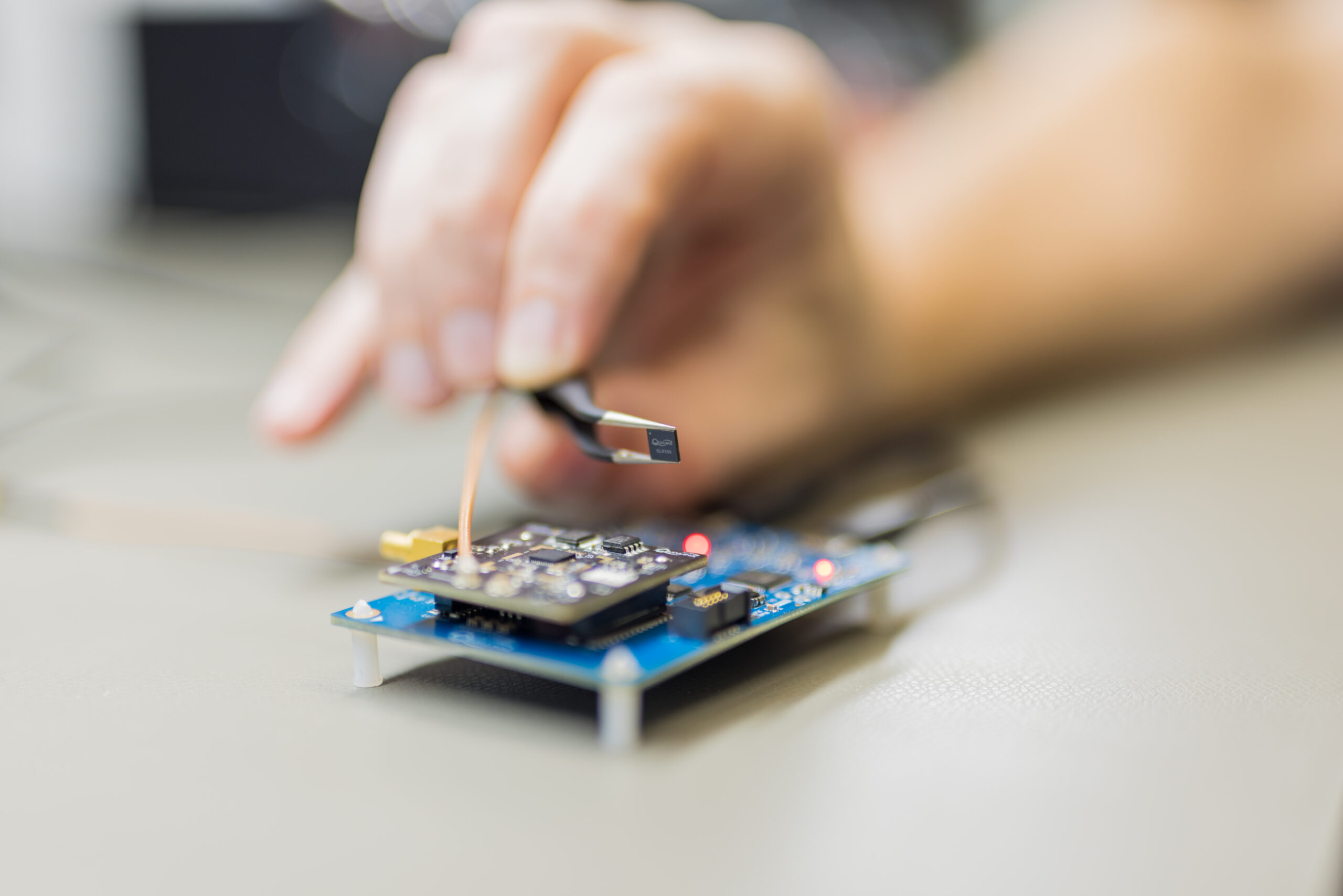
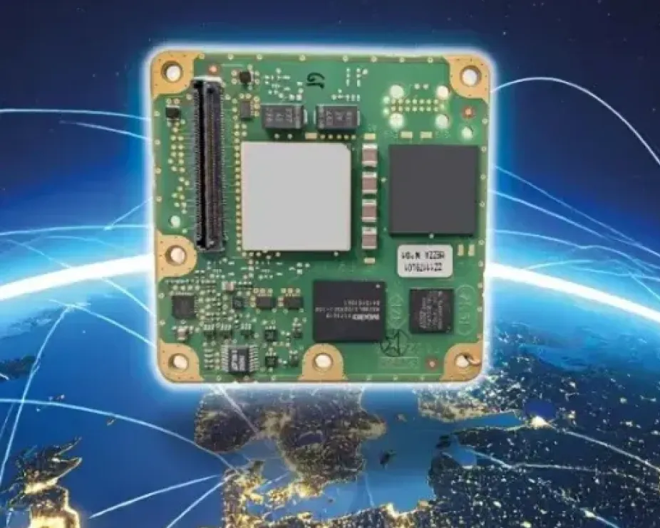
The QLX3Gx chip makes secure, authenticated positioning a standard feature
Qualinx has integrated support for the Galileo OSNMA (Open Service Navigation Message Authentication) on its QLX3Gx Series ultra-low-power GNSS receiver.
Developed with the support of the European Union Agency for the Space Programme (EUSPA), the integration makes the QLX3Gx a GNSS receiver purpose-built for ultra-low-power markets to deliver hardware-native OSNMA support as a standard feature across the entire product family.
Qualinx has embedded OSNMA support directly into the QLX3Gx hardware architecture from the ground up, enabling a fully optimized design with zero trade-offs in power consumption, cost or performance.
“Authenticated positioning has for too long been out of reach for the devices that need it most,” said Qualinx CEO Tom Trill. “By building OSNMA support into the QLX3Gx at the hardware level from day one, we’re making trusted positioning the default — not a premium option — for the wearables, asset trackers and IoT devices that make up the bulk of the GNSS market.”
The partnership with EUSPA reflects a shared commitment to disseminating Galileo’s advanced security capabilities across the widest possible range of applications and markets. EUSPA identifies OSNMA as a strategic priority for improving resilience against spoofing and signal manipulation
According to the EU Space Market Report 2026, global GNSS revenues are projected to grow from €300 billion in 2024 to €580 billion by 2034 with mass-market devices accounting for the largest share of shipments and representing the greatest growth potential.
Through Qualinx’s digital radio-frequency technology, the QLX3Gx delivers up to 10× lower power consumption than conventional GNSS solutions. By integrating OSNMA natively in hardware, the chip eliminates the processing overhead typically associated with authentication, ensuring security adds no meaningful cost to the power budget.
The chip’s reconfigurable digital RF architecture enables capabilities to be updated over time without hardware replacement — extending device lifecycles, cutting electronic waste, and lowering overall energy consumption. The result is a platform that makes connected devices more secure and sustainable.
The QLX3Gx chip is available for sampling, with mass production planned for the second half of this year. Developers and OEMs can register interest in the Qualinx QLX3Gx Evaluation Kit to secure hands-on evaluation of the QLX3Gx for upcoming consumer, industrial and mobility applications. Contact [email protected] to register interest and request a sample, or learn more at Qualinx.io.
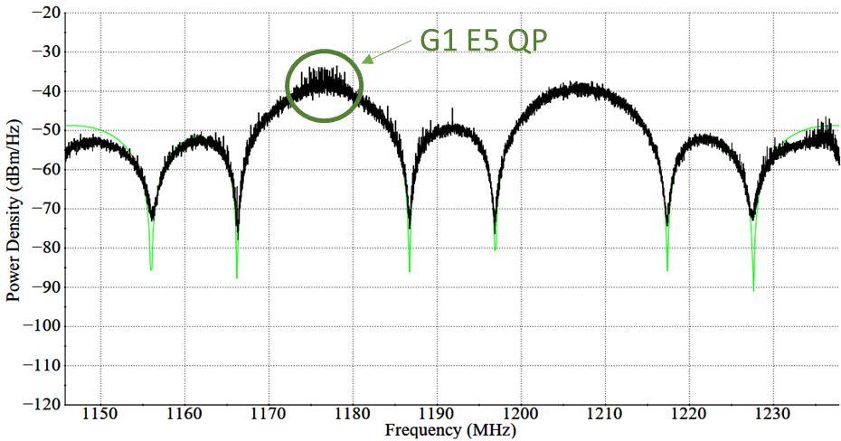
In April, Galileo marked a step forward with the deployment of a new signal component, known as E5a Quasi Pilot, on 12 satellites of Europe’s satellite navigation constellation. This upgrade makes Galileo signals easier to access, particularly on emerging mass-market, low-power devices used for Internet of Things and smart city applications.
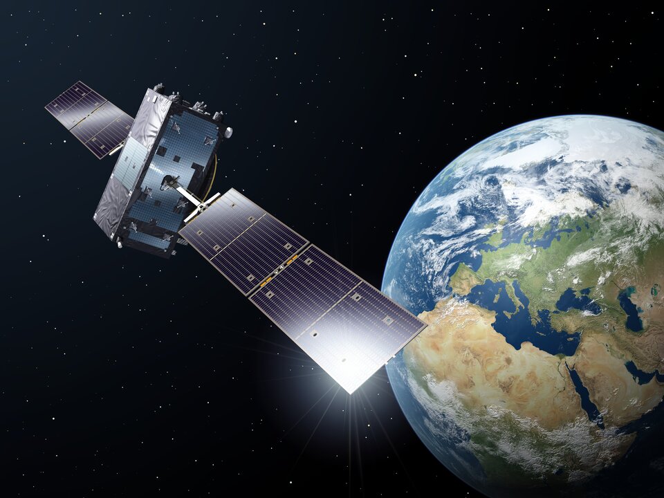
With the world’s most precise satellite navigation system, a constellation of more than 30 satellites and five billion of users worldwide, Europe’s Galileo continues to strengthen its position at the forefront of global navigation satellite systems (GNSS).
Galileo signals, like other GNSS signals, traditionally consists of two components: pilot signals and data signals. The first ones are data-less and help enable the receiver to acquire and track the signal, while the second carry all the navigation information needed to pinpoint the target’s location.
But what if this traditional concept could be rethought to respond to emerging market needs, particularly for users seeking faster and simpler acquisition?
The European Space Agency and its industrial partners have developed a solution targeted at mass-market applications that require low power: E5a-QP, a Quasi-Pilot (QP) signal component transmitted in Galileo’s E5 band.
The signal component is broadcast free of charge and now available for implementation in both new and upgraded chipsets, enabling all users of the Galileo Open Service to benefit from its capabilities.
A small addition for a big computational deduction
Quasi-Pilot means a pilot signal that retains its intended role but also carries a small amount of data, including the time information necessary for a first fix. This time information is fully predictable at user level. A Quasi-Pilot signal component is also characterised by a tailored signal structure that simplifies the acquisition process, which reduces the power consumption on the receiver’s end.
This proves particularly useful for low-power, basic receivers such as those found in smartphones, smart-city infrastructure, internet-of-things devices and those that only need to receive a GNSS signal for a very small time to determine their position (also known as ‘snapshot’ devices).
The deployment of E5a-QP also represents a key enabler for low-power receivers designed to process signals exclusively in the E5 band, rather than relying on signals in the E1 band. In this way, the resilience of the receiver against spoofing and jamming attacks is increased, as the fundamental acquisition process is no longer only dependent solely on E1 signals.
Test campaigns have demonstrated that E5a-QP can reduce signal acquisition time by a factor of three, while substantially lowering the number of operations required for acquisition by a factor of eight.
The introduction of this new Galileo signal component follows an extensive series of design, testing and validation that demonstrated the value of the signal and the feasibility of implementing new signal components on current Galileo satellites.
Starting 2020, a design phase explored how to reconfigure the Galileo satellites’ payload to integrate the new signal component. Following on, a series of tests were run on engineering models at ESA’s Navigation Payload Laboratory to demonstrate the feasibility and performance benefits that can be achieved with the new signal component.
In 2023, the solution was then validated using an in-orbit test bench: a duo of Galileo satellites operating in an elliptical orbit reconfigured to transmit the new signal component. The signal was measured at Galileo In-Orbit Test facility at ESEC in Belgium and DLR’s Signal Monitoring Facility in Germany, and successfully acquired and tracked by a set of receivers at ESTEC in the Netherlands.
First generation updated, second generation in mind
Between November 2025 and April 2026, twelve Galileo satellites were updated to accommodate this new signal component, marking the completion of this deployment.
This critical mass of satellites ensures that at least one of the satellites used to compute a position fix transmit the Quasi-Pilot signal at medium to high elevation angles, making sure that users around the world can benefit from the performance gains.
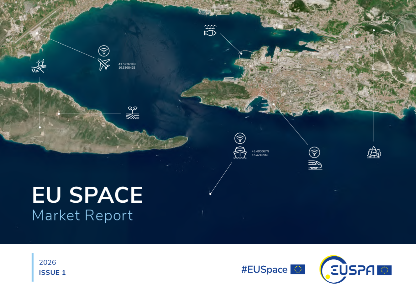
A new edition of the European Union’s Space Market Report is now available. According to the EU’s Agency for the Space Programme (EUSPA), it offers a comprehensive overview of the latest developments, emerging trends, and market dynamics shaping the global space downstream sector.
The report provides a comprehensive overview of the latest developments and trends in GNSS, as well as Earth observation (EO), secure satellite communications (Secure SATCOM), and space situational awareness (SSA) in one place for the first time. It also highlights the evolution of user technologies and the growing synergies between these domains.
“As Europe’s space capabilities become increasingly interconnected, it is essential to move beyond viewing them as standalone technologies,” explained Rodrigo da Costa, EUSPA executive director. The publication “reflects the growing synergies between these domains and their strategic importance for Europe’s economy, resilience and autonomy.
“By providing a comprehensive view of the evolving space ecosystem, EUSPA aims to foster innovation, strengthen collaboration across the sector, and support the development of a more competitive, agile and responsive European Union space economy,” da Costa said.
GNSS and EO
The report highlights sustained growth for both the GNSS and EO markets across all 16 analyzed market segments. The current €3.5 billion of EO market revenue in 2024 is expected to grow to €7.9 billion by 2034 with agriculture representing the largest share.
GNSS revenues are forecast to rise from €300 billion in 2024 to €580 billion by 2034. GNSS service revenues outpace device revenues and confirm the increasing role of digital ecosystems and value-added services in the space economy, the report said.
Revenues are mainly driven by consumer solutions, and road and automotive, with a global installed base of GNSS-enabled devices that will reach almost 10 billion by 2034.
Secure SATCOM
The Secure SATCOM market addresses the needs of surveillance, key infrastructure and crisis management. In this sector, data service revenues generated by EU users are forecast to grow significantly, increasing from more than €200 million in 2025 to nearly €1.2 billion by 2040.
While maritime surveillance drives demand in 2025, by 2040 the market is expected to be led by law enforcement interventions, civil protection and force deployment, fueled by growing security and resilience needs, demand for reliable connectivity, and stronger crisis-response capabilities.
Existing and future synergies
The report also examines how major macroeconomic trends —including climate change, geopolitical instability and rapid urbanization — are reshaping space markets and strengthening synergies between EO, GNSS and Secure SATCOM technologies. Together, these capabilities are becoming increasingly important for security, resilience, disaster response, environmental monitoring, and smarter urban and infrastructure management.
Low-Earth-orbit signals add increased signal strength, geometry diversity and robustness to GNSS.
U-blox, a global leader in positioning and short-range communication technologies for automotive, industrial and consumer markets, is exploring how the introduction of low-Earth-orbit (LEO) signals can complement and integrate with existing GNSS to support mass-market positioning solutions.
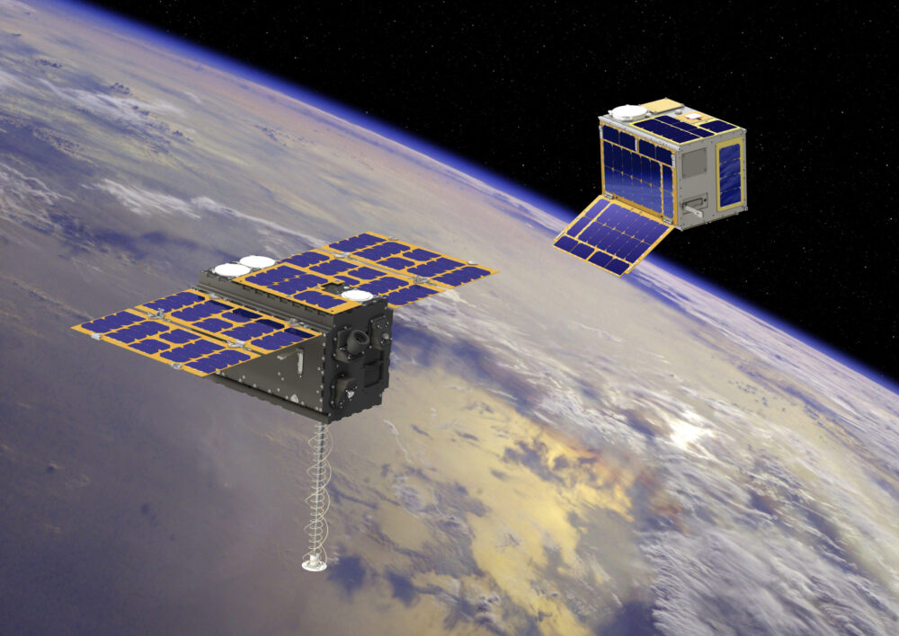
The announcement comes following the launch of the European Space Agency’s (ESA) first Celeste LEO-PNT demonstration satellites (IOD-1 and IOD-2) on 28 March 2026, marking a key milestone in bringing LEO-based signals into the operational positioning environment and ESA’s first step toward extending satellite navigation into low Earth orbit.
As the positioning ecosystem evolves, LEO-based signals are emerging as a complementary layer to established GNSS. Designed to augment systems such as Galileo, LEO satellites introduce a new building block characterized by lower orbital altitude, increased signal strength, and rapidly changing satellite geometry. GNSS remains the foundation of global positioning, delivering proven coverage and consistency at scale.
This evolution is not only about additional signals, but about how positioning systems behave over time. The dynamic geometry of LEO satellites introduces new system characteristics that influence convergence speed, robustness, and performance in challenging signal conditions.
Under its Navigation Innovation and Support Program (NAVISP) Element 2 (EL2) project, co-funded by ESA, u-blox is conducting a technical assessment of the role of LEO signals in multi-layer positioning architectures. This work forms part of a broader effort to bring LEO-PNT capabilities to mass-market GNSS receivers, combining emerging LEO signals with established GNSS systems.
This includes early integration work on u-blox’s X20 GNSS platform, exploring how different signal types and frequency bands can be optimally incorporated into u-blox’s positioning systems. The scope of work includes:
Observation and characterization of emerging LEO signal transmissions
Analysis of interactions between LEO signals and GNSS measurements
Evaluation of the impact of dynamic satellite geometry on positioning performance
Exploring different system-level approaches for integrating LEO signals into future platforms
“U-blox is committed to advancing positioning technologies through focused research and collaboration,” said Jani Käppi, head of technology positioning at u-blox. “Our work within the ESA NAVISP framework allows us to better understand how emerging signal sources can complement GNSS and contribute to robust and reliable positioning performance.”
U-blox expects to contribute to the development of the new LEO satellite ecosystem with significant innovation in the positioning solution, collaborating with key partners like ESA.
The Celeste initiative
The Celeste mission is ESA’s initiative for LEO-PNT (Low Earth Orbit Positioning Navigation and Timing) and is in its in-orbit demonstration phase. This first phase features a demonstration constellation of 11 satellites that will fly in low Earth orbit to test innovative signals across various frequency bands. Its goal is to advance satellite navigation concepts for resilient positioning and timing services.
The Celeste in-orbit demonstration phase was approved at ESA’s Council at Ministerial Level of 2022. The fleet is being developed through two parallel contracts respectively led by GMV in Spain with OHB in Germany as core partner, and by Thales Alenia France as prime and Thales Alenia Italy as space segment responsible and involving over 50 entities from more than 14 countries.
Celeste was further supported in ESA’s Council at Ministerial Level of 2025 (CM25), towards the implementation of the next phase: the LEO-PNT In-Orbit Preparatory phase.
Celeste also contributes to one of the three core pillars of ESA’s new European Resilience from Space (ERS) initiative, endorsed at CM25. ERS addresses critical security and resilience needs for Member States while laying the groundwork for future European strategic space capabilities.
Beyond Gravity has delivered key payload components for the ESA’s Celeste project aimed at making existing satellite navigation systems more accurate and resilient. The first demo satellites were launched into space on March 28. Beyond Gravity wants to further extend its payload offerings.
The European Space Agency (ESA) is embarking on a demonstration mission of 11 satellites in orbit to test and demonstrate the benefits of an additional layer of PNT (positioning, navigation and timing) in low Earth orbit. This will further improve the accuracy and responsiveness of Europe’s satellite navigation system, even during jamming and spoofing attacks. Celeste demonstrates how this additional layer can complement the resilience, security and precision of the European navigation system Galileo.
The first two demonstration satellites of the new Celeste navigation mission were launched into space on March 28.
“Key electronics for the Celeste satellite payload are provided by Beyond Gravity,” said Oliver Grassmann, chief operating officer at Beyond Gravity. “Expanding our payload capabilities is a top priority, as we continue to deliver high‑performance solutions for diverse missions — including radio occultation, reflectometry, electronic signal intelligence, and positioning, navigation, and timing.”
Kurt Kober, vice president, Electronic Solutions at Beyond Gravity, highlights the company’s key contributions to Celeste. “We play an important role in this mission and supply cutting-edge technology for digital signal generation and the clock for the satellite instruments,” Kober said. “These components ensure high reliability of the navigation signals as well as time accuracy and stability.”
Apart from the payload components, the company also supplied highly sensitive antennas. ESA has chosen Beyond Gravity as a key payload partner for Celeste alongside the Spanish space company GMV (prime contractor) and OHB in Germany.
Making Galileo more secure
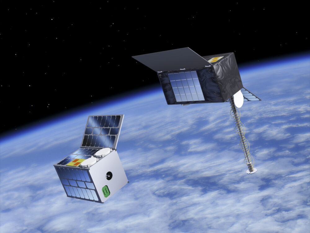
The new Celeste navigation satellites in low Earth orbit will demonstrate how an additional layer in a low-earth orbit around 500 km could complement the larger Galileo navigation satellites at an altitude of around 23,000 kilometers and make them more secure. This new satellite mission is known as Celeste, ESA’s first initiative in Low Earth Orbit PNT (LEO-PNT).
The in-orbit demonstrator phase for Celeste is being executed by two European consortiums in parallel and will comprise a total of 11 satellites plus one spare. GMV, as one of the prime contractors, is responsible for the complete end-to-end mission, including system definition and design, the space and ground segments, the user segment and operations, for 6 of the demonstrator satellites.
Importance of satellite payloads
The payload comprises those elements of a satellite that perform its actual task, in the case of Celeste the creation and transmission of navigation signals. “We have already delivered important satellite instruments, like our radio occultation weather instruments, and a reflectometer payload,” Kober said. “We also supplied payload elements in the field of signal generation for the European satellite navigation system Galileo. This expertise has been incorporated into the Celeste project.”
Kober sees satellite payloads as an important area for future business. “We want to play a greater role in this core area of satellites, the payload.”
Modular payload solution
With its FoX electronics platform, Beyond Gravity offers a flexible and modular solution that can host different payloads. Examples for such possible payloads include electronic signal intelligence (ELINT), which can be used for detecting and characterizing radar signals, or a PNT (positioning, navigation, timing) payload.
Other possible payloads from Beyond Gravity are its radio occultation and reflectometry instruments as well as high-resolution earth observation images (optical payload from a third-party supplier).
The FoX electronics platform, together with the payloads selected for the customer, can be easily integrated into Beyond Gravity’s satellite platform (multi-purpose platform), which successfully passed its Preliminary Design Review and is now undergoing intensive tests.
Celeste will test a complementary low-Earth-orbit layer for Galileo for more robust and accurate navigation.
At 10:38 CET on April 8, the Celeste IOD-1 satellite, developed by GMV and Alén Space under the European Space Agency’s (ESA) Celeste In-Orbit Demonstrator (IOD) program, successfully transmitted its navigation signal for the first time.
The reception of the signal from the Celeste IOD-1 satellite, confirmed by ESA teams at ESTEC, marks a key milestone for the program as it confirms the satellite’s successful commissioning in orbit. The signal was also received at GMV’s monitoring station in Lisbon.
The first two IOD satellites of the Celeste program — built by GMV and Thales Alenia Space, respectively — were launched March 28 at 10:14 CET from Rocket Lab’s Launch Complex 1 in Mahia, New Zealand. Separation from the launch vehicle took place one hour later, marking the start of the initial operations phase (LEOP) and commissioning, carried out by GMV for the IOD-1 satellite from the mission control center in Tres Cantos.
Next-generation LEO navigation
Celeste is ESA’s strategic program to demonstrate the benefits of an additional low Earth orbit (LEO) navigation layer that complements Galileo and EGNOS, with the goal of improving the accuracy, resilience and security of positioning, navigation and timing (PNT) services in Europe.
The in-orbit demonstrator (IOD) represents the program’s first phase and will validate key LEO-PNT technologies in flight ahead of potential future operational deployment.
The Celeste IOD phase is being carried out in parallel by two European consortia and will include a total of 11 satellites plus one in-orbit spare. As one of the prime contractors, GMV is responsible for the end-to-end mission for six of the demonstrator satellites, including system definition and design, the space and ground segments, the user segment, and operations.
Celeste programbeginnings
The Celeste program began with two demonstrator satellites, IOD-1 and IOD-2, aimed at securing registered frequency allocations and testing representative navigation signals through the end of the year. The mission will demonstrate precise autonomous orbit determination without relying on ground infrastructure, as well as stronger radionavigation signals in the L- and S-bands from low Earth orbit.
By demonstrating the advantages of integrating LEO capabilities into a multi-orbit architecture alongside Galileo (MEO), Celeste aims to improve resilience to interference and expand advanced navigation services. Operating at altitudes between 500 and 560 km, the Celeste demonstrators will assess how a complementary LEO layer can enhance Europe’s Galileo system in medium Earth orbit.
Eight additional, larger satellites are currently under development to extend the capabilities of the initial demonstrators. These will form part of the full fleet (eleven operational spacecraft and one spare) and will pave the way for subsequent launches starting in 2027.
GMV was selected in 2024 by the European Space Agency (ESA) to lead one of the parallel contracts for the development of Celeste. The first satellite in the constellation, a 12U CubeSat named Celeste IOD-1, was jointly developed by GMV and Alén Space.
In recent months, Celeste IOD-1 has undergone a complex assembly and integration process, as well as rigorous environmental and system testing. The results of these tests, carried out at GMV’s facilities, confirmed that the satellite was ready for launch, as well as for initial LEOP (Launch and Early Orbit Phase) operations and in-orbit experimentation activities.
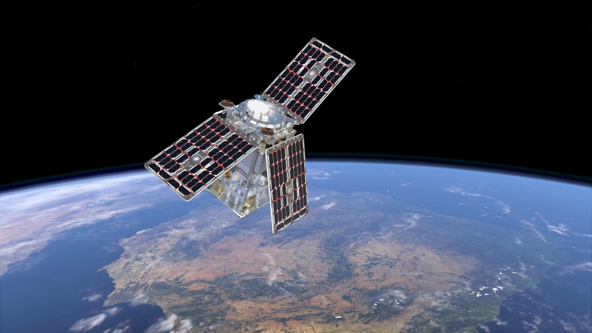
Ultra-low-noise amplifiers developed by European Engineering Consultancy Ltd. (EECL) are operating in orbit on the European Space Agency’s (ESA’s) HydroGNSS mission, marking a technical milestone for the hardware following the satellites’ launch in November 2025.
HydroGNSS consists of two small satellites designed to measure hydrological and climate-related variables using GNSS reflectometry. The satellites collect signals transmitted by navigation satellites such as GPS and Galileo and analyze those signals after they reflect from Earth’s surface. The reflected signals provide data on environmental parameters including soil moisture, freeze–thaw conditions in permafrost regions, wetlands and inundation, and above-ground biomass.
The satellites were launched aboard a SpaceX Falcon 9 rideshare mission from Vandenberg Space Force Base in California on Nov. 28, 2025. The mission is part of the European Space Agency’s Scout program, which focuses on relatively small and cost-effective Earth observation satellites designed to demonstrate new measurement techniques.
EECL designed and manufactured six multiband ultra-low-noise microwave amplifiers used in the spacecraft payload. The amplifiers are part of the radio-frequency front end of the receiver system and are designed to amplify very weak reflected GNSS signals while minimizing additional noise, helping preserve signal quality for scientific analysis.
Early on-orbit results indicate the satellites’ payloads are functioning as expected. Both spacecraft have begun collecting delay-Doppler maps of reflected GNSS signals, an early step in commissioning that confirms the receivers are acquiring and processing signals properly.
The HydroGNSS satellites were built by Surrey Satellite Technology Ltd., which also developed the GNSS receiver used on the mission. The spacecraft operate in low Earth orbit and are phased apart to increase global coverage of the measurements.
Data from HydroGNSS are expected to support research on the global water cycle and contribute to studies related to climate monitoring, agriculture, flood risk and ecosystem changes.
The small-form-factor Galileo OS (Open Service) or PRS (Public Regulated Service) sensors are designed to enhanced GNSS receivers and resilient multi-sensor navigation systems, ensuring safer and more reliable satellite-based navigation.
The Galileo PRS core module integrates a certified, single-chip, application-specific integrated circuit (ASIC) security module that incorporates all the necessary Galileo PRS security and navigation functions. It provides dual-frequency (E1/E6) iono-free Galileo PRS positioning, velocity and timing services. It also provides pseudorange and delta pseudorange raw data, along with GPS C/A (coarse acquisition).
The low-SWaP (size, weight and power) digital solution has been designed to work with any European GNSS receiver manufacturer seeking a standardized, easy-to-integrate Galileo module with which to develop their own GNSS receivers.
Credit: Thales
The modules can meet the requirements of a wide range of applications for manned or unmanned vehicles, combat aircraft, helicopters, high-dynamic missiles, and the navy. Their small form factor also makes them suitable for platforms with size constraints, such as ground vehicles, small drones and guided munitions.
The modules feature standardized interfaces, enabling the Galileo PRS function to be easily integrated into the host system. Furthermore, the TopStar Galileo core module can be embedded with minimum impact by using the analog RF front end of the host receiver.
The Galileo OS core module version enables the early integration of Galileo functionalities into the host system, as well as export to countries not authorized to use PRS. The PRS core module version provides an easy upgrade to Public Regulated Service capability, offering greater resilience against jamming and crucial protection against spoofing.
Austria is breaking new ground in space. BeaconSat is the largest satellite ever developed in Austria and also the country’s first military satellite. The project is being led by Austrian start-up GATE Space, based in Schwechat. Launch is planned for February 2027 aboard a SpaceX Falcon 9 rocket.
BeaconSat is designed to detect and analyze jamming and spoofing attacks on GNSS — targeted attempts to interfere with and manipulate navigation signals such as GPS or Galileo. Austria is responding to a security policy development that has real implications for aviation, transport, energy supply, and military operations.
Attacks on critical infrastructure
Jamming and spoofing incidents are frequent in geopolitically tense regions. In aviation, repeated disruptions have affected civilian aircraft.
“Space is now a central component of Europe’s and Austria’s security and defense strategy,” said Major General Friedrich Teichmann, head of the ICT and Cybersecurity Center. Navigation signals have long been part of critical infrastructure, and securing them is therefore of great strategic importance.
However, many of these attacks remain invisible. Countries often do not know where the interference is coming from, how systematic it is, or what pattern lies behind it. This is where BeaconSat comes in.
Technology demonstrator with strategic dimension
BeaconSat will systematically detect and analyze GNSS interference signals from orbit for the first time. The aim is to obtain data on when and where navigation systems are being deliberately disrupted. The mission is designed as a multi-year research and development project.
“It is important that we are able to act independently in terms of communication and navigation when necessary. This is a question of resilience and military capabilities,” emphasized Defense Minister Klaudia Tanner. “Space is an essential part of military capability.”
The satellite is not intended to be an isolated military project, but rather a demonstrator. Civil space technologies are being further developed for security-related applications and tested under real-world conditions. The findings will be incorporated into the operational processes of the Federal Ministry of Defense (BMVL).
Austrian industry at the center
GATE Space has overall responsibility for the project. Founded in 2022, the spin-off from TU Wien develops chemical propulsion systems for satellites and currently employs around 27 people. For BeaconSat, the company is supplying the propulsion system, the satellite structure, and the thermal management system, among other things.
“With BeaconSat, we are making a direct contribution to Europe’s security. The market for such capabilities is huge,” said Managing Director Moritz Novak.
The engines were tested in more than 8,000 hot runs at the site near Vienna Airport, both under atmospheric conditions and in one of Europe’s most powerful vacuum chambers.
GATE Space was supported by the Federal Ministry for Innovation, Mobility, and Infrastructure (BMIMI) through Austria Wirtschaftsservice (aws) with funding of around 750,000 euros.
Jamming and spoofing detection
A central contribution to the payload comes from the Graz-based company IGASPIN, which develops systems for the precise detection and analysis of GNSS interference. Additional components, including the on-board computer, are supplied by the Danish company Space Inventor.
At the European level, the mission is supported and co-financed as a technology demonstration via the European Space Agency’s ESA Marketplace. Off-the-shelf systems are specifically used to test commercially available technologies under security-relevant conditions.
New space chapter in the Ministry of Defense
BeaconSat also marks a turning point institutionally. The BMLV is currently setting up its own organizational unit for space services. The focus is on three areas: satellite communication, satellite navigation, and satellite-based reconnaissance.
“These space services are key to cross-domain operations and make a substantial contribution to the Austrian Armed Forces’ modern reconnaissance, command, and control network,” Teichmann said.
BeaconSat will provide data that will be directly integrated into military decision-making processes. At the same time, the project contributes to European resilience: those who recognize threats early on can respond diplomatically, politically, or technically.
Space as a growth area
The strategic importance of space technologies is growing both in terms of security policy and economics. Austria has recently increased its contribution to the ESA from 260 to 340 million despite budgetary constraints. Space and aviation technologies are anchored in the government’s industrial strategy as one of nine key technology fields.
Satellites have long been considered critical infrastructure. They enable navigation, communication, Earth observation, climate monitoring, and security applications. At the same time, new markets are emerging in the areas of propulsion systems, data analysis, and dual-use technologies.
With BeaconSat, Austria is repositioning itself in terms of security policy and industry. The project is an example of how startups, established technology companies, ministries, and European partners can and must work together successfully.
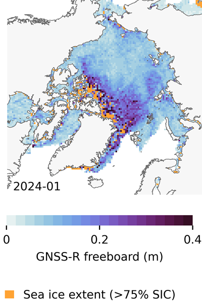
In recent years, scientists have shown that detecting changes in navigation signals from GPS and Galileo after they bounce off Earth’s surface (GNSS reflectometry, or GNSS-R) can deliver valuable information on sea ice. Now research drawing on data from Spire Global has enabled the generation of Arctic-wide sea ice maps, marking a major step forward for the emerging technique.
Spire Global‘s sea ice freeboard maps use data captured by Spire’s GNSS-reflectometry multipurpose listening constellation.
The research — enabled by the Third Party Missions (TPM) programme of the European Space Agency (ESA) — suggests that harnessing reflected navigation signals could become an important complement to established ice-monitoring altimetry missions.
The study leveraged Spire’s GNSS-R data to retrieve sea ice freeboard measurements across an entire winter season. The results show strong alignment with established altimetry datasets, including the ESA’s CryoSat mission, validating the complementary role of commercial satellite data alongside government missions.
Arctic-wide sea ice freeboard map for January 2024. (Credit: ESA)
The study was led by Felix Müller at the Technical University of Munich (DGFI-TUM) and Robert Ricker at the Norwegian Research Centre, experts in GNSS-R.
“The primary purpose of signals emitted from GNSS is to fix the location of a device at any point on Earth,” Müller explained. “However, when these signals bounce off Earth’s surface, their properties change. By analyzing these changes, we can infer information about the characteristics of Earth’s surface.”
“Previous research has shown that this technique works well experimentally,” Ricker added. “Using the Spire constellation, we aimed to demonstrate whether it would hold up on a larger scale by generating an Arctic-wide map of sea ice freeboard, which is a measure of how far ice protrudes above the waterline.”
Spire’s GNSS-R constellation
Spire’s constellation was first used to sample the atmosphere for weather forecasting. Then scientists began exploring other applications. Spire started collecting reflected signals arriving at shallow angles using a technique called grazing-angle GNSS-R. This method is particularly well suited for ice monitoring.
The research team analyzed data detected over the Arctic Ocean and surrounding seas between October 2023 and July 2024. The data was obtained via the TPM program, through which ESA disseminates data from a range of commercial and institutional partners on a free basis for research and development purposes.
The team focused on one of the most critical challenges in sea ice altimetry: reliably identifying narrow openings in the ice pack, known as leads. These openings are reference points for determining sea surface height and, ultimately, sea ice freeboard.
In turn, sea ice freeboard can be used to infer sea ice thickness — an essential parameter for tracking climate change, estimating sea level, and modeling ocean and weather patterns.
Identifying leads in sea ice with GNSS-R data. (Credit: ESA)
Classifying surface properties
“In the initial phase of the project, we used two complementary methods to identify surface properties based on GNSS-R data, with the aim of identifying leads,” Müller said.
The first — known as the adaptive threshold technique — involved measuring the power of the reflected navigation signal to classify surface type as either water or ice. This method allows rapid processing of the entire GNSS-R dataset, while remaining robust to changes in signal conditions.
The second method — known as unsupervised clustering — offers a more complex approach to classifying surface conditions. In addition to signal power, it considers multiple other signal features that tease out more nuanced information on surface type, including identifying thin or refrozen ice.
Both methods were compared with co-located CryoSat surface-type classifications and Sentinel-1 imagery, confirming that the GNSS-R classifications were largely comparable against conventional satellite products.
Mapping sea ice freeboard
“Building on this classification work, we then took the research to the next step by producing Arctic-wide sea ice freeboard maps from GNSS-R data,” Ricker said.
The team corrected ice surface height measurements generated from GNSS-R data for tidal variations, sea surface height, and atmospheric delays, which is standard practice in altimetry. A refined algorithm then identified where leads in the ice were likely to occur, with the lowest points in these areas revealing estimated sea surface height. Sea surface height estimates were then subtracted from ice surface heights to retrieve freeboard. Using this approach, monthly gridded freeboard products were generated for the full winter season.
The team reported that the GNSS-R datasets showed strong agreement with CryoSat freeboard datasets across much of the Arctic, confirming that GNSS-R can reproduce large-scale patterns previously observed by dedicated altimetry missions. Independent validation against upward-looking sonar measurements in the Beaufort Sea further supported the accuracy of the retrieved freeboard values.
However, as expected, the GNSS-R estimates became less reliable during spring, when surface melt alters reflection characteristics. This limitation is consistent with earlier GNSS-R and radar altimetry studies and remains an active area of research.
The contribution of commercial data
While GNSS signals have long been used for positioning, this research highlights how reflected signal analysis can extend their value into large-scale Earth observation applications, delivering persistent coverage independent of sunlight or weather conditions, said Theresa Condor, Spire Global CEO.
“Advances in miniaturization, digital signal processing, and machine learning have fundamentally changed what’s possible in RF sensing,” Condor said. “Commercial constellations can now deliver persistent, high-quality RF data that complements traditional government systems with greater flexibility and cost efficiency.
“As environmental monitoring requirements intensify, we’re seeing agencies increasingly integrate commercially sourced RF datasets into operational architectures, reflecting the continued maturation of this market and the growing role of commercial infrastructure in government missions.”
“By producing analysis-ready gridded datasets, this work marks an important milestone in the progress of grazing angle GNSS-R from an experimental method to a reliable technique for mapping Arctic sea ice freeboard at scale,” said Matthieu Talpe, Remote Sensing Product Engineer, Spire Global. “In doing so, it strengthens the case for the grazing angle GNSS-R technique employed by the Spire constellation as a valuable complement to existing ESA and partner missions, helping to close observational gaps in one of Earth’s most rapidly changing regions.”
EUSPA has signed a Framework Contract with Thales Alenia Space to build the European GNSS Service Demonstrator (ESD), a centralized modular platform advancing EU Space services like EGNOS, Galileo, Copernicus, and GOVSATCOM/IRIS2.
This EGNSS Service Demonstrator is a key innovation accelerator for EUSPA, paving the way for large-scale end-to-end testing future Galileo and EGNOS augmentation services through both geostationary satellite and internet-based dissemination.
The system will serve as the backbone of pre-operational EGNSS service validation, anticipating future positioning, navigation and timing (PNT) user needs across critical markets, support standardization activities, and sustain EUSPA’s commitment to service excellence.
Building on Thales Alenia Space’s track record in PNT satellite-based services, the EGNSS Service Demonstrator project inherently anchors Thales Alenia Space at the forefront of the new generation of GNSS-based applications and services for millions of European and global users.
Capabilities
The ESD will comprise modular and flexible ground and support segments to handle a diverse number of reference stations and data. It will be able to compute corrections, messages or data that will be disseminated in real-time via different means such as GEO SiS and the internet.
It centralizes EGNSS demonstrations, incorporating future services like high accuracy (HAS), authentication (OSNMA, SAS), maritime/rail DFMC safety, space weather and emergency warning via scalable infrastructure.
Strategic role
The ESD will facilitate the seamless rollout of new/improved services without disrupting operations of current EGNSS services, emulating signals for realistic testing to support future prototyping and standarization of receivers (such as for rail safety or automotive high-accuracy units), and app development. It will refine user needs across sectors while engaging users and developers.
Key use cases
The main use cases that the ESD will cover are:
Early Open Service signals, such as pre-operational EGNOS DFMC SBAS or Galileo HAS integrity, to accelerate user readiness.
Service consolidation for evolutions like enhanced HAS via E-GSC interface, OS-NMA/SAS testing, and sector-specific apps (maritime, rail).
Standardization support for receivers like MUGG, EDG2E and Fundamental Elements projects; SBAS promotions and demos.
With the European GNSS Service Demonstrator, EUSPA strengthens Europe’s ability to test, evolve and deploy future EU Space services, supporting innovation, standardization and market uptake while ensuring service continuity and resilience.
Dedicated research and development, funded by European Union (EU) and European Space Agency (ESA) programs over the years, has played a key role in Galileo Second Generation.
Among the innovations that will benefit the new satellites are the development of new atomic clocks, links that allow the satellites to “talk” to one another in orbit and a prototype ground station that can precisely pinpoint satellites in the sky. These advanced technologies will ensure Galileo continues to provide world‑class positioning, navigation and timing to users worldwide.
The importance of R&D
Satellite navigation is constantly evolving, with new technologies being deployed. But before a technology can fly on a satellite, it must be derisked and qualified. This is where research and development (R&D) comes in, laying the groundwork for new technologies long before they see the light of day.
Horizon 2020 and Horizon Europe are R&D programs funded by the EU. A significant budget from these programmes is delegated to ESA for R&D to derisk new technologies for evolutions of Europe’s Galileo and EGNOS systems.
Complementing these EU R&D programs, ESA programs such as the General Studies Programme (now Discovery and Preparation), General Support Technology Programme and the former European GNSS Evolution Program (EGEP) have also performed R&D for future satellite navigation technologies.
R&D spurs the innovation that allows Galileo and EGNOS to modernise and develop new applications and services. Several activities funded through these programmes have contributed to Galileo Second Generation (G2). Some of these technologies will already fly on the G2 satellites when they are launched in the coming years.
New ways of keeping time
Galileo relies on highly precise onboard atomic clocks to ensure accurate global positioning and timing. Here, an iodine optical clock by SpaceTech, Germany (Credit: ESA)
Galileo delivers world-class positioning and timing, and its onboard clocks are the key to its performance. Each first generation Galileo satellite carries two passive hydrogen maser and two rubidium atomic frequency standard clocks. These clocks, developed by Leonardo and Safran Timing Technologies, respectively, are currently Galileo’s only space-qualified clocks.
A rubidium pulsed optically pumped (Rb POP) clock by Leonardo, Italy. (Credit: ESA)
To keep up with the latest technologies and allow for a broader diversity of European qualified clocks, R&D activities have encouraged European companies to develop new types of space-worthy atomic clocks. This investment is critical due to the time and expertise it takes to develop such complex and sensitive technologies. These activities aimed to develop alternative atomic clocks for Galileo that can improve performance and robustness and support Europe’s place as a leader in satellite navigation.
A Mercury ion clock (MIC) from Safran Timing Technologies, Switzerland. (Credit: ESA)
Seven innovative clock technologies were developed by European companies from France, Germany, Italy and Switzerland. After initial development activities, three of these clocks — proposed by Leondardo, SpaceTech and Safran Timing Technologies — were selected to progress to hardware development in preparation for a first flight.
Leonardo’s Rubidium Pulsed Optically Pumped clock is currently under development and planned to fly as an experimental clock on a Galileo Second Generation satellite. The Iodine Optical clock developed by SpaceTech is undergoing early development and shows potential for future use as an experimental clock on Galileo satellites. The Mercury Ion clock by Safran Timing Technologies recently launched its development activities.
Following an analysis of the clocks’ eventual in-orbit performance, a programme decision by the European Commission will be made before starting the operational phase of these new clock technologies.
Conversations in the sky
An intersatellite link transceiver by Thales Alenia Space. (Credit: ESA)
The Galileo system currently relies on links between satellites and ground stations to monitor and control the satellites and to determine the onboard clock skew. Clock skew occurs when a clock signal reaches different parts of a system at different times, which can cause errors in position calculations.
Galileo Second Generation will introduce inter-satellite links (ISL), allowing the satellites to ‘talk’ directly to one another in orbit. This will enable additional time synchronisation and ranging measurements that will improve knowledge of the satellites’ orbit and clock skew.
ISL will also allow faster data dissemination. If a particular satellite is not visible to a ground station, information can be sent to a different satellite and then passed on instead of waiting for the satellite to be visible.
An intersatellite link transceiver by Airbus Defence and Space. (Credit: ESA)
Two early models of ISL transceivers that are essentially identical to those which will fly on the Galileo Second Generation satellites were designed and developed. The transceivers, which can both send and receive signals, were developed by Thales Alenia Space (Spain) and Airbus Defence and Space (Germany).
One of these transceivers is about to enter the formal testing phase, while the other has undergone successful environmental qualifications. After the transceivers have completed their qualifications and testing, they will be ready for their trip to space.
Precisely pinpointing satellites
Accurate positioning, navigation and timing relies on knowing precisely where satellites are in their orbits. Galileo satellites are located by tracking their L-band antenna transmissions from the ground. Each satellite also has a laser retroreflector, which allows measurement of their orbit to within a few centimeters. Known as satellite laser ranging (SLR), this method measures the time it takes for a laser pulse to make the trip from a ground station, called an SLR station, to the satellite and back, then uses these measurements to determine the satellite’s orbit. Presently, SLR stations are owned and operated by scientific community users and serve multiple space missions.
One of the challenges of current SLR is the fact that the lasers are not safe for human eyes and cannot be used if an aircraft is flying nearby as the lasers could blind the pilots. This means SLR stations must coordinate with civil aviation and may not be allowed to use all parts of the sky. SLR stations also have limited availability due to local atmospheric conditions (clear skies are key), and low levels of automation (intensive need for human operators).
A prototype satellite laser ranging station in Matera, Italy. (Credit: ESA)
To mitigate these limitations, a modernized, eye-safe SLR station prototype for Galileo satellites has been developed by DiGOS (Germany) and commissioned in Matera, Italy. Due to the station design and laser wavelength used, there will be no need to coordinate with civil aviation. The station’s new technologies also explore increased automation using a predefined schedule to reach satellites. Although human operators are still needed, their workload is reduced.
A field campaign of the prototype SLR station is planned for this year as part of the Galileo Second Generation System Test Bed tasks. It will evaluate the potential benefits of SLR as a complement to L-band ground ranging. If the station is added to the Galileo ground segment, it could enhance the system’s robustness by providing an independent means of determining the satellites’ locations. In this case, interface design adjustments would need to be made to allow operational use of the station.
Beyond providing another method for determining Galileo satellite orbits, this station could also help contribute to the Galileo Terrestrial Reference Frame and could support ESA navigation scientific missions such as Genesis.