Category: GLONASS

  • Directions 2021: GLONASS on the verge of a new decade

    Directions 2021: GLONASS on the verge of a new decade

    By Yury Urlichich, first deputy director general of Roscosmos State Space Corporation
    Sergey Karutin, designer general of GLONASS
    Nikolay Testoedov, director general, Information Satellite Systems JSC
    Sergey Koblov, director general, Central Research Institute of Machine Building JSC


    The year 2020 heralds the end of another 10-year stage of development of the Russian GLObal NAvigation Satellite System (GLONASS). Reconstruction of our orbital constellation, started in 2006, is bearing its fruit. Today, it is hard to imagine one’s daily life without the continuous artificial radio-navigation field provided to users globally by the GLONASS orbital constellation since 2011.

    GLONASS signals are employed to perform a wide range of tasks, such as

    • Saving lives in road accidents
    • Air, ground and naval traffic monitoring and control
    • Network synchronization of mobile cellular communications
    • Monitoring and enabling the energy grid, road travel, agricultural equipment operation, and more.

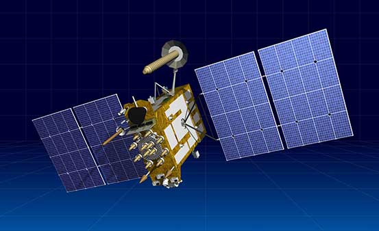
    Our orbital constellation is built upon a base of second-generation spacecraft (SC) — Glonass-M SC — that was developed in 2003 and has demonstrated outstanding operational capacity: 14 SC are already operating well beyond their expected lifetimes, and four SC celebrate their 13th birthday in orbit this year. Activities focused on improving GLONASS accuracy have not stopped for a single day.

    If we go back to 2014, the SC-based ranging offset (which specialists refer as equivalent ranging deviation) was 1.4 m. We managed to achieve 0.9 m offset on Jan. 30, 2020, and during the same week the offset did not exceed 1.15 m. Furthermore, the penultimate series-produced Glonass-M SC (Cosmos-2545), which was launched on March 30, demonstrated basic service ranging accuracy of 0.38 m on a daily interval and 0.63 m accuracy on the “best week” interval.

    Glonass-K No. 15 was launched into orbit on Oct. 25. (Photo: Roscosmos)
    Glonass-K No. 15 was launched into orbit on Oct. 25. (Photo: Roscosmos)

    It was Glonass-M SC development that enabled users around the world to gain access to the first dual-frequency navigation service, which is necessary for decreasing the effects of the ionosphere on navigation accuracy.

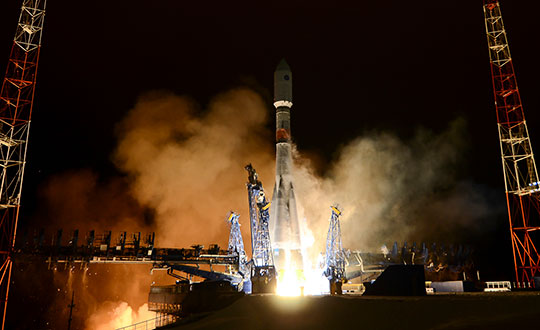
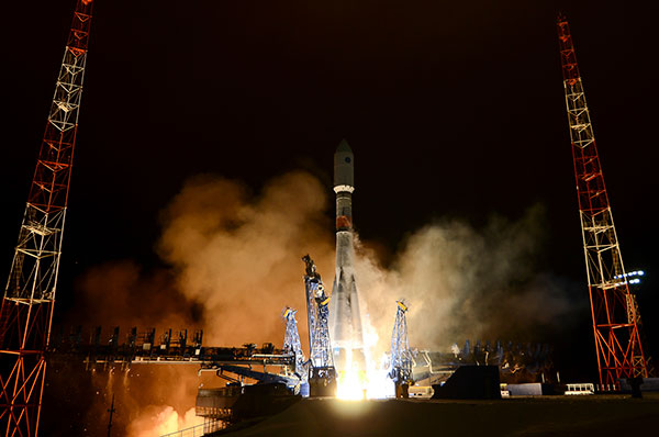
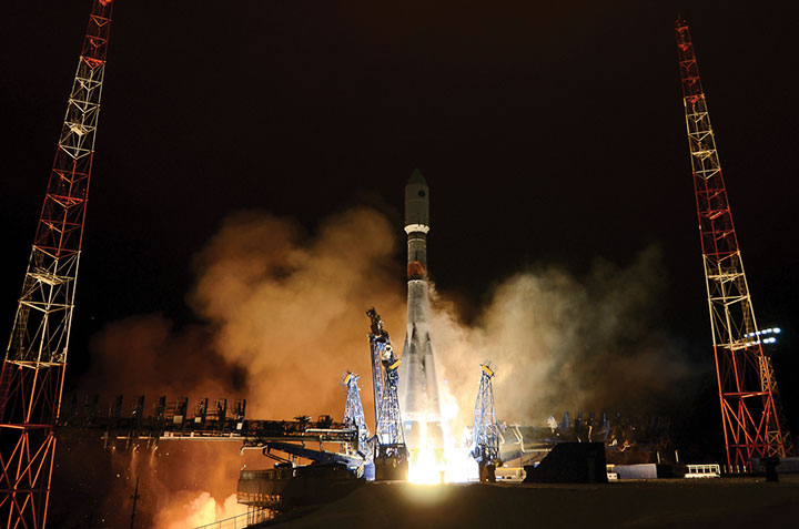
    The third generation of GLONASS SC — Glonass-K  — was successfully launched from the Plesetsk launch site on Oct. 25. This SC will provide users with a broader range of capabilities — and a more accurate and informative signal in the L3 frequency band. Further gradual rejuvenation of the GLONASS constellation will ensure the ever-improving quality of our navigation services.

    Two Glonass-K2 SC are planned for the launch campaign in 2021, and all the experience accumulated during the development of third-generation GLONASS SC (Glonass-K) will be implemented in the fourth-generation SС. Glonass -K2 is a unique SC: It will provide users with five navigation signals, its accuracy will be within 0.3–0.5 m, and its assured expected lifetime will be at least 10 years.

    High-Orbit Space Complex

    GLONASS developers remain focused on user requirements. Recent surveys show a growing demand for high-quality navigation services in difficult conditions where the SC is visible at more than 25° above the horizon. To satisfy these needs with the implementation of new CDMA signals, development of the GLONASS High-Orbit Space Complex (HOSC) will begin in 2021. Its first SC will be launched in 2025, and complete deployment of the constellation including six SC in three or six planes will be finished by the end of 2027.

    As a result, the accuracy and availability of navigation in difficult conditions will improve in the Eastern Hemisphere. But the major anticipated outcome of the HOSC implementation is assured two-fold coverage of the Northeastern segment of the globe with high-accuracy differential navigation data by GLONASS and other GNSS.

    HOSC implementation will ensure 25% navigation accuracy improvement over the Eastern hemisphere. Glonass-K SC will be used as a base platform for HASC deployment due to its excellent record.

    Ground Control at the Titov Main Test Space Center established a stable telemetry connection with the new satellite shortly after launch. (Photo: Roscosmos)
    Ground Control at the Titov Main Test Space Center established a stable telemetry connection with the new satellite shortly after launch. (Photo: Roscosmos)

    User Interface Harmony

    One of the most important tasks for the year 2020 is harmonization of the GLONASS user interface. As we already mentioned, the signal propagation environment has a strong effect on navigation accuracy; therefore, new issues of GLONASS Interface Control Documents (ICD) are being prepared for publication.

    We anticipate that GLONASS end-user accuracy improvement will be achieved through introducing additional information into reserve bits of navigation frames, including relevant parameters of an ionospheric model.

    The ICD will contain operating methods with parameters of the ionospheric model and definite recommendations designed for compensation of ionospheric delays by both single-frequency and dual-frequency receivers, as well as generalized methods for compensating for tropospheric delays.

    Changes in the ICD concerning FDMA and CDMA signals will ensure backward compatibility and uninterrupted operation for the existing range of user navigation equipment.

  • Russia adds to GLONASS constellation with latest launch

    Russia adds to GLONASS constellation with latest launch

    Russia launched a new-generation Glonass-K satellite, number 15, into orbit Oct. 25. Unlike its Glonass-M predecessors, Glonass-K satellites carry two types of navigation signals — frequency-separated and code-separated. The satellites emit additional code-division L2 navigation signals.

    In addition to their main functions, Glonass-K satellites will transmit information from the Cospas-Sarsat international search-and-rescue system. Additional Glonass-K satellites are in production at ISS Reshetnev, all with a domestic electronic component base.

    Russia’s Aerospace Forces (VKS) Space Forces launched the satellite aboard a Soyuz-2 rocket from the Plesetsk cosmodrome in the Arkhangelsk region. The launch of the carrier rocket and the maneuvering of the spacecraft into the orbit took place under normal operating conditions, according to Roscosmos.

    Two minutes after the launch, the ground-based automated control complex of the Titov Main Testing Space Center acquired the Soyuz-2. On schedule, the Glonass-K satellite was injected into the target orbit by the Fregat upper stage and taken over by the ground-based facilities of the VKS Space Forces.

    Photo: Roscosmos
    Photo: Roscosmos

    A stable telemetric connection has been established and maintained with spacecraft. The onboard systems of the Glonass-K spacecraft are operating normally.

    GLONASS consists of 28 spacecraft, with 24 active, two in reserve, and one Glonass-K undergoing flight tests. Another spacecraft is temporarily out for maintenance.

    Glonass-M satellites form the basis of the system’s orbital grouping. Replacing the orbital constellation with Glonass-K spacecraft will ensure the stable operation of the Russian navigation system and increase the accuracy of its navigation determinations up to tens of centimeters.

    According to Roscosmos, Glonass-K spacecraft are constructed in an unpressurized design, have a guaranteed period of active existence in orbit increased to 10 years, reduced energy consumption, and significantly lower weight.

    Photo: Roscosmos
    Photo: Roscosmos
  • Russia tests new GLONASS-guided missile

    Russia tests new GLONASS-guided missile

    Photo: Russia Ministry of Defense
    Photo: Russia Ministry of Defense

    The Russian Defense Ministry has tested new ammunition for its Tornado-S missile system, which is delivered via the multiple launch rocket system (MLRS), reports Russian newspaper Izvestia. Tornado-S is an ultra-long-range missile with a previous flight.

    The new MLRS is equipped with GLONASS signal reception equipment and an automated guidance and fire control system. The operator can enter coordinates into the system and give the command to set the guides and open fire. In addition, the system can itself receive and process information from reconnaissance vehicles and drones. For each missile, both range and azimuth angle can be set. The MLRS can launch 12 missile at once.

    Previously, the declared flight range of the Tornado-S missiles was about 120 km. Distance with the new ammunition was not disclosed, but the goal was 200 km. The main feature of the missiles is the ability to turn on the target after launch.

    The Russian Army was expected to receive 30+ Tornado MLRS this year.

  • 30 years of GNSS and the surveyor

    30 years of GNSS and the surveyor

    Photo: Ed Koziarski for GPS World
    Photo: Ed Koziarski for GPS World

    Depending on your age, 30 years represents a varying opinion of time. For some, it may seem like forever; for others, it may be a blink of an eye. In respect to technology, it can represent a complete change in the way we do things.

    When we turned the calendar page to January 1990, our world had yet to experience the internet, the Hubble telescope had not been deployed to share its fantastic views, and The Simpsons television series was preparing to become the cartoon juggernaut it remains today.

    Yes, lots has changed since 1990, and surveying is no exception.

    Most professions look back through their history and see various periods where discoveries and inventions revolutionized how the work was completed.

    For surveyors, the past 30 years have contained more advancements than all other years combined, with the greatest achievement being the global navigation satellite system (GNSS). With the United States leading the way with its Global Positioning System and the civilian ability to use this measuring system, modern surveying was forever changed.

    Solar and lunar observations replaced

    Before the implementation of a satellite navigation system, true global navigation was only computed using solar and lunar readings under specific conditions. GPS provided a new frontier for surveyors to establish positions without having to perform traversing from known points or collecting solar/lunar observations.

    As the constellation grew, it became easier to use GPS to gain initialization for accurate and redundant position determination. As processor speeds and data storage capability increased, real-time kinematic (RTK) observations became the norm for surveyors everywhere.

    The Russian satellite constellation, GLONASS, began operating fully in the late 1990s, and is now included to create today’s GNSS. More satellites provide more coverage, which in turn means more data collection potential.

    Many nations and regions are building their own constellations to augment the current GNSS lineup, and also to safeguard the ability to obtain geographic locations when other systems are not available.

    Bathymetric surveys made easy

    GNSS capability and integration revolutionized several aspects of surveying, including a new and more reliable way of performing bathymetric surveys over large bodies of water. Computerized depth sounders were programmed to coincide readings with GNSS data collection to provide a more accurate and precise method of hydrographic surveying.

    The past decade has continued the reliance on GNSS technology with many more devices and applications — not just for the surveyor, but for the public as well. While surveyors are using GNSS receivers on unmanned vehicles such as UAVs and boats, satellite navigation has infiltrated into many of our everyday routines. Cellphones, fitness trackers and our automobiles use this technology to guide us to our destinations.

    Surveyors have used the GNSS revolution to create a digital world for better data collection, asset management and increased efficiency. Much has changed in 30 years for the surveyor and the world around us, so we should not be surprised about what technology will bring us next.

  • Random recollections of GPS/GNSS

    Random recollections of GPS/GNSS

    2000: An Allstar OEM receiver. (Photo: NovAtel)
    2000: An Allstar OEM receiver. (Photo: NovAtel)

    GPS had been around for about five years before first launch in February 1978 and Full Operational Capability (FOC) was eventually declared in April 1995. It takes time to develop, field and prove something as complex as the world’s first satellite navigation system. But we’re now well into a third generation of the venerable GPS, with GLONASS, Galileo, BeiDou and IRNSS/NavIC and QZSS around the world and in geographic locales. So, putting aside Transit or anything else, this would make GPS about 47 years old — heading into middle age.

    Therefore, it would seem that Glen Gibbons waited until “this GPS thingy” looked like it might actually work — circa 1990 — to launch GPS World, since the magazine is now 30 years old and is also into its third-generation of editor-custodians! Alan Cameron bravely carried the flag after Glen and nurtured the magazine for a good number of years and brought me into the fold as a contributor. We shared ION GNSS conventions and GPS World Leadership dinners and he was able to cajole monthly articles out of me for many years. Now Marty Whitford has his hand firmly on the tiller as publisher, with Tracy Cozzens as senior editor.

    So what went down during these decades of technological advancement and for many of the people in the satnav industry? It would be impossible to answer within my word-limit, so I’ll take on an extremely small subset and recount a few things I can still remember.

    µGPS. I got into GPS around 1990 in an OEM board-level product spin-off program from a certified GPS airborne receiver at CMC in Montreal — we initally called that L1 receiver µGPS because then it was a small GPS board. Later it became known as the AllStar receiver. We found pretty neat applications for the early ’90s — golf-course systems, vehicle tracking, airport vehicle tracking, the start of vehicle nav systems and such.

    At NovAtel in Calgary in the early ’90s, we watched things develop through L1/L2 dual frequency, began RTK market applications in survey, geographic information systems (GIS), agriculture, mining and all multitudes of attempts to get new companies off the ground.

    2013: NovAtel’s WAAS G-II reference receiver. (Photo: NovAtel)
    2013: NovAtel’s WAAS G-II reference receiver. (Photo: NovAtel)

    WAAS. Eventually the U.S. Wide-Area Augmentation System (WAAS) program came and swallowed us up through three different prime contractors. Once that Federal Aviation Administration program was running well, we were into programs in Europe, Japan, India and China, and that led into Galileo ground reference receivers. The software qualification work we did on Galileo positioned us to take on mil-spec receiver work, and even anti-jam products.

    Then CMC bought NovAtel, and we also joined with CMC to develop a certified airborne receiver. In 2003, NovAtel bought the AllStar OEM product line from CMC — funny how things work out! The joint certified receiver program eventually resulted in a new generation of high-accuracy airborne sensors. We again changed hands in 2007 when Hexagon bought us, and then NovAtel began working closely with Hexagon subsidiary Leica on survey applications. Many new and interesting developments are still going on there.

    Nowadays, my interests lie with assisted GNSS and with Rx Networks in Vancouver, which I support and advise. Assisted GNSS comes in many forms, has many avenues in the marketplace, and presents its own unique challenges.

    As GPS has evolved into GNSS and into so many, many applications, companies have come and gone but the core of people who drive the industry has grown and acquired new and specialized skills, developing ever more capable technology and products. Even after 47 years of the industry and 30 years of GPS World, we aren’t anywhere close to done.

  • Javad Ashjaee, founder of Javad GNSS, succumbs to coronavirus

    Javad Ashjaee, founder of Javad GNSS, succumbs to coronavirus

    Javad Ashjaee (Photo: Javad GNSS)
    Javad Ashjaee (Photo: Javad GNSS)

    Javad Ashjaee, founder of Javad GNSS, has died in Moscow, Russia. He died on May 30 after a three-week fight with COVID-19.

    The news was first reported by a family member on social media. Ashjaee was born in 1949.

    “It is with heavy hearts that we share the news of the passing of our founder Javad Ashjaee, a GPS/GNSS pioneer and visionary, on the morning of May 30, 2020, due to COVID-19 in Moscow, Russia,” reports a statement on the JAVAD GNSS website.

    The website continues, “Over the course of 37 years, Javad made an incredible and far-reaching impact in the GNSS community. He pioneered the world’s most advanced GNSS technology through a multi-national effort that combined GPS and GLONASS and established more than a quarter century of partnership between Silicon Valley and Moscow. He was always proud of this ‘success story of cooperation.’ Javad was a true industry disrupter long before the term and concept became popular. His whole way of doing business was challenging and disrupting to the status quo.”

    Read more about Ashjaee in his own words on the Javad GNSS website, where he describes the founding of his company:

    “In 1998 I founded Javad Positioning Systems (JPS) and introduced Legacy, Odyssey and Regency products, followed by HiPer. It was a 76-channel geodetic receiver. Other companies later copied HiPer. Today, many of GNSS receivers look like it. I sold JPS to Topcon, who changed its name to Topcon Positioning System and is a very successful company.

    “In 2007, after my obligations to Topcon ended and according to the provisions of our agreement, I founded Javad GNSS and introduced Triumph products. These were 216-channel receivers, integrated with several communication channels. We also introduced their Alpha, Delta, and Sigma versions. We were again the first to offer European Galileo and Japanese QZSS tracking in mass production. Triumph technology has been shown to have the best signal quality and best multipath reduction capabilities against all others tested by the German Aerospace. We also introduced GLONASS inter-channel (group/carrier delay) calibration to 0.2 millimeter which made GLONASS FDMA as good as GPS CDMA. Javad GNSS is growing fast and gaining market share.”


    Articles, insight provided by Ashjaee to GPS World

    June 2011, p. 60, “How GPS and GLONASS Got Together — and Other Recent Events
    December 2012, p. 30, “Dealing with Interference: A Proactive Approach for More Efficient Spectrum Use
    January 2018, p. 8, “What is the biggest challenge facing designers of multi-constellation GNSS receivers today?
    February 2019, p. 40, “The Key to Accuracy for High-Precision Applications


    More on Ashjaee throughout the years


    A word from Ashjaee’s nephew

    Ashjaee’s nephew Sol Adibnejad provided this biography on his uncle via social media:

    Javad was born in 1949 in Qom, Iran. After finishing his bachelor’s degree in electronic physics from the University of Teheran in Iran, he left Iran in 1972 to continue his education at the University of Iowa and got his graduate degrees, a doctorate in 1976. He went back to his native country Iran to teach at the university. He became the chairman of the Department of Computer Engineering at the Aryamehr University of Technology where he founded and managed a UNIVAC-100 computer centre. There, he created the first Iranian microprocessor lab. In 1978 he created one of the earliest student online and interactive registration systems in the world. In a few years and after the 1978 revolution and the political turmoil, things happened and he had to flee the country in 1981.

    He went straight back to the U.S. and started the next chapter of his journey in life which led to the pioneering of GPS. He spent the rest of his life designing and manufacturing of many generations of his GPS and JPS products at JAVAD GNSS, JAVAD ArWest and JAVAD EMS in the Silicon Valley. Javad Ashjaee is listed as the primary inventor in 102 granted patents, the last one in April 2020.

    Products: http://javad.com/jgnss/javad/news/pr20111228.html
    Inventions: https://patents.justia.com/inventor/javad-ashjaee
    Early life: http://archive.amerisurv.com/PDF/Professional_Surveyor_Magazine_Javad_Interview.pdf

    Below is his post on Facebook.

  • Skycatch system provides in-the-field UAV maps

    The Edge1 system by Skycatch is a combination GNSS base station and drone data-processing unit that delivers high-accuracy maps and point clouds in minutes.

    The high-performance built-in Nvidia TX2 Mobile GPU enables both maps and point-cloud processing locally within 30 minutes, as well as running artificial intelligence (AI) tasks in real time.

    The base station of the Edge1 uses a Swift Navigation dual-frequency GNSS real-time kinematic (RTK) receiver. The receiver supports signals from GPS, GLONASS, BeiDou and Galileo, enabling reliably fast centimeter-level accuracy globally even in remote locations, with reliable 5-centimeter accuracy.

    Users of the Edge1 system can process and receive their maps in the field, without the need for internet connectivity to process data. The system automatically generates 2D maps and 3D data, with the capability to download and use them in Skycatch’s Data Hub, as well as commonly used programs like Civil 3D, BIM360 and others.

  • David Plus GNSS receiver applied in intelligent forklift

    David Plus GNSS receiver applied in intelligent forklift

    Image: Tersus GNSS
    Image: Tersus GNSS

    With the development of intelligent shipping ports, many port-related tools — gantry cranes, loaders and forklifts — can be made autonomous and controlled automatically. These applications use GNSS to obtain positioning and orientation data for machine operators.

    In traditional container-intensive terminals, forklift drivers spend a lot of time locating the designated goods; operating the forklift itself requires highly experienced drivers. Tersus GNSS offers a positioning and orientation solution that can greatly reduce the need for experienced drivers, improve the port’s operational efficiency, reduce error rates and improve accuracy.

    Installed on an autonomous forklift, a David Plus receiver and anti-interference GNSS dual antenna calculates positioning solutions, enabling operators to locate exactly where the target goods are and guide the forklift to them via the quickest, most convenient routes.

    The David Plus’s compact design can be easily installed on even small forklifts without affecting normal operation. The David Plus obtains high-precision positioning and orientation values by connecting via wireless to an Ntrip network, and then forwards corrections to the port-dispatching system as raw data.

    The David Plus supports GPS L1/L2, GLONASS L1/L2 and BeiDou B1/B2 from the primary antenna, and GPS L1/GLONASS L1 or GPS L1/BeiDou B1 from the secondary antenna. Its 384 channels can capture numerous satellite signals within a short time.

    Image: Tersus GNSS
    Image: Tersus GNSS

    With an IP67-rated enclosure, the David Plus GNSS receiver is built for outdoor environments such as shipping ports. A palm-sized unit, it can be easily integrated with various application systems. As a backup data-saving measure, 4 gigabytes of built-in memory record data for post-processing.

    A manned forklift can benefit from the positioning data. When the forklift reaches the designated position in the stack, the heading antenna will calculate the correct lift height of the forklift arm. This provides a suitable height for handling the cargo, and prevents accidents such as the cargo falling.

    For a fully autonomous forklift, the system will automatically analyze the orientation data and lift the forklift arm to the corresponding height of the cargo. It will then retrieve and lower the cargo to a safe height, and automatically drive it to the new storage point. During this process, additional infrared obstacle avoidance sensors can accurately identify the distance between the forklift and the cargo, avoiding inadvertent collisions.

    The positioning and orientation data obtained by the David Plus can be shared with third-party software and hardware. For instance, port terminal systems can configure containers to capture distribution information and instructions. By importing the positioning information of the forklift equipped with David Plus into the system in real time, it is possible to calculate the optimal driving trajectory to the final cargo delivery point.

    The Tersus David Plus positioning and orientation solution can combine its own high-precision positioning and orientation data with other automation system hardware and software to form a complete forklift unmanned/manned automated driving and handling solution.

  • Seen & Heard: Karma drone down, GLONASS guides missiles

    Seen & Heard: Karma drone down, GLONASS guides missiles

    “Seen & Heard” is a monthly feature of GPS World magazine, traveling the world to capture interesting and unusual news stories involving the GNSS/PNT industry.


    Photo: Karma drone/GoPro
    Photo: Karma drone/GoPro

    Bad karma

    The GoPro Karma drone has been grounded since the new year began, reports The Verge. Multiple owners say their Karma controllers are flashing errors about not receiving a GPS signal, and that they can’t calibrate the compass. They’re not able to fly the drones even after disabling GPS. A GoPro spokesperson told The Verge that it is “actively troubleshooting” the issue.


    Going wild at the casino

    A Waze ad in January misdirected drivers headed to Atlantic City’s Borgata Hotel Casino & Spa into New Jersey’s Pine Barrens. Jackson Township police helped numerous motorists stuck on unpaved roads about 45 miles from the casino, which is just off the Atlantic City Expressway. The address on the ad was correct, but the location pinned with the ad is actually in the Colliers Mills wildlife area.


    Photo: Rock penguins/Charles Bergman/Shutterstock.com
    Photo: Rock penguins/Charles Bergman/Shutterstock.com

    Feed the birds, not the mice

    Irish structural engineer John Houston used a Trimble R10 GNSS receiver and Centerpoint RTX to help mitigate a serious threat to Gough Island’s birds. The Royal Society for the Protection of Birds seeks to eradicate invasive mice left from 19th-century ships. The survey will help locate temporary infrastructure for workers to distribute poisoned bait to kill the voracious rodents, which feed on two million defenseless eggs and chicks each year. Though 1,000 kilometers from the nearest reference station, Houston achieved centimeter accuracy on all survey points. See the monster mice here.


    Photo: U.S. Marines at Al Asad Air Base in 2018. (Cpl. Jered T. Stone/Marine Corps)
    Photo: U.S. Marines at Al Asad Air Base in 2018. (Cpl. Jered T. Stone/Marine Corps)

    Missiles guided by GLONASS

    According to Israeli military intelligence website DEBKAfile, Russia gave Iran access to GLONASS to target the U.S. base in Iraq on Jan. 8. The strike injured 34 American soldiers. DEBKAfile reports that Russia-provided GLONASS access allowed Iranian missiles to hit with an accuracy of 10 meters at the Ain Assad base in western Iraq. “According to Russian sources, 19 missiles were fired from the territory of Iran, 17 of which hit the targets,” DEBKAfile said.

  • GLONASS company to build 27 more satellites

    GLONASS company to build 27 more satellites

    Artist's rendering of a Glonass-K satellite. (Image: ISS-Reshetnev)
    Artist’s rendering of a Glonass-K satellite. (Image: ISS-Reshetnev)

    ISS-Reshetnev Company — the primary GLONASS contractor — has a backlog of orders for navigation satellites up to 2025, according to General Director Nikolay Testoyedov.

    Testoyedov discussed GLONASS production on Dec. 30, 2019, at a meeting hosted by ISS-Reshetnev Company for Russia’s Science and Technical Council.

    “Within the Federal Target Program, GLONASS ISS-Reshetnev Company is tasked with the production of 27 navigation satellites,” Testoyedov said. “Taking all things together, we plan to double the number of satellites launched in 2020 compared to 2019.”

    The orders require production at full capacity at the company’s facilities. At any given time, about 50 satellites are in varying stages of production, including 12 ground spares. Some of them are slated for launch in 2020.

    In 2019 eight satellites designed and built by the company were launched into various orbits. As of today,  104 ISS-Reshetnev-made satellites are in space, or two-thirds of Russia’s entire orbital fleet of satellites. ISS-Reshetnev also successfully completed several projects for the manufacture of satellite onboard systems and instruments, including the international ExoMars-2020 program slated to launch this year.

    Glonass-M satellite goes into service

    The Glonass-M navigation satellite launched on Dec. 11, 2019, entered service Jan. 13.

    A joint team of experts representing ISS-Reshetnev Company and the operating organization successfully completed all procedures moving the Glonass-M satellite to its proper orbital position, and switched on its main instruments. To this date, all the required data has been received from the satellite, which allowed it to be commissioned into service.

    The new Glonass-M replaced a retired satellite of the GLONASS constellation that had surpassed its designed life expectancy by seven years.

  • Seen & Heard: Pedestrian safety, canoe tracking

    Seen & Heard: Pedestrian safety, canoe tracking

    “Seen & Heard” is a monthly feature of GPS World magazine, traveling the world to capture interesting and unusual news stories involving the GNSS/PNT industry.


    Keeping canoeists afloat

    The United Kingdom’s Hire a Canoe company has installed Kinesis trackers on its fleet to manage transport of clients to and from their water sport activities. Real-time traffic updates and live Estimated Time of Arrival calculations help manage riverside customer pickup, while advanced geofencing provides instant notification if a canoe, kayak or paddle board leaves a defined zone during off hours.


    Moscow historical district. (Photo: poludziber/iStock Editorial/Getty Images Plus)
    Moscow historical district. (Photo: poludziber/iStock Editorial/Getty Images Plus)

    Glonass aims for pedestrian safety

    Russian company Glonass is investing RUB 4–5 million in a mobile application aimed at pedestrian safety, reports Telecompaper. The app will warn pedestrians using smartphones and headphones of approaching cars, based on an AI collecting data from smart traffic lights. Tests will take place in 2020 in the Samara, Volgograd, Tomsk, Kursk, Tambov and Moscow regions.


    Image: Vladimir Obradovic/iStock/Getty Images Plus
    Image: Vladimir Obradovic/iStock/Getty Images Plus

    GPS spoofing service

    Virtual private network (VPN) Surfshark has added GPS Spoofing to its Android VPN. The new optional feature allows users to shield their online presence from unsolicited tracking by giving them the ability to change their device’s physical GPS location. The new feature is for “privacy conscious people” who want “to keep their physical location information only to themselves.” Instead of the user’s location, the app provides one of the Surfshark VPN server locations.


    Image: Skytruth
    Image: Skytruth

    ‘Spoofing circles’ appear in China

    “GPS spoofing circles” have been discovered at 20 locations along the Chinese coast, according to the non-profit environmental group Skytruth. Of the locations observed, 16 were oil terminals; the others were corporate and government offices. The spoofing in Shanghai resulted in reported positions from ships, fitness trackers and other GPS-enabled devices forming circles some distance from the shore — a phenomenon first observed by the non-profit C4ADS. Professor Todd Humphreys briefed the phenomena at an Institute of Navigation conference in September, and MIT Technology Review published an article about it in November 2019.

  • Directions 2020: GLONASS focuses on users

    Directions 2020: GLONASS focuses on users

    Yury Urlichich, First Deputy Director General, Roscosmos. (Photo: Roscosmos)
    Yury Urlichich, First Deputy Director General, Roscosmos. (Photo: Roscosmos)

    By Yury Urlichich, First Deputy Director General of ROSCOMOS State Space Corporation
    Sergey Karutin, Designer General of GLONASS
    Nikolay Testoedov, Director General, Information Satellite Systems

    Roscosmos keeps concentrating on user needs as it did in previous years. Growing digitalization is driving a high demand for high-accuracy navigation services. Space information technologies support user needs by modern digital services, including increasing accuracy of position and velocity determination. Because of this, it is of vital importance for us to ensure that GLONASS provides continuous services and stable performance.

    Figure 1. Mature Glonass-M satellites show improved cesium frequency standards performance in terms of daily stability. (Image: Roscosmos)
    Figure 1. Mature Glonass-M satellites show improved cesium frequency standards performance in terms of daily stability. (Image: Roscosmos)

    Performance Standard & ICD

    This year, we finished drafting the GLONASS Open Service Performance Standard (GLONASS OS PS; the Russian language version is available). In 2020, the new version of the GLONASS Interface Control Document (ICD) also will be publicly available.

    GLONASS OS PS serves as a high-level mainframe document specifying the values of the achieved GLONASS performance characteristics plus the significant guaranteed margin. These, coupled with the signal reception environment and a priori estimation of user equipment performance characteristics, can further be translated into the performance that an end user can expect to achieve in his specific PVT solution.

    This GLONASS OS PS is a basis for certification of GLONASS services and development of lower level standards for user receiver and GLONASS-based service, as well as for development of international standards like those of the International Civil Aviation Organization (ICAO), the International Maritime Organization (IMO) and others.

    Use of the unified set of performance parameters and calculation methods for all GNSS — GLONASS, GPS, Galileo and BDS — is a conventional practice. The similar standards for GPS, Galileo and BDS have been published and are regularly updated.
    In fact, this GLONASS OS PS is the second one after the ICD baseline interface between GLONASS and user receiver manufacturers and the GLONASS-based services developers. The OS PS establishes the minimum performance that can be achieved by users with a high level of trust based on the system’s long-term statistical history.

    Signal-in-Space. This OS PS specifies standards for the GLONASS OS Signal-in-Space (SIS) performance neglecting receiver biases, signal propagation and reception biases (in terms of performance metrics used to specify system performance, that is, taking into account the GLONASS space segment and the GLONASS ground segment contributions to the performance). It can serve as a basis for certification of the GLONASS-based services and receivers incorporating GLONASS, including those used in aviation and other user domains.

    The OS PS provides an overview of the GLONASS system and an overview of the GLONASS Open Service SIS. It specifies the standards for the performance characteristics of the channel of standard accuracy used to provide the Open Service, and lists the legal reference documents.

    L3 CDMA. One of the most significant tasks is the harmonization of GLONASS user interfaces with respect to new L3 CDMA signals. The requirements related to the interface between the space segment of GLONASS and the navigation user segment for radio frequency links is established by the GLONASS ICDs.

    The new version of ICD for CDMA L1, L2 and L3 signals to be broadcast by new-generation Glonass-K2 satellites was issued in 2016. However, the Glonass-M satellites (## 755-758) and the Glonass-K satellites currently in orbit transmit the L3 signal as per the L3 Open Access CDMA Radionavigation Signal Interface Control Document (Edition 1) of 2011.

    In order to mitigate the above-mentioned discrepancies, five reference documents (Interface Control Documents for open-access signals) have been updated and prepared for publication. In addition, flight tests to verify new ionospheric and tropospheric delay models have been scheduled.

    Incorporating More Data

    The new ICDs for open access and authorized signals incorporate changes related to the introduction of additional data into the spare bits of the navigation message. This additional data is to be used by user receivers for better PVT solution purposes.

    The updated versions of ICDs will incorporate:

    • The mathematical ionospheric delay model and inclusion of the model parameter into the navigation message.
    • The mathematical tropospheric delay model, which does not require that any specific parameters be included into the navigation message. It only employs data on the latitude of a user receiver location and the season (i.e., winter, spring, summer, and autumn).
    • The attribute (or flag) to inform a user that a satellite is in the turn mode and its antenna phase center behavior is different from that when a satellite is in the sun orientation mode.
    • Information about the types of signals broadcast on the L1, L2, and L3 frequencies; 5-bit field, in which the first three bits denote L1, L2, and L3 CDMA signals, respectively, while the 4th and the 5th bits denote L1 and L2 FDMA signals, respectively.
    • A 5-bit field to be used to broadcast age of data (AOD) for time offsets in addition to the similar field used to broadcast AOD for ephemerides.

    Backward Compatibility. The updated CDMA and FDMA ICDs will support the backward compatibility for the uninterrupted operation of the existing envelope of user equipment and the introduction of the ionospheric and tropospheric model parameters into the message spare capacity.

    Constellation Refresh

    The GLONASS constellation has been replenished steadily. Since 2013, we have been launching one to two satellites a year, and this year is not an exception. The launch on May 27 and the December launch will help sustain the nominal constellation. The Glonass-M satellites demonstrate good dynamics for the average operational life. Two satellites are well beyond their 10-year design life — their operational lifetime has exceeded 12 years. As some of the Glonass-M satellites grow older, their cesium frequency standards performance in terms of daily stability improves (see Figure 1).

    Glonass-K. In 2020, the launch campaign for the Glonass-M satellites will come to its end. The Glonass-K satellites will come on stage with the first launch of Glonass-K-15 scheduled for the beginning of the next year. We are fully confident that this satellite will not disappoint our users.