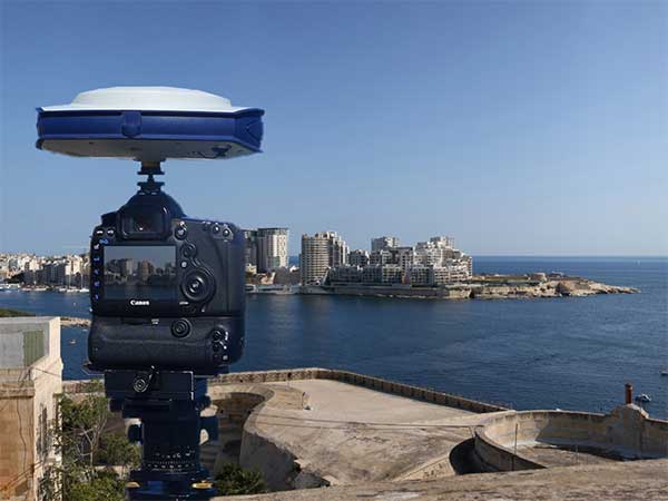
Phase One Industrial, a provider of medium-format metric cameras and imaging solutions for aerial applications, has signed an agreement with AI-Survey GmbH, a developer of UAS survey packages, services and tailor-made solutions.
Together, the companies’ high-end products are opening up opportunities in drone-based high-accuracy mapping and inspection markets, the companies said.
Under this agreement, AI-Survey will support Phase One Industrial’s iXM range of cameras in the UAV market for high-accuracy mapping and inspection. AI-Survey offers fast and efficient, simple and reliable UAS solutions tailored for geodesists with millimetre imaging results.
“Our cameras exemplify AI-Survey’s mission to optimize, increase efficiency and inspire UAV mapping and inspection missions,”said Dov Kalinski, CEO, Phase One Industrial. “As an industry leader, we are confident that they will help our strategic efforts to evolve the industry through innovative solutions using Phase One Industrial technology.”
“We have developed long-term relationships and collaborations with many global technology partners, like Phase One Industrial,” said Carsten Rudolph, managing director, AI-Survey explains. “As an independent solutions provider, with such a large international network at our disposal, we are free to offer the best possible solutions to meet our customer needs and achieve their required accuracies. With Phase One iXM cameras, we now have the best global sensor for UAV mapping available, we believe.”
Highly accurate, UK city-wide 3D models are now available to view and download from Bluesky’s online Mapshop.
The geographically accurate, photo-realistic MetroVista mesh models are available in a variety of formats ready for use in 3D GIS, CAD and other modelling software as well as visualisation, gaming and Virtual Reality workflows.
Captured using Leica’s large-format imagery and lidar hybrid airborne sensor and generated in Skyline’s PhotoMesh software, the Bluesky MetroVista datasets of major UK cities are available online offering a compelling alternative to traditional photogrammetrically produced models.
Now in America. In December, Bluesky launched its 3D data capture programme in the United States. The MetroVista product suite allows high-resolution imagery, both vertical and oblique, to be captured simultaneously with high-accuracy, wide-scale 3D data using an advanced Leica camera, the CityMapper. Specifically designed for 3D city modeling and urban mapping, the system includes a traditional vertical camera as well as survey-grade oblique cameras.
The CityMapper also includes high-performance lidar technology to accurately collect elevation data — even in shadows that are common in urban environments and can make photo-based collection difficult.
“Since launching in the UK the MetroVista product range has received enormous offline interest from sectors such as infrastructure and building development, risk assessment, telecommunications and environmental mapping,” said Rachel Tidmarsh, managing director of Bluesky. “By making the data easy to access and consume via our online Mapshop, we hope to increase the take up from traditional users of 3D models and encourage applications such as smart city management, autonomous vehicle testing, virtual reality experiences and gaming.”
Two seasons in the UK
Bluesky has been capturing MetroVista data in the UK for two flying seasons. Visitors to Bluesky’s Mapshop will initially be able to select an area and download MetroVista mesh models of London, Birmingham and Cambridge with other UK and U.S. cities coming online in the future.
Data can be supplied in a variety of proprietary and open source formats including OBJ, FBX, I3s and 3DML for use in Skyline’s TerraExplorer product suite.
The Bluesky Mapshop also offers complete nationwide coverage of aerial photography from multiple epochs, 3D models, lidar data, thermal mapping and Bluesky’s National Tree Map. Blueskymapshop.com is easy to use and purchasing of data is simple, straightforward and secure. Account options are also available and data can be purchased with a range of easy to understand licence options, including the option of a Sub Contractor Licence.
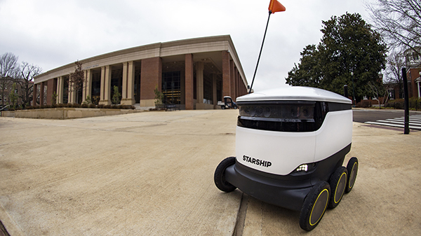
Photo: Christian Johnson/University of Mississippi
As University of Mississippi (UM) students resume classes for the spring semester, they are sharing the campus’ sidewalks with a fleet of robots that can deliver meals at the push of a button.
Starship Technologies has launched robot food delivery services at the university, the first in the Southeastern Conference to have autonomous delivery robots.
Beginning Jan. 22, Ole Miss students, faculty and staff can access the Starship Deliveries app (iOS and Android) to order food and drinks to be delivered anywhere on campus, within minutes from any of the 30 robots serving UM. The service will work in conjunction with student meal plans.
“Ole Miss Dining is focused on the continued utilization of advanced technology to enrich the student, faculty and staff dining experience,” said Chip Burr, resident district manager of Ole Miss Dining Services. “We are excited about the expansion of our mobile ordering operation and the new opportunities this partnership creates.”
The robots use a combination of sophisticated machine learning, artificial intelligence and sensors to travel on sidewalks and navigate around obstacles. The computer vision-based navigation helps the robots to map their environment to the nearest inch. They can cross streets, climb curbs, travel at night and operate in both rain and snow.
A team of humans also can monitor their progress remotely and take control if needed.
By making food and drink more accessible, the Starship robots save time and reduce stress, aiming to make the busy lives of the Ole Miss community a little easier, Burr said.
Items can be ordered from Starbucks, Chick-fil-A, McAlister’s, Panda Express, Which Wich, Qdoba, Einstein Bros. Bagels, Raising Cane’s, Steak ‘n Shake, Freshii, Papa John’s and Sambazon. After choosing their items, users select their location by dropping a pin on the campus map where they want their food delivered.
The app allows users to watch the robot’s journey in real time through an interactive map. Once the robot arrives, the user will receive an alert and can meet the robot and unlock it through the app.
The delivery usually takes just minutes, depending on the menu items ordered and the distance the robot must travel. The robots can carry up to 20 pounds.
Starship Technologies operates commercially on a daily basis around the world. Its robots have traveled more than 350,000 miles and completed 100,000 autonomous deliveries.
“We’re honored to be able to help make lives a little bit easier for Rebels across the Ole Miss campus by offering the world’s leading autonomous delivery service,” said Ryan Tuohy, senior vice president of business development at Starship. “Whether it’s getting breakfast delivered in the morning or having a late-night snack, our robots are here to serve students, faculty and staff at all times of the day.”
“Seen & Heard” is a monthly feature of GPS World magazine, traveling the world to capture interesting and unusual news stories involving the GNSS/PNT industry.
Keeping canoeists afloat
The United Kingdom’s Hire a Canoe company has installed Kinesis trackers on its fleet to manage transport of clients to and from their water sport activities. Real-time traffic updates and live Estimated Time of Arrival calculations help manage riverside customer pickup, while advanced geofencing provides instant notification if a canoe, kayak or paddle board leaves a defined zone during off hours.
Russian company Glonass is investing RUB 4–5 million in a mobile application aimed at pedestrian safety, reports Telecompaper. The app will warn pedestrians using smartphones and headphones of approaching cars, based on an AI collecting data from smart traffic lights. Tests will take place in 2020 in the Samara, Volgograd, Tomsk, Kursk, Tambov and Moscow regions.
Image: Vladimir Obradovic/iStock/Getty Images Plus
GPS spoofing service
Virtual private network (VPN) Surfshark has added GPS Spoofing to its Android VPN. The new optional feature allows users to shield their online presence from unsolicited tracking by giving them the ability to change their device’s physical GPS location. The new feature is for “privacy conscious people” who want “to keep their physical location information only to themselves.” Instead of the user’s location, the app provides one of the Surfshark VPN server locations.
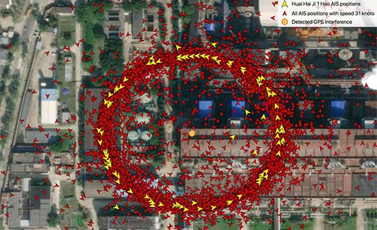
Image: Skytruth
‘Spoofing circles’ appear in China
“GPS spoofing circles” have been discovered at 20 locations along the Chinese coast, according to the non-profit environmental group Skytruth. Of the locations observed, 16 were oil terminals; the others were corporate and government offices. The spoofing in Shanghai resulted in reported positions from ships, fitness trackers and other GPS-enabled devices forming circles some distance from the shore — a phenomenon first observed by the non-profit C4ADS. Professor Todd Humphreys briefed the phenomena at an Institute of Navigation conference in September, and MIT Technology Review published an article about it in November 2019.
The HT1 is a slim, light, powerful “Android Enterprise Recommended” tablet
Photo: Janam
Janam Technologies, a provider of rugged mobile computers that capture data and communicate wirelessly, has introduced a powerful and advanced 8-inch rugged tablet. The HT1 is designed to improve line of business applications including put-away and replenishment, cross docking, shipping and receiving, inventory management, merchandising and clientele management.
Besides a stylish design paired with military-grade ruggedness, the HT1 offers dual-frequency GNSS using the u-blox M8 chip. It can provide accuracy within three feet in open skies and 15 feet in denser environments.
Janam introduced the tablet at the National Retail Federation Annual Conference and Expo (NRF 2020), taking place Jan. 11-14 in New York City.
As part of Google’s Android Enterprise Recommended (AER) program, Janam’s HT1 completed rigorous testing and is guaranteed to meet the most demanding enterprise-level requirements. AER certification also ensures a seamless deployment, familiar user experience and secure managed updates to deliver immediate improvements in productivity.
HT1 Facts
The HT1 rugged tablet provides latest-generation speed and performance and is purpose-built to thrive in any industry including retail, warehousing, manufacturing, field service, transportation, construction, law enforcement, hospitality and other tough work environments.
As a rugged tablet running Android 9 (with ability to be upgraded to future generations of Android) in Google’s AER program, the HT1 delivers a premium experience for mobile workers. Timely security updates extend the HT1’s product lifecycle while providing IT teams with more control to keep business-critical data safe and secure.
With LTE speeds up to three times faster than most 4G LTE devices, advanced Wi-Fi and Bluetooth technology, Janam’s HT1 provides robust connectivity and lightning-fast voice and data inside four walls and out on the road.
The versatile HT1 features a 14-pin pogo connector to easily attach accessories such as Janam’s optional 2D imager module to provide high-performance scanning of printed and mobile barcodes. High-resolution front and rear cameras provide HT1 users with additional data capture support for proof-of-delivery, proof-of-condition, proof-of-service and more.
Sealed to IP67 standards, the HT1 provides reliable operation in the rain, snow or dust. It is MIL-STD-810G certified to withstand tumbles, vibration, ballistic shocks and repeated drops to concrete across a wide temperature range.
Equipped with an 8200 mAh hot-swappable and rechargeable battery, as well as a low-power Qualcomm octa-core processor with efficiency-boosting features, the HT1 provides all-day battery life for uninterrupted usage and maximum productivity.
A standard two-year warranty provides customers with both peace of mind and the level of service they expect, at no additional cost, with optional comprehensive service plans available to those that want to further extend their mobile computing investment.
Carlson Software has released its Scan2K Laser Scanner, a versatile, fast, easy-to-use solution for the creation of accurate 3D survey data up to a range of 2K (2,000) meters. Carlson introduced the product at the Pennsylvania Society of Land Surveyors’ 2020 Conference.
Carlson’s Bradley Husack, Special Projects Engineer, and Michael Hyman, Regional Director with the Scan2K at the Pennsylvania Society of Land Surveyors’ conference. (Photo: Carlson)
Built with surveyors in mind, the Scan2K is at home in the field with its weather-proof housing, user-friendly sunlight-visible touch screen interface with simple, menu-driven operations for quickly collecting and georeferencing point cloud data. With an integrated high-resolution camera, inclinometers, a compass, and an L1 GNSS receiver, the Scan2K can be deployed in many environments and orientations, including mobile operations.
Carlson’s partner on the Scan2K project is Teledyne Optech, a world leader in 3D survey systems. Carlson will be the exclusive global distributor of the OEM Scan2K solution.
“The Scan2K addresses the diverse range of applications for a laser scanner in the surveying and mining industries,” said Bradley Husack, a Special Projects Engineer at Carlson. “Carlson is bringing to market an all-in-one solution that now leads the market in versatility, speed, and value.”
The Carlson Scan2K has a simple, sunlight-visible touchscreen interface. (Photo: Carlson)
Beyond its impressive 2,000 meter range, the Scan2K also has short- and medium-range modes, as well as the capability to record over 500,000 points per second, all within the chosen scanning target window.
Additionally, each laser pulse from the Scan2K records up to four returns, providing the capability to record the first return for a blocking object (such as a leaf) as well as the last return for an object behind it (such as a wall), and the versatility to exclude one or the other.
The Carlson Scan2K comes bundled with ATLAScan software, a powerful yet simple solution for registering the point cloud, as well as Carlson Point Cloud Advanced for feature extraction into Carlson’s suite of CAD office products.
The Scan2K comes ready to be equipped with an additional external camera, an external GNSS receiver, or for mobile operation.
Whether on a tripod, a vehicle, or another moving platform, the performance offered by the Scan2K easily makes it a versatile terrestrial laser scanner for the market.
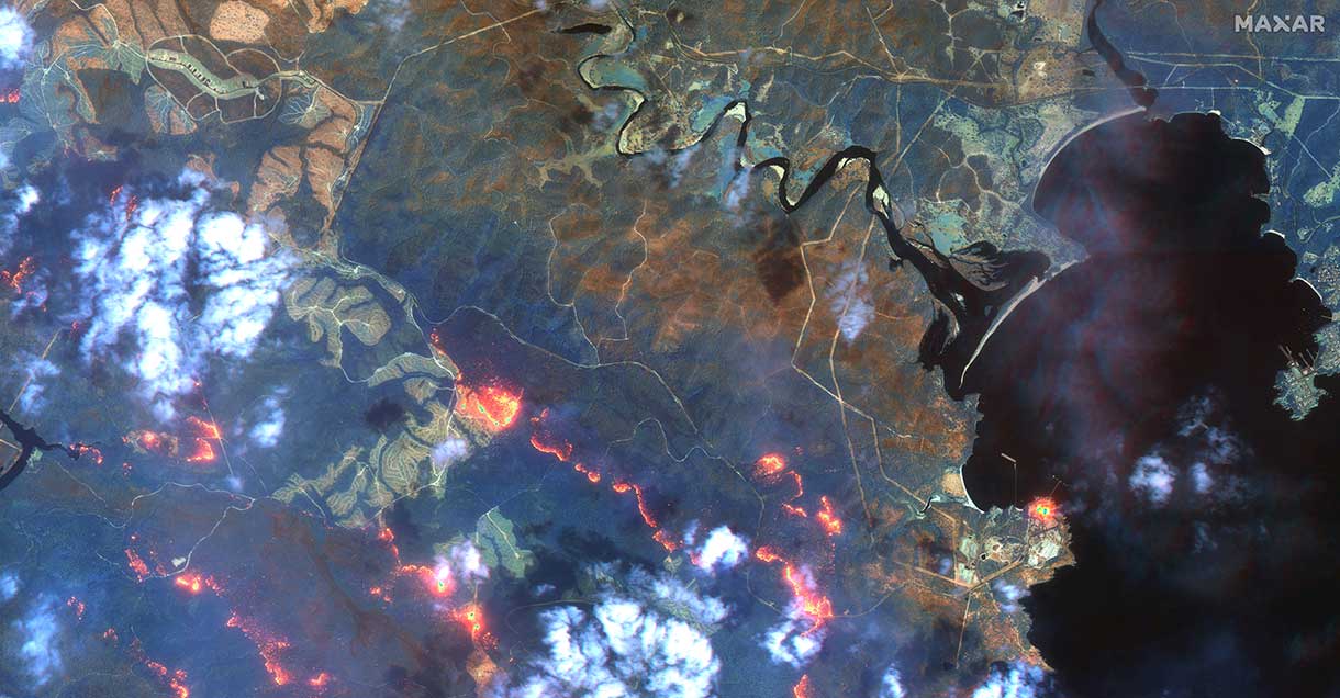
The months-long wildfires raging in Australia have killed at least 25 people. Millions — possibly 1 billion — animals have died. More than 2,000 houses have been destroyed. Around 150 fires are still burning in New South Wales and Queensland, with hot and dry conditions accompanied by strong winds fueling to the fires’ spread.
With this conflagration rocking the continent down under, satellite imagery has become important to understanding the scope of the disaster. Here are some of the recent captures.
As seen from the ISS
“Talking to my crew mates, we realized that none of us had ever seen fires at such terrifying scale,” European Space Agency astronaut Luca Parmitano tweeted on Monday, sharing photos taken from the International Space Station.
The astronaut posted images showing what he described as “an immense ash cloud” captured at the time the ISS was flying toward sunset.
An immense ash cloud covers Australia as we fly toward the sunset.
Another social media image, shared widely, was interpreted as a map showing the live extent of fire spread, with large sections of the populous eastern coastline molten red. Because of widespread misinterpretation, the original poster then explained that the image was a 3D visualization and not a photograph of Australia, and showed some areas where fires have been extinguished.
NASA and the U.S. Geological Survey’s Landsat 8 satellite imagery from Jan. 9 shows Kangaroo Island, home to nature reserves. The images were taken using the Operational Land Imager (OLI) on Landsat 8. Using natural-color observations, the images show burned land and thick smoke covering the island, of which at least 156,000 hectares have burned.
Photo: NASA/USGS
The U.S. National Oceanic and Atmospheric Administration (NOAA) satellites are also capturing images, including the resulting plumes of smoke.
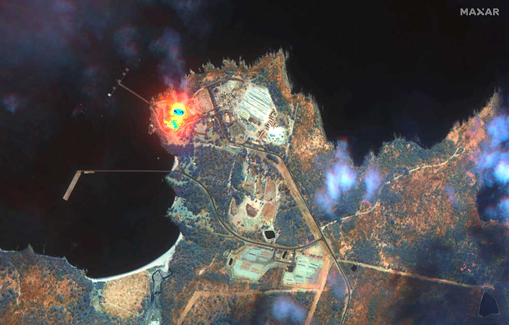
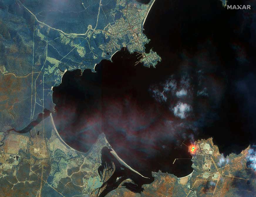
Maxar collected satellite imagery Jan. 12 of the wildfires in New South Wales (NSW). The imagery shown below focuses on the area near the town of Eden, and demonstrates the value of the shortwave infrared (SWIR) sensor.
In an image taken with Maxar’s normal RGB color imagery, the smoky air prevents a clear view of the fires and the hot spots. With Maxar’s WorldView-3 satellite, however, the team is able to penetrate through the smoke using its SWIR sensor for a detailed look at the fire lines and burned vegetation.
With SWIR imagery, burning areas are apparent and show up in a glowing orange-red. Healthy vegetation shows up in shades of blue, and burned vegetation appears in shades of brown.
Satellite Photo: :ESA
Copernicus Sentinel-3 imagery
Europe’s Copernicus Sentinel-3 mission has captured the multiple bushfires burning across Australia’s east coast.
In the above image, captured on Nov. 12, 2019, at 23:15 UTC (Nov. 13, 09:15 local time), the fires burning near the coast are visible. Plumes of smoke can be seen drifting east over the Tasman Sea. Hazardous air quality owing to the smoke haze has reached the cities of Sydney and Brisbane.
Flame retardant was dropped in some of Sydney’s suburbs as bushfires approached the city center, and many residents were evacuated. Firefighters continue to keep the blazes under control.
The Copernicus Emergency Management Service – Mapping was activated to help respond to the fires. The service uses satellite observations to help civil protection authorities and, in cases of disaster, the international humanitarian community, respond to emergencies.
Quantifying and monitoring fires is fundamental for the ongoing study of climate, as they have a significant impact on global atmospheric emissions. Data from the Copernicus Sentinel-3 World Fire Atlas shows that there were almost five times as many wildfires in August 2019 compared to August 2018.
A roundup of recent products in the GNSS and inertial positioning industry from the January 2020 issue of GPS World magazine.
OEM
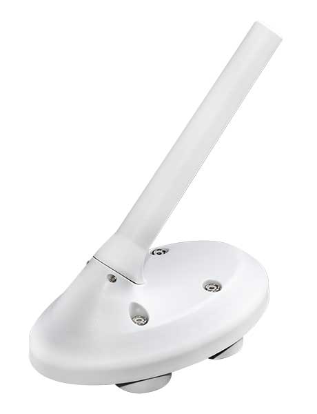
Heavy-duty antenna
For challenging environments
AT311 antenna. (Photo: CHC Navigation)
The heavy-duty CHCNAV AT311T is designed for demanding applications subject to shocks and vibrations. With advanced filtering and robust signal tracking, it provides survey-grade GNSS signals to enhance position reliability for marine applications, machine control, precision agriculture and industrial automation. Features include multi-constellation GNSS tracking using GPS, GLONASS, BeiDou, Galileo, QZSS, IRNSS and SBAS. Its IP68 water-resistant design makes it safe to use in extreme conditions with a wide temperature range (–40° C to +85° C). Its internal stacked structure enhances performance in high-interference environments, and the 40-dB signal gains, advanced signal filtering and multipath rejection design provide superior and robust GNSS signal tracking in challenging surroundings.
The UAS1 GNSS receiver module has been designed for UAV/UAS applications requiring centimeter accuracy in a small package.(Photo: Trimble)
The UAS1 compact, high-precision GNSS board was designed for unmanned aerial systems (UAS). It allows UAS system integrators to add upgradeable GNSS-based positioning using rugged connectors and Trimble’s software interface. Its 336-channel GNSS engine is capable of tracking L1/L2 frequencies from GPS, GLONASS, Galileo and BeiDou for centimeter-level, real-time kinematic (RTK) positioning. The compact board provides capabilities from high-accuracy GPS-only to full GNSS features. The receiver supports fault detection and exclusion (FDE) and receiver autonomous integrity monitoring (RAIM). System integrators also have the ability to detect interference with an RF spectrum monitoring and analysis tool embedded in the receiver.
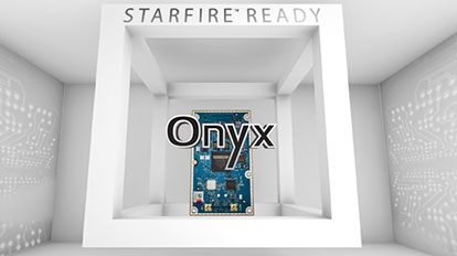
The Onyx multi-frequency GNSS OEM board offers integrated StarFire/real-time kinematic (RTK) GNSS capabilities. It features 255-channel tracking, including multi-constellation support for GPS, GLONASS, BeiDou and Galileo. It provides high performance in GNSS receiver sensitivity and signal tracking as well as patented multipath mitigation, interference rejection and anti-jamming capabilities. Through software options, the Onyx ,allows upgrades from free differential GPS signal sources such as WAAS, to increased accuracy services such as StarFire and RTK Extend. The software-enabled features are sold in bundles, but can also be purchased individually to suit changing application needs.
The OSA 5401 and OSA 5405 now enable power utility and broadcast networks to achieve sub-microsecond synchronization. (Photo: Business Wire)
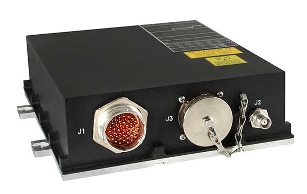
The OSA 5401 and OSA 5405 upgraded PTP grandmaster clocks deliver precise, robust timing in a compact form factor. Oscilloquartz PTP timing technology enables power utility and broadcast networks to achieve sub-microsecond synchronization. The pluggable OSA 5401 is a small PTP grandmaster clock, and the OSA 5405 is an integrated PTP grandmaster with dual GNSS antenna and receiver. With spoofing and jamming detection capabilities, they also provide high availability. The OSA 5401 and 5405 provide new levels of accuracy and resilience for infrastructure and support emerging bandwidth-intensive, latency-sensitive applications. With sub-microsecond synchronization, smart grids can perform flexible, real-time decision making, as well as monitoring and automated maintenance. The OSA 5401 and OSA 5405 comply with the latest PTP profiles for time, frequency and phase synchronization in both power utility and broadcast networks. These include the IEC/IEEE 61850-9-3 Power Utility Profile for precise time distribution and clock synchronization in electrical grids with an accuracy of 1μs, and SMPTE 2059 for synchronizing video and audio equipment over packet networks.
The SBAS-capable CMA-5024 GPS has received U.S. Federal Aviation Administration (FAA) approval for installation on Boeing 737 Next-Generation aircraft. It enables B737NGs to comply with worldwide ADS-B Out mandates as well as SBAS/GPS navigation, enabling the first localizer performance with vertical guidance (LPV) approaches for B737NGs. The CMA-5024 GPS is a cost-effective alternative to replace a multi-mode receiver (MMR). The approved DO-260B ADS-B Out positioning source can be paired with any DO-260B compliant transponder, allowing operators to meet FAA and EASA ADS-B Out requirements, the UAE’s ADS-B Out and RNP requirements mandated by GCAA as well as India’s GAGAN requirements.
The U.S. Federal Aviation Administration (FAA) has approved the VTU-20 automatic dependent surveillance – broadcast (ADS-B) transmitter for airport surface management. Adhering to the performance and design assurance specifications of FAA-E-3032, the externally mounted VTU-20 ensures integration and interoperability with Airport Surface Detection Equipment, Model X (ASDE-X), Airport Surface Surveillance Capability (ASSC) and ADS-B receiver surveillance solutions for airport. The VTU-20 can be permanently or magnetically mounted to all airside vehicles, including utility, emergency, snow-removal and maintenance equipment. Each vehicle is clearly and uniquely identified, providing an essential addition to any surface movement guidance and control system.
Skyward’s Advanced Airspace Intelligence drone airspace maps provide airspace data combined with essential ground intelligence including 3D views of key structures, transmission lines, and more than a million vertical obstacles. The platform also provides access to LAANC, the Low Altitude Authorization and Notification Capability program provided by the U.S. Federal Aviation Administration. Data available for situational awareness includes vertical structure obstacles, power lines, airports, runways, national parks, stadiums, hospitals and schools.
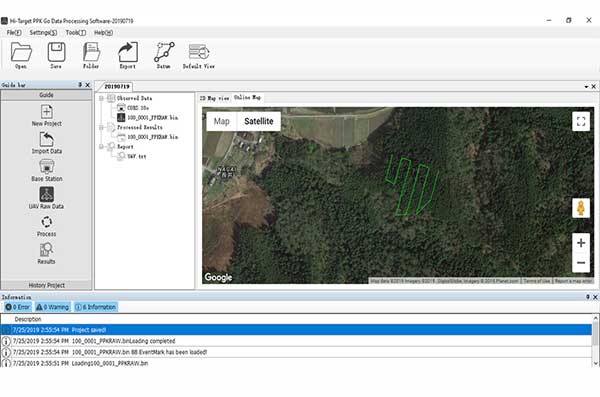
Hi-Target PPK GO precision add-on enables Phantom 4 RTK drones to achieve the accurate and reliable camera positioning data in any coordinate system without measure targets or ground control points. With 2-centimeter accuracies on XYZ, the output text file with position information or geotagged images can be used directly in major photogrammetric mapping or 3D survey software. The add-on allows selection of GPS/GLONASS/Beidou/ Galileo L1+L2+L5 and further parameter adjustments for position calculation in the PPK process to ensure the most reliable and accurate camera positioning even in poor single satellite system signals.
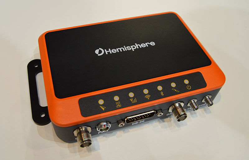
The R620 GNSS receiver is a complete refresh of Hemisphere’s previous version, the R330. (Photo: Allison Barwacz)
The next-generation R620 receiver is designed for land and marine applications requiring high-precision positioning. It is a complete refresh of the previous version (R330) and has a new low-profile ruggedized enclosure. Customers can start with sub-meter positioning accuracy and upgrade the receiver through activations and subscriptions to add functionality and improve performance capability to centimeter-level accuracy. Powered by the Vega series, the R620 GNSS receiver processes and supports more than 1,100 channels. It simultaneously tracks GPS, GLONASS, BeiDou (including Phase 3), Galileo, QZSS, IRNSS, SBAS and Atlas L-band corrections. It has status LEDs , a powerful WebUI, UHF (400-MHz and 900-MHz) radio, cellular modem, Bluetooth, Wi-Fi, Ethernet (including power over Ethernet), CAN, serial and USB.
For land surveying and geospatial information systems (GIS)
Photo: Geneq
The rugged SXPad 1500 data collector features an alphanumeric keypad and long-range Bluetooth, and was designed to meet the rigorous IP67 standard for challenging field conditions. It has a 5-inch sunlight-readable touchscreen. The SXPad 1500 can be connected to any GNSS receiver or compatible robotic total station. Driven by a 1-GHz processor and the Windows Mobile 6.5 operating system, providing the power to work with maps and large data sets in the field. Its integrated cellular modem and Wi-Fi provides wireless connectivity for internet access and GIS data transfer — helpful for configuring a real-time kinematic (RTK)-compatible GNSS receiver. Equipped with an internal memory of 1 GB (memory can be expanded to 16 GB with an SD card), the SXPad 1500 provides enough storage space for data recording. Its high-performance lithium battery allows uninterrupted field operation for up to eight hours.
The LT700H RTK Android tablet is designed to increase efficiency and productivity of the mobile field workforce in applications requiring centimeter-to-decimeter positioning accuracy. Portable, rugged and versatile, the LT700H enables precision GIS data collection, forensic mapping, construction site layout, environmental surveys, landscaping and earthmoving jobs. Powered by 184-channel high-performance GPS, GLONASS, Galileo and BeiDou module and a superior tracking GNSS helical antenna, the LT700H provides position availability in demanding environments. Its integrated 4G modem ensures seamless communication from field-to-office and robust connectivity to RTK correction networks.
The Trimble Alloy GNSS reference receiver now supports BeiDou Generation III (BDS-3) signals. This will enable operators to meet the ongoing demand from surveyors, mapping professionals and precision farmers for accurate, reliable corrections derived from real-time networks. Released in 2018, the Alloy has the processing power needed for high-quality data from multiple constellations. Alloy version 5.42 firmware tracks all available and planned GPS Block IIIA L1C and BDS-3 signals.
Hexagon showcased the Leica DSX utility detection solution at Intergeo 2019. (Photo: Allison Barwacz)
The Leica DSX utility detection solution can be used together with Leica GPS/GNSS systems to generate highly accurate, georeferenced maps. The DSX uncovers utilities for repair and maintenance, civil engineering and surveying projects. The ground-penetrating radar system includes portable hardware and software that automates data analysis and creates a 3D utility map.
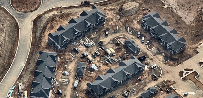
Aerial imagery company Nearmap has acquired technology and assets from Pushpin, a deep learning and analytics technology company that extracts data from 3D models to provide roof geometry insights to a variety of sectors including roofing, solar and government.
The technology acquisition allows Nearmap to rapidly extract and disseminate roof geometry from its wide-scale 3D models and offer a new form of location content to its customers.
‘‘By acquiring Pushpin’s 3D geometry extraction technology and pairing it with our rich data, we bring the best of both worlds together at unprecedented scale’’ said Rob Newman, Nearmap CEO. “Over the past couple of years, we’ve evolved our offering from 2D imagery to a multi-product portfolio, and this acquisition is an important milestone in our approach to continue adding new content types for our customers. This addition aides our company mission by providing 3D geometry data at unmatched speed, thereby changing the way our customers perform their work.”
With this new technology, Nearmap can provide a semi-automated calculation and extracted representation of any roof geometry within an hour, significantly reducing turnaround time. The combination of Nearmap’s 3D content and Pushpin’s geometry extraction technology opens up a diverse range of use cases, enabling businesses to fast-track job estimation, determine solar irradiance, plan drone delivery routes and model 5G propagation.
“The addition of Pushpin’s 3D geometry extraction technology into our large-scale 3D reality models will enable us to further evolve our offering and produce at scale roofing geometry,” said Tom Celinski, Executive Vice President, Technology and Engineering at Nearmap. “With the added ability to provide roof geometry data, we will be able to provide even deeper insights on what’s happening on the ground, and help businesses and government organizations transform the way they work and do their job more efficiently.”
The roofing and solar industries are poised for significant growth. Currently, 1% of the United States population has solar panels on their homes. According to the Solar Energy Industry Association (SEIA), total U.S. solar capacity will more than double over the next 5 years.
Additionally, a significant number of U.S. residential homes have their roofs replaced every year due to roof damaging storms and changes in roofing trends and material. This new product offering from Nearmap is poised to significantly impact these markets, as companies are expanding their use of technology to assist with tasks such as roof material and project quoting through reports, project management through roofing specific software, and customized sales and marketing tools for the roofing industry.
Verified photomontages for UNESCO World Heritage sites achieves accuracy with Spectra Geospatial SP80
Verified photomontage is an important planning tool to envision how proposed surrounding development plans would affect UNESCO World Heritage sites. Verified photomontage demands the best accuracy for the best visualization to determine what a development may look like to a person standing at the photographic viewpoint.
For MS Environmental (MSE), selected to provide verified photomontage for multiple UNESCO World Heritage sites, including in the UK Royal Botanical Gardens at Kew and the City of Bath, the Spectra Geospatial SP80 GNSS receiver enabled the highest quality visualization.
“The one-centimeter accuracy delivered by the SP80 is essential,” said Mike Spence, a verified photomontage specialist and founder of MSE. “The highest level of accuracy in the relationship between the actual camera location and the 3D model camera gives confidence in the visualization. In addition, The SP80 offers both simplicity and a robust design though it’s taken a few knocks over the years, it gives us the confidence we can use the equipment anywhere in the world and get the best results.”
At Kew Gardens, MSE was commissioned to produce accurate visualizations of views from within the UNESCO World Heritage Site. There was concern about development proposals for tall tower blocks in west London and how these might affect historic views from Kew Gardens.
The work culminated in a public inquiry, where evidence was presented that showed how views would change as a result of the proposed development. “Without the level of accuracy provided by the SP80 together with a transparent technical methodology it would have been unclear precisely how these historic views would change,” Mike Spence said.
At the UNESCO World Heritage City of Bath, the Bath and North East Somerset Council commissioned MSE to produce technical photography from strategic views around the World Heritage City to show how development proposals would affect strategic views across the city.
A roundup of recent products in the GNSS and inertial positioning industry from the November 2019 issue of GPS World magazine.
SURVEYING & MAPPING
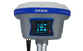
IMU-RTK receiver
Increases GNSS availability and reliability
Photo: CHC Navigation
The i90 IMU-RTK GNSS series receiver is designed to dramatically increase GNSS real-time kinematic (RTK) availability and reliability. The i90 is powered by the company’s latest inertial measurement unit (IMU) and RTK technology to provide robust and accurate GNSS positioning in any circumstances. Unlike standard micro-electro-mechanical (MEMS)-based GNSS receivers, the i90 GNSS IMU-RTK combines a high-end calibration and interference-free IMU sensor with a state-of-the-art GNSS RTK engine and advanced GNSS tracking capabilities. The i90 is designed to increase the productivity and reliability of survey projects, with no complicated calibration process, rotation, leveling or accessories are necessary. A few meters’ walk will initialize the i90 internal IMU sensor and enable RTK survey in difficult field environments. The i90 GNSS automatic pole-tilt compensation boosts survey and stakeout speed by up to 20%.
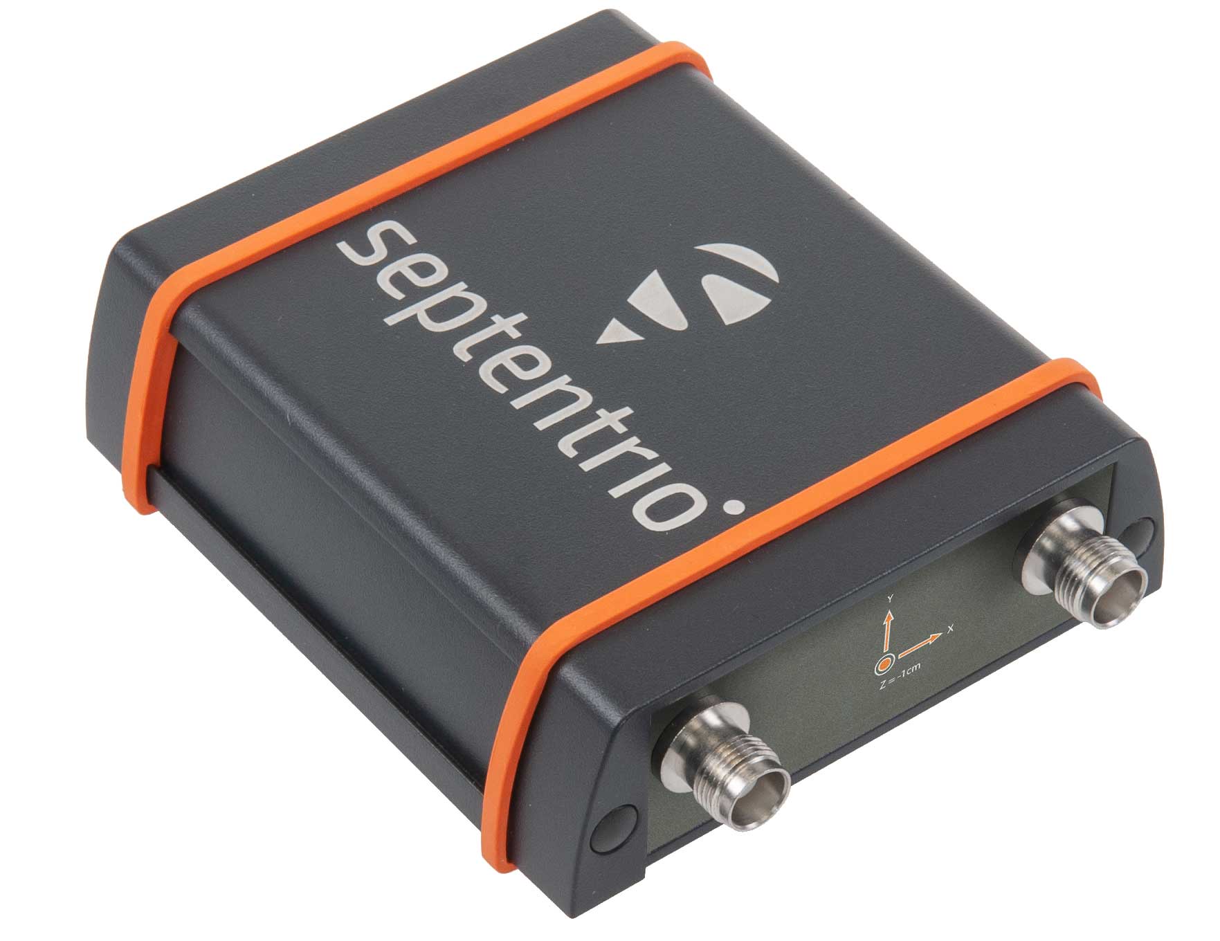
Both accurate and rugged for machine control, logistics
The AsteRX-SBi has a rugged housing, making it suitable for machine control and other outdoor uses. (Photo: Septentrio)
Septentrio has expanded its GNSS/INS portfolio with the AsteRx SBi, a new housed GNSS/INS receiver. The ruggedized AsteRx SBi fuses high-accuracy GPS/GNSS with a high-performance inertial sensor to provide reliable positioning and 3D orientation for machine control and logistic applications. Within its rugged, waterproof enclosure, a high-performance GPS/GNSS is coupled with an industrial-grade inertial sensor to provide high-accuracy, reliable positioning and 3D orientation (heading, pitch, roll). Offering the flexibility of either single or dual antenna, the AsteRx SBi is designed for quick and easy integration into any machine monitoring or control system. Reliable location and 3D orientation data is streamed with a high update rate and constant low latency. Septentrio’s reliable centimeter-level positioning is based on true multi-frequency, multi-constellation GNSS (GPS, GLONASS, Galileo, BeiDou, QZSS) technology.
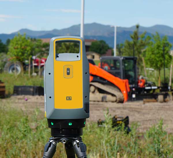
The Trimble X7 laser scanning system is designed for surveying, construction, industrial and forensic applications. It enables professionals to quickly and easily capture precise 3D scanning data to produce high-quality deliverables. The X7 features Trimble X-Drive technology, survey-grade self-leveling and a smart calibration system. It integrates streamlined workflows to provide automatic registration of point-cloud data in the field with Trimble Registration Assist, bringing scans together through self-leveling inertial measurement unit technologies and cloud-based software.
The Bluesky MetroVista range includes high-resolution imagery combined with high-accuracy, wide-scale 3D models. (Image: Bluesky)
The MetroVista city mapping service for Europe incorporates the Leica CityMapper hybrid airborne sensor designed for 3D city modeling and urban mapping. The sensor includes a vertical camera and survey-grade oblique cameras, and incorporates lidar to accurately collect elevation and infrared data. The MetroVista range includes high-resolution imagery combined with high-accuracy, wide-scale 3D models. CityMapper has already been used to capture MetroVista data for cities across the United Kingdom, including London, Manchester, Newcastle and Bristol.
The enhanced GSS9000 series GNSS constellation simulator has been updated to provide significantly improved capability, flexibility and performance to meet the test needs of high-performance navigation systems. It doubles the number of supported channels (320 in a single chassis) while maintaining its full performance specification in key areas such as signal iteration rate and low latency under maximum signal dynamics. These attributes, together with the ability to produce a comprehensive range of emulated multi-GNSS, multi-frequency RF signals, enables full and future-proofed testing of advanced applications. Greater signal flexibility is also built into the enhanced GSS9000 through its open application program interface (API) and flexible architecture. This delivers a highly sophisticated arbitrary waveform generator (AWG) capability.
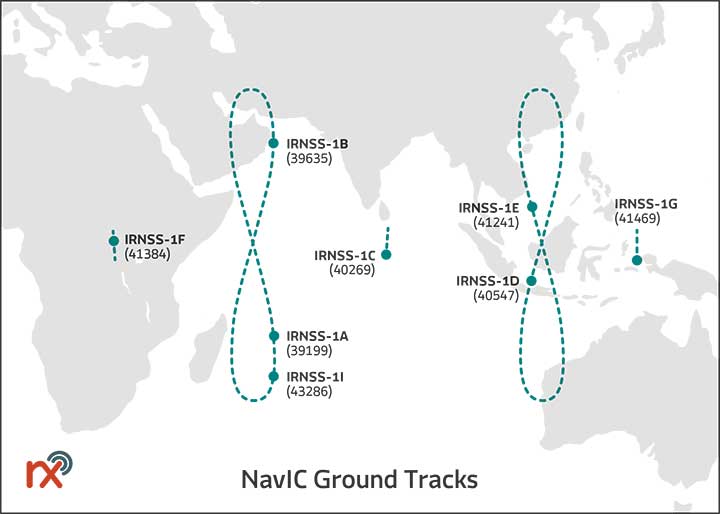
Rx Networks has added NavIC constellation support to its real-time and predicted-assistance data service. The company’s technology partners — semiconductor vendors, mass-market mobile device manufacturers and network operators — now have global support for all satellite navigation systems and L1 satellite-based augmentation systems (SBAS) for any region around the world. Used daily by more than two billion devices, Rx Networks data is delivered via ephemeris in RINEX and via the Location.io interface, with predictions in SP3. Predictions for NavIC via the Location.io platform will be added in the first quarter of 2020.
Endura micro-electro-mechanical system (MEMS) timing solutions are designed for aerospace and defense applications including precision GNSS. They provide high performance in harsh conditions such as severe shock, vibration and extreme temperature. SiTime offers customers 5 million possible part numbers that can be created from 17 programmable products. Solutions accommodate 4 parts per trillion per g force of acceleration (50 times better than quartz); support for –55° C and +125° C operation; timing specifications conforming to MIL-PRF-55310; and Endura Super-TCXOs (temperature compensated oscillators) for use in GNSS applications.
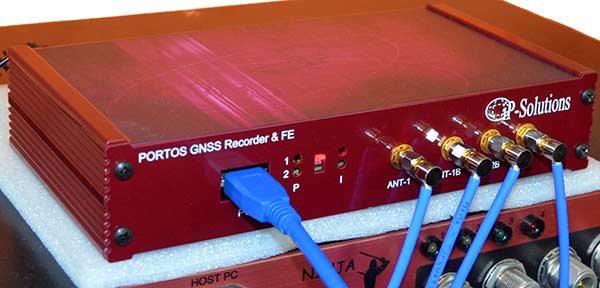
Portos Team paired with the Ninja. (Photo: IP-Solutions)
Portos Team is a new GNSS RF signal record-and-playback system. It can record and play back — or simulate —multi-frequency, multi-system GNSS signals when paired with the company’s Replicator. It can do the same for CRPA signals when paired with the company’s Ninja. The Portos itself can also operate as multi-frequency or CRPA front end for a GNSS software receiver.
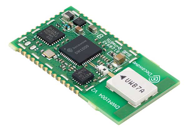
The DWM1004 module targets time difference of arrival (TDoA) tag applications that require years of battery life and a compact design. Based on the DW1000 chipset, the DWM1004C offers high-accuracy, real-time-location capability with a 6.8-Mbps data rate. It delivers more than five years of battery life. Real-time location systems (RTLS) enable managers to have a real-time view of their operations through data collected from connected objects such as tools, pallets, forklifts, badges and collars. The DW1000 is immune to multipath fading, with 2-centimeter precision in indoor environments.
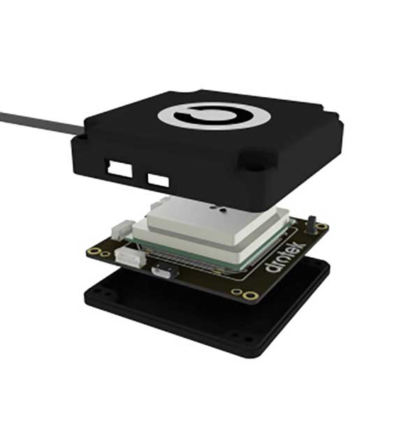
The F9P Sirius RTK GNSS rover is designed to be mounted on a moving vehicle. The u-blox ZED-F9P module inside provides 1-cm position accuracy, a convergence time under 10 seconds and a navigation update rate up to 20 Hz. The rover has a built-in active antenna patch. It receives GPS, Galileo, Beidou and GLONASS signals, providing additional accuracy. It is designed to fit most setup designs as well as integrate easily into a vehicle. Its six-pin JST-GH connector makes it plug-and-play with the Pixhawk Pro 3 autopilot.
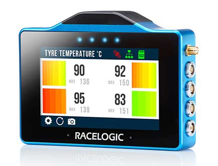
The VBOX Touch is a highly flexible GNSS datalogger with enhanced accuracy. The powerful hardware can be used diverse automotive tests such as acceleration, braking, speed verification, tire temperature monitoring, lap-timing and durability. The VBOX Touch comes preloaded with a sophisticated performance application that covers common use cases; applications can be downloaded from an online library. Racelogic can also write custom Python scripts based on customer requirements.
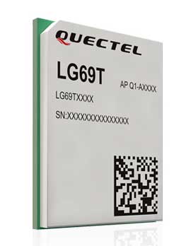
The LG69T GNSS module is an automotive-grade dual-band high-precision GNSS module that integrates dead-reckoning (DR) and real-time kinematic (RTK) technologies. The module facilitates open-sky positioning performance with an accuracy of up to 10 centimeters. It supports next-generation precision positioning capabilities for smart vehicles and autonomous driving scenarios. The LG69T module is based on ST’s STA8100GA, the latest automotive-grade dual-frequency positioning chip with 80 tracking channels and four rapid-acquisition channels compatible with GPS, BeiDou, Galileo, Navic and QZSS. The AEC-Q100-qualified dual-band module integrates multi-band RTK technology for centimeter-level accuracy. The LG69T module’s dead-reckoning capabilities feature an integrated inertial measurement unit (IMU) that provides continuous high-precision positioning.
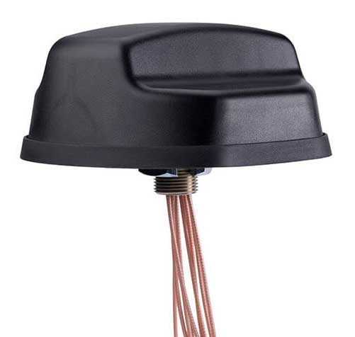
The Coach II antenna with GNSS L1/L2/L5 is designed to provide greater precision and reliability for advanced rail communications systems, enabling next-generation positive train control (PTC) and passenger Wi-Fi. The Coach II features global multi-GNSS compatibility, dual-port 4G LTE / sub-6 GHz 5G NR and 802.11ac Wi-Fi / Bluetooth connectivity. It is AAR compliant for railway applications and is IP67-rated.
Includes new automotive package for Ellipse GNSS/IMU products
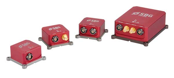
Photo: SBG Systems
New features have been added to the Ellipse product line with firmware update version 1.7. The update better answers needs of the autonomous testing and driving markets such as a CAN odometer. Users now have the choice to connect an external odometer (DMI) with pulses or use their car odometer with velocity information. New outputs include body velocity and slip angle, which calculate the drift angle between the vehicle’s assumed trajectory and its actual trajectory. For precision applications as well as low dynamics and reduced warm-up time, the new firmware allows users to run the Ellipse Kalman filter with no lever-arm estimation. This will ensure centimeter pass-to-pass accuracy for real-time kinematic (RTK) applications and allow operation in lower dynamics while reducing warm-up time. The firmware update also provides new features for advanced marine applications.
Epson has launched the Epson SureColor T3170x 24-inch wide-format wireless printer. Engineered to enhance workflow, the new model in the SureColor T-Series product line offers cartridge-free printing in a clean, space-saving design.
The new, easy-to-fill, refillable ink tanks eliminate time spent purchasing and changing ink cartridges. Ideal for low-cost POP and education posters, as well as blueprints and line drawings up to 24 inches, the SureColor T3170x produces accurate, A1/D-size prints in 34 seconds.
“This SureColor T3170x joins the popular T-Series line that delivers powerful printing solutions for many industries, including architecture, engineering, construction, creative professionals and graphic design,” said Matt Kochanowski, product manager, professional imaging, Epson America. “The new refillable ink tank design provides greater flexibility and productivity for workgroups — taking away the worry of changing ink cartridges and lowering running costs — while also delivering the advanced features and space-saving design our customers expect.”
The SureColor T3170x leverages an Epson PrecisionCore MicroTFP printhead with Precision Droplet Control to produce output with crisp lines and outstanding clarity. Whether printing from a roll or the Auto Sheet Feeder, the 4.3-inch color LCD touchscreen makes tasks simple and intuitive, and integrated wireless and Wi-Fi Direct connectivity, allows users to easily print from virtually anywhere in the office using a tablet or smartphone.
Additional product features include:
Cartridge-free printing – High-capacity ink bottles with auto-stop for easy, mess-free filling
Ultra-fast print speeds – A1/D-size prints in as fast as 34 seconds
Low running costs – Ink included in the box can print a substantial number of posters or technical drawings
Easy to operate – Large, intuitive 4.3-inch color LCD screen simplifies print tasks
Compact, clean design – Ultra-small footprint,4 and sleek, minimal design enhances workspaces; easily fits on a desktop or on its own with optional stand, sold separately
Print from virtually anywhere in the office – Easily print from tablets, smartphones and more with integrated wireless plus router-free Wi-Fi Direct printing
Outstanding image quality – PrecisionCore MicroTFP printhead with Precision Droplet Control for outstanding clarity, plus commercial-grade reliability with Nozzle Verification Technology
Versatile media handling – Accommodates rolls up to 24-inch wide and sheets up to 11”x17” through the auto sheet feeder
Precise, sharp details – Print posters, blueprints, line drawings, and more up to 2400 dpi
Easy setup – Get up and running out of the box in as quickly as 30 minutes
Availability
The SureColor T3170x 24-inch wireless printer will be available through authorized Epson Professional Imaging resellers in December 2019. The SureColor T3170x offers a standard Epson PreferredSM Limited Warranty, a one-year program that includes toll-free advanced telephone access Monday through Friday. The Epson SureColor T3170x is designed to work exclusively with Epson ink. For additional information, visit www.proimaging.epson.com.