Category: Mobile

  • Association Says Indoor Location Technology Not Ready

    Association Says Indoor Location Technology Not Ready

    Kevin Dennehy
    Kevin Dennehy

    Not everyone is talking up the accuracy of indoor positioning. Arlington, Virginia-based Telecommunications Industry Association says the technology, which is seen as the one way location-based services providers will be able to capture consumer interest, is not ready. In other LBS news, AT&T has come out with data pricing for its connected vehicle initiatives.

    In a recent FCC filing, the Telecommunications Industry Association said that indoor positioning technology is not sufficiently developed to support ongoing wireless E-911 location accuracy requirements.

    While TIA supports the FCC’s goal to improve location accuracy, “Imposing location accuracy mandates at this time would be premature, given the nascent stage of the technology that will be needed to accomplish the Commission’s objectives, and should neither favor nor disfavor specific technologies,” said the association in its filing.

    The NPRM proposes a requirement to achieve “rough” indoor location information, TIA said. It proposes to require providers to provide horizontal information for wireless 911 calls that originate indoors, specifically a caller’s location within 50 meters.

    TIA also disagrees with an FCC proposal to require mobile operators to provide z-axis, which is vertical location within 3 meters of a caller’s location, for 67 percent and 80 percent of indoor wireless 911 calls — ranging from three to five years after adoption. Again, TIA says that the technology is not fully developed.

    TIA quoted AT&T’s filing: “[The] time [is] right to begin discussing Indoor Location Accuracy for E-911” but the “FCC should be careful to ensure that any proposed rules on location accuracy are aligned with proven capabilities of the current state of technology and they should set realistic accuracy benchmarks that the industry and public safety can embrace.”

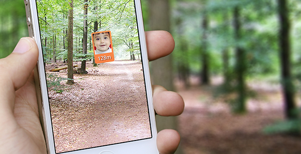
    The location industry has been counting on indoor positioning, with its beacons and Wi-Fi enhancements, to jump-start a location-based services market that always seems to have tremendous potential, but the numbers don’t back it up. Some big-time analysts have said that while the promise of indoor positioning is huge, it just isn’t there technically yet.

    In fact, one analyst said that the biggest technological breakthrough last year was indoor mapping. Such major retailers as Home Depot and Lowes launched indoor maps with product search locators. These same analysts say that indoor Wi-Fi positioning is not accurate enough for macro location.

    The big deal coming up is how FCC positioning accuracy regulations will affect beacons or Bluetooth low energy for micro location and proximity services.

    TIA said it supports initial FCC location accuracy requirements back to 2007. However, don’t ask TIA for more location regulation. “To date, the development of 911 and E911 location accuracy technologies and applications has been fostered by a voluntary and consensus-based standards process. This process has proven quite successful to date, and the Commission should refrain from imposing regulations that could slow additional development,” the association said.

    AT&T Announces Connected Car Pricing

    AT&T Mobility said standalone pricing for new LTE-enabled OnStar service will be $5 or $10 per month, depending on whether the driver is an OnStar subscriber. The company said it will allow customers, with a GM LTE-capable vehicle, to add the car as another device for $10 — which is the same price as a tablet.

    OnStar subscribers will get coverage ranging from $5 for 200 MB of data per month to $50 for 5 GB. GM is also allowing customers to buy one-time data packages.

    At this year’s CES, General Motors announced its first LTE-enabled vehicles — in which AT&T Mobility is powering the LTE network for GM’s OnStar service. The first LTE-enabled vehicles, which will be available this summer, are Impala, Spark, Volt, Orlando, Spark RV, Silverado, Silverado HD, Malibu, Equinox and Corvette Stingray. GM plans to have 30 Chevrolet, Buick, GMC and Cadillac vehicles LTE-equipped by the end of the year.

    AT&T also made recent deals to provide connectivity for Ericsson Connected Vehicle Cloud which connects to the AT&T Drive platform for automakers.

    CEA Hosts CES on the Hill

    Members of Congress and their staff had the opportunity to observe location technology during the Consumer Electronics Association’s recent CES on the Hill event in Washington. Exhibiting companies include Origo Safe, distracted driving; AT&T Drive; DashIt; Qualcomm, which showed off a geofencing product around schools; and RideScout.

    Washington-based Ridescout is a cool, and free, mobile app that allows a user to find the nearest subway, bus, taxi, bikeshare, sedan service, carshare, pedi-cab or carpool. A user can choose from a list of options by proximity, cost or arrival time.

    “We launched in November in Washington, D.C. We are in Austin, San Francisco, Boston, Chicago and planning several new markets,” said Steve Carroll, Ridescout vice president of operations.

    The app, which is on the iOS and Android platforms, generates revenue by sharing with the ride providers, large organizations and universities and the public transport network, Carroll said.

    Some of Ridescout’s partners include Mozio, RidePost, Metro of Washington, Bandwagon, Sidecar, Car2Go, Arlington Transit, Capital Bikeshare, Yellow Cab, DC Circulator and Dash.

    RideScout, founded by two Army veterans, was hatched when founder and CEO Joseph Kopser wanted an application to show him the best way to get to work in the Washington area. He could not find one and started the company with Craig Cummings. The company initially launched an alpha product at South by Southwest in 2013.

    Though it was the first to combine all modes of transportation in a single application, the company has some competition. Of course this competition is from the 800-pound location gorilla, Google.

    Google, with its Google Maps platform, shows the directions to the nearest transportation mode. Now it is incorporating Uber, which is an on-demand transportation provider.

    This is not the first time Google has launched a product in an effort to dominate a market place or niche. When it launched Google Maps in 2009, it put the hurt on many companies in the location industry, which underwent a three-year period of consolidation, company closings and layoffs.

  • McMurdo Group Completes Acquisition of Techno-Sciences

    McMurdo Group, an end-to-end search and rescue (SAR) and maritime domain awareness (MDA) company, has acquired Techno-Sciences, Inc. (TSi), a provider of SAR satellite ground stations, integrated emergency response center systems and coastal surveillance solutions. Terms of the acquisition were not disclosed. TSi’s Beltsville, Maryland, location becomes the U.S. headquarters for McMurdo Group, a division of Orolia, global specialist in critical GNSS solutions.

    TSi has been instrumental in the development of the COSPAS-SARSAT international satellite-based SAR program, which has helped to save more than 35,000 lives worldwide since 1982. TSi is also actively involved in the next-generation COSPAS-SARSAT system, MEOSAR (Medium Earth Orbit Search and Rescue), which will greatly improve the existing SAR process with near-instantaneous detection, identification and location of emergency distress beacons.

    MEOSAR, currently in its demonstration and evaluation phase, is expected to have initial operational capability in 2016 and full operational capability by 2018. MEOSAR will use SAR-enhanced Galileo (Europe), GPS (U.S.) and GLONASS (Russia) satellite constellations for greater global coverage and includes innovative end-user beacon functionality such as a return-link service on Galileo satellites to acknowledge distress signal receipt and provide ongoing rescue effort status.

    “The acquisition of TSi firmly establishes McMurdo Group as the global leader in satellite-based search and rescue solutions. We are the only provider capable of supplying a single-vendor, end-to-end COSPAS-SARSAT emergency solution with a seamless ecosystem of products, technologies and processes that will streamline and expedite search and rescue efforts,” said Jean-Yves Courtois, CEO, McMurdo Group and its holding company Orolia Group. “TSi expands our global sales, support and customer footprint and adds to our already extensive expertise in SAR and MDA. We look forward to developing a U.S. SAR Center of Excellence to include manufacturing, distribution and support of McMurdo Group’s broad solution offering of distress beacons, AIS equipment, satellite communications units and emergency control centers equipped with search and rescue management software.”

    TSi solutions are installed in more than 20 countries worldwide and include satellite ground stations or local user terminals (LUTs), rescue and mission control centers, and coastal surveillance/instruction detection systems. TSi installed the world’s first operationally ready six-channel MEOSAR LUT (MEOLUT) in 2011 for the U.S. National Oceanic and Atmospheric Administration (NOAA) and has recently completed a second NOAA installation (March 2014). With a team of 40 employees, TSi has a prominent list of government, military and commercial customers in Asia, Europe, Africa and the U.S. (including NOAA, NASA and the U.S. Navy).


  • Watch out for Falling Coconuts — with GPS

    Port Douglas, Queensland, Australia, is looking to reduce any potential deaths from falling coconuts, reports ABC News.

    The Douglas shire council is mapping the GPS locations of its coconut trees, to reduce the danger. Mayor Julia Leu says more than 4,000 mature coconut palms have been identified in Port Douglas.

    “All local governments that have coconut palms in their area do have a de-nutting program. However the de-nutting process is very costly,” Leu said. “What we want to do is look at this in a far more innovative way.”

    On average, 150 people die annually around the world from falling coconuts.

  • Test Shows Galileo Increases Accuracy of Location-Based Services

    The European GNSS Agency (GSA) and Rx Networks Inc., a mobile location technology and services company, announced the results of tests conducted by the company measuring the performance of Galileo when used in various combinations with GPS and GLONASS.

    Tests were conducted in real-world environments, including urban canyons and indoors. These environments pose significant challenges to location accuracy due to multipath and obstructed views of satellites. Each test consisted of a three-hour data capture of GNSS signals, which was later replayed to produce hundreds of fixes using a multi-constellation GNSS receiver from STMicroelectronics.

    The results showed that using Galileo with one or more other GNSS constellations provides significantly more accurate location fixes compared to GPS alone, when indoors or in urban canyons. As expected, the GPS+Galileo combination did not exceed the performance of GPS+GLONASS, due primarily to there only being four Galileo satellites available at the time of the testing. It is expected that, as more Galileo satellites are launched, the combination of Galileo with GPS will show further improvements in performance, GSA and RX Networks said.

    According to Gian-Gherado Calini, head of Market Development at the GSA, “Dual-constellation GNSS designs are the standard for many smartphones and other devices. The combination of GPS and Galileo provides a robust solution and is expected to offer performance that will meet or exceed end-user expectations.”

    “The results should be encouraging to any GNSS chipset manufacturer who is considering adding Galileo as a competitive differentiator,” said Adrian Stimpson, senior vice president of Sales and Marketing, Rx Networks.

    Test Results

    Recent test results confirm that Galileo significantly improves accuracy in challenging environments:

    GSA-Positive-Test-Results-27-May

    The tables above show the summary results for various scenarios and constellation combinations. The GPS row shows the absolute 2D errors in meters. All other rows show the improvement (+) or degradation (-) in meters and percentages relative to GPS-only fixes. All measurements are within the 95th percentile.

  • Globecomm Receives Contract Extension from NATO for GPS-Based Tracking

    Globecomm, a global provider of communications solutions and services, has received a contract extension from NATO Communications and Information Agency (NCI Agency) valued at $9.6 million to extend communication services and onsite support for the company’s previously deployed GPS-Based Force Tracking System (FTS).

    The FTS provides NATO with high levels of tracking data and messaging traffic. It enables NATO to identify where its personnel are located at all times, identify other multinational forces, and have the ability to do so in routine and operational situations. This is critical in assisting with the identification of friendly forces and helps prevent “blue-on-blue” incidents, the company said.

    Globecomm previously announced approximately $74.7 million in contracts from NATO for this project to design and install a GPS FTS, bringing the combined contract value to approximately $84 million.

    “Globecomm is pleased to receive this contract extension to continue to deliver this important service,” said Paul Knudsen, vice president of Globecomm’s Eastern Atlantic Team. “We completed an upgrade of this system last year under a separate contract that was previously announced. Globecomm has been providing this service since 2007.”

  • Trimble Introduces Compact OEM GNSS UHF Receiver Module for High-Accuracy Positioning

    Trimble Introduces Compact OEM GNSS UHF Receiver Module for High-Accuracy Positioning

    The Trimble BD930-UHF high-performance integrated UHF receiver.
    The Trimble BD930-UHF high-performance integrated UHF receiver.

    Trimble has introduced the Trimble BD930-UHF receiver and communication module. As part of Trimble’s GNSS OEM portfolio, the new compact module features centimeter-level, Real-Time Kinematic (RTK) positioning capabilities coupled with an integrated UHF receiver for precise mobile positioning. The BD930-UHF module’s connectivity and configuration capabilities allow system integrators and OEMs to easily add GNSS, centimeter-level positioning to specialized or custom hardware solutions.

    “The OEM and system integrator communities demand high performance, reliability and support for their positioning solutions,” said Dale Hermann, general manager of the Integrated Technologies division at Trimble. “The Trimble BD930-UHF delivers the latest GNSS and communication technology in an easy-to-integrate form factor for demanding conditions and applications such as field computing, port automation and lightweight robotic or unmanned vehicles. With the BD930-UHF module, customers are purchasing a solution not just a GNSS receiver.”

    Taking advantage of Trimble’s expertise in both GNSS and UHF communications, the Trimble BD930-UHF module has been designed for applications requiring centimeter accuracy in a compact package. By integrating wireless communications on the same module, the task of receiving RTK corrections is significantly simplified.

    The triple-frequency GPS/GLONASS/BeiDou/Galileo BD930-UHF provides customers with a multi-constellation solution that can reduce their integration effort and time to market. Ethernet connectivity and onboard web server allows high-speed data transfer and configuration via standard browsers. USB and RS232 ports are also supported. By tightly integrating communications with the GNSS receiver, integrators can reduce costs, power, weight and size.

    The Trimble BD930-UHF is expected to be available in July 2014 through Trimble’s Precision GNSS + Inertial sales channel worldwide.

  • Raytheon’s VIIRS View App Provides World Weather to Mobile Users

    Raytheon’s VIIRS View App Provides World Weather to Mobile Users

    Raytheon-VIIRS

    Available for iPhone, iPad and Android, VIIRS View provides mobile device users a look into the type of data meteorologists and climatologists use every day to track the weather and monitor Earth’s environment.

    Based on data generated by the Visible Infrared Imaging Radiometer Suite aboard Suomi NPP, VIIRS View combines visible light imagery, low-light nighttime imagery and ocean chlorophyll concentration onto a full Earth globe, rotatable and zoomable on any location on the planet.

    A desktop version of the VIIRS View app, launched in February, has been downloaded more than 90,000 times.

    An original large format VIIRS View interactive tabletop display is being shown at Raytheon Booth #203 at the the 30th Space Symposium, being held this week in Colorado Springs, Colorado. GPS World Defense Editor Don Jewell is providing coverage from the symposium.

    The app can be downloaded by searching VIIRS View at the Google Play and Android stores, or by clicking here:

    Google

    Apple:
    VIIRS iPhone
    VIIRS iPad

  • Travel Oracle App Aimed at Business Traveler Safety

    HX Global’s new Travel Oracle mobile app provides an instant lifeline for business travelers and expatriate employees as well as access to critical information and support, before and during their travels, the company said.  Key features include an instantly accessible Mayday call, automated personal tracking, online storage of all travel documents, instant news reports of unrest pushed to impacted travelers, e-learning travel security certification and destination profiles.

    “Duty of Care requires that measures be taken to protect employees and Travel Oracle accomplishes that,” said Gregory Cain, president of HX Global. “Emergencies can strike at any time. On average, we airlift six medical emergency cases every day and respond to more than 450,000 assistance calls every year. The Travel Oracle app provides a safety net for employees and employers to provide protection for security issues and medical emergencies.”

    “Traveler tracking systems have provided travelers and corporations with peace of mind over the years, but they have significant limitations,” said Dave Sarafinas, managing director and senior vice president of HX Global.  “Travel Oracle overcomes those limitations by making traveler tracking personal and proactive.  This new tool helps corporations provide end-to-end travel security.”

    Travel Oracle leverages eLearning, live personal tracking and situational awareness to drive traveler empowerment. Combined with HX Global’s global capabilities and resources in the event of an emergency, a Travel Oracle traveler will be safer, and employers have the confidence that they have exceeded duty of care responsibilities.  Key features include:

    • Emergency Call Function – calls are instantly sent to a 24/7 Command Center
    • Mayday Alert-Personal Tracking – alerts nominated contacts of traveler whereabouts via email, takes situational photographs, sends an audio recording and current GPS location, if pre-authorized
    • Online Personal Profile & Documents – online storage of travel documents and photographs
    • News Alerts and Live Support – global incident monitoring service with real-time country alerts sent directly to employee mobile devices.  Access to 24/7 Emergency Assistance Helpdesk
    • e-Learning – travel safety courses, including certification upon successful completion
    • Country Profiles – comprehensive country briefings on over 200 countries including country risks and cultural differences


  • Public Safety Organizations Support FCC Rule to Help Find Wireless 911 Callers

    Many of the nation’s leading public safety and public health organizations submitted comments this week in support of a proposed Federal Communications Commission (FCC) rule to help emergency responders more quickly and accurately find 911 callers using wireless phones from indoor locations.  More than 300 individuals and organizations filed during the initial comment period with the overwhelming majority supporting the FCC proposal.

    Among those supporting the rule were many of the largest and most respected organizations representing 911 professionals, police officers, fire fighters, EMS workers, public safety professionals, older Americans, heart attack and Alzheimer’s patients, and the deaf and hard of hearing.  They were joined by hundreds of individual 911 dispatchers and first responders who submitted personal comments through the FCC’s web site or in survey responses that were filed with the FCC.

    “The support for this rule across the public safety and public communities is truly breathtaking,” said Jamie Barnett, director of the Find Me 911 Coalition and former chief of the FCC’s Public Safety and Homeland Security Bureau. “These organizations are on the front lines of emergency response, and they know that lives are being lost every day because 911 professionals cannot quickly find indoor callers using wireless phones.  The urgency of this rulemaking is unquestionable, and we commend Chairman Wheeler and the other commissioners for their leadership by taking fast action on it.”

    According to the FCC’s estimates, at least 10,000 lives a year could be saved by improvements in response time through the FCC’s proposed rule. All of the comments submitted are online.

    Find Me 911 is an effort supported by more than 200,000 individuals, as well as national and local organizations. The individuals and organizations represent a broad range of 911 operators and first responders — emergency medical services personnel, fire fighters and police. Find Me 911 seeks to ensure that the FCC moves forward quickly to establish a reasonable, measurable level of location accuracy for emergency calls made indoors, enabling first responders to locate emergency calls from wireless phones from all locations rapidly and efficiently.

    Among the organizations filing joint or individual comments in support of the FCC’s proposed rule were:

    • Law Enforcement
    • International Association of Chiefs of Police
    • National Sheriffs’ Association
    • Fire Fighters
    • International Association of Fire Fighters
    • International Association of Fire Chiefs
    • Emergency Medical Professionals
    • National Association of State Emergency Medical Services (EMS) Officials
    • National Association of EMS Physicians
    • National Association of EMTs
    • National EMS Management Association
    • American College of Emergency Physicians
    • 9-1-1 Professionals
    • National Association of State 911 Administrators
    • National Emergency Number Association
    • Association of Public Safety Communications Officials
    • CALNENA
    • Texas 9-1-1 Alliance
    • Texas Commission on State Emergency Communications
    • [Texas] Municipal Emergency Communication Districts Association
    • San Francisco Department of Emergency Management
    • Nebraska Public Safety Commission
    • Older Americans
    • AARP
    • Alliance for Retired Americans
    • Public Health
    • Alzheimer’s Association
    • American Heart Association
    • Public Safety
    • National Association of Regulatory Utility Commissioners
    • National Public Safety Telecommunications Council
    • Deaf and Hard of Hearing
    • Telecommunications for the Deaf and Hard of Hearing
    • National Association of the Deaf
    • Association of Late-Deafened Adults
    • Cerebral Palsy and Deaf Organization
    • California Coalition of Agencies Serving the Deaf and Hard of Hearing

    Deaf and Hard of Hearing Consumer Advocacy Network

    Technology Access Program, Gallaudet University


  • SPOT Satellite Devices Mark 3,000 Rescues


    SPOT LLC, a wholly owned subsidiary of Globalstar, Inc., says its SPOT products have been used to initiate 3,000 rescues around the world since the technology’s launch in 2007. With more than 200,000 SPOT units in service, that averages to one rescue a day. SPOT delivers affordable and reliable satellite-based connectivity and real-time GPS tracking, completely independent of cellular coverage.

    “Lifesaving rescues around the globe are now a daily occurrence for our SPOT products. SPOT is an absolute must for the outdoor recreation market and aviation, as well as an essential government and enterprise solution,” said Jay Monroe, CEO and Chairman of Globalstar. “With 3,000 confirmed rescues, saving lives continuously drives us to innovate, creating affordable satellite communications solutions that reach a market well beyond traditional mobile satellite users, including millions of people globally.”

    Spot-Google-MapSPOT products allow users to track their assets, use location-based messaging and emergency notification services, and make calls beyond the boundaries of cellular. SPOT products work around the world, including virtually all of the continental United States, Canada, Mexico, Europe and Australia, portions of South America, Northern Africa, North-Eastern Asia and thousands of miles offshore of these areas. Over the past seven years, boaters, hunters, recreational pilots, hikers, off-road travelers and outdoor enthusiasts have come to depend on the lifesaving capabilities of SPOT.

    The 3,000th rescue occurred in the Hayman Fire area of Central Colorado. Two dirt bikers were outside of cell range when an accident occurred. One of the riders, Kevin, activated the SOS button on his SPOT Satellite GPS Messenger. The GEOS International Emergency Response Coordination Center was alerted and coordinated the rescue with local law enforcement. “SPOT worked really well. Without it, getting out would have been more difficult and time consuming and who knows what could have happened in that time. There were a lot of different variables involved,” Kevin said.

    SPOT products and services include:

    • SPOT Gen3, a device that provides off-the-grid messaging, emergency alerts, extended battery life, and extreme GPS tracking at 2½-minute intervals.
    • SPOT Trace, a GPS tracking device that uses satellite technology to track anything, anytime, anywhere.
    • SPOT Global Phone, a satellite phone that allows users to make calls virtually anywhere beyond the boundaries of cellular.
    • The SPOT App, a web-based interface allowing users to view their SPOT messages, show their track points, and monitor their assets via smartphone or tablet.
  • Tracker for Children, Pets Integrates u-blox GNSS, Cellular Technologies

    Tracker for Children, Pets Integrates u-blox GNSS, Cellular Technologies

    The Trax personal tracker for children and pets uses a u-blox receiver.
    The Trax personal tracker for children and pets uses a u-blox receiver.

    Swedish WTS (Wonder Technology Solutions) has launched Trax, a personal tracking device for children and pets. Based on a u-blox GNSS receiver module with integrated antenna and cellular module, the tiny tracker can be located anywhere, anytime via a free Android or iPhone mobile phone app.

    In addition to real time tracking, Trax provides flexible geofence alerts, and can monitor how fast your teenager is driving. It also works indoors, thanks to a proprietary dead-reckoning algorithm that delivers a position even when satellites are out of sight. Accurate down to 1.5 meters, the robust, water resistant device also provides an “augmented reality” mode that helps users locate their trackers using a smartphone’s built-in camera view.

    To achieve the smallest possible size, Trax uses a u-blox’ CAM-M8Q GNSS receiver module with a built-in antenna. CAM-M8Q (chip antenna module) provides both small size (9.6 x 14.0 x 1.95 mm) and multi-GNSS capability. It is based on a u-blox M8 chip and includes an integrated chip antenna plus SAW filter, LNA, TCXO, RTC crystal and passives. The surface-mount module is also extremely low in height making very thin customer designs possible.

    “Trax is the world’s smallest and most versatile personal tracking device available, packed with features designed to provide peace of mind to parents and pet owners almost anywhere in the world,” said Fredrik Danelius, Managing Director at WTS, “By combining the leading GNSS and cellular technologies from u blox, we have designed a tiny, reliable, low-cost device that protects our most valuable family members: children and pets.”

    Trax comes with an integrated SIM-card and two years of free data and roaming in 33 countries. It is charged via USB and typically lasts between two and four days on a full battery. For wireless connectivity, device integrates a u blox SARA-G3 GSM/GPRS module which is footprint compatible with the SARA-U2 UMTS/HSPA module for easy 2G to 3G upgrade.

    “Trax is an elegant and sophisticated example of our embedded GNSS and cellular modules combined to protect people’s loved ones,” said Pasi Alajoki, Area Sales Manager at u-blox, “It is an extremely important application of our mobile communications and global positioning technology where performance, size and power consumption play a critical role. We are proud WTS chose u-blox for Trax.”

  • DeCarta Search Engine for LBS Expands to 120 Countries

    deCarta, Inc., an independent LBS platform company, has expanded coverage of its advanced local search technology, the L2 Geospatial Search Engine, to 120 countries including Europe, North America, and most major countries around the world.

    L2 is a high-performance, scalable local search engine with single line input to enable a more intuitive user interface, the company said. deCarta sources and indexes premium map and POI (Points of Interest) content but also enables customers to index and control their own content using the L2 Index tools.

    deCarta’s L2 has advantages over most other search engines in that it can be used as a pure geocoder for address search, or for POI search….or simultaneously as a combination of the two mixed in a single line search query – with the additional ability to tune this behavior at runtime. This gives developers maximum flexibility and creativity in producing their mobile and desktop applications. The new expanded country coverage now enables deCarta customers to offer truly global services.

    The L2 Search engine is an integral component of deCarta’s LBS platform which provides specialized geospatial technologies for maps, routing, navigation, geocoding, local search and geo-data integration and processing. deCarta offers two deployment models for its LBS platform: a Hosted LBS Platform Service (PaaS) or, alternatively, customers can self-host the platform either on-premise or in a cloud service such as Amazon’s AWS. Both approaches utilize deCarta’s advanced REST API architecture and can scale to support billions of maps and searches and millions of users per month.

    L2 enables deCarta’s customers to offer flexible, advanced local search capabilities that are on par with Google Maps but beyond other search engines, deCarta said. Examples include:

    • Single line entry of POI or address or both
    • Fast typeahead, predictive entry – ideal for mobile devices and web interfaces
    • High tolerance for misspellings and partial entries
    • Random ordering of address parameters
    • Search for a POI near a POI, such as:
      • “Coffee near XYZ company”
      • “Restaurants on Main Street”
      • “ATMs near AMC Theater”
    • Search for POI near a specific address, such as “Parking near 1234 Main Street”

    Furthermore, the ability to integrate L2 with deCarta’s patented “Search Along A Route” technology gives automotive OEMs and Telematics Service Providers the ability to offer more advanced and helpful “driver-centric” connected car services.

    “We are excited by the market reaction to L2 since its introduction last year,” said J. Kim Fennell, CEO of deCarta. “We’re winning business competing with, and in some cases replacing, major local search engines such as Google Maps based on the merits of L2’s technology advantages, customization capabilities, flexible content offerings, less restrictive license terms and our superior customer service – all of which creates a more satisfied customer experience.”

    deCarta offers a “house blend” of premium map and POI content with L2. It works closely with worldwide and regional map data providers including TomTom, Nokia/HERE, OpenStreetMap (OSM), AND, Sensis, IPC, Nav2 and eMapgo; as well as leading POI providers and other content sources (traffic, parking, weather, speed cameras, etc). deCarta integrates and de-duplicates multiple content sources for optimum search results.

    deCarta provides the tools to let companies index and search on their own content for maximum control and commercial advantage. This content can stand alone or be merged with industry map and POI content. Customers can “boost” content and control rankings to suit their needs. These capabilities provide huge benefits for local search companies, Automotive OEMs and telematics service providers seeking to offer their users the best customer care and connected car services.

    For more information on L2, please visit deCarta’s web site at www.decarta.com or go straight to the demo. Developers can find more technical details at deCarta’s DevZone.