Category: Mobile

  • Competition to PNDs Coming from All Angles

    It isn’t the same old news that the portable or personal navigation device, PND, has lost a lot of ground to mobile applications found on smartphones. The reason it isn’t old news is that the drop in sales is being measured by the millions — from a high of 33 million in 2011 — to a little more than half of that amount. While consumers’ tastes are shifting, often to automobiles equipped with connected features, a smartphone is still the device of choice for quick navigation, location-based services and other features.

    While stand-alone portable navigation systems seem to be a fading market driver, connected units seem to be the rage at trade shows and other venues. One example is the recent partnership of Audi of America and T-Mobile USA, who announced a data plan that includes real-time news, weather and fuel prices, Google Earth access and Google Voice Local Search.

    The marriage of usually two distinct industries the past three or so years has generated new interest in telematics, which has always been a catch-all term for an automobile’s mobile information features.

    While not exactly an eye-opening finding, Berg Insight says sales of PNDs are set to significantly decrease in coming years as consumers choose alternatives. The company says that PND sales will fall to 17 million units, down from the more than 28 million sold last year — and 33 million in 2011.

    Berg says PNDs will face stiff competition from lower-cost embedded systems. The company says 150 million people use smartphone navigation apps, compared to 105 million in 2011.

    Such companies as Dutch PND manufacturer TomTom said it posted a 13 percent fall, to $262 million, in first-quarter sales. The company is diversifying its product line to counter the loss of revenue from falling PND sales.

    To diversify, TomTom rolled out a GPS watch recently to compete with rival Garmin, which has similar products on the market. According to published reports, the company said it is competing with mobile phones for the navigation market.

    To echo the Berg findings, TomTom said about 2.1 million navigation units were sold in Europe last year, but in the United States, the drop was even more significant. The company’s PND products fell from 1.5 million units in 2012 to 1.1 million in 2011.

    The competition to PNDs is coming from a number of areas. In the recent Audi and T-Mobile deal, users can retrieve information over Wi-Fi for $15 a month (the company says new and existing owners can receive full data services for 30 months for $30 a month). Through the Audi Connect system, users can get connectivity for as many as eight devices.

    Audi Connect, which first went on the market in 2011, allows users to gain access to real-time localized weather, news and fuel prices.

    Apple Buys Indoor Navigation Company WiFiSLAM

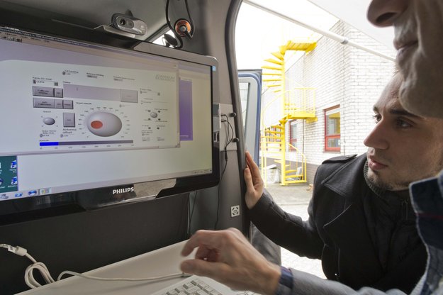
    Say what you want about the recent surge in interest of indoor navigation. Some call it an over-hyped fad — or not technically ready for market. The bottom line is that Apple thinks enough of the market to have spent $20 million for Silicon Valley start-up WiFiSLAM in late March.

    According to published reports, WiFiSLAM can pinpoint a user’s indoor location to within 8 feet, using Wi-Fi.

    Apple has made several inroads to enhance its location portfolio since its Apple Maps debacle in 2012 when users complained about inaccurate directions.

    The problems were so acute for Apple Maps that its CEO told potential customers to buy navigation from its rivals, including Waze.

    Apple rival Google already has been in the indoor positioning and navigation market, mapping shopping malls, airports and sports venues in several countries.

    DeCarta Launches Local Search Engine

    DeCarta has launched the L2 Local Search Engine. L2 offers companies the ability to index their own data and make it searchable via a sophisticated single-line search, said Kim Fennell, deCarta president and CEO. Those companies might include local search, vertical search (hotels, restaurants), classifieds, newspapers, Internet yellow pages and others.

    “Single-line search is the standard for most web search and for the big mapping portals, but is oddly missing from most local search sites,” Fennell said. “They still use a two-line entry, first specifying what you want and then where you want it. The main reason for that disconnect is that the technology to do good single-line geo-search requires a pretty deep understanding of geospatial data and technology, and is hard to do well. L2 solves that problem. We provide a fully featured local search engine with baseline map and POI data,” he said.

    “The local site can clean and index their proprietary data using our tools and then host the search engine in the cloud,” Fennell said. “They get the control of the data and the user interface that the big map portals use.”

    Some examples of a deCarta Local Search Engine point of interest entry may be, “coffee near XYZ company,” “restaurants on Main Street,” and “parking near AMC Theater.”

    In other LBS news:

    • Telenav introduced its embedded product for the Scout for Cars product line. The embedded product features in-dash navigation with mobile and cloud services for real-time, personalized information, the company said. Marketed to automakers, the company said installers can connect Scout for Phones service in their cars for real-time services and personalization. The company said the unit comes with flexible branding so OEMs can offer embedded navigation in their vehicles through their own brands.
    • Audiovox’ $169.99 Car Connection kit tracks vehicles and monitors the driver with a built-in GPS unit and a two-way cellular data connection, without a smartphone, the company said. Once an account is established, and the unit is recognized by the Car Connection service, owners can track their cars’ movements and receive e-mail or text alerts in the event the car is stolen or used without permission. An interesting feature is a free app that allows users to find the car via a smartphone. Car Connection costs $10 a month, or $90 per year, and has a $20 activation fee.

    Send your LBS news and announcements to Kevin Dennehy at [email protected].

  • The Inner Edge: Who Holds the Key to Indoor Nav?

    The Inner Edge: Who Holds the Key to Indoor Nav?

    The FCC released in March results of intensive indoor location trials of various technology solutions to this most difficult of PNT problems — yet the one that will unlock the greatest remaining untapped potential. The results will shape FCC-mandated position-reporting requirements for cell phones, and will drive future development of all indoor positioning applications. This story gives a top-level view of the results. For in-depth exploration, tune in to the free webinar this Thursday to hear critical information, insight, and perspective on this groundbreaking study from four key participants.

    The April 18 webinar is free, but you must register beforehand. A downloadable file of the webinar will be available roughly one week afterwards, in case you miss the live presentation. Speakers include Khaled Dessouky from TechnoCom Corporation, a company that supervised the trials; Ganesh Pattabiraman from NextNav and Norm Shaw from Polaris Wireless, two companies whose technologies underwent rigorous testing in the trials; and Greg Turetzky from CSR, a company closely involved in the process.

    Testing Overview

    Conducted by the Communications Security, Reliability, and Interoperability Council (CSRIC) of the Federal Communications Commission (FCC), Working Group 3 (WG3), the tests trialled thousands of attempted location fixes in four representative morphologies (dense urban, urban, suburban, rural) and various building types.

    The massive R&D movement focus on consumer-level applications, that is, cell phones, but this work will also ultimately affect professional and high-precision uses of GNSS. Those involved in machine control for warehousing, industrial assembly, indoor and even underground mapping, construction both above- and underground, underground mining, utility work, and even forestry will find this of particular interest — any activity in areas where sky-view is limited or negligible.

    Today, well more than half of mobile phone calls are made inside buildings. The number of emergency calls roughly parallels that, and both figures are only projected to rise. The FCC has a clear mandate to bring E-911 capability to indoor calls.

    The 2001 regulations governing such emergency calls required that both landlines and cellphones should provide the location of callers to within specific accuracy levels. Location information was to be sent transparently to public safety answering points (PSAPs), to dispatch fire/rescue/police personnel to the source the 911 call, and not just to the right street address, but to the right floor of a multi-storied building. That’s the driver for all this.

    Widespread application of successful technology/ies meeting the indoor requirement, once determined, is the key to significant revenue for many parties, not least of them GNSS manufacturers and location-based services (LBS) providers.

    GPS and augmented GPS technologies were only part of the cellphone solution, and other implementations included use of the cell signal itself along with an extensive database which can contain amongst other things signal attributes and network asset locations.

    The WG-3 Locations Based Services (LBS) sub-group set about finding what technologies exist, how well they work and how they could be applied to E-911. Click here for the full report.

    In the tests, Polaris Wireless used an RF pattern-matching/fingerprinting technique, Qualcomm used a hybrid assisted-GPS (A-GPS)/advanced forward link trilateration (AFLT) system, and NextNav used wireless beacon technology.

    WG3 selected the San Francisco Bay Area for the Stage-1 Indoor Test Bed. The methodology centered on indoor testing in sample buildings within the most common wireless use environments, called morphologies: dense urban, urban, suburban, and rural.

    Bldg. 2: One Front Street, San Francisco, California.
    Dense urban: Bldg. 2: One Front Street, San Francisco, California.
    Bldg. 18: Super 8 Motel on O’Farrell St., San Francisco, California.
    Urban: Bldg. 18: Super 8 Motel on O’Farrell St., San Francisco, California.
    Bldg. 13: Gilroy Gaits, Beige Stable Building, Hollister, California.
    Rural: Bldg. 13: Gilroy Gaits, Beige Stable Building, Hollister, California.

    Polygons surrounding areas containing 19 buildings were selected; the distribution of buildings tested was 6 dense urban, 5 urban, 6 suburban and 2 rural. 75 test points were selected by TechnoCom within these 19 buildings. Statistically significant samples of stationary test calls were placed from each test point using multiple test devices for each of the 3 location technologies under test by NextNav, Polaris Wireless, and Qualcomm.

    More than 13,000 valid test calls were collected across the test points for each of the three technologies. Broad, representative wireless industry participation in the test bed meant that Polaris’ results were aggregated over AT&T’s and T-Mobile’s networks; Qualcomm’s results were aggregated over Sprint’s and Verizon’s networks; and NextNav operated essentially as a standalone overlay location network.

    A certified land surveyor provided indoor ground-truth accuracy to compare test-call locations. The certified accuracy was +/-1 cm horizontal and +/-2 cm vertical.

    The test results show the location-performance attributes under test: horizontal location accuracy, vertical accuracy, yield, time to first fix (TTFF), and reported uncertainty.

    NextNav Summary Indoor Accuracy Statistics.
    NextNav Summary Indoor Accuracy Statistics.
    Polaris Summary Indoor Accuracy Statistics.
    Polaris Summary Indoor Accuracy Statistics.
    Qualcomm Summary Indoor Accuracy Statistics.
    Qualcomm Summary Indoor Accuracy Statistics.

    Dense Urban Environment

    Satellite signals (in this instance, GPS) have, of course, significant challenges in penetrating large buildings. Consequently, AGPS fall-back modes, such as AFLT, were experienced frequently. Accuracy degraded as expected when GPS fixes were not attained. While a surprising proportion of hybrid fixes were experienced, even at test points where one would not expect a satellite signal to penetrate, the quality of the hybrid fixes was in general significantly degraded compared to GPS fixes.

    RF finger-printing experienced its best performance in the dense urban setting. This is probably a combination of a confined environment that could be extensively calibrated and many RF cell sites and handoff boundaries that could be leveraged in creating a good RF fingerprint map of the dense urban center.

    The best observed performance in the dense urban setting was that of the dedicated terrestrial (beacon) location system — a new infrastructure. However, due to multipath, location fixes that may be relatively close in absolute distance (for example, 40 meters away) are often located in a building across the street, in a neighboring building, or even across a few blocks from the test point.

    Urban Environment

    Each individual test building in the urban morphology produced different challenges, and the three technologies under test met them in varying degrees.

    A major-league baseball stadium created a situation where AGPS fallback fixes could be very far away due to the exposed RF propagation outside the structure in which the test points were located. Stadium structure created challenges to RF fingerprinting at some test points.

    A convention center created in some cases an environment that was deep indoors but with very strong cellular signal from cell sites inside the building. This made the beacon-based location system perform poorer than in most other test points, since attenuation to different directions in the outside world was particularly strong in those scenarios. AGPS and RF fingerprinting relied on the cell sites inside the structure to create adequate location fixes.

    An older building of comparatively heavy construction, with a large atrium in its middle, produced widely varying results based on distance from windows or the atrium. Again, the phenomenon of apparent location in a building across the street was seen for both NextNav and Qualcomm. RF fingerprinting fixes appeared to cluster about the larger reflectors in this urban corner of San Francisco, which happened to be mostly across the streets from the target building.

    A motel building demonstrated the unique challenge with indoor location: absolute distances (like 50 or 150 meters) which may have meant much in assessing outdoor performance mean less for the indoors, since emergency dispatch to the wrong building or even the wrong block could be easily encountered at those distances. A location across the street is certainly better than one a few or many blocks away but it may still leave some human expectations unmet.

    A tall condominium building in a (non-dense) urban downtown San Jose created relatively poor AGPS performance, uneven beacon system performance, and RF fingerprinting performance that degraded with the height of the test point. All of the above factors related to each of the urban buildings, combined with a generally lower cell site density for fall back (than in dense urban), resulted ultimately in an aggregate urban performance that is slightly worse than the dense urban performance.

    Suburban Environment

    The effect of smaller buildings with lighter construction and more spacing between buildings quickly became evident. Outstanding GPS performance, almost as good as outdoors, can be achieved inside single-story homes. Similarly outstanding performance is achieved on average by the beacon-based location technology under similar circumstances. RF fingerprinting appears to suffer from performance degradation compared to more dense morphologies in the city.

    The AGPS performance predictably changes as the suburban buildings become bigger and higher. The terrestrial beacon-based network continues to perform well in the larger suburban. RF finger-printing shows some enhancement relative to the smaller suburban buildings, but still shows most of the location fixes along the roads, highways or reflecting buildings.

    Rural Environment

    Large one-story structures with metal roofs limited the available number of satellite signals available for trilateration. In these cases more hybrid fixes were experienced with a concomitant increase in the spread of the location fixes about the true location. The performance of the beacon-based network was less impacted by the metallic roof (since that roof had more impact on sky visibility rather than on side visibility towards terrestrial beacons). Consequently the performance was somewhat better than for AGPS. The performance of the beacon-based network would of course depend on the density of its deployed beacons covering the rural area, which was sufficient in the case of the rural test polygon.

    RF finger-printing showed reduced performance relative to the suburban environment due to the large spacing between surveyed roads (where calibration is done) and the rural structures as well as the lower density of cell sites.

    Conclusion

    Finally, the report concludes: “Stage-1 of the test bed contained in the end only three technologies to test. With the complexity of the task at hand, this created a good learning opportunity for both CSRIC WG3 members and the test house. However, there are a number of technologies that are either in use for location based services (LBS) or that are emerging which should be evaluated for their potential to contribute to the improvement of indoor wireless E911.

    “Indoor wireless E911 is a critical public safety issue that will only increase.”

    One key factor that the report does not at all address is relative cost of implementing these respective solutions. The same can be said for timeline. While some observers have concluded that “NextNav came out on top,” this solution in particular can be presumed to face much greater challenges for full or nationwide implementation than the other two, which rely largely on already existing infrastructures.

    Another round of E-911 test-bed activities will ensue once funding and management issues are resolved. See CSRIC WG 3 LBS Subgroup member Greg Turetzky’s “Expert Advice” column from GPS World for perspective and a forward look.

    Once again, for an up-close and personal look at the CSRIC Bay Area indoor tests, register beforehand here for Thursday’s webinar, April 18. A downloadable file of the webinar will be available roughly two weeks afterwards, in case you miss the live presentation.


  • DeLorme Launches Next-Generation inReach Satellite Communicator with GPS

    inreachse_m01
    inReach SE (Screen Edition)

    DeLorme has announced the launch of its newest product, the inReach SE (Screen Edition) satellite communication device. With 90 percent of the world’s surface lacking cell phone coverage, inReach SE is designed  for the traveler or outdoor adventurer to keep them connected and safe anywhere in the world. The expanded standalone capabilities of inReach SE include a color screen, virtual keyboard, slim design and long-lasting internal lithium battery. In standalone mode, inReach SE provides free-form texting capabilities of up to 160 characters to any cell phone number, email address or social media page.

    Using DeLorme’s Earthmate App, inReach SE pairs wirelessly with iPhone, iPad and iPod touch to access topographic maps and NOAA charts and to make text messaging more convenient. inReach SE is also compatible with Android devices.

    With the ability to maintain satellite signal lock even in difficult GPS environments, inReach SE also offers global SOS capabilities, adjustable tracking intervals from 10 minutes to four hours, and remote real-time follow-me/find-me tracking and ping-me locating. In the event of an emergency, the interactive SOS capability of inReach automatically triggers remote tracking and allows users to describe and update their situation so proper resources can be deployed, DeLorme said.

    “Whether you’re deep in the backwoods, floating on a remote lake, or simply traveling abroad, anyone can benefit from the comprehensive functionality of inReach SE,” said Michael

    Heffron, DeLorme CEO. “Over the last two years we have been listening to customer feedback, so the next generation of inReach includes many new features based on their input. The internal rechargeable battery and the on-screen, free-form texting are especially beneficial, making on-the-go communications more convenient and delivering peace of mind to family and friends easier than ever before.”

    inReach operates over the Iridium satellite network, providing global two-way satellite communications, high network reliability and low-latency data links (less than 60 second delivery of messages end-to-end) anywhere on Earth, with no gaps, fringe or weak signal areas, DeLorme said.

    The follow me / find me tracking feature of inReach provides GPS position updates allowing family and friends to follow the user’s trip as it happens. Family and friends can log into a dedicated MapShare page to follow a detailed breadcrumb trail, ping a location, and send messages to the inReach owner. In the event of an emergency, the built-in SOS button can be activated to trigger a distress alert with delivery confirmation and it automatically activates the remote GPS tracking feature. GPS tracking assists search-and-rescue personnel with homing in on the user’s location, whether stationary or on the move.

    Pairing the inReach SE via Bluetooth with the Earthmate App turns a mobile device into a global satellite communicator and navigation tool. Real-time GPS location, tracking and text messages are overlaid on the digital maps for easy navigation and position location. inReach owners get exclusive, unlimited access to DeLorme’s topographic maps and North American NOAA charts, which can be downloaded via an Internet connection prior to departure and remain available in the Earthmate App even when outside cellular coverage.

  • Mobile Location-Based Advertising Will Be Worth 6.5B Euros in 2017

    According to a new research report from the analyst firm Berg Insight, the total value of the global real-time mobile location-based advertising and marketing (LBA) market will grow from €526 million in 2012 at a compound annual growth rate (CAGR) of 65 percent to €6.5 billion in 2017. This will then correspond to 32.8 percent of all mobile advertising and marketing. This means that location-based advertising and marketing will represent around 5 percent of digital advertising, or more than 1 percent of the total global ad spend for all media. SMS, mobile search and coupons are today important high-volume LBA formats.

    The ability to precisely target prospective customers using real-time location is currently one of the most promising additions to the advertising toolbox, Berg Insight said. “Key drivers for LBA include the growing adoption of both outdoor and indoor location technologies, as well as the increasing consumer acceptance of location-based services in general,” said Rickard Andersson, Telecom Analyst, Berg Insight. Location targeting in combination with other contextual and behavioral segmentation greatly enhances the relevance of mobile advertising. “Major brands are so far the main spenders, but LBA has also opened the mobile channel for small local merchants. Local businesses can extend their marketing initiatives with mobile components such as location-sensitive coupons using online self-services, while big box retailers leverage enterprise LBA solutions for conquesting and to combat showrooming,” Andersson said.

    The LBA value chain is still forming and there are a large number of players involved in the ecosystem, Berg Insight said. Since the value chain is fragmented and the industry has not yet reached maturity, many different roles are involved. Companies range from LBA specialists such as Verve, Placecast and xAd, to LBS players including Telmap, Telenav and Waze, and operators such as AT&T, SFR and the new UK joint venture Weve.

    There is, furthermore, an abundance of location-aware applications and media that serve geo-targeted ads, with examples such as Foursquare, Shopkick and SCVNGR. Other stakeholders include coupons and deals providers including Vouchercloud, Yowza!! and COUPIES, search solutions such as Yell and Yelp, and proximity marketing providers like Proxama, NeoMedia and Scanbuy. A number of traditional mobile advertising players are also active in the LBA space, for example Millennial Media, Madvertise and Nexage, as well as major digital and telecom players such as Google, Apple and Facebook.

  • ESA Telecom and Navigation Vehicle Ready for Test Driving

    The radio spectrum is about to get even busier, as Europe’s Galileo satnav system starts services, at the same time the European Space Agency (ESA) tests novel satellite-based telecommunication services. Supporting these developments from the ground, ESA’s new custom-built Telecommunications and Navigation Testbed Vehicle will measure the resulting signals from all over Europe.

    Adapted from a Mercedes Benz Sprinter van, this unique measurement vehicle has been delivered to ESTEC by Austria’s Joanneum Research institute. “This is a dual-purpose vehicle, suitable for both telecommunications and navigation system testing,” explained Simon Johns of ESA’s Radionavigation Systems and Techniques Section.

    “For navigation, we have the Galileo constellation coming on stream, as well as the stepping up of ESA’s GNSS Evolution programme — designing what comes next after Galileo’s first generation.”

    The four wheel-drive vehicle can host a three-person team, and is crammed with dedicated navigation and telecommunication monitoring equipment.

    Testbed vehicle screen.
    Testbed vehicle screen.

    “One of the main goals driving the design was to have an ‘easy to adapt’ test platform suitable to set up test campaigns for different mobile satellite systems and standards that would require different types of antennas and specific receiver/transmit equipment,” explained Olivier Smeyers of ESA’s Communication-TT&C Systems and Techniques Section.

    “On the telecommunications side, there is a continuous effort to enhance current and create new mobile satellite-based broadcast and interactive services via the evolution of current systems or developing new standards,” Smeyers said. “Testing in the field is an essential element for validating and eventually establishing evolved or new standards. The vehicle has built-in multimedia equipment, including storage and control computers, multimedia gateway, passenger LCD screens, cameras and microphones, to serve this purpose.”

    The vehicle features include two removable roof plates to mount specialized antennas (one currently hosts the antenna of a Broadband Global Area Network satellite terminal for Internet connectivity and multimedia and data streaming), an 8-meter-high telescopic mast capable of carrying 25 kilograms, a rubidium atomic clock synchronized to GPS time with nanosecond accuracy, a high-end spectrum analyzer and oscilloscope for signal measurements, and mobile temperature sensors to monitor the rack equipment.

    A fish-eye video camera incorporating onscreen GPS timing and positioning performs continuous recording of its surroundings — to throw light on high buildings, trees, or other factors that might affect results.

    Internal and external generators yield up to 5 kilowatts to keep everything running — sufficient power to supply two typical European households.

    “The challenge was to fit in all the equipment and provide the necessary power and air conditioning, while still weighing less than 3.5 tonnes,” said Thomas Prechtl of Joanneum Research. “Exceeding this weight would have meant drivers would have needed a special license, and potentially limited its operations in some European nations.”

  • Indoor Trial Results, Next FCC Chief

    The long awaited results from the independent field trial of indoor wireless location technologies are here. The FCC-chartered Communications Security, Reliability and Interoperability Council (CSRIC) tested NextNav, Qualcomm and Polaris. NextNav bested the others.

    Speakers from NextNav and Polaris, as well as test adminstrator Technocom, will take part in a GPS World webinar on April 18. Registration is free.

    Also, there is a guessing game in town and stakes are high. Who will President Obama nominate to replace FCC Chief Julius Genachowski? Tom Wheeler, popular in the telecom community, has been a front runner, but the tide may be turning against him with some charging that he is too snug with our industry.

    Developers will be even more enticed to utilize indoor location now that Apple has signaled its market intents with the purchase of indoor-GPS company WifiSLAM. Safety and security mandates around the world are spurring a wave of telematics offerings by automotive OEMs. For more, read on.

    Who Will Be the New FCC Chief? A coalition of public interest groups sent a letter to Obama warning that Wheeler is too close to the industry that he would be regulating. “You can’t have an objective chairman of the FCC that’s got 20 years of his life invested in being the head lobbyist for industry,” Sascha Meinrath of the New America Foundation said in an interview. In his past life, Wheeler was an industry lobbyist and also served as head of both CTIA and the National Cable and Telecommunications Association.

    Adding to Wheeler’s woes, 37 Democratic senators have signed a letter supporting FCC Commissioner Jessica Rosenworcel. Since she already sits on the commission, Rosenworcel would not need Senate confirmation to ascend to the chairmanship. That could be appealing to Obama, who has faced GOP opposition to many of his second-term nominees.

    However, it could also put Obama in a sticky spot, as he would have to jump over the FCC senior Democrat, Commissioner Mignon Clyburn, the daughter of Rep. James Clyburn, a member of the House Democratic leadership who has strong African-American support. Obama has been criticized for low minority leadership appointments in his second term.

    Genachowski’s term was a disappointment to people on many sides of the fence, but not the all-out disaster of his predecessor, Kevin Martin. Genachowski will be remember for the introduction of the National Broadband Plan, as well as plans for a complete overhaul of the Universal Service Fund. During his time as chairman, Genachowski took the lead on killing AT&T’s proposed $39 billion acquisition of T-Mobile. The next FCC chair will need to navigate hefty issues including media ownership, Internet rules, universal and affordable broadband, and locking of phones.

    CSRICHow Good Is It Indoors? The FCC chartered CSRIC to test the indoor performance of location systems across urban, suburban and rural areas in the San Francisco Bay Area. TechnoCom, an independent agent, conducted the trial with more than 13,000 test calls placed from different technologies in 75 unique indoor locations. Three vendors submitted technologies for evaluation: Qualcomm, NextNav and Polaris. They were scored for horizontal and vertical accuracy, speed of location, and reliability and consistency of results. NextNav stood out for its performance on height and horizontal accuracy. The full report is available from the FCC.

    To hear from the experts involved, tune in to GPS World’s webinar, “Indoor Positioning & Navigation: Results of the FCC’s CSRIC Bay Area Trials,” on Thursday, April 18. Speakers include Khaled Dessouky (Technocom); Ganesh Pattabiraman (NextNav); Norm Shaw (Polaris Wireless); and Greg Turetzky (CSR). Registration is free.

    Apple Goes Inside. Apple has acquired indoor-GPS company WifiSLAM, a sign that the indoor mobile location market will be heating up. Apple’s involvement is a significant move that will ignite the developer community to rush to create more innovative apps and solutions based on indoor location. WiFiSlam is a two-year-old start-up that detects a phone user’s indoor location by analyzing the strengths and IDs of Wi-Fi signals in its vicinity. WiFiSlam has been offering the technology to developers for indoor mapping and new types of retail and social networking apps. Retail has been the first adopter of indoor technology.

    Interactive Voice Ads Leverage Location. Nuance Communications unveiled Voice Ads, a new mobile ad format that enables consumers to interact directly with ad campaigns by speaking (or perhaps, yelling) into their smartphones. Voice Ads expands on voice and natural language technologies and leverages capabilities like location to deliver ads that prompt the user to ask questions. In a YouTube video, Mike McSherry of Nuance demonstrates a virtual Magic 8-Ball campaign that answers users’ verbal queries to promote a fictional deodorant brand. “Mobile has a monetization challenge,” McSherry told AllThingsD. “By introducing voice you can transcend the small screen size.”

    Telematics Boom. The telematics market is about to ride a wave of growth. Vehicle OEMS are rolling out safety telematics in advance of safety and security mandates throughout the world including Europe (eCall, 2015), Russia (ERA GLONASS, 2013) and Brazil (Contran, 2013). ABI predicts that the OEM and aftermarket safety/security telematics vendors will see the number of users rise from 72 million at year-end to more than 300 million in 2018.

    GPS Ankle Monitors Not Working. In 2012 the state of California started conducting tests on the GPS ankle devices that monitor more than 4,000 high-risk sex offenders and gang members. Officials discovered that the batteries died early and reported locations were off by as much as three miles. Tampering alerts failed and offenders could cover the devices with foil or use GPS jammers to go undetected. Many of California’s ankle monitors were replaced with devices from a different vendor, but test results of the new system were not made public.

  • Comodo Integrates Skyhook Wireless Location Tech into Android Anti-Theft App

    Skyhook Wireless, a provider of location positioning, announced a partnership to integrate Skyhook’s hybrid location platform into Comodo’s Anti-Theft app for Android devices.

    Comodo’s Anti-Theft for Android is a new service that enables customers to remotely locate, lock and recover a lost or stolen Android smartphone or tablet. The app can remotely capture and upload photos of whoever is operating the missing device to aid authorities in their recovery efforts and also in identifying the thief.  The product is designed to address the security, monitoring, and management needs of users with limited time and IT support.

    “Comodo selected Skyhook’s leading hybrid location service because of its precision, speed, and power efficiency, all of which are critical to Comodo in our mission to locate, track, and recover lost or stolen devices,” said Melih Abdulhayoglu of Comodo.

    Comodo Anti-Theft for Android is free and available at the Android Play Store. Skyhook provides an SDK for developers across most platforms.


  • FairSearch Files European Commission Complaint on Google’s ‘Anti-Competitive’ Mobile Strategy

    FairSearch.org has filed a complaint with the European Commission laying out what it sees as Google’s anti-competitive strategy to dominate the mobile marketplace and cement its control over consumer Internet data for online advertising as usage shifts to mobile.

    The complaint says Google uses deceptive conduct to lockout competition in mobile. Google’s Android is the dominant smartphone operating system, running in 70 percent of units shipped at the end of 2012, according to Strategy Analytics. Google also dominates mobile search advertising with 96 percent of the market, according to eMarketer.

    “Google is using its Android mobile operating system as a Trojan Horse to deceive partners, monopolize the mobile marketplace, and control consumer data,” said Thomas Vinje, counsel to the FairSearch coalition. “We are asking the commission to move quickly and decisively to protect competition and innovation in this critical market. Failure to act will only embolden Google to repeat its desktop abuses of dominance as consumers increasingly turn to a mobile platform dominated by Google’s Android operating system.”

    FairSearch is an international coalition of 17 specialized search and technology companies whose members include Expedia, Microsoft, Nokia, Oracle, and TripAdvisor.

    Google achieved its dominance in the smartphone operating system market by giving Android to device-makers for “free.” Android phone makers who want to include must-have Google apps such as Maps, YouTube, or Play are required to pre-load an entire suite of Google mobile services and to give them prominent default placement on the phone, the complaint says. This disadvantages other providers, charges FairSearch, and puts Google’s Android in control of consumer data on a majority of smartphones shipped today.

    The FairSearch complaint comes at a time when users are increasingly switching from desktop to mobile platforms. Mobile Internet usage is expected to overtake desktop usage as soon as 2014, according to MindCommerce.

    The European Commission is already considering how to remedy concerns that Google may be abusing its dominance in desktop search advertising, in particular Google’s search bias that favors its own services in search results.

    Meanwhile, in April, six European data protection authorities began coordinating efforts to force Google to comply with European Union privacy laws they say Google violated by consolidating its privacy policies. Google paid a record fine to the U.S. Federal Trade Commission in August 2012 to settle charges it gave misleading privacy promises to Safari Internet browser users.

    “European consumers deserve a rigorous investigation of Google’s mobile practices, and real protections against further abuses by Google,” said Vinje. “Given Google’s track record of ignoring the law, mobile Internet users should be very concerned.”

  • CrowdOptic, LBMA Research Focus-Aware Mobility for Events

    CrowdOptic, a maker of crowd-powered mobile applications for live events, and the Location Based Marketing Association (LBMA) have joined forces to develop and promote new focus-aware mobile technology for fans at live events.

    Part of LBMA’s mandate is to foster research, innovation and pilot projects that push the boundaries of place-based marketing. Through this initiative, LBMA has partnered with several top-tier global brands carefully selected from among LBMA’s large network of marketing affiliates to introduce the new technology to consumers. The technology will be introduced in a series of test launches at major entertainment events throughout the summer, before making it widely to marketers in the fall, the association said.

    Focus awareness combines traditional GPS-location awareness with data on where mobile users are aiming their smartphones. Focus-based technology enables new kinds of apps in which users aim their phones to engage with one another as they watch events simultaneously — for example to connect, chat or vote on the shared subject of focus. Focus-awareness also allows marketers to chart the shifting momentum in crowds.

    The partnership comes as demand grows among LBMA’s network for mechanisms to enhance context-awareness in mobile. Marketers want to know how many phones are engaged with their apps as events are happening (heat), who those users are, where they are looking, and how the crowd’s engagement is dynamically changing moment to moment — all capabilities of CrowdOptic’s technology.

    “Our vision of the future is new apps that dynamically adapt based on knowing what activities people in a crowd are watching and engaging in, as well as joining people with shared interests together, right there in the moment,” said Asif Khan, founder and president of LBMA.

    “Focus is an emerging mobile category that will play a significant role in the next generation of location services,” said Brent Iadarola, Global Research Director of Mobile & Wireless Communications at Frost & Sullivan. “In contrast to augmented reality, which combines location and mobile Internet search to provide information on landmarks in static environments, focus-based services enable the tracking and tagging of objects (or individuals) in moving or dynamic environments. By enabling mobile users to point their phones at moving objects or people to access real-time information about their subject of interest, this area of technology in which CrowdOptic is a pioneer clearly presents some very unique and lucrative avenues for hyper-targeted marketing promotions, advertising, and mobile coupons.”

    CrowdOptic is in use around the world in apps that enable users to “aim their phone” to act or interact — whether to discuss, report or discover other people based on their shared focus.  The company powers a range of applications which vary from finding friends in a crowd, to aiming a phone to vote, to aiming to alternate views of a live broadcast, to aiming to connect with athletes and celebrities at live events.  The technology works both through an app and anytime without an app, by historically mining the standard metadata tags embedded in shared photo images. The mechanisms used to acquire context beyond location include continuous streams of GPS, compass and triangulation algorithms illuminating common points of focus between mobile users.

    The LBMA will begin to introduce these projects which leverage the CrowdOptic platform for top global brands beginning in the summer of 2013.

    About LBMA – http://thelbma.com/

    The Location Based Marketing Association is an international group dedicated to fostering research, education and collaborative innovation at the intersection of people, places, and media. Our goal is simple: To educate, share best practices, establish guidelines for growth and to promote the services of member companies to brands and other content-related providers. The over 600 members of the LBMA include retailers, restaurant chains, agencies, advertisers, media buyers, software and services providers, and wireless companies.

    About CrowdOptic – www.crowdoptic.com

  • Micro GPS / GPRS / SMS Module for Personal Tracking

    tracemminilarge
    Photo: KCS BV

    The TraceME micro by KCS BV is a small GPS / GPRS tracker that fits inside a key chain. It is targeted for personal use and any application that need a minimum size while maintaining the exact same options and server connection full-size units have. KCS TraceME GPS / GPRS modules enable remote tracking of objects such as cars, trucks, containers, and motorcycles.

    Equipped with a 65-channel Skytraq Venus634LPx GPS receiver, the KCS TraceME Module provides reliable and accurate navigational data. All communication is handled rapidly and effectively by a GPRS/GSM modem (quad-band) through GPRS or SMS. In areas without network coverage, position data and events are stored in memory (up to 55,000 positions). As soon as communication is restored, all information can be transmitted. The user-configuration menu controls actions such as sending position information, depending on all possible events. All of the necessary server-side scripts to process and store data from the TraceME units are available free of charge.

  • Expert Advice: Setting Standards for Indoor Position

    GregTuretzky-W
    Greg Turetsky

    Communications Security, Reliability, and Interoperability Council (CSRIC) Update

    By Greg Turetsky

    Many of us remember way back in 2001 when the FCC first announced E911 position reporting requirements for cell phones. That was a long time ago in many significant ways. Everyone had 2G phones and anxiously anticipated the arrival of 3G, and with it, data. Most people still had a landline at home, and used their mobile sparingly lest they overrun their monthly minutes. Roaming was very expensive and nearly impossible overseas. Very few phones had GPS, and people only turned it on when needed, as it significantly reduced battery life.

    Now, in 2013, all of the technology has changed, but — not unexpectedly — the regulations have not. This is one of the reasons the U.S. Federal Communications Commission (FCC) created CSRIC.

    The Communications Security, Reliability, and Interoperability Council’s mission is to provide recommendations to the FCC to ensure, among other things, optimal security and reliability of communications systems, including telecommunications, media, and public safety. The current council, CSRIC III, was born on March 19, 2011, and ended on March 18, 2013. Working Group 3 (WG-3), the E911 Location Accuracy group, has looked into both outdoor and indoor location accuracy issues to help the FCC shape new guidelines. I don’t think any of us would argue that given the current patterns of cell phone usage, the ability to provide a location indoors to a public safety answering point (PSAP) is something that is now needed, has significant value to the public, and would seem to lie within our grasp technically.

    Working Group 3 is a fairly large group of experts from a wide variety of backgrounds. The actual list of participants is publicly available; what’s more interesting is the groups that they represent. Three main constituencies constitute the Working Group: the public safety community, the wireless operators, and the technology vendors. Each group has a slightly different goal, but they all worked well together to produce clear, unbiased reports that represent all the different members’ views in a way that lends more credibility to the overall report.

    On March 14, the FCC released two reports created by WG-3: the “Indoor Location Test Bed Report,” and “Leveraging LBS and Emerging Location Technologies for Indoor Wireless E911 Report.” I will not review either document here as they are available publicly, but I will summarize the highlights of the reports from my perspective as a member of the location community and a concerned citizen, and attempt to predict where the process might lead next.

    Figure 1. Indoor accuracy in the dense urban environment.
    Figure 1. Indoor accuracy in the dense urban environment.

    Test Bed Report. In my mind, two key results emerged from the Test Bed Report. The first was very positive: the test bed showed that there are technologies capable of yielding positions indoors, and their performance can be compared analytically. This may seem like a bland statement, but it carries a significant amount of weight with both the public safety community and the FCC. It acknowledges that the technology has evolved sufficiently such that in a test bed setting, we can gather and compare, in an apples-to-apples way, the performance of diverse technologies in terms of yield and accuracy. Similar to the LightSquared reports, this report focuses on ensuring that the data itself is valid. The interpretation of the data is far too politically and economically charged to be agreed on by all parties involved. It is a great accomplishment to concur on a methodology by which testing should be done, and to produce a set of results that can be given to the FCC with the entire council’s approval.

    The second highlight from my perspective was less positive. The test bed originally had seven participants, but in the end only three completed the process. This indicates that there are even more candidate technologies for solving the indoor E911 problem — but for a variety of reasons, they were not ready for CSRIC testing at this juncture. Although having three choices is good, seven (or even more) would be better for the FCC to feel confident in its ability to create a new mandate with sufficient flexibility on implementation. There are clearly many ways to skin this cat technically, but we have to ensure that the test bed methodology allows as many as possible viable alternatives to be compared. There is clearly a gap between those technologies that are commercially available and those that can be used for E911.

    Leveraging LBS. The Leveraging LBS Technology report also reached some interesting conclusions. The concept of leveraging LBS was actually how I became involved in the CSRIC. The underlying question that the FCC asked me to explore was “Why can a smartphone user can get a dot on a map indoors (usually with an uncertainty circle, no less), but no location information shows up on the PSAP screen if he makes an E911 call?”

    As we dug into this problem, it became clear that this was less of a technology problem and more of a business/policy one. Quite a few large companies make money by providing that indoor location for various applications, but there isn’t any real money in E911 — although there are lots of liabilities. Also, many of these solutions are proprietary either to the phone, the operating system, or the application, while an E911 solution would need to be standardized across all of those as well as different carriers.

    Figure 2. Indoor accuracy in the urban environment.
    Figure 2. Indoor accuracy in the urban environment.

    Conclusion. The FCC has received two reports with similar conclusions: We have come a long way since 2001, but we might not be there — the indoor E911 promised land —just yet.

    There is still more to come, however. Therefore, many participants and observers hope the work of the current CSRIC will lay the foundation for a rational conversation about indoor E911 right now, and still be around to allow for future improvements. We have recommended that the test bed be maintained so future results can be compared with current ones. At issue is the funding source for the test bed. The FCC has announced the coming of a CSRIC IV, but has not released any further details. It is certainly the hope of WG-3 that the work performed to date to establish and validate the test bed will be available for use by future technologies as they mature.

    Locating emergency callers indoors is a critical capability that we as society must address — not for the callers’ convenience, but for their safety and or public safety generally. The problem has technical, commercial, regulatory, financial, legal, and public safety facets to it, making it a very complex issue.

    I should also note, that although E911 is a U.S. regulation, the problem of indoor location is under scrutiny in nations all over the world. I earnestly hope that all sides can continue working together to find a solution that can be implemented for the benefit of everyone.


    Greg Turetzky is senior director, CTO Office, for CSR. He served on the CSRIC Working Group 3 LBS Subgroup. He will participate in a April 16 GPS World Webinar on this topic. Registration is free.