Editor’s Note: Tony Murfin is managing consultant for GNSS Aerospace LLC and editor of GPS World’s monthly Professional OEM newsletter. The views expressed are his own.
Another year has gone by, with another year of further improvements in navigation performance of micro-electro-mechnical systems (MEMS) inertial products. SBG Systems in France is now fielding a new generation of MEMS inertial products for much higher accuracy applications.
SBG Systems is based in Rueil-Malmaison, less than eight miles west of the center of Paris. Founded in 2007, SBG has developed a number of innovative MEMS inertial products over the last seven years, along with a respected reputation in the navigation industry, and by 2014 the company was recognized as the 26th fastest growing company in France.
The roots of the company began to form at the end of 2004, when a group of ECE School of Engineering students in Paris put a team together for a new UAV competition. The goal was to build a UAV of less than 1 kg, capable of flying autonomously indoors — at the time, a significant technical challenge. In 2004, miniature INS was not commercially available, so the team decided to build one, as well as other electronic parts such as the autopilot. The competition ran out of money, but the design was a success and led to a working UAV. The INS was by far the most advanced part of the project.
The students went back to their studies and took internships at UAV companies and ONERA (French aeronautics, space and defense research labs), but they still believed in the need for low-cost navigation solutions for the emerging civilian UAV market.
So, in 2007, three of the students — Raphaël Siryani, Thibault Bonnevie and Alexis Guinamard, S, B and G — formed SBG Systems with the goal of providing affordable, highly accurate MEMS inertial navigation systems for UAVs.
SBG quickly received its first Innovation Award from the French Research Ministry, and with this funding launched the IG-500 series of MEMS AHRS and INS in December 2008.
The company has since grown into a worldwide player with a strong product innovation focus. UAVs are still an important part of revenue, but the company has diversified into:
- Aerospace and defense applications (UAVs, gimbaled cameras, antenna tracking, etc.)
- Marine and offshore activities (ROV/AUVs, buoys, etc.)
- Survey (hydrography, mobile mapping, aerial LiDAR, etc.)
SBG Systems has a small staff of mostly development and sales engineers — graduate students and experts. SBG has recruited navigation experts and some sales people from key players in the inertial business. Most (95%) have at least a master’s degree in engineering — R&D has 45% of the staff, and 40% are in sales, marketing and technical support. Production has been extremely automated and requires very few staff for in-house system assembly, calibration and final acceptance test. They do expect to double in size over the next two to three years.
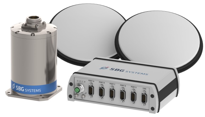
The company is owned by the three founders, who still lead operations. SBG grew 1,304% over the last five years, and last year was ranked the 26th fastest growing company in France on the Deloitte Fast50. Today, SBG Systems has fielded more than 4,000 attitude and heading reference systems (AHRS) and INS (mostly INS), with almost a third of those delivered last year. The company forecasts growth for the next five years to be at this same phenomenal rate! SBG Systems currently offers a line of MEMS inertial sensors that include AHRS, inertial measurement units (IMU), and INS with embedded GPS (INS/GPS).
Not only have MEMS sensors improved in performance, but SBG has also developed advanced calibration capabilities that allow it to reach high-precision performance approaching high-end ring laser gyro accuracies in much smaller, less expensive packages. SBG owns an extensive set of temperature chambers combined with rotary tables and vibrating tables. Each SBG system gets to stay two to five days inside these calibration tools. But the “secret sauce” is in a state-of-the-art SBG developed calibration algorithm…
SBG buys MEMS gyros and accelerometers from MEMS manufacturers such as Colibrys, Analogue Devices and Silicon Sensing and builds complete inertial systems. The team embeds different GNSS receivers, depending on the product line and intended application — from miniature automotive-grade chipsets from u-blox to the very best from the key survey-grade players such as Septentrio, NovAtel and Trimble. Some customers may already have their own GNSS receiver, so SBG has developed and tuned their systems to work with any of these big manufacturers. The antenna employed depends on the receiver being used — from Tallysman Wireless and Antcom to Trimble, Septentrio or NovAtel — a very diversified range of antennas.
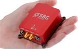
SBG announced the Ellipse-D dual-antenna mini INS/GNSS earlier this month. The Ellipse-D is a miniature INS with an embedded dual-antenna survey-grade GNSS receiver for high-accuracy orientation and positioning.
Independent hydrographic testing in October 2014 of earlier model designs has already shown accuracy improvements, and the latest D version promises even better performance. The products tested were:
-

Ekinox-D Ellipse-E, miniature inertial navigation system connected to a Hemisphere VS330 GNSS with two antennas.
- Ekinox-D, inertial navigation system integrating a dual-frequency GNSS receiver with two antennas.
The test was a typical marine survey, with each leg about 550 meters long. Attitude performance was compared to a fiber-optic gyro compass reference system with much higher roll and pitch accuracy than the two SBG products under test.
Ellipse-E roll and pitch accuracy is better than the specs. The use of an RTK GNSS receiver additionally improves the sensor’s performance. The Ekinox-D also has good results — around 0.03° in both roll and pitch. SBG claims that low-noise gyroscopes and advanced algorithms are the basis for this performance.
The SBG list of 250 customers in 30 countries includes some impressive names, many outside Europe, and the company claims to have nearly 4,000 inertial sensors in the field. So this is not a prototype shop, but more a fully equipped production facility. SBG has opened an office in Chicago to address the North American market.
So, what are people doing with these devices? There are a number of applications in aerospace, land, marine and sub-sea.
In the aerospace industry, SBG sensors are used for UAV navigation and flight analysis — they could eventually be incorporated in certified avionics. They are also used for antenna tracking, camera stabilization and more demanding applications such as LiDAR orientation and data georeferencing.
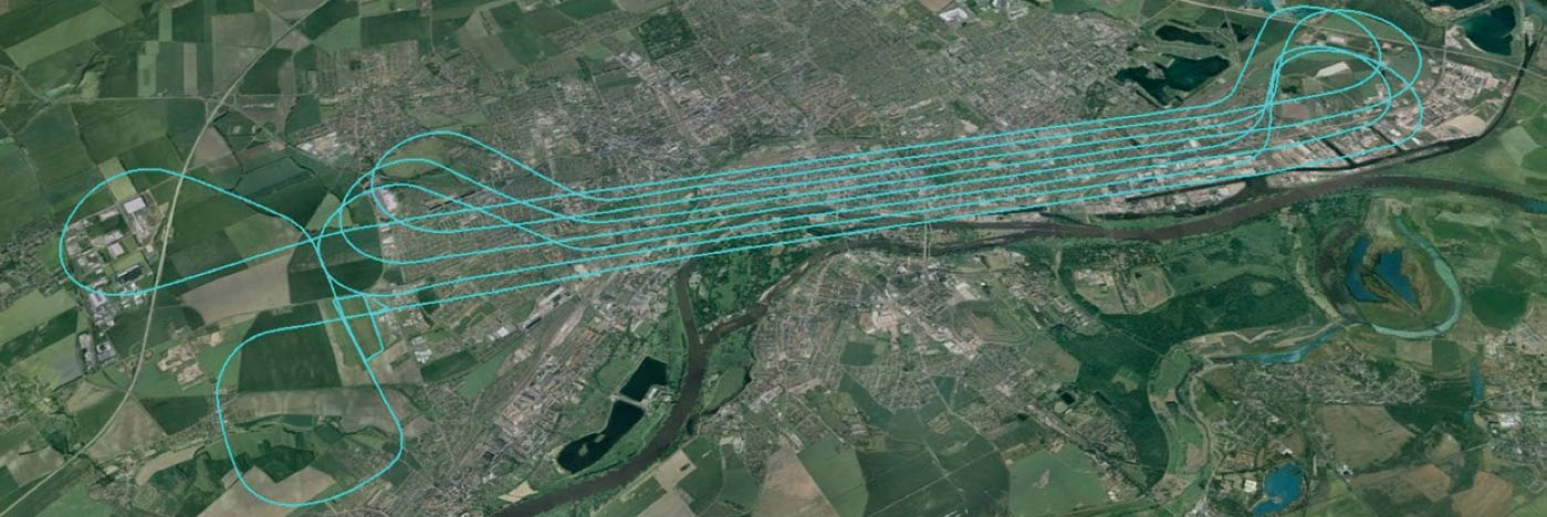
An Ekinox-N INS with embedded GNSS receiver was installed for the tests in a single-engine general aviation aircraft flying out of Magdeburg, Germany. A typical airborne survey-type flight was flown under mixed weather conditions with some turbulence, and roll, pitch, and altitude data was collected for real-time analysis and was also post-processed. A high-grade FOG-based AHRS was used as reference unit — with very high accuracy gyroscopes.
| Roll | Pitch | |
| RMS Error Real Time (max) | 0.043° (0.16) | 0.043° (0.16) |
| RMS Error Post Processing (max) | 0.017° (0.19) | 0.025° (0.20) |
Real-time accuracy remained below 0.05° RMS for roll and pitch. Post-processed output had a lower RMS error and a better stability over the whole flight. Only one GPS antenna was used in this test with Ekinox-N; nevertheless, heading reached an estimated accuracy of 0.06° when post-processed. The Ekinox-D model provides more accurate heading thanks to its integrated dual-antenna and GNSS receiver.
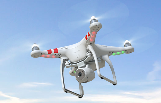
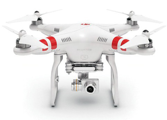
The Ekinox-N has been integrated on a UAV by Headwall in the U.S. for remote-sensing applications.
Headwall is a leading designer and manufacturer of high-performance hyperspectral imaging sensors for harsh environments. As a pioneer for remote-sensing applications, Headwall is the first to market a fully integrated remote-sensing solution combining hyperspectral and LiDAR sensors on a small UAV. This “total solution” approach has been welcomed by the remote-sensing market because it quickens time to deployment, decreases implementation costs, and enables operations in harsh environments.
The multi-rotor UAV carries Headwall’s lightweight Micro-Hyperspec VNIR hyperspectral sensor and a Velodyne LiDAR unit. The LiDAR collects a point cloud that reflects the field’s topographic relief, and the hyperspectral sensor delivers a picture showing spectral signatures of every object within the field of view. The SBG inertial navigation system has an embedded GPS and is used to provide positioning and orientation data. Weight is a key factor — Ekinox-N weighs only 500 grams, even though it integrates a survey-grade L1/L2 GNSS sensor to provide accurate positioning and precision roll, pitch, and heading data.
Mounted on the UAV, the Ekinox-N provides LiDAR and the hyperspectral camera with orientation and position during the whole flight. This and other data is recorded in real time at 200 Hz within the onboard computer. On the ground, the Headwall post-processing Hyperspec software fuses all sensor information. Ekinox-N data allows every scanned point and every pixel to be georeferenced and be tilt compensated to within a centimeter.
For miniature inertial sensors, smaller and lighter applications are possible at less cost. One of these applications includes the SLAM-based Indoor Mapping System by VIAmetris.
Simultaneous localization and mapping (SLAM) is becoming increasingly important to enable efficient indoor mapping. VIAmetris has created a different spin on indoor mapping with the “MID” portable SLAM-based scanner. This handheld system integrates a 2D LiDAR, a camera, an SBG Ellipse-A AHRS, and a tablet PC that shows the map being drawn while the user walks around inside the building. The AHRS also compensates for movement while orienting the generated maps to the north.
While the user walks, the 2D LiDAR scans in a horizontal plane by measuring 43,000 points per second across a 270° field of view. The SLAM technology progressively builds the map in the shape of lines made of points. At the office, the surveyor imports the data into the post-processing software and uses the lines of points to design the map. If there is any doubt about a specific shape — whether it is actually wall or furniture, for example — a photo of the location is available as MID automatically takes contextual pictures every meter, or whenever there is a change of direction, or manually.
The centimeter-level accurate map is then ready to be imported into most CAD software. As the system works without GPS, the generated map is not georeferenced or in a local coordinate reference system. To do so, the user links MID’s points cloud to a known point and all data is automatically referenced. MID is much easier to use than a laser distance meter, a tachometer, or a 3D scanner, and significantly reduces the time required for indoor mapping.
SBG is now working more often in the marine industry, equipping boat, cranes, or instrumented buoys. The company has even developed a specific solution for the hydrographic market. The SBG Ekinox Hydrography Solution integrates Ekinox-U which operates to a depth of 200 meters, and incorporates a SplitBox with a built-in tri-band RTK GNSS receiver and uses Terrastar, OmniSTAR, or Marinestar corrections.
For subsea operations, positioning is required for ROVs and AUVs that navigate for minutes or sometimes for hours underwater. GPS fixes are only available when the vehicle comes close to the surface. But operators usually try to expend the time they are able to operate close to the seabed. To avoid typical INS drift, different aiding sources are used — the three main ones are acoustic positioning, Doppler velocity loggers (DVLs) and depth sensors.
- Acoustic position is far more noisy and unstable than GPS.
- DVL is a kind of 2D odometer, providing speed over the seabed.
- The INS and the Kalman filter therefore play a key role to provide reference heading and reliable position data.
It’s a major concern when you have a massive ROV working on pipes under an offshore platform. Any mistake can cause severe damage and cost millions.
So SBG is moving along and taking on new, challenging applications with a range of MEMS inertial products that appear to be growing quite rapidly, with ever-improving performance. Once upon a time, we couldn’t stay anywhere within RTK-level performance during GPS outages because of the high drift-rate of MEMS inertial devices. Now, SBG has introduced its latest Ellipse-D dual-antenna mini INS/GNSS spec’ed at 0.1° real time for pitch and roll, with 2-cm RTK position.

And just today, SBG Systems has even bigger news with the release of the Apogee series, which is Apogee’s most accurate, robust and cost-effective MEMS technology inertial navigation system. The Apogee INS/GNSS integrates the very latest generation of MEMS sensors along with a triple-frequency GNSS receiver, achieving 0.008° in roll and pitch in real time, and 0.005° in post-processing. With two antennas, it also provides reliable and accurate heading.
Amazing what scientific skill, focused investment and time has done for MEMS inertial technology!
Tony Murfin,
GNSS Aerospace