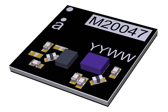
Antenova Ltd., manufacturer of antennas and RF antenna modules, has launched a new compact, all-in-one active GNSS antenna, part number M20047-1, at the Consumer Electronics Show (CES) show, Jan. 9-12, in Las Vegas.
The M20047-1 antenna adds another option to the company’s existing range of positioning antennas and modules.
It operates in the 1559–1609 MHz bands, and offers designers a useful, space-saving option for small tracking devices.
It’s key features are the active components, the built-in LNA and filter, which act to boost the signal to the GNSS processor in environments where there is a restricted view of the sky and line-of-sight to the horizon is difficult. With the LNA and filtering already built into the antenna, designers will not need to add them, and can save space on their PCB.
The M20047-1 is a very low profile rigid FR4 antenna measuring 7.0 x 7.0 x 1.1 millimeters, making it suitable for use in small tracking devices. It is suitable for tracking all kinds of moving objects, telematics and wearable sports devices.
The M20047-1 antenna is named Active Sinica and is an alternative to Antenova’s existing Sinica antenna, part no SR4G008, which is marketed for accurate positioning.
Antenova’s antennas are specifically designed for easy integration; however, the company provides full engineering support to help customers with all aspects of antenna testing, tuning and integration.
Septentrio’s debuted its Altus NR3 at Intergeo 2017, which took place Sept. 26-28 in Berlin, Germany. According to the company, the Altus NR3 combines easy-to-use, multi-frequency, quad-constellation RTK with an unrivalled communications toolset.
Key features of the antenna include a light and portable GNSS receiver; quad-constellation, multi-frequency RTK positioning; and an anti-jamming and monitoring system. The Altus NR3 also features all-in-one base and rover operation.
“This is a true RTK system that makes the use of all the signals to have the best performance that Septentrio is recognized for,” said Gustavo Lopez, product manager at Septentrio. “We also bring something that is quite unique in terms of technology, which is interference mitigation.”
According to the company, the Altus NR3 can suppress the widest variety of interferers from simple continuous narrow-band signals to the more complex wide band and pulsed transmitters, as well as lnmarsat and Iridium satellite transmissions.
The Altus NR3 also features an open interface, so it can be used for a variety of use cases and applications, Lopez added.
Watch the video to learn more about the Altus NR3’s features.
Tallysman, a manufacturer of high-performance GNSS antennas, has released a family of high-performing economical wideband low noise amplifiers (LNAs) for choke-ring antennas.
Tallysman offers four models of the LNA with options of 35-dB and 50-dB gain. The capabilities of the models are shown in the table below. The LNAs are designed for upgrading existing choke-ring antennas with Dorne Margolin/EDO elements to receive new and expanding GNSS signals.
The LNAs provide consistent gain across the full bandwidth and include filters for suppression of out-of-band interfering signals, such as cellular LTE and Iridium signals, while maintaining a low noise figure, high third-order intercept point, small group delay and low power consumption, the company said.
The enclosure is designed to fit a wide variety of currently deployed choke-ring antennas.
Tallysman, a manufacturer of high-performance GNSS antennas and related products, has released two high-gain (50dB) GNSS antennas: the TW3152 and TW3752.
High-gain GNSS antennas are useful in situations where long cable runs are required, such as in timing systems and GNSS re-radiator systems, the company said.
The TW3152 provides reception of GPS L1. The TW3752 provides reception of GPS L1, GLONASS G1, BeiDou B1 and Galileo E1 signals. Both antennas employ Tallysman’s Accutenna technology, which provides a high degree of multipath signal rejection through the full bandwidth of the antenna.
According to Tallysman, the antennas are triple filtered to prevent the saturation of the front-end LNA by strong near frequency and harmonic signals, which are a growing concern throughout the world.
These antennas are available with a choice of radome shape (flat or conical), color of radome (white or grey), as well as a wide variety of connectors.
Leica Geosystems showed off its Zeno GG04 smart antenna and DS2000 Utility Detection Radar at the 2017 Esri User Conference, which took place July 10-14 in San Diego, California. The Zeno GG04 improve mobile devices’ GNSS accuracy with Real-Time Kinematic (RTK) and precise point positioning (PPP), while the Leica DS2000 Utility Detection Radar detects and positions shallow and deep targets simultaneously.
Tallysman, a manufacturer of high-performance GNSS antennas and related products, released its NMO (New Motorola) mounts for its dual- and triple-band GNSS antennas. NMO mounts are used in a variety of applications such as automobiles, railway cars and emergency vehicles.
With the introduction of this mount, customers can now upgrade existing GPS L1-only antennas to dual (L1/L2) and triple (L1/L2/L5) band GNSS antennas.
The NMO mount is available for Tallysman’s TW3872 (GPS L1/L2, GLONASS G1/G2, BeiDou B1, and Galileo E1) and the TW3972 (GPS L1/L2/L5, GLONASS G1/G2/G3, BeiDou B1/B2, Galileo E1/E5a+b + L-band correction) antennas.
The NMO mount is able to accept a ground plane (also available from Tallysman) to increase the gain of the antenna.
Tallysman antennas are housed in an IP67 compliant housing and are REACH and RoHS compliant.
CAD model of the antenna system: The antennas will be arranged so that the center of mass is at the center of the tube. Each antenna will be counterbalanced. (NASA)
Researchers at NASA’s Armstrong Flight Research Center have designed an antenna-mounting platform to provide users satellite-based tracking functions for unmanned aerial vehicles. The platform integrates multiple capabilities onto one low-cost platform.
In August 2016, NASA signed a license agreement with Mobile Antenna Platform Systems Inc. to commercialize the portable antenna platform.
The platform is built to rotate 60 pounds of antennas, transmitters and receivers and eliminate the need for additional load-balancing hardware. A smaller version can be flown on a plane, greatly extending the telemetry link range without requiring more power from the aircraft.
Auto tracking software uses the target’s GPS location to coordinate and maintain a line-of-sight link as great as what the telemetry system can support.
NASA researchers originally developed the technology for use with research UAVs, which often involve multiple transmitters and receivers on the aircraft and on the ground, with multiple antennas that must be pointed at a single UAV.
The platform is a middle ground between the low-end tracking platforms that support only one antenna and expensive, high-end options designed for military use.
Besides research, the platform could be used in marine communications, satellite tracking in multiple frequencies and weather balloon tracking, NASA said.
Powered by 120 VAC, the platform moves all of the antennas simultaneously in continuous rotation in azimuth and vertical ±180°, effectively tracking a line-of-sight object up to 20 miles away or further, limited by transmit power and antenna configuration.
It is designed for use with any moving system needing to transmit large quantities of data over one or more RF links. RF signals can include video, command and control, and signals to and from the UAV as well as the research data of interest.
The platform design includes:
a horizontal bar with antenna mounts
a platform head containing the motors and gears
an antenna stand containing electrical slip rings and cables to connect to the radios, motors and external computer
a microcontroller interface to drive the motors and receive antenna commands from the software
Its user interface runs on Microsoft Windows and enables the tracking antenna to be interfaced to any ground station that can provide the GPS coordinates of the target being tracked in real time and the GPS coordinates of the tracking antenna.
Platform benefits
According to NASA, the antenna platform offers these benefits:
Portability. Lightweight components and a small profile allow the platform to be carried by a single person.
Simplicity. Its unique design eliminates the need for additional load-balancing hardware, simplifying setup.
Versatility. Up to 58 pounds (26 kg) of multiple antennas from various manufacturers in any combination (including Yagi-Uda, dish/parabolic, omnidirectional, patch/microstrip) under 10 W can be accommodated
Low Power Use: Using a smaller motor that is faster than those on other platforms requires less power to achieve continuous rotation.
Low Cost: The overall system is estimated to cost less than $5,000.
Two new topic areas and presentations have been added to this Thursday’s free webinar on Signal Interference: Detection and Mitigation.
The speakers will explore anti-jamming protection with controlled radiation pattern antennas (CRPAs) and with dual-polarized antennas. The latter topic is also the cover story for the February issue, which demonstrated a significant improvement in positioning accuracy and robustness against interference with a dual-polarization approach: a gain in terms of C/N0, particularly for low-elevation angle satellites and valuable in urban environments.
Headshot: Kirk Burnell
Kirk Burnell from NovAtel joins the Feb. 2 panel to present “How to deliver assured positioning, navigation and timing in GNSS-compromised environments.”
He will look at applications that stress the importance of high-reliability PNT. Compromised GNSS signals due to unintentional interference is of great concern, but intentional interference due to jamming is much more insidious. Anti-jamming protection via controlled reception pattern antenna (CRPA) technology is now available to a wide range of users. A brief explanation of the technology will be followed by a few use-cases where CRPAs have been deployed in a variety of applications.
Burnell, Core Cards Product Manager for NovAtel, has worked at the company since 2015. With an education in survey engineering, Kirk has been working with precision GNSS system designers and integrators in both support and product management capacities for more than 20 years.
Headshot: Matteo Sgammini
Matteo Sgammini of the German Aerospace Center (DLR) will talk about work with dual-polarized antennas: the principles of operation of such an antenna array and how one performed in real-world jamming and non-jamming scenarios. This ION GNSS+ 2016 presentation became the cover story for GPS World’s February issue.
Innovation editor Richard Langley writes in his introduction to the February column, “All GNSS satellites transmit RHCP [right-hand circularly polarized] signals and therefore most GNSS receiving antennas are designed for such signals. However, a funny thing can happen to a satellite signal on the way to a receiving antenna. If the signal bounces off a nearby structure or the ground or the sea surface, its polarization is modified and it will become LHCP [left-hand circularly polarized] or a combination of the two polarizations.
“A primarily LHCP antenna can capture a significant portion of the energy in such a RHCP signal and could provide a strong response to a reflected signal when the line-of-sight signal is missing or very weak. So, there could be a benefit in having a dual-polarized antenna to improve positioning capability in marginal situations. Furthermore, jamming signals can be of arbitrary polarization and a dual-polarized antenna array with beamforming capability could better separate and mitigate such interference.”
February cover story. Photo: GNSS
Researchers at the DLR equipped a GNSS receiver with a diversely polarized antenna array to combine signal processing in the spatial and in the polarization domain. Tests show a significant improvement in receiver robustness against interference compared with the general single-polarization case.
The carrier-to-noise-density ratios of the line-of-sight components are improved since the receiver can use the power present on the left-hand circularly polarized channels, particularly for satellites with low elevation. Interference mitigation improves due to the possibility of filtering in the polarization domain and the additional number of available degrees of freedom.
Sgammini received a Masters degree in electrical engineering from the University of Perugia, Italy and now works at the Institute of Communications and Navigation, DLR. He is currently pursuing a Ph.D. in electrical engineering with research interests in interference mitigation techniques for GNSS. His research activity includes adaptive filtering, array signal processing and estimation theory for GNSS.
As the number of GNSS signals being tracked increases, so does the potential for interference to dismiss the performance gains of using those additional signals.
To maximize performance and efficiency, prepared PNT users need their equipment to be able to detect when interference is present and mitigate it.
Developers, integrators and users need mitigation tools to protect and preserve GNSS measurement quality, maintaining high-quality multi-frequency multi-constellation positioning performance, even in challenging RF environments. This is essential particularly on the integration journey, especially during prototyping and when encountering unforeseen interference events in field testing, in order to produce fully successful integrated products.
The one-hour webinar also will include a follow-up Q&A session with the speakers. Burnell and Sgammini join Patrick Casiano of NovAtel and Rick Hamilton of CGSIC on the speaker panel. Casiano will present an Interference Toolkit that measures RF spectrum levels and allows the user to apply mitigation tools to protect and preserve GNSS measurement quality. Hamilton will explain the proliferation of jammers, aspects of illegal use, coordinated government response to interference events, and regulations to prohibit manufacture, import, export, sale and use of jammers.
Taoglas, provider of IoT and M2M antenna solutions, has launched the Engager Logarithmic Periodic Dipole Antenna (LPDA) series in booth No. 4849 at CTIA Super Mobility 2016.
The wide-band directional antenna series offers high gain at multiple frequencies, including all cellular 2G/3G and 4G LTE bands globally for all carriers and networks, the company says in a news release.
In areas of low signal strength, the higher gain can help a device get connectivity when a standard Omni directional antenna would not.
“These wonderful looking Engager’s eliminate the need for Yagi’s,” Dermot O’Shea, Taoglas joint CEO, says. “The Yagi’s are also directional and high gain but are limited to a narrow bandwidth or single frequency. That means if you installed an antenna for a base station belonging to a certain carrier at a certain time, that frequency or base station equipment can be changed over time, meaning you have to go back on site and change the antenna. That scenario can happen over and over again but with the Engager series it’s a one time installation and future proofs the site’s connectivity for many years.”
The Engager series launches at CTIA Super Mobility 2016, which is being held Sept. 6-9 in Las Vegas, Nevada, with four variants, and more planned:
All are available in wall or pole mount options. The wall mount option consists of a two-part bracket, allowing it to be tilted and rotated and pointed in the required direction of the base station. The pole-mount bracket is delivered with u-bolts and clamps and, when secured on the pole, also allows a 30-degree tilt above or below horizontal.
“Taoglas engineering continue to not only innovate but exhibit the never give up attitude. To achieve such wide bandwidths, while maintaining high performance, makes us all very proud of the Engager series,” O’Shea says.
Everyone talks about the weather, but nobody does anything about it — right?
Our lead authors this month are doing something about it.
The July cover story of GPS World magazine was titled “See into the Smoke with Inertial.” This month’s feature could have been called “See into the Fog with CDGNSS,” but we just didn’t have room in the already extensive article to go into that angle. So here it is.
Precise carrier-phase differential GNSS positioning will in the near future become a must-have complement to cameras and lidar for all-weather automated driving. Positioning will be furnished, as the article explains, by a dense reference network broadcasting to low-cost antennas for precise (10 centimeter) performance.
Here’s the kicker, not included in your cover-story package, although hinted at by the orange and green trapezoids on the cover, and replicated in the fog-bound version above.
Such vehicle positioning would enable new driver-assistance systems. With precise knowledge of a vehicle’s position and orientation, intuitive driving directions can be rendered on the windshield in luminous paths that appear to be painted on the roadway. These paths will guide the driver along the fastest route to destination. Other symbols will suggest lane changes for safety or efficiency, and highlight the presence of vehicles dangerously close ahead. Because satellite navigation signals are not affected by rain, snow or fog, they can be combined with radar sensors to safely guide a driver or an automated vehicle in all weather.
As author Todd Humphreys explains it, “Imagine how relaxing it would be to follow a yellow brick road safely home! I envisioned this augmented-reality heads-up display during a recent road trip. Driving on unfamiliar roads, I was trying to interpret various route options on my wife’s smartphone while simultaneously fielding questions (in Spanish!) from my in-laws, and more questions from my nine-year old son. It was too much to ask of one driver!”
Not any more. That is, soon, in our brave new future, no longer.
NovAtel Inc. has introduced the GPS-713-GGG-N and GPS-713-GGGL-N ATEX-qualified triple-frequency GNSS antennas with an Inmarsat rejection filter.
Based on the company’s pinwheel technology, the antennas offer multi-constellation reception of L1, L2 and L5 GPS; L1, L2 and L3 GLONASS; B1 and B2 BeiDou; as well as E1 and E5 a/b Galileo frequencies.
The GPS-713-GGGL-N also supports L-Band from 1525 to 1560 megahertz. The same antenna can be used for GPS-only, dual or triple constellation applications, resulting in increased flexibility and reduced equipment costs, the company said in a news release.
The phase center of the antennas remain constant as the azimuth and elevation angle of the satellites change. Signal reception is unaffected by the rotation of the antenna or satellite elevation, according to NovAtel. With the phase center in the same location for the GNSS signals, and with minimal phase center variation between antennas, the antenna is suitable for baselines of any length.
The rugged antenna is enclosed in a durable, waterproof housing and meets MIL-STD-810G for vibration, corrosive environment and salt fog, NovAtel says. The GPS-713-GGG-N and GPS-713-GGGL-N are similar in form factor to our other high performance GPS-700 series antennas, and bth antennas meet IEC60945 specifications.
The two antennas deliver choke-ring level antenna performance, but without the size and weight, NovAtel said. Both antennas provide enhanced Inmarsat interference rejection, which allows tracking of GNSS signals in the presence of high-powered Inmarsat transmitters that are typically found on marine vessels.
Sponsored by:NavCom Broadcast date: Thursday, February 19, 2015 Moderator: Alan Cameron, Group Publisher, GPS World and Geospatial Solutions Speakers: Maged Shenouda, Project Manager, Antenna Group, NovAtel Inc.; Kenneth M. Pesyna Jr., Ph.D. candidate, department of electrical and computer engineering, The University of Texas at Austin; Dr. Stani Licul, Co-Founder, President and CEO, Maxtena Summary: Understand the whys and hows of simulating signal problems now to avoid real-world problems later when newly released GNSS products encounter unanticipated problems in the field. As the number of critical applications that rely on positioning, navigation and timing (PNT) increases, the list of considerations for testing also grows. Topics addressed include leap seconds (next one coming up in June!), multipath, and interference of all sorts. The stakes for attacks on GNSS technologies are rising as incidents increase from occasional, often accidental, interference to more structured and organized approaches to jamming and spoofing. Moderated by Alan Cameron, Group Publisher, GPS World and Geospatial Solutions.
 It’s key features are the active components, the built-in LNA and filter, which act to boost the signal to the GNSS processor in environments where there is a restricted view of the sky and line-of-sight to the horizon is difficult. With the LNA and filtering already built into the antenna, designers will not need to add them, and can save space on their PCB.


 With the introduction of this mount, customers can now upgrade existing GPS L1-only antennas to dual (L1/L2) and triple (L1/L2/L5) band GNSS antennas.