On Dec. 22, Hexagon AB announced its acquisition of LocLab, a German company that specializes in 3D digital twin content creation. LocLab will operate as a part of Hexagon’s Geosystems division.
This acquisition, which began as a partnership, strengthens Hexagon’s ability to make its Smart Digital Reality, a 3D hub for data management and information, more accessible to new and existing users while giving LocLab’s users a platform to host, share and keep 3D digital twins up to date.
LocLab’s toolchain leverages several data input formats such as terrestrial videogrammetry, survey data and point clouds, but only requires photos or videos. Hexagon is integrating LocLab’s 3D digital content with its HxDR cloud-based storage, visualization, and collaboration platform. This integration drives HxDR’s expansion as a digital reality platform into the transportation, construction and urban planning industries.
The integration of HxDR and LocLab’s capabilities strengthens Hexagon’s reality capture and software portfolio while offering LocLab global scalability opportunities through Hexagon’s sales and partner network.
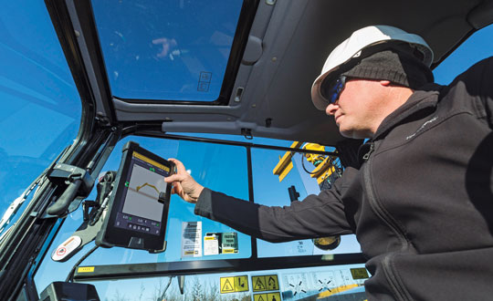
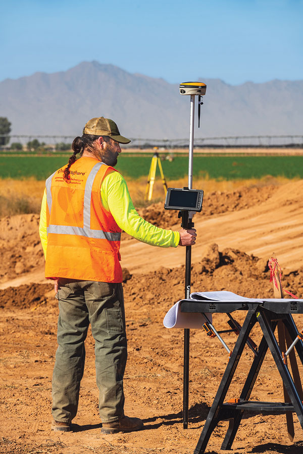
Guidance and precision control, the base elements of modern machine control for construction, have continued to evolve since broad productization began in the mid-1990s. However, the value proposition has become even sweeter since, with value being realized beyond the return on investment (ROI) of the general contractors and the total project price tag for the clients. While the majority of equipment globally is still non-digital, new levels of simplicity and affordability are helping to fill that gap.
The roots of machine control stretch back a century. The Historical Construction Equipment Association (HCEA) posits that the A.W. French & Co. “utility grader” of the 1920s, a crawler-mounted unit that used stringline control, may be the very first example — and this before electronics and computing. However, it was the advent of real-time kinematics (RTK) for GPS in the mid-1990s that brought machine control as we know it to the construction site, and coincidentally to precision agriculture.
Initially, the focus was on guidance. Then it moved to precision control, such as blade control, and later propagated to more classes of motorized equipment, improved with further sensor integration.
The impact on construction and agriculture has been undeniable: productivity gains, less rework, more efficient handling of materials, shorter timelines, site safety improvements, and more. These benefits are as obvious to clients and operators as they were in the early days of adoption, gains from nearly three decades of innovation.
What form have these growing benefits taken, and who is realizing them? We sought insights from industry experts to find out.
Grading and Excavation
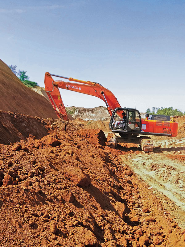
Automation is not just about speed; it is also about better control of the load and stress on the equipment and moving just the right amount of materials so as not to place a burden on it. (Photo: CHCNAV)
These two activities, as each of our interviewed experts attest, represent the lion’s share of realized productivity gains.
While not the complete picture of overall value, the sheer volume of equipment that has been, or could be, automated speaks, well, volumes. “Apart from the skid steer systems, there are more excavators manufactured than all the other equipment types combined,” said Daniel Sass, product manager of machine control at Hemisphere GNSS. “Excavators are the workhorse. And people use them differently, and they use other pieces of equipment to complement excavators somewhat differently. Certainly, the bulk of our sales is excavators, and in fact a key part of our value proposition is focused on compact machines, but also all the way up to mining shovels. Certainly, by volume it is excavators and compact excavators.”
Numbers help tell the story. “In the United States, at least in a three-year period from 2019 to 2022, about 253,000 excavators were sold, for which I have pretty reliable data, but only 61,000 dozers and only 7,000 scrapers,” Sass said. “That’s North America, where we also use a lot of dozers and scrapers. If you go to Europe, where they use excavators for many other tasks, the proportional impact might be higher.”
Operators can easily gauge the ROI of going digital for individual pieces of equipment such as excavators, but part of the incentive could be that general contractors are requiring subcontractors to be equipped and ready to fit into a more complete digital site. “Some definitely require it,” said Randy Noland, vice president of global sales at Hemisphere GNSS. “A lot of … larger sites. I wouldn’t say everybody mandates it yet, but that it is growing.”
“Operator assistance is not only helping someone cut to grade faster, but is also the best way to cut to grade,” said Cameron Clark, earthmoving industry director, Trimble Civil Construction. “How do you move the material? That directly ties into productivity by only moving the material you need to move, which also equates to less fuel because you can do it faster.” With operator assistance, Clark said, it is not uncommon to see productivity gains of 30% to 40%, even with inexperienced operators. And with automatics, this could exceed 75%, depending on the work done.
There are substantial gains to be made in operator assistance for less complex heavy equipment, such as compactors. “Often a contactor will put a less experienced operator in the compactor,” Clark said. “In manual days, to overcome the potential of under-compaction and missing spots, they’d create quite a big overlap, maybe up to 40% of overlap between paths. By adding steering control, we can automate the compactor to where it needs to be — to stay on line every day, all day. And you can reduce the overlap to 10% or 15%; having to compact a smaller area means that you’re quicker, say 30% quicker.”
“Grade control gains can be 30% to 50%,” said Magnus Thibblin, president, machine control division, Hexagon Geosystems. “Depending on the machine and the job application, and how experienced the crew is, it can be similar for excavators.” Thibblin was an end user from the early days of machine control. He saw its potential and how it might work better. Its benefits came not just from automating elements of the equipment, he said, but from implementing a more complete digital workflow.
“How much are you working with the digital design from the start?” Thibblin said. “I’m one of those who believes you should have 3D from the start; for any kind of layer that the machines can build to. Incidentally, in North America, working to models is implemented for a lot of graders and dozers. In Europe, there is a large excavating market, but it’s the same foundation. If you work from the design, you will have savings in fuel, time, efficiency, safety, etc. Depending on all of these things, the total value proposition may be 30% to 70%.”
Wenming Sun, vice general manager for digital construction, CHCNAV, reiterates these points. “Currently, our machine control solutions are mainly installed on earthmoving machines, including bulldozers, excavators and motor graders,” Sun said. “The greatest value of these solutions is to improve construction efficiency, shorten construction time, reduce fuel consumption and mechanical wear while ensuring construction quality.”
CHCNAV is a relatively new player in the construction machine control market, launching initially in Europe and Asia. The company has been developing automation and steering systems for equipment that can yield the highest gains for their customers. “For example, our 3D TG63 automatic control system for motor graders can double efficiency compared to manual operation of machines and reduce time by 50% for the same workload,” Sun said.
Getting to the designed grade, or trench line, of earthworks geometry faster is a huge benefit, while reducing or removing finishing steps is a bonus. “Now we’re seeing that with excavators that have automatics, the finishing we can get out of an excavator is amazing,” Clark said. “You used to get dozers cleaning up after excavators. Now, with the performance you can get with an automatic excavator, you often don’t need to run the dozer — the excavator can get it done the first time.”
However, dozers are used for many other tasks. Clark noted that about 95% of blade-control systems for dozers sold have automatics. He said grade control brings tremendous productivity gains, but that excavation is right up there as well. “When you look at the number of machines out there, it’s in a different league,” Clark added. “In 2021, for example, globally about 370,000 crawler excavators and 325,000 mini excavators were sold.”
Lateral Benefits
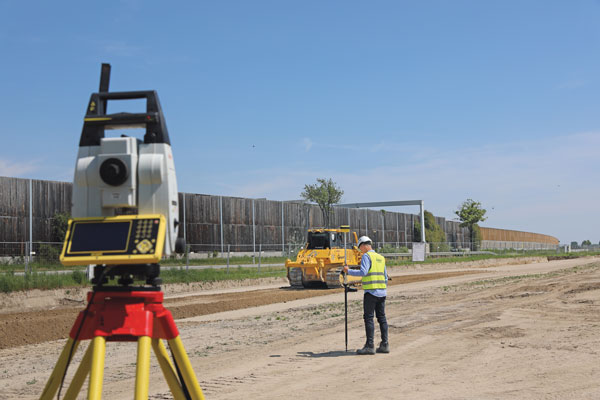
GNSS has revolutionized automation for many classes of heavy equipment. However, for certain high precision work, particularly finished elevations, site levels and totals stations are essential. (Photo: Hexagon)
For the general contractor, ROI is a key measure. This can be reasonably easy to gauge, as this ROI calculator shows: intelligent-construction.com/roi-calculator/. However, what matters is not just the upfront time and cost for grading and excavating, but also avoiding lateral time and costs. “If you can do jobs faster and more accurately, it lends itself to less rework,” Clark said. “You do it right the first time, which again goes into less fuel, and then also less material. For example, let’s say your excavator is digging down to a trench and the operator digs too deep, which happens often. That material dug out of the trench potentially needs to be carted away. So, extra fuel and trucks are needed to take the material away. They’ve got to put high quality material back in, so that means they actually have to cart more material back to put in the trench, and you have to spread the material.
Again, it’s a flow-on effect — a chain reaction. When you look at sustainability, what we do has direct and indirect effects — it’s 1 gallon of fuel you don’t use that saves about 22 pounds of carbon emissions.”
The green dividend goes beyond just what individuals and firms wish to see. Increasingly, infrastructure developers and owners may be subject to sustainability requirements. Depending on where the work is being done, sustainable development goals are being acted on. This includes not just the environmental goals, but also requirements for the digitalization of design and construction, and ultimately smarter and more sustainable infrastructure. Machine control in construction can deliver some of the most substantial benefits in meeting these goals.
Like overall value for the operators and clients, gauging the highest green dividend becomes a proposition of sheer volume. “On average, your dozer is going to burn much more fuel. However, we sell four times as many excavator solutions as we do for dozers,” said Miles Ware, vice president of marketing and global customer care, Hemisphere GNSS. “The excavator solution is critical for both an ROI and an environmental impact.” Among the most-sold excavators in the United States are the Kubota 4-ton, the John Deere 3.5-ton and 5-ton, and the Caterpillar 5-ton. “The smaller excavators are going to use a lot less fuel,” Ware added. “If we compare this to mid- and large-sized excavators and dozers, we might be getting close to a point of equilibrium, when it comes to environmental impact. Those that consume huge amounts of fuel move massive amounts of earth. However, the ability to have the larger units operate much more efficiently, complete jobs much faster, and get on site and off site quicker with fewer passes in fewer hours adds up to a green dividend. Then you take the smaller volumetric scale of so many excavators and the environmental benefit really starts to balance out. There are huge incentives for all these platforms, whether it be dozers or excavators, to have the technology in place.” Hemisphere announced at the Bauma Exhibition in October that it now has systems to support loaders and scrapers.
“One of the things that’s really intriguing to me about the loader solution is that it represents a crossover point between construction earthmoving and agriculture,” Ware said. “There’s a huge benefit for feedlots and agriculture-related operations, where they use machine-controlled loaders to avoid damaging base layers. We have a growing machine-control audience, and a substantially growing precision agriculture audience. It is just one example of how technologies are cross-pollinating in different verticals.”
The benefits of machine control are broadly recognized across the industry. “Improved construction efficiency and shorter construction time means that the machine operating time is shortened for the same workload,” Sun said. “According to our own calculation results, using for instance our system for motor graders, fuel consumption can be reduced by 35% to 50% under different working conditions. Thanks to the full real-time automation of its blade, the grader can achieve the expected finish accuracy in one or two passes, whereas an unequipped machine would require four to five passes. This effectively reduces fuel consumption and, as a result, minimizes the carbon footprint of construction projects.”
Automation means you can build to the model in less time and refine the movements of the equipment to move just the right amount of material — enough to improve productivity, but not so much as to put an undue strain on it. “Any time you have a piece of equipment that needs to be repaired or is out of service, it is disruptive to the project of course, but it can also have an environmental impact, and sustainability is something we all work toward,” Thibblin said.
Connectivity and Collaboration
Going to a fully digital site means working fully in 3D, from a digital model, and seeking to eliminate 2D plans sets. No more interpretation, no more estimation—the right amount of material is moved rapidly and reliably by multiple machines working in harmony. (Photo: Hemisphere GNSS)
Moving forward, there may be additional incremental gains in the productivity of individually automated equipment, yet this may be modest in contrast to the time since the introduction of machine control decades ago. For the next sea change in construction productivity, we should be looking beyond simply the machines. “Let’s take the holistic viewpoint,” Thibblin said. “You have everything from the machines that of course have either machine control or different levels of autonomy, everything from semi-autonomous to semi-automatic. Then you have the trucks, which can be connected also with the tracker devices, which enables optimal routing, enhanced safety, and coordinating material handling cycles.”
Total project and site coordination has been in the works for vertical construction for quite some time; we hear a lot about building information modeling. However, heavy civil is catching up. “We anticipate that the ongoing integration of digital construction solutions with internet of things technologies will bring more choice and functionality to customers,” Sun said.
Further, real-time collaborative software platforms are already in use. Many vendors for machine control have added live connectivity for such coordination.
“Our customers are using ConX,” Thibblin said, referring to Leica ConX, a cloud-based collaboration tool. “It is remotely connecting to the mission, which is support, service, file transfers, project updates.” While online collaborative tools have been around for years, current offerings have reached such a level of maturity that they have driven a boom in adoption for even smaller operations. Customers need to make sure that projects are working optimally, and continuously.
Another major difference from the early days of machine control is that the relative cost of outfitting equipment with automation components is far less. Therefore, it is more practical to automate nearly all equipment on a site, making a truly coordinated digital site possible. “It’s not just the larger businesses that are investing, it’s also the smaller businesses that understand and can calculate the ROI. It is also a difference in competency level: how complex and support-intensive the system was. Now, it’s much more integrated,” Thibblin said.
Today’s systems are tighter, work better, connect better with original equipment manufacturers (OEMs), and the learning curve not as steep. The machines have become smarter, yet easier to use and integrate. “You do not have to be a nuclear scientist to understand the systems,” Thibblin said. “The equipment and collaboration tools are now much simpler. Not simple to make, but we do that for you.”
It is a chain reaction: the equipment gets smarter yet simpler, and both characteristics drive more adoption. More of a site gets automated, enabling digital collaboration, and with that comes more efficiency, saving on time, costs, materials and fuel. The sum of the parts yields productivity gains, the site gets safer, and of course there is a green dividend as well. “It is not just the one thing that gets to this,” Thibblin said. “It is many parts.”
Clark reiterates, “The biggest driver and the biggest impact is when we can actually control the site, optimize how we coordinate groups of machines working together, and efficiently run the job site. That’s where you’re going to see the biggest benefit for sustainability and reducing the carbon footprint. You don’t just optimize productivity at the machine — it’s the coordination of the site and how the machines work together.”
What about the smaller firms and short-duration projects? Should the same level of full site integration happen for each job? Perhaps not. However, there are alternative ways to realize nearly all the benefits of automation without a full digital site. “There’s a lot of focus on short-duration jobs, not only for the typical small contractors, but also for large contractors,” Clark said. “Some large contractors actually target a decent portion of jobs for smaller duration, to balance out changes in market dynamics.” There is a lot of demand for small contractors with technology, and many small contractors have to automate just to stay in the game.
“People using grade control see all the benefits, and that affects their costs,” Clark said. “They can get jobs at a different price than someone who isn’t benefiting from grade control. We’re seeing this a lot in the adoption of our earthworks and grade-control products.”
A challenge to adoption by smaller firms used to be that with a small staff, they might not have the necessary office software, a surveyor, a design engineer, or a 3D modeler. While there is a cottage industry of drafters who do small 3D modeling contracts for that market, there are now more alternatives. “We’ve added features to our systems that enable these contractors, on these short duration jobs, to create designs without requiring office software,” Clark said. “Typically, without a 3D design, you are eyeballing, and you have to do grade checks. There are conventional systems that can include lasers and line tracers, but now that simple designs can be added to the machine-control systems without additional office steps, more operators will be able to use them on a greater number of small jobs.”
Multi-sensor integration has enabled more equipment on the site to be automated. Not long after the first GPS-guided machine control systems came along, more sensors were added, such as inertial measurement units (IMUs). Besides IMUs, the sensors in play can include GNSS receivers, lasers, lidar scanners, sonics, optics, cameras, displacement sensors, pressure sensors, thermal sensors, inclinometers, vehicle distance measurement instruments and telematics.
Beyond GPS, the wealth of additional GNSS satellites and signals has brought more robust and reliable solutions in mixed environments. Recently, a heavy equipment operator called to ask if there was “something wrong with GPS” that day. He reported having spotty fixes and wildly varying results. After some standard troubleshooting of his communications and correction sources, we determined he was using a legacy broadcast format, and his GNSS receiver, while fully multi-constellation enabled, was only using one constellation. Once a newer correction format was chosen — bam! — he was fixed instantly with results as good as he’d ever seen. Things are getting better on all tech fronts.
Coordination of a fully digital site often involves integrating as many operations as possible through a back-end site management software, connecting as much equipment as possible, and working from standard models. This can be a relatively simple proposition if a site is under a single solution. However, general contractors may not be in a position to use equipment from a single brand. They may have a diverse equipment portfolio and seek flexibility in being able to onboard subcontractors. Vendors have recognized this and offer different levels of interoperability. “In addition to high-performance and real-world site-smart software features, our systems play well with mixed fleets,” Noland said. “Meaning multi-brand GNSS systems, radios and various file formats. This is key for firms that have already made investments, as well as new users entering the market concerned about how compatible their equipment will be.”
“If you have a mixed fleet, you can easily grow it,” Ware said. “Or, you can interoperate with other contractors or entities. So, if there’s a brand X already working, and if a Hemisphere GradeMetrix contractor is added to that project, they can seamlessly come in and handle most of the files, go immediately to work, and further expand the use of the technology on that particular project.”
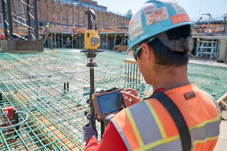
The Underserved Market
Machine control has evolved in the decades since initial productization from navigation and guiance to include precision control of blades, buckets and more, and the ability of even smaller equipment to work from 3D models. (Photo: Trimble)
If the construction industry is going to help meet growing global infrastructure needs, to fill the existing multi-trillion-dollar infrastructure gaps, then a lot more equipment needs to be automated.
“Let me just make a general comment that speaks to both productivity gains and a lower carbon footprint: as an industry, we can do much better,” Noland said. “Only about 15% to 20% of the equipment that could be outfitted for machine control has been, and the other 80% is up for grabs.” Noland credited other key players — such as Trimble, Topcon, and Leica — with providing excellent solutions for certain sectors of machine control, yet he sees an opportunity for Hemisphere to excel.
“The next wave is the underserved part of the market,” Noland said. “If we’re successful, then your climate impact is greater and your productivity gains higher.” He noted that in addition to systems for large equipment, a particular focus for Hemisphere has been providing a range of affordable solutions for smaller equipment. “We feel like we are tapping into that part of the market that has been underserved. It’s not necessarily new features from what everybody already has, as much as it is democratizing the technology to that underserved 80%.”
Autonomy and the Near Future
It is exciting to think about, but is the next sea change for construction machine control going to be full automation? Is that truly an inevitability? Or is the road to autonomy already paved with productivity gold?
“The autonomous machine, and the autonomous site; it is what we are doing to get there that continually boosts productivity,” Clark said. “As more operator assistance is added, the semi-autonomy that many systems already provide means that the operator can concentrate on more aspects of the operation; and this definitely enhances site safety.”
Autonomy might not necessarily reach every piece of equipment, and contractors may not want it for every task. With the prospects of anything like a fully autonomous site being on a sliding horizon, contractors and clients are not waiting around — they are already reaping the benefits of automation on the individual equipment level. Productivity gains and a green dividend will only increase as sites become more fully integrated. In some ways, the best parts of such a future are already here.
Gavin Schrock is a practicing surveyor, technology writer and operator of a cooperative GNSS network.
Advances in geospatial technology have opened up many new possibilities in areas such as national security, urban planning and emergency preparedness. When I was embedded with the U.S. Army as a scientist in Afghanistan, I got to experience firsthand the exceptional value of 3D data. The military used nation-scale imagery and lidar to generate 3D maps that then informed their safety-critical operations. However, since lidar—like most three-dimensional unstructured data—contains incredible complexity and detail, it was painfully slow to analyze manually.
As a result, the impact of this technology was severely restricted by speed and cost due to the significant manual effort required to extract actionable insights. As we looked to the future, where lidar would become commonplace in consumer electronics and automobiles, it became clear that there was an opportunity to combine computer vision/AI with large-scale cloud computing to rapidly and automatically generate actionable insights from 3D data.
Screenshot: Enview
After returning from Afghanistan, I reconnected with Krassimir Piperkov, a former colleague from ICON Aircraft, and fellow Stanford alum, to launch Enview. Our objective was to automate 3D geospatial analytics and create a living 3D model of the world to help organizations to protect their critical infrastructure and communities.
Powering geospatial data with AI can take the limits off 3D data analytics, prevent threats from becoming incidents, and protect critical infrastructure. What used to take days or months to process can now be done in minutes, enabling analysts, operators, and decision-makers across the public sector to make timely and accurate decisions. By enhancing our understanding of the physical world, this technology empowers us to tackle pressing challenges like wildfire prevention, humanitarian assistance, disaster response, and more.
Let’s take a look at how AI-powered 3D modeling is being put to use.
Digital twins
A living 3D model of the world, or a digital twin, can be used for many purposes. Enview’s software fuses many different data sets together to create digital twins that are global in scale but have high-resolution to enable local decision-making. These digital twins include 3D terrain, vegetation, buildings, and infrastructure such as power lines, roads, and water works. Enview also fuses real-time and forecasted conditions, such as wind, temperature, humidity, traffic, and IoT (internet of things).
This sort of rich representation of the physical world is an incredibly complex big data challenge. Data comes from radically different sensor modalities, with different resolutions, formats, time-domains, and accuracy. AI plays a critical role in automating the fusion of these datasets, by helping to intelligently align and then fuse them into a cohesive entity. 3D geospatial data is particularly challenging, as it is unstructured data, which requires a new generation of deep learning frameworks whose convolutional kernels are specifically developed from the ground up to work on unstructured data. Further, the datasets are massive in scale. A square-mile of 3D lidar data can have hundreds of millions of points; the magnitude of the data easily passes the petabyte scale when one considers applications that span nation-scale areas. In order to process this volume of data, modern geospatial AI architectures must be containerized and dynamically deployable across cloud compute resources to generate timely insights.
AI is essential to help human experts to extract meaningful insight from this overabundance of data. The application of automated workflows allows experts to look at larger areas, with more speed and higher frequencies. This machine-assisted cognition draws upon the respective strengths of people and computers to do what neither could do on their own.
Humanitarian aid and disaster relief
3D models can be built to monitor hurricane hotspots, such as the Gulf Coast, before major storms strike. By layering in real-time weather information such as rainfall, winds, and flooding, these models can help with planning, emergency response, and relief efforts.
This data also provides life-saving insight that can assess damage to buildings, transportation, and downed power lines, in addition to determining where to send medical and relief supplies, and how to best get them there. 3D data can help to lessen the impact of future weather events by updating the baseline understanding of how storms impact coastal communities so they can plan for the future.
Screenshot: Enview
Infrastructure protection
Inadequate clearances between vegetation and power lines can result in wildfires and unplanned power outages. Many federal, state, and local regulations are in place to mandate clearances, and power line operators monitor their networks continuously to ensure that they abide by these regulations and prevent incidents and outages. However, doing so by walking or flying the lines and judging distances with the human eye is challenging and inaccurate.
The ability to identify the exact location and clearances of high-risk vegetation early, and at scale, lets operators identify, prioritize, and address problem areas proactively. Lidar-driven programs have helped with risk-reduction, but are constrained by the massive levels of manual data manipulation required to derive insights from this 3D data. The automation of 3D geospatial analytics through AI, machine vision, and parallel computing enables the accurate and rapid identification of at-risk areas, protecting critical infrastructure and communities.
Screenshot: Enview
Fighting wildfires
Devastating wildfires resulting in the loss of life and property have become commonplace in the western U.S. and other parts of the world. The tools and methods previously relied on to keep communities and infrastructure safe are now struggling to keep up with this increased threat.
Geospatial information, including 3D data, provides a digital view of the physical world and, when paired with AI, gives stakeholders the informational edge they need to minimize wildfire damage, injuries, and deaths. This technology can be used to automatically build and update real-time, high-resolution wildfire risk maps that give firefighters and communities more notice when threats are imminent, and provide firefighters with real-time situational awareness when they’re fighting the blazes.
Change detection
According to the Pipeline and Hazardous Materials Safety Administration (PHSMA), third-party excavations are one of the leading causes of pipeline incidents in the U.S. These incidents can lead to service disruptions, expensive repairs, and sometimes serious injuries or deaths.
Detecting signs of excavation or earth movement via aerial patrolling is challenging and costly, while resource limitations make it difficult for pipeline operators to continuously monitor remote areas such as farms. AI-powered 3D maps can be used to monitor topography and accurately detect changes that threaten pipelines in real time.
3D data provides remarkable value when it comes to decision-making as it relates to many different applications—from military defense to protecting neighborhoods from wildfires. However, its success hinges on one thing: speed. The ability to process 3D geospatial data rapidly, and at scale, is made possible through advances in AI and cloud computing. In the future, we can expect to see more exciting and innovative use cases for AI-powered geospatial technology.
San Gunawardana is co-founder and CEO of Enview, a geospatial analytics company. After finishing a Ph.D. in aerospace engineering at Stanford, Gunawardana went to Afghanistan, where he combined data analytics and remote sensing to detect threats and prevent incidents. He is excited to apply those insights to help the energy sector solve problems. He has done computer vision at NASA, built imaging satellites with the Air Force, and was an early employee at ICON Aircraft.
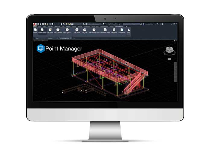
Topcon Positioning Group has released Topcon Point Manager, a point creation software that’s available as a plug-in for Autodesk AutoCAD and Autodesk Revit users in the U.S. and Canada.
According to Topcon, the solution is designed to automate point creation and easily import and export layout files to and from a robotic total station. It’ll also simplify the BIM-to-field process with a faster, more seamless point creation experience from within the design platform, reducing the time and cost of layout, Topcon added.
“Unlike standalone point creation software, which requires the user to leave their particular design environment, users of these two widely used Autodesk technologies will be able to access the solution as a plug-in component to their design package,” said Ray Kerwin, director of Topcon global product planning. “Users will benefit from the ability to automatically create multiple points on BIM objects and 2D/3D drawings from within the Autodesk environments. Just as importantly, however, they will see an increase in their quality assurance and control efforts through easily generated point and deviation reports; a likely reduction in on-site personnel (key during these challenging times), and, with the simplified processes, avoid costly construction errors and rework — the goal of most any operation working in today’s highly competitive construction environment.”
Photo: Topcon Positioning Group
In addition, Topcon MAGNET users can wirelessly send points to the field for layout and completed layout files can be sent back to the office to update the model to match as-built conditions.
“With the cloud-connected MAGNET workflow, BIM personnel or CAD teams can immediately share information to and from the field crew using a layout device. Doing so can prove invaluable, as any conflicts in point data can be quickly identified, keeping production levels up and eliminating costly rework,” Kerwin added.
Topcon Positioning Group designs, manufactures and distributes precision precision measurement and workflow solutions for the global construction, geospatial and agriculture markets.
Golden Software has improved visualization and other functionality in the new version of its Surfer gridding, contouring and 3D surface mapping package. Surfer users now have a greater number of options for displaying their scientific data in the new version, the company said.
Surfer enables users to model data sets, apply an array of advanced analytics tools and graphically communicate the results in ways anyone can understand, Golden Software added.
“In the new Surfer release, we worked on making it easier for users to gain insights into their data sets by providing additional visualization tools,” said Kari Dickenson, Surfer product manager. “New display options also enable users to more easily communicate the information extracted from their data.”
The updated Surfer
In its latest version of Surfer, Golden Software has added the peaks and depressions layer type. This layer type automatically identifies and outlines closed high and low areas, or peaks and depressions, in a grid file. In addition, a statistics report is generated for the areas, including information such as length, width, depth, volume and orientation. The feature also allows high and low areas to be colorized, annotated and displayed on their own.
The company also added four new capabilities to 3D Views: color scale bars can be added to explain the elevation, concentration or other data values depicted by colors; VRML file format exporting enables users to export their 3D Surfer model into another 3D software package or to a 3D printer; anti-aliasing makes axes and grid lines inside the 3D model appear smoother and more professional; and improved 3D PDF exporting has reduced the PDF file size and made the file exporting process faster.
In addition, Golden Software added several existing capabilities to the automation function so that users can write scripts to automate certain workflows. Automated features now include base from data layer type, vector base map symbology, new scale bar options, new legend options and new grid data options. Finally, the new Surfer version allows users to identify objects in vector base maps, such as polygons, polylines or points, by automatically renaming them based on any attribute, as well as select multiple polygons and choose to calculate their statistics, areas or volumes either as a single combined polygon or as individual polygons.
Surfer Beta
Golden Software released a Beta version of Surfer simultaneously with the new version to give customers a chance to try out new features while they are still in development. The three features the company plans to release for the spring/summer 2021 release of Surfer include 3D base maps, contour volume/area calculation and more automated features.
The 3D base maps feature allows .DXF, .SHP and other file formats to be imported with their 3D geometry (3D polylines, polygons and polymeshes) and displayed as three-dimensional features in the 3D View.
A new shortcut also will enable users to calculate volumes and areas above, below or between contour lines with just a few clicks of the mouse, the company said. Finally, additional functions that have been added to automation include point sample, grid project, new classed post layer options and label options for the degrees-minutes-seconds label format.
Golden Software, headquartered in Golden, Colorado, develops 2D and 3D scientific modeling packages.
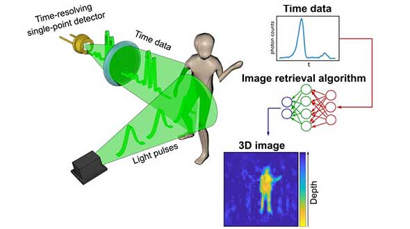
A new method of imaging that harnesses artificial intelligence to turn time into visions of 3D space could help cars, mobile devices and health monitors develop 360-degree awareness.
Photos and videos are usually produced by capturing photons with digital sensors. 3D images can be generated either by positioning two or more cameras around the subject to photograph it from multiple angles, or by using streams of photons to scan the scene and reconstruct it in three dimensions. Either way, an image is only built if spatial information of the scene is gathered.
Now, researchers based in the United Kingdom, Italy and the Netherlands describe how they have found an entirely new way to make animated 3D images — by capturing temporal information about photons instead of their spatial coordinates. The team’s paper, “Spatial images from temporal data,” was published in Optica.
Their process begins with a simple, inexpensive single-point detector tuned to act as a kind of stopwatch for photons. Unlike cameras, which measure the spatial distribution of color and intensity, the detector only records how long it takes the photons produced by the split-second flash of a pulse of laser light to bounce off each object in any given scene and reach the sensor. The farther away an object is, the longer it will take each reflected photon to reach the sensor.
The information about the timings of each photon reflected in the scene — temporal data — is collected in a simple histogram. Those graphs are then turned into a 3D image using a sophisticated neural network algorithm. The researchers “trained” the algorithm by showing it thousands of conventional photos of the team moving and carrying objects around the lab, alongside temporal data captured by the single-point detector at the same time. Eventually, the network learned enough about how the temporal data corresponded with the photos that it was capable of creating highly accurate images from the temporal data alone.
In the proof-of-principle experiments, the team managed to construct moving images at about 10 frames per second from the temporal data, although the hardware and algorithm used has the potential to produce thousands of images per second.
Alex Turpin, a Lord Kelvin Adam Smith Fellow in Data Science at the University of Glasgow’s School of Computing Science, led the university research team with Prof. Daniele Faccio and support from colleagues at the Polytechnic University of Milan and Delft University of Technology.
“Cameras in our cellphones form an image by using millions of pixels,” explained Turpin. “Creating images with a single pixel alone is impossible if we only consider spatial information, as a single-point detector has none. However, such a detector can still provide valuable information about time. What we’ve managed to do is find a new way to turn one-dimensional data — a simple measurement of time — into a moving image that represents the three dimensions of space in any given scene.”
After data collection, 3D images are retrieved from the temporal histograms. (Image: University of Glasgow)
The approach is capable of decoupling light altogether from the image-capture process, and the paper discusses how the team managed to use radar waves for the same purpose. “We’re confident that the method can be adapted to any system which is capable of probing a scene with short pulses and precisely measuring the return ‘echo.’”
Right now, the neural net’s ability to create images is limited to what it has been trained to pick out from the temporal data of scenes created by the researchers. But with further training and by using more advanced algorithms, it could learn to visualize a range of scenes, widening its potential applications in real-world situations.
“The single-point detectors that collect the temporal data are small, light and inexpensive, which means they could be easily added to existing systems like the cameras in autonomous vehicles to increase the accuracy and speed of their pathfinding,” Turpin said. “Alternatively, they could augment existing sensors in mobile devices like the Google Pixel 4, which already has a simple gesture-recognition system based on radar technology. Future generations of our technology might even be used to monitor the rise and fall of a patient’s chest in a hospital to alert staff to changes in their breathing, or to keep track of their movements to ensure their safety in a data-compliant way.”
Next, the team will work on a self-contained, portable system-in-a-box as well as examining options for furthering research with input from commercial partners. The research was funded by the Royal Academy of Engineering, the Alexander von Humboldt Stiftung, the Engineering and Physical Sciences Research Council (ESPRC) and Amazon.
Citation. A. Turpin, G. Musarra, V. Kapitany, F. Tonolini, A. Lyons, I. Starshynov, F. Villa, E. Conca, F. Fioranelli, R. Murray-Smith, and D. Faccio, “Spatial images from temporal data,” Optica 7, 900-905 (2020), https://doi.org/10.1364/OPTICA.392465.
Cesium users now have access to Cesium OSM Buildings, a global base layer of more than 350 million 3D buildings.
Cesium OSM Buildings expands the suite of Cesium Global Base Layers including worldwide terrain, aerial imagery and streetmaps already available on Cesium ion.
“As digital twins and urban mapping gain momentum in 3D geospatial, we are excited to offer a global layer of 3D buildings that can be easily visualized, styled and analyzed in an efficient and interoperable manner using 3D Tiles,” said Cesium CEO Patrick Cozzi. “Cesium OSM Buildings will help geospatial developers innovate by giving urban context to 3D applications for a broad range of use cases.”
Cesium OSM Buildings are built for efficient visualization and are streamable to any device thanks to 3D Tiles, the OGC open standard developed by Cesium to stream massive 3D geospatial datasets. Adherence to open standards means the buildings can be used in any compatible viewer, including Cesium’s free open-source offering, CesiumJS.
Seattle’s Space Needle. (Image: Cesium)
“Cesium OSM Buildings will be useful for everyone from builders sharing planned construction projects, to government agencies seeking tools for planning, training, and simulation,” said Kevin Ring, lead developer on the project.
Cesium OSM Buildings are derived from OpenStreetMap, a community-driven mapping project that welcomes anyone to improve the dataset. Buildings are also regularly updated, firmly clamped to terrain, and are individually selectable and styleable.
“Thanks to the OpenStreetMap project, most cities contain rich metadata that is useful for on-the-fly styling, like highlighting hospitals in a certain color or filtering buildings by the year they were constructed,” Ring said.
Cesium OSM Buildings is included in every Cesium ion subscription.
Cesium is a complete platform that makes the world’s ever-growing collection of real-world 3D data more useful and accessible by enabling the creation of applications that visualize, analyze and share this data – all from your browser.
Rooted in the aerospace industry, Cesium was built to track satellites orbiting the Earth with sub-millimeter accuracy. Cesium continues to aggressively develop and enhance the platform for a range of customers in government agencies, startups and Fortune 500 companies alike.
The ability to capture and evaluate truth on the ground through aerial imagery is an ever-growing industry, thanks to the proliferation of UAVs and access to imagery on demand and online. Yet obstacles remain that could prevent organizations from capturing location intelligence.
For organizations that require timely, accurate and current aerial imagery, an additional capture program outside of drones could be necessary. One company, Nearmap, flies fixed-wing aircraft two to three times per year over 430 urban areas across the United States. Using proprietary camera technology, Nearmap captures aerial data in a variety of formats: vertical, oblique and 3D. The location content is then delivered to customers via a web browser application and can be easily integrated into GIS/CAD applications.
A mid-size tech company in New Mexico using a drone to capture digital surface model data ran into two obstacles: proximity to no-fly zones at Albuquerque International Airport and need for image consistency over an entire metro area. With a project due date looming, the company turned to Nearmap, which provided the necessary image data around the airport, as well as historical imagery. With the Nearmap data, the company was able to speed project planning from design to project completion.
Nearmap aerial imagery also provides data at scale (an entire city, not one city block). The clarity of the imagery is 2.8-inch ground sample distance, providing optimal data for seeing truth on the ground.
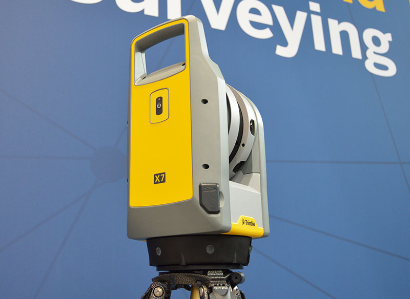
The Trimble X7 is designed for surveying, construction, industrial and forensic applications. (Photo: Allison Barwacz)
Trimble has released its X7 3D laser scanning system at Intergeo 2019, which took place Sept. 17-19 in Stuttgart, Germany. According to the company, the system is designed to enable professionals of all scanning levels to quickly and easily capture precise 3D scanning data to produce high-quality deliverables.
The X7 is designed for surveying, construction, industrial and forensic applications. The scanner features Trimble X-Drive technology, survey-grade self-leveling and a smart calibration system.
“We are really excited to bring the X7 to the market,” Gregory Lepere, marketing director, optical and imaging, Trimble, told GPS World. “It’s a very simple solution but offers a lot of smart technology. Every time you turn the instrument on, the automatic calibration will start, so you’re guaranteed to have all of the specifications all of the time.”
It also integrates streamlined workflows to provide automatic registration of point cloud data in the field with Trimble Registration Assist.
“The feature bringing the most simplicity to the solution is the Trimble Registration Assist technology, which is a full registration in the field, bringing all of the scans together thanks to self-leveling IMU technologies combined with cloud-based software,” Lepere said.
Survey applications
For surveyors and geospatial professionals, the X7 provides fast and balanced performance in both indoor and outdoor environments and is ideal for industrial survey/tank calibration, civil infrastructure, general surveys, road intersection surveys, utilities, mining, and historical documentation and renovation, Trimble said.
The X7 is fully integrated with the Trimble Perspective software, which enables scans and images to be captured, fully registered together, refined, controlled and exported to a variety of established data format for Trimble and non-Trimble software suites.
Building design and construction applications
For users in building design and construction, the X7 assists with measurement problems and improves field productivity for a broad range of applications in architecture, engineering and construction industry projects.
For these applications, the X7 is fully integrated with Trimble Field Link software to provide streamlined workflows specific to the building construction industry — from scanning to modeling to field layout.
Forensics applications
According to Trimble, the X7 can perform in demanding conditions and offers easy setup for investigators and law enforcement. It also pairs with the company’s Trimble Forensics Capture software.
The Trimble X7 is expected to be available in the first quarter of 2020.
KVH Industries’ Bill Houtz offers an overview of the KVH TACNAV 3D, a fiber optic 3D inertial navigation systems with embedded GNSS, at the Institute of Navigation’s 2019 Joint Navigation Conference in Long Beach, California. According to the company, TACNAV 3D’s modular tactical design and flexible architecture allow it to function as either a standalone navigation solution or as the core of a multi-functional Battlefield Management System.
How are oblique views derived from aerial imagery?
Typically, a camera takes a field of view of 120 degrees (+/– 60 degrees either side of centerline). The nadir is straight down +/– 5 degrees either side, but everything beyond is considered oblique imagery.
Overlapping imagery is required to ensure clean images and to reduce the angle of obliquity. Too much of an oblique angle causes parallax, which distorts the image, so it is usual for imagery to overlap by 70% each pass, meaning that 30% either side of center is used, but everything except for a small path considered nadir is double imaged.
However, in the case of stereographic imagery, which is required for building a 3D mesh, the overlap has to cover the centerline of the last flight path, so the flights must be much closer together.
Oblique imagery allows 3D meshes to be created, which is a huge benefit to geospatial analysis. It allows the actual terrain to be measured not in a straight line, but in an actual topographic line that includes elevation changes for point-to-point distance.
Additionally, straight lines work when everything looks flat, but in reality straight lines are rare, and point-to-point measurements often have to take advantage of the existing terrain, avoiding steep terrain and aiming to stay on the highest ground to avoid marshy areas.
Oblique imagery also allows for mensuration, which is the measurement of the vertical based on the trigonometry of the sensor’s position and height compared to the target’s angle. More than one oblique image of the same target area allows for stereographic imagery for building the 3D meshes and seeing in 3D. Without the magic of oblique imagery, GIS would be a 2D science.
An electric cooperative that serves more than 33,000 member customers in Lakeside, Arizona — including the White Mountain Apache Tribe — is using an unmanned aerial system (UAS) to enhance the utility’s GIS effort, working with UAS specialist Skynetwest. Noah Ruiz started Skynetwest in 2015 to provide aerial photographic and videographic services, but seeing the potential of UAS he began making the pivot to high-value data retrieval.
Initial work for the Navopache Electric Cooperative (NEC) included an inspection of an area’s substations. Conducted on a day in which the winds were blowing at 20+ mph, with most other aircraft, the flight would have been extremely risky if not scrapped.
Skynetwest used an Intel Falcon 8+ Drone, Topcon Edition. Windspeed limits for the Falcon 8+ in GPS mode are set at 26 mph; in height mode that threshold is extended to windspeeds as high as 35 mph.
The Falcon 8+ has triple-redundancy inertial measurement units (IMUs), double-redundant compasses, dual-constellation GPS, eight propellers and two batteries. Built into the aircraft’s software is an algorithm that detects the electromagnetic frequencies coming off of power lines and tells the IMUs which one it wants to switch from, which GPS it wants to use, and which compass it wants to use.
The aircraft’s stability is key not only for power line work but also for items like inspection of oil and gas components. For inspection applications — close-up inspections to detect millimeter-sized damage, fine hairline cracks, leaks or heat power losses, for example — the Falcon 8+ payload consists of a Panasonic Lumix DMC-ZS50 camera for true-color RGB images and the FLIRTau 2 640 thermal imaging camera for infrared imaging. The hybrid RGB + 14-Bit RAW data inspection payload combines a near-infrared camera with a high-resolution digital camera mounted in parallel.
The mapping package Skynetwest uses includes a 36-megapixel RGB camera (Sony Alpha 7R) and delivers both orthophotos and 3D models in Topcon ContextCapture software, powered by Bentley Systems.
Upon completion of the substation project, using ContextCapture and Agisoft PhotoScan software, Skynetwest stitched together all of the images it had gathered to create a georeferenced 3D model of that substation. NEC is looking into building more 3D representations of the entire grid and ultimately hoping to build a complete 3D spatial record down to nuts and bolts — all with survey grade data.