The 23rd International Flight Inspection Symposium (IFIS) will gather experts in San Salvador May 4-8. There, Rohde & Schwarz will demonstrate its test and measurement solutions for ground-based navigation aids. The exhibits address the rising traffic volumes and stricter safety requirements.
Rohde & Schwarz will take part in the conference’s technical sessions with a presentation on “Challenges for UAV Operations in RF Dense Aerodrome Environments.”
The aviation sector today faces increasing air traffic density, rapid technological advancements and heightened security concerns, the company explained. Operators need test equipment that delivers laboratory level precision while tolerating the harsh environment of an airport runway or a remote navigation site.
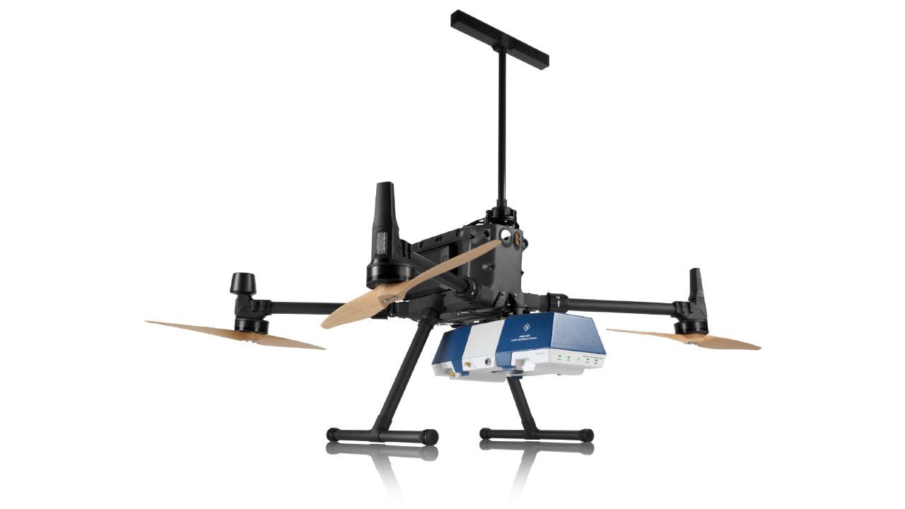
Among the exhibits at the Rohde & Schwarz booth is the R&S EVSD1000 VHF/UHF Nav/Drone Analyzer, designed to conduct GBAS, ILS and VOR measurements in line with ICAO Doc 8071 and ICAO Annex 10. The receiver delivers laboratory precision, supports an air to ground Wi‑Fi datalink and gapless measurements with improved location accuracy during flight inspections. Customers benefit from a device that can be mounted on a drone, reducing the need for manned flights and lowering operational expenses.
Rohde & Schwarz gives airlines, airport operators and navigation service providers a reliable way to certify and maintain ground‑based aids under today’s demanding conditions. By combining high measurement accuracy, easy operation and durability, Rohde & Schwarz aims to help the industry keep pace with growth.
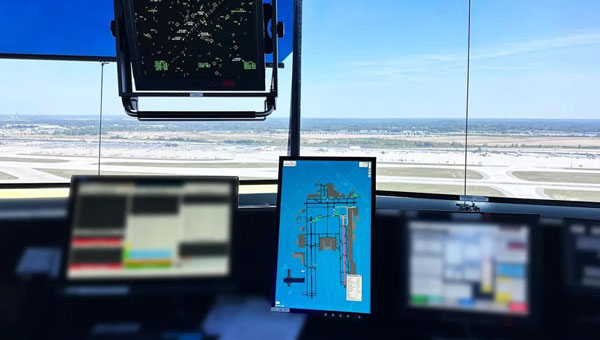
uAvionix has successfully installed and approved its surface situational awareness systems at two major U.S. airports: Indianapolis International Airport (IND) and Austin-Bergstrom International Airport (AUS). Developed in collaboration with Capital Sciences, the systems have passed the Service Acceptance Test (SAT) and will be operational for Air Traffic Control (ATC) starting June 30, 2024.
“This milestone marks the first approvals under the Federal Aviation Administration (FAA) Surface Awareness Initiative (SAI), part of a broader effort to enhance runway safety across the nation,” said Christian Ramsey, chief commercial officer for uAvionix.
The uAvionix systems use the Automatic Dependent Surveillance-Broadcast (ADS-B) service called FlightLine, which offers controllers real-time, precise depictions of aircraft and vehicles on the airport surface. This technology seeks to improve situational awareness and reduce the risk of runway incursions.
The delivery of the FlightLine systems to IND and AUS was completed and accepted within a 90-day timeframe, thanks to close collaboration with the FAA, National Air Traffic Control Association (NATCA), Indianapolis Airport Authority and AUS.
Each airport also installed several of uAvionix’s VTU-20 ADS-B Vehicle Movement Area Transmitters (VMATs) on airport vehicles. The VTU-20 is an FAA-approved system that allows vehicles operating on runways and taxiways to be electronically seen by the tower and aircraft equipped with ADS-B In technologies, further reducing the risk of runway incursions.
Following the success of these implementations, uAvionix will continue working with the FAA to expand the capability to other airports nationwide.
Key benefits of the enhanced system include:
Improved real-time tracking of aircraft and vehicles on the airfield.
Increased safety and efficiency in all weather conditions.
Decreased risk of runway incursions due to timely and accurate data.
The European Organization for the Safety of Air Navigation (EuroControl) has awarded GMV a contract for the evolution of AUGUR, a free service for pilots, airspace users and air navigation service providers.
AUGUR is a web-based service that makes it possible to predict the availability of the GPS and receiver autonomous integrity monitoring (RAIM) navigation solution for a wide range of air operations. The RAIM processing algorithm, which is standardized and incorporated into most aeronautical GPS receivers, allows operators to check the integrity of GPS satellite signals by exploiting the redundancy of measurements offered by the current constellation.
Although only four satellites in view are needed to calculate the position and time of the aircraft, the current GPS constellation has 31 active satellites, meaning that the receivers are getting signals from more than four satellites much of the time. The RAIM technique takes advantage of these additional measurements to check the integrity of the satellites and ensure the position obtained is correct within the alarm limits established for each operation.
Within the framework of the new project, GMV will lead all phases related to the development of the new AUGUR services, including the definition of requirements, design, implementation, verification, validation and software deployment. Throughout the process of designing, developing and validating the new version, GMV will also continue to provide the current services, ensuring that they are not interrupted. The new version will be available in May 2025.
The improvements made to the AUGUR include RAIM GPS availability displayed on a map and the integration of the planned Navigation Integrity Category (NIC), which measures the quality of the aircraft navigation position transmitted via automatic dependent surveillance–broadcast (ADS-B). It also issues space weather warnings such as solar flares, geomagnetic storms and coronal mass ejections (CME) and has options to import or export geographic data in industry-standard formats.
NV5 Geospatial, a large geospatial data company, provides services for airport projects across the United States and U.S. territories — mainly supporting airport planning and engineering firms that must meet FAA survey and mapping requirements for data collection at airports. “We generally are a sub-consultant to them, helping them achieve those survey standards for collecting the data and submitting it to the FAA,” said David Grigg, the company’s Aviation Program Director. Typically, this is around planning projects such as airport layout plans and master plans, but also engineering projects such as runway extensions and runway reconstructions.
As an example, Grigg cited the extension of a runway, which requires new flight procedures to be established. “Two survey missions are required for runway extensions. The primary mission is to establish control for the aerial imagery. Using the imagery, control and design data, we check for obstacles photogrammetrically. That data is sent to the FAA and procedures are developed. After construction is complete, we go back to the airport to survey the changed runway and navigational aids (NAVAIDS) to verify that what was designed was ultimately built.”
Another way in which NV5 Geospatial supports airport clients is by conducting obstruction studies around them for vegetation management. “That’s generally where we pull in the lidar surveys,” said Grigg. The FAA’s standards for relative and absolute positioning accuracy for trees are “rather generous” by surveying standards, he said. “We’re talking two to three feet vertically and twenty feet horizontally. It’s not like a typical mapping job where you’re guaranteeing it to one foot or better horizontally and half foot or better vertically.”
The FAA, he points out, has published guidance on how lidar may be used. “We mostly use aerial photogrammetry to support projects in the FAA’s airports GIS program. When we collect lidar at an airport, we do it to generate contours and to identify individual tree canopies. Our lidar-derived data is most often developed to benefit airports for tree mitigation not for FAA airports GIS survey projects.”
Image: NV5 Geospatial
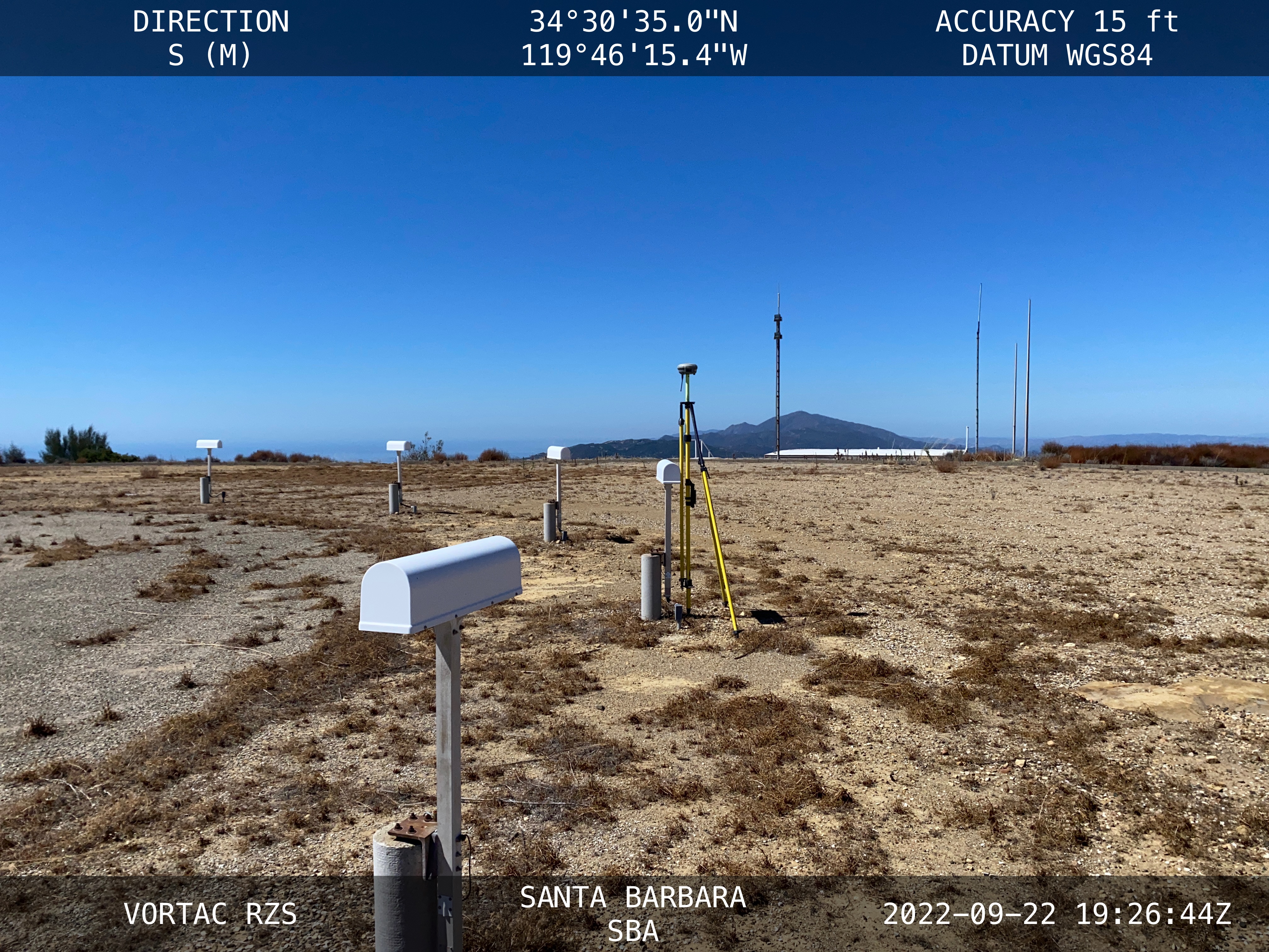
On the other hand, the FAA has strict requirements regarding metadata to document when, where, and how each control point is collected. “At the time of the survey, photographs are taken of the GPS units from different angles and cardinal directions,” Grigg said. “This is visual documentation for NGS that the surveyed point is at the location described. ”
Another challenge for surveyors working at airports is that they are required to pull back for incoming aircraft. “Obviously, you will have some logistical issues at busy airports,” said Grigg. Surveyors are required to have special lights and markings on any vehicles that enter the airport property to ensure ground and air visibility. Aircraft movement also impacts surveyors as they must move away from the runway safety area (RSA) for take-offs and landings. Busier airports are surveyed at night, when air traffic is reduced or runways are closed.
Image: NV5 Geospatial
A typical project for a small airport takes about nine months, while for bigger airports — such as Chicago O’Hare, Dallas-Fort Worth, or Hartsfield-Jackson Atlanta — they can take up to twice as long. “The large hubs update their master plan on a more reoccurring basis, such as every three to five years,” said Doug Fuller, NV5 Geospatial’s Airport Solutions Specialist. “As the airports get smaller, you start stretching out that timeframe.”
Airport survey requirements
[The following was written by NV5 Geospatial and only lightly edited by GPS World.]
Airports have surveys conducted for many different reasons. However, all survey types require the collection, classification and reporting of accurate data about the project. The methodology selected to gather the information is up to the professional surveyor’s judgment. Some features require observation through ground field methods, while others lend themselves to collection via remote sensing technologies.
All surveys start with a search for existing airport control, which are called Primary Airport Control Points (PACS) and Secondary Airport Control Points (SACS). These are points on the airport that have been adjusted by the National Geodetic Survey (NGS). This ensures that the survey is done on the National Spatial Reference System (NSRS).
A typical survey includes surveying the runway, the end points, any displaced thresholds, and a profile along the centerline of the runway. If the centerline marker is not in the correct location or if it is not there at all, the surveyor will make the necessary measurements to establish the proper location and set a new marker. Next the surveyor must locate all NAVAIDS and survey them at the proper location as described in FAA Advisory Circular 150/5300-18B.
After the NAVAIDS are located, the photo control survey will be done. This still requires the PACS and SACS to be the points of origin of the survey. The base requirement as described in FAA Advisory Circular 150/5300-16C is to survey ten photo control points and five check points. The check points are sent to NGS’s Online Positioning User Service (OPUS). This is used to check that the survey was done on the NSRS and that the compilation meets FAA standards.
The standards the surveyor must meet vary depending on the equipment type or photo control point. Examples of the accuracy requirements for the NAVAIDS are as follows:
Point
Horizontal
Vertical
Distance measuring equipment
+/- 1 ft
+/- 1 ft
Glideslope
+/- 1 ft
+/- 0.25 ft
Inner marker
+/- 10 ft
+/- 20 ft
Localizer
+/- 1 ft
+/- 0.25 ft
Runway end point
+/- 1 f ft
+/- 0.25 ft
Runway profile points
+/- 1 f ft
+/- 0.25 ft
Photo control
+/- 1 ft
+/- 1 ft
PACS and SACS
X
Y
Z
Ellip.
Inverse from PACS to SACS
surveyed relative to published
0.09 ft
0.09 ft
0.15 ft
0.13 ft
When surveying on airport property, the largest challenge is always accessing the runway safety area to locate the runway ends and profiles. At small airports Surveyors must work when the runway is not busy; at airports with FAA control towers when the runway is closed. Frequently this is done overnight. Other challenges include access to the FAA NAVAIDS. Some of them must be turned off to be surveyed and others require survey points on which it is not possible to set an instrument. When we are not able to occupy a point, we collect it by surveying multiple equidistant locations around the NAVAID and averaging them.
Image: NV5 Geospatial
NV5 Geospatial surveyors use a combination of real-time (R/T) and post-processing techniques. We also use OPUS with the PACS and SACS and the five check points. Once the PACS and SACS have been determined to be stable, the proper coordinates are applied to them and the R/T points are adjusted using Trimble Business Center (TBC). NV5 Geospatial uses Trimble TRM-R8s and we recently added TRM-R12i receivers to our equipment. We use ground control points to orient the photography and to calibrate the lidar.
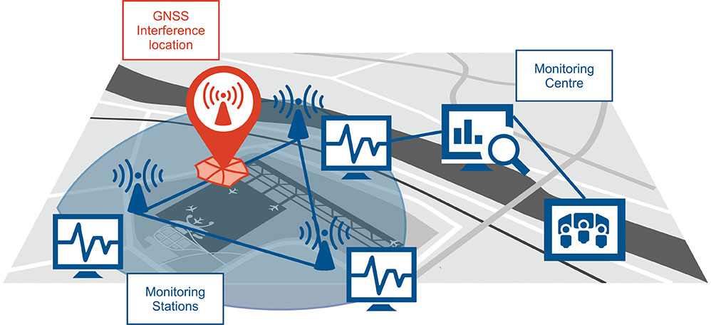
Schematic of the GNSS interference detection and analysis system GIDAS. (Image: OHB Digital Solutions)
In September 2020, the first GIDAS monitoring stations were installed at the Czech airport in Brno.
GIDAS — GNSS Interference Detection and Analysis System — enables continuous 24/7 monitoring of the GNSS frequency bands within a defined region to automatically detect, classify and localize intentional interference from jamming and spoofing.
GIDAS can raise the alarm in real time, identify the type of interference, and then pinpoint the location of these dangerous portable devices causing the interference so the authorities can take immediate remedial action. It considerably improves safe and robust operation of GNSS receivers, terminals and applications.
GIDAS was developed by OHB Digital Solutions and Joanneum University of Applied Sciences through ESA’s Navigation Innovation and Support Programme (NAVISP).
The system works autonomously and is designed to be easily deployed. It is scalable and flexible; it can be used as a standalone monitoring station or upgraded to a network of stations.
Recent GNSS interference attacks include:
shutdown of navigation equipment at Newark airport
GNSS attacks of North Korea against South Korea
117 incidents within one day at Kaohsiung airport in Taiwan
a U.S. military drone forced to land
a 65-meter yacht drifting off course during field trials
failure of emergency pagers, traffic management systems and ATMs in San Diego caused by U.S. Navy jamming.
“In recent years, GNSS applications have increasingly become the target of intentional interference attacks, since GNSS is widely used in safety and value-critical applications,” said Andreas Lesch, CEO of OHB Digital Solutions. “GIDAS detects, classifies and localizes GNSS interference signals and thus reduces the already existing threat of receiving worse accuracies or even denial of service.”
The GIDAS system user interface helps to pinpoint interference. (Image: OHB Digital Solutions)
GIDAS monitors the GNSS L1/E1 frequency band and reliably detects and classifies intentional and unintentional interference sources using sophisticated algorithms. GIDAS consists of a high performance data processing unit including antenna and RF front-end, and a sophisticated software solution.
GIDAS is able not only to monitor GNSS-based position, velocity and time solutions, it monitors the received signal and baseband processing.
The system is composed of the following software modules:
Software-defined GNSS radio
Position, baseband and C/N0 monitoring
Jammer and spoofing parameter estimation
Localization capabilities through synchronization of several GIDAS systems
Graphical user interface
Initial GIDAS reports show an average of seven GNSS interference events per day. GIDAS was able to successfully classify the signal type in 96% of jamming cases that have occurred.
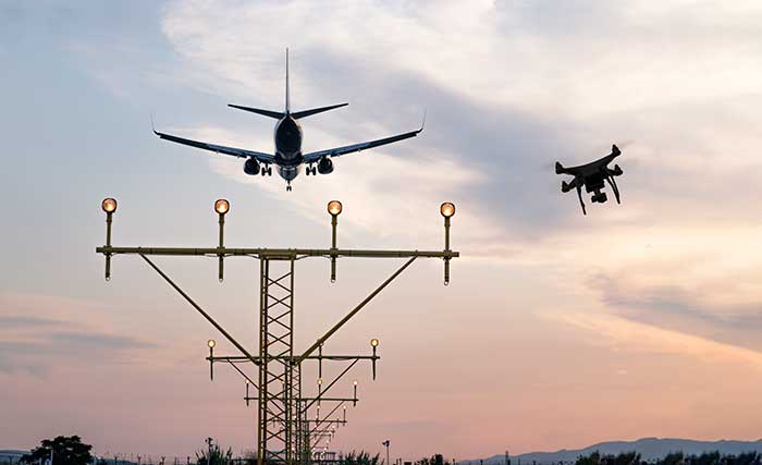
The Federal Aviation Administration (FAA) plans to evaluate technologies and systems that could detect and mitigate potential safety risks posed by unmanned aircraft. The effort will be a part of the agency’s Airport Unmanned Aircraft Systems Detection and Mitigation Research Program.
The FAA Reauthorization Act of 2018 requires the agency to ensure that technologies used to detect or mitigate potential risks posed by unmanned aircraft do not interfere with safe airport operations.
The FAA plans to test and evaluate at least 10 technologies or systems. The evaluations are expected to begin later this year and will initially occur at the FAA’s William J. Hughes Technical Center, located next to the Atlantic City International Airport in New Jersey.
After the initial testing and evaluation in New Jersey, the agency expects to expand the effort to four additional U.S. airports. Those selections will be made at a later date.
According to the FAA, interested manufacturers, vendors and integrators of drone detection and/or mitigation technologies/systems will have 45 days to respond to its announcement.
In addition, the FAA expects to issue another solicitation in the coming weeks for airport operators interested in hosting the additional research and testing.
Photo: Joel Papalini/iStock / Getty Images Plus/Getty Images
Airports are extremely congested spaces, both on land and in the air, making it difficult to conduct surveys that provide insights into their continued monitoring and maintenance.
UAVs create the opportunity to survey such sites safer and faster, reducing disturbances to everyday operations while collecting a level of detail unparalleled by conventional surveying techniques to locate and accurately capture areas in need of maintenance and management on airport runways.
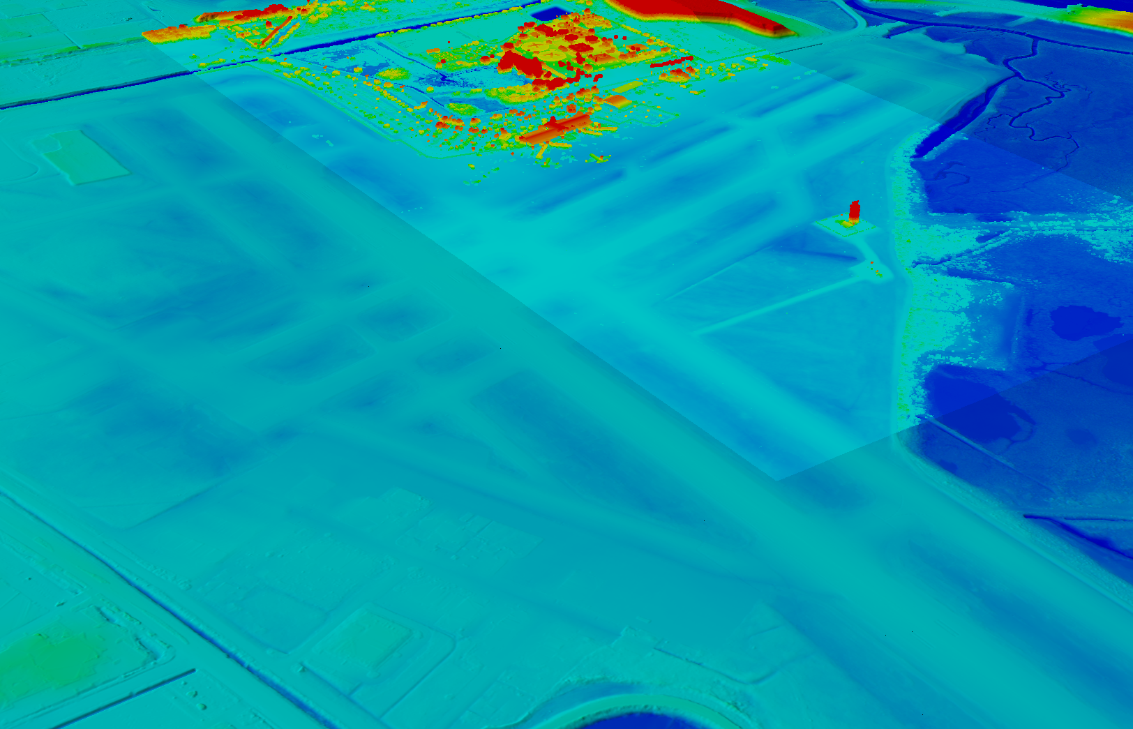
Following several drainage and grading issues throughout a 650-acre airport, Texas-based civil engineering company Gessner Engineering was contracted to provide surveying services to identify the most problematic regions.
The team had to conduct the survey with minimal impact on runway operations. By coordinating with the airport’s air traffic controllers, the team planned a 6–8-hour flight window, with just a few pauses for ongoing traffic, while the airport operated as usual.
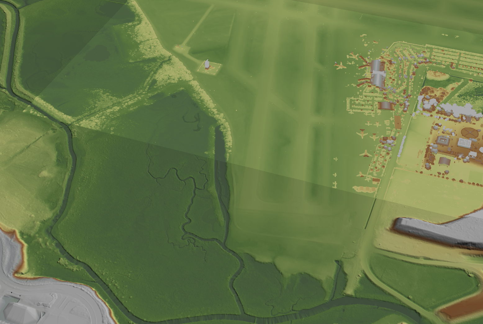
Before the flight, the surveyors used senseFly eMotion flight-planning software to carry out pre-flight risk assessments and plan flights. During the survey, four 20-minute flights were completed with the senseFly eBee fixed-wing drone. With its fully autonomous and easy-to-use aerial mapping capabilities, the eBee was able to capture the high-resolution aerial photos needed to map the entire airport. The data was processed using Pix4D Mapper to generate a topographic model including a point cloud with a ground sample distance of 1.5 inches.
The point cloud was so comprehensive, it brought attention to four more areas with drainage issues, providing a level of detail that would not have been possible using only a ground GNSS base station. The UAV survey took one day, compared to four weeks for traditional surveying. This cut the project time in half and significantly reduced disturbances to airport operations.
“The savings in manpower with the shorter surveying time, accurate data retrieved, and the additional drainage issues identified demonstrate the value of drones, as an enabler of solving complex challenges in congested airspaces, especially where time is limited,” said Troy Hittle, general manager, North America, SenseFly. “The success of this project by using UAV equipment has offered new possibilities to both Gessner Engineering and the future of aviation maintenance.”
PCCW and Unistrong will collaborate on developing GNSS technologies and services for the telecommunications and aviation industries.
PCCW Global is the international operating division of HKT, a Hong Kong telecommunications service provider. Beijing UniStrong Science and Technology Corporation Limited is a navigation and positioning company.
The collaboration intends to link satellite positioning to 5G mobile networks to provide positioning data accurate to within centimeters. The link will unlock new services for telecommunications providers rolling out new networks to support the internet of things (IoT), smart cities and the aviation industry.
UniStrong’s experience in developing high-precision products, solutions and services will enable PCCW Global to integrate new services with 5G mobile infrastructure, providing high-precision positioning (HPP) accurate down to centimeter levels.
This integration of precision positioning expertise and technologies has the potential to revolutionize industries such as commercial drone operations, autonomous vehicles and transportation, logistics, construction, agriculture and others.
New Airport Technology
The integration of technologies will also enable the provision of smart aviation solutions for airport authorities. Based on high-precision positioning and navigation technology, new airports will be able to leverage smart civil construction works that will facilitate safer and more efficient airport operations.
These aviation technologies will also be able to integrate with a wide variety of IoT sensors, edge-computing capabilities, machine vision and other artificial intelligence (AI) technologies to create intelligent surveillance platforms capable of managing and enhancing many aspects of airport safety and efficiency.
The installed base of GNSS devices in use globally is forecast to increase from 6.4 billion in 2019 to 9.6 billion in 2029, with Asia-Pacific continuing to account for more than half of the global GNSS market.
In terms of global annual GNSS receiver shipments, the market is forecast to grow from 1.8 billion units in 2019 to 2.8 billion units in 2029, according to the 2019 GNSS Market Report by the European Global Navigation Satellite Systems Agency (GSA).
“As a global ICT service provider with extensive high speed fiber networks and cloud services coverage worldwide, we are delighted to cooperate with UniStrong with the aim to offer unique, game-changing solutions in Satellite High Precision Positioning (SHPP) and Continuous Operating Reference Station (CORS) solutions ideally suited to the new era of 5G, IoT and smart cities,” said Benney Cheng, head of Strategic Project and Development, PCCW Global.
“The cooperation between UniStrong and PCCW Global will further promote the development of professional solutions and applications that are oriented towards global users’ needs,” said Jun Shen, corporate vice president and chief scientist of UniStrong. “Based on GNSS technologies, and deeply integrated with communication technologies, Big Data, Industry 4.0, IoT, artificial intelligence and other technologies, these solutions will empower and influence more industries and countries, and promote BDS/GNSS global applications and international services worldwide.”
Photo: Bill Oxford / iStock / Getty Images Plus / Getty Images
Starting this year, new-generation GNSS-based landing systems — ground-based augmentation systems or GBAS — will be deployed at airports all around Europe to increase runway capacity by up to 6% in peak traffic periods, according to Indra, a key partner of the European GBAS Alliance.
The GBAS technology allows aircrafts to make steeper approaches, which saves fuel and reduces noise and CO2 emissions. GBAS further improves airport capacity by letting approaching aircraft use different glide slopes to avoid wake turbulence left by precedent aircraft in the runway.
According to research by the European Union’s SESAR initiative supported by Eurocontrol simulations, this can lead to a runway capacity increase between 2% and 6%.
The European GBAS Alliance includes airports, airlines, air navigation service providers and air- and ground-manufacturing industry working for a coordinated and synchronized deployment of ground-based augmentation systems (GBAS).
Photo: Indra
The plan is for deployment preparations to start this year, and ramp up in 2020. The focus is particularly on precision approaches in low-visibility conditions.
The first collaborative meeting took place in Toulouse, France, in June with more than 20 organizations represented.
GBAS is recognized as a supplement and, in the future, the replacement of instrument landing systems (ILS).
A synchronized GBAS implementation for low visibility operations (GBAS GAST D for categories II and III) will lead to environmental, economical, capability and safety benefits for airports, airlines and air navigation service providers.
Indra has been a driver for GBAS development for years, and is one of the initiators behind the European GBAS Alliance. It contributes with one of the technological pillars; the NORMARC GBAS system is an Indra Air Solution capable of guiding aircraft even in low visibility conditions (CAT II and III). The technology is ready, and the focus now is on getting the infrastructure and regulatory framework in place.
“The great response to this initiative is very encouraging,” said Hugo Moen, GBAS general sales manager at Indra. “In spite of the indisputable benefits to everyone, we need a collective effort to get out of a “chicken or egg” situation. Both airlines and airports need to make some investments, but airlines are reluctant to invest in GBAS receivers for aircraft as few airports have the required infrastructure. Likewise, airports or ANSPs are not investing since few aircraft can make use of the system.”
GBAS differs from ILS in being based on GNSS instead of conventional radio signals. Whilst ILS signals can be affected by topography and other physical objects, GBAS has no critical or sensitive areas. This allows for higher capacity during precision approaches, reducing the risk of diversion, cancellation and go-around.
“GBAS enables steeper and shorter approaches. Precision landings can be performed at airports where this has not been possible due to topography or other reasons. In Norway, we have used GNSS-based landing systems at 17 airports for many years, with great results. It is nice to see the industry working together so more countries can benefit from this new technology,” said GBAS Product Manager Linda Lavik from Indra.
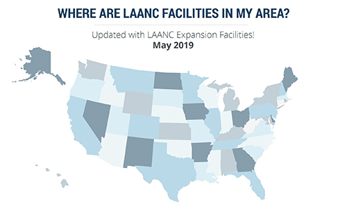
More than 100 control towers and airports have been added to the hundreds of Federal Aviation Administration (FAA) air traffic facilities and airports that currently use the Low Altitude Authorization and Capability (LAANC) system.
LAANC is a collaboration between the FAA and industry that directly supports the safe integration of unmanned aircraft systems (UAS) into the nation’s airspace.
LAANC expedites the time it takes for a drone pilot to receive authorization to fly under 400 feet in controlled airspace. By adding contract towers to the number of LAANC-enabled facilities, drone pilots will have access to more than 400 towers covering nearly 600 airports.
In less than two years, LAANC has provided fast access to controlled airspace for more than 100,000 flights, according to Matt Fanelli, director of strategy at Skyward.
Image: Skyward
“People have been asking the FAA to add more airports and today, 109 contract towers have now been added to LAANC.” Skyward has updated its 2019 LAANC Facilities Guide so that UAV pilots can easily reference airports near them that will be adding this service.
Contract towers are air traffic control towers that are staffed by employees of private companies rather than by FAA employees. LAANC provides air traffic professionals with visibility into where and when authorized drones are flying near airports and helps ensure that everyone can safely operate within the airspace.
The expansion to more than 100 contract towers means the FAA has further increased drone pilots’ access to controlled airspace safely and efficiently.
LAANC is used by commercial pilots who operate under the FAA’s small drone rule (PDF) (Part 107). The FAA is upgrading LAANC to allow recreational flyers to use the system and in the future, recreational flyers will be able to obtain authorization from the FAA to fly in controlled airspace.
For now, recreational flyers who want to operate in controlled airspace may only do so at fixed sites.
The airport’s new autonomous ATV begins testing in August. (Photo: Edmonton International Airport)
An autonomous all-terrain vehicle (ATV) equipped with NovAtel Inc. technology will soon join the security fleet at the Edmonton International Airport in Alberta, Canada.
The ATV will be used to detect people and animals that breach the airport perimeter, as well as locate holes in the fence to alert the security team.
This is the only known autonomous ATV to be used for airport security and it will be used to monitor its 20-kilometer fence line on a narrow perimeter road, according to Hexagon, NovAtel’s parent company.
The unarmed vehicle is controlled remotely by humans and can also drive autonomously, incorporating machine-learning to perform its tasks.
The vehicle system includes navigation, path planning, obstacle avoidance, animal and human recognition, communication systems to airport security, geo-fencing, and situational awareness and analysis.
The autonomous ATV patrols will focus on the following:
Identifying damage to the chain-link fence and fence posts, verifying barbed wire is taut and undamaged, and detecting holes or gaps under the fence
Detecting human or animal activity
Searching for obstacles using lidar
“We would not have been able to navigate the vehicle on such a narrow road if we had not used NovAtel gear,” said Ken Brizel, CEO, ACAMP.
The autonomous security ATV was developed by the Alberta Centre for Advanced MNT (microprocessor and nanotechnology) Products (ACAMP).
The airport is a member of the Advanced Systems for Transportation Consortium established by ACAMP and supported by the Government of Alberta. ACAMP is a member of the Alberta Aerospace and Technology Centre at EIA. ACAMP and EIA were able to harness technologies developed by consortium members to construct and test the autonomous ATV security vehicle, readying it for regular use at EIA.
Streamlined application and 30-minute response improve unlocking process.
DJI’s Matrice 200 drone. (Photo: DJI)
Drone maker DJI is introducing improvements to its geofencing system. Professional drone pilots with authorization to fly in sensitive locations can now use a streamlined application process to receive unlocking codes within 30 minutes.
DJI’s geofencing system uses GPS and other navigational satellite signals to automatically help prevent drones from flying near sensitive locations such as airports, nuclear power plants and prisons. These improvements are carefully designed to help expand the beneficial uses of drones in sensitive areas that have been restricted in DJI’s geofencing system.
While those areas will remain restricted to more casual drone pilots, DJI now staffs its global authorization team around the clock in order to process applications and provide unlocking codes quickly.
Professional drone pilots can apply to unlock restricted zones at www.dji.com/flysafe/custom-unlock. This portal page allows pilots to easily enter information about their aircraft and controller, as well as authorization documents supplied by the controlling authorities in areas where they wish to fly.
Enterprise users can for the first time include multiple aircraft in a single unlocking request.
“DJI now processes most requests within 30 minutes, though requests involving unusual circumstances or requiring additional documentation may need additional time,” said Michael Perry, managing director of North America at DJI. “By making it easier for authorized pilots to put drones to work in sensitive areas, DJI is once again showing why professional drone operators choose our aerial platforms for the most important tasks.”
“DJI first implemented geofencing in 2013, and it is now established as an important tool to help our customers make thoughtful flight decisions, while also addressing legitimate concerns about safety and security by helping prevent unauthorized flights in the most sensitive locations,” said Brendan Schulman, vice president of policy & legal affairs at DJI. “These improvements illustrate DJI’s ongoing commitment as the industry leader to continually improving the safety features we implemented years ago, while enabling beneficial applications for our technology.”
For more information about how enterprises are using DJI products to work safer, faster and more efficiently, visit enterprise.dji.com.