Tag: Bluetooth

  • Prince’s death highlights 911 location issues

    By Tracy Cozzens
    Managing Editor

    Prince-signPrince’s death on April 21 highlights a fatal flaw in the United States’ antiquated 911 emergency system. When you call from cell phone, 911 doesn’t automatically know where you are. 911 often can’t determine the location of an emergency, even when the call for help comes from a GPS-equipped smartphone. Often the 911 operator can only zero in the nearest cell tower, which can be several miles away or in the next county.

    In the transcript of the 911 call from Prince’s house comes this exchange:

    911 operator: OK, what’s the address?

    Caller: We’re at Prince’s house.

    911 operator: OK, does anybody know the address? OK, your cell phone’s not going to tell me where you’re at, so I need you to find me an address … OK, have you found an address yet?

    Caller: Yeah, um, I’m so sorry, I’m so sorry. (The caller is heard asking others if they know the address.)

    911 operator: Is there any mail around that you could look at?

    While a quicker response may not have saved Prince’s life, some experts estimate that cutting 911 response by one minute could save one person every hour every day nationwide.

    The FCC and the four largest cellphone carriers say they’re doing their best to address the problem. One possible solution is LaaSer, a technology suite that runs in the cloud. LaaSer updates your precise location at the exact same time that the call to 911 is being made, so that the answering operator is immediately presented with your information.

    With Laaser, any mobile device delivers accurate location information about the caller to 911 operators immediately. It does this using existing infrastructure, so carriers, handset manufacturers and 911 call centers wouldn’t have to change their systems to receive the benefits.

    Unlike current 911 mobile phone technology, LaaSer takes advantage of all of the location information already available in smartphones, including GPS, Wi-Fi, Bluetooth, near-field communications (NFC)/RFID, compass, accelerometer, barometer and more.

    Our lives may depend on it.

  • PoLTE offers indoor/outdoor positioning using LTE networks

    PoLTE Corporation has developed technology that harnesses the global long-term evolution (LTE) deployment to provide accurate and reliable location data.

    Photo: planetc1 via Foter.com / CC BY-SA
    Cell-phone tower in California. Photo: planetc1 via Foter.com / CC BY-SA

    Unlike localized solutions, such as Wi-Fi and Bluetooth, PoLTE’s technology leverages its Positioning over LTE (PoLTE) Macro software to achieve precision of 2 to 6 meters. The technology makes use of the sounding reference signals (SRS) embedded in an LTE handset user’s transmission. Using adapted radar location techniques, it converts portions of the LTE uplink signal into a probe signal.

    The technology enables mobile network operators to deliver highly accurate location data to customers in indoor and outdoor environments.

    Traditional macro cell location methods require at least three towers to see the user device to locate the device with precision. Historically, single tower deployments were limited in accuracy to the width of the sector created by the 120-degree antenna that was serving the user device. For example, at a distance of 1.5 kilometers from a base station, the cross range precision would be 4,000 meters. PoLTE Macro can improve the precision to less than 2 meters.

    The benefits to leveraging network-based positioning include speed, flexibility, accuracy and data analytics. Customers for the technology include machine-to-machine and Internet of Things technologies, mobile advertising, crowd and customer tracking, and public safety.

    Learn more about PoLTE technology in the company’s white paper.

  • Nationwide BYOD submeter and RTK GNSS rental program announced

    Anatum Field Solutions (AFS) has launched a nationwide BYOD (Bring Your Own Device) submeter GNSS and centimeter (RTK) GNSS receiver rental program. With the explosion of smartphones and tablets in recent years and the availability of universal Bluetooth submeter and real-time kinematic (RTK) GNSS receivers, high-accuracy GNSS data collection is available to everyone.

    AFS rentals target high-accuracy users in GIS, UAV, environmental, engineering, surveying, agriculture, electric/gas/water utilities, pipeline, forestry, mining, transportation, construction, architecture, and federal/state/local government markets.

    AFS offers all mobile GIS devices including Apple iOS, Android, Windows and Windows Mobile/EHH. It also stocks various GNSS receivers such as Eos Arrow (submeter and centimeter), SXBlue (submeter and centimeter), Trimble R1 (1 meter) and BadElf (1-3 meters) in a variety of configurations.


    “We intend to make centimeter and submeter accuracy GNSS receivers available to everyone, even if you only need it for a couple of days,” said Matt Alexander, Vice President at AFS. “Our full rental systems come complete with GNSS receiver, tablet with cellular data, data collection software and accessories. You can literally be collecting centimeter-accurate data within minutes of opening the box, no matter what your experience level is.”

    AFS can accommodate a wide variety of mobile GIS software solutions with its systems, including Esri’s ArcGIS Collector, Survey123 and ArcPad; iCMTGIS; TerraGo; AmigoCloud; Avenza PDF Maps; Fulcrum; and tMap. AFS provides the software tools and technical support to turn mobile GIS software into centimeter or submeter-accurate data-collection systems.

    AFS offers three different rental configurations:

    • Complete systems including GNSS receiver, tablet computer with cellular data plan, mobile GIS software and accessories. Ready to map.
    • GNSS receiver and tablet computer with cellular data plan (user logs into their own mobile GIS account).
    • GNSS receiver (centimeter or submeter) only. Ready to connect to your mobile device.

    All rentals come with a return shipping label so the user can leave the box at a FedEx pick-up location, hotel counter, office counter or anywhere that Fedex picks up.

  • TerraGo and Eos Positioning partner on next-generation GPS/GNSS solutions

    TerraGo and Eos Positioning partner on next-generation GPS/GNSS solutions

    Eos Positioning's Arrow 200 Bluetooth receiver supports Hemisphere's Atlas correction service.
    Eos Positioning’s Arrow 200 Bluetooth receiver.

    TerraGo and Eos Positioning Systems have entered a collaboration to combine the TerraGo Edge mobile GPS data-collection platform with the Eos Arrow line of sub-meter and centimeter accuracy receivers. The combination delivers a modern, cloud-based, real-time data collection capability, according to a TerraGo press release.

    While the working environments and the projects are very different, customers in for water utilities, energy, survey and engineering are using TerraGo Edge and Eos Arrow receivers to replace traditional GPS handhelds for cost-savings and improved productivity.

    Enmapp, a pipeline inspection company based in Canada, was able to cut hardware costs by 85 percent while capturing sub-meter data in real-time, eliminating all the costs of post-processing handheld data.

    Summit Engineering, a Colorado-based engineering and land surveying firm, was able to reduce hardware costs by over 50 percent and improve productivity by more than 30 percent while surveying power lines in Minnesota for one of the country’s largest energy companies. Similar performance improvements and cost reductions are reported by joint customers in water utilities, forestry, engineering, agriculture and environmental operations, TerraGo said.

    “When we talk about Eos Arrow, we’re not simply pairing their receivers via Bluetooth, there are millions of apps that do that without any meaningful integration,” said Dave Basil, VP of products and services at TerraGo. “We interoperate with their receivers at the software level to ensure our customers get the full real-time GPS data set so they can monitor, alert and capture data that meets the highest accuracy and quality standards. For customers, it’s as simple as Bluetooth pairing, but we’ve done the work to turn their phone or tablet into a survey-grade receiver.”

    “TerraGo and Eos Positioning are strategic technology partners,” said Jean-Yves Lauture, chief technology officer of Eos Positioning Systems. “This means that our collaboration goes beyond simple marketing and includes sharing core technology for the benefit of our customers. For example, we have been able to share Eos software components, which TerraGo has built into the Edge app. This integration provides the full fidelity monitor and lossless capture of NMEA data from the Eos receivers, including the Arrow 200.”

  • Aman Enterprises launches iOS Bluetooth adapter to connect GNSS receivers to iPhone, iPad

    Aman-bluetooth-nmea-W
    Photo: Aman Enterprises

    Aman Enterprises introduces NMEA-BT — a Bluetooth iOS adapter that enables any high-precision GNSS receiver with a serial port to connect to an iPad or iPhone.

    The NMEA-BT adapter is a small, weatherproof device that solves the problem of connecting non-iOS GNSS receivers and other field sensors to iOS devices. It connects to the iOS devices wirelessly using the native Bluetooth built into the iOS devices.

    GPS World reported on a Kickstarter campaign to develop the device in January 2015. The device is now shipping.

    By replacing the iOS device’s internal GPS location information with the location information from the intrinsically more accurate external GNSS devices used by mapping and survey professionals, NMEA-BT allows users to pair external GNSS devices to their location-enabled iPhone or iPad app. The patent-pending product helps preserve the user’s investment in sub-meter and centimeter GNSS receivers and other sensors while users migrate their workforce to iOS devices.

    A free app from the Apple iTunes App Store (NMEA Talker) enables the user to specify any required GPS connection parameters; connect to a local cellular RTK network (NTRIP) or a Direct IP (DIP) based correction service; and feed the corrections to the GNSS receiver, allowing for centimeter accuracy in real time in the field. The app can also be used to display error notifications like high PDOP, loss of an RTK correction, loss of satellite lock.

    In addition to connecting to GNSS devices, users can connect to other sensors like laser rangefinders, resistographs, underground cable locators, and commercial weigh scales that output NMEA-formatted data.

    For developers, they have full access to the entire raw NMEA stream of data from multiple devices without sacrificing app security or design architecture. No proprietary libraries are required to access the NMEA data stream.

    GPS/GNSS Receiver Compatibility

    The NMEA-BT has been tested with the following receivers:

    • John Deere StarFire
    • Trimble Pro 6, Geo Explorer, 372
    • Casel H372
    • Topcon HiPer series
    • Septentrio APS and NR series
    • Geneq SXBlue series
    • Ag Leader 6000 and 6500 series
    • Raven Industries – Envizio Pro series
    • Novatel

    The only requirement to interface the NMEA-BT adapter is that the GNSS receiver must output at least the $GPGGA and $GPRMC messages via serial port.

  • Bluvision demonstrates indoor location solution at CES 2016

    Bluvision, a real-time location services (RTLS) provider, will be demonstrating its RTLS solution along with Texas Instruments (TI) at CES 2016.

    Bluvision’s location algorithms “continue to redefine how technology can be used for indoor location,” the company stated in a news release. Its RTLS solution uses Bluetooth low-energy and Wi-Fi technology to determine specific positioning, leveraging multiple techniques, including smart machine learning algorithms for accuracy.

    The combination of Bluetooth Smart, Wi-Fi and sophisticated algorithms on the cloud allows tracking and monitoring of assets — equipment or people — without the need for a smartphone application and uses minimum hardware that is fast and easy to implement, Bluvision said.

    Bluvision’s RTLS solution is accurate down to three feet even in harsh conditions. It can be deployed in a large area within hours. The solution supports creating multiple alerts and policies, including creating multiple virtual geofences that trigger alerts when entering or leaving pre-defined areas.

    Bluvision will demonstrate the RTLS solution in the TI Village (#N115-N118) at CES 2016, using TI’s SimpleLink Bluetooth Smart CC2640 wireless microcontroller (MCU).

    “Our LBS (location-based service) solution is disruptive,” said Jimmy Buchheim, CEO of Bluvision. “Using TI’s SimpleLink CC2640 wireless MCUs with built-in SDR (software-defined radio) and the combination of our talented data scientists, advanced algorithms team and cloud team, allows us to revolutionize indoor location, achieving what is considered impossible accuracy for Bluetooth-based technology.”

    For more information on the demo or Bluvision’s RTLS solution, contact Subhashree Sukhu.

  • Antenova’s Tiny Weii Antenna Designed for Consumer Applications

    Antenova announces its first antenna for consumer applications — the tiny Weii 2.4-GHz ceramic antenna. Measuring 1 mm x 0.5 mm x 0.5 mm, the company believes the Weii could be the smallest antenna in the world.

    The new Weii miniature ceramic antenna is designed for 2.4-GHz, Bluetooth, Wi-Fi, Zigbee and industrial, scientific and medical (ISM) applications.

    While all of Antenova’s antennas and antenna module products are small surface mounted devices, this antenna is the smallest that Antenova has created so far. It is designed specifically for the consumer, Internet of Things (IoT) and machine-to-machine (M2M) markets.

    Colin Newman, Antenova’s director and vice president of sales, explains how Antenova has miniaturized the antenna. “Ceramic antennas offer low dielectric losses and high isolation. Our engineers have used this technology to greatly reduce the antenna volume without sacrificing performance. The challenge in building antennas for today’s small consumer devices is to achieve high isolation and frequency selectivity while maintaining good efficiency. This antenna is resistant to detuning from environmental effects, and combining this with its ultra-small size, makes it ideal for today’s wearable products.”

    The Weii is an omni-directional, surface-mount device (SMD) mounted dielectric antenna that can be used to add wireless connectivity to any small electronic device, such as wearables, headsets, medical devices, personal navigation devices, dongles and sensors.

    A ceramic antenna offers several advantages for these emerging applications. Its tiny footprint is designed for the new, scaled-down printed circuit boards (PCBs) that are being developed for consumer devices in M2M. It offers a highly efficient antenna that is powerful over indoor ranges, and that performs well when sited close to the human body, Antenova said.

    Antenova says it takes a unique approach to the design of antennas, which it calls “Design For Integration” (DFI). Because the antennas are always embedded within a customer’s design, the successful operation of the customer’s device depends upon obtaining the correct performance from the antenna when it is placed on the PCB; therefore, Antenova is designing its antennas with this difficult RF integration in mind.

    The Weii is designed to be easily integrated into all kinds of PCB designs and various ground plane sizes — it has been engineered so that it can simply be dropped into the design, using CAD footprint files, which are provided free of charge. To ensure that customers can harness the antenna successfully and achieve the optimal performance of the antenna, Antenova provides engineering assistance along with advice on RF design layout and the integration of the antenna, and customer support.

    The antennas are available through distributors worldwide. See www.antenova-m2m.com for more details, or to request a sample board for the Weii antenna.

  • Distracted Driving Device Allows GPS Functionality While Driving

    TextBuster_large
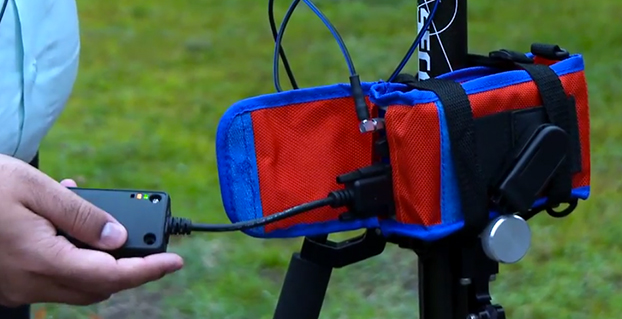
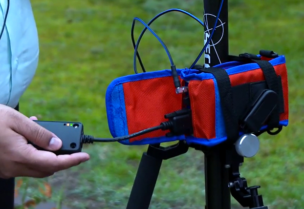
TextBuster, a device by Access 2 Communications that prevents drivers from accessing text, email and Internet functions while driving, allows GPS to function while driving.

    It does not interfere with inbound and outbound calling. The firmware technology behind TextBuster sends a blocking signal to the user’s phone automatically, every time the user enters the vehicle.

    TextBuster will not interfere with any other hands-free or Bluetooth items in the vehicle, according to the company. It is a patent-pending device that will disable the data functions to the driver’s phone only while inside the vehicle without interfering with inbound and outbound calls. It includes two components, the mobile app, which is a free download, and a small “brain box” that is mounted under the dash.

    Ohio-based Access 2 Communications developed the distracted driving device with the hopes of significantly reducing the number of preventable distracted driving fatalities worldwide.

    TextBuster will be available in Target stores nationwide starting in mid-November, according to TextBuster.

  • Kickstarter Launched for NMEA Dongle to Connect GPS, iOS

    Kickstarter Launched for NMEA Dongle to Connect GPS, iOS

    NMEA-dongle-W
    Photo: NMEA

    kickstarter campaign has launched for an NMEA dongle that connects any existing GPS receiver to iOS devices. The device connects and communicates with high-accuracy GPS/GNSS devices and other field sensors that emit NMEA data to iOS devices over Bluetooth, allowing users to collect data on an iPad or iPhone using one or more sensors in the field.

    Primary functions include:

    • overriding the internal GPS on iOS device with the location data coming from the external GPS so all existing apps using internal location services can benefit from the increased accuracy without any changes to the app.
    • providing the ability to connect with other field sensors that emit NMEA-format data (such as underground cable locators, lasers, resistographs, and audiographs) simultaneously with a GPS so data from multiple sensors can be incorporated into the data-collection application.

    Garg explained the need for the dongle on his Kickstarter page: “The accuracy and precision of the internal GPS on iPads and iPhones is highly unreliable — it works fine for navigational purposes but fails miserably for mapping and asset management applications. The accuracy varies in range from a few meters to a few hundred meters depending on operating conditions, and there is no easy way to reliably ascertain that. Tests have proven that the accuracy rating on the location data returned by Apple is more of a general estimate than a reliable metric.”

    The NMEA dongle is business-card-sized, and has an internal battery and a long-range Bluetooth. The dongle plusg into an existing GPS receiver’s serial port or connects via bluetooth to transmit the GPS data to the iPad. This allows users to feed RTK/NTRIP data to their iOS device.

    “We have tested our solution with most of the leading brands of GPS receivers available in U.S., including Trimble, Topcon, John Deere, Altus, Geneq, EOS, CHC,” developer Sharad Garg told GPS World, “on most of the popular networks that we could get access to, including the Leica, Trimble, MyWayRTK, a few state-run networks and of course Unavco. Our solution is compatible with all of them, so its a very generic product at this point compatible with just about all the different solutions out there.”

    Garg said his team also designed the dongle so that it allows users to connect to sensors such as laser range finders, valve exercising machine, Resistographs or agricultural sensors that emit data in NMEA format. The National Marine Electronics Association (NMEA) specification defines the interface between various pieces of marine electronic equipment, a standard that permits marine electronics to send information to computers and to other marine equipment.

    “We have actually improved the design very significantly to be very modular and be compatible with all sorts of GPS connections that might be offered by the different vendors out there,” Garg said.

    This YouTube video shows the dongle’s RTK functionality.

    GPS World published general articles on NMEA and RTK in Innovation:

    NMEA 0183: A GPS Receiver Interface Standard

    RTK GPS

  • Eos Positioning Launches Arrow High-Accuracy GNSS Receiver

    Eos Positioning Launches Arrow High-Accuracy GNSS Receiver

    ipad-iphone-samsung-arrow-O Photo: Eos Positioning Systems
    Photo: Eos Positioning Systems

    Eos Positioning Systems has introduced a new line of high-accuracy GNSS receivers for smartphones and tablet computers, including both sub-meter and RTK performance for all mobile platforms: iOS, Android, and Windows.

    Eos’s entry-level product, the Arrow Lite, is Bluetooth compatible with all mobile devices.

    The Arrow 100 is Eos’s advanced real-time, sub-meter GNSS receiver that utilizes both GPS and GLONASS, and is expandable to Galileo, Beidou and QZSS. It offers superior tracking under tree canopy, around buildings and in rugged terrain, the company said. In addition to supporting SBAS in North/Central America, Europe, Northern Africa, Japan, India and Russia, the Arrow 100 also supports OmniSTAR’s worldwide, real-time sub-meter service.

    The most advanced Arrow receiver is the Arrow 200, a dual-frequency, multi-constellation RTK GNSS receiver capable of 1-cm accuracy in real time. The Arrow 200 is an iOS-compatible RTK and OmniSTAR receiver that works with all models of iPads and iPhones via wireless Bluetooth connection. An iOS NTRIP app that allows the user to log into any available RTK network. The Arrow 200 will provide quality RTK performance for years to come because it supports current and future satellite constellations: GPS, GLONASS, Galileo, BeiDou and QZSS, the company said. It also supports OmniSTAR’s G2, XP and HP real-time worldwide decimeter services.

    “After spending more than 12 years designing high-accuracy Bluetooth GNSS receivers, I believe Eos has set the new standard for high- accuracy GNSS receivers that work across all mobile platforms, no matter if it’s iOS, Android or Windows,” said Chief Technology Officer Jean-Yves Lauture.

    All Arrow receivers employ long-range (1-km) universal Bluetooth connectivity so the user can interface to any brand of smartphone or tablet, whether it’s iOS, Android, or Windows-based. A variable-power Bluetooth implementation allows the Arrow receivers to communicate up to one kilometer from the mobile device.

    Arrow receivers have been optimized to run all day on battery power. The battery pack is field-replaceable and rechargeable separately. It contains smart charging logic so expensive battery chargers are not needed.

    All Arrow receivers have been designed to meet IP-67 specifications for immersion in water and are completely dust-proof so they will survive in the harshest environments.

    The Arrow receiver product line is targeted at high-accuracy applications like GIS, environmental, agriculture, electric/gas/water utilities, surveying, machine control, and federal/state/local government.

  • Ready for Black Friday: Study Shows Americans Aware of In-Store Beacons

    A new Placecast poll indicates that nearly 118 million smartphone owners will be relying on their phones for holiday shopping this year. For smartphone owners who plan to do holiday shopping, three out of four will use their phones to find sales, comparison shop, take pictures of possible gifts, and make purchases.

    The survey also showed that American shoppers are very aware of in-store beacons, despite the fact that it is a relatively new technology; more than half (52 percent) of the cell phone/smartphone owners surveyed said they have heard of in-store beacons, and 15 percent have engaged with them.

    “Brands that embrace beacons are highly likely to see a spike in their sales in the coming shopping season and in general,” said Placecast CEO Alistair Goodman.

    Beacon technology is only one indoor location technology being pursued by retailers. Kevin Dennehy’s Wireless LBS Insider column from August, Indoor Location Has Major Growing Pains, but Big Upside, provides an overview.

    Conducted in October among more than 2,000 U.S. adults, this was the fifth survey in Placecast’s Alert Shopper series, one of the longest running research series around how consumers interact with various marketing and purchasing mechanisms. This year’s poll reveals the latest trends in mobile shopping and provides key insights for brands and technology providers on how to connect with the highly connected consumer this holiday season, when stakes are high. The poll was conducted online within the U.S. for Placecast by Harris Poll.

    According to the National Retail Federation (NRF), holiday spending will be up nearly 5 percent this year compared to last year, with the average person expected to spend about $800. The NRF reports that gift givers “plan to splurge” for holidays like Christmas, Kwanzaa, and Hanukah: “Consumers are spending more across the board on family, friends, co-workers, pets and even babysitters…Sales and discounts were listed as the most important factor.”

    “It’s not surprising that consumers are most influenced by sales and discounts; the question is, what is the best way to get these offers to them? Our survey looked at various ways brand can reach customers, and we found that reaching users on mobile while they are near stores, and using in-store technology — like beacons — are some of the best ways of reaching consumers who are looking for offers, or for more information to make a purchase,” said Goodman.

    Beacons are a small, low-cost piece of hardware installed in stores. They emit a signal (called Bluetooth low energy, or BLE) that can be targeted directly to phones. Beacons can bring the analytics and targeting capabilities of the online experience to physical stores — for example, sending a discount for perfume to a 40-year-old woman who has recently done an online search for scents.

    Because beacon technology is relatively new, the high awareness level discovered in this wave of the Alert Shopper series may seem surprising to the industry; the research team involved in data analysis for the Harris Nielsen poll explains the possible cause: “Consumers are clearly voting in favor of beacons due to stores promoting them and the value they deliver in couponing. While awareness seems high at 52 percent, this may be due to people wanting to identify with the coolness of new technologies, and certainly indicates huge promise for it. Minority Report is looking more and more like a reality than a movie,” said Kathryn Koegel, chief of Insights and Communications Steampunkt Collaborative.

    Goodman seconds this “halo effect” of new tech: “There could very well be a huge halo effect here, but nonetheless, one fact remains: we are all now assuming that there is technology in stores that can connect with our phones — whether it’s opening an app or getting a push notification. But the real art lies in delivering timely and useful ads and offers, not overwhelming the consumer, and making sure the promotions are targeted accurately.”

    The Alert Shopper V survey revealed that 15 percent of cell phone/smartphone owners had interacted with beacons. “Though this number is likely higher than the actual number of people who have interacted with in-store beacons, the fact that people are highly aware of them and think they interact with them bodes well for the technology,” said Koegel.

    The importance of in-store marketing was underscored by another data point from the Placecast survey; the top activity for Mobile Millennial females (women 18-34 who own a smartphone and plan on doing any holiday shopping this year) — when asked what they plan to use their smartphone for while holiday shopping this season — is searching for a coupon for a store they are already in, with over half (52 percent) looking to save money by checking their phones. The same percentage said they would use their smartphone to take a picture of a potential gift to text a friend or family member for their opinion (52 percent).

    The Alert Shopper Survey #5 revealed these key takeaways for brands and marketers this holiday season:

    • Phones are an integral part of the shopping process: among those who plan on doing any holiday shopping, 3 out of 4 smartphone owners plan to use their phones for some part of their gift-finding and buying experience.
    • Among all smartphone owners, searching for an item in a search engine to find a local retailer topped the list of mobile actions for holiday shopping this season, with 2 out of 5 (39 percent) saying they plan to use their smartphone for this; sending a picture of a potential gift to a friend or family member at a close second (38 percent), followed by searching for a coupon for the store they’re in (33 percent).
    • Mobile Millennials are the most active mobile shoppers this holiday season: Young men ages 18-34 (91 percent) and women ages 18-34 (85 percent) who own smartphones reported the highest percentages when asked if they plan to use their phones while shopping this holiday season; these Millennials make up about 25 percent of the United States population, outpacing Baby Boomers and Gen X (ages 28-38). Though they have not reached their peak spending potential, Millennials nonetheless control 21 percent of consumer discretionary purchases, which is estimated at over a trillion dollars in direct buying power and a huge influence on purchases by older generations (i.e., parents and grandparents).
    • Moms and dads with children under 18 in their household will be very active on mobile: 86 percent of dads plan to use their smartphones for holiday shopping this year. When asked what they will use their phones for the most popular answer among dads was “use my phone to look for an item in a search engine to find a local retailer.” Over half (54 percent) gave this answer. Three out of four (75 percent) mothers plan on using their smartphones for holiday shopping this year. While men are searching for retail locations, mobile moms selected “take pictures of potential gifts to text and get opinions from friends/family” as the top mobile activity, with nearly half (48 percent) saying they will do this.
  • Out in Front: My Heart in My Sleeve

    The next time I see Paris, I will be swinging down the boulevard in a brand new set of threads. An elegant, location-enabled set of threads that will take me by the sleeve and lead me through the City of Light.

    This wearable experiment goes by the name — of course it does — Navigate, a new line of city-specific, location-enhanced apparel. Either plug or Bluetooth the jacket (the press materials are not clear on this point) into your smartphone, download the appropriate city guide with walking tour, and start your adventure. Stash the phone in the pocket of the houndstooth jacket with red felt collar flips, no further need to look at it. Vibrations along left or right arm tell you when to turn; their frequency, intensity, and placement vary to indicate soft turn, merge, or hard turn.

    Oh, I love the colorful clothes she wears, and the way the sunlight plays upon her hair . . . I’m pickin’ up good vibrations, oom bop bop, she’s giving me excitations, oom bop bop. 

    Good, good, good, good vibrations. 

    “How we can ease the stress of navigating an unfamiliar path without interfering with the experience of discovering a new place?” asks Billie Whitehouse, design director of Wearable Experiments. “No longer do you need to hunch over a map or smartphone. Now you can experience fill-the-blank-here as a traveler rather than a tourist.” 

    Not interfering with the experience of discovering a new place: that caught my attention. In my misspent youth, I traversed the upper Amazon, the Andean highlands, and the Galapagos Islands unencumbered by a camera. To my lasting regret. I thought the device lifted to my eyes would interfere with my discovery and experience. Now I see my error. Instead of subtracting a layer of technology from my travel trunk, I should have added one. That GPS did not exist at that time, except as a gleam in young Col. Parkinson’s eye, perhaps absolves the fault in this case.

    “The skin is a vastly underutilized form of communication,” says Wear:Ex technical director Ben Moir. “Haptic vibrations are built into a full physical language, allowing the technology to communicate critical information. Technology doesn’t need to be invasive or obtrusive. It should be designed with the human at the center.”

    From signals in space to the surface of my skin. It doesn’t get much more human-centric than that. 

    Je me baladais sur l’avenue,

    Le coeur ouvert à l’inconnu.


    Also read GPS World’s December cover story on GNSS chip architecture for wearables, “The Fashion Demands of Always-On.”