Tag: CHC Navigation

  • Receiver innovators log trends and product launches — Part 1

    Receiver innovators log trends and product launches — Part 1

    Cover photo: Topcon
    Cover photo: Topcon

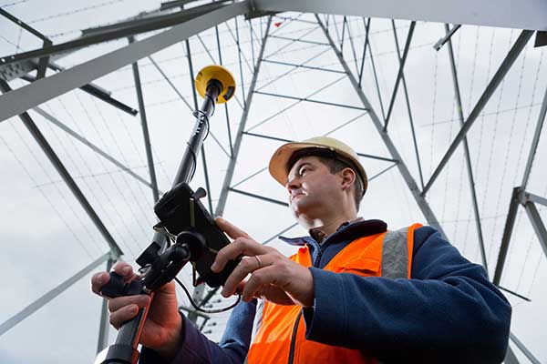
    Lay of the GNSS Land

    Top receiver manufacturers discuss what’s on the horizon for GNSS receivers. The companies reveal recent and upcoming innovations, how to combat spoofing and jamming, fusing GNSS with other sensors, and the impact of increasing accuracy both for professional surveyors and consumers.

    With regard to jamming and spoofing, the preferred approach is a combination of monitoring, detection and filtering. However, shielding, the use of IMUs and other third-party sensors, and advances in processing algorithms also help mitigate interference. In a few years, hopefully, encrypted or “watermarked” signals will substantially reduce this problem.

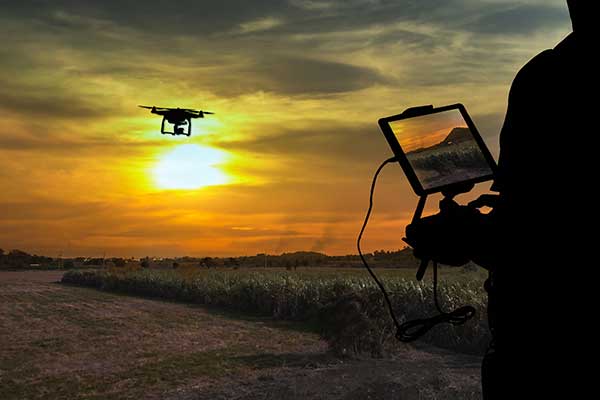
    IMUs and other sensors are now routinely integrated with GNSS receivers, with their outputs fused. This trend is largely propelled on the demand side by the needs of the emerging market for autonomous vehicles and on the supply side by smaller, cheaper and more accurate IMUs and lidar scanners. Meanwhile, developments in algorithms have improved the modeling of errors to correct for the inherent tendency of IMUs to drift. Additionally, digital cameras, lidar and other industry-specific sensors are increasingly common, especially for collision avoidance in human-machine interactions.

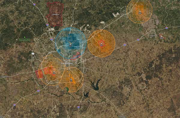
    In surveying, the use of all constellations and frequencies, as they become available, is an industry trend. Costs will continue to drop as the growth in the adoption of GNSS solutions enables manufacturers to take greater advantage of economies of scale. Precise point positioning (PPP), which benefits greatly from the growth in GNSS constellations, is now giving real-time kinematic (RTK) positioning a run for its money. Available applications enable Android mobile devices to achieve centimeter accuracy, while innovations continue in core positioning algorithms.

    In the world of mobile consumer devices, dual-frequency, multi-constellation GNSS chipsets are increasingly prevalent. As increased accuracy fuels expectations for even higher accuracy, precision positioning may become the norm in the consumer space, and new applications for these devices may emerge. Already, crowdsourcing the monitoring of both GNSS signals and interference helps improve accuracy for everyone, in a positive feedback loop.

    Other notable trends include the introduction and expansion of 5G data networks, the increased use of satellite-based correction services, and continued efforts to develop precise positioning for indoor areas. (See part 2 of this feature here.)


    Topcon

    Jamming and Spoofing. “We continue to develop and deploy patented technology to detect spoofing,” said Alok Srivastava, director, product management. “We already have cutting edge GNSS antenna technology to provide stellar support for interference rejection and filtering.” All Topcon end products have this advanced antenna and filtering technology.

    Sensor Fusion. “Topcon has been using inertial systems for decades for a variety of positioning applications — such as machine control, mobile mapping, and agriculture,” said Srivastava. “In recent years, advancements in IMU technology have progressed to where the size and cost of these sensors are at levels to be utilized at a larger scale. For example, the recently released Topcon HiPer VR takes advantage of inertial technology to improve productivity in real time with our Topcon Integrated Leveling Technology (TILT), which compensates for mis-leveled field measurements out of plumb by as much as 15 degrees.”

    Surveying. Topcon continues to invest in its core positioning algorithms to innovate such features as quartz lock loop, advanced multi-engine platform, and VHD heading technology into its positioning engines, Srivastava said. “We also produce solutions such as our Millimeter GPS and Hybrid Positioning innovations, which are designed around improving accuracy, higher reliability, and greater flexibility by converging positioning technologies.”

    Consumer Devices. “GNSS in consumer devices and other commercial systems is used to aid other positioning sensors,” Srivastava said. “So, it may not be in the best of interest to offer that level of accuracy from GNSS alone.”

    Other Challenges. Precise indoor positioning is a requirement of the vertical construction industry. “Topcon’s combined optical instrument takes a unique approach to solve that problem by integrating a compact laser scanner with a fully featured robotic total station,” Srivastava said.
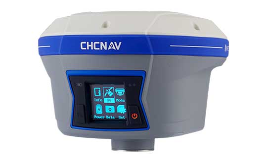
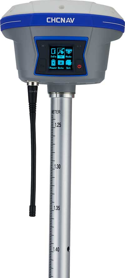
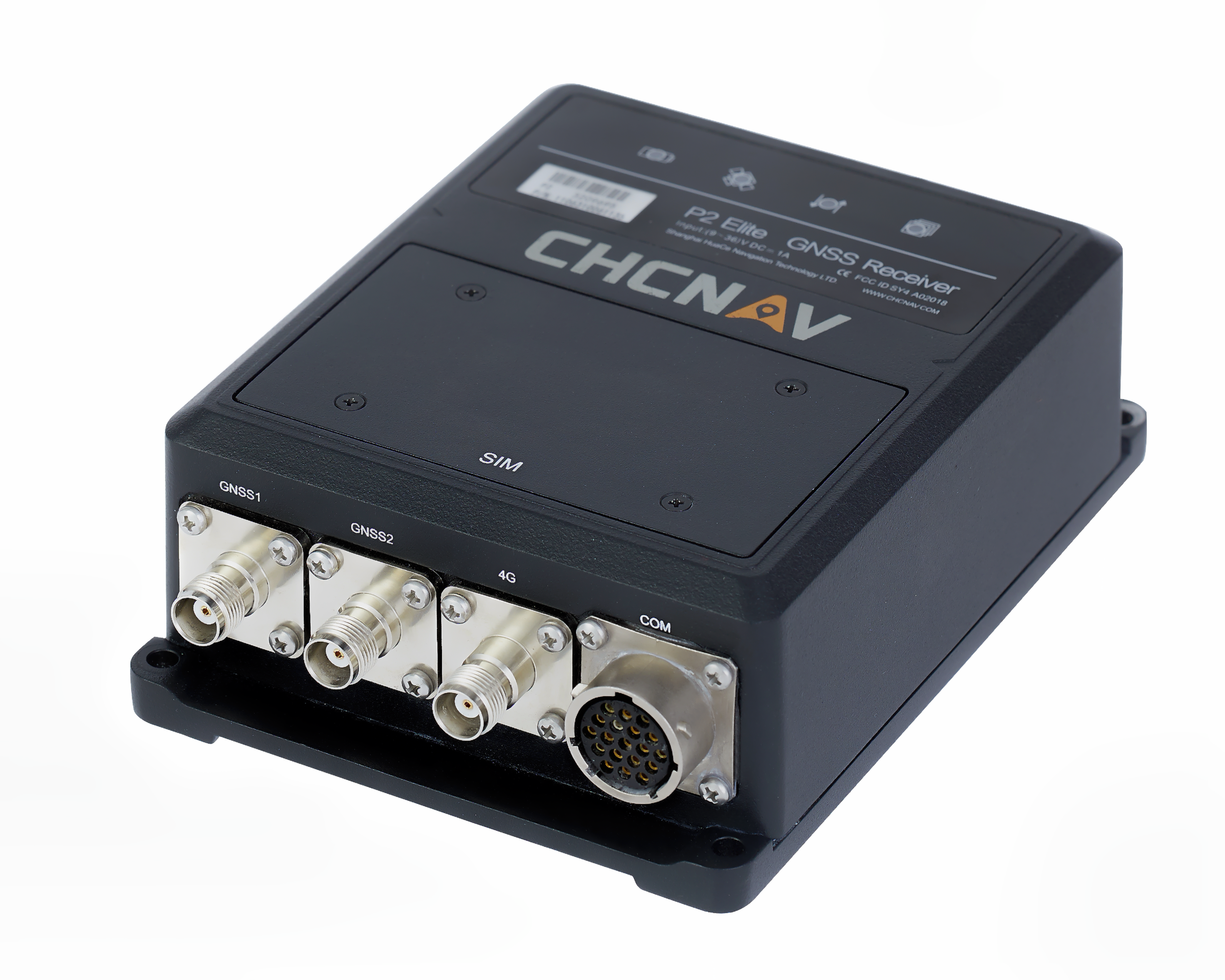
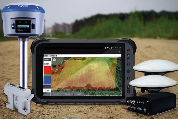
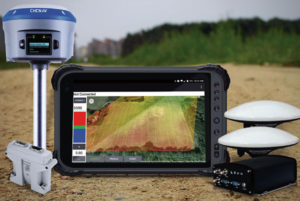
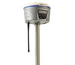
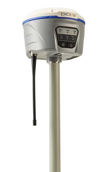

    Photo: CHC Navigation
    Photo: CHC Navigation

    CHC Navigation

    Jamming and Spoofing. CHCNav is currently taking a twofold approach to GNSS interference, said François Martin, vice general manager, International Division. “As a GNSS system integrator, we focus our design around strong electromagnetic shielding and sealed isolation chambers.” Additionally, he pointed out, the advanced filtering of GNSS signals and an antenna patch produce optimal interference mitigation.

    Sensor Fusion. Integrating interference-free, high-dynamic IMUs instead of MEMS has brought the full benefits of tilt compensation to users, Martin said. The latest development in algorithms dramatically obviated the need for the annoying process of initializing GNSS IMU receivers and boosted the availability of GNSS RTK in demanding environments.

    Surveying. The fast adoption of GNSS solutions by large user segments has reduced costs by enabling a sizable manufacturing economy of scale, Martin pointed out. “Tighter combination of embedded technologies such as GNSS and connectivity modules are sustaining that cost reduction process.”

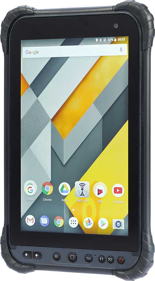
    Consumer Devices. “The emergence of dual frequency multi-constellation GNSS chipsets supports the development of untapped user segments, but the position accuracy repeatability remains an issue,” Martin said. “The integration of GNSS chipset and high-performance helical antennas, as precision add-on modules, onto rugged Android cell phone and tablets is creating a prosumer-grade centimeter to decimeter accuracy answering to a wide range of mobile workforce applications.”

    Other Challenges. A growing number of positioning and navigation applications require the fusion of technologies to increase productivity, Martin said. “The integration of advanced tightly integrated positioning algorithms, scanners, IMUs, HDR cameras, IoT and cloud-based connected solutions are a clear trend.” However, their adoption by a large user base remains limited by their current price point.


    Photo: Septentrio
    Photo: Septentrio

    Septentrio

    Jamming and Spoofing. “Recent developments in receiver-antenna combinations maximize the benefits of anti-jamming techniques,” said Gustavo Lopez, market access manager. Third party sensors, such as IMUs, also help mitigate interference, he pointed out. “Septentrio’s advanced receiver technology such as AIM+, a standard feature on all the company’s products, bring not only real time monitoring but also jamming/spoofing mitigation. Galileo and GPS have clear roadmaps bringing signal authentication in order to avoid spoofing.”

    Sensor Fusion. Smaller IMUs with higher grade performance now on the market are enabling new use cases in autonomous applications, said Lopez. Other important elements are a new generation of compact high-performance sensors and the growing importance of multi-sensor technology “to provide even higher levels of positioning integrity.” He cited Septentrio’s AsteRx-i family of products as an example of GNSS/INS integrated solutions.

    Surveying. As an example of Septentrio’s survey-specific products, which “continuously benefit from advanced developments being rolled out in our platform,” Lopez cited the Altus NR3.

    Consumer Devices. The increasing positioning accuracy of cell phones, Lopez pointed out, “has spurred innovations such as PPP and the use of mobile phone measurements,” as well as “other purposes, such as interference detection and crowdsourcing.”

    Other Challenges. “Sensor fusion is a key element in positioning and orientation,” Lopez said. “Easy integration is a key element in this trend. Also, integrity in error reporting and positioning will be required as well as reliable raw measurements which can be integrated with other sensors. This drives the requirement for receivers capable of running customer proprietary software. Another important element will also be the possibility of running positioning algorithms on a third-party processor.”
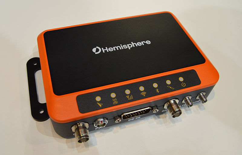

    Photo: Hemisphere GNSS
    Photo: Hemisphere GNSS

    Hemisphere GNSS

    Jamming and Spoofing.Hemisphere’s new Lyra II ASIC platform used in our Phantom and Vega series positioning and heading boards,” said Miles Ware, director of marketing, “introduces new technology and filtering methods to identify and mitigate known and unknown interference sources that typically have an adverse effect on GNSS performance.”

    Sensor Fusion. “Advancements in IMU integration and sensor fusion,” Ware said, “will continue to be a key focus for Hemisphere to support the growth and adoption of the expanding autonomous vehicle and application marketplace. The positioning and heading technology offered in our Vega 28 will be a core component for autonomous marine, machine control, and agriculture solutions for new and emerging markets.”

    Surveying. “Access to modern and future signals like BeiDou Phase III, ALTBOC and BS-ACEBOC significantly enhance GNSS accuracy, especially in challenging environments where satellite visibility is compromised by the topography and or the structures present,” Ware pointed out. “Survey solutions that can not only track but also use all the available GNSS measurements in their RTK solution will have a substantial advantage in the market.”

    Consumer Devices. “As mobile phones and consumer devices continue to adopt hardware designs that can access the latest GNSS signals,” Ware said, “the opportunities for solutions where high precision measurement engines can be hosted within mobile devices opens up a new realm of solutions that can leverage the high accuracy positioning performance found in Hemisphere technology and products. We see this as a very exciting and emerging area.”

    Other Challenges. Ware pointed to “leveraging GNSS technology to further support environmentally friendly transportation solutions and sustainable agriculture,” for which GNSS continues to be an integral component.


    Photo: Unicore
    Photo: Unicore

    Unicore Communications

    Sensor Fusion. “We are implementing GNSS with different level IMUs, including low-cost and high-end, targeting automotive, intelligent driving, and robot application scenarios,” said Gao Jingbo, marketing director. “The algorithm can also integrate with the already-existing sensors on the platform, such as IMUs, cameras and odometers. The solution can be done on the GNSS side, with high information synchronization accuracy, or processed on the platform.”

    Surveying. Products with Unicore boards inside can provide centimeter- to millimeter-level positioning accuracy, said Jingbo. “Unicore’s high-precision boards and modules can track all frequencies of all satellite systems. The UGypsophila RTK technology can make the most of the observation data of all frequencies in all systems even without the observations of the base station in the RTK solution, thus greatly improving the usability, reliability and accuracy of RTK.” The company is now also working to reduce the dimensions and cost of its products, Jingbo pointed out. “With Unicore’s single GNSS SoC on board, the UB4B0M and UM4B0 modules are making affordable high-end high precision surveying possible.”

    Consumer Devices. Algorithms and hardware are ready now to implement PPP+RTK in cell phones, Jingbo said, and this increase in positioning accuracy will enable many more applications. “We have rich experience in high precision GNSS, but the antenna might be a challenge. Our new generation 22 nm GNSS SoC features low power consumption and support of sensor fusion. Additionally, true point technology by Rx-Networks (also a BDStar company) can provide sub-meter data service, which also enables users to access centimeter-level accuracy location data through their mobile phones and wearable technologies, without increasing the demand for processing power.”


    Photo: Trimble
    Photo: Trimble

    Trimble

    Jamming and Spoofing.Trimble’s latest GNSS receivers leverage our seventh-generation Maxwell technology, which implements hardware- and software-based techniques to detect and mitigate spoofing,” said Stuart Riley, vice president, GNSS Technology. “In addition, Trimble continues to improve the robustness of our GNSS receivers with advances in processing algorithms and hardware enhancements such as the integration of inertial technology.”

    Sensor Fusion. “For many years, IMUs have been widely used in Trimble agriculture and Applanix products,” Riley said. “Over the past few years, we’ve created a new line of lower-cost inertially integrated board-level GNSS receivers. We have also integrated inertial components into survey and construction products, including tilt compensation in the Trimble R10, R12 and SPS986 receivers. Trimble also combines its GNSS solutions with optical, laser, lidar and other sensors.”

    Surveying. Trimble’s GNSS products, Riley pointed out, range from GIS handhelds to high-performance mobile mapping systems.

    Consumer Devices. “The Trimble Catalyst system uses Android-based smartphones or tablets to run an application that includes a software-defined GNSS receiver,” Riley said. “The recently introduced SiteVision system builds on this ecosystem and integrates Google’s ARCore platform with precision GNSS to provide an augmented reality solution for a variety of professional applications.”

    Other Challenges. To address signal masking and multipath, Trimble has “continued to improve performance in difficult environments with products such as the Trimble R12 receiver, which provides sophisticated multipath mitigation and an advanced precision processing engine.” Riley said, “Trimble’s RTX Correction Services, delivered via satellite, enable users to achieve RTK speed and accuracy nearly anywhere on the planet without the need for local reference stations.”


    Photo: NovAtel
    Photo: NovAtel

    NovAtel

    Jamming and Spoofing. “The RF environment is at best crowded and at worst hostile,” said Sandy Kennedy, vice president of innovation, Hexagon’s Positioning Intelligence division. “The NovAtel OEM7 generation of receivers was launched in 2016, with interference detection and mitigation as key features on every variant. Protecting authenticity, availability, and precision for multifrequency measurements is the challenge going forward — in all segments of the system: constellation management and SIS, antenna, receiver design and processing in FW/SW.”

    Sensor Fusion. In the last three years, Kennedy pointed out, IMU manufacturers have made significant improvements in the performance offered in smaller, cheaper IMUs. “At the same time, new methods to improve error modelling (to control positioning errors) have been added to the NovAtel SPAN product line, especially in SPAN Land profile. Extended GNSS outages are easily handled now.”

    Surveying. “PPP has become a strong competitor to RTK, as convergence times have decreased, and this will continue in service offerings like Terrastar-X from NovAtel,” Kennedy said.

    Consumer Devices. The devices, Kennedy said, offer “the tantalizing promise of quality measurements from a common utility device with huge computing horsepower and data connectivity built in! It’s fun to watch, and we shall see if accuracy is truly addictive enough to fuel development for general use of precision positioning.”

    Other Challenges. “In the past 20 years, users have moved from awe and wonder that centimeter-level positioning is possible — to utter contempt when it is not,” Kennedy said. “This will continue, with an added requirement of integrity and functional safety. Continuously available positioning within a usable protection level is a requirement for autonomous vehicles.”

    Also read part 2 from our February issue, and our antenna feature.

  • Launchpad: Handheld and UAV receivers, GNSS antennas

    Launchpad: Handheld and UAV receivers, GNSS antennas

    A roundup of recent products in the GNSS and inertial positioning industry from the January 2020 issue of GPS World magazine.


    OEM

    Heavy-duty antenna

    For challenging environments

    AT311 antenna. (Photo: CHC Navigation)
    AT311 antenna. (Photo: CHC Navigation)

    The heavy-duty CHCNAV AT311T is designed for demanding applications subject to shocks and vibrations. With advanced filtering and robust signal tracking, it provides survey-grade GNSS signals to enhance position reliability for marine applications, machine control, precision agriculture and industrial automation. Features include multi-constellation GNSS tracking using GPS, GLONASS, BeiDou, Galileo, QZSS, IRNSS and SBAS. Its IP68 water-resistant design makes it safe to use in extreme conditions with a wide temperature range (–40° C to +85° C). Its internal stacked structure enhances performance in high-interference environments, and the 40-dB signal gains, advanced signal filtering and multipath rejection design provide superior and robust GNSS signal tracking in challenging surroundings.

    CHC Navigation, www.chcnav.com

    UAV GNSS board

    Compact, high-precision for UAS

    The UAS1 GNSS receiver module has been designed for UAV/UAS applications requiring centimeter accuracy in a small package.(Photo: Trimble)
    The UAS1 GNSS receiver module has been designed for UAV/UAS applications requiring centimeter accuracy in a small package.(Photo: Trimble)

    The UAS1 compact, high-precision GNSS board was designed for unmanned aerial systems (UAS). It allows UAS system integrators to add upgradeable GNSS-based positioning using rugged connectors and Trimble’s software interface. Its 336-channel GNSS engine is capable of tracking L1/L2 frequencies from GPS, GLONASS, Galileo and BeiDou for centimeter-level, real-time kinematic (RTK) positioning. The compact board provides capabilities from high-accuracy GPS-only to full GNSS features. The receiver supports fault detection and exclusion (FDE) and receiver autonomous integrity monitoring (RAIM). System integrators also have the ability to detect interference with an RF spectrum monitoring and analysis tool embedded in the receiver.

    Trimble, trimble.com

    Upgradeable OEM board

    Offers software-enabled features

    Photo: NavCom
    Photo: NavCom

    The Onyx multi-frequency GNSS OEM board offers integrated StarFire/real-time kinematic (RTK) GNSS capabilities. It features 255-channel tracking, including multi-constellation support for GPS, GLONASS, BeiDou and Galileo. It provides high performance in GNSS receiver sensitivity and signal tracking as well as patented multipath mitigation, interference rejection and anti-jamming capabilities. Through software options, the Onyx ,allows upgrades from free differential GPS signal sources such as WAAS, to increased accuracy services such as StarFire and RTK Extend. The software-enabled features are sold in bundles, but can also be purchased individually to suit changing application needs.

    NavCom Technology, www.navcomtech.com

    Network timing

    Sub-microsecond synchronization

    The OSA 5401 and OSA 5405 now enable power utility and broadcast networks to achieve sub-microsecond synchronization. (Photo: Business Wire)
    The OSA 5401 and OSA 5405 now enable power utility and broadcast networks to achieve sub-microsecond synchronization. (Photo: Business Wire)

    The OSA 5401 and OSA 5405 upgraded PTP grandmaster clocks deliver precise, robust timing in a compact form factor. Oscilloquartz PTP timing technology enables power utility and broadcast networks to achieve sub-microsecond synchronization. The pluggable OSA 5401 is a small PTP grandmaster clock, and the OSA 5405 is an integrated PTP grandmaster with dual GNSS antenna and receiver. With spoofing and jamming detection capabilities, they also provide high availability. The OSA 5401 and 5405 provide new levels of accuracy and resilience for infrastructure and support emerging bandwidth-intensive, latency-sensitive applications. With sub-microsecond synchronization, smart grids can perform flexible, real-time decision making, as well as monitoring and automated maintenance. The OSA 5401 and OSA 5405 comply with the latest PTP profiles for time, frequency and phase synchronization in both power utility and broadcast networks. These include the IEC/IEEE 61850-9-3 Power Utility Profile for precise time distribution and clock synchronization in electrical grids with an accuracy of 1μs, and SMPTE 2059 for synchronizing video and audio equipment over packet networks.

    Adva, www.adva.com


    TRANSPORTATION

    Aircraft GPS

    Helps with ADS-B Out compliance

    CMA-5024. (Photo: CMC Electronics)
    CMA-5024. (Photo: CMC Electronics)

    The SBAS-capable CMA-5024 GPS has received U.S. Federal Aviation Administration (FAA) approval for installation on Boeing 737 Next-Generation aircraft. It enables B737NGs to comply with worldwide ADS-B Out mandates as well as SBAS/GPS navigation, enabling the first localizer performance with vertical guidance (LPV) approaches for B737NGs. The CMA-5024 GPS is a cost-effective alternative to replace a multi-mode receiver (MMR). The approved DO-260B ADS-B Out positioning source can be paired with any DO-260B compliant transponder, allowing operators to meet FAA and EASA ADS-B Out requirements, the UAE’s ADS-B Out and RNP requirements mandated by GCAA as well as India’s GAGAN requirements.

    CMC Electronics, www.cmcelectronics.ca

    ADS-B transmitter

    Receives FAA approval

    Photo:
    Photo: uAvionix

    The U.S. Federal Aviation Administration (FAA) has approved the VTU-20 automatic dependent surveillance – broadcast (ADS-B) transmitter for airport surface management. Adhering to the performance and design assurance specifications of FAA-E-3032, the externally mounted VTU-20 ensures integration and interoperability with Airport Surface Detection Equipment, Model X (ASDE-X), Airport Surface Surveillance Capability (ASSC) and ADS-B receiver surveillance solutions for airport. The VTU-20 can be permanently or magnetically mounted to all airside vehicles, including utility, emergency, snow-removal and maintenance equipment. Each vehicle is clearly and uniquely identified, providing an essential addition to any surface movement guidance and control system.

    uAvionix, uavionix.com


    UAV

    Airspace Intelligence

    Provides critical safety data to drone pilots

    Image: Skyward
    Image: Skyward

    Skyward’s Advanced Airspace Intelligence drone airspace maps provide airspace data combined with essential ground intelligence including 3D views of key structures, transmission lines, and more than a million vertical obstacles. The platform also provides access to LAANC, the Low Altitude Authorization and Notification Capability program provided by the U.S. Federal Aviation Administration. Data available for situational awareness includes vertical structure obstacles, power lines, airports, runways, national parks, stadiums, hospitals and schools.

    Skyward, skyward.io

    PPK for Phantom 4 RTK drones

    Provides reliable camera positioning data

    Screenshot: Hi-Target
    Screenshot: Hi-Target

    Hi-Target PPK GO precision add-on enables Phantom 4 RTK drones to achieve the accurate and reliable camera positioning data in any coordinate system without measure targets or ground control points. With 2-centimeter accuracies on XYZ, the output text file with position information or geotagged images can be used directly in major photogrammetric mapping or 3D survey software. The add-on allows selection of GPS/GLONASS/Beidou/ Galileo L1+L2+L5 and further parameter adjustments for position calculation in the PPK process to ensure the most reliable and accurate camera positioning even in poor single satellite system signals.

    Hi-Target, en.hi-target.com.cn


    SURVEYING & MAPPING

    GNSS Receiver

    Full-featured positioning system

    The R620 GNSS receiver is a complete refresh of Hemisphere's previous version, the R330. (Photo: Allison Barwacz)
    The R620 GNSS receiver is a complete refresh of Hemisphere’s previous version, the R330. (Photo: Allison Barwacz)

    The next-generation R620 receiver is designed for land and marine applications requiring high-precision positioning. It is a complete refresh of the previous version (R330) and has a new low-profile ruggedized enclosure. Customers can start with sub-meter positioning accuracy and upgrade the receiver through activations and subscriptions to add functionality and improve performance capability to centimeter-level accuracy. Powered by the Vega series, the R620 GNSS receiver processes and supports more than 1,100 channels. It simultaneously tracks GPS, GLONASS, BeiDou (including Phase 3), Galileo, QZSS, IRNSS, SBAS and Atlas L-band corrections. It has status LEDs , a powerful WebUI, UHF (400-MHz and 900-MHz) radio, cellular modem, Bluetooth, Wi-Fi, Ethernet (including power over Ethernet), CAN, serial and USB.

    Hemisphere GNSS, hemispheregnss.com

    Rugged data collector

    For land surveying and geospatial information systems (GIS)

    Photo: Geneq
    Photo: Geneq

    The rugged SXPad 1500 data collector features an alphanumeric keypad and long-range Bluetooth, and was designed to meet the rigorous IP67 standard for challenging field conditions. It has a 5-inch sunlight-readable touchscreen. The SXPad 1500 can be connected to any GNSS receiver or compatible robotic total station. Driven by a 1-GHz processor and the Windows Mobile 6.5 operating system, providing the power to work with maps and large data sets in the field. Its integrated cellular modem and Wi-Fi provides wireless connectivity for internet access and GIS data transfer — helpful for configuring a real-time kinematic (RTK)-compatible GNSS receiver. Equipped with an internal memory of 1 GB (memory can be expanded to 16 GB with an SD card), the SXPad 1500 provides enough storage space for data recording. Its high-performance lithium battery allows uninterrupted field operation for up to eight hours.

    Geneq, sxbluegps.com

    GNSS RTK tablet

    Receives 184 channels

    Photo: CHC Navigation
    Photo: CHC Navigation

    The LT700H RTK Android tablet is designed to increase efficiency and productivity of the mobile field workforce in applications requiring centimeter-to-decimeter positioning accuracy. Portable, rugged and versatile, the LT700H enables precision GIS data collection, forensic mapping, construction site layout, environmental surveys, landscaping and earthmoving jobs. Powered by 184-channel high-performance GPS, GLONASS, Galileo and BeiDou module and a superior tracking GNSS helical antenna, the LT700H provides position availability in demanding environments. Its integrated 4G modem ensures seamless communication from field-to-office and robust connectivity to RTK correction networks.

    CHC Navigation, www.chcnav.com

    Reference receiver

    Now supports BDS-3 signals

    Photo: Trimble
    Photo: Trimble

    The Trimble Alloy GNSS reference receiver now supports BeiDou Generation III (BDS-3) signals. This will enable operators to meet the ongoing demand from surveyors, mapping professionals and precision farmers for accurate, reliable corrections derived from real-time networks. Released in 2018, the Alloy has the processing power needed for high-quality data from multiple constellations. Alloy version 5.42 firmware tracks all available and planned GPS Block IIIA L1C and BDS-3 signals.

    Trimble, www.trimble.com

    Utility mapping

    Ground penetrating radar

    Hexagon showcased the Leica DSX utility detection solution at Intergeo 2019. (Photo: Allison Barwacz)
    Hexagon showcased the Leica DSX utility detection solution at Intergeo 2019. (Photo: Allison Barwacz)

    The Leica DSX utility detection solution can be used together with Leica GPS/GNSS systems to generate highly accurate, georeferenced maps. The DSX uncovers utilities for repair and maintenance, civil engineering and surveying projects. The ground-penetrating radar system includes portable hardware and software that automates data analysis and creates a 3D utility map.

    Hexagon, hexagon.com

  • Hot, cold, high, low: GNSS and INS perform under pressure

    Hot, cold, high, low: GNSS and INS perform under pressure

    GNSS and inertial navigation sensors are meeting the challenges of extreme conditions, from freezing Arctic ice to the edges of steaming volcanoes, from high-speed aircraft over cities to the subways under them. Even beyond, into deep space.

    IN THE ARCTIC

    Wave Buoys Help Study Arctic Climate Change

    Where the edge of Arctic ice transitions to open water, towering seas are smashing sea ice into melting pieces, with far-flung effects on climate and nature. Over recent decades, the Arctic has warmed more than any other region, leading to a significant reduction in sea ice volume. The combination of increased ice-free area and more mobile ice cover has led to the emergence of a seasonal marginal ice zone (MIZ) in the Beaufort Sea, north of Prudhoe Bay, Alaska.

    The United States Office of Naval Research conducted a five-year study of the MIZ, which included intense field work in the freezing Arctic sea. Here, the ice is vulnerable to ocean surface waves that form in the open water, resulting from strong winds and frequent storms. Also studied were in-ice waves, where ice and water clash. The goal was to understand how both factors impact the ice floe melting.

    Autonomous ocean flux buoys integrate SBG Systems’ miniature inertial sensors. (Photo: SBG Systems)
    Autonomous ocean flux buoys integrate SBG Systems’ miniature inertial sensors. (Photo: SBG Systems)

    The MIZ lies in the subarctic seas in winter and transitions into the interior of the Arctic Basin in summer. To investigate the MIZ’s dynamics, ONR engaged an international program of observations and simulations using several autonomous systems, including wave buoys. The wave buoys — officially designated the autonomous ocean flux buoys — integrate SBG Systems’ miniature inertial sensors.

    The MIZ study comprised an international team of scientists from more than a dozen organizations.

    Buoys for All Seasons. The program included 20 buoys deployed in the summer, and five in the winter, to quantify open ocean and in-ice wave characteristics and evolution. “We needed a very rapid and cost-effective solution to measuring directional wave spectra in the ocean,” said Martin Doble, oceanographer at the French UPMC School and member of the research program. “Time to deployment was very short, so an integrated solution, giving us good heave numbers straight out of the box, was essential. Delivery time of the units was also critical.”

    Drilled into the ice, the summer buoys were powered with solar panels and equipped with SBG Systems’ IG-500A miniature attitude and heading reference system to detect both distant and near-wave effects on the local ice floe. Once the ice melted, the summer buoys continued to measure open ocean characteristics.

    Five winter buoys were installed on the ice. These buoys were made of aluminum for better resistance and contained enough battery power to keep them going through the dark winter months. Every buoy also contained processing and control electronics, an SD card, a GPS receiver and an Iridium satellite modem and antennas to transmit the recorded data to its base station. Both summer and winter data from the buoys were used to quantify the wave attenuation rate.

    Winter buoy installed on an ice floe. (Photo: SBG Systems)
    Winter buoy installed on an ice floe. (Photo: SBG Systems)

    By measuring the waves and ice, the buoys help scientists understand how waves are approaching and breaking up the sea ice. When winter approaches and ice begins to refreeze, the buoys help show how the waves interact with the ice as the temperatures change.

    Calibration. The IG-500A inertial sensors were used for wave height and direction. IG-500A measures in real time the roll, pitch, heading (accurate to 0.35°) and heave (accurate to 10 centimeters). Every sensor is calibrated for bias, linearity, gain, misalignment, cross-axis and gyro-g from –40° to +85°C. The calibration is key to enabling the sensors to provide reliable data in the harsh environment.

    Doble said the units were reliable, with no failures in the harsh Arctic conditions. They ran continuously for more than a year without requiring power cycling, and “the numbers look good, giving clear results.”

    The data is helping researchers understand the physics that control sea ice breakup and melt in and around the ice edge. “We have this amazing picture of the ocean, atmosphere, and ice going from the fully frozen period in March to meltdown and breakup right through to freeze-up,” said Craig Lee of the University of Washington’s Applied Physics Laboratory.

    The IG-500A sensors also delivered heave measurement, important for instrumented ocean buoys. During the project, SBG Systems released the Ellipse Series, and the new line replaced the IG-500 series. More accurate in attitude and more reliable (with an IP68 rating) for the same budget, the new miniature inertial sensors now provide a heave measurement that automatically adjusts to the wave period, resulting in higher performance.

    Clear differences were measured between surface wave activity outside of the ice, and then moving into the ice, with huge attenuation as the waves enter the ice and die back quickly.

    Current Arctic Program. Following the close of the MIZ project in 2015, the ONR launched a new project for 2016–2020, the Stratified Ocean Dynamics in the Arctic (SODA). SODA is also taking place in the Beaufort Sea, and is using the autonomous ocean flux buoys. The buoys are now equipped with SBG’s Ellipse-A sensors.

    Why the Arctic Matters

    “There’s no question that the Arctic sea ice extent is decreasing,” said Martin Jeffries, program officer for the ONR Arctic and Global Prediction Program. “Multiple sources of data — autonomous underwater gliders, ice-measuring buoys and satellite images of the marginal ice zone — were used to help understand why the ice is retreating.”

    The implications for the U.S. Navy, and the world, are significant. If there were no sea ice in the Arctic at the end of summer, that would mean that the Arctic Ocean would, until the winter ice came in, be completely open — something unprecedented in living memory, Jeffries noted.

    Naval leaders have made it clear that understanding a changing Arctic is essential for the Navy to be prepared to respond effectively to future needs.

    “[T]he opening of the Arctic Ocean has important national security implications as well as significant impacts on the U.S. Navy’s required future capabilities,” said then Chief of Naval Operations Admiral Jonathan Greenert, in his introduction to the U.S. Navy Arctic Roadmap, 2014–2030, published in 2014. “The United States has a history of maritime homeland security and homeland defense concerns in the Arctic Region […] .”

    In the period between 2007 and 2014, satellites recorded the eight lowest sea ice levels ever. A key goal of the MIZ and SODA programs is to use the new data collected to make better predictive computer models — ensuring safer operations for not only naval vessels, but also anticipated increased sea traffic by shipping and fishing industries; oil, gas and mining companies; and tourism operations.
    Much of the data coming in to Arctic scientists is now from improved sensors, with greater ability to survive the harsh weather and ocean conditions.

    Inside the Ellipse

    Alexis Guinamard, chief technology officer of SBG Systems, described to GPS World the company’s most advanced sensor for extreme environments.
    “Of course we have more precise sensors like Ekinox, Apogee or even Horizon, for ‘extreme’ precision. But for extreme environments, the more appropriate sensor line is the Ellipse series,” Guinamard said. “There are several key parameters that make them better for this kind of environment.”

    Those features include a high-temperature calibration range, from –40°C to +85°C, which enables the sensors to operate at the same performance level in the most extreme temperature environments.

    “While typical entry-level or industrial-grade sensors only provide a room temperature or basic temperature calibration, we have developed a calibration procedure used for both survey-grade and industrial-grade sensors using a precision two-axis rotary table with temperature chamber,” Guinamard said. “An advanced thermal modeling minimizes the calibration error over the full temperature range.”

    Ellipse-D dual-antenna mini INS/GNSS. (Photo: SBG Systems)
    Ellipse-D dual-antenna mini INS/GNSS. (Photo: SBG Systems)

    The sensors work in highly dynamic and vibrating environments because their gyros operate well, changing position up to 900° per second. Similarly, their accelerometers can reach up to 40 g, with excellent behavior in vibrating environments. “We can typically install our sensors directly on the chassis of the vehicle, while lower grade sensors may require specific dampers that are complex to design and make it difficult to precisely align the sensor,” Guinamard said.

    A GNSS interference-mitigation capability enables the sensors to perform in challenging GNSS environments.

    With the Ellipse-D, high latitude operation is possible because it provides a dual-antenna heading that is insensitive to higher latitudes, Guinamard explained.

    Saltwater-Proof. SBG Systems sensors typically have waterproof (IP68) enclosures that can deal with harsh conditions and sustain exposure to saltwater for a limited period of time. For long exposure to salt water, the company offers specific titanium enclosures. For instance, its Navsight series has a saltwater-proof inertial measurement unit.

    Navsight marine solution. (Photo: SBG Systems)
    Navsight marine solution. (Photo: SBG Systems)

    The Navsight Marine Solution is a motion and navigation solution for hydrographers available as a motion reference unit (MRU), as an inertial navigation solution (INS) with embedded GNSS, and as an INS using a third-party GNSS receiver.

    Navsight can be outfitted for demanding shallow- or deep-water environments to survey highly dense areas (bridges and buildings), as well as applications where only a single antenna can be used.

    With the addition of the Horizon inertial measurement unit (IMU) to the Navsight line in January, which joined the Ekinox and Apogee IMUs, the line is suitable for large hydrographic vessels surveying harsh environments. The Horizon IMU is based on a closed-loop fiber-optic gyro (FOG) technology that enables ultra-low bias and noise levels, allowing robust and consistent performance.


    Dust, noxious gas and loose rock near the summit makes volcanic surveying especially challenging. (Photo: Trimble)
    Dust, noxious gas and loose rock near the summit makes volcanic surveying especially challenging. (Photo: Trimble)
    AT VOLCANO’S EDGE

    GNSS Tracks Magma on Mount Etna

    Scientists seeking to better understand volcanoes are using GNSS to investigate one of the most active in the world.

    Mount Etna, in eastern Sicily, Italy, has been erupting for hundreds of thousands of years. The constant activity makes it a popular tourist attraction — smoke often billows from the mountain and fiery lava spews down its sides.

    Researchers flock to Mount Etna, too, to study the movement of magma — the hot fluid beneath the Earth’s surface from which rocks are formed when cooled.

    To measure the vertical gradients of gravity on Mount Etna’s slopes and summit craters, geophysicists from Slovakia and Italy teamed up on a field campaign during which they used high-accuracy GNSS positioning with emphasis on accurate height measurements to collect gravimetry and topographic information.

    The extreme environment and spotty cellular coverage on Mount Etna made using GNSS with real-time kinematic (RTK) or virtual reference station (VRS) a challenge. The geophysicists used the Trimble CenterPoint RTX correction service and Trimble R10 GNSS receivers to ensure reliable GNSS performance.

    “On many points, especially the higher part of the volcano, Internet signals were poor or [there were] none at all,” said Juraj Papčo, a geodesist with the Earth Science Institute of the Slovak Academy of Sciences. “Only by using RTX were we able to collect real-time data. It performed well in higher elevations and difficult conditions.”

    The project teams also used Trimble RTX to navigate to locations where they needed measurements. At each station, they collected static and real-time positions and later compared post-processed results with the real-time positions.

    Dust, noxious gas and loose rock made approaching the summit especially challenging. Trimble RTX helped the Slovak-Italian team of geophysicists better understand volcanoes and anticipate volcanic events.

    Researchers used high-accuracy GNSS positioning to collect gravimetry and topographic information. (Photo: Trimble)
    Researchers used high-accuracy GNSS positioning to collect gravimetry and topographic information. (Photo: Trimble)

    Prisms affixed to the track enable measurement of change and structural movement. (Photo: Topcon)
    Prisms affixed to the track enable measurement of change and structural movement. (Photo: Topcon)
    UNDER A METROPOLIS

    Harsh Construction Environment Monitored

    Deep beneath Paris, work is underway to expand the Metro, the city’s rapid transit system. The Grand Paris Express project encompasses a 200-kilometer-long network of railway lines — mostly underground — that will link the suburbs to the city.

    The contractor responsible for monitoring construction of the first stage of the project’s infrastructure, Cementys, is using more than 100 instruments from Topcon’s MS series of robotic total stations because they can withstand the harsh construction environment.

    Monitoring structural movement across the network is critical; the goal is to protect the surrounding Parisian structures and the people who live and work in them. Use of the monitors also ensures that the expensive equipment used on the project is not stolen.

    Topcon’s MS Series robotic total stations continuously measure the angles and distances of prisms fixed to structures. As a result, site engineers know immediately when measurement change and structural movement occurs. The technology also includes Matrix Detection software to help increase the measurement system’s speed and accuracy. The company’s TSshield integrated security software, standard on all its total stations, provides remote locking and location positioning data to within 100 meters, depending on GPS and cellular coverage.

    “We have been able to integrate this open technology perfectly into our global data management system, which also includes optical fibers sensors, vibrating wire sensors, and others,” said Cementys CEO Vincent Lamour.

    Construction of the Grand Paris Express project is taking places in stages and is expected to be complete in 2030.


    Photo:Position tracks from two laps of the race show that when the plane inverts and starts to track the reflected signal, the VN-300 GNSS/INS (blue trace) reverts to free inertial navigation and propagates the position based on inertial data. The trace follows a smooth trajectory through the next air gate until the GNSS data converges with the INS position. (Image: Google Earth with VectorNav Data)
    Photo:Position tracks from two laps of the race show that when the plane inverts and starts to track the reflected signal, the VN-300 GNSS/INS (blue trace) reverts to free inertial navigation and propagates the position based on inertial data. The trace follows a smooth trajectory through the next air gate until the GNSS data converges with the INS position. (Image: Google Earth with VectorNav Data)
    ABOVE THE SEA

    Flying High with Augmented Reality

    The 2018 Red Bull Air Race World Championship in Cannes, France, made it easier for fans to follow along. Though pilots race one at a time, the new “Ghost Plane” augmented reality imagery provided fans with a real-time representation of each pilot’s flight, which challenges their speed, precision and skill maneuvering lightweight racing planes.

    The Ghost Plane is driven by onboard telemetry data gathered during flight. For a pilot’s run to be accurately represented, the onboard telemetry system has to track position, velocity and attitude (yaw, pitch and roll) through high-dynamic maneuvers and in challenging environmental conditions.

    While every Red Bull Air Race track layout is different, they all include a difficult vertical turning maneuver (VTM), where pilots pass through a gate and turn 180 degrees to reverse course quickly without exceeding the g limit.
    Each plane is fitted with several GNSS receivers to track the plane, but dynamic maneuvers made during the race rapidly changes which satellites the GNSS receiver can track, which typically results in a loss of position fix.

    To further increase the challenge for the telemetry systems, races are commonly held over water, which can reflect GNSS signals and create significant multipath errors at low altitudes. During the VTM, the plane can experience 300°/second angular rates and 12-g accelerations, during which GNSS tracking is typically lost because the antennas no longer point to the sky.

    To make the Ghost Planes possible, a VectorNav VN-300 dual-antenna GNSS/INS (inertial navigation system) couples gyroscope and accelerometer data to propagate position and velocity estimates during loss of GNSS measurements through maneuvers such as the VTM.

    The VN-300 combines two GNSS receivers with a 9-axis inertial measurement unit (IMU). It couples acceleration and angular rates from the IMU with position and velocity data from the receiver using a quaternion based Extended Kalman Filter (EKF). VectorNav algorithms work in conjunction with the state estimation filter, making the VN-300 more robust and intelligent, and enabling it to reject poor GNSS data and perform accurately in high-dynamic maneuvers and challenging operating conditions.


    NEW EQUIPMENT

    Antenna Designed for Challenging Environments

    CHC Navigation’s latest GNSS antenna is an example of a product designed specifically for harsh environments.

    AT311T antenna. (Photo: CHC Navigation)
    AT311T antenna. (Photo: CHC Navigation)

    The heavy-duty CHCNAV AT311T is designed for demanding applications subject to shocks and vibrations. With advanced filtering and robust signal tracking, it provides survey-grade GNSS signals to enhance position reliability for marine applications, machine control, precision agriculture and industrial automation.

    Features include multi-constellation GNSS tracking using GPS, GLONASS, BeiDou, Galileo, QZSS, IRNSS and SBAS. Its IP68 water-resistant design makes it safe to use in extreme conditions with a wide temperature range (–40°C to +85°C). Its internal stacked structure enhances performance in high-interference environments, and the 40-dB signal gains, advanced signal filtering and multipath rejection design provide superior and robust GNSS signal tracking in challenging surroundings.


    One of the two solar arrays on the InSight lander dominates this view of the plain of Elysium Planum, taken Dec. 4, 2018. (Image: NASA/JPL-Caltech)
    One of the two solar arrays on the InSight lander dominates this view of the plain of Elysium Planum, taken Dec. 4, 2018. (Image: NASA/JPL-Caltech)
    IN OUTER SPACE

    Exploring Beyond Earth

    While GNSS isn’t useful on the surface of Mars, inertial navigation is a key technology for exploration of the red planet. For instance, the Northrop Grumman LN-200S sensor guided the Mars Opportunity rover, which explored Mars for 15 years until a storm struck in June 2018.

    The LN 200S sensed acceleration and angular motion, with its data output used by the rover’s control systems for guidance.

    The hermetically sealed unit, suitable for planetary and asteroid probes, helped position the rover’s antennae to relay photos and data to satellites. Opportunity beamed back 187,000 raw images, according to NASA.

    Because IMUs don’t depend on satellites, they work well for deep space missions, Honeywell explained in a press release.

    In November 2018, NASA’s InSight spacecraft landed on Mars to study the interior with a heat probe and listen for marsquakes with a seismometer. Aboard was Honeywell’s Miniature Inertial Measurement Unit (MIMU), an IMU that has been a part of Lockheed Martin’s Mars satellites and landers since 1998.

    The MIMU is a three-axis strapdown device specifically designed for the satellite and deep-space-probe market (more than 500 MIMUs have been deployed throughout the solar system). It uses ring laser gyros to help control and stabilize a spacecraft during entry, descent and landing, as well as maintain orbit and payload orientation. The radiation-hardened design supports 15-year missions.

  • CHC Navigation introduces LT700H GNSS RTK tablet

    CHC Navigation introduces LT700H GNSS RTK tablet

    CHC Navigation has launched its LT700H RTK Android tablet, designed to increase efficiency and productivity of the mobile field workforce in applications requiring centimeter-to-decimeter positioning accuracy.

    Photo: CHC Navigation
    Photo: CHC Navigation

    Portable, rugged and versatile, the LT700H enables precision GIS data collection, forensic mapping, construction site layout, environmental surveys, landscaping and earthmoving jobs.

    Powered by 184-channel high-performance GPS, GLONASS, Galileo and BeiDou module and a superior tracking GNSS helical antenna, the LT700H provides position availability in demanding environments. Its integrated 4G modem ensures seamless communication from field-to-office and robust connectivity to GNSS real-time kinematic (RTK) networks corrections.

    “With the LT700H RTK Tablet, we are offering a professional and accurate GNSS solution to any mobile applications requiring high-portability,” said George Zhao, CEO of CHC Navigation. “The LT700H enables further use of GNSS technology, from single operator to companies with large field crew.”

    Combined with CHCNAV Landstar 7 field data-collection software, the LT700H has a vibrant 8-inch IPS sunlight-viewable screen that perfectly displays GIS data tables, vector and raster maps or high-resolution pictures.

    The LT700H Google GMS certification guarantees compatibility with any common GIS and mapping Android applications.

  • CHC Navigation’s new i90 GNSS receiver improves RTK

    CHC Navigation’s new i90 GNSS receiver improves RTK

    Photo: CHC Navigation
    Photo: CHC Navigation

    CHC Navigation has released and is immediately shipping its new i90 IMU-RTK GNSS Series receiver. The i90 IMU-RTK GNSS Series is designed to dramatically increase GNSS real-time kinematic (RTK) availability and reliability.

    The i90 is powered by the company’s latest inertial measurement unit (IMU) and RTK technology to provide robust and accurate GNSS positioning in any circumstances.

    Unlike standard micro-electro-mechanical (MEMS)-based GNSS receivers, the i90 GNSS IMU-RTK combines a high-end calibration and interference-free IMU sensor with a state-of-the-art GNSS RTK engine and advanced GNSS tracking capabilities.

    The i90 is designed to increase productivity and reliability of survey projects. No complicated calibration process, rotation, leveling or accessories are necessary with the i90 GNSS Series. Just a few meters’ walk will initialize the i90 internal IMU sensor and enable RTK survey in difficult field environments. The i90 GNSS automatic pole-tilt compensation boosts survey and stakeout speed by up to 20%.

    “Our new i90 IMU-RTK GNSS Series is pushing the boundaries of conventional GNSS survey by extending RTK positioning availability and reliability,” said George Zhao, CEO of CHC Navigation. “CHCNAV is the GNSS technology enabler, making high-end GNSS solutions available for every surveyor.”

  • CHC Navigation introduces new corporate website

    CHC Navigation introduces new corporate website

    Image: CHC Navigation
    Image: CHC Navigation

    CHC Navigation has launched a new website to convey its expanding role as a provider of geospatial and GNSS products and solutions.

    “Our new website provides a clear insight of who we are and where our ambition lies when developing, delivering and supporting high-end, professional and innovative GNSS-based solutions to our customers,” the company stated in a press release. “The website offers extensive refreshed and updated resources presenting the entire scope of CHCNAV solutions to make any surveying work more effective.”

    In commenting on the new website, George Zhao, CEO of CHC Navigation said, “We have been enjoying double-digit growth for over 16 years demonstrating the strength of CHC Navigation in the professional GNSS-based markets. Our new website brings a comprehensive vision of our technology and innovation, expanding compelling solutions and our global customer care approach.”

    Founded in 2003 and based in Shanghai, China, CHC Navigation creates GNSS navigation and positioning solutions.

  • CHC Navigation offers 8-inch professional tablet

    CHC Navigation offers 8-inch professional tablet

    Photo: CHC Navigation
    Photo: CHC Navigation

    CHC Navigation has launched its LT700 rugged Android tablet. The LT700 is designed to increase the efficiency and productivity of the mobile workforce in different industries and applications.

    An integrated GNSS module (GPS/GLONASS/BDS/SBAS) provides robust positioning performance. The LT700 dual-SIM 4G modem ensures fast and reliable connection with mobile teams.

    The LT700 tablet features an 8-inch sunlight-viewable touchscreen. It displays geospatial information system (GIS) data tables, complex vector and raster maps, or high-resolution pictures in direct sunshine and high-bright areas, CHC Navigation said.

    Unlike consumer-grade tablets, the L700 is intended for mobile field workers. Its industrial IP67 design withstands all-day use in harsh environments and conditions, and is protected from dust, rain, extreme temperatures and accidental drops from 1.2 meters. Rugged design, soft corner bumpers and long battery life provide the LT700 with the capability to perform uninterrupted for a complete working day.

    The LT700’s octa-core 2.2-GHz CPU supports running large maps and datasets without any lag or slowdown. Driven by Android 8.1 and bearing the GMS (Google Mobile Service) certification, the LT700 runs seamlessly the most common professional data collection applications available from the Google Play store.


  • CHC Navigation opens NA headquarters in Arizona

    CHC Navigation opens NA headquarters in Arizona

    Photo: CHC Navigation
    Photo: CHC Navigation

    Shanghai-based GNSS technology and solutions company Shanghai Huace Navigation Technology Ltd. — known as CHC Navigation — has opened a North American subsidiary, CHC Navigation USA Corporation, in Scottsdale, Arizona.

    CHC Navigation was established in 2003 and was ranked as one of China’s top GNSS and RTK technology and solutions companies in 2017. It has customers in more than 100 countries worldwide and has been providing GNSS and RTK products and solutions to the US marketplace since 2009.

    The establishment of a North American head office in Scottsdale illustrates CHC Navigation’s ongoing commitment to expanding its products, services and customer support in the U.S. and North American marketplaces.

    CHC USA will warehouse, sell and service from Scottsdale all of its products to its dealer and OEM network of customers across North America. With the new U.S. presence, CHC USA will be able to respond more quickly to its dealer and customer order requests and service requirements.

    CHC USA specializes in CORS GNSS base-station infrastructure, deformation monitoring, surveying and mapping. With new 3D lidar scanning and hydrographic unmanned survey vessels launching later this year, CHC USA’s North American office and team members will continue to focus on ensuring a great customer experience.

    “On the heels of strong CHC Navigation growth in the US in 2018, the time was right to establish a domestic US sales and service office and warehouse with a local team of positioning industry professionals,” said George Zhao, CEO of CHC Navigation. “Our U.S. and Canadian customers have been very supportive of CHC Navigation over the years and our focus will continue to be on providing industry leading products and services to our valued North American dealers and customers,” added Phil Gabriel, President of CHC Navigation USA.

  • CHC Navigation launches P2 GNSS sensor series

    CHC Navigation launches P2 GNSS sensor series

    Designed for demanding positioning and heading applications

    The P2 Elite GNSS sensor. (Photo: CHC Navigation)
    The P2 Elite GNSS sensor. (Photo: CHC Navigation)

    CHC Navigation has released the P2 GNSS sensor series, which the company says provides high-accuracy positioning and heading in a compact, rugged enclosure.

    The P2 GNSS sensor series is suitable for a wide variety of applications such as reference station, marine systems, unmanned navigation, industrial automation, robotics and machine control.

    Integration. The P2 GNSS series is designed to significantly reduce system integration efforts by combining numerous connectivity interfaces including RS232, low-latency PPS output, Ethernet, CAN bus protocol and a comprehensive web interface for configuration set-up.

    The series integrates the latest GNSS technology in an extremely rugged IP67 and lightweight enclosure. It delivers reliable, uninterrupted, high-accuracy, real-time positioning and heading measurements.

    Scalable with 3 models. The P2 GNSS series is available in three different models to match various application requirements.

    • The P2 GNSS sensor offers cost-effective and powerful real-time kinematic (RTK) positioning.
    • The P2 Pro GNSS adds a dual-antenna input for precise heading data.
    • The P2 Elite integrates additional 4G and UHF modems to provide a powerful, all-in-one, GNSS sensor.

    “The P2 GNSS sensor series is leveraging our expertise in providing high-performance and reliable GNSS solutions,” said George Zhao, CEO of CHC Navigation. “Back-up by CHCNAV’s professional integration support, the P2 GNSS sensor series offers exceptional feature set to system integrators and machine manufacturer partners.”

  • AMW offers new construction and ag products

    AMW offers new construction and ag products

    DIRT, the AMW Machine Blade Control Solution. (Photo: AMW)
    DIRT, the AMW Machine Blade Control Solution. (Photo: AMW)

    AMW Machine Control Solutions, a subsidiary of CHC Navigation, has introduced four new solutions for the survey, construction and agriculture markets, all of which run on Android and CHC Navigation GNSS tablet hardware.

    GRADE I and II Products. GRADE I runs on a CHC Navigation industrial tablet and utilizes an internal meter-accurate GNSS receiver for field workers and supervisors to view layered maps including design files, topo or Google Maps for locating elevations and topographical features.

    GRADE II adds centimeter elevation and positioning accuracy with an external CHC Navigation RTK-capable GNSS receiver that wirelessly communicates with the tablet.

    GRADE II collects topographic data on the jobsite by walking or driving the area, eliminating surveyor stakes and providing accurate data for earth-moving operations. The density of elevation points can be adjusted. The GRADE II “Smart Base” allows a user to establish RTK control points.

    DIRT I and II Products.

    DIRT combines GRADE II mapping functionality with automatic blade control for skid steer, scraper, grader or dozer applications for rough and fine land-shaping activities on large or compact equipment. DIRT is available as DIRT I or DIRT II versions depending on the type of blade control needed. Utilizing additional sensors, DIRT II adds the ability to manage cross slopes.

    DIRT includes an RTK GNSS, inclinometers, tablet computer, CANBUS controller and DIRT software running on a CHC Navigation tablet. The tablet wirelessly connects to the RTK receiver and other sensors, making the system easily portable so it can be reinstalled on other equipment.

    For agriculture applications, AMW Solutions’ proprietary algorithm within the DIRT solution results in accurately graded surfaces within the limits of the equipment.

  • CHC Navigation releases all-in-one GNSS RTK solution

    CHC Navigation releases all-in-one GNSS RTK solution

    The i50 GNSS receiver comes bundled with the CHC HCE320 Android controller and CHC LandStar 7 field data collection software. (Photo: CHC Navigation)
    The i50 GNSS receiver comes bundled with the CHC HCE320 Android controller and CHC LandStar 7 field data collection software. (Photo: CHC Navigation)

    CHC Navigation has unveiled its i50 GNSS receiver, an all-in-one GNSS RTK solution.

    The GNSS receiver comes bundled with the CHC HCE320 Android controller and CHC LandStar 7 field data collection software. According to the company, it is a cost-effective solution for topographic and construction positioning tasks in land surveying, small- and medium-sized construction projects, and precision GIS data collection.

    “The i50 GNSS is designed to match the demand of cost-conscious yet demanding professionals searching for one all-in-one GNSS RTK survey solution,” said Hans Huang, product manager of GNSS solutions for CHC Navigation. “By integrating field proven GNSS positioning and communication technologies in a compact and rugged unit, land surveyors will experience unmatched work flexibility in their daily field work with CHC i50.”

  • CHC Navigation unveils Alpha3D mobile mapping solution at Intergeo 2018

    CHC Navigation debuted its new Alpha3D mobile mapping solution at Intergeo 2018, which took place Oct. 16-18 in Frankfurt, Germany. Alpha3D combines a laser scanner, high-resolution HDR panoramic camera, GNSS receiver and high precision IMU.