Tag: coronavirus

  • Testing suspended on Galileo Batch 3 satellites

    Testing suspended on Galileo Batch 3 satellites

    In response to the ongoing coronavirus pandemic, the test campaign for the first two satellites of Galileo’s Batch 3 has been suspended.

    The suspension is based on the medical advice for social distancing — too high a concentration of people is needed on site if testing were to continue, according to the European Space Agency (ESA).

    An aerial view of ESTEC. The Erasmus building is at front right. The T building (home to ESA's Galileo team) is in the foreground. (Photo: ESTEC)
    An aerial view of ESTEC. The Erasmus building is at front right. The T building (home to ESA’s Galileo team) is in the foreground. (Photo: ESTEC)

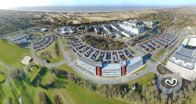
    The satellites are based at the ESTEC Test Centre in the Netherlands for engineering tests ahead of launch. The stored satellites are being monitored by staff visiting ESTEC every few days, to verify that all is in order.

    Other Galileo-related testing continues with the aim of supporting future launches. ESTEC-based lifetime testing of the next set of rubidium atomic clocks is set to continue, involving on-site monitoring every few days.

    Working from home

    ESA’s Directorate of Navigation has shifted to teleworking while also ensuring the continuity of essential tasks, in particular the continued delivery of positioning, navigation and timing services of both Galileo and EGNOS.

    The ESA team is using video and audio conferences to continue meetings with the industries involved and minimize the impact on the deliveries of EGNOS upgrades, Galileo Batch 3 satellites, and preparatory work for Galileo Second Generation.

    The national, local and industrial decisions on travel, meetings and quarantine are impacting the ability to deliver all ongoing commitments, so measures are being taken to minimize their impact, ESA said in a press release.

    Priority has been given to ensure continued operations of both EGNOS and Galileo, so the ESA Navigation Directorate has been supporting the European GNSS Agency (GSA), the operator of Galileo and EGNOS, on behalf of the European Commission.

    The team also is maintaining constant contact with various stakeholders.

    NAVISP and Horizon 2020

    Research and development projects under the Directorate’s Navigation Innovation and Support Programme (NAVISP) are continuing at a somewhat slower pace, given the crisis. So are satellite navigation projects financed by the EU’s Horizon 2020 programme, which develop future technology for the EU satellite navigation projects.

    “Confronted with this unprecedented situation, our efforts are focussing on business continuity and supporting the GSA with services provision of Galileo and EGNOS, while taking all necessary measures to protect our personnel,” said Paul Verhoef, ESA Director of Navigation. “An impact assessment will only be possible when we see the end of the restrictions in the various European countries. For the time being, stay home, stay healthy, is the priority, whereas however we are in close contact with industry to try and keep momentum on the projects that are underway.”

  • Esri supports John Hopkins COVID-19 Design Challenge

    Esri supports John Hopkins COVID-19 Design Challenge

    Photo: RomoloTavani/iStock / Getty Images Plus/Getty Images
    Photo: RomoloTavani/iStock / Getty Images Plus/Getty Images

    Esri is supporting the COVID-19 Design Challenge, hosted by the Johns Hopkins Center for Bioengineering Innovation & Design (CBID). The challenge is taking place March 26-30.

    The virtual, student-driven hackathon challenges teams to develop innovative solutions to the problems posed by the COVID-19 pandemic. Over the course of the event, teams will work on urgent problems and challenges that have been identified and validated by subject matter experts, said CBID. Solutions to these problems have the potential for timely impact in the fight against COVID-19.

    In addition, each team will have access to lectures and Q&A sessions with experts on the disease, as well as the design process.

    Esri is providing developer licenses and software guidance to participants, the company said. An Esri expert also will serve as a judge for the competition.

    Teams presenting the best ideas will be invited to work with CBID to secure resources and contacts to further develop their concepts. Monetary prizes may be awarded based on funding, but the spirit of the competition is to contribute to the global war against COVID-19, CBID added.


    Related: John Hopkins University created an Esri ArcGIS map that tracks global coronavirus cases. In addition, Esri is providing free technology, as well as maps, apps, data and other resources, to anyone impacted by the COVID-19 pandemic through its COVID-19 GIS Hub site.

  • 19 countries track mobile location to fight COVID-19

    19 countries track mobile location to fight COVID-19

    In moves sure to concern privacy advocates, 19 countries are now accessing citizens’  mobile location data in an effort to fight the coronavirus outbreak.

    A COVID-19 Digital Rights Tracker by Top10VPN lists countries that are using mobile data for the pandemic. Uses range from anonymous aggregated data to monitor the general movement of people, to tracking the phones of individual coronavirus patients, to tracking suspected patients and their contacts, known as “contact tracing.”

    “In the past week we have witnessed a 90% growth in the number of countries implementing digital tracking measures and a 100% increase in reports of censorship,” reported Top10VPN on March 26.

    Actions by country

    Photo: AntonioGuillem/iStock / Getty Images Plus/Getty Images
    Photo: AntonioGuillem/iStock / Getty Images Plus/Getty Images

    In the United States, the Senate’s $2 trillion economic stimulus bill includes $500 million for the Centers for Disease Control (CDC) to launch a new “surveillance and data-collection system” to monitor the spread of COVID-19, reports Business Insider.

    Europe’s telecom companies are sharing location data with health authorities in Italy, Germany and Austria,  according to Reuters, to check whether people are remaining at home. The data is aggregated and anonymous, mapping concentrations rather than individuals to respect Europe’s privacy laws.

    In South Korea, the government created a map of cellphone data provided by telecom and credit card companies. The map was made public so everyone could track whether they’d been exposed, according to The Verge.

    According to reports, Iran used the COVID-19 epidemic to gather private data from its citizens “to boost Tehran’s surveillance capabilities,” reports Vice. The country sent a link to download the AC19 app with government endorsement, touting it as a way to determine whether users have the virus, but usage required sending back location data.

    In Taiwan, a mobile phone-based geo-fence uses location-tracking to ensure people who are quarantined stay in their homes, reports the New York Times. If the patient leaves their home address or turns off their smartphone, the police will visit within 15 minutes.

    SafePaths app

    The new Private Kit: SafePaths app, developed by Massachusetts Institute of Technology (MIT) researchers, is now available, though it is still under development. The downloadable app (for IOS and Android 8.0 and above) informs users if they’ve crossed paths with coronavirus patients, known through published data.

    “The solution is a ‘pull’ model where users can download encrypted location information about carriers so the users can self-determine their likely exposure to COVID-19 and coordinate their response with their doctor using their symptoms and personal health history,” according to a white paper about the contact-tracing app.

    The app takes privacy into consideration — COVID-19 patients consent to provide health officials with an accurate location trail once they are diagnosed. “Governments are equipped with a tool to redact location trails and thus broadcast location information with privacy protection for diagnosed carriers and local businesses,” the white paper reads.

    “Since the outbreak of COVID-19, governments around the world have implemented a range of digital tracking, physical surveillance and censorship measures in a bid to slow the spread of the virus,” warns Top10VPN. “Some of these may well be proportionate, necessary and legitimate during these unprecedented times. However, others have been rushed through legislative bodies and implemented without adequate scrutiny.”

  • GPS tracking shows critical truck deliveries continue despite COVID-19

    GPS tracking shows critical truck deliveries continue despite COVID-19

    Photo: RichLegg/E+/Getty Images
    Photo: RichLegg/E+/Getty Images

    The American Transportation Research Institute released data showing that trucks are continuing to move — in many cases faster than usual — to respond to the demands placed on the industry by the COVID-19 pandemic.

    “ATRI’s real-time GPS data comes from more than a million trucks, allowing us to analyze freight flows, and so far in March, what we are seeing is an unprecedented level of truck movement,” said ATRI President and COO Rebecca Brewster. “Not only are trucks continuing to move, but they are doing so at speeds well in excess of normal traffic patterns.”

    For example, according to ATRI’s data, at the intersection of I-85 and I-285 in Atlanta, known locally as Spaghetti Junction, afternoon rush hour truck speeds are typically less than 15 MPH due to congestion. Last week, truck speeds averaged 53 MPH.

    “Spaghetti Junction is typical of what we’ve seen across the country, especially in areas hit hard by the virus and subject to quarantines and lockdowns,” Brewster said. “As other traffic dissipates, trucks continue to move, delivering much-needed relief supplies to markets, hospitals, gas stations and other essential businesses.”

    Among the hardest hit states, New York, California and Illinois, the data is showing similar changes.

    • In New York, along I-495 in Queens, the afternoon rush hour typically sees average truck speeds of 16 MPH. Speeds have now more than doubled, averaging 38 MPH, still below the posted speed limit but certainly an improvement.
    • In Los Angeles, at the intersection of I-710 and I-105, truck speeds during highly congested morning rush hours are normally less than 25 MPH between the hours of 6 and 8 a.m. Truck speeds are now averaging 53 MPH in the morning as Californians stay home but truck deliveries increase.
    • At the Byrne Interchange in Chicago, where I-290 intersects with I-90/I-94, morning truck speeds are now averaging 43 MPH, more than twice the typical morning rush hour speed of 20 MPH.

    According to ATRI’s analysis, the results can be explained by several COVID-19 related factors:

    1. The dramatic reduction in commuter traffic allows trucks to operate at higher speeds, particularly during traditional rush hours.
    2. Continuous 24/7 truck operations generate higher average truck speeds across nearly all hours of the day.

    ATRI’s analysis used truck GPS data from more than a million heavy-duty trucks and the locations examined included some of the nation’s top truck choke points.

    “Normally, ATRI’s bottleneck data is used to show us where the problems are on our highway system,” said American Trucking Associations President and CEO Chris Spear, “but during this period of extreme uncertainty, the data is showing us where the solution is — in the back of America’s trucks as professional drivers continue to quickly and safely deliver life-sustaining medical supplies, food, fuel and other essentials to Americans when they need it most.”

    ATRI is the trucking industry’s 501c3 not-for-profit research organization. It is engaged in critical research relating to freight transportation’s essential role in maintaining a safe, secure and efficient transportation system.

  • Pandemic drones to monitor, detect those with COVID-19

    Pandemic drones to monitor, detect those with COVID-19

    Draganfly will integrate a breakthrough health diagnosis onto cameras and UAVs to combat coronavirus.

    In a rush to combat the global spread of the deadly coronavirus (COVID-19) in the U.S., Draganfly will deploy “pandemic drones” to remotely monitor and detect people with infectious and respiratory conditions to help stop the spread of the disease.

    The Draganfly drones will be fitted with a specialized sensor and computer vision system that can monitor temperature, heart and respiratory rates, as well as detect people sneezing and coughing in crowds and other places where groups of people may work or congregate.

    Draganfly will serve as the global systems integrator for the Vital Intelligence Project, a health and respiratory monitoring platform from Vital Intelligence Inc. The breakthrough technology was developed in a collaboration between the University of South Australia and the Science and Technology Group (DST), which is part of Australia’s Defence Department.

    Coughing detected

    The sensing system uses existing and new camera networks, UAVs and remotely piloted aircraft systems for health monitoring and detection of infectious and respiratory conditions — including monitoring temperatures, heart rates and respiratory rates.

    The drones can monitor people in public crowds, workforces, airlines, cruise ships, convention centers, border crossings or critical infrastructure facilities. The technology can also be used to monitor potential at-risk groups, such as seniors in care facilities.

    The Draganfly demonstration video below shows the camera detecting not only temperature, heart rate and respiration, but when a person is coughing.

    Draganfly Video


    Under the exclusive contract, initially budgeted at $1.5 million, Draganfly will use its engineering, integration and distribution expertise as well as its secure supply chain for immediate commercialization and deployment of the technology.

    “The university and Defence supported my team’s efforts to develop automation for use in epidemics and disasters,” said Javaan Chahl, Defence Science and Technology Chair at the University of South Australia. “We had imagined the technology being used in a future relief expedition to some far-away place. Now, shockingly, we see a need for its use in our everyday lives immediately. Draganfly’s industrial know-how is quickly helping us ensure our research can save lives.”

    The Draganflyer Commander UAV is a remotely operated miniature helicopter designed to carry wireless camera systems. (Photo: Draganfly)
    The Draganflyer Commander UAV is a remotely operated miniature helicopter designed to carry wireless camera systems. (Photo: Draganfly)

    “Draganfly has been selected because of its proven leadership in an industry so important to public safety at such a critical time. We look forward to working with global agencies and industry to rapidly deploy this important technology,” said Cameron Chell, Draganfly CEO.

    “Draganfly is honored to work on such an important project given the current pandemic facing the world with COVID-19,” said Andy Card, Draganfly director and former U.S. Secretary of Transportation and White House chief of staff. “Health and respiratory monitoring will be vital for not only detection, but also utilizing the data to understand health trends. As we move forward, drones and autonomous technology doing detection will be an important part of ensuring public safety.”

    “With fighting epidemics rising as a global priority, new versatile technologies, such as humanitarian mission UAVs, are immediately needed to detect and track outbreaks so that critical interventions can be deployed sooner and with greater effectiveness,” said Jack Chow, advisor to the Vital Intelligence Project. Chow is a former first assistant director-general on infectious diseases for the World Health Organization (WHO).

  • Analysis of satellite imagery shows reduced NO2 in China, Italy

    Analysis of satellite imagery shows reduced NO2 in China, Italy

    Screenshot: ESA video
    Screenshot: ESA video

    Descartes Labs, a geospatial data analytics company, is using satellite imagery analysis to examine how the coronavirus reduced nitrogen dioxide (NO2) emissions in China.

    NO2 is produced by vehicles, power plants and heavy industries such as cement manufacturing, which were shut down during the coronavirus epidemic.

    Descartes Labs shared its visualization in a Facebook post. The visualization maps a time series of NO2 levels across Eastern China, Japan and the Korean Peninsula using data from the European Space Agency (ESA)  Sentinel-5P satellite.

    Plots of NO2 emissions from 2019 compared to 2020 show declines of nearly 60%. Read more on Descartes Lab’s blog.

    Copernicus data shared

    In a video provided by ESA, a drop in concentrations in late January is visible in China, coinciding with the nationwide quarantine; from the beginning of March, the nitrogen dioxide levels have begun to increase.

    Italy reduction

    Copernicus data also reveals the decline of air pollution, specifically nitrogen dioxide emissions, over Italy. This reduction is particularly visible in northern Italy, coinciding with its nationwide lockdown to prevent the spread of the coronavirus.

    “Satellites offer a unique vantage point to monitor the health of our planet,” said Josef Aschbacher, ESA’s director of Earth Observation Programmes. “Sentinel-5P is one of seven Copernicus satellites in orbit today. It currently provides the most accurate measurements of nitrogen dioxide and other trace gases from space.

    “As nitrogen dioxide is primarily produced by traffic and factories, it is a first-level indicator of industrial activity worldwide,” Aschbacher said. “What is clearly visible is a significant reduction of nitrogen dioxide levels over China, caused by reduced activity due to COVID-19 restrictions, but also the Chinese New Year in January. The Copernicus programme is a perfect example of how space serves all European citizens by combining the political strength of the EU with the technical excellence of ESA.”

    “We can certainly attribute a part of the nitrogen dioxide concentration reduction to the impact of the coronavirus,” said Claus Zehner, ESA’s Copernicus Sentinel-5P mission manager. “We currently see around a 40% reduction over Chinese cities, however these are just rough estimates, as weather also has an impact on emissions. We are conducting a detailed scientific analysis which will soon provide more insights and quantified results in the following weeks and months.”

    The Copernicus Sentinel-5 Precursor mission, also known as Sentinel-5P, is dedicated to monitoring air pollution by measuring a multitude of trace gases as well as aerosols — all of which affect the air we breathe.

  • Coronavirus and location: Is there a line?

    Coronavirus and location: Is there a line?

    No, I’m not talking about the line at the grocery store to buy toilet paper and hand sanitizer. Or the line at the doctor’s office. I’m talking about that gray privacy line invisible to the naked eye, but all too accessible on our mobile devices.

    On March 16, Israeli Prime Minister Benjamin Netanyahu and his cabinet approved using citizens’ smartphones to track the locations of people infected with the novel coronavirus (COVID-19), as well as anyone they might have had contact with.

    Such a strategy might work — some citizens reported receiving smartphone alerts when they were near an infected person. However, it does raise the ubiquitous privacy concerns of allowing your government to know your every move.

    Some may think this an acceptable use of tracking, except that the Israeli Knesset — the citizenry’s representative legislature — was not involved in the decision. The tracking didn’t require a court order, and records were to be kept until the new regulation expired.

    A few days later, Israel’s top court put a stop to the program, saying there would be no tracking of Israelis by the Shin Bet without Knesset oversight.

    Of course, Israel is a democracy, and Netanyahu’s move is nowhere near the draconian measures undertaken by the Chinese government in response to the virus. Those actions included forcibly removing people from their homes and placing them in quarantine.

    Yet China’s actions worked. As of press time, the outbreak there is under control, with no new cases reported on March 19. That’s impressive, if one can trust the state news. After all, this is the same country that warned the doctor who discovered the virus not to talk about it. Dr. Li Wenliang died in February of the disease.

    Privacy versus public health: Something to think about while social distancing at home.

    Image: Yuuji/E+/Getty Images
    Image: Yuuji/E+/Getty Images
  • WHO Health Alert brings COVID-19 facts to billions via WhatsApp

    WHO Health Alert brings COVID-19 facts to billions via WhatsApp

    Image: wildpixel/iStock/Getty Images Plus/Getty Images
    Image: wildpixel/iStock/Getty Images Plus/Getty Images

    The World Health Organization (WHO) has launched a messaging service with partners WhatsApp and Facebook to keep people safe from coronavirus.

    The messaging service has the potential to reach 2 billion people and enables WHO to get information directly into the hands of the people that need it.

    From government leaders to health workers and family and friends, this messaging service will provide the latest news and information on coronavirus including details on symptoms and how people can protect themselves and others. It also provides the latest situation reports and numbers in real time to help government decision-makers protect the health of their populations.

    The service can be accessed through a link that opens a conversation on WhatsApp. Users can type “hi” to activate the conversation, prompting a menu of options that can help answer their questions about COVID-19.

    The WHO Health Alert was developed in collaboration with Praekelt.Org, using Turn machine learning technology.


    Check out more of GPS World‘s coverage of coronavirus here.

  • Esri provides mapping software for organizations fighting COVID-19

    Communities in need of resources can access location intelligence technology at no cost with six-month trial

    Logo: EsriLocation intelligence company Esri is making its software available to public and private sector organizations fighting the coronavirus (COVID-19) pandemic.

    The COVID-19 outbreak has escalated rapidly across the globe, and with municipalities struggling to respond, Esri has built out resources to help organizations understand the potential impact of the disease on public health, as well as potential community risk areas and their capacity to respond.

    A COVID-19 GIS Hub site provides much of this essential data, including case locations and social vulnerability, that communities and health organizations can use to inform their response.

    To help public health agencies and other organizations jump-start their response, Esri is providing the ArcGIS Hub Coronavirus Response template at no cost through a complimentary six-month ArcGIS Online subscription with ArcGIS Hub. The template includes examples, materials, and configurations to rapidly deploy a local ArcGIS Hub environment. ArcGIS Hub is a framework to build a website to visualize and analyze the crisis in the context of an organization’s or community’s population and assets.

    “Esri has always prioritized assisting communities during large-scale emergencies and natural disasters,” said Jack Dangermond, Esri founder and president. “For the past 25 years, our Disaster Response Program provides data, software, configurable applications, and technical support for emergency operations. We consider it part of our mission to provide these services free of cost during this time of national crisis.”

    For more information on the complimentary software and the disaster relief support, visit esri.com/disaster.

  • COVID-19: Israel’s citizens now tracked by their smartphones

    COVID-19: Israel’s citizens now tracked by their smartphones

    Image: Yuuji/E+/Getty Images
    Image: Yuuji/E+/Getty Images

    UPDATE: Israel’s High Court of Justice put a stop to the tracking on Thursday, March 19. The court declared that the Shin Bet security service may not track confirmed and suspected coronavirus patients if a Knesset panel to oversee this practice isn’t set up by noon Tuesday, according to Israel news agency Haaretz.


    Israel’s internal security agency Shin Bet is using citizens’ smartphones to track the locations of people infected with the novel coronavirus (COVID-19) as well as anyone they might have had contact with, news agencies are reporting. Some citizens report receiving smartphone alerts when they have been near an infected person.

    Privacy concerns. The tracking doesn’t require a court order and records will be kept until the regulations expire, according to Israeli news source Haaretz. The regulation can be renewed, and the country’s Health Ministry can keep the location records for 60 days after the regulation expires.

    Israeli Prime Minister Benjamin Netanyahu told The New York Times that the government would approve the plan Monay night. “We have to maintain the balance between the rights of the individual and needs of general society, and we are doing that,” he told the newspaper.

    No legislature involved. The plan was reportedly approved by cabinet members without approval of the Knesset, the Israeli legislature, which has just been sworn into office and has not yet convened.

  • Genasys releases COVID-19 interactive map layer service

    Genasys releases COVID-19 interactive map layer service

    Access to global web map service feature free for public and enterprise use

    Image: wildpixel/iStock/Getty Images Plus/Getty Images
    Image: wildpixel/iStock/Getty Images Plus/Getty Images

    Genasys Inc., a global provider of critical communications solutions, has released an interactive map layer service for daily monitoring of Coronavirus – COVID-19 cases.

    The company-created Web Map Service (WMS) displays daily spatial data from Johns Hopkins University. The data from reporting countries, which includes U.S. states and territories, tracks confirmed cases and other information.

    “As a global provider of critical communications solutions, Genasys is strongly committed to providing information to help keep people safe during emergencies and crisis situations,” said Richard Danforth, chief executive officer, Genasys. “We are providing free use of our WMS feature to keep people informed and assist businesses with decisions regarding employee safety. Additional Genasys COVID-19 response initiatives are planned.”

    Follow this link for more information and access to the interactive Genasys WMS: genasys.com/corona/

    The unified Genasys Public Safety Mass Notification Platform provides a multi-channel approach to deliver geo-targeted alerts, notifications, instructions and information before, during and after public safety threats and critical business events. The Company’s end-to-end critical communications solution includes SMS, cell broadcast, email, social media and other mobile device emergency messaging.

    Genasys systems are in service in 72 countries around the world in diverse applications, including public safety, national emergency warning systems, mass notification, defense, law enforcement and critical infrastructure protection.

  • GEO Business 2020 rescheduled amid coronavirus concerns

    GEO Business 2020 rescheduled amid coronavirus concerns

    Logo: GEO Business

    GEO Business 2020 organizer Diversified Communications U.K. has decided to change both the venue and date for the event. The event will now be taking place Sept. 24-25 at ExCeL London.

    According to show organizers, GEO Business is the U.K.’s largest geospatial event designed for those involved in the gathering, storing, processing and delivering of geospatial information.

    “GEO Business is one of the most important business events for the geospatial industry,” said Carsten Holm, managing director of Diversified Communications U.K. “A lot of companies rely on it to meet new and current customers, so this decision has not been taken lightly. However, the response to the outbreak is unprecedented and I think many would agree that it is not a climate in which we want to hold the show. The success, as well as the safety of our exhibitors and visitors, have always been our priority and this continues to be the case. We have been overwhelmed with support on the decision to move the show to new dates, including from our show partners AGI, CICES, TSA, ICE and RICS.”

    Portfolio Director Caroline Hobden also addressed the location change.

    “After six successful years at the Business Design Centre, we have taken the decision to move GEO Business to the new venue ExCeL London,” she said. “As the show has continued to grow, we have been looking to move to an alternative venue in 2021. However, the current situation presented an opportunity to make the move ahead of plan this year. Best of all, this new tenancy keeps the show in the heart of London.”

    Register for the show here.