The demand for autonomy is accelerating across industries, reshaping how systems are being developed and deployed.
For UAVs, the push for precision is driven by emerging use cases, such as package delivery, medical transport and complex route navigation in urban environments, all of which require centimeter-level accuracy in positioning and landing.
Importance of Correction Services
Trimble is expanding its Centerpoint RTX positioning technology from agriculture and surveying applications into the rapidly growing autonomous markets of UAVs, robotics and vehicles.
CenterPoint RTX is a global correction service that delivers centimeter-level positioning accuracy, engineered to ensure reliable and precise positioning anywhere around the world.
RTX employs a fixed, stable datum to ensure consistent and reliable performance. The system supports all major satellite constellations and frequencies, offering users a robust and flexible positioning system. The service can be accessed through either L-band satellite signals or a standard internet connection, eliminating the need for local base stations and making high-precision positioning far more scalable and accessible.
This level of reliability is crucial for emerging applications such as drone delivery.
“When you start talking about package delivery, operators need robust positioning,” explained Joe Hutton, director of inertial technology and airborne products at Trimble Applanix. “One reason is what we call ‘the last meter’ — drones need to be able to land or drop packages consistently within that final meter of their destination.”
Hutton noted that precision requirements are becoming even more demanding. “It’s actually getting smaller than a meter now. You need that robust centimeter-level positioning to ensure the drone is in exactly the right spot for safe and accurate delivery.”
When asked about alternative positioning methods, Hutton explained why traditional RTK systems can fall short for these applications. “RTK has its traditional limitations,” he said. “You have to be within 20 km of a base station, you need to set up infrastructure, and then you face all kinds of datum issues between different base stations.”
This is where CenterPoint RTX offers a significant advantage. “You don’t get those problems with CenterPoint RTX because it’s a global correction service operating on a fixed reference datum that never changes,” Hutton explained. “If you use the same technology to survey your landing spot — say with a Trimble DA2 product using RTX — everything fits perfectly. It’s always going to be in the same datum.” He noted that this consistency has proven very popular with users because it eliminates the complex datum coordination issues inherent in RTK systems.
Beyond datum consistency, Hutton highlighted another critical consideration: signal robustness and jamming and spoofing. “While commercial drone applications typically operate outside conflict zones where intentional jamming occurs, operators still need protection against interference,” he said. “You can have radios causing jamming just inadvertently.”
Trimble’s OEM GNSS/INS systems for UAV navigation, such as Trimble PX-1, use aided inertial navigation system (INS) software that blends GPS positioning with inertial sensors using RTX corrections to offer robust position and orientation data — including precise roll, pitch and heading measurements — that can maintain accuracy even during short GNSS signal outages.
The system provides inertial-based heading, which addresses another critical challenge in drone navigation. Traditional approaches rely on magnetometers for heading determination, but these are easily influenced by nearby metal structures and electromagnetic interference. In contrast, inertial-derived heading comes directly from the IMU itself, making it immune to magnetic disturbances and far more reliable in complex environments, making it suitable for drone delivery in busy urban environments.
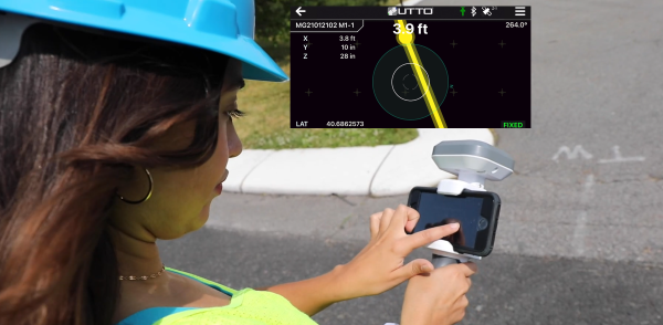
GEODNET, a decentralized real-time kinematic (RTK) network with more than 20,000 active stations worldwide, is now partnering with UTTO, a leading innovator in underground utility mapping and digital damage prevention solutions.
The partnership enables UTTO to leverage GEODNET’s global RTK correction services across its solutions, bringing enhanced centimeter-level accuracy to the utility locating and GIS industries.
UTTO is known for pioneering products such as the vLocate Mapper, which integrates directly with GIS platforms like Esri’s ArcGIS Field Maps to streamline underground asset mapping and verification. By adopting GEODNET’s RTK correction services, UTTO customers gain access to reliable, triple-band GNSS corrections delivered through a uniform, global network. This ensures consistent accuracy across regions and significantly reduces the complexity traditionally associated with GNSS corrections.
The collaboration provides UTTO users with seamless access to GEODNET’s correction services out of the box, eliminating the need for manual RTK configuration and reducing deployment friction for field teams. This simplifies the process of achieving centimeter-level accuracy in mapping underground infrastructure, while maintaining scalability for large utility operators and municipalities.
Key benefits of the partnership include:
Turnkey RTK Access. UTTO devices now integrate directly with GEODNET corrections, requiring no manual RTK setup.
Global Coverage. GEODNET’s network of 20,000+ stations ensures consistent high-precision positioning across multiple regions.
Utility Mapping Optimization. Enhanced accuracy for locating underground assets, reducing strikes and improving field efficiency.
GIS Integration. Seamless compatibility with platforms such as Esri ArcGIS.
u-blox has introduced PointPerfect Global, its new high-precision GNSS correction service designed for applications that require sub-decimeter positioning accuracy, such as precision agriculture, UAV-based mapping and autonomous outdoor robotics. The service offers global coverage, including remote areas, through both internet and L-band satellite broadcast.
PointPerfect Global is engineered to provide convergence times under two minutes and accuracy of less than 10 cm. It uses Precise Point Positioning with Ambiguity Resolution (PPP-AR) corrections and is optimized for products built on the X20 platform. The u-blox ZED-X20P GNSS receiver will be the first device to support the new service, offering integrated L-band support for use in areas without cellular connectivity.
PointPerfect Global expands the u-blox PointPerfect portfolio, which also includes PointPerfect Live, a regional nRTK service for the most demanding applications, and PointPerfect Flex, the original PPP-RTK service designed for flexible IoT deployments. Together, these services provide scalable, high-performance positioning solutions tailored to a range of technical and commercial requirements.
The broadcast-based architecture of PointPerfect Global allows for scalable deployment across continents without the need for complex regional integration. This approach is intended to simplify logistics and operational complexity for OEMs and solution providers, supporting a variety of sectors including agriculture, robotics, UAVs, industrial automation, and automotive. The service is designed to deliver reliable performance with minimal infrastructure dependency, which is critical for mass-market autonomy and global scalability.
Early access to PointPerfect Global is scheduled for late 2025, with general availability expected in the first half of 2026.
More than 34 million miles have been driven with Super Cruise engaged on General Motors vehicles. (Photo: GM)
General Motors and Trimble have reached more than 34 million miles of hands-free driving with Super Cruise engaged on General Motors vehicles.
GM teamed with Trimble to develop a reliable way to maintain in-lane positioning for hands-free driving, putting safety top-of-mind.
Trimble’s precise GPS technology enables a vehicle to maintain its lane position in a variety of environments, including inclement weather conditions (rain, snow, fog and more), which often challenges other sensors. GM’s Super Cruise, a hands-free driver assistance system, uses Trimble RTX (Real-Time eXtended) technology to deliver high-GNSS accuracy corrections since it introduced the technology in 2017 on the model year 2018 Cadillac CT6.
“Trimble RTX has been in commercial use for more than 10 years, and in 2018 was the first precise point positioning correction service to log miles in a commercial autonomous driving system,” said Patricia Boothe, senior vice president of Autonomy, Trimble. “It works with Super Cruise to help a vehicle maintain its lane position, bringing more consumers access to a more enjoyable and convenient driving experience.”
Standard GPS receivers can have a margin of error of up to 25 feet, which is not suitable for vehicles that require precise absolute position information to maintain lane-level positioning. Trimble’s RTX technology removes errors in GNSS satellite data broadcasts to improve location accuracy on our roadways.
“Super Cruise is a life-changing technology, allowing customers to experience hands-free driving on compatible, mapped roads nationwide,” said Mario Maiorana, GM chief engineer, Super Cruise. “The technology is a collaborative effort internally and externally to bring this advanced driver assistance technology to life. Trimble Autonomy has been a valuable collaborator in bringing Super Cruise to our customers.”
Trimble has introduced data integrity monitoring for CenterPoint RTX Fast, its precise point positioning (PPP) correction service.
The Trimble RTX Integrity monitoring system is an innovative, patented solution, built in direct response to client requirements for production-ready applications. It continuously validates the reliability of correction data processed by the network, which is broadcast to users in the agriculture, geospatial, construction and automotive industries, ensuring positioning data is right the first time.
Through a two-step process, the Trimble RTX Integrity system verifies the integrity of GNSS data and filters faulty information in the network server before the data is broadcast. A secondary post-broadcast check is conducted on the entire data transmission process where additional errors may be detected and removed.
The integrity monitoring system is fully automated and reacts in seconds to detect, isolate and block faulty data to provide even more highly accurate and reliable positioning.
Trimble RTX Integrity is comprised of independent monitoring stations strategically positioned across RTX Fast networks in the United States, southern Canada and across Europe. These stations continuously monitor data output during multiple stages of the Trimble RTX positioning process. Any suspicious satellite data is removed during the integrity protection process and positioning is calculated using only validated data.
Trimble Alloy GNSS reference receivers power the independent monitoring stations using redundant internet connectivity for added reliability. To date, no other positioning network offers the same level of data integrity validation across such expansive, contiguous geographies.
Trimble RTX Integrity monitoring system was developed in accordance with Automotive Software Performance Improvement and Capability dEtermination (ASPICE) and ISO 26262 automotive safety standards, making it easy to integrate into major automotive manufacturers’ autonomous driving systems.
Trimble RTX Integrity can also be used by Trimble’s customers in the agriculture, geospatial and construction industries to ensure correction stream integrity and reliability for applications such as machine control and high-accuracy surveying applications.
“Trimble remains committed to exceeding expectations by providing accurate corrections to our customers to support safety-critical and other day-to-day applications,” said Patricia Boothe, SVP of autonomy, Trimble. “Implementing additional checks and balances to ensure our data is authenticated, trustworthy and accurate is of paramount importance to maintaining the integrity of our RTX network and instilling confidence with our users that the data is correct.”
Land surveying is an ancient practice, dating back at least 5,000 years to when Egyptian rulers used it to tax land plots. Over the centuries, it has been repeatedly transformed by new technologies — the compass (about 200 B.C), the theodolite (1550s), Gunter’s chain (1620), the sextant (1757), electronic distance measurement (1950s), and total stations (1970s). Then came GPS, followed by the other GNSS and corrections services.
Now comes sensor fusion, which aims to compensate for the limitations of GNSS — orbit and satellite clock errors, ionospheric and tropospheric delays, multipath, dilution of precision, urban canyons, jamming, extremely weak received signal, etc. — by integrating it with other sources of positioning data, including inertial measurement units (IMUs), lidar sensors and cameras. Even crowdsourced geolocation data collected with cell phones help expedite surveys by guiding surveyors to landmarks.
In the following article, representatives of five companies share their perspectives on recent advances in surveying and the remaining challenges.
Many More Satellites
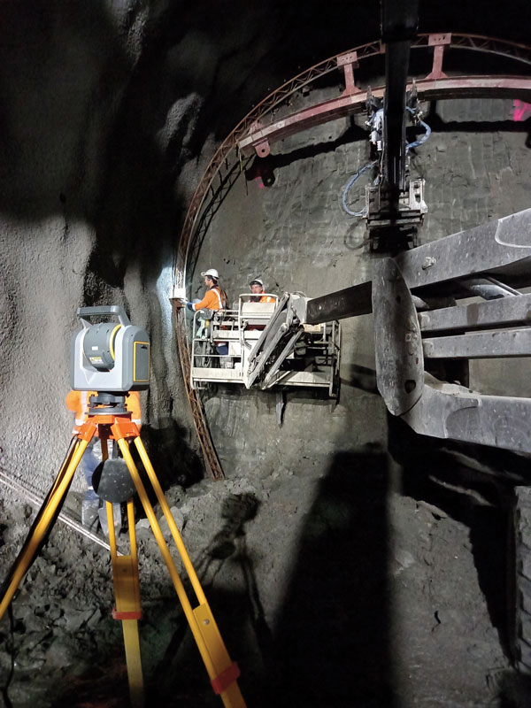
City Rail Link is New Zealand’s first underground rail network and the largest transportation project ever undertaken there. In this photo, taken at Karangahape Station, the Mined Tunnel Team installs a lattice girder secondary support structure using a Trimble SX12. (Photo: Link Alliance)
Compared to just a few years ago, there are many more GNSS satellites, signals and options for correction services. Over the past decade, the average number of satellites in view has more than doubled to more than 40 today. Some parts of the world have more than 70 satellites in view, said Boris Skopljak, vice president, Surveying & Mapping Strategy and Product Marketing at Trimble Inc.
“The developments in GNSS field systems have always been geared toward simplifying workflows, improving accuracies and increasing productivity,” Skopljak said. “In the last few years, we’ve seen that on a massive scale. In some of our materials, we no longer even quote how many signals our GNSS receivers are tracking.”
The vast increase in the number of satellites has extended high-precision applications to the robotics and automotive markets. The challenge now is “position solution,” not just GNSS, said Simon Peng, director of the Overseas Department at ComNav Technology. The improvements in the satellite constellations, antenna technologies and algorithms also enable surveyors and other users to obtain results faster and to operate in environments previously impervious to GNSS, such as under heavy canopy and very close to buildings.
“Our customers can now operate in environments where there is no virtual reference station (VRS) infrastructure or real-time kinematic (RTK), by leveraging precise point positioning (PPP) solutions, such as the Trimble RTX corrections service,” Skopljak said.
“Additional satellite signals and constellations (like Beidou),” Skopljak said, “improved antenna technology and continuously evolving algorithms are contributing to improving the RTX accuracy while bringing the convergence times to almost instantaneous in normal conditions and making technology available in more regions.”
“When I first started surveying, if we had a 12-channel receiver, that was doing very well,” recalled Jesse Huff, head of Sales and Marketing, JAVAD GNSS. “Now, we’re tracking 36 birds in the sky at one time with an 874-channel receiver. That’s phenomenal.”
Huff described a patent-pending feature called real-time post-processed kinematic (RTPK). “It combines RTK, PPK and PP techniques, with multiple core processing engines and a single solution coming out of that. It is impressive standing underneath a giant oak tree and surveying that monument with GPS and knowing what your accuracies are. We’re not even chasing RMS values; we can report the actual positional uncertainties, which is amazing.”
Pole tilt compensation enables surveyors to precisely and easily localize points that are difficult or dangerous to access. (Photo: ComNav Technology Ltd.)
“With so many signals and the new ways of how we compute positions based on PPP technology, we can almost globally get to centimeter-level positioning within a couple of minutes from just one global correction link,” said Bernhard Richter, vice president of Geomatics at Leica Geosystems AG, part of Hexagon. “Under optimum conditions, you can have almost an instantaneous global accuracy of a couple of centimeters.” In mature areas, he added, a local RTK network infrastructure enables achieving centimeter accuracy within a couple of seconds.
Galileo, Richter pointed out, will be fully operational in 2023 with great signals, though he’s “a bit skeptical” about the system’s target date for its high-accuracy service. “So, we will basically get global constellation corrections that allow us also centimeter-level positioning.” BeiDou has been fully operational since 2020. “GLONASS is more unpredictable,” Richter said. “It looks like modernization is slowing down a bit, in particular the CDMA developments.” Additionally, he pointed out, it is possible that one or more governments may decide not to use those signals, for military or political reasons. “It’s not the manufacturers who decide which signals to take.”
“In open-sky conditions, additional satellites have added redundancy — which is always good for position integrity — but it’s only when obstacles start to appear on the horizon, blocking out parts of the sky, that all-in-view RTK really comes into its own,” said François Freulon, Head of Product Management at Septentrio. When they did not have a full view of the sky, he recalled, GNSS users used to have to carefully schedule their work to coincide with times of high satellite visibility. “Nowadays, by using multiple constellations and signals, RTK can reach the parts that receivers in the past could not tread. More signals and constellations have also helped in easing the collection workflow for surveyors, making the capture of data in difficult conditions much quicker and more efficient.” New correction services are further simplifying the workflow “thanks to new positioning techniques, pricing business models and simplified network density.” However, corrections companies still face challenges in ensuring that centimeter accuracy can be uniformly achievable at a global scale.
Sensor Fusion
The ongoing evolution in computing power and communication technology “leads to many more sensor combinations,” Skopljak said. “We are not talking about GNSS alone anymore. We are talking about integrating a GNSS antenna, a receiver, an IMU, power and communications into a single compact housing.” The integration of inertial sensors makes it possible to localize the instrument rod tip when the pole instrument is tilted. “That allows our customers to measure more safely in dangerous environments.”
“We are reaching a maturity stage of what we can do only with GNSS,” said Richter. “It’s all about sensor fusion. The problem when signals are obstructed, that’s not solved, even though we can do positioning from Wi-Fi hotspots or from local pseudolites.” So, fusing data from cameras, lidar, GNSS and IMUs in better ways is the way to go and presents “a huge open research ground.”
For Richter, the challenge is not just positioning, the orientation of objects is almost as important as that, especially for such tasks as machine control. “It’s also about what you do with the data that you collect. Hexagon’s vision is of an autonomous future where we put data to work in connected ecosystems to boost efficiency.” However, he pointed out, this requires large amounts of data, such as those from aerial photogrammetry, lidar and mobile mapping systems used to create city models and digital twins of buildings. “If you really want a car to drive autonomously through a city with all the things that could happen, you must rely on a perfect replication of the real world,” he said. Other examples he cited are more efficient evacuation plans and flooding simulations. “GNSS will never be enough, but it will always be a very good enabler because it works.”
Classes of Receivers
JAVAD GNSS designed its TRIUMPH-LS Plus receiver to work under heavy tree canopy. (Photo: JAVAD GNSS)
Two decades ago, we would often group GNSS receivers by accuracy into three buckets: consumer grade, resource or mapping grade, and survey grade. As accuracy has increased for all GNSS receivers, the boundaries between those categories — especially between mapping and surveying — have blurred. “The performance of GNSS has increased so much that we are not using the traditional accuracy-based differentiation between surveying and GIS,” said Skopljak. “For mapping professionals, 10 years ago it was all about points, lines and polygons; now it is all about locating assets and adding the most accurate positions as attributes to those assets. For our survey and engineering customers, what matters is still geometry and working with the models to serve the connected construction in the field.” As for the pure GNSS technology stack, “we are seeing fewer differences between mapping and surveying receivers, but we are focusing on serving the customer in terms of product-as-a-service or as a productivity tool.”
Huff made two points. First, that “survey grade” does not necessarily equal RTK. “Some education needs to happen so that people understand RTK as a technique, not an accuracy. You can get poor accuracy and poor fixes with RTK, even when you’re using good techniques. So, when I say ‘survey grade’ I’m still talking about the full frequency receivers, using all available signals.” Second, that consumer-grade receivers, such as the chipsets in our phones and computers, do not require the same robustness as professional ones. “While they may be achieving the same precision, surveyors must be able to defend their position in a court of law.”
Huff cited the “phenomenal” success of the simultaneous localization and mapping (SLAM) movement with all kinds of positioning challenges. “From a survey perspective,” he said, “we’re dealing with a much more feature-rich dataset than we were even just 10 years ago, with everybody having some type of GPS device on their phones. There are location tags on everything. That creates evidence for the surveyor to be able to go out and recreate things, reduce trips to the field, reduce rework times — all those things that make a surveyor’s life much easier.”
Surveyors now can fly aerial surveys of hundreds of acres in less than half an hour using drones with RTK, Huff said, instead of having to wait for the flying season with traditional airborne photos. If needed, they can pick a few ground-control points for ground truthing. “We’re able to do that with photogrammetry techniques, but using GNSS technology to position drones, whether it’s real time or post-processing, has definitely made surveying jobs easier.”
Correction Services
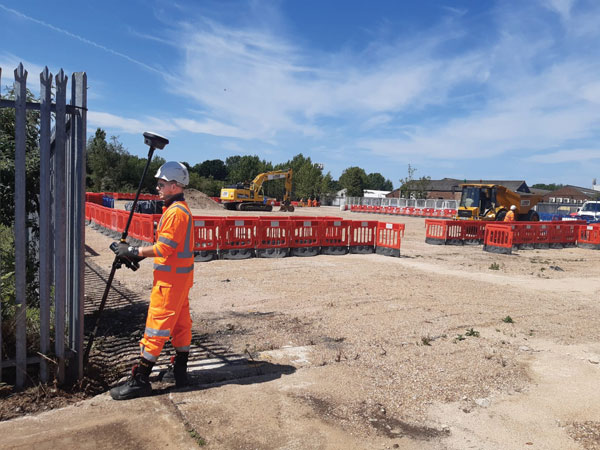
The adoption of GNSS in construction is growing and receiver manufacturers are making it easier to use their equipment in the field. (Photo: Leica Geosystems)
Correction services — such as satellite-based augmentation systems (SBAS), the ground-based Wide Area Augmentation System (WAAS) and the European Geostationary Navigation Overlay Service (EGNOS) — make a big difference along with PPP and similar techniques when base stations are not available. “We have the whole CORS network here in the United States,” Huff pointed out. “We also have services available from the National Geodetic Survey.”
Those who don’t want to have to fully engage in post-processing can upload their data to the Online Positioning User Service (OPUS), AUSPOS (a free online GPS data-processing facility provided by Geoscience Australia) or other corrections services that will post-process positioning data. “It has made it more accessible for all the surveyors all the way around, especially as the technology has improved and the cost barrier to entry into a survey-grade GPS receiver has come down significantly as well,” Huff said.
Growing Adoption of GNSS
The greater number of satellites in orbit significantly reduces convergence time and increases the accuracy of the solution, which makes the technology much more user-friendly for professionals and nonprofessionals alike.
For surveyors and mapping professionals, the increasing levels of GNSS performance means that “GNSS continues to be the dominant equipment and they can operate in challenging GNSS environments while still meeting the accuracy and precision requirements,” Skopljak said. GNSS usage is also growing in such industries as agriculture, construction, transportation and logistics. “Now, when farmers are on a combine, they don’t have to wait for an RTX or PPP solution to converge for 20 minutes. The solutions just work, and they can perform their task.”
Skopljak also pointed to “more flexible business models, such as pay-as-you-go or equipping seasonal workers or fleets of spatially enabled consumers to use GNSS,” that reduce the required upfront investment. “Surveyors now can go for longer and be productive in more areas where they could not use GNSS technology before. The non-surveying professionals — such as in natural resources, farming or construction — now can just turn on the machine and things work for them. They don’t have to worry about coordinate transformations and things like that.”
“Twenty years ago, when RTK and networks kicked in and then became popular, we were discussing whether it was the end of the automated total station,” Richter recalled. “Yet, the number of automated total stations has grown ever since.” To him, this is proof that GNSS alone will never solve all surveying problems. GNSS’ weak signal will always require surveyors to supplement it with other sensors, such as reflectorless total stations. “These instruments always need to work in harmony,” Richter said.
Success on both construction sites and in machine control require a very good robotic total station and a very good GNSS receiver, Richter said. “The simple problem of leveling a pole is actually solved, and we are using the technology that we developed for tilt-compensating GNSS receivers. We’re leveraging this now into the world of the total station.” This has solved one of the fundamental problems surveyors have long had, because they no longer need to level up and can measure tilted poles with a total station and with a GNSS receiver. “We have also made it very seamless for surveyors to switch between using GNSS receivers and total stations,” Richter said.
Interview with Sara Masterson, Director, Positioning Services, Hexagon’s Autonomy & Positioning division, Hexagon | NovAtel
The accuracy of GNSS receivers continues to increase thanks to new satellites and signals, improved antennas, etc. How is that changing the role of correction services?
For sure, the accuracy of GNSS receivers and antennas is improving. However, most applications still require a higher level of accuracy than what is available from an uncorrected position even with the positioning improvements brought by new constellations and signals. GNSS corrections are still required to enable, say, lane-level accuracy, or sidewalk-block accuracy for autonomous driving or mobile phone applications and for off-road autonomy applications such as construction, mining, agriculture — these all still require centimeter-level accuracy that is enabled through GNSS correction services.
Corrections also help by improving the availability and reliability of a solution. In the future, corrections will play a key role in adding integrity to enable functionally safe solutions that are required for new applications, such as autonomous driving.
There are many options for corrections — local, regional and global, ground-based and satellite-based, public and private, etc. Which of them are generally best for which applications and conditions?
That depends very much on the user and the application. There are many new correction services in the market. Some are free, some are commercial services. Even now we see in agriculture that WAAS is sufficient for some broadacre-type applications. So, we will continue to see a range of applications, some of which will be satisfied with the level of performance from a free service and others that will be looking for the better performance and service level guarantees that come with commercial services.
If something is not working when you are using a free service, there’s no one to call. With commercial services, you get responsive customer support and you pay for higher levels of performance and service availability. In many applications, especially those that involve autonomy or safety applications, you cannot afford to have downtime, or your machine just stops working, which costs money. So, many applications are still going to be needing the performance and service level guarantee that commercial services offer.
How does TerraStar fit into this range of options? What industries and applications are you targeting?
TerraStar has a range of services that enable us to target many industries and applications. Agriculture, of course, is one of the key applications for our services and we have customers using TerraStar for mobile mapping, UAVs and new autonomy-based applications. We are also involved with some interesting Hexagon joint projects that use TerraStar corrections for mine train automation and surveying and construction.
Our entry-level TerraStar-L service is still better in performance to many of the free services or to an SBAS-type service in terms of accuracy, but it is available globally, including regions where you don’t have other options. It also provides better pass-to-pass and year-over-year repeatability, as well as very quick reconvergence time if there are any issues with GNSS outages.
Our flagship offering is the TerraStar-C PRO service. That’s where we just introduced the “RTK from The Sky” technology, bringing the performance down to converging to two and a half centimeters in three minutes. That, too, is available globally which makes it a real game changer for customers in many different applications, because they can start to look at that service as an alternative to RTK and without the added connectivity logistics that an RTK solution brings.
Our RTK assist solutions are good augmentation solutions for customers who still primarily need RTK but experience some RTK correction outages – RTK ASSIST bridges through those outages. So, we have a wide range of service offerings in the portfolio that can address the positioning needs of many applications.
Photo: Hexagon | NovAtel
Will the reasons for having a base and rover setup decrease sharply?
Use of base and rover setups is already decreasing and being replaced by both PPP and network RTK solutions. There are applications where RTK still makes sense, such as those that have very tight vertical requirements and many survey applications. Another Hexagon division, Hexagon’s Geosystems division, incorporates TerraStar correction data into their new SmartNet Global offering as a seamless service that provides both SmartNet RTK plus TerraStar for either bridging outages or independent PPP operation, depending on the project’s location and whether they’re within range of SmartNet coverage.
There will be many applications that continue to benefit from a combination of the two technologies. However, as the PPP services, like TerraStar, continue to improve by reducing convergence time and providing highly reliable solutions, users in those applications can be confident that the standalone PPP solutions meet their performance needs and bring many additional benefits such as consistent, global coverage and performance.
Is TerraStar completely receiver agnostic?
TerraStar is currently only compatible with NovAtel’s GNSS hardware. Going forward, through the work that I referenced with autonomous driving and mass-market applications, we will be providing TerraStar services in industry-standard formats, depending on the inter-operability requirements coming from those applications. We expect that there will be demand for dual sourcing of corrections and interoperability between chipsets that are used in vehicles, for example. For those applications, we will be developing TerraStar services that are compatible with hardware from other GNSS manufacturers.
Will GPS modernization and improvements in GPS receivers and antennas reduce or even eliminate the need for correction services for most applications?
Julian Thomas, managing director, Racelogic
“For most applications, I think the answer is yes, the need for correction services will be reduced. When you can get <1m without external corrections, the majority of conventional accuracy requirements are fulfilled. However, increases in accuracy always open up new applications for GPS, so correction services will still be required.” — Julian Thomas
Racelogic
Miguel Amor, chief marketing officer, Hexagon’s Autonomy & Positioning Division
“Correction services will continue to be in demand for those markets and applications requiring precision and accuracy below a few inches, 2-3 sigma confidence levels and high reliability, availability and integrity. While ionospheric errors have been low in the past 15+ years, correction services will also provide ionospheric models beneficial in periods of higher activity. Even as there are improvements in user equipment and signal modernization, the demand for correction services will increase in line with these improvements and new functionalities to enable more markets and applications worldwide.” — Miguel Amor
Hexagon’s Autonomy & Positioning Division
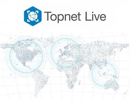
Topnet Live coverage map for 2021. (Image: Topcon)
Topcon Positioning Group has expanded its Topnet Live GNSS network of correction solutions with more types of correction services and subscription options. According to Topcon, the growth is a result of the increasing demand for digitalization in various industries including construction, surveying, machine control and agriculture.
Flexible service options include Realpoint, the real-time kinematic (RTK) service, and Starpoint, a Precise Point Positioning (PPP) service. The different services have varying delivery methods, coverage and reliable centimeter-level accuracy.
Under a flexible subscription model, customers can purchase to suit their needs. An RTK service supported by precise point positioning (PPP), Skybridge, is available to maintain connectivity and productivity if the customer temporarily leaves RTK coverage.
Topnet Live uses all four GNSS constellations — GPS, GLONASS, Galileo and BeiDou — to provide continuous accuracy and always-on service coverage. The service provides advantages for these industries:
Survey, Construction and Machine Control. Topnet Live removes the need for individual base stations, dramatically increasing flexibility, productivity and safety, and can drive large-scale projects with constant, reliable accuracy.
Precision Agriculture. The solution delivers fast, consistent, accurate positioning at any time day or night for soil preparation, seeding, spreading, spraying and harvesting.
OEMs, System Integrators, Product Designers. The solution provides scalable precise positioning and supports the implementation of flexible business models tailored to fit both OEMs’ and their customers’ needs.
“The Topnet Live RTK network, first established over a decade ago, continues to grow, with 5,100 reference stations globally, a 14% increase in the last year,” said Ian Stilgoe, Topcon vice president. “We are growing throughout the world in areas where there is an increasing demand for productivity and accuracy through digitalization, with strong growth particularly in North America and Europe. We are focused on continued expansion to maximize support for our customers, so they always have the best options globally.”
Original equipment manufacturers (OEMs) supplying automotive, industrial internet of things (IoT), autonomous robotics and all sectors that require positioning, navigation and guidance also benefit from the enhanced robustness of the network, Topcon said. OEMs can sell their hardware with correction services onboard and preconfigured for immediate use by customers, regardless of geographic location, with flexible subscription and licensing options to suit exact needs.
The GNSS augmentation service provides real-time, verified and scalable high-precision positioning to consumer, industrial and automotive applications.
U-blox has launched its new PointPerfect location service. PointPerfect delivers an advanced GNSS augmentation data service designed from the ground up to be ultra-accurate, ultra-reliable and immediately available.
The service enables the fast-growing demand for high-precision GNSS solutions including autonomous vehicles such as unmanned aerial vehicles (UAV), service robots, machinery automation, micro-mobility and other advanced navigation applications.
Emerging automotive applications include automated driving (AD) and advanced driver assistance systems (ADAS), lane-accurate navigation and telematics.
Delivered via mobile internet or L-band satellite signals, PointPerfect broadcasts on a continental scale with homogeneous coverage in Europe and the contiguous United States, up to 12 nautical miles off coastlines to any number of end-devices, delivering sub-10-centimeter positioning accuracy and convergence of seconds. It uses the SPARTN messaging format with the lightweight, secure MQTT internet of things (IoT) delivery protocol for a real-time, bandwidth-optimized, cost-efficient solution for mass-market applications.
PointPerfect cooperates smoothly with u-blox positioning and connectivity hardware, providing a one-stop-shop solution from silicon to cloud. Because it is based on the open SPARTN GNSS correction data format, its use is not restricted to a single hardware provider, allowing customers the flexibility to optimize solutions.
PointPerfect is delivered via the Thingstream IoT service delivery platform, an enterprise-grade cloud platform that supports billions of messages. Thingstream provides a self-serve environment where users can manage their device fleet, optimizing cost and performance through flexible and predictable pricing plans.
The service is backed by a full warranty, 99.9% uptime availability and 24/7 reliability. In-house development of all the technological building blocks ensures expert technical support while eliminating any external dependencies that could otherwise lead to delays.
“PointPerfect seamlessly integrates our advanced high accuracy GNSS augmentation service with industry-leading positioning and connectivity hardware,” said Franco de Lorenzo, principal product manager services, u-blox. “Designed for increased flexibility, PointPerfect lowers barriers to adoption and supports scaled-up high precision positioning solutions, even in segments where such solutions would previously have been considered impractical. Moreover, innovative delivery options fully integrated into our easy-to-use Thingstream IoT service delivery platform eliminate complexities and allow users to engage more efficiently, reducing time-to-market.”
As part of an ongoing global correction service strategy, the company is adding more than 400,000 square kilometers (156,000 square miles) to its European footprint, which now totals 2.5 million square kilometers (975,000 square miles).
VRS Now delivers reliable, easily accessible, centimeter-level accuracy that is ideal for professionals in the surveying, GIS and mapping, construction and agriculture industries, as well as many emerging autonomy applications in the automotive and robotics industries.
The subscription service is brand agnostic and works with most GNSS receivers. It is supported by a global team of GNSS network specialists and customer service representatives around the world, ensuring users have a consistent, reliable, high-performing service whenever they need it.
“Launching Trimble VRS Now services to Norway significantly expands our correction services footprint across Europe, offering a robust and reliable accuracy solution to farming, construction and mapping professionals across the region,” said Lisa Wetherbee, general manager of Trimble’s Advanced Positioning Division. “Trimble solutions are helping customers optimize workflows, improve productivity and deliver operational efficiency, while increasing user safety.”
Positioning company u‑blox has acquired full ownership of Sapcorda Services GmbH, a joint venture formed by u‑blox, Bosch, Geo++ and Mitsubishi Electric in 2017.
Sapcorda — SAfe and Precise CORrection DAta — provides advanced GNSS augmentation services for the high-precision GNSS mass market. The joint venture was formed by the four companies to bring scalable, affordable and high-quality GNSS positioning solutions to industrial, automotive and consumer applications.
Relevant industrial applications include autonomous vehicles, such as unmanned aerial vehicles (UAV) and unmanned ground vehicles (UGV), machine automation, surveying, monitoring and other advanced navigation applications.
Within the automotive sector, applications include automated driving and advanced driver-assistance systems (ADAS), lane-accurate navigation, telematics and vehicle-to-everything (V2X) communication.
Sapcorda Services GmbH is a GNSS service provider focusing on the emerging high-precision GNSS mass markets. The company has designed its technology and service offerings to serve high-volume automotive, industrial and consumer markets.
Sapcorda developed its advanced SAPA service based on open formats, and has specifically tailored it for industrial and automotive markets. It uses real-time kinematic (RTK) and precise point positioning (PPP).
Launched in January 2020 in the U.S. and Europe, SAPA Services have been expanded to full coverage of the contiguous U.S. and 32 countries in Europe. Distribution of the service via an additional geostationary satellite L-band signal also has been announced.
“We appreciate the support and cooperation of all the joint venture shareholders. As a part of u‑blox, I see enormous potential for our technology,” said Botho Graf zu Eulenburg, CEO of Sapcorda.
The acquisition of Sapcorda expands u‑blox’s suite of location services complementing its existing data services, including its assistance data and communication service offerings. Sapcorda has focused on establishing a platform from which to bring GNSS augmentation services to the mass market by delivering on robustness, reliability and end-to-end security as it relates to performance.
Full ownership of Sapcorda will also enable u‑blox to serve customers more efficiently, the company said, by streamlining certain processes, including reducing implementation time to market and simplifying the integration process for customers.
“The acquisition of Sapcorda reinforces our position as a leader driving innovation in the most advanced areas of GNSS positioning technology,” said Thomas Seiler, CEO of u‑blox. “It represents another step forward in the execution of our strategy, which is to deliver value to our customers by means of a comprehensive ‘silicon-to-cloud’ set of solutions and offerings.”
Sapcorda operates in Europe and in the U.S. with offices in Berlin and Hanover in Germany and in Scottsdale, Arizona, in the U.S.