Tag: Dana Goward

  • 10 answers about eLoran

    10 answers about eLoran

    the former Loran-C transmission antenna at Værlandet, Norway. (Photo: UrsaNav)
    the former Loran-C transmission antenna at Værlandet, Norway. (Photo: UrsaNav)

    By Alan Grant and Dana Goward 

    In my “First Fix” editorial in the January 2022 issue of this magazine, I listed 10 questions about eLoran I had received from a PNT expert in response to an article about eLoran I wrote for the November 2022 issue. I encouraged eLoran proponents to address these questions. Two well-known authorities, neither of whom have a financial interest in the technology, stepped forward to help. Below, again, are my 10 questions about eLoran and their answers.

    Alan Grant is head of Research and Development for the General Lighthouse Authorities of the United Kingdom and Ireland (GLA). He is an expert in radionavigation systems and leads the team that established the U.K.’s eLoran system, which operated from 2007 to December 31, 2015 in support of maritime users. 

    Dana A. Goward is president of the Resilient Navigation and Timing Foundation and a retired U.S. Coast Guard Captain. He also served in the federal Senior Executive Service as the maritime navigation authority for the United States. He has decades of experience with navigation policy and leading government policy and programs. 

    Matteo Luccio, Editor-in-Chief


    Accuracy specifics. While my November article stated that eLoran would have a two-dimensional accuracy of “better than 20 meters, and in many cases, better than 10 meters,” is that RMS, 95%, or some other statistic?

    AG: Like any radionavigation system, the achievable accuracy will depend on several aspects, including the user’s location with respect to the broadcast stations and how error sources are modelled. The GLA eLoran service, when in operation in 2015, provided positional accuracy in the order of 8-10m (95%) to seven ports on the east coast of the UK. These ports had local reference stations to help manage temporal errors and the ports had been mapped to correct for additional secondary factors (ASF).i 

    DG: Others have reported greater accuracies using differential corrections.


    1. Performance standard. GPS provides a commitment to users in a published performance standard. What specific measures of positioning accuracy, integrity and continuity would you recommend the proposed eLoran system be committed to provide (using the architecture described in the answer to Question 6)?

    AG: The target performance would need to be tied to the target use cases to ensure the appropriate requirements are met. IALA provides guidance in this area for maritime services with general maritime requirements provided by the IMO within resolutions A.1046 and A.915. 

    Photo: Enjoylife2/iStock/Getty Images Plus/Getty Images
    Photo: Enjoylife2/iStock/Getty Images Plus/Getty Images


    1. Coverage. Would you recommend this eLoran positioning performance hold for the entire United States (including Alaska, Hawaii, Puerto Rico and other territories), only for the “lower 48” states, or only parts of these 48 states?

    DG: The primary goal of any effort to complement and back up GPS/GNSS would be to make the nation and its citizens safer in at least two ways. First, to provide an alternative PNT source or sources in the event that signals from space were not available for any reason. Second to make GPS satellites and signals (and therefore the nation) safer by “taking the bullseye off GPS.” Having one or more alternatives will greatly reduce incentives for malicious disruption. To achieve these two goals the alternatives must be widely available and easily accessed. How widely available and easily accessed the United States or any other country wants to make such systems is a policy decision. 


    1. Current users. By number of users, the predominant common current civil uses of GNSS for positioning are consumer devices (mostly cellphones). By contribution to the U.S. economy, the predominant uses are high-precision applications. For what fraction of these uses would eLoran positioning be adequate? Could an eLoran receiver and antenna fit in today’s consumer devices?

    DG: Lots of presumptions and assumptions in this question. Several overall thoughts, though. First, determining users’ real requirements can sometimes be difficult. I have a nice new full-size sedan. So, I think that is my requirement even though I could get to work almost as quickly and much less expensively if I owned a used compact car or caught the bus at the corner.  

    Second, GPS/GNSS will, hopefully, always be the primary source. The questions then are 1) how accurate can eLoran positioning become with additional work, and 2) how accurate does a fallback system need to be? 

    Durk van Willigen of REELEKTRONIKA b.v. displays a combined GPS, GLONASS and eLoran receiver at the 2017 Munich Satellite Navigation Summit. (Photo: Reelectronika)
    Durk van Willigen of Reelelektronika b.v. displays a combined GPS, GLONASS and eLoran receiver at the 2017 Munich Satellite Navigation Summit. (Photo: Reelelektronika)

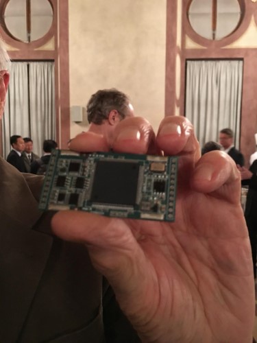
    Finally, as to equipment size, I recall seeing a photo of the first GPS receiver sitting on a pallet with two chairs for operators. Today, receivers are made at chip scale. Huge reductions in C-SWAP have been the growth arc for all kinds of technologies as they are implemented more and more widely. 

    In 2017 the Dutch company Reelektronika showcased a combination eLoran, Chayka, GNSS receiver that was only 6 cm long. This was achieved without a whole lot of investment in research and development. Who knows how low C-SWAP for eLoran receivers will go? 


    1. Future uses. Emerging civil uses of GPS for positioning include autonomous ground and air vehicles, navigation to space and in space, and lane-accurate car navigation. Which of these could be served by eLoran?

    AG: The overall concept of having a mix of dissimilar position sources remains sensible for all modes. GNSS is expected to remain the primary means of position determination, with different use cases selecting different complementary systems based on their needs. eLoran may support some use cases but may not be the answer for all.   

    DG: Many believe GPS alone is not sufficient to serve some of the applications cited. This is the basis for language in both the European Radionavigation Plan and a U.S. Presidential Executive Order cautioning against over-reliance on GNSS. Perhaps GPS and eLoran together might be deemed sufficient. Or, perhaps a more diverse and resilient PNT architecture will give rise to additional applications such as precise positioning from 5G that will be sufficient.  


    1. Architecture. To maintain accuracy during a prolonged GPS outage, eLoran would require reference stations to calibrate time-varying propagation errors, as well as a certain number of transmitters for good nationwide geometry and for redundancy, ensuring service even if a transmitter is attacked or is taken off-line for maintenance. What architecture would you recommend to achieve this?

    AG: The MarRINav project considered a similar question for the UK and the project’s approach could be employed to consider this question for the United States.iv 

    DG: A good starting point for the United States might be the sites used by the shuttered Loran-C system. The federal government still retains custody of most of them. Also, considerable thought has been given to the questions of eLoran reference stations and integrity in the United States. PNT expert Mitch Narins, formerly of the FAA and now Strategic Synergies, advises that much of this work has been done. The FAA and Coast Guard conducted a study to deploy eLoran in the United States to support aviation non-precision approach, maritime harbor entrance and approach, and precise time and frequency users. The proposed architecture supported aviation’s demanding integrity requirement (1×10⁻⁷), maritime’s demanding accuracy requirement (8-20m), and time and frequency users’ precision requirements (100 ns/Stratum 1). 


    7.  Infrastructure cost. What would be the cost of installing the required transmitters, power supplies, reference stations, communication links and control system for the architecture described in the answer to Question 6? Can you reference a recent and independent estimate? To a ballpark figure, what cost fixed-price contract would you accept to implement it? Similarly, what would be the annual costs for operating and maintaining this infrastructure? 

    AG: The MarRINav project produced a cost-benefit analysis report that addresses some of these questions, albeit aligned to the approach proposed for the UK. The documents are open source and available on the MarRINav website 

    DG: To quote President Kennedy, “There are costs and risks to a program of action, but they are far less than the long-range risks and costs of comfortable inaction.” I agree with Dr. Grant that the capital costs in MarRINav are roughly transferrable to the United States. As another data point, the 2010 operating cost for Loran-C in the United States was about $36M/year. That number included several hundred employees, though. Plans to automate the system projected reducing annual costs to $15M/year in 2010 dollars. 


    1. Impact.  eLoran transmitters are large and high-power. Providing positioning across the United States could require building some of them from scratch or significantly reconstructing old Loran sites. What issues — such as environmental, aviation safety and security — would this raise, and how would you recommend they be addressed?

    DG: These issues would be dealt with the same way they are for any construction project. eLoran transmission sites are essentially the same as commercial AM radio stations. Reusing sites still owned by the government could make the process even easier. Compared to the cost and difficulty of putting PNT assets in orbit, these challenges should be relatively easy to overcome. 


    1. Receivers. Assuming all the above were achieved, it would accomplish nothing unless eLoran receivers were widely purchased, installed and used. How much would that cost? Who would pay? Should we assume that “if we build it, they will come”?

    AG: This is a valid concern and has different answers depending on the planned use case and the level of national/international standardization required. Within the maritime sector, the IMO has approved a multi-system receiver performance standard that supports the use of all GNSS and terrestrial systems within one device, rather than having a separate eLoran receiver.   

    DG: I completely agree — adoption and use are absolutely key. Fortunately, government leaders have a wide variety of levers to influence adoption and use. These range from education and encouragement to regulation, legislation, and subsidies.  


    1. Alternatives. Given the widespread development of other positioning technologies over the past decade, much has changed since the earlier recommendations for eLoran. How do we know that eLoran is the right investment — or even a needed part of the solution or needed system in a system of systems — for the future of U.S. PNT?

    AG: The MarRINav project researched and compiled details of different positioning, navigation and timing technologies supporting maritime navigation, within Deliverable D4. The recommended system-of-systems approach recognized that there was no one-fit-all solution, rather it sought to allow for a scalable solution that reflects users moving from location to location and between systems. It considered global, regional and local solutions, recognizing the cost vs. usable coverage tradeoff for each. The proposed solution of GNSS, supported by eLoran in combination with VDES R-Mode and radar absolute positioning, was deemed as the most appropriate mix for the UK, given geographical and political constraints. The approach can be ported to investigate the appropriate options for the United States. 

    DG: The U.S. Department of Transportation’s January 2021 report to Congress has findings similar to those in MarRINav. It described a system of systems that included fiber, satellites and terrestrial broadcast. The department subsequently said that a critical factor for a terrestrial broadcast system would be the coverage area per unit of required infrastructure. Of the systems discussed, eLoran met this criterion best. This recent finding is consistent with numerous other government reports, two previous government announcements that it would build eLoran, two recommendations from the President’s National Space-based Positioning, Navigation, and Timing Advisory Board and the technology’s on-going use around the world. Likely someday there will be something to replace GPS and other legacy technologies. We must work with the combination of technologies we have now until that day arrives.  


    Common Threats

    Common threats to GNSS and eLoran could include the following:

    1. Cyber attacks. Given that GPS’s OCX is said to be the most cybersecure system built by the U.S. Department of Defense, how would eLoran’s control system be even more cybersecure than OCX, to avoid a common cyber-vulnerability? 

    AG: Cybersecurity is a key concern and one that any navigation and safety of life system must consider. I will leave manufacturers of each system to comment on how secure they are. However, if we consider signal interference and data manipulation within this category, then using a stronger signal at a different frequency to GNSS provides some protection against jamming. While any radio signal can be jammed, the perpetrator would need more power and physically larger equipment to jam at lower frequencies.   

    DG: Yes, the security of control systems is very important and must be included in the design up front. Authentication and security of signals, and the cybersecurity of receivers must be as well. This is especially true for complementary systems for GPS since GPS signals are so open and vulnerable, and so many receivers are largely unprotected. We will have the opportunity to do better with a new system and avoid the huge expenses of OCX, the new GPS control system. 

    Additionally, let us not forget that cybersecurity is needed for much more than control systems. Signals and receivers need to be much more secure than civil GPS is right now. A new system, be it eLoran or another technology, will be able to build cybersecurity in from the beginning. 


    1. Physical attacks. Given concerns about possible physical attacks on GPS satellites, which move at multiple km/sec 20,000 km from Earth, would it not be easier to physically attack eLoran transmitters, which are stationary, terrestrial, in remote locations, and hundreds of feet tall and require massive power sources?

    AG: We should not lose sight that any ground infrastructure can be attacked, regardless of whether it is a satellite uplink station or part of a terrestrial communications or positioning system. Careful selection of the transmitter location, along with suitable site security options should help deter the attack and mitigate the impact where possible.  

    DG: Every physical asset and every signal is vulnerable to some degree to attack by a host of malicious actors, and damage by a variety of natural occurrences. The key to resilience and making PNT sources less attractive targets is to have diverse sources with the smallest number of common failure modes. 


    1. Space weather. GPS is potentially vulnerable to severe space weather that could damage satellites or temporarily hinder signal propagation from space to Earth. However, severe space weather could also damage the power grid upon which megawatt eLoran transmitters rely. How would eLoran service be protected from the effects of severe space weather, such as a Carrington Event?

    AG: Space weather has the potential to affect all radio broadcasts. Depending on the type of event it can affect performance several different ways, including ionospheric scintillation, applying forces to satellites or disrupting power networks. The aim is to use systems where the underlying failure modes are as different as possible. Using a combination of satellite and terrestrial signals, at different frequencies, with local power generation where possible can help mitigate the impact.  Whether it’s possible to mitigate all the implications of a Carrington type event is not clear and perhaps one for the experts.  

    DG: With the available warnings about solar events, it is conceivable that both GNSS and terrestrial systems could be powered off or otherwise secured for such an event to minimize damage. A new-build terrestrial system could also be constructed with surviving a Carrington Event in mind. And, of course, terrestrial systems will be easier to access, repair, and replace than those in space. As for other possible issues with the power grid, generators, uninterruptable power supplies, and other backup methods can easily be installed. Before 2010, several U.S. Loran-C transmitters were in such remote locations, they never had grid power and were always powered by generators.  

  • Worry about PNT and national security, not just eLoran

    Worry about PNT and national security, not just eLoran

    Headshot: Dana Goward
    Dana Goward, President, Resilient PNT Foundation

    Letter to the Editor

    February 2022


    In November’s issue of GPS World, Editor-in-Chief Matteo Luccio opined that eLoran is part of the solution to GNSS vulnerability.

    In January’s issue, he listed 10 questions from a PNT expert perhaps unfamiliar with eLoran.

    These are important questions that must be asked of any technology, especially one under consideration to augment and back up our essential, but very weak and vulnerable, GNSS signals.

    Yet the expert’s concerns pale in comparison to the essential questions about GNSS and PNT facing the United States and the West.

    While I look forward to answers to the “10 questions” as a part of our ongoing professional dialogue, there are two important points of context we all need to keep in mind.

    A Broad Consensus

    First, Mr. Luccio’s assertion about eLoran being a part of the solution is more than reasonable. It also has a lot of impressive support from a wide variety of authoritative sources.

    In 2008 and 2015, after much study each time, the U.S. government decided on and committed to building eLoran systems. Also, the U.S. government-sponsored National Space-based Positioning, Navigation and Timing (PNT) Advisory Board recommended eLoran in 2010 and 2018 as a part of securing the nation’s critical PNT capability.

    In 2021, the U.S. Department of Transportation told Congress that wide-area terrestrial broadcast was a necessary part of a national PNT architecture. They later commented that infrastructure required per coverage area would be a key selection criterion for that broadcast technology. In other words, a system like eLoran.

    Overseas, support for Mr. Luccio’s statement on eLoran is even stronger.

    • The United Kingdom has long endorsed eLoran and operates an eLoran transmitter as a timing reference.
    • Russia operates Chayka, a version of Loran.
    • Available information points to Iran’s terrestrial PNT system being a form of Loran or eLoran.
    • China and South Korea have long had Loran-C systems, and both are in the process of upgrading to the eLoran standard.

    Each of these countries has publicly announced that it operates Loran/eLoran as a matter of national security in case space-based systems are jammed or destroyed, and to generally avoid overdependence on space-based PNT signals.

    So, Mr. Luccio’s assertion was not at all revolutionary. Given all the studies, recommendations and existing uses, it would be surprising if he did not consider eLoran a part of the solution.

    The Important Questions

    Second, modern keying, encryption, authentication and other tech advances will help make all PNT technologies much safer and more resilient than they would have been decades ago, Loran and eLoran included.

    Yet all will still have their strengths and weaknesses.

    The most important questions we must ask are about how to establish the right level of national PNT security. These include:

    • What is the right combination of technologies and systems with different delivery and failure modes that complement and reinforce GNSS and each other?
    • How can the systems be efficiently and effectively implemented?
    • How can the services they provide be easily accessed and widely adopted to ensure all parts of society are protected?

    Countries such as China have answered these questions and are well down the path to implementation and wide adoption. Their robust national PNT architectures support easier rollout of 5G, rural broadband and other systems. They also serve as solid tech infrastructure upon which to build myriads of technologies and applications yet to be conceived.

    Those nations not so advanced must accelerate their efforts. Otherwise, they must resign themselves to perpetually coping with GNSS vulnerabilities, including the possibility of attacks, and an eventual second or third place in the world because of their shortsightedness.

    Dana A. Goward, President
    Resilient Navigation and Timing Foundation

  • The true value of inertial navigation: An interview with Brad Parkinson

    The true value of inertial navigation: An interview with Brad Parkinson

    A U.S. Secretary of Defense once predicted that navigation would eventually be based on inertial devices that were set at the factory, and then always knew where they were forever after. Recently published research has reported on steps in that direction. However, according to navigation expert Brad Parkinson, the outlook is not as bright as some might think.
    RNT Foundation President Dana A. Goward recently discussed the issue with him.

    Goward: Dr. Parkinson, you are well known for your contributions as the chief architect of the Global Positioning System. But you have more than a passing familiarity with inertial systems also, is that right?

    Parkinson: I do. Long before I was involved in radio navigation, I was the chief analyst for all the U.S. Air Force testing of inertial navigation systems. I earned my masters degree in Doc Draper’s Inertial Lab at MIT in 1961. I am a major advocate and defender of inertial systems. I also have in-depth understanding of their limitations.

    Goward: Have you been following the recent media coverage about advances with inertial systems?

    Parkinson: I enjoy reading about these advances in physics devices. At the same time, I am a little impatient with media articles that do not appreciate the differences between building a device that measures specific force (or senses rotation) and a working inertial navigation system.

    Goward: What are some of the inherent limitations of these systems?

    Parkinson: I find it interesting that some of the articles speculate they may be able to supplant GPS and other GNSS. There is no way an inertial navigation system, even with perfect gyros and force sensors, can provide its accurate position (say, better than 10 meters) after extended periods (hours to days). In fact, attaining better than 200 meters accuracy after a few hours will be very difficult in a moving vehicle.

    Today, farmers require even greater accuracy from GPS. They routinely use GPS for row operations, with accuracies of a few centimeters. The economic value is indirectly measured by the farmer’s purchase of such equipment — the agriculture market for GPS equipment is well over a billion dollars a year. Thus, a general replacement for GPS must provide centimeter accuracies.

    Goward: So, what is it about inertial systems that stands in the way of them becoming autonomous substitutes for GPS?

    Parkinson: There are some very simple and fundamental reasons that inertial positioning systems cannot hope to deliver such capability.
    First, force sensors are not accelerometers, because they cannot sense gravity. To find acceleration, one needs to add vector gravity to their outputs. But gravity, or g force, varies a lot at the micro-g levels, and the inaccuracies are fed to the double integration that produces position. Errors grow as time or time squared and, without outside reset, are essentially unbounded. The physics devices described in some of these articles are definitely instruments that Doc Draper described as “specific force sensors.”

    What we loosely call g force, or just g, is actually the inverse of the reaction to maintain stationarity on Earth. G is defined to include the centrifugal force due to Earth’s rotation, which varies greatly as a function of latitude — the radius of the merry-go-round called Earth. Mountains and chasms affect the local g. Further, it is a vector quantity: its direction can change locally by many arc seconds. In other words, down does not generally point to Earth’s center. Gravity gradiometers might be of limited help, but they are very large and not made for dynamic environments.

    In a nutshell, estimating acceleration requires calculating and adding gravity to the three-dimensional specific force sensor.

    Second, to use these devices for extended navigation, coordinate frames would have to be defined and stable to milli-arc seconds. All instruments would have to have input axes and cross-axis sensitivity calibrated to corresponding levels. Generally, this problem is ignored in many lab projects.

    Third, for inertial navigation sensors to work, they need to accurately know their initial position. Any initial velocity or position errors will grow as a function of time.

    Fourth, the vertical position axis is inherently unstable and diverges exponentially.
    Physicists have been enamored with instruments that can use atoms to sense specific force and rotation. While scientifically interesting, even if perfect they cannot overcome these challenges.

    Goward: But there is still a role for inertial systems in navigation, isn’t there? How good are they, and what are some of the applications?

    Parkinson: I suspect the best inertial systems of today (which are in nuclear submarines) can maintain an accuracy of about 0.1 nautical miles or about 200 meters for a few days. I am sure the real number is classified. These systems are very large, expensive and complicated. They rely on a very low acceleration environment and are periodically reset with GPS. Furthermore, they probably use gravity gradiometry to calculate the local variations in gravity to the first order. They do not calculate the vertical position, and use water density and knowledge of the local geoid to keep the vertical axis stable.

    An aircraft with inertial can, to some extent, keep the vertical dimension errors bounded, provided it has knowledge from elsewhere of local sea-level barometer settings and by assuming adiabatic pressure variations.

    I strongly support the inertial/GPS/directional antenna marriage for users who want assured PNT. Aviation is a good use case for this. Inexpensive inertial components (called micro-electromechanical systems, or MEMS) can improve the jamming resistance of the GPS receiver by 15 dB or more. This step alone can reduce the effective line-of-sight jammer denial area by more than 95%.

    Goward: So, inertials can be a good part of the solution but are not necessarily the whole solution themselves.

    Parkinson: Exactly. Despite what some media outlets might publish to lure in readers.

    At the ION GNSS+ 2021 conference in St. Louis, Missouri, the annual meeting of the Satellite Division of the Institute of Navigation, Brad Parkinson bestowed Lakshay Narula with the division’s Bradford W. Parkinson Award for his Ph.D. thesis “Towards Secure & Robust PNT for Automated Systems” at the University of Texas at Austin. The award honors Parkinson, known as the “father of GPS,” for his leadership in establishing both GPS and the Satellite Division of the ION. Narula is now an applied scientist at Amazon Lab126 in Sunnyvale, California, where he researches robust navigation and state estimation methods for robots, from self-driving cars to aerospace applications. (Photo: ION)
    At the ION GNSS+ 2021 conference in St. Louis, Missouri, the annual meeting of the Satellite Division of the Institute of Navigation, Brad Parkinson bestowed Lakshay Narula with the division’s Bradford W. Parkinson Award for his Ph.D. thesis “Towards Secure & Robust PNT for Automated Systems” at the University of Texas at Austin. The award honors Parkinson, known as the “father of GPS,” for his leadership in establishing both GPS and the Satellite Division of the ION. Narula is now an applied scientist at Amazon Lab126 in Sunnyvale, California, where he researches robust navigation and state estimation methods for robots, from self-driving cars to aerospace applications. (Photo: ION)


  • ION announces award winners, fellows

    ION announces award winners, fellows

    Logo: IONThe Institute of Navigation (ION) presented its annual awards during the ION International Technical Meeting (ION ITM) and Precise Time and Time Interval Systems and Applications (PTTI) meeting held Jan. 25-27 at the Hyatt Regency Long Beach in Long Beach, California.

    The ION Annual Awards Program recognizes individuals making significant contributions or demonstrating outstanding performance relating to the art and science of navigation.

    Jonathan “JR” Ryan received the Per Enge Early Achievement Award for developing vision-based navigation software used operationally on aircraft, UAVs and glide munitions that provides continuous high-accuracy absolute position measurements in GPS-denied environments. The Per Enge Early Achievement Award is presented in recognition of outstanding contributions made early in one’s career.

    Major Matthew L. Sutton received the Superior Achievement Award for his ingenuity, dedication and leadership in ensuring critical operational test and tactics improvements for warfighters in a contested electromagnetic environment. The Superior Achievement Award is presented to recognize an individual who has demonstrated outstanding performance as a practicing navigator of any vehicle, in any medium — marine, land, air, undersea and space.

    John Fischer received the Distinguished PTTI Service Award for his pioneering research, patents, and leadership that advanced resilient positioning, navigation, and timing technology; and his prominent role in increasing global awareness of PNT. The Distinguished PTTI Service Award is presented to recognize outstanding contributions related to the management of PTTI systems. Fischer is a member of the GPS World Editorial Advisory Board.

    Mark L. Psiaki received the Dr. Samuel M. Burka Award for his paper “Navigation Using Carrier Doppler Shift from a LEO Constellation: TRANSIT on Steroids” published in the Fall 2021 issue of NAVIGATION: Journal of the Institute of Navigation, Vol. 68, No. 3, pp. 621-641. The Dr. Samuel M. Burka Award recognizes outstanding achievement in the preparation of a paper advancing the art and science of positioning, navigation and timing.

    Satoshi Kogure received the Captain P. V. H. Weems Award for technical and programmatic leadership in the development of Japan’s Quasi-Zenith Satellite System serving the Asia-Pacific region, and for leadership in international GNSS. The Captain P. V. H. Weems Award is presented to individuals for continuing contributions to the art and science of navigation.

    Dana A. Goward received the Norman P. Hays Award for inspirational leadership in the pursuit and preservation of navigational excellence, developing international support for protecting, toughening and augmenting GNSS, and for advocating policies and systems to support resilient PNT. The Norman P. Hays Award is given in recognition of outstanding encouragement, inspiration and support contributing to the advancement of navigation. Goward is a frequent contributor to GPS World magazine.

    Ignacio Fernández-Hernández received the Thomas L. Thurlow Award for pioneering contributions in the design and development of GNSS authentication and high-accuracy services. The Thomas L. Thurlow Award recognizes outstanding contributions to the science of navigation.

    Fellow Members Announced

    ION also announced recipients of 2022 Fellow membership during the conference. Election to Fellow membership recognizes sustained professional accomplishments that have significantly contributed to the advancement of the arts and sciences of positioning, navigation and/or timing (PNT) in the areas of technology, management, practice or teaching and a demonstrated and sustained impact on the PNT community. Fellows have maintained an observable presence in the ION community over the long term, including contributions to ION programs and publications.

    Dennis M. Akos was elected for fundamental contributions to the design, development and commercialization of GNSS software-defined radio technology.

    Charles A. Schue, III, was elected for distinguished and sustained technical and strategic contributions, leadership and guidance in resilient PNT solutions.

    Charles K. Toth was elected for significant contributions to the development and implementation of multi-sensor integrated navigation systems, and for demonstrated excellence as an academic mentor and professional leader.

  • Congressman to introduce webinar on protecting GPS

    Congressman to introduce webinar on protecting GPS

    webinar header

    A Nov. 17 webinar will focus on ways to deter attacks on and interference with GPS satellites and signals. The webinar takes place 2:30-3:30 p.m. EST; register for free.

    Rep. John Garamendi (D-CA) will provide opening remarks for the webinar, which is co- sponsored by Domestic Preparedness Journal and the Resilient Navigation and Timing Foundation. Garamendi is the chair of the House Armed Services Readiness Subcommittee and has long been concerned about the vulnerability of America’s GPS.

    “America’s over-reliance on GPS makes it a high priority target for a wide range of bad actors,” said Dana A. Goward, president of the Resilient Navigation and Timing Foundation and one of the webinar moderators. “And, since other nations, such as China, Russia and Iran, have terrestrial systems they can use when space is not available, the U.S. is at a strategic disadvantage.”

    This “technology resilience gap” is one of several dangers that could lead to armed conflict that webinar panelist George Beebe discusses in his book The Russia Trap. His concern is that having such a pronounced relative weakness can invite meddling and exploitation by adversaries. Even if done on a small scale, this could lead to a series of escalating responses ending in an unintended, much more serious conflict that neither party wants.

    Beebe is vice president and director of studies at the Center for the National Interest. He spent more than two decades in government service as an intelligence analyst, diplomat and policy advisor, including service as director of the CIA’s Russia analysis and as special advisor to Vice President Dick Cheney for Russia/Eurasia and Intelligence Programs.

    Eliminating the gap between the United States and its adversaries is key to protecting GPS and the nation, according to webinar panelist Greg Winfree, director of the Texas A&M Transportation Institute. Winfree previously served as an assistant secretary for the U.S. Department of Transportation. While acknowledging there is no single answer, he has asserted that providing at least one alternative system will go a long way toward “getting the bullseye off GPS.”

    The third webinar panelist, Scott Pace, has supported Winfree’s approach. Pace is the director of George Washington University’s Space Policy Institute and former executive director of the National Space Council. He has commented that having an alternative to GPS will contribute to national security and improve global stability. It will “lower the pressure on us to escalate and respond” should GPS satellites be damaged or services disrupted.

    Attendance at the webinar is free, but attendees must register in advance.

  • eLoran: Part of the solution to GNSS vulnerability

    eLoran: Part of the solution to GNSS vulnerability

    Opposite and complementary

    Though marvelous, GNSS are also highly vulnerable. eLoran, which has no common failure modes with GNSS, could provide continuity of essential timing and navigation services in a crisis.

    GPS fits Arthur C. Clarke’s famous third law: “Any sufficiently advanced technology is indistinguishable from magic.” Yet, it also has several well-known vulnerabilities — including unintentional and intentional RF interference (the latter known as jamming), spoofing, solar flares, the accidental destruction of satellites by space debris and their intentional destruction in an act of war, system anomalies and failures, and problems with satellite launches and the ground segment.

    Over the past two decades, many reports have been written on these vulnerabilities, and calls have been made to fund and develop complementary positioning, navigation and timing (PNT) systems. In recent years, as vast sectors of our economy and many of our daily activities have become dependent on GNSS, these calls have intensified.

    A key component of any continent-wide complementary PNT would be a low-frequency, very high power, ground-based system, because it does not have any common failure modes with GNSS, which are high-frequency, very low power and space-based. Such a system already exists, in principle: it is Loran, which was the international PNT gold standard for almost 50 years prior to GPS becoming operational in 1995. At that point, Loran-C was scheduled for termination at the end of 2000.

    However, beginning in 1997, Congress provided more than $160M to convert the U.S. portion of the North American Loran-C service to enhanced Loran (eLoran). In 2010, when the U.S. Loran-C service ended, its modernized and upgraded successor was almost completely built out in the continental United States and Alaska. During the following five years, Canada, Japan, and European countries followed the United States’ lead in terminating their Loran-C programs.

    Today, however, eLoran is one of several PNT systems proposed as a backup for GPS.

    The National Timing Resilience and Security Act of 2018 required the Secretary of the U.S. Department of Transportation (DOT) to “provide for the establishment, sustainment, and operation of a land-based, resilient, and reliable alternative timing system” as a backup to GPS. In January 2020, the DOT awarded contracts to 11 companies to demonstrate their technologies’ ability to act as a backup for GPS. Of these companies, two were working on eLoran projects.

    Technical advisers to the federal PNT Executive Committee have been advocating and recommending that the government implement eLoran for the past 11 years. Yet, while the U.S. government announced in 2008, and again in 2015, its intention to build an eLoran system, it has not done so yet.

    Photo:

    Not Your Grandfather’s Loran

    In the 1980s, I used Loran-C to navigate on sailing trips off the U.S. East Coast. It had an accuracy of a few hundred feet and required interpreting blue, magenta, black and green lines that were overprinted on nautical charts. The system was a modernized version, launched in 1958, of a radio navigation system first deployed for U.S. ship convoys crossing the Atlantic during World War II. Its repeatability was greater than its accuracy: lobster trappers could rely on it to return to the same spots where they had been successful before, though they may have had some offset from the actual latitude and longitude.

    By contrast, eLoran has an accuracy of better than 20 meters, and in many cases, better than 10 meters. It was developed by the U.S. and British governments, in collaboration with various industry and academic groups, to provide coverage over extremely wide areas using a part of the RF spectrum protected worldwide. Unlike GNSS, eLoran can penetrate to some degree indoors, under very thick canopy, underwater and underground, and it is exceptionally hard to disrupt, jam or spoof.

    Unlike Loran-C, eLoran is synchronized to UTC and includes one or more data channels for low-rate data messaging, added integrity, differential corrections, navigation messages, and other communications. Additionally, modern Loran receivers allow users to mix and match signals from all eLoran transmitters and GNSS satellites in view.

    Finally, eLoran can be used for integrity monitoring of GPS — and vice versa. “Think of a resiliency triad, consisting of GNSS (global), eLoran (continental), and an inertial measurement unit, a precise clock, or a fiber connection,” said Charles A. Schue, CEO of UrsaNav. “It is extremely difficult to jam or spoof all three sources at the same time, in the same direction, and to the same amount.”

    For the eLoran system to cover the contiguous United States, between four and six transmission sites could provide overlapping timing coverage, and 18 transmission sites could provide overlapping positioning and navigation.
    U.S. Developments

    The INVEST in America Act authorizes $157 million for the Department of Homeland Security to conduct research in five separate areas, one of which is positioning, navigation and timing resiliency; however, none of this money is for eLoran per se. The regular DOT appropriation for next year has $17 million for PNT-related research, $10 million of which is for “GPS Backup/Complementary PNT Technologies Research.” However, neither of these bills has yet been finalized, let alone passed into law, so they may change.

    “These are very complex systems, with five- to seven-year sales cycles,” pointed out Schue, “and the process is even slower now due to the pandemic. With adequate funding, eLoran signals could start becoming available in the contiguous United States within a year of a service contract being signed. We should recall that GPS — as, indeed all of the GNSS — was brought online gradually as satellites were developed and launched into space. There should be no expectation that any other nationwide system would be available at the flip of a switch instead of through gradual implementation.”

    the former Loran-C transmission antenna at Værlandet, Norway. (Photo: UrsaNav)
    the former Loran-C transmission antenna at Værlandet, Norway. (Photo: UrsaNav)

    International Developments

    Loran-C and eLoran operate internationally. Saudi Arabia, China and Russia continue to operate Loran-C or Chayka systems. In October 2020, a Chinese paper described how the nation is expanding Loran to its west to cover the whole country to protect itself from disruptions of space-based services. A previously published report made it clear that they are upgrading or have upgraded from Loran-C to eLoran. South Korea has an ongoing project to upgrade its Loran-C to eLoran. It also seems the project will ensure that the South Korean system will be useable on its own, even if the Russian and Chinese systems with which it normally cooperates are not available for some reason, according to Dana Goward, president of the Resilient Navigation and Timing Foundation.

    The United Kingdom is still committed to eLoran, and operates one station that has been used as an alternative time reference to GNSS. “However, as the sole station still transmitting in that area of Europe it’s of no use for positioning,” said Nunzio Gambale, CEO of Locata Corporation. “Unfortunately, the EU’s shutdown of their old Loran sites seems to have been completed, and no EU-based Loran sites remain operational. Their actions leave scant hope for Loran’s resurrection any time soon as an alternative to GNSS positioning in Europe. That’s a shame, because eLoran has beneficial PNT characteristics that other alternate technologies will struggle to replicate.”

    A deck officer on a ship takes a relative bearing using a pelorus. Loran-C was developed in large part for maritime navigation. (Photo: aytugaskin/iStock/Getty Images Plus/Getty Images)
    A deck officer on a ship takes a relative bearing using a pelorus. Loran-C was developed in large part for maritime navigation. (Photo: aytugaskin/iStock/Getty Images Plus/Getty Images)

    Advocacy

    “There is fairly good agreement across the PNT community that there is no sole solution [to GPS vulnerabilities],” Schue said. “It needs to be a system of systems.”

    The PNT community, he said, is working with Congress and the administration “to move ahead with actual RFPs to start the contracting process — instead of continuing to admire the problem.” UrsaNav, NextNav, OPNT and other companies and organizations “are working together as best as we can to tell the federal government that we all believe in a system-of-systems approach and that there ought to be some tangible forward motion.”

    While DOT has the lead on providing PNT resiliency, it and the departments of Defense and Homeland Security need to cooperate on this, Schue argued. “Many, if not all, of the other departments — such as Commerce, Energy, State, Interior and Agriculture — also have a stake.”

    GNSS will remain for a reason. “Unless a new national terrestrial PNT system moves the game forward for many markets, it’s just far too easy to remain with the GNSS system, which is fundamentally free,” Gambale said. “That’s a really difficult price point to compete with, unless you’re delivering significant new value to the market.”

    The time to act is now. “This issue has been studied to death for more than 20 years,” Goward said. “There are technologies ready to deploy. It is time for action. A failure of national PNT will be catastrophic.”


  • Sen. Inhofe introduces bill to make Ligado pay everyone harmed

    Sen. Inhofe introduces bill to make Ligado pay everyone harmed

    The bipartisan RETAIN GPS and Satellite Communications Act seeks to compensate all GPS and satellite communications users harmed by the April 2020 Ligado Order from the FCC.

    Sen. Inhofe with his staff introduces the RETAIN GPS and Satellite Communications Act. (Photo: RNTF}
    Sen. Inhofe introduces the RETAIN GPS and Satellite Communications Act. (Photo: RNTF)

    On June 23, Senator Jim Inhofe (R-OK) held a press event on the lawn of the U.S. Capitol. There he announced his introduction of the “Recognizing and Ensuring Taxpayer Access to Infrastructure Necessary for GPS and Satellite Communications Act” or the “RETAIN GPS and Satellite Communications Act.”

    Inhofe is the ranking member of the powerful Senate Armed Services Committee. That committee’s chair, Senator Jack Reed (D-RI), is a co-sponsor, as are Senators Tammy Duckworth (D-IL) and Mike Rounds (R-SD).

    The bill has several provisions, all of which are aimed at ensuring anyone using the frequencies the Federal Communications Commission (FCC) allocated Ligado in April 2020 will compensate all GPS and satellite communications users that are harmed.

    This would pose a significant increase in financial liability for Ligado. Under the current FCC order, is only responsible for reimbursing the federal government for costs to modify systems and replace equipment.

    Many see this provision as manifestly unfair. “The FCC is requiring Ligado to pay damages to federal equipment, so the company should also pay damages to equipment owned by ordinary Americans,” said George Washington University economics professor Diana Furchtgott-Roth.

    “With Ligado 5G transmitters overwhelming GPS signals, pipeline maintenance and systems operations would be affected. Plus, private pilots might find that navigation technology does not operate, joggers might find that their health trackers ceased to work, and firefighters might not be able to get to their destinations.”

    She estimates the cost of damage to non-federal entities to run into the billions of dollars. Furchtgott-Roth previously served as and Acting Assistant Secretary for Economic Policy at the Department of Treasury and Deputy Assistant Secretary at the Department of Transportation.

    The FCC decision was, and remains, controversial. Seven different petitions to reconsider were filed by various organizations and coalitions, including the National Telecommunications Information Agency (NTIA) on behalf of the entire executive branch.

    The FCC has yet to respond to any of the petitions, though it has denied requests to stay its order pending resolution of concerns.

    Inhofe has long been concerned about the FCC’s action. As then-chair of the Senate Armed Services Committee, he held hearings, issued press releases, and made public statements aimed at Ligado’s financial backers and potential backers. All warn of disastrous consequences should Ligado’s plan for transmissions in the bands adjacent to GPS be put into operation.

    Inhofe also ensured several provisions were included in the 2021 National Defense Authorization Act (NDAA) that addressed the FCC’s action. These include:

    • A requirement for the Department of Defense (DOD) to estimate and report to Congress the cost of damage to department systems as a result of the FCC order.
    • Prohibiting use of department funds to upgrade or modify military equipment to make it resilient to interference caused by broadcasts in the spectrum allocated (the FCC order requires this to be funded by Ligado).
    • Prohibiting DOD from contracting with any entity using the frequency bands allocated to Ligado unless the Secretary of Defense certifies the use will not interfere with GPS services.
    • Requiring the Secretary of Defense to contract with the National Academies of Sciences, Engineering, and Medicine for an independent technical review of the FCC order.

    More information about the proposed “RETAIN GPS and Satellite Communications Act” is available at the Senator’s website.


    Dana A. Goward is President of the Resilient Navigation and Timing Foundation. The foundation has petitioned the FCC to reconsider its decision regarding Ligado Networks.

  • RAND: Federal investment in timing network for GPS backup likely worthwhile

    RAND: Federal investment in timing network for GPS backup likely worthwhile

    Study’s emphasis, timing of release, work against that, some say

    timing architecture network PNT futuristic
    Image: Panuwat Sikham/iStock/Getty Images Plus/Getty Images

    The stated goal of a recently published RAND study was to answer a question from Congress about what should be done to back up and complement the nation’s GPS. One of its findings was that the government should consider investing in a national timing network.

    Yet the study’s report emphasizes the wrong things, according to some. So much so that it is working against establishment of a timing network to reinforce GPS.

    Report Misleading

    “The main thrust of the study’s report is that we don’t need another GPS-like, system,” said Pat Diamond. “That has always been fairly obvious. I don’t know anyone who has ever advocated for duplicating GPS.” Diamond is CEO and founder of a network company and is a member of the president’s National Space-based Positioning, Navigation, and Timing (PNT) Advisory Board.

    “By pounding so hard on the ‘don’t duplicate GPS’ drum, RAND hides its more important findings,” he said. “The public message comes across as there is no need to do anything.”

    Diamond thinks the study should have better highlighted the things the federal government should do. “That is really the question Congress wanted answered,” he said.

    RAND’s study supports four federal initiatives that “… appear to be cost-effective or close to cost-effective.” Included are a “timing-only” GPS-backup and support of high performance “geographically limited” systems.

    Timing Essential, GPS Backup Needed

    Cover: NSTAC
    Cover: NSTAC

    GPS timing signals are used in a wide variety of technologies including cell phones, IT networks, digital broadcast, first responders’ hand-held radios, and to synchronize electrical grids. Yet these signals from space are weak and easily disrupted.

    A recommendation for a GPS timing backup was part of a report to President Biden last month from the National Security Telecommunications Advisory Committee (NSTAC). The group of telecom CEOs and senior executives urged the administration to fund “a National Timing Architecture.”

    A timing backup for GPS is also a long-standing recommendation of the president’s National Space-based PNT Advisory Board.

    “There are few things more important to tech infrastructure today and tomorrow than timing,” according to Marc Weiss who was a lead researcher at the National Institutes of Standards and Technology for 35 years.

    Weiss, along with Pat Diamond, co-authored the white paper “A Resilient National Timing Architecture” cited in the NSTAC report to the president.

    Cost-Benefit Might Be Wrong Approach

    Cover: Thomas Dunne Books
    Cover: Thomas Dunne Books

    The RAND study was a cost-benefit analysis, which some have argued was not the best approach.

    “Cost-benefit is always tricky,” says Greg Winfree, Director of the Texas Transportation Institute. “There are always a lot of assumptions. Small changes to any of the inputs can radically change the outcomes.” Winfree led civil PNT efforts during the Obama administration as an official at the Department of Transportation (DOT).

    “One of my big concerns is that GPS is so important to so many things in America, that it is one of the most attractive targets for our adversaries. At least one alternate PNT that most people can access takes the bullseye off GPS,” Winfree said.

    Scott Pace, director of the Space Policy Institute at George Washington University (GWU) agrees a diversity of PNT sources is important. At a recent GWU event, Pace commented having an alternative to GPS will contribute to national security and improve global stability. It will “lower the pressure on us to escalate and respond” should GPS satellites be damaged, or services disrupted. Pace was the Executive Secretary of the National Space Council in the Trump administration.

    In the book The Russia Trap, author George Beebe has similar concerns, citing the lack of a backup for GPS as a technology resilience gap. Russia, China, and Iran all have terrestrial backups for PNT signals from space while the United States does not. Beebe says this is a weakness that can be exploited and could lead to an escalating series of exchanges resulting in all-out war.

    Government Investment in Location Services

    The RAND study suggestion for the government to invest in highly accurate PNT services in some limited geographic areas cited emergency responders’ needs for precise location. Federal investment will likely be required, it says, as commercial entities cannot make a business case everywhere service is needed.

    GWU economics professor Diana Furchtgott-Roth has written that the federal government needs to provide a complement to GPS. She served as a Deputy Assistant Secretary at DOT from 2019 to 2021 leading civil PNT issues for the government.

    “Without federal participation, commercial providers won’t ensure adequate resilient services for everyone. Some sectors, such as finance, will have it, but others won’t. This is a matter of national and homeland security. The RAND report did not emphasize this sufficiently.”

    Questionable Timing and Motivation

    “This is a particularly bad time for a confused message,” said a congressional staff member speaking about the RAND study. “Congress mandated a timing backup for GPS in 2018, though the project was never funded. There is real momentum this year to provide that funding, but the way this study reads works against that.”

    Others see the structure of the study’s report and the timing of its release as a deliberate effort to derail budget negotiations. One retired Department of Homeland Security (DHS) official sees a pattern but is at a loss to explain the motivations behind it.

    “RAND’s study was completed in 2019, and it was used as the basis for a DHS report to Congress in April 2020. But DHS didn’t tell Congress about RAND’s findings on a timing network and other actions the government should take,” they said.

    “The study being made public now saying ‘do not back up GPS’ smells like a deliberate attempt to derail funding for the timing system. Something two presidential advisory boards, telecom leaders, RAND and so many others agree is needed.”

    “Why would someone want to do that?” they asked. “Why would they want to keep America’s PNT so much weaker than China’s, Russia’s, and those of other countries?”

  • $17M proposed for DOT resilient PNT initiatives

    $17M proposed for DOT resilient PNT initiatives

    Photo: E4C/E+/Getty Images
    Photo: E4C/E+/Getty Images

    The U.S. Office of Management and Budget (OMB) seeks to extend Trump policies and repeal timing law counter to its own study and industry input

    The Biden administration’s budget proposal delivered to Congress last week includes $17 million for the small Department of Transportation (DOT) office responsible for leading civil positioning, navigation and timing (PNT) efforts for the nation. This is a marked increase over the $2 million allocated in 2020 and estimated $5 million being spent this fiscal year.

    At the same time, it seeks to repeal the National Timing Resilience and Security Act of 2018 that mandated DOT establish a terrestrial timing backup for GPS. This, despite the findings of a recently published RAND study completed for the Department of Homeland Security (DHS), and other input from a telecommunications industry group.

    Proposed Spending

    The administration’s budget proposes $17 million for the DOT Office of Research and Technology to be split among three areas of effort.

    Monitoring and detection. The first is a $3.5 million “(GNSS) performance monitoring and interference detection” project. This is a one-time request that is expected to be followed by a request for $1 million in yearly funding to maintain and operate the capability.

    While these may not seem like sufficient funds to many, DOT is tasked with working with other departments and agencies, and to leverage existing capabilities. The National Geospatial-Intelligence Agency (NGA) is specifically named as an important partner with DOT in this effort. NGA already has responsibility for issuing worldwide navigation warnings for U.S. interests. It also has access to a wide variety of information that could be used for the project.

    Signal authentication. Another $3.5 million is proposed for Executive Order (EO) 13905 Implementation and GPS Signal Authentication. The EO was issued in February 2020. It seeks to leverage market forces and education to create additional sources of PNT and encourage users to access them. This approach has been criticized by many as unworkable without extensive regulation and mandates for users, while still not addressing the majority of American companies and users.

    $1.5 million of this $3.5 million will go to further implement the EO through development of a “PNT threat space model” and otherwise support inter-department PNT profile and research and development efforts.

    $2 million would be allocated for a one-time investment in GPS signal authentication to “result in the development and validation of requirements for data and signal authentication capability for civil GPS,” reads the proposal. DOT has regularly requested much greater sums to establish civil signal monitoring, leading many to believe the requirements are already well known. One industry observer suggested this could be “a study in lieu of action.”

    GPS Backup. $10 million would be spent for “GPS Backup/Complementary PNT Technologies Research,” essentially follow-on studies to the DOT GPS Backup Technologies Demonstration. “These efforts will further develop PNT modeling, simulation, and testing tools, as well as standards and performance monitoring tools needed to evaluate integration of diverse positioning, navigation, and/or timing technologies into end-user applications. This work will also support development of cyber-secure receivers,” reads the proposal.

    Proposed Repeal of Timing Law

    More surprising to many than the significant increase in proposed funding is inclusion of a proposal to repeal the National Timing Resilience and Security Act of 2018 (NTRSA).

    One congressional staff member expressed shock at seeing that provision. “The act was the epitome of thoughtful, bipartisan congressional effort,” the staff member said. “It was co-sponsored in the Senate by Markey and Cruz, for crying out loud. You can’t get more bipartisan than that. To have this dumped on us without any notice or consultation is amazing. It is not something I would expect from this White House. I am not sure how serious a proposal it is.”

    Some observers on the hill and elsewhere have opined that, rather than the repeal proposal being a well-vetted administration policy, it is an effort by OMB staff held over from the previous administration to carry forward and preserve President Turmp’s Executive Order 13905 and other PNT policies. Rather than focusing on establishing a GPS backup capability, they instead urged PNT users to find and pay for alternatives on their own.

    Harsh Tone, False Assertions

    Compounding the surprise is the exceptionally harsh tone in the proposal, and assertions that many claim are outright false.
    Among the problems with the language seen by observers is its assertion that NTRSA seeks to establish a single backup for GPS services.

    “It’s unclear to me where such an assertion is supported in the record,” said Greg Winfree, former Assistant Secretary at DOT in the Obama administration. “NTRSA requires the department to incorporate findings from the GPS back-up demonstration program. That project found a variety of systems are needed to protect America,” he said. “NTRSA does require establishment of at least one system, which is incredibly important. Without at least one alternative in place, GPS is one of highest priority targets for our enemies. We have to get the bullseye off of GPS. NTRSA does that.”

    This point on national security was reinforced by Scott Pace, head of the Space Policy Institute at George Washington University (GWU). Pace was executive director for the Space Council in the Trump administration. At a recent GWU webinar on the topic, he commented that having an alternative to GPS will contribute to national security and improve global stability. It will “lower the pressure on us to escalate and respond” should GPS satellites be damaged, or services disrupted, he said.

    China, Russia, and other nations have terrestrial PNT alternatives to GNSS already in operation. This imbalance creates strategic and tactical problems for the United States, according to many analysts.

    The proposed budget also describes NTRSA’s goal of providing at least one backup as “inefficient, anti-competitive and potentially harmful to the existing market for back-up/complementary PNT services.”

    “Exactly the opposite is true,” according to Diana Furchtgott-Roth, GWU economics professor. Until January of this year, she led civil PNT issues within the Trump administration as a Deputy Assistant Secretary for Research and Technology at DOT. “DOT’s Complementary PNT and GPS Backup Technologies Demonstration Report, published in January, specifically stated that a variety of technologies are needed to complement GPS. What is the most cost-efficient in an urban area is not necessarily the most cost-efficient in a rural or maritime area.”

    “PNT is a utility used by every American. Having affordable complementary service available to people in rural and urban areas is the height of efficiency. It is unquestionably in the interests of national and economic security. In fact, access to at least one alternative should be free so to encourage adoption and best protect the nation,” she said.

    “GPS is now a free service provided by the government, and the government is responsible for making sure that it is reliable. GPS outages would cause harm across a broad range of economic activities, including emergency services, general aviation, pipelines, and the electricity grid,” according to Furchtgott-Roth.

    No-So-New and Contradictory Research

    The proposal to repeal NTRSA cites “recent federal analyses” as part of its justification. One of these is likely a report done for the Department of Homeland Security (DHS) by the RAND Corporation. Touted in a press release last month as “new research” and labeled “Published 2021,” the work was actually completed in 2019. DHS representatives have said the delay in publication was needed for review and approval.

    Yet the report was the basis for a DHS report to Congress submitted in April 2020. This has caused some to opine that its publication was timed to reinforce OMB’s effort to repeal NTRSA. “You don’t submit reports to Congress based on un-reviewed, un-approved material,” said a retired DHS official. “The timing of its release is clearly deliberate.”

    The study, “Analyzing a More Resilient National Positioning, Navigation, and Timing Capability,” takes a cost-benefit approach to the issue. One of its high-level findings is that government investment in a duplicate, GPS-like backup capability is not warranted.

    At the same time, it found that government investment in a national timing network, such as the one mandated by the NTRSA, is likely warranted. Saying that a complete backup for all GPS services in all parts of the country is not cost-beneficial, the study says there are some “…federal initiatives that do appear to be cost effective or close to cost effective.” These include “Timing-only backup through fiber/FirstNet, eLoran, or STL [Satelles].”

    According to the retired DHS official, this directly contradicts OMB’s assertion that NTRSA should be repealed. “Either they didn’t read the whole thing, or they counted on most people not reading farther than the top-level recommendations,” he said. “And those top recommendations were clearly selected to match OMB’s desired outcome.”

    Telecommunications Industry Cites Need for NTRSA Provisions

    The May 2021 “Report to the President on Communications Resiliency” also runs counter to claims made in the budget proposal. In it, the president’s National Security Telecommunications Advisory Committee (coordinated by DHS) cites the need for GPS alternatives in telecommunications and urges President Biden to fund them. It specifically mentions the need for a national timing architecture, and cites the provisions of NTRSA several times as a step in the right direction.

    The industry group Alliance for Telecommunications Solutions also sent letters in May to congressional leaders urging funding for GPS alternatives.

    Continuing the Discussion

    Congress has become increasingly dissatisfied with executive branch actions on resilient PNT over the last decade.

    The most recent evidence of this is an extensive and highly critical report of the Department of Defense’s approach to PNT resilience released May 10 by the Government Accountability Office (GAO). Among its recommendations was to not rely on GPS as a primary PNT source but look to more resilient technologies.

    While President Trump’s 2020 Executive Order did not make precisely the same recommendation to civil users, it did focus on “responsible use” of PNT and transitioning to using additional, non-GPS dependent sources.

    The question still under discussion is how far the government should go to support such a transition.

    Seasoned observers regularly comment that Congress has the “power of the purse” and every president’s budget is “dead on arrival” regardless of which party controls the White House.

    It seems clear that resilient PNT will be a topic of lively debate between the Congress and the White House, as well as internally on the hill, for the foreseeable future.


    Controversial GAO report on DOD nav webinar June 15

  • Telecom groups press president, Congress for GPS alternatives

    Telecom groups press president, Congress for GPS alternatives

    America urgently needs alternatives to GPS and the government must fund efforts to make that happen. So say separate documents sent to President Biden and senior members of Congress earlier this month.

    On May 6, the government’s National Security Telecommunications Advisory Committee (NSTAC) issued its “Report to the President on Communications Resiliency.” The next day the industry group Alliance for Telecommunications Industry Solutions (ATIS) sent letters to Congress. Both organizations identify the need for alternatives to GPS to support telecommunications and other critical infrastructure. Both also urge government funding for the effort.

    NSTAC is a federal advisory committee composed of 18 members from the telecommunications industry. Most are CEOs and very senior leaders in companies such as AT&T, Microsoft, and Iridium.

    This month’s NSTAC report highlights the critical role that PNT, especially timing, plays in telecommunications. It notes that widespread use of GPS makes the system vulnerable to a host of threats. To address this, the group recommends the administration consider an approach “similar to that reflected in the Resilient Navigation and Timing Foundation’s paper entitled “A Resilient National Timing Architecture.” Further, to enhance the ability of commercial entities to afford leveraging this architecture, the Administration should appropriate sufficient funds to lay the foundation for creating this timing architecture, with the Federal Government being the first customer for what will ultimately become a resilient, interconnected network for PNT delivery.”

    Federal funding is necessary, according to the board, because free GPS services eliminate market demand for alternatives.

    ATIS sent letters to leaders in the House and Senate citing an “urgent need” for funding deployment and adoption of GPS alternatives for use in critical infrastructures, including telecommunications.

    ATIS develops standards and other technical deliverables for information and communications technology (ICT) and services companies on a broad range of issues, including 5G and the Internet of Things (IoT).

    Network and system synchronization is key for telecommunications. At present this is done almost exclusively using signals from GPS. ATIS had previously documented in reports and letters to Congress the vulnerability of GPS signals and the need for complementary and alternative systems to use when GPS is not available.

    The letters outline the criticality of precision timing to critical infrastructure, industries, first responders, and U.S. government entities. They cite applications such as E9-1-1 and Assisted GPS used to find wireless handsets, as well as critical infrastructure networks, as some of the applications at risk.

    ATIS also endorsed the findings of a recent Department of Transportation (DOT) report to Congress. That report documented that there exist “suitable, mature and commercially available technologies” able to provide alternatives to GPS.

    Also mentioned was the appropriateness of government funding. “The role of government in protecting its citizens suggests an imperative to safeguard the capabilities of critical infrastructure industries by facilitating resilient PNT.”

    Some in previous administrations had questioned whether it was necessary and appropriate for the government to fund GPS alternatives. According to NSTAC and ATIS, the answer is “yes” to both.

    While the Biden administration has not made any official statements on the matter, reports of conversations with recent appointees seem to indicate that they agree with the need for government funding. There also seems to be bipartisan support for this view.

    As one example, Ms. Diana Furchtgott-Roth, a conservative economist who served in the Trump administration as the leader for civil PNT issues, supports government funding wholeheartedly. At a recent webinar she indicated that the national need is beyond the business model of any company. “Just as the government funds national defense, it should also provide a complement to GPS,” she said.

    The NSTAC “Report to the President on Communications Resiliency” can be found here.

    ATIS letters to members in the House can be found here, and to members in the Senate here.


    Dana A. Goward is President of the Resilient Navigation and Timing Foundation


    Featured image: AnuchaCheechang/iStock/Getty Images Plus/Getty Images

  • GAO Report: ‘Use resilient tech vs. GPS as DOD primary PNT’

    GAO Report: ‘Use resilient tech vs. GPS as DOD primary PNT’

    Cover: USGAO Report
    Click to open the GAO Report.

    A new report by the Government Accountability Office (GAO) questioned the Department of Defense (DOD) strategy of keeping GPS as the central pillar of its positioning, navigation and timing (PNT) capabilities.

    It said policymakers “could consider selecting the most resilient technologies as the cornerstone of the PNT suite for military missions, rather than defaulting to GPS.”

    The 51-page report takes a comprehensive view of alternative PNT policy and leadership across the department. Its findings are an interesting and informative look at issues and efforts.

    Increasing demands

    The report comes at a time when U.S. forces have been seeing increasing interference with their own and allied GPS-enabled systems. The Organization for Security and Cooperation in Europe has regularly reported that its surveillance drones in the Ukraine have been jammed. Chinese press recently bragged that jamming caused U.S. Navy ships in the South China Sea to switch from using GPS to the Chinese BeiDou system. Additionally, U.S. military commanders have regularly described the Middle East as the most contested electronic warfare area on the planet, in large part because of regular interference with GPS signals.

    The GAO study also comes on the heels of a provision in the National Defense Authorization Act (NDAA) for this year which directs DOD to provide non-GPS PNT to combatant commanders by 2023. The act says this timeline is consistent with responding to Joint Urgent Operational Needs, a formal method for commanders to communicate with department leadership. According to some sources, this suggests that the Pentagon has been receiving such requirements from field commanders, but has not responded to them in what Congress considers a timely manner.

    Alternative PNT “not a priority,” resisted

    Despite chronic GPS signal interference across the globe, outside experts and officials across the DOD told the GAO study team that developing alternative sources of PNT was not a priority for DOD. One example cited was the lack of a central program office.

    One expert said, “PNT — It’s everyone’s need, but nobody’s business.” Another expert said, “Everyone wants to use [PNT], no one wants to pay or care for [PNT].” One DOD official characterized alternative PNT as an afterthought. DOD’s PNT Roadmap states that PNT capabilities, despite being mission critical, are not normally considered a key requirement, but rather may be treated as “a second-tier requirement.”

    Worse, the report indicated that some forces within the department resist alternative PNT efforts.
    According to one DOD official cited anonymously in the report “bureaucratic and political obstacles [represent] the biggest challenges for alternative PNT” and “anything that threatens GPS, such as alternative PNT technologies, faces pushback.”

    The report cited another DOD official as agreeing that “there is an impression that the GPS program has a lot of political clout within DOD, and that those trying to develop alternative PNT technologies may face political challenges.”

    Realistic requirements

    Many missions do not need the accuracy provided by GPS, according to the report. Nevertheless. DOD programs often default to GPS performance standards when developing requirements. Many alternative technologies, while more resilient, are unable to achieve the same accuracy as GPS and therefore fail to meet the over-stated requirements.

    Open architecture

    Both DOD and GAO see development of modular open system architecture (MOSA) as key to PNT success in the future. This will allow addition of new PNT sources to a platform without the need for a major retrofit. With MOSA, all that would be needed is a new sensor module for the desired PNT source.

    The GAO report endorsed this approach and encouraged DOD to institutionalize it with dedicated funding.

    Working with industry

    Decades of civil GPS use have benefited DOD in many ways. Broad academic and commercial research has resulted in a host of applications and improvements in the size, weight, and power requirements of equipment, as well as lowered costs. These benefits would almost certainly not have been realized at the current scale if the market for GPS equipment and apps had been restricted to military users.

    The 2021 NDAA directs the department to “…enable civilian and commercial adoption…” of the GPS alternative technologies it develops for field commanders. The GAO report suggests DOD also work to leverage industry advances in technologies.

    Scope and recommendations

    GAO’s tasking for this effort did not include examining efforts to make GPS signals and equipment more resilient to disruption, nor use of non-U.S. satellite navigation systems. Neither were non-defense uses of PNT, nor improvements in such things as tactics, techniques, and procedures considered.

    The study focused solely on department efforts to complement GPS services.

    Six recommendations for policymakers are included in the report:

    1. Increase Collaboration — Consider mechanisms to coordinate across DOD to clarify responsibilities and authorities in prioritizing the need for alternative PNT technologies.
    2. Focus on Resiliency — Consider selecting the most resilient technologies as the cornerstone of the PNT suite for military missions, rather than defaulting to GPS.
    3. Clarify Requirements — Consider opportunities to clarify what level of PNT performance is actually needed for missions, rather than defaulting to requirements that match GPS performance.
    4. Coordinate with Industry — Consider ensuring that DOD and commercial industry coordinate so that industry is prepared to meet DOD’s needs, and DOD can leverage industry advances.
    5. Institutionalize Open Architecture — Consider making the open architecture initiative more permanent, including providing funding.
    6. Analyze Vulnerabilities — Consider having DOD conduct ongoing analysis of vulnerabilities of different PNT systems.

    The May 2021 GAO report “Defense Navigation Capabilities: DOD is Developing Positioning, Navigation, and Timing Technologies to Complement GPS” is available here.


    Dana Goward is president of the Resilient Navigation and Timing Foundation.


    Feature image: gorodenkoff/iStock/Getty Images Plus/Getty Images

  • ‘Take the bullseye off GPS before it’s too late!’ — PNT leaders at GWU webinar

    ‘Take the bullseye off GPS before it’s too late!’ — PNT leaders at GWU webinar

    A May 5 webinar about the GPS Backup Technology Demonstration by the U.S. Department of Transportation (DOT) provided valuable insights about the project and intended way forward for PNT efforts in the department.

    It also evolved into a policy discussion with former government leaders saying establishing alternative positioning, navigation, and timing (PNT) systems would make GPS safer by “taking the bullseye off,” and that “the time is now, before it is too late.”

    The webinar, titled “What Technologies Can Secure GPS?”, was hosted by the Space Policy Institute at George Washington University (GWU). A bipartisan constellation of civil PNT stars gathered to participate in the event.

    Featured in the webinar were:

    • introductory remarks by Robert Hampshire, chief scientist for the U.S. Department of Transportation (DOT). He has also been nominated to be DOT’s assistant secretary for research and technology.
    • a presentation by Karen Van Dyke, director, Positioning, Navigation and Timing for DOT, and Andrew Hansen of DOT’s Volpe Transportation Systems Center.
    • discussion of the issues by Diana Furchtgott-Roth, adjunct professor at GWU and a DOT deputy assistant secretary during the Trump administration, and Greg Winfree, director of the Texas Transportation Institute at Texas A&M University and DOT assistant secretary during the Obama administration, both of whom led civil PNT issues for the federal government during their time in office.
    • Scott Pace, director of GWU’s Space Policy Institute, serving as moderator; he was executive secretary of the Space Council during the Trump administration.

    Hampshire opened the event with an address that touched on Biden administration themes of “building back better,” modernizing infrastructure, reducing transportation deaths, making transportation more efficient, and preserving America’s technological leadership. All of these were linked to the need to improve PNT resiliency and reliability.

    Robert Hampshire, U.S. DOT chief scientist, speaking at GWU webinar on May 5. (Image RNT Foundation)
    Robert Hampshire, U.S. DOT chief scientist, speaking at GWU webinar on May 5. (Image RNT Foundation)

    Backup tech demo did not close any doors

    Van Dyke and Hansen then gave a presentation on the results of the department’s technology demonstration project.
    Van Dyke pointed out that, while “GPS backup” may be a popular term, we need complementary capabilities that come into play not just when GPS is unavailable but work alongside it and provide additional capability and resilience all the time.

    She also mentioned that the department is well aware there are more candidate technologies than those selected for the demonstration. Companies offering other ways of providing PNT will not be excluded from future consideration and efforts just because they were not part of the demonstration project.

    Also, while the government collected the data during the demonstrations, she acknowledged that the effort was designed to “showcase the technologies in their best light.” Further study, stress testing, and evaluation will be needed for any system or technology that might be of interest to the government.

    Key elements in the demos

    Hansen discussed the particulars of how the technology demonstrations were conducted and some of the results. While the department evaluated 14 measures of effectiveness during the project, Hansen said that two were key — accuracy and coverage per unit of infrastructure.

    All the technologies demonstrating timing showed accuracy that would be useful across a wide range of applications, he said. Positioning accuracy, though, varied from a “ones of meters to around 300 meters” depending on the technology.

    Hansen said that coverage per unit of infrastructure varied exceptionally between the technologies. These included satellite systems that provide global coverage with a fixed infrastructure, and radio frequency systems with widely different coverage areas per transmitter.

    He also observed that the technology demonstration project was not the end of the department’s technical inquiries. In fact, some of its results—such as eLoran performance in an underground scenario—were unexpected and are being further examined.

    Transportation has some of the most stringent PNT requirements for accuracy, integrity, availability, and reliability, he said. And not all safety-critical transportation requirements may be met by market-based business models. Commercial systems lack the open standards and specifications that have made GPS so useful and widely adopted. Hansen said that the department will be working on these issues going forward, as well as performance monitoring for alternative systems.

    A recurring theme throughout the webinar from all participants was that there is no single solution, no silver bullet, to achieve sufficient national PNT resilience. A systems-of-systems approach was needed. In Hansen’s words “a plurality of complementary systems” is required to ensure PNT reliability and safety, as well as efficient transportation.

    Take the bullseye off GPS! — An urgent national security issue

    While agreeing with the systems-of-systems approach, Greg Winfree pointed out that a first step still needs to be taken. He said that the nation has known about the need for alternate PNT since a 2001 report by DOT’s Volpe Center. Twenty years later, still no long overdue first step has been taken.

    Just establishing the first alternative and complementary system, Winfree said, will make GPS and the United States much safer. “We need to take the bullseye off of GPS,” he said. GPS is so critically important to this country that it is a very attractive target for those who would do us harm. Having even one just alternative in place would make it much less of a target.

    Diana Furchtgott-Roth pointed out that China, Russia, Iran and others have terrestrial systems that complement space-based PNT. About establishing alternatives, she said “The time is now, before it’s too late.”

    Provisions in the United States National Space Policy provide that “[a]ny purposeful interference with or an attack upon the space systems of the United States or its allies that directly affects national rights will be met with a deliberate response at a time, place, manner, and domain of our choosing.”

    Scott Pace also commented that an having an alternative to GPS will contribute to national security and improve global stability. It will “lower the pressure on us to escalate and respond” should GPS satellites be damaged, or services disrupted, he said.

    Next steps

    One of the questions posed at the end of the session was about actions and expected accomplishments in alternate PNT at DOT in the next 18 months. When could the first alternative system be expected?

    The DOT technology demonstration report recommended that the department work next to develop standards and requirements for alternative systems. Current government employees were appropriately reluctant to say much more.

    Calling upon her recent experience in government, however, Diana Furchtgott-Roth that said she believed that the department needed time to stress test technologies, develop standards and finalize requirements. Since many capable technologies were mature, some already in operation, she thought the first capability could be up and running within a year after that.

    The only missing element according to Furchtgott-Roth is funding, and the focus needs to be on motivating Congress to provide it. The stage is set, she said, with all parties agreeing on the importance of resilient PNT.

    She observed that it is very difficult to get the two parties in Congress to agree, and to pass legislation. Yet this has happened three times in support of establishing GPS alternatives. And PNT is such a critical capability that the entire executive branch even came together to protect it last year opposing the FCC’s decision in the Ligado Networks application.

    She also related that, when she was in office, she requested $15M for the current fiscal year to do needed stress testing and standards development, but the funding did not appear in the budget.

    One reason could have been questions she was asked about whether it is the government’s job to pay for an alternative to GPS, she said.

    As a conservative economist her answer was and is a resounding “Yes.” The national need is beyond the business model of one company or private entity. That is something also suggested in DOT’s report on the tech demo.

    Also, “enormous value and vast efficiencies” come from one entity funding such a utility, she said. “Just as the government funds national defense, it should also provide a complement to GPS.”

    George Washington University’s Space Policy Institute reports a recording of the webinar will be posted on YouTube within the next week.


    Dana A. Goward is President of the Resilient Navigation and Timing Foundation.