Tag: Defense PNT newsletter

  • The 29th Annual National Space Symposium: Better Every Year

    Neither rain, sleet, snow, hail, wind, nor dark of night will deter…

    Loosely Translated, Herodotus, Histories (8.98)

    …attendees at the 29th National Space Symposium from their appointed rounds.

    Seriously, folks, with apologies to postal workers everywhere, here in the Rocky Mountains it was 72 degrees on the eighth of April, the first day of the largest space symposium in the world. This morning, the ninth, the startled thermometer hovered around eleven degrees with snow, high winds and attendees searching for any outer wear they could find. And except for NASA (National Aeronautics and Space Administration) personnel, everyone braved the weather and soldiered on.

    NASA, of course, one of the few government agencies with space in its name, decided they did not need to attend the National Space Symposium this year. But that is NASA’s loss and a story for another time, because more than 9,000 other dedicated space professionals did attend, and more than 170 companies provided major exhibits that filled to capacity the largest pillar-less exhibition hall west of the Mississippi. Just writing this makes my feet hurt. And the best part is this all takes place at the five-star Broadmoor Resort in the foothills of the Rocky Mountains, hence Mother Nature’s raucous spring weather shenanigans.

    This is truly a watershed event for the global space community, and it improves every year. I have had the honor of attending 25 of the 29 National Space Symposiums, and as usual there are always a few major topics of interest that everyone wants to discuss. This year I can literally not walk ten feet without someone stopping me to discuss:

    1. The error-plagued GAO (Government Accountability Office) OCX (Next Generation GPS Operational Control System) report and subsequent regrettable sensationalized news reports
    2. The actual status of the OCX program
    3. Lockheed Martin’s GPS III program
    4. NavSat – Nee Parkinson’s NibbleSat – real or imagined
    5. Software-defined GPS receivers and GPS user equipment in general

    When it comes to opinions, informed or otherwise, concerning each of these topics, the resulting litany reminds me of the old saw about asking three psychologists to comment on a patient’s diagnosis, and you will invariably wind up with four opinions. But have no fear: I spoke directly with the prime companies developing each of these programs, and the following is straight from the horse’s mouth, or some other part of their anatomy as the case may be. You be the judge.

    GAO and OCX

    The Government Accountability Office, which historically is anything but, released a report on March 28titled “Defense Acquisitions: Assessments of Selected Weapon Programs,” in which it seems to claim that the original $886 million GPS OCX program awarded to Raytheon Information Systems in Aurora, Colorado, in February 2010, has grown by 43 percent and ballooned to $3.695 billion. In fact, the report does not actually say that exactly, but you have to dig deep to determine that. Most readers won’t take the time to do that and will assume that the OCX program is grossly over budget. It is not. In fact, to reach that extraordinary number, OCX cost overruns would need to have grown by 43 percent for each year since it was awarded, and that is ludicrous. According to Raytheon VP and OCX Program Manager Ray Kolibaba, the $3.695 billion number probably comes from including “…programmatic costs beyond OCX development costs and pessimistic projections from the government” that in my experience no acquisition agency, nor Congress for that matter, would ever include when determining true program cost adherence parameters. Such ancillary costs would certainly never be included in a Nunn-McCurdy-Sarbanes-Oxley-Graham-Rudman-Harry Potter fiscal responsibility evaluation.

    Speaking from personal experience, in 1990 I was appointed the very first Legislative Liaison Director for Headquarters Air Force Space Command. I had a small office and staff and spent most of my time on Capitol Hill meeting with congressmen and senators, where I advocated the latest space programs, and/or sat in on congressional hearings and then advised senior U.S. Air Force space officials on what budget and policy decisions they could expect from Congress. And I can tell you now, using the methods the GAO concocted to compile this report, I could cause any space program to come under close and unwarranted scrutiny. However, using time-tested congressional oversight rules of engagement (ROE), OCX has not come close to triggering any of the automated congressional watchdog cost overrun tripwires. The truth of the matter is OCX has grown in scope and schedule due in part to government change requests, mainly in the cyber and information assurance areas, along with affordability mandates due to schedule slips and sequestration. According to Stephen Moran, Raytheon mission solutions director, the true cost of OCX today is approximately $967 million, which means the total program cost to date has grown by approximately 10 percent, a far cry from the fictitious annualized 43 percent increase claimed by the GAO. While the GAO goes to great lengths to justify its inflated numbers, it is comparing or rather sensationalizing apples and oranges.

    Some may say, so what? Who outside of Washington D.C. reads or believes GAO reports? Unfortunately, Congress, the congressional staff and congressional budgeters read these reports, since the GAO is officially the investigative arm of Congress. In fact the GAO is an independent, nonpartisan agency that works for Congress. Often called the “congressional watchdog,” GAO investigates how the federal government spends taxpayer dollars. And many times they do a great job. But in this case they are wide of the mark. It would be a shame if Congress cancelled OCX because of a flawed or, at a minimum, a poorly explained report.

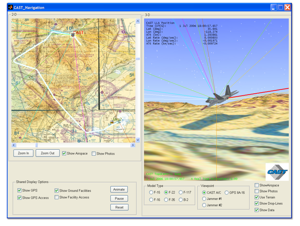
    Ray Kolibaba and Stephen Moran assured me during our talks at the 29th NSS that OCX was alive and well and on track to meet a re-baselined time and costs schedule. OCX Block One RTO should occur as planned in the first quarter of 2017 and will include the ability to launch and control GPS IIF and GPS III satellites and payloads, but not GPS IIA satellites and payloads. That mission, along with the responsibility for maintaining residual satellites, still falls to the LADO (Launch Anomaly and Disposal Operations) contractor Braxton Technologies, which is an OCX subcontractor to Raytheon.

    The bottom line is the OCX schedule has slipped and the budget has grown, but within historically acceptable parameters; certainly, it is not even close to triggering congressional oversight. However, having said that, in this budget sequestration environment, the overall GPS budget has taken some significant hits so that even the slightest cost overrun is of concern. Still, let’s hope that Congress makes funding decisions using actual historically acceptable numbers and not overblown rhetoric.
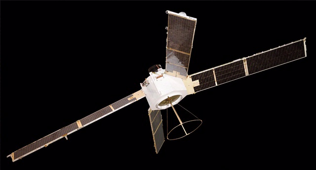
    LMCO and GPS III

    Keoki Jackson
    Keoki Jackson

    Let me say right up front that I really like Keoki Jackson and what he has accomplished on the GPS III program at Lockheed Martin. Keoki is the vice president of Navigation Systems, and as such heads the GPS III program. Keoki has an honest and open demeanor and just oozes integrity. He runs a very open program and, indeed, has extended an open invitation to me, wearing multiple hats, to visit the LMCO GPS III facility in Waterton, Colorado, to discuss GPS III anytime. Believe me, I have and will continue to take him up on his offer. To someone in my line of work, that confidence speaks volumes. Keoki obviously has supreme faith in his people, and is assured the GPS III program is on the path to success. I spoke with Keoki on Monday, April 8, as I toured the GPS III facility with him. He was like a father with pictures of his children. Happy, smiling, engaging — he could not wait to show off their latest accomplishments.

    My bottom line is this is a rare attitude among senior execs and PMs on major space programs. And that may be because so many of them are under congressional scrutiny. Not the case for GPS III, however. The back-to-basics GPS III program is on schedule and budget, and is set to deliver GPS III SV-01in May 2014, exactly six years after program award. The USAF has said it may not launch the first GPS III until April 2015, but that is a separate ground support and commanding issue. It has nothing to do with the schedule and availability of the GPS III satellites.

    Historically, LMCO-built satellites are some of the best in the world. According to LMCO statistics, and verified by yours truly, LMCO GPS satellite vehicles have accumulated more than 175 operational years on orbit with a reliability record better than 99.9 percent. Keoki also proudly pointed out that the Lockheed Martin heritage dates back to the production of the Oscar and Nova Transit satellites — programs that paved the way for the current GPS gold standard on orbit today.

    Now, don’t let the back-to-basics approach fool you. That just means sound, solid, proven engineering and management practices are employed, but the technology is anything but basic. The kingpin of the LMCO GPS III approach is an artifact known as the GNST, or pathfinder spacecraft. The GPS III Non Flight Satellite Testbed (GNST) gives everyone confidence that Lockheed is on the right track. The pathfinder goes through all the rigorous steps a flight article goes through, only it completes them first and allows LMCO personnel to find all those schedule-busting, expensive glitches that show up in any program. As Keoki said, “Our endeavor is to find any anomalies now before the satellites and payloads are on orbit.” The GNST, along with cutting-edge 3-D motion studies with avatars (an amazing story and teaser for another time), will hopefully allow a smooth transition for SV-01 through SV-09 when the program plans to initiate programmatic and hardware changes to allow for the first-ever GPS dual launch.

    This is a far different approach from the Boeing GPS IIF spacecraft and payloads, which experienced major anomalies on orbit for the first two SVs. Changes were made to subsequent ground space vehicles before launch, but the first two SVs on orbit are stuck with those anomalies. The LMCO approach hopes to eliminate or at least minimize that risk. If the full LMCO GPS III program comes to fruition, there could eventually be as many as 32 GPS III satellites in various configurations on orbit. Which means Keoki will probably be referring to GPS IIIs not as children but grandchildren, and he will need a much bigger scrapbook. Bottom line, GPS III is alive and well, on schedule and budget.

    NavSat or NibbleSat

    For those of you who have not heard about the NavSat or NibbleSat, it is a small GPS satellite endeavor by AFSPC, SMC, and AFRL to determine the feasibility of building a GPS-only small satellite, one without NDS, SAR, or any other auxiliary payloads. However, this is not solely a Weight Watchers program — it is about far more than a slimmed-down GPS. It addresses technological aspects of the GPS program as well as SWAP (size, weight, and power) issues that have plagued the GPS program since its inception.

    Since 1978 when the very first GPS satellite was launched, the program has grown in complexity and size with ancillary payloads, more signals, more power, and more flexibility, which all add up to a heavier, more complex satellite — and in space, where weight and complexity equal greater costs. GPS III has finally reached the point that it will cost nearly $450 million to place a single GPS SV and payload in orbit.

    As I said earlier, the GPS III payload may last 30 years, which equates to a sizeable return on your investment (ROE) for space assets, but in this constrained sequestration budget environment Congress is not looking down the road 30 years; it is barely able to consider the FYDP or the next five years’ development plan budget. So $450 million per GPS III on orbit is a big number. Even with dual launch, according to Lockheed’s Keoki Jackson (see above, “LMCO and GPS III”), from SV-09 forward the savings will only amount to about $70M per launch because it will require a larger launch vehicle. Certainly, $70 million is not a number to disregard, especially if you could build and launch a small GPS-only SV for that same amount. I know it sounds nearly impossible, but that is what the NavSat program hopes to achieve. To date, no less than 20 companies, U.S. and European, have expressed an interest in making NavSat happen. Most companies I spoke with are convinced it is not a technological issue, but a commitment and funding issue on behalf of the U.S. government. So what else is new? In my book, NavSat is a real possibility, and the recent plethora of BAAs (Broad Area Announcements) from SMC (Space and Missile Systems Center), AFRL (Air Force Research Laboratory), and SPAWAR (Space and Naval Warfare Systems Command) attest to that fact. Stay tuned for more.

    GPS Payloads, Receivers: Software-Defined and Otherwise

    It is a fact of life where GPS is concerned that when you talk about GPS technology, you are talking about ITT Exelis. There is not a single U.S. GPS payload on orbit today that was not built in whole or in part by ITT Exelis. There are few companies in the world today that can claim such a prestigious record for space assets that are arguable the best in the world. The ITT Exelis record of providing proven GPS payloads for 35 years is unequaled in the space arena, and the company continues to innovate and grow. So, it should come as no surprise that Exelis provided LMCO with the GPS payload for the GNST pathfinder mentioned earlier. The bottom line is, when it comes to GPS payloads, nobody does it better than ITT Exelis.

    Therefore, I took the opportunity to sit down with Mark Pisani, a vice president and general manager in the geospatial systems business at ITT Exelis, to discuss the recent $2.15 million contract award from AFRL to research navigation payloads to support the current GPS program and the NavSat program specifically. Mark stated that the technologies being investigated could easily translate to the entire GPS program.

    Mr. Pisani stated that over the next 18 months, the company will conduct research into potential methods to reduce payload size, weight, and power, and improve GPS signal strength and reception for disadvantaged users, especially warfighters, in either urban canyons or mountainous terrain. ITT Exelis is also working on new methods of tamper-proofing for its GPS reference and monitor receivers, which will deployed around the globe to ensure GPS accuracy for all global users. So it appears that where GPS is concerned, you name it and ITT Exelis is working some aspect of the program.

    NSS Wrap-up

    29NSS_Leadership_TopImage
    Space Foundation Leadership Team.

    NSS 29 is still in full swing as I write this. Indeed, my old friend and colleague in uniform, General William (Willie) Shelton, just gave his state-of-the-military-space-community address, and he did it in his usual exemplary manner. Few generals can match his grace and style. But to paraphrase Robert Frost, “…deadlines, time and tides wait for no man,” so I will wrap up with a few personal observations.

    As many of you have heard me say, year after year, the National Space Symposium is like no other space event in the world. It gets bigger and better every year, and this year events extended all the way to LMCO in Denver and to Broadmoor properties that have never been used for this event previously. The NSS agenda and speakers are top notch and international in nature. Just a sampling are George Nield, associate administrator for commercial space transportation at the Federal Aviation Administration (FAA), Jean-Jacques Dordain, director general of the European Space Agency (ESA), and Yasushi Horikawa, chairman of the United Nations Committee on the Peaceful Uses of Outer Space. Officials from commercial space leaders such as LMCO, SpaceX, Boeing, XCOR Aerospace, Sierra Nevada Space Systems, and others will also speak, while actress Sigourney Weaver, star of the Alien films among others, is the featured speaker at the Space Technology Hall of Fame gala tomorrow night. So there is literally something for everyone.

    Sigourney Weaver
    Sigourney Weaver

    I have known Elliot Holokauahi (yes, it is a mouthful) Pulham (CEO), Chief Chuck Zimkas (USAF, Ret) who serves as president of the Space Foundation, and Holly Roberts, the CFO, for many, many years, and they are always striving to make the National Space Symposium better every year; in my book, they have succeeded beyond anyone’s wildest dreams. Their zeal is combined with the dedicated support of Steve Bartolin, CEO and president of the Broadmoor. I first met Steve more than 25 years ago when he ran the famed Greenbriar Resort in White Sulphir Springs, West Virginia, the playground of congressmen and senators. Steve has always had a penchant for living in places that ended in Springs, as well as for perfect service, while going to great lengths to make sure his employees are happy and enjoy their work. It shows at the Broadmoor, which is a Triple AAA Five Diamond Resort, and has been for more than 20 years. Together, Steve’s commitment to perfection and the vision of the Space Foundation make the National Space Symposium not only the world’s largest but by far the best space symposium in the world today.

    Braxton Technologies Sets the Example

    Personally, I enjoy the exhibit hall and tend to spend most of my time there. The event along with the Cyber presentations lasts for four full days, but you cannot see and do everything in that time, which leads me a personal observation. Many of the vendors and exhibitors in the past several years have begun to offer refreshments in their booth space, to help draw in the huge crowds always roaming the exhibition floor. Some offer ice cream, coffee, even beer and pretzels, but personally I like what Braxton Technologies has developed. Remember, this is a Space Symposium, so Braxton decided to mount small-scale full working models of various satellites above their booth space and allow attendees to actually send wireless commands to control the satellites. You can sit at one of their control stations, see a real spacecraft commanding (TT&C) screen, send commands to the scale-model satellites, and watch the satellites react in real time.

    Now, Fred (I call him the model builder and engineer extraordinaire) is the one who built the majority of the models, and they are an excellent example of fine craftsmanship. Indeed, the first night there were some issues with one of the older models, and Fred stayed in the booth working the problem from closing time on Monday evening until 0700 on Tuesday morning. And his hard work paid off, because there is always a crowd around the Braxton booth waiting to control or just watch the satellites respond. The Braxton folks are very good at and very proud of what they do, and it shows. They automated GPS scheduling, on their own nickel last year, and this year offer a glimpse at the future of GPS mission planning. Plus, they have an application for unimproved aircraft landing sites around the world that is simply amazing.

    But, in the end it is watching the children, the future space operators and astronauts, who gather in huge crowds around the Braxton booth, waiting with thinly veiled anticipation to send a command to a satellite. It has been a long time since I was a child, but you should have seen the smile on my face when Fred allowed me to send a command and I could see the satellite model respond. Both Frank Backes, Braxton CEO, and Kenny O’Neil, Braxton president, and most of the Braxton employees are former space operators, and they have not forgotten the thrill of actually commanding satellites. Now they have made that thrill available for our future space operators. I think they hit it out of the park.

    There’s still time. Drop by the Braxton booth, speak with Fred, and send a command to a satellite. Oh, and you are allowed to smile!

    Until next time, happy navigating, and go fly a satellite!

  • When Am I?: The Importance of Time in Navigation

    A few months ago, many of you may remember that I wrote about an encounter with a rather well-known female journalist who, after listening to one of my GPS presentations, said something like this, “I came here today to learn more about GPS and so far all you have talked about is atomic reference systems…what the heck do those *&@# atomic clocks have to do with GPS…?”

    I mentioned at the time how incredulous I was at the question, but that I answered it with a straight face. Now, while professional courtesy prevents me from ever revealing the name of the female journalist, I will say that she evidently started an uncomfortable trend. Much of my correspondence lately has concerned the connections between time and position and/or navigation and why we are so concerned about time.

    I won’t bore my more sophisticated readers with GPS 101, or certainly not Time and Frequency Metrology 101, but I will tell you that I think we (this is not the royal “we” but includes all of us who work with and promote GPS on a daily basis) need to do a better job describing just how GPS works and more importantly how critical precise time and frequency is to position and navigation solutions, whether GPS is utilized or not. And I don’t have the time here to take up the argument concerning how important GPS is to our critical national infrastructure. Indeed, a topic and column for another time.

    I am sure my time and frequency metrology friends and colleagues at NIST (National Institute of Standards and Technology in Boulder, Colorado) and USNO (U.S. Naval Observatory — read as UTC — home of Coordinated Universal Time and the Master Clock) would probably go about this differently. They tend to approach these problems strictly from a metrology viewpoint. While there is nothing wrong with that perspective, I hope to give you a more hands-on operational view of time and how it relates to position and navigation.

    Smithsonian Institution and Time Exhibit

    An operational backup of a Transit 5-A satellite.
    An operational backup of a Transit 5-A satellite.

    Of course, I could take the easy way out and advise all my readers to visit the latest Smithsonian time exhibit entitled: Time and Navigation – The Untold Story of Getting From Here to There. The new exhibit opens in April.

    Here are a few quick Smithsonian facts, with commentary added, for those who want to visit and learn just what time has to do with GPS and navigation in general:

    What: The Relationship Between Time and Navigation

    When: Opens in April 2013.

    Where: The Smithsonian’s National Air and Space Museum, Independence Avenue at Sixth Street, S.W., Washington, D.C.

    Responsibility: “Time and Navigation — The Untold Story of Getting From Here to There” is being produced jointly by the Smithsonian’s National Air and Space Museum and the National Museum of American History. This is one of the few times, if not the first, that two museums have jointly produced a major exhibit of this importance.

    Sponsors: The exhibition is made possible through the generous contributions of Northrop Grumman; Exelis Inc.; Honeywell; National Geospatial-Intelligence Agency; U.S. Department of Transportation; Magellan; National Coordination Office for Space-Based Positioning, Navigation and Timing; Rockwell Collins; and ION the Institute of Navigation. Note: The sponsors are listed in order of the amount they gave to present the exhibition, but it should be noted that ION was among the first contributors, making the museums’ decision to go ahead with the exhibit a more comfortable one. More on that and why it is significant later.

    The USS Alabama.
    The USS Alabama.

    Artifacts: (Don’t you just love the word artifact? Indeed, someone once told me, and not unkindly, that I resemble that word.) The time exhibition features 144 artifacts, drawn primarily from the collections of the participating museums. Highlights of the exhibition include a representation of a 19th-century ship from the U.S. Exploring Expedition; the first sea-going marine chronometer made in the United States; the submarine navigation system for the USS Alabama; a TRANSIT navigation satellite (a major naval predecessor to GPS); Wiley Post’s airplane, the Winnie Mae; and Stanley, originally from the Stanford University Racing Team and written about many times by yours truly in GPS World. Stanley is a robotic vehicle that can drive itself. Stanley is a 2005 Volkswagen Touareg, which has been considerably modified to navigate without remote control and without a human driver onboard. Stanley handily won the 2005 DARPA Grand Challenge (Defense Advanced Research Projects Agency), a robotic vehicle race. Stanley successfully navigated 212 kilometers (132 miles) across desert terrain and has had his (here we go, anthropomorphizing automobiles) own robotic exhibit at the Smithsonian since 2009.

    An official DARPA photograph of Stanley at the 2005 DARPA Grand Challenge. Stanley, created by the Stanford University Racing Team, won the race.
    An official DARPA photograph of Stanley at the 2005 DARPA Grand Challenge. Stanley, created by the Stanford University Racing Team, won the race.

    Organization: The current time exhibition is organized into five sections: Navigation for Everyone; Navigating at Sea; Navigating in the Air; Navigating in Space; and Inventing Satellite Navigation.

    Theme: If you want to know where you are, you need an accurate clock. In other words, you need to know when you are. About 250 years ago, sailors first used accurate clocks, later known as chronometers, to navigate the oceans. Today, we locate ourselves on the globe with synchronized atomic clocks in orbiting satellites (GPS is the primary method today). Among the many challenges facing navigation from then to now, one stands out: keeping accurate time.

    For centuries, nations have invested enormous resources to determine time and place for geopolitical reasons, and their research has changed people’s view of the world. Advanced technology that was once available only to the military has become commonplace and downloadable to cell phones, iPADS and computers. Instead of unfolding a map or stopping at a gas station to ask for directions, drivers can now consult their car’s GPS (Global Positioning) system. The new gallery examines the cultural and technological history of precise timekeeping and navigation at sea, in the air, and in space and the impact of satellite navigation on our everyday lives. Which of course are also the missions of the Institute of Navigation and GPS World magazine.

    When Am I?

    Many of you have heard the old saw about those who don’t know history being doomed to repeat it, and if you don’t know where you have been, how can you know where you are? There are probably numerous maxims that fit the bill when it comes to the history of time and navigation, and the Smithsonian Exhibit certainly does a great job of hitting all the high points, but beyond that, they will take you into about as much detail as you can stand. If possible, plan on attending the exhibit several times and delving into each of the five major themes. But if you can’t visit Washington, D.C., and the Smithsonian exhibit, then visit virtually on their excellent website.

    For our purposes, suffice it to say that you can’t really know where you are unless you know when you are. That requires a clock, the more precise the better, and consequently the more accurate your position.

    History Lesson

    More than 200 years ago, sailors sailing between Europe and the New World knew where they were only in relationship to their latitude, but had no idea other than dead reckoning of their longitude.

    Enter Boston clockmaker William Cranch Bond who, although he was not the first, constructed a specialized timepiece, which later became known as the Bond Chronometer, which sailors used to determine longitude at sea. But still there were problems. Sailors used a maritime sextant and chronometer to determine position, but both devices depended on the other. On cloudy or foggy days, either the horizon or the sun and stars or both were unavailable, and positioning/navigation was relegated to, in all seriousness, dead reckoning with a dubious magnetic compass, a rock and a rope. The problem being, of course, that dead reckoning made many mariners resemble the first word in that very unfortunate navigational phrase.

    Time and Air Navigation

    Fast forward almost a century (1903), and aeroplanes are now on the scene along with all the problems attendant in navigating a machine easily traveling ten times faster than most ships. But of course the U.S. Navy rationalized that if a watch and a sextant were good enough for navigating maritime ships, then they were good enough for ships of the air — even if the horizon was often obscured or moved around a great deal, or turbulence made balancing a sextant difficult.

    The result was most aviators gave up on the sextant, especially solo aviators, and just used a watch and, you guessed it, dead reckoning, which is exactly what happened to many aviators in 1927 who attempted to win the Raymond Orteig $25,000 prize for being the first solo aviator to cross the Atlantic nonstop from the East Coast of the U.S. — in fact, it had to be New York to Paris, France. For you trivia buffs, it had to be New York to Paris because the person offering the prize, Monsieur Raymond Ortieg, was an emigrant from France who did well for himself and went from a penniless restaurant busboy to owning two of the most prestigious hotels in New York City at the time. Hence the connection between New York and Paris. But I digress.

    Charles Lindbergh (left) and Raymond Orteig.
    Charles Lindbergh (left) and Raymond Orteig.

    Enter Lindbergh

    As most of you are aware, then captain, later colonel, Charles Lindbergh took up that dare and won the Orteig-prize on the 21 of May, 1927, when he landed in Paris after a grueling 33½-hour solo flight across the Atlantic. When Lindbergh hit land after being “feet wet” for more than 30 hours and 3500+ miles, he was less than three miles from his intended European entry point, a feat that would be hard to duplicate today without GPS, as even with an unaided inertial system the drift can sometimes be as high as one kilometer per hour.

    One part I always find amusing about the Lindbergh transatlantic saga is that after flying with “dead reckoning” as his only means of navigation for 30 hours across the Atlantic, he followed the Seine river all the way to Paris, so he essentially converted from VFR (Visual Flight Rules) to the IFR or “I fly rivers” navigation method for the last part of his journey.

    Meteorologists and the sealed barometric equipment Lindbergh carried on board — to prove he never landed enroute or that it was indeed a non-stop flight — would not only verify that fact but also verify that he navigated the Atlantic in what we might call today The Perfect Calm. Indeed, Lucky Lindy picked the perfect 48-hour period for his flight. For those of you who read the book, saw the movie, or were there, will remember that in New York the weather during the night preceding his historic takeoff from the dirt-churned-into-mud runway at Roosevelt Field, Long Island, New York, was less than cooperative. There was a major thunderstorm with lots of lightning and several inches of rain; consequently, many counseled Captain Lindbergh to postpone his flight. But he would have none of it and the rest is history.

    The most interesting part of the story, however, is that the entire flight was accomplished with “dead reckoning,” a compass and a watch, the very same tools that Captain Lindbergh used during his tenure as a U.S. Mail pilot. So, in fact, Lucky Lindy actually knew very little about navigating an airplane or avigation, as many called it at the time. Indeed, according to Roger Connor from the National Air and Space Museum and his wonderful article in this month’s Smithsonian Air & Space magazine, Even Lindbergh Got Lost, Captain Lindbergh did not learn to properly navigate with a sextant, chronometer and star charts until more than a year after his famous flight to Paris.

    I won’t spoil the story for you, but he learned to navigate as did his famous wife, Ann Morrow Lindbergh, from then Lieutenant Commander Philip V.H. Weems of the U.S. Navy. LCDR Weems set up the nation’s first independent navigation school, and went on to instruct such notables as General Curtis LeMay, the Commander of Strategic Air Command (SAC), who went on to serve as the Chief of Staff of the USAF. Most people are not aware, but General LeMay was dual-qualified as a pilot and a navigator in the USAF. As the Commander in Chief of SAC or CINCSAC, he mandated that all SAC flight crews be able to navigate from Point A to Point B using only passive means that were always available and did not involve transmitting a signal outside the aircraft. In other words, celestial navigation, using a sextant, chronometer, special plotter and star charts, much as was taught by LCDR Weems.

    I was one of the lucky SAC flight crew members who learned to navigate with those basic instruments. And checking my logbooks, I find that I made just short of 200 flights (99 round-trips) across the big pond, the Pacific that is, using those basic instruments. I mentioned this to a group of USAF aircrews recently during a speech, and when I asked how many of them could accomplish that feat if required to do so today, I was informed that sextants are no longer carried on USAF aircraft and most do not even have sextant ports. In other words, it is a lost art among flight crews today, and it is a shame, but it is also a topic for another time.

    The important fact concerning navigation and time is that time — indeed, precise time — is and always has been critical to accurate navigation, especially aircraft navigation, no matter whether you are flying from New York to Paris, Texas, or New York to Paris, France. And GPS Atomic Reference Systems (Atomic Clocks) on orbit today, which deliver time accurate to millionths of a second, are even more critical since they are the heart of the system. So I would say to my journalist enquirer, GPS and atomic clocks are one and the same. You can’t navigate accurately without precise time.

    Weems Legacy

    Now, to bring this full circle, I first heard about the proposed Smithsonian Time Exhibit about two years ago from a friend and professional colleague, James Doherty, Captain, USCG retired. Jim, who once served as the Commander of the United States Coast Guard Navigation Center, is a past President of ION (Institute of Navigation), one of the few U.S. members of the Royal Institute of Navigation (RIN) in London, England, and now serves as the Chairman of the newly created Military Division at ION. And for full disclosure purposes, I must say that I have been a proud member of ION for more than 30 years.

    Jim, who was serving on a Smithsonian panel as a subject-matter expert on navigation, told me that the Smithsonian had the idea for the time exhibit, but was looking for support, and the first organization to pledge support was indeed ION. The Institute of Navigation certainly does not have the deep pockets of Northrop and Exelis or the other major sponsors, but they are very serious about navigation and they are always looking for ways to promote their vision. This was the perfect opportunity.

    And just in case you were wondering, the legacy that Captain, U.S. Navy, V.H. Weems left the world is a method of celestial navigation that persisted as the primary means, especially in the U.S. military and military forces around the world, for more than 60 years and is still the only reliable means of navigation available to us when everything else goes away. For with the Weems Method, as long as you have a sextant and an accurate clock, you can navigate anywhere.

    Oh, and one other legacy: Captain V.H. Weems was the founder of the Institute of Navigation, which is the leading society devoted to the advancement of navigation in the world today. And for you trivia fans, the ION predates the RIN by two years.

    Sequestration and Cancellations

    Normally I would wrap it up here and say grab your sextant and happy navigating, but just as I wrap this up I have been told by informed sources at SMC and AFCEA that the GPS Partnership Council scheduled for May this year has been postponed. Sources at ION tell me that ION/JNC in Orlando has been cancelled for this year due to the restrictions on travel for U.S. government and military officials. In other words, more victims of sequestration and a Congress that can’t make the decisions we elect and pay them to make.

    At ION they have always had the mantra, do it right or don’t bother doing it at all, and this year the travel restrictions are just too great. Certainly Jim Doherty and I were in the process of setting up another great Warrior Panel for the classified day, but that will have to wait for another time. However, I am assured by ION Executive Director Lisa Beaty that the ION GNSS meeting from September 16-20 at the Nashville Convention Center is definitely a go, so I look forward to seeing everyone there. Stop by the GPS World booth and say hello. Plus, I hope to see many of you at the 29th Annual National Space Symposium in Colorado Springs from April 8-11, 2013.

    Until then, Happy Navigating – blow the dust off your sextant and give it a shot.

  • BYO What?

    Every time I see a headline or read an article concerning BYOD (Bring Your Own Device) from a government source, where that source details only the risk associated with BYOD, especially where GPS/PNT (position, navigation and timing) is concerned, I am incredulous. Consider these recent BYOD headlines:

    • BYOD – Disaster Waiting for Government Networks
    • BYOD – Bring Your Own Disaster to the Government Enterprise
    • BYOD – Are the Military Networks Ready?
    • BYOD – Bring Your Own Destruction
    • BYOD – A Huge Security Risk?
    • BYOD – A Smart Choice or a Cyber Disaster?

    Historical Perspective

    The naiveté of the authors that penned these stories astounds me, as frankly they are out of step with the times by about 2,000 years. BYOD and the military go hand in hand. During Roman times, except for conscripts or slaves, Roman soldiers were expected to furnish their own supplies, their own weapons, their own horses and their own support. Often they brought their own slaves/servants to care for them in camp. In our (U.S.) Revolutionary War, many of the ragtag regiments were formed from state volunteers and local militias who were commanded by officers who, having paid for their commissions, supported the soldiers they brought to the fight, with food and uniforms; many were even expected to bring their own weapons and ammunition. The same applies to our (U.S.) Civil War, the War Between the States or the War of Northern Aggression, as my Southern colleagues are wont to constantly remind me.

    Since warfare began, warfighters have supplied their own equipment (BYOD), and today’s warfighters are no different, especially when it comes to personal electronic equipment, even though antiquated DoD (Department of Defense) regulations frown on such behavior. Hopefully you can see where I am going with this, especially as it relates to GPS/PNT user equipment. Unfortunately, DoD regulations also specify our warfighters in all services must utilize the government-supplied GPS equipment known as MUE (Military User Equipment), and even specifies the consequences of not adhering to that inane policy. Consequently, warfighters generally have the GPS MUE readily available if it is embedded, thereby avoiding the horrendous user interface, but they invariably also have their own personal GPS/PNT devices close at hand.

    These BYO-GPS-D are, without a doubt, more useful, certainly more user friendly, and actually provide a modicum of situational awareness, with such incredible features as actual moving color maps, annotated roads and rivers, up-to-date geographical features and even voice guided navigation — all features not available on the GPS MUE as a stand-alone unit today. Some PNT devices answer verbal inquiries from their users. Can you say, “Hi Siri, where am I?”

    Fast Forward: First Gulf War

    Consider the first Gulf War in 1990, which in GPS lore is touted in military aviation circles as the turning point for GPS transitioning from just another en route navigation system to a weapons systems multiplier and situational awareness tool that made believers of even the most jaded fighter pilots and land warriors. Suddenly fighter pilots and weapons systems operators were scoring “shacks” or direct hits on targets, on every sortie. Instead of using four bombs to hit one target, four bombs now equaled a direct hit on four targets — a phenomenal increase in accuracy, with minimal collateral damage, all due to the Global Positioning System.

    For land warriors, the famous “left hook” strategy, employed during the midst of a major, once-a-decade sandstorm that placed American warriors behind the Iraqi forces occupying Kuwait, was widely credited with bringing the ground war to a close in just four days, and it could never have been accomplished without GPS. However, the part of this story that often gets misinterpreted is the sudden appearance of BYOD GPS devices during that extremely short duration conflict (August 2, 1990, until February 28, 1991).

    Newspapers and military magazines carried numerous pictures of commercial/civil GPS devices taped to military vehicle windshields, windows on ships bridges, in fighter cockpits, inside tanks and fighting vehicles — and of course carried by individual warfighters, despite regulations to the contrary.

    I Don’t Know Where It Came From Sir…It Just Magically Appeared!

    What we tend to overlook is that these BYOD or personal PNT devices, despite warfighter protestations to the contrary (“Methinks thou dost protest too much…”) did not just appear overnight. Warfighters carried them in flight-suit pockets and briefcases for years. They saw minimal use, and then the U.S. decided to fight a war on and over a featureless desert. And I can confirm first-hand that navigating over a featureless desert without any external navigation aids is particularly troublesome. No landmarks, no ground-based navigation aids, no radar returns, and frequent sandstorms that obscure everything in sight and radically change the landscape make life a real challenge for warfighters prosecuting a war. Navigation in this environment is challenging at the best of times; add the fog of war and it becomes a nightmare. General William Tecumseh Sherman said “War is hell!” and while it can certainly never be a walk in the park, add GPS and precise navigation along with precision targeting/bombing becomes infinitely doable.

    Personal Experience

    I sat in my first aircraft cockpit and took my first flight more than 50 years ago. Contrary to popular belief, neither Orville or Wilbur Wright were my first flight instructors, just close friends, but I did learn a great deal from Charles Lindberg. Seriously, I can tell you that in the “good ol’ days” an inordinate amount of airborne time was spent determining your position/location, airspeed, altitude and heading to your destination or next waypoint, often with wildly varying degrees of accuracy. Ask any aviator hailing from that era and they will tell you we really had to work at it. It was a constant struggle where IFR (Instrument Flight Rules) frequently equated to “I Fly Roads.” Certainly it was gratifying when it all worked out, but also extremely frustrating when it did not, and there was no alternative.

    Nature of the Beast

    Fighter pilots by nature tend to be vain and querulous creatures that by definition are the best at what they do. Did you ever meet one who wasn’t? Just ask them and they will be quick to tell you they are the best fighter pilot in the world, every one of them. And they hate to ask for directions or admit they are lost, male and female alike, hence the old adage, “You can always tell a fighter pilot, but you can’t tell them much.” Indeed, just ask any fighter pilot worth their wings and they will invoke the Daniel Boone response when asked about being lost. When asked if he had ever been lost, that great woodsman, statesman and explorer replied, “Lost? No I can truly say that I have never been lost… I was mighty bewildered once for about four days, but never lost.”

    Unfortunately pilots and/or navigators don’t have the luxury of pulling over and checking for moss on the south side of trees. But one glance at a GPS device in flight (it does not have to be an aviation-grade receiver) will tell you your current heading, time and desired heading to your next waypoint and final destination, speed along the ground, altitude, and of course current position down to a meter or better. This wonderful device leaves the intrepid aviator with time to concentrate on putting weapons on target, which, if they are also GPS guided, is almost a cinch.

    Now you understand why aviators were among the first warfighters to embrace BYO-GPS, and why they seemed to just “pop-up” during the first Gulf war. Today’s ultra modern jets, such as the F-22 and F-35, have built-in GPS/PNT systems with redundant inertial systems, Doppler systems, and of course radars that are all tightly integrated. Some smart weapons even have their own GPS and laser systems on board. But you can bet your next paycheck there is a backup civil/commercial battery-operated BYO-GPS in a flight-suit pocket or helmet bag, just in case, as fighter pilots also have a great sense of self-preservation.

    Warfighter GPS Equipment Database

    I have personally compiled a “Warfighter GPS Equipment Database” over the last 10 years, since we have been at war in Iraq and Afghanistan. The database is comprised of more than 8000 entries from warfighters from all services, U.S. and allies alike. Only 1 in 40 warfighters utilize issued GPS MUE as a stand-alone handheld device, but every single warfighter (that’s 100 percent, a rare event in statistics) in the database proudly possessed and freely spoke about their own personal BYO-GPS device, with the majority of them being various iterations of a Garmin device, with Trimble devices and iPhones coming in a close second and third; although the iPhone and other smartphones are rapidly gaining ground on all the PNT devices in theater. So the bottom line is when it comes to BYOD, GPS is alive and well and has been for the last 23+ years with no end in sight.

    BYOD Here to Stay

    While thousands of warfighters have written me to say, “I love my Garmin, Trimble, iPhone, etc.” I do not have a single letter or email saying I love my PLGR or DAGR (precision lightweight and defense advanced GPS receivers or MUE). However, I will and must caveat my BYOD position by stating, as I always do, that while the PLGR and DAGR are, in my opinion, woefully inadequate as handheld PNT devices, they are extremely functional and sometimes the best/only option warfighters currently have as an embedded device, especially in a GPS-denied environment. Anything that improves on the display, battery life and user interface of the current GPS MUE is to be applauded.

    So to be clear, I would never advise a warfighter not to utilize the GPS MUE issued to them, but would certainly encourage them to have a backup or two. Fortunately that encouragement is totally superfluous as I have yet to meet a warfighter who did not have at least one civil/commercial PNT receiver as a backup, even in the cockpit. During a recent visit to a local firefighting C-130 squadron, the navigator utilized the on-board, original equipment MAGR GPS unit, a Trimble unit, Velcroed to the navigation console, and two laptops with different independent GPS capabilities, such as color real-time moving map displays, and the navigator had a BYOD Garmin in his flight suit pocket. QED!

    BYOD is here to stay!

    Let’s embrace the technology of the 21st century, stop asking if our warfighters, government employees and government contractors should be allowed to use their own PNT, computer and communication devices, and begin incorporating the smartest and best devices in the world into our networks and enterprise infrastructures. For all the hype to the contrary, there really is no alternative.

    Until next time, don’t forget to BYOD and happy navigating!


  • 2C or not 2C: An Important Signal Question

    Don Jewell
    Don Jewell

    With apologies to the Bard of Avon, as I paraphrase his prose, 2C or not 2C — that is the question for millions of GPS users and has been for several years. Indeed, over the past seven years hardly a week has gone by without an email or inquiry about the status of the GPS L2C signal.

    The name “L2C” refers to the radio frequency used by the signal (1227 MHz, or L2) and the fact that it is for civilian use, but of course it will also be used by the military. There are also two military signals on the L2 frequency. In the past couple of months inquiries concerning L2C have become an almost everyday occurrence. Plus I have it on good authority that it was a topic of conversation at recent a PNT EXCOM or Executive Committee Meeting.

    However, when I started making inquiries I was met with an interesting dichotomy. One group of users actually laughed and accused me of having a Don Quixote complex and tilting at windmills, since this debate has been continuing for over seven years, while other more sanguine user groups are seriously interested in the future of L2C. Here is what I discovered.

    What is L2C?

    According to the official U.S. government website concerning GPS, “L2C is the second civilian GPS signal, designed specifically to meet commercial needs. When combined with L1 C/A [ed. coarse acquisition] in a dual-frequency receiver, L2C enables ionospheric correction, a technique that boosts accuracy. Civilians with dual-frequency GPS receivers enjoy the same or better accuracy as the military. For professional users with existing dual-frequency operations, L2C delivers faster signal acquisition, enhanced reliability, and greater operating range. L2C broadcasts at a higher effective power than the legacy L1 C/A signal, making it easier to receive under trees and even indoors. The Commerce Department estimates L2C could generate $5.8 billion in economic productivity benefits through the year 2030. The first GPS IIR(M) satellite featuring L2C launched in 2005. Every GPS satellite fielded since then has included an L2C transmitter.”

    Problems

    So while this would appear to be a “no brainer” as it were, especially the $5.8 billion in economic benefits, it appears the Global Positioning System is actually at a crossroads and the decision makers are apparently on the horns of a dilemma. For some groups of users, the laudable global PNT (position, navigation and timing) gold standard is looking a bit tarnished of late but has an opportunity to shine once again. The question and future perception of GPS by many global users simply revolves around implementing full navigation messages on signals that are already in place, namely L2 and L5 with CNAV and M-code with MNAV. So, what’s the issue, you say? The signals are there, and in the case of L2C and M-code, have been for seven years — simply upload a full navigation message and be done with all the ambiguity that has become unwelcome baggage for these modern day signals. Au contraire, mon ami, if it were only that simple.

    Now grant you this, should be a simple decision, but remember this is the U.S. government we are talking about — apropos failed budgets, endless continuing resolutions, health care fiascos, and the fiscal cliff — important but in the end actually simple decisions all. Unfortunately, history reflects when the U.S. government is involved, nothing is ever easy and timely decisions are hard to come by. So as not to confuse anyone, especially the players, let’s take this process one step at a time and see what all the fuss is about, shall we?

    Problem Statement: The L2C and M-code signal capability has been on orbit for more than seven years, since 2005. In 2009, the 2SOPS began uploading and broadcasting a Message Type Zero on L2C, which, while not a navigation message, does put data on the channel. What users are now asking for is the full navigation message on L2C or CNAV, which is a modern-day navigation message and will have significant advantages for all users. Plus, the signal would be available to potentially more than 3 billion users versus the small subset today that utilizes the L2C carrier phase for RTK (real-time kinematic) operations. Indeed, when compared to the L1 C/A (coarse acquisition) signal, L2C has 2.7 dB greater data recovery (with a navigation message) and 0.7 dB greater carrier tracking.

    The bottom line is that, with the addition of a valid and updated CNAV message on L2C, all users, the military included, would immediately have ten more potential navigation signals available, and that number would grow with each new GPS launch. Obviously, the same is true for military users with M-code and for all users with an L5 capability. However, the upgrade process needs to start somewhere, and L2C is the obvious choice since there are essentially no M-code receivers available today and there are approximately between 450,000-500,000 L2C capable receivers already in the hands of users.

    Assets

    Hardware – Simply put, there are currently 10 satellites (SVs) capable of broadcasting a full navigation message or CNAV message on the L2 signal and MNAV message on the M-code signal, also on L2 and three L5 CNAV capable SVs:

    7 – IIRM SVs (does not include SVN-49 which, while capable, is currently in residual and/or test status).

    3 – IIF SVs (same capabilities as the IIRMs and also capable of broadcasting an L5 signal with CNAV).

    While the lack of L2C monitor stations has historically been used as a reason for not broadcasting the new CNAV navigation messages, today there are literally more than one hundred L2C- and L5-capable monitoring stations, which includes the NASA JPL (Jet Propulsion Laboratory) monitoring stations. Logs from several independent monitoring stations show that at any given time there are from one to three L2C SVs visible for the majority of global users, including our warfighters, who in the mountains of Afghanistan need all the signal availability we can provide.

    Plus, of the estimated 450,000-500,000 fully capable L2C receivers, several thousand of those are in the hands of our warfighters. Trimble started building in the L2C and L5 CNAV capability as far back as 2003, a full two years before the first L2C launch, for users that wanted the option. However, that option has never been fully tested with live on-air CNAV coded transmissions and they need to be. More on testing later.

    From a global user perspective, Japan has essentially leapfrogged the U.S., since the L2C and L5 signals with full CNAV messages are already being broadcast on the Japanese QZSS navigation satellite QZSS-1.

    Software was initially thought to be an issue, but according to my sources, the current MNAV or M-code full navigation message is remarkably similar, as to be almost identical to the CNAV messages for L2C and L5, and MNAV has already been shown to work well on the ten GPS SVs capable of broadcasting the M-code signal. Granted, it is not fully integrated into the current OCS or operational control system known as AEP or Architecture Evolution Plan, but then not many future capabilities are, so this is really not an issue since manual processes abound in the current OCS. The L2C, L5 and M-code full navigation messages are supposedly still part of the plan for OCX or the future operational control system for GPS, which should be up and working sometime in early 2017. This would be twelve years after the L2C and M-code signal capability was first placed on orbit.

    Timelines

    Given those timelines, some would say, hey that’s only four years from now, maybe five if you count testing, and the full navigation message might actually be turned on. But, alas, rumors abound that there is a government agency apparently objecting to the immediate activation of L2C and L5. This agency, and it is not hard to ferret out exactly which one, wants extensive testing to ensure there will be no complications with the WAAS or Wide Area Augmentation System broadcasts, and as an alternative plan it proposes waiting until all the L5 satellites are on orbit before activating navigation messages on L2C or L5. Let’s do the math – that’s 24 L5 SVs, before the L2C and L5 PNT signals are activated with full navigation messages. At one launch per year, the current GPS launch rate, and it matters not whether it is a IIF or a III, and with three L5 SVs already on orbit, that effectively means we will see all 24 L5 SVs on orbit sometime in 2034, if indeed the II-F SVs are truly the first 30-year GPS SVs. If not, then it could be as late as 2037.  However, given the average life span of GPS SVs today, it is more than likely that by 2037 every single L2C, L5 and M-code capable satellite on orbit today will have been disposed of without ever having broadcast any of the new signals for which they were designed. Now, how’s that for a lachrymose plan?

    Fortunately, this alternate long-term “plan’ has not a prayer of passing, dare I utter the words, the dreaded Washington Post test. Never having purposely written anything for the Washington Post, even though several of my articles have been quoted and misquoted there, it is still a force to be reckoned with in our nation’s capital, simply because the Washington Post continually asks the question, “Is this a wise use of taxpayer’s money?” The answer for the alternative GPS L2C and L5 plan is obvious.

    Personnel and monetary issues are always mentioned in the context of new GPS capabilities; however, I have no doubts that the absolutely superb blue suit operators, tacticians and support contractors at 2SOPS are more than capable of performing the simple actions of uploading the new navigation messages on their own.

    Sure, times are tough but the blue suit operators and their on-site support staff, at the 2SOPS, have proven themselves time and again to simply be the best in the business. They have brought GPS SVs back from the dead, they (with Braxton Technologies Software) maintain residual satellites that everyone thought for years was an impossible task, and they have saved SVs for important missions that everyone else thought should have been abandoned. We don’t give the fine men and women at Schriever AFB, the 50th Space Wing and the 2SOPS (2nd Space Operations Squadron) enough credit, and I am not about to sell them short. I am convinced the signals in question can be uploaded with full navigation messages, tested and made operational, even if only on a test basis, within six months without expensive outside help.

    Full-Scale Testing

    This brings us back to the full testing proposal, which actually makes a lot of sense. We (all users) need immediate full scale and extensive operational evaluations that confirm “we have it right” with the CNAV and MNAV data messages. We should encourage manufacturers to participate in this testing process to ensure their GPS devices meet specifications and are not flawed because of a misinterpretation of an interface specification. The GPS equipment manufacturers would be the first to embrace this approach. The manufacturers and users need open-air full-scale testing with valid CNAV messages being broadcast by numerous satellites to ensure they have coded the L2C, L5 and M-code receivers properly.

    Immediate testing is the key here, because otherwise under one proposed plan we will only find out if there is a problem with full end-to-end testing of the L2C CNAV signal and user equipment 13 years after manufacturers began fielding the supposed and promised capability. Under the wait for L5 FOC (full operational capability) plan, we won’t find out if the implementation of specifications are correct for another 20-plus years. Personally, I find this to be unacceptable. We need to begin the immediate six-month test plan now. 

    The aviation community has the mantra, “Test it as you fly it.”  We should not do any less.  A full six-month evaluation is absolutely appropriate and should be undertaken now. We cannot afford to repeat the 5.5C debacle. [ed. click to read more about 5.5C].

    Users, of course, are the prime concern. If you or your organization, including the military, can benefit from 23 more navigation signals today (and three additional signals each year from now until 2034), one of them being the strongest GPS signal to ever be broadcast (L5 with CNAV), and you want/need those signals active now, then please let us know. You may email me at [email protected].

    Stand up and Be Heard

    Although some of my comments have been a bit tongue-in-cheek, this is indeed your chance to be heard and to make a difference. Let there be no mistake: there is no other PNT system in existence today, planned or unplanned, on the drawing boards or on PowerPoint slides that approaches the capability, availability, reliability, longevity, accuracy and integrity of the Global Positioning System. The folks at Air Force Space Command have been and continue to be admirable stewards. We just need to let them go about their business without undue restrictions.

    Dare to Compare

    If you want to know exactly how the GPS compares to other PNT systems, consider that the Russian GLONASS (Globalnaya Navigatsionnaya Sputnikovaya Sistema), which came into existence in 1979 only one year after the first GPS launch, has only been Fully Mission Capable (FOC) as a global PNT system for about two years, and that dubious status is literally day-to-day as it teeters on that magic number of 24 available SVs broadcasting multiple PNT signals simultaneously. Contrast that to the GPS, which currently has 32 active SVs with several additional SVs in residual status. Three GPS SVs are nearing, have attained or will soon attain 20 years on orbit. One of our SVs has been on orbit for more than 22 years. GLONASS has serious problems merely attaining an average SV life of less than five years on orbit. Even the vaunted Chinese are experiencing serious technical, longevity and integrity issues with their multiple PNT constellations. It is just not as easy as it sounds. So yes, GPS is the global PNT gold standard, and its stewards must always strive to improve and lead the way. The GPS must continue to grow and innovate or risk being left behind. This is your chance to contribute to that leadership role. Let your opinion be heard.

    Until next time Happy New Year, happy navigating, and keep those card, letters and emails coming.


  • PHGPST Resurrected: Seeking the Perfect Device

    Don Jewell

    By Don Jewell

    Cards and Letters

    It happens every year and it is an emotional rollercoaster.  It generally starts a couple of weeks before Thanksgiving and continues until just after New Years – and it is simply heartbreaking. The letters and emails start arriving just like clockwork before the holidays and they all ask the same question – where can I buy the PHGPST or the Perfect Handheld GPS Transceiver?

    As many of you know, who are faithful readers, I receive hundreds of letters and emails like this throughout the year from our warfighters and first responders, but the letters and emails over the holidays are special because they are from the wives, sisters, children, parents and grandparents of war fighters. They want nothing but the best for their loved ones. It breaks my heart to have to tell them that the PHGPST does not exist – yet.

    Without a doubt, our warfighters and first responders, who put their lives on the line so that we may continue to live and thrive in a free world, where innovation and response to customer needs are hopefully met with success both emotional and fiscal, deserve nothing but the best, and that is the goal I continue to pursue on their behalf.

    Dissatisfaction

    Paraphrasing Walter Kaufman, “Otherworldliness or ‘belief that there is a better world’ is the child of disenchantment with this world.” To say our warfighters are disenchanted with the antiquated legacy MUE or military user equipment they are forced by policy to utilize today is an understatement. DoD’s antediluvian MUE is a joke compared to what is available in the commercial marketplace today. Studies indicate our warfighters are aware of this dichotomy and have shown their disdain in the last ten years by using commercial and civil PNT equipment in theater 40/1 over the government’s archaic MUE handheld devices. Studies further show that MUE is utilized by our warfighters only as a last resort and as a matter of necessity due to the outdated policies and technologies that continue to prevail. However, I am happy to say these anachronistic restrictions are reportedly rapidly coming to an end.

    Consider that the USMC (US Marine Corps) decertified the PLGR in 2009 because “the PLGR or Precision GPS Lightweight Receiver is an obsolete GPS military receiver” [ed. PLGR was designed circa 1988] and almost all Services today use the DAGR or Defense Advanced GPS Receiver [ed. the DAGR was designed circa 2002]. The DAGR was a major capability improvement ten years ago but today is technologically obsolete and primarily used as an embedded solution only. As an embedded device the DAGR serves its purpose — providing an antiquated, unfriendly user interface to legacy government equipment. For example, rumor has it that one version of the Stryker, of which the Army has more than 4,200 in service, described as a technologically advanced combat fighting vehicle, uses nine, count them, nine individual DAGRs. Draw your own conclusions. I suspect this has more to do with the inadequacies of the DAGR vice the capabilities of the Stryker. The good news here is that my sources in the DoD tell me there will be no further DAGR purchases. Now if I were giving this as an oral presentation, I would pause here for thundering applause and a standing ovation. Can I have an Amen?

    Several years ago, I penned the following: “MUE is necessary because it is the only platform that currently provides SAASM (selective availability anti-spoofing module) protection, along with a second military frequency giving the military user an advantage over his civilian counterpart.” Today none of that statement is true from a purely intrinsic or commercial point of view. There are much more capable receivers with all these capabilities and more, to include real-time centimeter-level accuracy, available on the commercial market today.

    Marketplace Responds

    This year the PNT (position, navigation and timing) marketplace has finally responded, and I am able to reply to warfighter family enquiries with more positive information. In just the last 18-24 months, the path to an actual PHGPST has been blazed by several major GPS manufacturers, and well-informed pundits say DOD policy changes may be in the wind as well.

    The PHGPST

    I had a three-hour lunch several weeks ago with the chief PNT engineer from one of the companies pursuing the PHGPST. It was enlightening to hear him wax eloquent concerning their new PNT device and the capabilities it will provide the warfighter, first responders and commercial/civil users as well. Indeed, there is a real possibility, if DoD policy changes lag technology (can you imagine that ever happening?) that civil/ commercial users may be the first recipients of this technological manna from the gods. But not to worry — if the actions of our warfighters during the last ten years of warfare are any indication, the warfighters and first responders will merely purchase what they need, from whatever sources are available, regardless of antiquated policy and doctrine. As one Marine lieutenant colonel warfighter commander so eloquently phrased it, “So please tell me where I can purchase the PHGPST…because when your life and those of your fellow Marines is on the line, who gives a damn about policy … give me the best solution possible  … because the current #@*&% MUE is not even in the same ballpark as the best.”

    Unfortunately, the chief engineer declined to allow me to use the name of his company, but they have promised me a pre-production unit to test and write about. As to time frame, he assures me there will still be plenty of snow banks and icy mud puddles in Colorado for my exhaustive real-world tests. Ever since that lunch I have been like a kid at Christmas… I just can’t wait for the test unit to arrive.

    Trimble

    However, while I am waiting with bated breath, another major PNT company/manufacturer pursuing the PHGPST has gone public with its intentions, and that is Trimble. I had the pleasure of visiting with Ann Ciganer and other Trimble executives in San Jose for a day recently, and then in early November attended Trimble Dimensions for the first time. I was simply amazed. Talk about feeling like a kid in a candy store – and that feeling had nothing to do with the venue – the Mirage in Las Vegas. Seriously, Jim Sheldon, general manager of Trimble’s Mobile Computing Solutions (MCS) Division and his team in Corvallis, Oregon, have outdone themselves. Their rugged line of PNT devices is simply jaw dropping in appearance and capability. I was privileged to sit in on some MCS planning meetings and I was blown away by what I heard — none of which I can relate here because of NDAs (non-disclosure agreements) and such — but suffice it to say that Trimble has been listening to its customers (what a concept) including warfighters/first responders, and it shows in the devices hitting the market now and in the next few months.

    I was very impressed, and I guess it showed because one company PR/marketing pundit commented that I could probably write about nothing but Trimble rugged equipment for the next twelve months. Although he said it in jest, he was more correct than he knew. Indeed, another person in that group commented that I could write nothing but reviews for the next twelve months and become known as the Gunnery Sergeant Lee Emery military twin for GNSS. You may remember Emery hosted two History Channel programs: Mail Call, where he answered military questions, both modern and historic; and Lock N’ Load with R. Lee Ermey, which focused on the development of different types of military equipment, mostly weapons. I personally never missed an episode of either program and while I am flattered at the comparison, frankly I prefer the written word. But it does offer up the possibility of conducting even more PNT/GNNS equipment evaluations – the only issue being that it takes me about six weeks to properly evaluate a piece of PNT equipment, and it really helps if there is are lots of snow banks and deep icy puddles around. And remember, my rules of engagement are to never write a bad review, because why should you spend your time reading about something you can’t use, and, if at all possible, I won’t review equipment I have not personally used in the field under the most austere conditions available.

    So in the next twelve months we will be looking hard at candidates vying for the title of the PHGPST, and I will do my best to keep you abreast of all the technological advancements and policy changes that make that possible. And maybe next year as the holidays approach, I will be able to respond with a plethora of choices for the PHGPST.

    Until next year, semper fi and happy navigating.

  • Conversation with Ray Kolibaba on the GPS Ground Control Segment

    Ray Kolibaba, Raytheon VP and Program Manager for OCX, took part in a candid conversation with Don Jewell, our defense editor at GPS World. Kolibaba gives us an unprecedented look at the GPS ground control segment, warts and all, as it exists today. His updates about a viable program are good news because at one time the OCX program was close to being terminated. Join us now for a look at OCX today and the way ahead for the GPS ground control segment.

    By Don Jewell

    Ray Kolibaba, Raytheon vice president and program manager for OCX.

    DJ: Ray, thanks for taking time to be with us today. Perhaps we should start off with your title, your bona fides if you will, and just what you do at Raytheon in Aurora, Colorado.

    RK: Don, I am a vice president at Raytheon here in Aurora and the GPS OCX program manager.

    DJ: Concentrating on the OCX program, how many people do you oversee and how many people do you have on your team including sub-contractors? In other words, just how big an effort is OCX when it comes to manpower?

    RK: We currently have 450 people at Raytheon working OCX, and with our subs, an additional 300 personnel. Altogether we have 750 personnel working GPS and OCX issues. This does not include the military and civilian personnel at AFSPC and SMC. [ed. Air Force Space Command and Space and Missile Systems Center].

    DJ: It sounds like a thousand people when you account for all the different players. An important part of the Raytheon team has to be your subcontractors. Let’s talk about your subs and the roles they play, just so our readers have an idea of the expertise required for OCX to succeed.

    RK: Don, our subs are a critical part of our team and we could not succeed without them. First of all, our major subcontractors on board include ITT Exelis — their primary role is navigation, along with JPL [ed. Jet Propulsion Laboratory]. JPL is active in the Kalman Filter area. Key management and global monitoring station receivers are also part of Exelis’ efforts. They are based in New Jersey and have been a key part of this team from the beginning. I am happy to say they survived the recent storms and did not miss a beat. For the overall GPS enterprise, ITT Exelis also supports the navigation side with Lockheed Martin for the space vehicle.

    We have a number of small company subcontractors — all experts in their chosen fields of endeavor. First, we have Infinity Systems, from Colorado Springs, Colorado, and they do primarily training, technical documentation, and opscon [ed. Operations Concepts] work. We are also teamed with Braxton Technologies, which you know well, also out of Colorado Springs. Braxton does our modeling and simulations as well as the command and control or C2 segment. We also have Soladyne Solutions, from Colorado Springs, supporting C2 and mission management and some of our infrastructure support. Geologics Corporation primarily provides staffing support and other key resources. RT Logic is on board for front-end processor work. All in all about 10% of the entire OCX program is being handled by our small business partners.

    We also have several large subcontractors such as Boeing out of Aurora and Colorado Springs. Boeing is focused on the transition from AEP, the current operating C2 system, to OCX as well as operational activities, such as networking and data storage. Then we have our own Raytheon Network Centric Systems (NCS) folks out of Fullerton, California, who are our key connectivity into the FAA [ed. Federal Aviation Administration] and the civil world. NCS developed the GPS-based Wide Area Augmentation System or WAAS for the FAA and similar systems for Japan and India.

    So, as you can see, this a very specific and highly qualified team put together to address OCX requirements.

    DJ: Thanks, Ray. Perhaps this would be a good time to review the history of the OCX program and how we arrived where we are today.

    RK: Absolutely. The history of OCX at Raytheon goes back much farther than you might think. There are actually two aspects of the history. Let’s start by looking at the OCS, or the operational control system for GPS that came on board in 2007.

    When I was here at Raytheon in the 2002-2003 time frame, one of the primary objectives that we had was based on my and others experiences in space and ground development projects. The issue was this — the majority of space programs’ critical decisions were primarily based on the need to support the space segment. Most space programs contracted with a single space prime to build the ground, payload, and space segments. When push came to shove, decisions were made favoring the space and payload needs thereby often depriving the ground segment. Too many trades were made from the space segment perspective. For most of my career in the US Air Force and in the aerospace industry, decisions were made the same way. In other words, the ground segment would suck it up and do whatever it had to do to make it work with what assets remained.

    DJ: It sounds like you are saying the ground segment was often an afterthought.

    RK: Exactly, Don. It was truly an afterthought. When additional money was needed to pay for issues on the spacecraft or payload side, it was always an easy decision to go pull money out of the ground segment, because management was always primarily spacecraft or hardware guys. Now many of these decisions may have been the best decisions given the flexibility of the ground segment and its ability to respond to changes in space, but the ground was not always an equal partner when it came to system level trades. Now I have to admit that the hardware, the spacecraft, and the sensors are sexy because it is great to be able to go out and touch and feel something, but it just does not work without the core capability of the ground segment and software that makes the system truly operational. This mindset, as I said, goes all the way back to my ops days in the Air Force in Sunnyvale, California, in the 1970s. Some of the stuff I saw back then helps me with OCX today from an ops viewpoint, because knowing what it takes to build and deliver a system and then make it operational are often two totally different areas of expertise. So having operational experience in running a ground control system and seeing what it takes to get there is important.

    Don, this brings me to an item concerning testing that I will talk more about later, but in Sunnyvale in the 1970s we often found system software deliveries with numerous problems. We were launching three vehicles a year and had 30-60 days between missions. We had issues primarily because the software developers — and this goes back to a whole “day in the life” testing, or “test it as you fly” paradigm — did not test software against real life databases or actual flight commands, like we do today. So in the ’70s we went down to the contractor’s integration facility and started running our own tests before the software ever officially came into the facility; this added step greatly improved our capability to test and run the system. They delivered the right stuff the first time and it actually worked.

    These are the types of things that, when you have a ground segment and operations background, help you improve the overall system. That history is part of the motivation for the changes we are looking at with the government today; it applies to OCX as well as other space programs. There is a genuine need to separate ground and space acquisitions. So that is part of the history of what this organization, Raytheon, started to do and was pushing for in the early 2000s in Air Force Space Command. Fortunately for GPS, we were able to get the ground segment broken out as a separate acquisition. This is a concept we have been chasing and pushing since the early 2000 time frame.

    For instance, in 2007 the competition for OCX was between Northrop Grumman, Raytheon, and Lockheed Martin. I think our separate ground approach really helped us put together a winning bid and a system and capability that in the end will optimize and drive the overall system performance so that we all benefit. We have a very operable system, and we support the navigation needs of the civil and the military user.

    DJ: So, Ray, what you are saying is that Raytheon, since the early 2000s, came to the realization that just because a company knows how to build a rocket does not necessarily mean they know anything about the ground system, the command and control system, or even the satellite and payload. They may have some expertise in those areas but it is not a given.

    RK: That is absolutely correct, Don. Those are all different specialties, and as you go forward you need people that are smart in all regimes so you can figure out how to optimize the system and work from the system perspective.

    DJ: Ray, you mentioned your Air Force career several times and the perspective it gave you. Give us just a bit more background and clarify how you wound up as the OCX PM.

    RK: Sure, Don, I was very fortunate. I spent from 1971-79 in the U.S. Air Force. The first couple of years I attended graduate school at AFIT in Dayton, Ohio, at Wright Patterson Air Force Base [Ed: Air Force Institute of Technology]. Then I went off to Sunnyvale, California, to the Air Force Satellite Control Facility, or the Blue Cube as it was often called at the time, for four years, where I did my satellite operations stint. I did satellite ops in the days when we generated our command messages to the satellite on an old IBM 29 keypunch card and a CDC 3800 computer. We used telephone networks to transmit the data to the remote tracking stations where it was uploaded to the satellites. It was a totally different world of Command and Control in the days before relay satellites. We had remote tracking stations. We were ready with our data every ninety minutes in a message format that was sent up to the vehicle. It taught us a lot about schedule and timeliness and the ability to respond to the needs of the system.

    After Sunnyvale I went down the road to Los Angeles to work in the Special Projects Organization. I worked the mission SPO and the ground systems for some future space capabilities. I spent two and a half years in LA, and then got out of the Air Force after nine years. I really enjoyed my time in the Air Force and I learned a great deal, but I made a personal decision to get out based on family considerations. Plus I really did not enjoy moving all the time.

    I kept working in the industry and I worked for a small company doing orbit determination and mission management work for a number of programs. We had an opportunity to support a couple of programs in the Denver area with the old Martin Marietta Company, and one thing led to another, and in 1981 we moved to Colorado and we have been here ever since. I worked various programs for Martin Marietta and then Lockheed Martin. Then I worked for the Hughes Raytheon Group, and Northrop Grumman, basically working ground support systems for DoD and intelligence programs.

    I left Raytheon in 2006, spent five years with Northrop Grumman, and decided to retire. I quickly got bored with retirement, and Bill Jones at Raytheon allowed me to come back as his deputy. So I returned in February 2011, and since we were making changes on the OCX program, I volunteered to run the program. I really thought I could come in, make a difference and help. I came to this job last December [ed. 2011].

    I know you want to talk about the management changes made back then and why they came about. I can only give you Raytheon’s viewpoint. You should talk to the government about its changes. For Raytheon, part of the reason for change is because there is a huge difference — as I found out when I was working for Lockheed Martin with some really creative people who know how to put a concept and a message together concerning what you should build and why — between the planners and marketers and how you actually get it done. The same group that sells the program is not always the best group to go off and execute and make a program successful.

    DJ: So, Ray, even though some old-school types make think this is heresy, you’re saying that a good or even great capture manager does not always a good or great program manager make.

    RK: Yeah. Most of my background has been on the mission execution side of the house. When management discussed making changes, I talked with Bill Jones and Lynn Dugle about OCX and managing the program to see if we could move it in the right direction. So far, we have been successful in making changes that have benefited the program. We have more challenges to tackle, but that happens on big programs — and GPS OCX is a big program. We are making progress.

    The changes we made on the program would not be possible without the partnership of an exceptional government team. They have solid program management and development experience. In particular Mr. Leonard, who is running the ground system for the GPS Directorate, and Lt. Col. Blevins [ed. USAF] who is our COTR or Contracting Officer’s Technical Representative, understand what it takes to build a complete system. Still, we continue to work through the new mindset of separate ground segment development. This is the first major program where the Air Force has separate space and ground primes. It takes a strong partnership across the enterprise to make this work.

    DJ: Ray, pardon my interruption, but I think you are being a bit too modest. You have been on board since last December, and I will frankly tell you that my sources, and they are considerable and closely connected to the GPS program, indicate that a year ago OCX was in dire danger, some would even say imminent danger of being cancelled. The PMs for both Raytheon and the government were both pointing fingers at each other, acrimonious arguments ensued, and I’m told the Raytheon PM at the time blamed the customer for most of the problems. It was, so my sources say, a “my way or the highway” paradigm on the part of Raytheon… Then you stepped in and changed all that. It was a sea-state change of major proportions and a complete change of attitude, a more mature attitude if you will. Of course the government also changed its program managers around the same time, and now things seem to be back on an even keel. Plus, since you successfully negotiated Milestone B, things are looking up.

    In all seriousness, I am sanguine that a year ago the whole OCX program was within a hair’s breadth of being cancelled, and you have to or should take some of the credit for saving the program. It goes back to the earlier assertion that a good capture manager does not always translate or make the transition to a good program manager. It is nothing for anyone to be ashamed of, and in my opinion the positions just require different strengths. Raytheon obviously saw the need for a change, and I for one think and the evidence bears out that they made the right decision.

    RK: Don, in all modesty, I do too, but once again if it had just been a change with me coming over I am not sure if we would have been successful. The government made changes as well, and it is a partnership at this point, and that is how we have been able to work with the customer and that is the only way we are going to be successful on this program. And we have been successful. As you said we successfully negotiated Milestone B and we have to keep our nose to the grindstone and make it happen if we are going to continue to be successful. We still have a lot of work to do. We also needed our technical team to buy into a new way of doing business on the program. We have an excellent team that is building a quality product and, we and the government, are focused on program execution. This was demonstrated by our achievement of program performance milestones that were used as part of the Milestone B decision.

    DJ: Ray since you took over, there have been several programmatic changes. Capabilities have been modified, deleted, and moved to the right in some cases. Talk about what Raytheon originally hoped to achieve on OCX and how the contract changes and modifications have affected those original goals and if they are even achievable today.

    RK: Don, part of what we originally wanted to achieve with OCX goes back to my earlier comments about expertise. We demonstrated that separating the ground from the space segment and making the ground segment agnostic from the space segment is important…that is really objective one as we get into working with different GPS vehicles. Particularly as we look at the future and installation options, one of the abilities we have, here at Raytheon, is that we continue to build that agnostic mindset, and let’s say an expandable ground system. So if we come in with different kinds of smaller vehicles, different kinds of obits with different capabilities, we are in a position to build architectures that are able to accommodate those. We are not tethered to a given hardcore set of requirement. I think that gives the government a lot of capability in the future to transform GPS operations and really make it a much more active and dynamic kind of environment that provides the necessary data for both civil and military users.

    We truly need to look at how we automate and allow easier access for the end user to some of the navigation data. We are looking at this as part of our CIP team or Capability Insertion Program. We are looking at future enhancements to expedite the process rather than requiring everyone to go to a central node to get things taken care of.

    A little bit more on CIP: Today all major developments, on a back-to-basics approach, have a CIP to help mature technologies for on-ramping new capabilities in the program. In fact, Don, if you remember, you actually saw the outcome of one of our CIP demos at the National Space Symposium last year.

    The key is getting data to the user faster and helping them in their situational awareness and planning activities. These are the keys we have in place and now we need to perform and demonstrate that the concepts we had up front make sense for the Air Force and the civil community.

    DJ: Ray, that is an excellent historical synopsis, and with that perspective, just where are we today in the OCX program? Outline some recent highlights and give us a current status.

    RK: One of the highlights is successfully passing Milestone B — which, while it is not an official contractor event, it is a government event and it is certainly a strong message that we do have an executable program. We now better understand what it is going to take to get us there. The government has the FYDP [ed. Future Years Defense Program] budget dollars to make it happen. I think that message, especially given the concerns we had with the program less than a year ago, is a substantial highlight for the whole program.

    DJ: Ray, did you read the tea leaves as many of us did — had Raytheon failed to successfully negotiate Milestone B, recognized official pivotal event or not, it could have spelled the end of the OCX program?

    RK: Yep, we understood that and so there was pressure. And I will once again say that I really admire the work accomplished by the program office to prepare and get us there. They busted their tails in making sure they responded to all the requests from OSD [ed. Office of the Secretary of Defense].

    DJ: As you said previously, both sides are now cooperating to make OCX a success. However, there are still major issues concerning cyber and information assurance. Almost every program today is struggling with these requirements. Is OCX any different?

    RK: During the whole Milestone B process, there were issues regarding information assurance or IA, and whether we have the right approach. Initially, there was clearly some doubt. I will say that some early comments were not necessarily clear…they were misinterpreted or misstated, which led folks to say, “gee we don’t think you have a solution.” Consequently, we got to spend a quality day with the OSD CIO [ed. Chief Information Officer] team. Actually I think that was probably one of the most beneficial days we spent with any of the government review groups. When the CIO group came in… Well, to say they were skeptical is probably an understatement. One of the statements from the chairman was, “I don’t know why I’m here… I don’t think you have the right answer.” That is how it started.

    At the end of the day, and again I give credit to Lt. Col. Blevins and the government team, the IA team had a solid understanding of exactly what we were doing for information assurance, how we were looking at things. How we ensured that all the STIG [ed. Defense Information Systems Agency’s Security Technical Implementation Guides] updates came out and how we updated and drove forward with our coding standards. We had the right approach to work the security vulnerabilities for our legacy code, which is still an issue, in that we have a lot of old C and C++ that was never designed to operate in this kind of IA world; even with test plans, and I know we will spend more time with them on test plans. I think getting the acknowledgement that we have a solid activity going forward was a big message. Then last week we learned that, according to Lt. Col. Blevins and Mr. Leonard, it now appears our IA program is the poster child for DoD and space programs.

    DJ: Ray, my colleagues and I have been hearing those same IA and cyber concerns and what you just said is huge for OCX. It appears that you made believers out of what is known to be a tough bunch of critics from OSD and even 24th Air Force.

    RK: Success can be good and bad, Don, because it now puts additional pressure on us and gains us additional visibility from DoD, but I think it also speaks for the quality of the Information Assurance activity. And let’s face it, IA and cyber security are critical for the enterprise given the dependence of the system by both the DoD and civil users.

    DJ: You alluded to the fact that many IA concerns are due to code reuse, which if I remember correctly was a large part of your response to the initial RFP for OCX. In other words, reusing legacy code is a big part of your program and planning going forward. Correct?

    RK: Indeed, some concerns were over code reuse. We showed what we had accomplished to solve problems with regards to code reuse and how we isolate and treat vulnerabilities. Some issues are simple, like typically when you use C and C++, memory leaks are a common occurrence, but with IA you can’t allow that to happen. If you go to some of the old C-code stuff, one of the big issues is that C-code typically requires a root authority or a system administrator authority for the code, and you can’t do that in an IA environment. So we need to solve those issues going forward in the legacy code. Now, let’s face it, as you said, there is a lot of legacy code in the OCX program and we need to address it. There is a lot of COTS [ed. Commercial Off The Shelf) code on this program, and the COTS and the hardware require a lot of capabilities be built in to support hardening and configuring the system. So there is a lot of effort going into these solutions. We must ensure we’ve got the secure coding standards right as we develop our modified or new code going forward and most importantly we have to test it all.

    DJ: Ray, that is a testimony to all the hard work Raytheon and the government team have put into the OCX program. I can tell you that a year ago most pundits thought if OCX was going to be a poster child, it would be simply be for how not to conduct a program of this complexity and magnitude. However, it appears you have turned it around. I think we all better understand the comment by General Shelton during our conversation last month when he said, he was sanguine that, “OCX had turned the corner.”

    RK: Thanks, Don, and we hope he is right. Another important event is Exercise One. Exercise One completed in August of this year, and it was our first exercise with Lockheed Martin and the GPS III Team. Actually, it was amazing because we started delivering data back in April that were crucial to the August test. Exercise One was the first of five exercises and five rehearsals that led up to the first launch of a GPS III space vehicle. Exercise One was primarily a command and telemetry exercise utilizing Lockheed simulators and our Iteration 1.4 core system. Part of the importance of the Exercise One process is the HMI [ed. Human Machine Interface]. We used the event to sit down with Lockheed Martin and make sure they understand the HMI, focusing on how to inject commands into the system, how to build command plans that go into what we call “procs” or procedures that basically are a linked number of commands that will command, in this case, the simulator, or ultimately the vehicle, to do whatever…turn on the command unit, turn on power or heat… whatever is required. We ingest command measurement lists from Lockheed, which are basically here are the commands and here is the format, back to bits in zeroes and ones to send out, and then these are the responses or telemetry coming back. Then we look for the nominal or yellow and red range where you would have the telemetry. Getting that done was Exercise One, a huge event for the enterprise. It put everybody, all segments of the program, in a great position going forward.

    Next is Exercise Two, which is scheduled for January or February. Exercise Two moves into mission management aspects: planning, scheduling, orbit determination, maneuver determination, and maneuver simulation. It demonstrates some of the navigation capabilities, but the real test is to make sure we have all the capability to do the launch and checkout of the GPS III system when it is ready for launch in 2014.

    Along the way we are going to do a significant amount of parallel testing and ultimately when we deploy the system there will be parallel ops with regards to OCS and OCX. We will conduct parallel ops until folks say, “OK, I am ready to start the real transition.” During that time, we will do some basic forward and backward data migration to ensure that ultimately with the switch over to OCX we have not lost access to the historical data the program requires.

    DJ: I am assuming that, while you can run the systems in parallel, only one can be active. They can’t both be active and simultaneously commanding the GPS constellation, correct?

    RK: That’s right, they can’t. We run parallel for testing only, and that is why the actual transition needs to take place sooner rather than later.

    DJ: Ray, I was present for the whole buildup phase and ultimate transition from OCS to AEP, and while it went well, it was not without issues. I personally never cared for the metaphor of changing an engine on a car traveling down the freeway without the driver noticing. That is simply ludicrous, and the transition did not go that smoothly. Plus, if the users do not notice the difference, then why are we spending a billion dollars to make the change? I would hope your philosophy on transition is a bit more realistic and is built around dealing with the contingencies that invariably arise.

    RK: I totally agree, Don. We are looking at it now, totally separate from the development of the minimized crew manning and automation study, and how we move forward. Reportedly the government will brief General Shelton [ed. Commander AFSPC] on these issues sometime just before the holidays.

    DJ: Ray, since you took over as the new PM, there has been talk of capabilities and functions that have been deleted or moved to the right on the schedule to make the program more affordable and timely — fact or fiction?

    RK: Frankly, I cannot address some of these issues in this venue. I will tell you that neither we nor AFSPC have moved much functionality to the right. The most important program that has moved is global M-code.

    One of the areas that is straightforward and we can address here concerns ground antennas. OCX will use the ground antennas we have today. There will be a toggle switch, determining whether the ground antennas support OCX or OCS, and we will toggle that switch as necessary. We are working out the protocols for exactly how that will work and who makes the decisions on the position of the switch. It sounds like a simple thing, but frankly nothing is simple. Except for maybe the AFSCN [ed. Air Force Satellite Control Network] where OCS and OCX are totally transparent.

    DJ: Ray, one of the big issues from a user standpoint is that OCX is currently not tasked to support the remaining active and residual GPS IIA satellites when transitioned. Rumor has it that IIA functionality is delegated to one of your subs, Braxton Technologies, which conducts LADO [ed. Launch, Anomaly, and Disposal Operations] today and maintains the residual satellites as well. We currently have GPS IIA satellites that have been in orbit and operating for more than 20 years. There could still be quite a few GPS IIAs in orbit if OCX sticks to the original deployment schedule. Any comment?

    RK: Don, I knew you would ask about GPS IIAs, and right, that issue is still up in the air. As soon as these issues are finalized we can have a discussion about GPS IIAs and residual satellites. Sorry I can’t be of more help.

    DJ: So now to a more timely topic, cost and schedule. Where is the OCX program in the budget and do you think it will be affected by sequestration, should it occur? Plus what is the RTO date? Is it the date OCX comes on line, or the date you do a DD250 handover to the government?

    RK: Basically we are nearly on cost for the OCX contract. The current contract value is $925M; the original cost estimate was $886M. We are driving forward on that and the Block 1 date or Ready to Operate (RTO) date. Right now, the customer team is working on finalizing a new enterprise schedule that will show the PMD [ed. Program Management Directive] dates. So, we don’t know the exact date the government envisions. I expect an official date either late this year or early next year. I encourage you to ask Colonel Gruber [ed. Director GPS Directorate] this question and maybe then we will also get an answer. We have given them our recommendations.

    Concerning sequestration, I am not worried. I believe we have a reasonable level of support from Congress to maintain and continue OCX. That doesn’t mean something won’t change. Our Washington folks tell us that OCX appears to be on solid footing. The Air Force FY13 RDT&E [ed. Research, Development, Test & Evaluation] budget request for OCX, to include Raytheon, support contractors, the GPS Directorate, FFRDCs [ed. Federally Funded Research and Development Centers] and the like, was $371.6M, and the CR or Continuing Resolution amount was $369.4 — given the current budget environment that is strong Congressional support.

    DJ: Whether you know it or not you are echoing General Shelton’s comments in our last conversation when, to paraphrase, he indicated that in his view space programs were so important to the nation that he thought they would fare well in the budget debates and allocations.

    Now Ray the bottom line is, so what? What will the successful deployment of OCX mean to civil and military users? Where’s the real bang for the buck?

    RK: Don the successful completion of OCX will make a huge difference on a number of fronts. For instance even though the FAA and DOT don’t have a whole lot of funding to ante up, we are going to make a difference in how they operate in the future. Some actions are transparent, but not all, as we implement their requirements and as we move forward with OCX.

    For example, you and I both do a lot of flying in our respective jobs; the sooner we implement the true capabilities of GPS on airliners and stop adhering only to the fixed air routes, the sooner we will start saving time and money with a vastly more efficient and flexible air routing system.

    So, from the civil side, there is certainly a difference, and when we bring other signals in they will be key for us, such as L2C, L5, and L1C. We have the solutions to do that with our receivers at this point in time and I think it is fairly low risk. Indeed that is probably another of my unofficial milestones.

    We accomplished a lot of work with ITT Exelis to ensure we have a good solid solution in Block 1 and Block 2 for URE or User Range Error. We are working to get the receiver elements deployed, which at one point was considered to be a high-risk item, but that is now in the works. This will allow all users to achieve greater accuracy.

    I have not addressed the navigation side, but GPS accuracy will noticeably improve, and we will use a new Kalman Filter. We are working the new Kalman filter with ITT Exelis and JPL to enhance capabilities. Couple that with better information assurance, increased integrity and predictability, along with system safety, and you have many of the key differences in the OCS system going forward.

    DJ: Ray, Steve Moran from Raytheon and I were in meetings last week where we discussed the requirements for and capabilities and accuracy resulting from adding a significant number of new GPS monitoring stations to the mix. Will OCX be able to handle the increase?

    RK: We will accommodate them. We can always add more nodes to the system and building additional receivers is not an issue, unless you are an anti-tamper guru.

    DJ: More pragmatically we have an arbitrary 31 PRN limit on the current AEP system. Can you tell me what the number of permissible PRNs will be with OCX, everything else being equal? Without any artificial constraints, what will OCX support?

    RK: We are required to support 40 PRNs at a minimum, with growth potential to 63 PRNs, and we may be able to support more. I’m not sure there is a limit on the system as such.

    DJ: Ray, thank you for your time today, and this wonderful conversation about one of my favorite topics. Considering there are more than 3 billion GPS users worldwide, it should be the favorite topic for lots of folks. Any closing comments?

    RK: Having dealt with space programs all my career, I can say that it is not often that you see a program that generates developments in your career that make such a difference.

    GPS and its utilization is such that the people in this country and around the world would not know what to do without it. How many cars or cell phones do you find today that do not have GPS? Something that started as a program to support military objectives has made such a substantial change in everyone’s lives around the world, whether they realize it or not.

    Unfortunately, GPS is a lot like NASA space programs: most people don’t realize the impact these programs or other space programs have on their lives. It is truly a unique program from that aspect. Most of the stuff I dealt with earlier in my career has stayed behind closed doors and that is where it will remain. The GPS program is out there where you can see the benefit for everybody in the global community. That has probably been one of the best parts of the last 10-12 years in my career, because GPS supports so many of the programs I worked. What we do from space today, supporting this country and the rest of the world, along with the real applications that enhance activities and benefit individuals, is phenomenal and I think we have just scratched the surface.

    My conversation with Congressman Pearlmutter’s Legislative Director was interesting from the aspect that he looked at what we could do concerning Tropical Storm Sandy. For instance the subways in New York pump over one million gallons of water out of the tunnels on a normal day. Using GPS, you can now determine vulnerable areas with respect to tidal and wave actions. It is amazing what you get when you connect weather and GPS data; it allows you to prevent some events that typically occur during these storms. Hopefully, the next generation will be able to use this data much more effectively.

    There are people like Dr. Penny Axelrad at the University of Colorado and Professor Per Enge at Stanford, that I work with routinely on GPS matters, and I know they are working to make GPS data more useful and effective for all users. GPS adds extreme value to what we can do as a country at home and around the world. I am proud to be part of that.


    So, that’s the story on GPS OCX, past, present and future.

    Until next time, Happy Navigating.

    — Don Jewell

  • ION, LightSquared, and GPS IIF-3

    Headshot: Don Jewell
    Headshot: Don Jewell

    By Don Jewell

    It had to happen sometime. I just thought or hoped it might take a few more years.

    But I guess I should not be surprised since I experienced a wonderful 30-year U.S. Air Force (USAF) career and that has been over for more than a decade. I have been working GPS issues since 1978. So I guess it should not have come as a surprise when just a couple of weeks ago a wet-behind-the-ears USAF 2nd Lieutenant actually inquired of me, in a public GPS-related forum no less, “So, what did you do in the war, granddad?”

    Several irreverent and potentially satisfying responses immediately came to mind:

    1. I am not your granddad.
    2. Where do you get off asking me a question in that tone of voice?
    3. Frankly, it is none of your business.

    Instead, I simply inquired, “Which one?” This obviously unexpected response necessitated a long pause while the offender, a now obviously-easily-confused 2nd Lieutenant, ruminated about which war(s) to inquire. For my part I was ready to hit him over the head with my cane if he responded with WWII. Of course I would probably have been accused of child abuse, so he saved the day and a possible court date when he replied in a questioning falsetto, “Vietnam?”

    I won’t bore you with my response. However, since that unfortunate “age discrimination” incident (from both parties), it has occurred to me that many of us who were privileged to experience GPS in its infancy are certainly not spring chickens. Indeed, many (Dr. Ivan Getting for one) have passed on to their great reward. Remember, Professor (Colonel) USAF Ret. Bradford Parkinson, who created and ran the NAVSTAR GPS Joint Program Office from 1972 to 1978, was a full colonel in 1972. However, that says nothing about commitment or expertise. Most of us, Brad included, are still as engaged and passionate about the future of GPS as we ever were. Consider that the first satellite in the system, Navstar 1, was launched February 22, 1978. In just a few months the GPS operational constellation will be 35 years old, and Air Force Space Command is celebrating its 30th anniversary this year. My point being that few operational space systems, if any, engender this type of lifelong loyalty, passion and dedication. Plus, those of us who count ourselves among the original sojourners on this amazing journey, especially those who are graying and threatening to beat impertinent whippersnappers with canes, are actually very proud of the fact that we are still engaged, and even more amazed and heartened that there’s a generation of young USAF and other military personnel, engineers, scientists, inventors, and everyday believers to follow in our footsteps. I highlight the USAF personnel because they are the official stewards of GPS.

    Indeed, at the recent ION GNSS Conference held it Nashville, Tennessee, it was apparent that many of the youngsters (many of whom are Ph.D.s) are just as engaged as we are. They see a future for GPS and PNT (position, navigation and timing) systems that we may never have imagined. As prescient as many of us “seniors” claim to be, I have no doubt, indeed I fervently hope, that the young men and women following in our footsteps will achieve feats with GPS and PNT systems of which we never dared dream.

    ION GNSS 2012 – Nashville

    I state here without equivocation or worry of being challenged that the plenary at this year’s event, which was titled “GNSS Revolution, the Catalyst of the New Information Age,” was the best I have ever encountered at any ION event in the past twenty years. Dr. Jade Morton from Miami University was an excellent moderator and kept the program moving along, but it was the presenters, their evident, extensible passion for their subjects and their excellent presentations (see list below) that made the night unforgettable:

    1. High Precision Agriculture: Tony Thelen, Director of Intelligent Solutions Group, John Deere
    2. Crime, Punishment, and the Global Positioning System: Professor David Last, Crime Consultant Engineer and Professor Emeritus, University of Bangor, UK
    3. Precision Navigation Sensors Based on Atom Interferometry: Professor Mark Kasevich, Applied Physics, Stanford Universit

    GPS and Agriculture

    Tony Thelen, the first presenter from John Deere — yes, the people who make green farm and lawn tractors among other things — actually made GPS and agriculture sound interesting. His presentation was top notch. It certainly kept my interest, and he left me wanting to know more about GPS and agriculture! Of course, I am being a bit disingenuous, since one of my most requested columns, titled “The Farmer in Finland,” concerns the unparalleled John Deere StarFire system, which probably deserves another column soon. Conversations with plenary attendees after his excellent presentation indicate that Tony managed to ignite that spark and interest again for many in the audience. The effect that GPS and companies like John Deere have had on agriculture is simply amazing, and the quantifiable benefits almost beyond belief. Plus, according to Tony Thelen, there is good reason to believe we will continue to be astounded at what the future holds for GPS and agriculture. I encourage you to visit the ION website and review not only Tony’s excellent presentation, but all the ION GNSS 2012 Plenary presentations.

    GPS Forensics

    When you have three excellent and inspiring speakers lined up for an evening of edification, you always face the conundrum of order. Should the featured or most entertaining speaker be in the middle, or should you risk losing some of your audience early and build toward a climax? With this audience Dr. Jade Morton made the wise decision, and put the most anticipated speaker in the middle of the lineup. There is always great expectation on my part, and I expect from most of the audience, when Professor David Last is scheduled to speak. At Nashville, he certainly did not disappoint. Only the infamous tonal chimes from “Law and Order” could have made his presentation any more dramatic.

    For my part, I kept expecting to hear those infamous tones whenever David transitioned to a new slide. David’s presentation was a perfect combination of “Law and Order” combined with “The World of Stupid Criminals.” With material like that, how could it have not been a roaring success? Add the dulcet British Public School accent and perfect comic timing and delivery and you can’t fail. Indeed, anyone listening outside the auditorium that night would have thought they had stumbled upon a standup comic convention instead of a bunch of staid scientists and engineers listening to a presentation on GPS forensics.

    David is always interesting, but that night he was competing for and in my book won the ION GNSS Emmy. If you ever have the chance to hear Professor David Last speak publicly, don’t miss it. And criminals in the UK should just surrender — they don’t stand a chance in court against a consulting engineer and expert witness like Professor Last. I dare say even Sherlock Holmes, the famous consulting detective, would be proud of Professor Last.

    Cold Atom Interferometry

    None of this lessens the impact or obvious passion for his subject displayed by Professor Mark Kasevich from Stanford University. It is not that I don’t have a passion for cold atom interferometry, it’s just that two weeks later I am still trying to figure out what he said and how it applies. I have no doubt that you can, excuse me, that Professor Mark Kasevich can, construct a cold atom interferometer that can be used to determine a position or a fix; I am just trying to figure out how that 10-cubic-foot rack is going to fit into anything remotely mobile. But, of course, even the optimistic Professor Kasevich admitted that mobile or handheld atom interferometers of this caliber are probably 10 years in the future.

    So, at this years’ ION GNSS Plenary event, the audience was treated to a down-to-earth and yet exciting look at the future of GPS and agriculture: the comedic and yet brilliant GPS forensic expertise of a passionate John Cleese wannabee, a caped crusader who is feared by criminals everywhere, and the futuristic “Star Trek” look at cold atoms and interferometry. What more could you ask for? This was an evening that for me elucidates the best ION GNSS Plenary ever. My hat is off to ION Executive Director Lisa Beaty and Plenary Program Director Dr. Jade Morton for an excellent program, but mostly I applaud all three speakers for a wonderfully educational and entertaining evening. How often do you get to combine those adjectives?

    GPS World Leadership Dinner and Annual Awards Ceremony

    However, for myself and many others the highlight of the ION GNSS event for the past several years has been the annual GPS World Gala and Dinner, now known as the annual GPS World Leadership Dinner and Awards Ceremony. This wonderful and prestigious event is the brainchild of Alan Cameron, our beloved editor-in-chief and now publisher of GPS World. Every year the event just gets better and better. The venues are always palatial, and this year was no exception as we held the event at the beautiful Nashville Hermitage Hotel. The stained-glass ceiling in the lobby was astounding.

    I won’t say much more since Alan wrote a complete review of the evenings events, except to caution you that invitations to this wonderful event are extremely hard to come by, and if you are nice to me, who knows? You might receive an invitation next year. It reminds me of the admonition from my daughter, a PsyD in Psychology and a practicing clinical psychologist, when she says: “You should always be nice to me Dad. Remember, I get to pick your nursing home!”

    Kudos and Final Thoughts on ION GNSS 2012

    I can’t complete my comments on ION GNSS this year without pointing out that the venue, Nashville or Music City, and the Renaissance Hotel by Marriott were both outstanding. The ambience of the entire event was professional yet also warm and friendly, and the ION staff as well as the staff at the Renaissance could not do enough to make my stay more memorable. The Renaissance staff was extremely professional and attentive, working hard to make the event a success. I am already looking forward to next year’s conference, which will be held at the same location September 16-20, 2013. Book early and arrive early for reasons I elucidate next.

    Lest we forget, while the ION GNSS is the main performance, the center ring if you will, it is historically preceded by the Civil GPS Service Interface Committee (CGSIC) meeting, which is co-chaired by the United States Coast Guard (USCG) NAVCEN/CC. The CGSIC has been around for 52 years, and was outstanding this year. Yes, the title sounds incredibly dry and boring, but CGSIC meetings are actually very informative, down to earth, informal and even occasionally entertaining. The new USCG NAVCEN commander, Captain William Burns, and his NAVCEN team did an excellent job putting the event together. So, again, I highly recommend arriving a couple of days early for next year’s ION GNSS in Nashville, so you too can attend the CGSIC. You will find it worthwhile.

    LightSquared

    As much as I hate to close my column on a downer I must unfortunately inform you that the amnesiacs at LightSquared (LSQ) are at it again. Not exactly the same amnesiacs, of course, as their CEO resigned in February, and Philip Falcone from Harbinger, whose solipsistic behavior resulted in a federal security SEC indictment for fraud, joined the LightSquared board recently. The U.S. Securities and Exchange Commission recently filed securities fraud charges against Falcone and Harbinger Capital Partners. However, this has not slowed LSQ as it subsequently on Septembert 28 submitted two proposed spectrum sharing filings with the FCC, proposing to utilize the lower 5 MHz of LSQ’s non-existent broadband network in a form that was not initially sanctioned or envisioned and, according to the filings, will not interfere with GPS signals. LSQ did not submit any evidence or test data to prove the lack of interference, just conjecture. These filings, of course, are in addition to LSQ’s recent filing for Chapter 11, better known as a bankruptcy filing. Plus, Philip Falcone has publicly alerted the FCC that LightSquared will not go away!

    Where have you heard this song and dance before? I have read both filings very carefully, and they are filled with the same flawed technology and total refusal to adhere to the laws of physics as their previous filings. LSQ fails to understand that you cannot abrogate the laws of physics merely because they are inconvenient and interfere with your grand scheme. Previous test results have determined that transmitters as powerful as the ones proposed by LSQ will interfere with GPS signals no matter what portion of the immediately adjacent spectrum bands are proposed.

    The latest filings clearly seem to be a last-gasp effort of a dying company that is attempting to snatch victory from the jaws of defeat. LSQ must think the U.S. government has an incredibly short attention span. In my humble opinion, if the FCC were to approve either of the proposed filings, pilots, airlines and passengers at Ronald Reagan National Airport and other major airports on the East Coast would be unable to use GPS to fly out of or navigate to the airports. LSQ continues to think it is more important to be able to tweet, “I just saw Elvis” than it is to navigate safely to your destination. However, as improbable as the acceptance of these LSQ filings may be, in a recent memo I warned my GPS/PNT colleagues, via notable quotes you may recognize,  “…unfortunately this is not over, ‘prepare for boarders’ and remember ‘we have not yet begun to fight’.”

    GPS II-F 3

    Fortunately, I won’t end on a down note after all. As I write this, the third GPS IIF satellite, designated SVN-65, is on orbit being checked out by the 19th SOPS (Space Operations Squadron) with LADO (Launch, Anomaly, and Disposal Operations) software developed by Braxton Technologies. My hat is off to AFSPC (Air Force Space Command), SMC (Space & Missile Systems Center), Boeing, ULA (United Launch Alliance), the 50th Space Wing, and Braxton Technologies for a successful launch and hopefully a quick and flawless checkout. It has been a long 15 months since the last IIF launch, and this is the only launch in calendar and FY12. Plus, technically the satellite on orbit is actually satellite vehicle (SV) four, as SV three is undergoing some necessary changes. Most experts expect a minimum 30-day checkout. However, my sources tell me it could be as long as 90 days. Wouldn’t it be great if it were sooner? We will just have to wait and see. Stay tuned to GPS World for the latest news on GPS IIF-3. The good news is we have another GPS IIF on orbit.

    Until next time, happy navigating, and remember all of us at GPS World now have new email addresses in the following format. If you wish to email me please do so at [email protected]. I look forward to your comments.

  • A Conversation with General William Shelton, Commander, Air Force Space Command

    Don Jewell
    Don Jewell

    It happened over 20 years ago and I remember it like it was yesterday.

    Three young U.S. Air Force officers stood respectfully in the office of Lt Gen Thomas Moorman, then Vice Commander of Air Force Space Command. All three were summoned to the same meeting, but I expect none of us knew exactly why. It would soon become apparent that we were there for “The Talk.”

    For those of you unfamiliar with “The Talk,” it is not unlike the awkward conversation most young men have with their fathers around the age of puberty. However, this talk would determine if the powers that be thought we had a future in the USAF.

    I naively assumed that all military officers at some point experience “The Talk” with their superiors, but I have discovered this is not the case. For many, “The Talk” launches them confidently into the latter part of their service careers, and for others it is the dreaded signal that immediately pursuing other endeavors is in order, i.e., look for a new day job.

    The three of us that day actually had little to fear. We all served, or in my case were serving, as Executive Officer for General Thomas Moorman. Serving as an Executive Officer for a senior General Officer can be daunting, but for each of us it was also a rewarding experience; indeed, none of us could have asked for a more perfect mentor and role model. Plus, we knew that General Tom Moorman cared about each one of us. He did not choose his Executive Officers lightly…many volunteered, few were chosen. Plus, I will give you a hint: long though the hours may be, it is easy to work for a man that you admire, and to this day we all admire General Tom Moorman.

    The meeting that day was short and to the point. We were all cheerfully informed that we had a future in the USAF and from that simple statement we also knew that assignments would be forthcoming. I say cheerfully because, when all is said and done, General Tom Moorman is a very cheerful man. He always has a ready smile, is kindhearted and loves a good joke. He also has a prodigious memory and is a workaholic, but that often comes with the territory. He is tough when he needs to be, but his countenance inspires confidence. So we all felt honored, fortunate and even blessed to be mentored, counseled and led by this wonderful man. I know we all left his office that day with a smile on our face, although my trip was only about five feet outside his front door. We all briefly discussed what our future assignments might hold and then went our separate ways, little aware of what the future would actually hold.

    Of the four officers in the AFSPC Vice Commander’s office that day, all experienced or are experiencing successful military careers: two eventually pinned on four stars, one found himself literally and successfully fighting for his life in intensive care at the United States Air Force Academy hospital only a year later, and yours truly proudly served his country for 30 years and now finds himself writing about “The Talk” and having a conversation with General William “Willie” Shelton, who now sits in that same office where “The Talk” occurred 20 years ago.

    Indeed, General Willie Shelton and I have been good friends for almost 25 years, and so it feels natural for us to sit down and have a brief conversation about the past and what the future holds for him and his family, for Air Force Space Command and, of course, the Global Positioning System.

    WS = General (USAF) – William Shelton, Commander, Air Force Space Command

    DJ = Don Jewell (USAF, Ret) Defense Editor, GPS World magazine

    DJ: First of all, General Shelton, thank you for your time today. To say that you are a busy man is a gross understatement and we do sincerely appreciate you taking the time to have this conversation.

    First of all, on a personal note as an Air Force Academy graduate, with numerous assignments in the Colorado Springs area, do you find this to be a nostalgic time in your life?

    WS: Don, it is great to be back in Colorado Springs. You know Linda and I really love it here. If any place is home anymore then this is it, and when retirement comes around, this is the place where we will retire. So we are delighted to be back in town and delighted to be back at Air Force Space Command.

    DJ: You and I have spoken many times about how much we, and our families, love this area. However, I’m not sure that back when we were carpooling together to Falcon, now Schriever Air Force Base, either one of us would have predicted we would be having this conversation 20 years later and you would be presiding over the 30th anniversary of Air Force Space Command. Can you tell us about some of the 30th anniversary plans?

    WS: Don, there are numerous activities planned around our 30th anniversary. We have new Space Pioneers that we will induct. We’ve planned a big Commanders Conference, of course. We are bringing in our Commanders Group, which  is a group of civilians from across the Command that provides advice to our Commanders. We are also having a 30th Anniversary Gala sponsored by the Space Foundation at the Broadmoor. And while we are looking forward to all these activities, there is another major event that is special to me and I know will be to you and many of us in this community, and that is the naming of our new education building after General Thomas Moorman.

    DJ: I know General Moorman must be pleased about that. He always pushed education as a way to get ahead in the USAF and in life. I’ve heard he’s been a bit under the weather; will he and Barbara be able to attend the dedication ceremony?

    WS: Absolutely, he and Barbara and several family members will attend, along with several of his old cronies. It will hopefully be a nice celebration.

    DJ: Indeed, it will probably be old home week for many of them — many of whom you and I met when we worked for General Moorman back in the day. There will be a lot of people looking forward to that dedication ceremony.

    And speaking of General Moorman helps me segue into our next topic, which is stewardship. General Moorman has always been a big proponent of the importance of the stewardship of space. In this case I would like to bring us around to the stewardship of one system in particular, and that of course is the Global Positioning System or GPS.

    Recently a retired General officer, who you know well and has served as a mentor and still serves as an advisor, made a telling comment concerning the stewardship of GPS, “Thank God GPS is run by the United States Air Force and not the French Air Controllers, who go on strike every August.”

    WS: I had not heard that one but it does make a point. I guess what I want to say about stewardship is that for 20+ of the 30 years that  AFSPC has been in existence, the USAF has been the proud steward of GPS. We built and sustained the constellation, we have operated the constellation, we have been the engine driving many of the innovations in receiver technology — indeed there have been a whole variety of technologies and innovations concerning GPS that the USAF has been behind.

    Now this takes nothing away from a critical industry that continues to develop applications that I personally never dreamed of.  But in terms of the basic provisioning of the GPS capability and all that GPS enables today, we — the United States Air Force and Air Force Space Command — are very proud of our accomplishments and our stewardship

    DJ: Certainly no one can deny the Air Force has been an excellent steward of GPS, but what can you tell us about the future of GPS? What do you personally see as the way ahead? You have commissioned several studies to look into what the future holds. What can you share with us?

    WS: First of all, Don, we want to stay the course with GPS III and then maybe look at some different constructs for future satellites…adding some capabilities and looking at a whole mix of future opportunities. But as you said, those are all studies that are under way. In this budget environment we definitely don’t have a course set in concrete, but for GPS III we are definitely on a good path for now. I think we want to stay on that path. It is really a very good and well-run program. It is on schedule and pretty much on cost. We have a little bit of cost growth in the program but it is not anything outside the management reserve fenced for the program. So we are in very good shape on GPS III. Lockheed Martin is doing a very good job putting the factory together, in Denver, to crank out those satellites. All signs are good.

    DJ: That’s great to hear. Coincidentally, I have a column coming out shortly on the status of the GPS III program. Now, what can you share with us about OCX, the ground control segment?

    WS: Don, the ground segment is coming along. OCX has had some issues but we really believe we have turned the corner on OCX.

    Indeed, my hat’s off to Raytheon for really taking this on. The management within Raytheon has taken this program very seriously. They’ve brought in the right people and basically turned the OCX program around, and we are confident that we are going to be in a good place once we get OCX delivered. It is not going to be as soon as we had hoped. It is not going to be coincident with the arrival of GPS III, but it will be ready shortly thereafter, and we will have some capability of controlling the GPS III satellites until we can get them OCX support.

    DJ: That, of course, brings us to the inevitable “gap” question, which I know you have been asked a hundred times; it sounds like you now have a plan for that eventuality.

    WS: We do. We have some special software that we are going to have to work to get that accomplished, but we have a good plan to make that happen. We will be in good shape on GPS III. We will not have all the capabilities that OCX will bring us, of course, but we will at least be able to make use of the satellites while we are waiting on OCX to deliver.

    DJ: There are those who openly speculated about whether OCX even had a future, so it is certainly good to hear that there is a plan, you have confidence in that plan, and in the future of OCX.

    You and I had a conversation recently where you stated emphatically that you were not interested in placing GPS III satellites on orbit just as a means of storage, but that they had to be operational.

    WS: That’s exactly right. We certainly need to get the first GPS III satellite up as soon as possible to make sure that we don’t have any design issues. And you’re right, I am not in favor of storing on orbit, because of life-limiting components.

    DJ: Then you must be comfortable with the fact that in the future we will most assuredly be launching GPS-IIFs and GPS-IIIs simultaneously?

    WS: Yes, we know how to handle that.

    DJ: OK, then as long as we are discussing GPS III, why don’t we move into the arena of trying to pin down a vehicle or set of vehicles for dual launch? You and I once discussed GPS III vehicles 7-8 for that honor, and you mentioned at the time that it was a moving target. Where do we stand today?

    WS: Don, I think we are now probably talking about GPS III vehicles 9-10.  We are still in the  study phase on this issue with Lockheed Martin and United Launch Alliance. We are still trying to figure out how we would do dual launch and what kind of capabilities we need to develop. I think this is really the wave of the future…being able to put two up simultaneously will save us a lot in launch costs.

    Plus, we will look at new launch entrants. If a new entrant can come in and provide a cost-effective launch capability for several launches, then we will look seriously at them as well.

    DJ: I can barely remember the last GPS launch failure — it was more than 15 years ago — but that is the last thing any space program needs, a launch failure. In that regard are you comfortable with the, as you say, new entrants into the launch market?

    WS: Not yet. We will go through a very rigorous certification process to get new entrants certified, but once they are certified we will look to contract with them just like we do with ULA today. New entrants will certainly introduce new options for us.

    DJ: Some would argue that the USAF really has very little choice but to look at alternative launch systems. I was briefed recently that the projected on orbit costs of an initial GPS III satellite, with NRE (non-recurring expenses) but without added launch costs, is in the neighborhood of $265M. When you add the launch costs of approximately $220M, you get to $480M or just shy of half a billion dollars in a hurry. Is this sustainable?

    WS: That is exactly why we are looking at alternatives to include dual launch. We know we need to bring the launch costs down as much as we can. We are doing that in a variety of ways, both in terms of how we are acquiring boosters, and what we are paying ULA for — just an overall launch capability from an infrastructure point of view. We are, as I said, considering new entrants. So there are a variety of things we are doing, trying to get a handle on launch costs.

    DJ: So, what I take away from that is that studies are under way both for dual launch and launch acquisition and stay tuned for more. But in the area of affordability in this budget environment, surely there is more to consider than just launch costs?

    WS: Of course, we are looking at GPS III for example — when I first arrived here the plan called for GPS III A, B and C variants. I thought that was probably not going to be affordable in the future. So we scrapped the A, B and C mentality and went with a basic GPS III. Now as we can afford it, we will roll in additional capabilities that we might want or need for the future. I think that helps control the costs. We are also looking at what we can do in the manufacturing area to help control costs. So we are going at this from a variety of ways. We are leaving no stone left unturned in terms of trying to drive out costs.

    DJ: Controlling costs is certainly admirable, but you and I have been in the space business for a long time and I cannot ever remember launch costs going down, can you? Do you really think you can make that happen?

    WS: I suppose it depends on what you mean by going down. I don’t know that we will ever get cheaper than we are right now, but the cost projections left unchecked were a 40% increase in costs. So we are really talking about controlling the growth as much as we are about reducing costs.

    Now, if you can introduce some of these new entrants and they deliver on their promise — for example let’s say you can do a medium class EELV [Ed. Evolved Expendable Launch Vehicle] for $90M, which has been suggested by one particular company…what a bargain. Now we will see if that price really holds when we put in our mission assurance requirements and as we look at those rocket companies when they actually go into production as opposed to a one-off type of rocket.

    DJ: When you talk to Dr. Bradford Parkinson about launch and the history of GPS, he will quickly remind you that back in the day, GPS could not stand on its own as a space requirement. Back in 1978, GPS had to have additional payloads to justify the mission just to get the GPS satellites into orbit. That is certainly not the case today, so are you seriously looking at a GPS-only configuration?

    WS: God bless Brad Parkinson. He certainly fought through a very different environment than we have today. And yes, we are certainly looking at a very de-scoped capability for NDS [Ed. Nuclear Detection System], and we are considering some options that might have some GPS platforms being a navigation payload only. So, we will see what comes out of the studies. We are concerned about the size, weight and power of the NDS payload, and we think we have a handle on that for GPS III number 9 and out. But the first eight GPS III satellites will still have a fairly heavy NDS payload.

    DJ: Well, these things do take time to fix. And speaking of the number of satellites, things have changed quite a bit from when you were the 2SOPS Commander (2nd Space Operations Squadron) back in 1990. GPS had only been FOC (Full Operation Capability) for about five years and you were struggling just to keep 24 active payloads on orbit. Today there are 32 active payloads and three residuals. Do you think we are going to be able to maintain those numbers?

    WS: This is actually more of a debate about actual coverage of the GPS constellation. I don’t think it is going to be as much about numbers as it will be about coverage and dealing with things like terrain, terrain masking, and urban canyons. How much coverage do we in the United States want to provide? Do we want to instead count on other satellite systems to fill in gaps that we might have — such as systems like Galileo? So it is going to be an interesting future. We really have some serious debates on what kind of coverage we want to provide from GPS and what kind of coverage we might count on from others. We also have to consider how we might alter our architecture designs based on the need for coverage.

    DJ: Now it sounds like we are getting close to discussing the mastodon that has been unsuccessfully trying to hide in the corner, and that is budget issues. Cost savings and cost reductions are terms thrown around by your budgeters today. I assume you are looking at all these issues to include the dreaded sequestration costs.

    WS: It is all the same to me; whether it is cost avoidance or cost savings, it is all part of the space budget. But as to sequestration, that’s another matter.

    Space and cyber are foundational capabilities for this nation. That said, we’ll take our reductions, and certainly we’re proactively looking for places we can reduce, but we believe foundational space and cyber capabilities will have to remain to support every other military operation.

    I challenge audiences to find a military operation that doesn’t in some way depend on space and cyber.  That foundational capability must be protected, despite what might happen with sequestration or any other budget reduction.

    DJ: In a couple of weeks you will be attending the annual AFA (Air Force Association) national meeting in the D.C. area. Is there a space message, such as you just mentioned… all military operations depend on space and cyber in some way, that you will be trying to get across this year?

    WS: Don, the message I am trying to develop is the need for a partnership across the community. From Capitol Hill to OSD [Ed. Office of the Secretary of Defense] to the operational commands, to Air Force Space Command including SMC [Ed. Space and Missile Systems Center] — we all need to have a very strong partnership and pull on the rope in the same direction so that we are not at cross purposes. As we look at some of the acquisition challenges and as we look at some of the congressional marks, it is not always apparent that we are all singing from the same hymnal. That is one thing I would like to see us work very hard — getting everybody on the same sheet of music.

    DJ: While that is certainly a laudable goal, with all the budget issues and everybody wanting to have a hand in the space AOR (area of responsibility), do you really think it is realistic or even doable?

    WS: I am not so naïve as to believe that there will ever be a time when there will not be challenges to our plans. We would like to get to the place where the long experience we have with GPS — along with the architectural designs we have developed that have helped give us that experience — that all this carries some weight.

    DJ: I agree, but a great deal of that weight and responsibility winds up on your shoulders. I don’t think that you or I ever thought there would be three billion plus GPS users in the world. Isn’t this global utility we call GPS an incredible burden on the USAF and yourself? No other service in the world today has the responsibilities that are attendant on the USAF as stewards of the Global Positioning System.

    WS: Don, I think we happily bear that burden. To tell you the truth, our job is to provide the best signal that we can provide from space. That is what we do every day, and we are happy to do that. We know it supports billions of users, and we know that we are underpinning economic institutions around the world. We know we have fundamentally changed war fighting as a result of that signal. So it is a source of pride for us – it is not a burden.

    DJ: Well said! Any final thoughts? There are so many issues we haven’t had time to discuss.

    WS: The one point I want to be sure and make is one of credibility. There are certainly some naysayers out there, but I firmly believe that we have proven our credibility over the past 20-plus years that we have been flying the GPS constellation. I think we have done a good job… I am talking about the U.S. Air Force writ large now… a good job of funding the GPS constellation and being responsible stewards of the capability and insuring that that the world has this capability where it is needed. GPS has enabled applications that are simply mindboggling, and the credibility piece doesn’t get stated as often as it could.

    The other issue is that there are certainly threats to GPS that we need to pay attention to. The jamming threats are obvious. Not so obvious are the spectrum threats such as we have been through in the last year. We need to continue to be vigilant and protect that part of the spectrum that is essential for GPS to work as well as it does.

    It is truly a physics problem. It is not just GPS encroachment on somebody else’s spectrum. The way receivers are designed to work, they have to be able to acquire the GPS signal and the harmonics of that signal in an adjacent spectrum. If you bring in rather noisy signals or you allow noisy signals to operate in the GPS neighborhood, you are going to kill the accuracy of GPS. So, I think as we continue to provide good stewardship for GPS, we need to be good stewards of the spectrum as well.

    DJ: Actually, I was hoping this would come up. I want to publicly thank you for being one of the few general officers, from any service, who stood up and were counted when it came to this huge threat to billions of GPS users worldwide.

    But, in the end, were you surprised that it took over a year to fight the spectrum battle?

    WS: Not necessarily. I knew we were into a very structured process with the FCC [Ed. Federal Communications Commission] and they have their way of doing business. I was confident that once we could get the facts on the table, the right decisions would be made. It was just a problem of making sure that the facts were heard. In the end it came out like it should have come out, it just took longer than I think most people were comfortable with.

    DJ: Without a doubt the world and GPS users everywhere owe you a great debt of gratitude for your fearless leadership during a very trying time.  Thank you for your leadership, and thank you for taking the time to speak with us today.

    WS: It was my pleasure, Don.

    Until next time, happy navigating. All of us at GPS World hope to see you at the ION Technical Meeting in Nashville, Tennessee, September 17-21 , 2012. Drop by the booth and get acquainted.

  • No Status Quo for GPS

    Defense PNT Newsletter

    By Don Jewell

    The huge white charger galloped into the clearing. The destrier slid to a stop, steam snorting from his nostrils, as he pranced to a huge oak tree where the four-star Templar Knight astride the magnificent equine posted an urgent message for all to see in status quo voluntas non sufficit. Checking his GPS, the knight charged off into the surrounding woods.

    Then I awoke, but remembered the quirky dream vividly. The Latin phrase, resurrected from torturous Latin courses more than 45 years ago, translates to, “The staus quo will no longer suffice,” a theme being pushed at Air Force Space Command and, indeed, throughout the space community and the entire DoD, for that matter.

    Budget Control Act and Sequestration

    And here’s why, just in case you have a bad case of Rip Van Winkle syndrome. Consider that all space programs, which have relatively huge budgets, are in jeopardy in 2012 and the decade beyond due to the Budget Control Act of 2011 (BCA). The BCA reduces DoD budget authority by approximately $500B over the next ten years. Now consider that number doubling due to a process incongruously labeled sequestration, a deficit- reduction consequence called out in the BCA triggering $500B more in Defense cuts unless Congress agrees to change the law. Oh, by the way, none of this would have occurred in the first place if Congress had only managed to agree on a budget-cutting process in 2011.

    Consequently, General William “Willie” Shelton, Commander of Air Force Space Command (AFSPC) announced recently, in several forums, that the status quo for space acquisitions and operations would no longer apply in status quo voluntas non sufficit, although of course he said it in English and not Latin. He urged AFSPC and Space and Missile Systems Command (SMC) to find more cost efficient and innovative methods of conducting business, which is successfully acquiring, developing, launching, and accomplishing space missions. In the case of GPS it also means supporting more than 1 Billion users globally.

    None of this activity can be officially designated “planning for sequestration,” however, because according to the Office of Management and Budget (OMB), services, departments, and agencies are not allowed to plan for sequestration. Truly an insane edict that hopefully every organization is ignoring. Just imagine… BTW, DOD we plan to cut your budget by $1 trillion over the next 10 years, but you are not allowed to plan for it. Really?

    Naturally, OMB edicts aside, this started me thinking about how the new paradigm General Shelton desires to implement applies to GPS operations, especially the ground control and operational support segments. Both these segments, in almost all space operations, are historically behind the power curve, especially when it comes to cutting-edge operational capabilities. In other words, the ground control segment and operational support missions are too often implemented as though they were an afterthought.

    When it comes to a highly successful and visible system like GPS, which is the most ubiquitous and yet by far the most operationally critical satellite constellation in orbit today, the story is unfortunately no different. So the key question quickly becomes, how can an antiquated space acquisition system, that General Ellen Pawlikowski, the Space and Missile Systems Center (SMC) commander, is working hard to change, overcome that unfortunate legacy and find options and companies that offer General Shelton, AFSPC, and SMC something other than the status quo?

    Fortunately, there are ongoing studies to determine how to infuse the support and operational segments of GPS with cutting-edge capabilities, and while that sounds great, even an old aviator knows that unless you change the acquisition and contracting process, very little progress is actually achieved. The words “smoke and mirrors” come to mind. Companies with great innovative ideas literally spin their wheels seemingly forever if governmental processes fail to change along with or fail to embrace new requirements and processes. The government has to be willing to totally support the cutting-edge model, or new paradigm, not just give it lip service.

    CSC

    So imagine my surprise when I learned the operational support contract for GPS, better known as Level 1 and Level 2 Operational Support, was up for re-competition. Boeing has functioned as the operational support contractor for about the last ten years. Now they are being challenged by several teams, one of which is a CSC-led team with several small companies as subcontractors that are looking to implement a totally new level of support, one that will virtually do away with legacy support as we know it today. As Martha says, this is a good thing.

    Consequently, I sat down recently with retired Air Force Major General Irv Halter, who leads the CSC team efforts in Colorado Springs, to discuss new operational support options for the Global Positioning System.

    First, a quick word about my experience concerning retired general officers of any service and how they typically function as managers and business professionals. I had the pleasure of working with two retired USAF three-stars at one of the largest government contractors in the world, and frankly, they were not initially very good businessmen. In some cases generals have less business sense when they initially come on board than a brand new MBA. However, they are certainly great leaders, know how to be an effective team member, have the highest integrity; those traits combined with their contacts and operational expertise is exactly why they are hired. It is up to the company to make it work. I have long said, mangers can be trained but leaders are born with an ability to lead that cannot be taught. So find a general officer who is a great leader and is humble enough to suck it up and learn the business and you most likely have an unbeatable combination. This is exactly my impression of General Irv Halter and his position at CSC. He is a leader and he now knows how the business works. I was impressed with his grasp of GPS and the current business climate, which is one of the reasons our scheduled thirty-minute conversation took over two hours.

    Rules of Engagement  

    Loyal readers know I rarely conduct formal interviews. I prefer to engage in a focused yet relaxed conversation and see what transpires. People like to hear about other people and what motivates them to be successful more than they like to hear about boring programs and policies. If we manage to combine all these aspects in an amiable, interesting conversation and still inform GPS World readers about subjects that matter and they care about, then we have all succeeded. I see it as a win/win for everyone, and hope you do as well.

    My conversation with General Irv Halter from CSC came about initially because of General Shelton’s desire to conduct space business differently. He certainly has not spelled out exactly what that entails; however, he has let it be known, in no uncertain terms, that the status quo will no longer suffice, and presenting him with that option as a way ahead is a non-starter.

    The space acquisition community at SMC, led by Lt Gen Ellen Pawlikowski, has taken General Shelton’s admonition to heart and are providing alternative pathways especially in the area of GPS operational support. Considering all the GPS specific programs that are looming on the horizon, it is proving to be a daunting task.

    Key GPS Programs in Progress

    OCX

    For example, GPS OCX or the GPS Ground Command and Control contract is in its 30th month since being awarded to Raytheon (Aurora, Colorado) in February 2010. (Ed. Click here to see Don’s column on the OCX award from Feb 2010.) While the contract is progressing, it has not been a smooth ride for Raytheon or the government. Both the Raytheon and U.S. government OCX program managers were replaced in 2011, and many of the original OCX requirements have been restructured to help Raytheon meet looming deadlines and critical milestones. Raytheon says it has a plan in place and is pressing forward. Only time and pending reviews will tell. I wish them the best of luck, but schedules have slipped and the current OCX RTO (Ready To Operate) Phase One date now hovers around December 2016 — almost three years after the first GPS III satellite will be ready for launch. The dreaded gap does exist, but I am told both AFSPC and SMC have plans in place to address the issue.

    GPS III

    As for the space and satellite segment, the GPS III contract awarded to Lockheed Martin (LMCO) in May 2008 has excelled in all respects. Unlike any other major space program in recent memory, LMCO is set to deliver on time and within the scope of the original contract budget, an almost unheard of accomplishment for a major space program. The GPS III delivery date could still move to the left, and the first GPS III satellite should be ready for launch in early 2014, depending on the length of the checkout schedule — by anyone’s yardstick the GPS III program is a proving to be a phenomenal success.

    I offer these predictions and congratulations armed with a plethora of supporting data. I recently had the opportunity, and pleasure, to tour the 5,400-acre LMCO GPS III Waterton Canyon manufacturing and assembly facility in Littleton, Colorado, with the LMCO VP for Navigation Mission Systems Keoki Jackson, and I was very impressed. But that is a success story for another time. Suffice it to say that GPS III is right on schedule thanks to Lockheed Martin and teammates Exelis, General Dynamics, Infinity Systems Engineering, Honeywell, ATK, and other subcontractors.

    GPS User Equipment

    The GPS user equipment segment is in turmoil due to the lack of a suitable stand-alone handheld GPS device that the troops will actually use. This is where we segue into the evolving Perfect Handheld GPS Transceiver, written about so many times in this column. PHGPST has become practically a perpetual topic, although I never intended for it to be one, and I promise more on that avenue as well at a later date.

    Operations Support

    For now, let’s concentrate on a less well-known aspect of the GPS — and that is what functional system operators and maintainers historically label as Level 1 and Level 2  operations support.

    This is the contract now up for a major recompetition and is what I discuss with General Irv Halter from CSC, which is the prime for one of the teams competing with Boeing for the new support contract.

    Before you say why do I care, allow me to explain exactly what Level support actually means and why it is critical to the GPS signal we all utilize and depend on everyday.

    Level 1 and Level 2 Support

    The current GPS operational control segment (OCS) program implements a traditional support model with Level 1 support providing basic day-to-day administration of the ground system and routinely handles rudimentary troubleshooting of basic system problems. Level 2 troubleshooting issues, however, frequently deal with advanced operational configurations, system capabilities, and possible product bugs or even failures.

    The current GPS OCS Level 2 support team is off-site — in other words, not co-located with 2 SOPS (Second Space Operations Squadron) that flies and maintains the GPS satellites. Rather, the Level 2 support operators are called on as needed. Which unfortunately puts them out of the operational loop for day-to-day operations.

    The current support model reflects a traditional and outdated legacy approach, concerning only the signal in space, that weighs the value of operational uptime and reliability against the cost of expert support. Such an approach may work well for a satellite system where downtime is not a big concern. However, that is certainly not the case for a system as universally critical as the Global Positioning System. Unfortunately, historically the cost of downtime, critical problems, and impacts to the mission were rarely considered in the trade analysis between cost and operations resiliency.

    An excellent operational example of the realm of the possible and hopefully the future for operational support is the Cheyenne Mountain complex, which moved away from the traditional Level 1 and Level 2 based support model in 2004 in order to significantly improve operational resiliency, support response times, and mission success.

    One of the critical downsides of the traditional Level-based support model is the time required to determine and solve problems. It takes considerably longer than the more modern and responsive support model implemented in 2004 by the Cheyenne Mountain complex.

    Typically, using the GPS Level 1 and Level 2 operational support model in place today, when a mission operations team is in need of technical assistance, a Level 1 technician is notified and attempts to troubleshoot and solve the issue. Only when the Level 1 support team fails to remedy the technical issue is the Level 2 team called. The Level 2 support team, which is usually offsite, then starts the troubleshooting process from the very beginning.

    This reminds me of the frustrating process we all go through when we call our local cable, satellite, television, Internet, or phone provider(s). Before the problem is finally solved, we typically explain it no less than three times and spend an inordinate amount of time talking to people who are not able to solve our problem. Eventually we are routed to the correct technician and the problem is solved. This is a perfect example of the failings of Level 1 and Level 2 based support. The model CSC and Braxton Technologies are proposing fixes these major shortcomings of the current process.

    For GPS operational support, the circumstances are even more complicated and nonsensical. The GPS Level 2 operational support team is at a critical disadvantage from the beginning of the process, since they do not have the day-to-day context of the operational use of the system to assist them in the troubleshooting process. Again, precious time and money are wasted explaining the problem and its criticality in the context of day-to-day operations.

    How do Air Force Space Command, SMC, and 2SOPS plan to fix the problem? Hopefully by searching for a better operational support system that does away with the frustration of two independent levels of support and brings the GPS OCS (Operational Control System) into the 21st century.

    Mission and Delivery Assurance 

    One solution could certainly be the proposed CSC team operational support concept, which builds on the foundation and solution established and sustained by Braxton Technology and CSC at Cheyenne Mountain several years ago, as in the example mentioned earlier. This new support paradigm revolves around two basic concepts: 1) Mission Assurance and 2) Delivery Assurance. The mission assurance concept centers on putting the smartest personnel on the operations floor with the operators, so that most problems are identified, triaged, and solved without calling in outside help. CSC and Braxton initiated this concept in Cheyenne Mountain in 2004 in an operations area that appropriately enough became known as the Cheyenne Mountain Mission Assurance Center (CMAC). Level 2 support personnel replaced Level 1 personnel in Cheyenne Mountain, and the talent pool was significantly upgraded in an effort to increase mission uptime by having the most knowledgeable personnel on the floor at all times, so problems could be remedied in seconds or minutes, not hours or days.

    This concept proved so successful that the Integrated Space Command and Control (ISC2) Program Office supported expanding this single-level operational support concept to the primary Test and Development Facility (TMAC), the Alternate Missile Warning Center at Offutt AFB (OMAC), the Command Center at Peterson AFB (NMAC), and the Space Control Center at Vandenberg AFB (VMAC), just to name a few.

    Hopefully, the operational success of the support model used in the Cheyenne Mountain complex teaches us that mission critical systems have unique requirements that weigh in favor of a more experienced operational support team with mission and operational knowledge/exposure. History has proven, time and time again, that the length of time to repair operational problems and outages impacts the overall cost of sustaining the system significantly and outweigh the marginal increase in cost of moving to a more experienced operational support team. Time is money and downtime for the GPS is an unacceptable compromise, especially in wartime and when lives are at stake.

    The success story continues; shortly after the Mission Assurance Center concept was rolled out, it was expanded by adding an element known as Delivery Assurance. Personnel from the MACs were exported for short periods of time to participate in critical delivery milestones, to include software unit test, factory acceptance testing, hardware/software integration, and installation procedure testing. Many MAC personnel participated in the writing and testing of installation and integration procedures so that problems encountered prior to the installation of new hardware and software were familiar to those participating in installation, integration, and checkout, thereby reducing the probability of problems and significantly shortening the time to solve issues during delivery.

    Remember the AEP GPS 5.5C upgrade fiasco? Consider that the problem might have been avoided entirely with the CSC approach that has proven so effective in the operations centers where it has been fully implemented.

    These intuitive concepts, Mission Assurance and Delivery Assurance, increased operational uptime markedly in the Cheyenne Mountain Complex as well as throughout the Integrated Threat Warning/Attack Assessment (ITW/AA) network in general. In addition, scheduled downtime for testing and installation were reduced as problems were eliminated altogether, or lessened as many issues encountered during installation and integration at the operational site had been previously encountered and successfully solved by the same personnel responsible for the long-term success of the installation. Using the foundation of efficient and effective processes combined with an experienced support team to deliver software and system sustainment, the GPS program can deliver exactly what the GPS user community needs: dependable deliveries of new capabilities, at a lower cost, with shorter and reliable schedules, and without giving up dependability, quality, or the critical integrity of the GPS signals we all depend on everyday.

    That is why the new AFSPC GPS support paradigm and the CSC approach are so critical to all users, and why I dropped by CSC to speak with General Halter.

    The CSC Discussion

    With the previous history as a background, I contacted Irving L. Halter Jr. (Maj Gen, USAF Ret), who is leading the CSC efforts in Colorado Springs. A few weeks ago, we sat down to discuss the issues. With 60 years of U.S. Air Force aviator experience between us, I was sanguine we would solve all the world’s problems in less than five minutes, with a couple left over for GPS issues.

    This was a focused conversation among aviators, so we both spoke at length, using our hands a great deal, shot our watches and checked six continually.

    I asked General Halter (GIH) if CSC was nervous about taking on an established prime like Boeing in the recompete, thinking that it was a key concern. However, he soon let me know that Boeing was not the issue. CSC’s primary consideration is focusing on bringing value to the U.S. government and SMC through a new contract proposal and the reality of a new paradigm.

    GIH: Don (DJ), the very first issues we had to ascertain were do we have the requisite expertise, can we put a qualified team together, and is this a serious competition or is SMC merely re-competing the contract just because it is time? Are they (SMC and AFSPC) seriously looking for a new contractor, a new paradigm, and a new way of doing business? In this case, we have every reason to believe the acquisition community and AFSPC are looking for an agile, more compact team with a fresh new outlook, and new ideas to perform operational support for GPS.

    We’ve had the sense for some time that SMC’s objectives are the same as General Shelton’s, and we determined that indeed they are; so we set out to achieve GPS operational support in the most effective way possible that relates to cost, schedule, risk and efficiencies. This is a serious competition that enables us to bring an extraordinary new way of doing business to Air Force Space Command and SMC in the Ground Segment sustainment domain.

    Partners

    GIH: Don, let’s start by discussing our partners because we can’t do this alone. One of our key partners is Braxton Technologies. Braxton is the current LADO (Launch, Anomaly, and Disposal Operations) contractor for the GPS. They do launch, on orbit checkout, anomaly detection and resolution, perform some normal housekeeping chores similar to or in place of AEP, and they maintain the current residual satellites, all while their current LADO software provides troubleshooting capabilities that fit well with our new approach to operational support. In fact, the Braxton LADO software is the only software capable of performing all these actions. We are very happy to have them as a partner. They are a small business that has a great reputation in the space community. They are an agile and highly respected small company, always leaning forward, their reaction time is phenomenal, they adjust quickly to changes, and frankly they are one of the most knowledgeable partners we have on the CSC team. We would not have bid this contract without them.

    Now, just like you, I have been an operator my whole life and now I am in the support business, but that does not mean that I have lost sight of the operational impacts of support. I know first-hand our support operators benefit by understanding the operational mission and making things happen. For the military customer our job is to provide unparalleled rapid operational support that makes a significant difference to warfighters and theater commanders, and that is not reciting battery voltages and satellite ephemeris parameters. It is enabling the GPSOC, the JSpOC, and the operational commanders to make the best decisions that affect, number one the warfighters, but also support all global users.

    By teaming with companies like Braxton Technologies, who already have an incredible GPS experience base, we make the CSC team stronger and more relevant.

    And I agree with you, Don, and with General Shelton — GPS support and operations have to change, and I firmly believe the CSC team can make that happen, quickly and effectively, with the government a full partner in the process.

    I mentioned that I have always been an operator (fighter pilot) but that also applies to space operations. I spent a significant amount of time in the National Reconnaissance Office or NRO — remember when we could not even say those three letters together? — my job there was to translate operational concepts into support for the warfighter and vice versa. I was the translator so to speak. Because often in the intelligence-gathering world and in the space world in general, the warfighters, first responders, and even everyday users are not aware of all the capabilities that exist or the abilities that GPS enables. So when any of those folks (the users) came to the NRO with a request, it was our job to hook them up with the right people who could provide what they needed. My team and I were very successful with that at the NRO, and I see this new challenge as very much the same scenario. Our task at the 2SOPS will be to support and enable the operational GPS mission so all the enabling capabilities are utilized and shared across the broad spectrum of users.

    Government Participation

    GIH: Don, along with this operational bent we need to work hand in glove with the government, support them to the best of our ability and at the same time be alert for new ideas and innovations that make a difference. We need to do that in such a way that the government — the customer — is excited to see our innovative approach and will help us implement proposed efficiencies. Not every new idea requires a contract modification or a new contract line item number (CLIN); many innovations simply involve a smarter way of doing business, and those that do require a change can many times be offset by dropping something that is not as productive. It requires cooperation from and probably a new attitude by the government, but I am convinced, partially by my experience at the NRO, that this support contract can and indeed needs to be accomplished in just that manner; it’s a new and better way of doing business.

    DJ: Let’s hear about the rest of your team. We have certainly established the Braxton bona fides but there are several other members of your team as well.

    GIH: That’s right, Don, we strategically selected our team, and the next partner is one that many teams forget and that is our new government partner in this endeavor, the professionals at the Ogden Air Logistics Center (ALC) in Odgen, Utah. This is a new line of business and support for them but I can tell you they are chomping at the bit to make this happen. They are excited about this contract and we are excited to be teamed with them in this new acquisition paradigm. In fact I would go so far as to say our success is directly related to their success in assuming this new line of business…we both have to succeed in a new way of doing business and break some rice bowls or this will not work. However, I am convinced that with perseverance and hard work we can make it work and work well for the benefit of the government and GPS users everywhere.

    Now I don’t want to make it sound like our relationship with Ogden is totally new because we (CSC) have been working other efforts and contracts with them as well, as have some of our partners. So we understand the new AFSPC mandate, we know how Ogden ALC prefers to operate, and we are excited about pursuing that relationship and expanding our partnership.

    Now on to other more traditional teammates:

    Exelis is a former ITT company spun off in 2011. They are a leader in Command, Control, Communications, Computers, Intelligence, Surveillance and Reconnaissance (C4ISR) related products, systems, information and technical services that supply military, government and commercial customers in the United States and abroad as well. They are a relatively new company with a rich heritage and a phenomenal legacy with significant bench strength because they can reach back to their original parent. They have a strong presence including a depot in Colorado Springs and are a key-player supporting GPS operations today. Exelis has Kalman Filter expertise, they build monitor station receivers, and they understand the GPS extremely well from a technical and support standpoint. We are proud to have them as a partner.

    Apogee is another partner. They are a small business in Colorado Springs that fills a particular niche for us that I don’t want to go into here, as it gets too much into our acquisition strategy. But they are a great small business known for excellent execution.

    Kratos Defense and Security Solutions is a fast growing company, that recently bought Integral Systems Inc., and has a great deal of experience supporting Command and Control solutions. We are currently working with them on a MILSATCOM contract and we know they are a great teammate.

    We previously discussed Braxton Technologies, a key player in this effort and frankly we know what they are doing currently with GPS and they have demonstrated excellent results.  As the current LADO contractor, and member of the Raytheon OCX Team they are working future OCX efforts and other critical aspects of GPS; so their system knowledge nicely augments the expertise and experience the rest of the team brings to this new acquisition strategy with SMC, AFSPC and the Ogden ALC.

    And, Don, the other important scenario for our partners is that we, CSC as the prime, look at this as a long-term relationship. This is a formidable team and we desire to do more with our partners in future endeavors and opportunities. We think both the team and the contract have considerable growth potential.

    DJ: Now that we know about the team, tell us something about CSC.  To me CSC is like Northwestern Mutual Life who describe themselves as the ‘Quiet Company.’ Certainly those of us in the industry know CSC but you don’t exactly put yourselves out there in the public eye. You don’t advertise during the Super Bowl!

    GIH: Don actually CSC is the ninth largest government contractor. We are primarily an IT, IA, crypto and services company. And talk about slogans — remember the old BASF slogan? I modified it slightly and unofficially for CSC “…’at CSC we don’t make many of the products you use, we make the products you use better’. We have significant contracts with the U.S. military, with NASA, the FAA and the IRS just to name a few. So we may be a bit on the quiet side but ‘still waters run deep’ and we are very good at what we do.

    The CSC Team has some great new ideas about operationally supporting GPS and taking it to new levels. We strongly believe that the most effective way to successfully execute in a new paradigm, such as GPS GCS (Ground Control Segment) is for Team CSC to truly partner with AFSPC, SMC and the Ogden ALC.

    The other issue I see here Don is that the world in general does not know what the USAF does with GPS and how critical it is to our national infrastructure. You quoted someone as saying, “Thank goodness the USAF runs GPS and not the French Air controllers.” While I could not agree more I unfortunately run into people all the time that just do not understand GPS. They see GPS as a tool that get’s them from Point A to Point B. They don’t understand that this country would quickly grind to a halt without the critical national infrastructure and services that GPS enables. I often tell people and mention in speeches that they could not cash a check or buy gas for their car if GPS failed. In fact they could use their credit cards as Frisbees without GPS timing. When I make statements like that people generally look at me dumbfounded because they just don’t get it. But we do understand that at CSC, and we understand it at a personal and professional level as well.  The bottom line is we look forward to the opportunity to deliver excellent results to GPS users worldwide.

    DJ: Gen Halter I was around during the AEP transition and as transitions go it went well, but it can be a perilous process especially for a system considered a worldwide utility. Have you thought much about the transition process and how that will play out?

    Technical Expertise and Transitions

    GIH: Don, CSC has a Capability Maturity Model Integration (CMMI) Level 3 certification and we have developed a tried and true transition process, we call ‘Sure Start’, to minimize risk and provide a seamless transition plan that will be invaluable to our partners and invisible to the GPS community, users included. Part of that process will be supported by our forensics process, which examines every level of a problem to insure we provide the best information assurance possible. If something doesn’t work, if it is broken or just not working efficiently, we examine it with our forensics tools and devise a real time plan to make it better and more bullet proof. We feel strongly this will prove to be a huge benefit to the government and to GPS users.

    Information Assurance and Crypto

    DJ: Gen Halter some of the most stringent regulations and requirements today exist around information assurance and cyber threats? How are you going to address what has to be a very dynamic process?

    GIH: Information Assurance (IA) and Cyber are both a process but cyber is not IA and IA is not cyber even though they are at times closely related and often integrated. We understand this completely and since we are known as an IA and cyber company, we are going into this with our eyes wide open and are fully confident that we can respond as required. We know from experience at CSC that the IA and cyber process is not something you bolt onto the end of a program or another process but rather IA and cyber today are an integral part of operational support that must be infused from the very beginning to be effective.

    Plus we are always looking at automation and for ways to work IA and cyber issues more efficiently. Certainly Braxton Technologies is a recognized expert in this area; all their processes are IA and cyber certified currently, so we feel we have a good handle on those issues.

    We are also familiar with how automation can improve most any process. Our program manager, Tom Ocvirk, is very familiar with GPS and the issues involved.  Tom worked in the GPS Program Office and he supported the Boeing IIF satellite program as the sustainment manager. So he has considerable experience and is recognized for his innovative ideas. Certainly we will depend on him to keep us compliant with all the rules and regulations, which are considerable, but we feel strongly that compliance should never get in the way of innovation.

    Bottom line we are excited about this opportunity, we have put together a phenomenal team and we look forward to the competition because frankly we have developed a better way of doing business, of supporting GPS operations and users globally will be the beneficiaries.

    DJ: General Halter I appreciate your candor. I enjoyed our conversation immensely and I wish you the best of luck in the competition. We will certainly keep our readers informed as the competition progresses.


    Until next time, happy navigating.

  • My First-Hand Experience with the Waldo Canyon Wildfire and GPS

    By Don Jewell

    Tuesday, the 26th of June, started off as a beautiful day in Colorado Springs, if you ignored the towering plume of smoke to the west from the Waldo Canyon Wildfire.

    image001

    The wildfire started three days before in the popular Waldo Canyon hiking area in the Rocky Mountains just off Highway 24. While people in the Colorado Springs area were concerned, there were currently eight other wildfires raging in the state of Colorado and over the past month arsonist(s) were suspected of starting up to 20+ wildfires. So, many had become inured to the sight and smell of smoke. Only one serious wildfire was known to be currently out of control in Colorado at the time, so concerns in the Colorado Springs community could be described as moderate.

    Then, at 1630, that’s 4:30 P.M. for my non-military readers, the wildfire displayed its true personality. Driven by what meteorologist later described as “a perfect storm of weather conditions” and howling winds exceeding 65 miles per hour out of the West, the fire spread eastward toward Colorado Springs at an alarming rate.

    image003

    The dark black roiling smoke blotted out the sun, which was suddenly no more than an angry red disc in the sky providing little illumination. The suddenly disobedient wildfire began marching, indeed running and leaping, relentlessly eastward voraciously consuming homes and lifetimes of memories. My wonderful wife of 32 years and I had all of five minutes to leave our comfortable foothills home, amid swirling, stinging, cloying black smoke, flying embers, and flames that danced over 100 feet high. It was simply a terrifying event. As we fled the wildfire with quickly gathered pictures, important papers, and little more than the clothes on our backs, neither of us thought we would ever see our home of 22 years or anything inside intact again.

    image005
    Fox 21 file photo of the Waldo Canyon Fire in Colorado Springs, June 26, 2012.

    Evacuation

    The wildfire and smoke turned a now-indelible drive down familiar streets into an alien landscape. Visibility was limited to less than ten feet and premature night had fallen in a fiery, smoky, unbreathable pall on more than half of Colorado Springs. In the end more than 32,000 people were evacuated, 11,000 homes were threatened in several nearby communities, and approximately 350 homes were lost in the Mountain Shadows neighborhood in the foothills of the Rocky Mountains. Firemen tell me the heat was incredibly intense, and homes that were lost were quickly turned into nothing more than smoky white ash. It was a truly devastating turn of events but without all the capabilities generated by and enabled by GPS, the results could have been much worse. Mayhem was avoided, and I have no doubt that GPS units of various descriptions guided thousands of people to safety that unforgettable day. Thousands of people, who suddenly and unexpectedly found themselves to be evacuees, followed voice and visual commands from small electronic GPS units that eventually led them to safety and safe havens all around the state of Colorado.

    Heroes

    Firefighters and support agencies from around the U.S. responded. When the fire broke out and wreaked havoc in the Rocky Mountain foothills, there were ~423 firemen fighting the fire. After the breakout and at the height of the fire, there were firefighting assets from every source available including the DoD and the National Guard. They totaled more than 1500 in number, and in my book they are all heroes. Case in point, as we were fleeing down the mountain from our home in a billowing preternatural darkness, along with thousands of others just like us that just wanted to get out safely, the brave men and women of Fire Station #12, at the end of our street, were racing up the mountain to confront the fire and save our homes and our neighborhood. In this regard I hold them and all firefighters in the same regard as U.S. Marines, who when shots are fired run toward the sound of gunfire, not away from it. Our courageous local firefighters, joined by a thousand more from across our nation, were running toward the fire, not away from it. Their bravery brought tears to your eyes that had nothing to do with the smoky atmosphere.

    We Survived

    All this occurred less than two weeks ago — as I write this column from my home, which was fortunately spared, albeit with a slightly smoky bouquet. We certainly consider ourselves to be blessed as the fire was stopped just a few hundred feet from our neighborhood.

    When we finally and gratefully returned home and were able to fire up our computers, I discovered several testimonials from readers, first responders, firemen, and GPS users extolling the virtues first of the firemen and then of the GPS equipment that played such an important role in averting a total catastrophe.

    One note from a couple who had only been in the local area for a couple of months described their experience fleeing before the raging wildfire in an only vaguely familiar neighborhood suddenly plunged into darkness, with air that was difficult to breathe and street signs that were unreadable. However, they movingly wrote, “Our brand new Garmin, that led us across country, also led us to safety during the WC wildfire and it was extremely comforting to know that the GPS knew the way…it eventually led us safely to a hotel outside the evacuation area…we had no idea which way to go and were totally dependent on our Garmin…we had a map but in all the confusion and panic it was of very little use…we could not read the map in the sudden darkness…we just listened to that small little voice that said…prepare to turn right in 400 feet…it saved our lives.”

    USAFA under Attack by the Waldo Canyon Wildfire.
    USAFA under Attack by the Waldo Canyon Wildfire.

    Another shining example of bravery in firefighting came from the various agencies and firefighters that joined the firefighters from the United States Air Force Academy (USAFA). A USAF Colonel went on local television and declared that they had evacuated the academy and then established what they hoped was an impenetrable several-mile-long firebreak with bulldozers and heavy equipment, and although their numbers were limited, they would not allow the fire to penetrate the USAFA beyond that line and hold the line they did. These brave men and women were not all trained and certified wildfire firefighters, but they had the courage of their convictions and they held the line. The fire did not penetrate the USAFA beyond that firebreak. There are many more examples of true heroism that are too numerous to mention.

    Firefighters from across the Nation

    I spoke with many first responders — as I said, eventually 1500+ were fighting the fire — from as far away as California and Utah, who knew nothing about Colorado Springs or the Rocky Mountains to the west when they arrived on the scene, but who efficiently navigated the fiery wasteland with their map reading skills and various official and commercial/civil GPS units, both stand-alone and embedded units. And again Garmin units were almost always mentioned in the conversation — from sophisticated Garmins using elaborate forestry and military grid systems used by military and Forest Service first responders, in vehicles and aircraft, to wrist Garmins that simply allowed users to immediately locate their positions on a local area map.

    At the height of the WC Wildfire, which as I write this is 98% contained but most certainly not under control, there were firefighters and first responders from the Forest Service, U.S. Army, U.S. Air Force, National Guard (Army and Air Force), the U.S. Air Force Academy, and numerous federal agencies to include C-130 MAFF (Modular Airborne Fire Fighting System) units from Peterson AFB, in Colorado Springs (the 302nd) and from a National Guard Unit in Wyoming. The majority of the firefighters were not from the local area; consequently, most all of them were using an incredible array of various GPS devices to locate and navigate. And in most all cases there was some reference to an external map. Local television stations, which covered the fire exclusively for the first five days, all had different and multiple maps and many were frankly almost indecipherable. What was interesting is that in almost every case there was a definite and clearly visible unfamiliarity by the participants with both the maps and even the local area. It seems that except for certain branches of the military and those who use maps daily in their profession, map reading and orienting skills have fallen by the way side, if indeed there was ever any initial proficiency. It is a skill we all need to relearn.

    Maps and GPS

    A very close friend and business colleague of mine, Robert Rosenberg (Maj Gen USAF Retired), once ran what was then known as DMA or the Defense Mapping Agency and is now known as NGA or the National GeoSpatial Intelligence Agency. NGA specializes in maps and may be the best in the world at gathering the necessary data and producing them. Indeed, some of the NGA maps are simply amazing and true works of art. However, the sad fact is they are utterly useless if you don’t know how read and utilize them properly.

    Historically, some of the inaccuracies wrongly attributed to the GPS were actually map errors. I personally observed an incident where Dr. Ivan Getting, a possible father of the GPS, whom I have written about previously, determined the exact geographical coordinates of his home from a long integrated GPS position, but which DMA maps showed to be in the middle of a lake. Obviously the map was several hundred meters in error, and this was a common occurrence in the “old” days. However, modern map-making techniques and accuracies today are such that this is no longer the case. But even the best and most accurate map in the world today is useless if we don’t know how to make use of it — we must learn to orient ourselves, accurately locate our position on a map, and generally make use of the features all modern maps provide. It is time to stop blaming the maps and map makers and start learning to use the phenomenal maps and PNT tools at our disposal.

    Now, please don’t misinterpret my comments or take them out of context. After all, this is GPS World magazine and there is not a greater proponent of GPS anywhere than yours truly; however, I have also always been a proponent of developing simple map reading skills as well, which to some seems to be anything but simple.

    Dwindling Skillsets

    Like many of you, I have read passionate and somewhat inaccurate articles bemoaning the use of GPS for the navigation and situational skills that are lost by blindly following GPS dictates, and certainly I have received numerous letters from and responded to those who prefer to navigate using granddad’s old Texaco map in the glove compartment. However, unlike many uninformed critics of the GPS and proponents of map reading skills, I do not believe the two are mutually exclusive. In fact, one of the features I most appreciate about the GPS navigation system in my Audi is the traffic avoidance feature that when potential routes are blocked, or conflicts arise, automatically reroutes, without ever broadcasting that most irritating word “recalculating.” The other feature is the map display zooms out and displays more map features and alternate routes, so if I wish I may manually choose an alternate route. I have, just as you do, the option of blindly trusting the GPS, picking my own route on the map display or, as I most frequently do, using a combination of both map-reading skills and PNT automation.

    In the grand scheme of things, map-reading skills are not difficult to develop and the basics are simple; however, it does take some practice — practice that can be gained every day by choosing different routes to work or common destinations and challenging yourself and your map reading skills when you travel. And here is a novel idea — actually read the instructional/operators manual that came with your GPS — learn all its secrets and built-in capabilities. You might be surprised by what you will learn and the skills GPS can help you develop.

    Plethora of PNT Equipment

    I had the enviable opportunity to speak with representatives from many of the more than 20 agencies that responded to the Waldo Canyon Wildfire and get a brief look at some of their PNT equipment. The equipment in general ranges from high end and highly sophisticated official first responder units with built-in communications capabilities to Garmins, iPhones, and iPads. The Garmins were equally split between vehicle-mounted, aircraft-mounted, and portable units, while the more sophisticated units were large and considered more appropriately as portable units with communication capabilities than as true handhelds. By far the most noticeable and prevalent units, other than Garmins, were Apple iPads, especially the new iPad IIIs with retina displays and ruggedized with Otterbox and Otterbox-like enclosures. There are numerous mapping and GPS/GIS applications that run on the iPad and other portable display devices, and in the future I will be reviewing the best mapping applications to assist you in choosing the one that is best for your situation. However, regardless of the application or device it would behoove us all to learn a bit more about maps and the devices we have on hand to display them, to include becoming familiar with that old Texaco map in the glove compartment, even if it is a last resort.

    Tragically two souls perished in the Waldo Canyon Wildfire, as they were unable to evacuate their home before the fast moving wildfire overcame them. The Waldo Canyon Wildfire is truly a catastrophic event that will long be remembered in Colorado, and from which we can all learn a valuable lesson. And I wholeheartedly believe that many lives were and will continue to be saved by GPS/PNT devices in these types of catastrophes. We simply owe it to ourselves and our loved ones to learn how to best use our GPS/PNT equipment now, so it will be second nature when a catastrophe occurs. Take it from me, you life may depend on it. When you are fleeing for your life, you need all the help and good fortune available — it is not the time to figure our how your GPS/PNT device really functions.

    God bless our firefighters and first responders.

    Until next time, as Tennessee Ernie Ford said, “God willin’ and the creek don’t rise,” happy navigating and remember to read your GPS/PNT equipment owners manual.


  • NIST and Metrology

    I must govern the clock, not be governed by it.
    — Golda Meir

    The Question

    A few months ago at a speaking engagement, I took questions from the audience after my presentation. The audience was made up of GPS enthusiasts, GPS equipment vendors, and evidently GPS neophytes as well, because the last question was asked by a young lady, from a large well known government user segment, who was intrigued by but obviously knew little about the inner workings of GPS. Her question so stunned me and the audience that it brought the questions to an abrupt end. Thank goodness no one actually laughed out loud, and frankly I was so incredulous that I almost gave an impertinent answer that would not have served any purpose other than to embarrass the young lady and expose some insensitivity on my part. No, fortunately, after recovering from the initial shock due to the naiveté of the question, I answered her with a straight face, because it seemed to be an honest and sincere question.

    Allow me to set the stage. My talk was on the Perfect Handheld GPS Transceiver and how the PHGPST could be aided by a Symmetricom Chip Scale Atomic Clock (CSAC).

    The young lady’s comment and eventual question was exactly as follows: “I came here this afternoon because I was intrigued by your columns in GPS World and I wanted to know more about the Perfect Handheld GPS Transceiver and possibly learn how I could even purchase one or more for my organization. However, most of your comments have been focused on the benefits of atomic clocks. Frankly, I am a bit disappointed. So where can I buy a PHGPST and what do atomic clocks have to do with GPS anyway?”

    Retrospective

    I have had a few months to think about that episode, and although all ended well, with no one being overly embarrassed, despite some good-natured ribbing, it was a little unsettling. It also takes me back to a previous theme in several of my columns concerning educating users about the Global Positioning System. Not just what GPS can do for you — certainly that is well covered in GPS World, other publications, and on the Internet. Indeed, just type the acronym “GPS” into any search engine and you will be rewarded with the rather daunting number of 1,670,000,000 hits — yes that’s 1 billion, 670 million hits.

    A Daunting Perspective

    Considering that the average person today, who has reached my advanced age, my will probably live to be approximately 80 years of age or more, the obvious question is does anyone actually have the time to peruse ~1.6B websites on GPS?

    You don’t have to be a professional metrologist or an expert mathematician to determine the logical answer, but if you are really concerned about time it might help. Consider the following answers — yes, plural — to the question posed, which assumes that a person would spend one minute or 60 seconds at each website — which begs the question, just how many minutes are there in an 80-year life span anyway? Of course, this answer assumes the hopefully unlikely event that one would come out of the womb Googling “GPS.”

    Calculations

    By the nominal quartz clock on the wall, and using the Gregorian calendar, and not considering leap years, 80 human years equates to 42,048,000 minutes.  If we utilize the Julian calendar and add leap years, it equates to 42,076,800 minutes. By a standard years definition it equates to 42,075,936 minutes. By SI, international system of units, or true metrology standards, 80 years equates to, 42,075,901.3 minutes. The differences have to do with metrology and atomic reference systems versus the nominal unaided quartz clock. And although we say GPS runs on atomic clocks, the true answer is GPS runs on highly stable (accuracy is not a relevant term to be used here) atomic reference systems — noble gases and all that.

    Now stay with me and allow me to explain the 80-years-in-seconds answers (and you naively thought there was only one answer) in terms a metrologist (the guys and gals who really care about time and frequency) at NIST, the National Institute of Standards and Technology in Boulder, Colorado, would use:

    80 Years by the Calendar and Clock

    For an entire block of 80 years, containing 20 leap years, the number of minutes would be the same as in 80 Julian calendar years of 365.25 days.

    The number of minutes as calculated by calendar and clock is 42,076,800 — 80 years x 365.25 days/year x 24 hours/day x 60 minutes/hour = 42,076,800.

    Or 80 times the number of minutes in a year, which is calculated as 525,960.

    SI or Leap Years

    Now, when we approach the question from an SI perspective, the answer is slightly but significantly different. The definition of a year is 31,556,926 standard seconds, while the standard leap year calculation is equal to 365 days, 5 hours, 49 minutes, and 12 seconds (31,556,952 seconds). Instead of 525,960 clock minutes, you have 525,949.2 (standard) minutes. For 80 years, the results equal 42,075,936 minutes.

    The variation between clock/calendar minutes and the measured length of the year only becomes important to those unfortunate enough to be born on the 29th of February. That’s when the two calculations and calendars diverge by enough to subtract an entire day from the normal leap year system, hence the varying length of February, on the Gregorian calendar, every four years. However, to metrologist and GPS experts, who define an SI second as the duration of 9,192,631,770 periods of the radiation corresponding to the transition between the two hyperfine levels of the ground state of the Caesium 133 atom, the differences are astronomical (pun intended).

    Caesium, Rubidium, Hydrogen…

    At this point many GPS/PNT cognoscenti are probably saying, wait a minute, there are also Rubidium and hydrogen maser clocks on orbit today, so why use the Caesium standard for the SI second?

    The Standard Tale

    The Caesium standard for the SI second was established in 1960 when it was decided that it was time to abandon the astronomical or ephemeris, revolution of the Earth around the Sun, basis for the second. Indeed Louis Essen from the National Physical Laboratory (NPL in Teddington, England) and William Markowitz of the United States Naval Observatory (USNO in Washington, D.C.) determined the relationship between the hyperfine transition frequency of the Caesium atom and the ephemeris second. Using a common-view measurement method based on the received signals from radio station WWV  (operated by NIST and broadcast continuously from Boulder, Colorado) they determined the orbital motion (ephemeris) of the Moon about the Earth. From this data they inferred the apparent motion of the Sun, in terms of time as measured by an atomic reference system, in this case Caesium. They determined a second of ephemeris time (ET) to be equal to 9,192,631,770 ± 20 cycles of the atomic Caesium frequency. Consequently, in 1967 the 13th General Conference on Weights and Measures formally defined a second of atomic time in the International System of Units as the duration of 9,192,631,770 periods of the radiation corresponding to the transition between the two hyperfine levels of the ground state of the Caesium-133 atom.

    So, since 1967 the Caesium atom has determined and supplied the atomic time reference for the globe. Caesium clocks have certainly undergone numerous refinements, and companies like Symmetricom in the U.S. still build Caesium reference systems that are used globally to determine the SI second and hence coordinate both International Atomic Time (IAT) and UTC or Coordinated Universal Time. And just how accurate is Caesium as a standard? The Swiss have built a continuous cold Caesium fountain atomic clock in Switzerland that started operating in 2004 at an uncertainty of one SI second in 30 million years.

    Numbers Can Be Deceiving

    Now while that sounds and is very impressive, the fact of the matter is one SI second is a long duration when it comes to atomic clocks — notice I avoided saying a “long time.” Indeed, today metrologists routinely speak in terms of 18 orders of magnitude less than an SI second. That is 18 places to the right of the decimal place, a very small number, destined to become even smaller.

    Unit

    Size

    Notes

    yoctosecond 10−24 s
    zeptosecond 10−21 s Future of optical reference systems
    attosecond 10−18 s Shortest time uncertaintyin present measurements
    femtosecond 10−15 s Pulse time of ultrafast lasers(100 as = 0.1 fs) – Hydrogen Maser
    picosecond 10−12 s
    nanosecond 10−9 s Time for molecules to fluoresce
    microsecond 10−6 s Think millionths of a second
    millisecond 0.001 s, 10E-3 Think thousandths of a second
    second 1.0 s SI base unit

    We are speaking of incredibly short measures of duration (time) and they keep getting smaller.

    So What?

    Now many of you may be thinking, this is all very well and good, possibly even interesting, but so what? OK, here is the “so what.” Asking what GPS and all the incredible technology it enables has to do with atomic clocks is like asking what gas or electricity, as the case may be, has to do with my automobile. Atomic clocks, and the increasingly minute measurements of time they define, fuel our global economy today. And if you doubt the veracity of that statement, think about all that GPS/PNT enables in around the globe. All of our critical national infrastructure depends on a coordinated time, and the primary distribution system for that time for the last 20+ years has been GPS.

    While there are academically numerous definitions of time and several so-called standards, primarily today the world runs on UTC (Universal Coordinated Time) distributed by GPS and other PNT systems with the requisite corrections.

    System

    Description

    UT1

    UTC

    TT

    TAI

    GPS

    UT1

    Mean Solar Time

    UT1

    UTC = UT1 – DUT1

    TT = UT1 + 32.184 s + LS – DUT1

    TAI = UT1 – DUT1 + LS

    GPS = UT1 – DUT1 + LS – 19 s

    UTC

    Civil Time

    UT1 = UTC + DUT1

    UTC

    TT = UTC + 32.184 s + LS

    TAI = UTC + LS

    GPS = UTC + LS – 19 s

    TT

    Terrestrial (Ephemeris) Time

    UT1 = TT – 32.184 s – LS + DUT1

    UTC = TT – 32.184 s – LS

    TT

    TAI = TT – 32.184 s

    GPS = TT – 51.184 s

    TAI

    Atomic Time

    UT1 = TAI + DUT1 – LS

    UTC = TAI – LS

    TT = TAI + 32.184 s

    TAI

    GPS = TAI – 19 s

    GPS

    GPS Time

    UT1 = GPS + DUT1 – LS + 19 s

    UTC = GPS – LS + 19 s

    TT = GPS + 51.184 s

    TAI = GPS + 19 s

    GP


    Note: In June 2012, GPS will add another leap second.


    NIST and Metrology

    What then is time? If no one asks me,
    I know what it is. If I wish to explain

    it to him who asks, I do not know.
    — Saint Augustine
    Now, just how do you learn about atomic time and frequency, GPS, UTC, clock errors, ephemeris errors, and all the other multitude of errors that affect the GPS time we all, meaning the world, depend on every day?

    Obviously there are many routes to that knowledge, but for me, and I have been involved with GPS since 1978, the best resource I have experienced to date was the annual week-long Time and Frequency Metrology Seminar that has been held at NIST in Boulder, Colorado, for the last 37 years.

    I was kindly invited by Dr. David Howe, the seminar chair and group leader of the Time and Frequency Metrology Physics Measurements Laboratory, Time and Frequency Division at NIST, to attend this year’s seminar, and it was an eye-opening experience. Not only for the knowledge gained, but for the people met and the networking opportunities as well.

    The Metrology Seminar

    The seminar is billed as a course on understanding clocks, oscillators, atomic frequency standards, RF (radio frequency) and optical synchronization, optical oscillators, quantum information, optical cooling and heating (think lasers); making precise frequency, time, phase-noise, and jitter measurements; and establishing measurement accuracy and traceability. I am convinced the four-day course is the most comprehensive available anywhere today.

    The June 2012 seminar included extremely informative presentations by Judah Levine, David Howe and David Allan (Ph.D.s all) — David Allan is the author of the Allan Variance — and 23 other presenters in subjects as diverse as direct-digital PM (phase modulation) noise measurements, how to specify frequency uncertainty, oscillator needs for new radars and surveillance systems, GPS vs. other global navigation satellite systems, photonic (laser-based) oscillators, chip-scale atomic clocks, femtosecond laser dividers, active PM-noise reduction techniques in oscillators, millimeter-wave applications and noise measurements, and ultra-low noise amplifier design techniques.

    As the seminar descriptor says it is comprehensive in nature and there is no wasted time. One day the presentations lasted from 8 a.m. until 9 p.m. that evening. So it is an intensive metrology seminar filled with incredible learning opportunities. This year’s activities included an enjoyable and educational evening with Symmetricom, a forward-looking company that I sincerely view as the last true major commercial atomic reference builder in the United States. Symmetricom produces Hydrogen, Cesium (the ubiquitous 5071A), and Rubidium atomic reference standards, as well as high-end quartz oscillators with superior spectral purity and short-term frequency stability that support more military communications, satellite ground stations, and test and measurement applications than any other precision frequency references in the world today. Plus the incredible Symmetricom Chip-Scale Atomic Clock (CSAC), the world’s smallest atomic reference, has achieved historic breakthroughs in size, weight and power consumption — you can and I have balanced a CSAC on the end of my little finger. It is tiny yet powerful, and supports reference requirements as small as 1x10E-12 for specified periods of time. Indeed, this is the device that has the potential to revolutionize the Perfect Handheld GPS Transciever (PHGPST), but that is the subject for another column. As are the interviews I conducted with Judah Levine, who I refer to as “Father Time,” a Fellow at NIST, and David Allan, the originator of the Allan Variance and Allan Deviation, which allows the GPS Kalman Filter to work wonders and assures a GPS position accuracy of less than 1 meter possible for us all, with the right equipment of course.

    The Right Equipment

    Which leads me to my closing comments for this month’s column. While it is true that you can now routinely utilize GPS for real-time centimeter accuracy, since GPS does have the best atomic reference systems of any PNT system in orbit today, without monitoring systems and excellent GPS receivers you can’t depend on those parameters — the integrity is just not guaranteed without adequate signal monitoring, corrections, and augmentations.

    Consequently, to ensure the best possible results, the receivers in the GPS global monitoring stations, of which there are hundreds more than those sanctioned by the U.S. government, tend to be high end and of stellar quality. And a majority of those receivers, according to my sources are, NovAtel receivers. Certainly NIST has a good number of NovAtel reference receivers, even though they are not allowed to specify or recommend a reference-grade receiver. I have also noticed large numbers of NovAtel receivers at FAA facilities around the U.S., and NovAtel’s reference receivers are at the core of national aviation ground networks around the world.

    Recently NovAtel announced the development of a new receiver card known as the OEM625S Selective Availability Anti-Spoofing Module (SAASM) Global Navigation Satellite System (GNSS) receiver, which is actually a collaborative effort between NovAtel and L-3 Interstate Electronics Corporation (IEC). Since this is designated an OEM card, it is primarily for system integrators. However, since many users worldwide have come to rely on the centimeter-level positioning accuracy of real-time kinematic (RTK) GPS receivers, this may be a card you want to specify in your next high-end GPS receiver purchase or upgrade.

    PPS Accuracy

    Since defense users routinely rely on access to the Precise Positioning Service (PPS) for single-point positioning and this is certainly available with the OEM625S, it should be of special interest to those users. The card combines a commercial dual-frequency NovAtel GNSS receiver with an L-3 IEC XFACTOR SAASM in a single card solution, reducing overall size and power requirements for user applications. The new card maintains the OEMV-2 form factor, meaning it should be a drop-in replacement with backward compatibility for existing users.

    NovAtel has promised to ship me a card to review in depth at the end of the third quarter of this year, so more on the new NovAtel/L3 card at that time. It promises real-time centimeter level accuracy and I can’t wait to see how it performs.

    Make Your Reservation

    Meanwhile, give Dr. David Howe a call at NIST and sign-up for the 38th Annual Time and Frequency Metrology Seminar — you will be glad you did.

    I hope to see you all at ION JNC (Institute of Navigation – Joint Navigation Conference) in Colorado Springs, June 12-15, 2012! The classified Warrior Panel promises to be the hit of the show. Don’t miss it!

    Until next time, Happy navigating.


  • CAST Navigation: Signal Diversity and the PHGPST

    As loyal readers are aware, I have long been an advocate of signal diversity as a solution to many of the ills that plague the GPS user, especially outdated user equipment. Signal diversity potentially provides users with more signals and signal origins. More signals improve availability, the number-one user criteria by a huge margin, and serve as a defense against jamming and spoofing. Signal diversity also provides security and integrity, resulting in accurate and reliable GPS-derived data.

    For users to take full advantage of signal diversity, they must have the best software-defined user equipment available. And the best equipment, if it were available today, would be the PHGPST or Perfect Handheld GPS Transceiver, which has so often been a popular topic of discussion over the last several years. I cannot count the thousands of letters and emails from warfighters, first responders, and civil users who immediately see the value of software-defined receivers and want to know where to purchase the PHGPST. For now, some early GPS software-defined user equipment does exist, but to reach the goal of the PHGPST, receiver manufacturers must first be able to accurately and reliably simulate/generate all the diverse PNT (position, navigation and timing) signals available, which include some signals not ordinarily categorized as PNT signals today. Certainly not an easy task; however, there is hope. Recently, I heard about a small GNSS/INS simulation company that may be paving the way to the PHGPST — CAST Navigation in Tewksbury, Massachusetts.

    CAST Navigation

    CAST Navigation, which qualifies under current federal acquisition guidelines as a small company, bills itself as, and my military contacts confirm that they are indeed, a leading provider of GPS signal simulators, as well as a company that supports navigation system research, development, integration and testing at commercial and military laboratories worldwide. CAST develops cutting-edge GNSS/INS simulation systems with an expert staff that provides their customers with the latest technology and knowledgeable, experience-driven support.

    Tough Industry

    Those of you who are real GPS techies should not have to think very hard to call up the names of at least three GPS–PNT signal simulation companies that have gone belly-up in the past five to ten years, and some of those memories are just plain painful for the U.S. military and industry alike. This can really be a tough business.

    According to Susan Gove, vice president of CAST Navigation, “…the signal simulation field is certainly not an easy business and it is extremely competitive, but we have been around for a long time and are doing well,” which is exactly why a company like CAST Navigation — which has survived and grown for the last 25+ years with an outstanding track record — is of such interest when it comes to PNT signal diversity and the PHGPST.

    Add the fact that recent Information Assurance (IA) and cyber security requirements have just made the GNSS business tougher for all concerned and a reliable, professional, flexible GNSS/INS signal simulation company becomes critically important to the industry as a whole. According to John Clark, VP for Engineering at CAST Navigation, “…our scenario-based software simulations, which include jamming, interference, multipath signals and spoofing allow for simultaneous and multiple scenarios — indeed, almost any battlefield signal perturbation the user needs to simulate is doable with our hardware and software. In fact, we routinely help our customers tailor scenarios for specific needs, and our customer feedback mechanism tells us our customers are extremely happy and productive with CAST Navigation’s scenario-driven software capabilities.”

    cast_1000-W . Credit: Cast
    The CAST-1000 GPS Simulation System.

    Signal Diversity

    A major requirement for signal diverse solutions to GNSS issues — to include jamming, unintentional interference and high masking angles — is the right antenna. Conventional wisdom says the right antenna is a Controlled Radiation Pattern Antenna or CRPA. Ideally, the right CRPA will eventually be capable of receiving all space-based PNT and SBAS signals (GPS, GLONASS, Galileo, Beidou, WAAS, EGNOS etc.) as well as ground-based cellular and LF (low frequency) and/or eLORAN signals. The CAST-5000 Wavefront simulator allows companies and the military to perform a full end-to-end test of a platform’s CRPA, the antenna electronics, and the GPS receiver before that receiver is ever deployed to the field. So it is a must-have capability for the truly signal diverse GPS receiver manufacturer. But to be honest, GPS signals are still key; they are still the gold standard for PNT. I am not aware of any GLONASS-only receivers on the market today, nor am I aware of any Galileo-only receivers being planned. GPS is the key component for available, reliable, and accurate PNT data.

    Recently at the Munich Satellite Summit, all the European receiver manufacturers were touting GPS receivers with the Galileo/GLONASS option. Even if the marketing brochures list Galileo or GLONASS first in the name, a little probing makes it obvious that the primary baseline PNT system is GPS with augmentations. So although signal diversity is the goal and more and more systems are, to some extent, signal diverse or signal-diverse capable today, the reality is that GPS is still the Gold Standard. If we are ever to truly enjoy signal diversity and all the associated benefits, PNT signal generators and simulators will be a key developmental tool. To that end and with affordability in mind, CAST Navigation has the capability or is in the process of developing simulations for many of the diverse signals mentioned to include SAASM signals for the U.S. military and our allies.

    Simulations and Predictions

    For the past several years the DoD and several government agencies have made good use of a very functional PDOP (positional dilution of precision) prediction algorithm and tool named GIANT. General Dynamics originally developed the GIANT program under contract to the U.S. government. Currently, GIANT is being enhanced primarily by LINDQUIST, with the help of select government agencies; with the recent integration of Google Maps, GIANT is proving to be a very useful tool for the warfighter and first responder. Amazingly CAST Navigation has a very similar product that is available for all users to include the U.S. military. The CAST product is called TOP or Terrain Obscuration Program. Like GIANT it provides a real-time determination of satellite visibility based upon the terrain (presented in a 3-D visualization) surrounding the actual position or predicted position of specific GPS receivers, fixed or mobile.

    TOP170map . Credit: Cast
    (Click to enlarge.)

    While this concept sounds a bit academic at first, when you see it in action and talk to warfighters and planners who have benefited from GIANT first hand, it is clearly a mission-success parameter as well as a life-saving capability. For years GIANT was purely a flat Earth planning tool, and while it was useful, the addition of real-time processing, Google Maps, and DTED data have made both GIANT and TOP incredibly useful programs. Both programs help ensure GPS user equipment, applications, and weapon systems are more accurate, since signal availability is now predictable. The first time I saw the new GIANT tool in action, it literally took my breath away, and now that capability is available for everyone with the TOP product from CAST Navigation. Knowing first-hand what both GIANT and TOP are capable of for warfighters and first responders, I cannot now imagine a government, commercial, or civil planner, who must utilize or install GPS equipment or systems that depend on GPS capabilities, that would not benefit from these groundbreaking programs. In a natural or urban canyon situation, with high masking angles, installing GPS receivers or antennas with the greatest visibility would be pure guesswork without a program like TOP that guides planners and installation engineers with real-time data extrapolating optimal PNT reception locations, both fixed and mobile, over time.

    sgx_high-W . Credit: Cast

    SGX

    Combine the capability of GIANT or TOP with a portable or handheld GPS signal generator/simulator, such as the new handheld CAST SGX, and users are able to accurately characterize and predict the effects of area terrain and masking angles on any GPS receiver prior to actually venturing into the field. Users are able to determine which receivers will function optimally and produce the most reliable results in any physically constrained or sky-challenged environment. For both government and civil users, the fidelity of TOP and GIANT are a direct function of and only constrained by the Digital Terrain Element Data (DTED) access authorized for specific users.

    The CAST SGX (signal simulator/generator) is a GPS signal device housed in a portable lightweight handheld enclosure. In other words, it is a portable handheld GPS signal device at home in the laboratory, running on house current, or in the field running on long-life batteries. Regardless of the power source, the CAST SGX is capable of generating GPS L1 signals (with P-Code options) of up to 16 GPS satellites, which are more than most users would normally have in view at any one time.

    The CAST SGX is an important new development in GPS signal simulation and generation. Historically GPS signal simulators/generators have been huge, heavy and complicated pieces of laboratory equipment requiring a Ph.D. to run properly, and users were tied down to evaluating GPS receivers only where the unwieldy GPS signal simulator/generator was located. Now with the portable CAST SGX, the signal generator can go where the receivers are located and real-world data can be collected in real time. The scenarios the SBAS (satellite based augmentation system) capable SGX have made available are extraordinary, and I have purposefully not speculated on the military possibilities as those speculations become classified in a hurry. But just allow your imagination to wander a bit and you will see what I mean.

    SGX Software

    The optional CAST-XGen Plus software, which I have not had a chance to personally test but hope to in the near future, has the capability to integrate with Google Maps and reportedly gives the user the ability to generate advanced customized scenarios for use with the SGX device. The software allows for complete control over atmospheric effects, the GPS almanac, ephemeris and all satellite error sources to include masking angles and multipath. So you don’t actually have to take the SGX device out into the field, but the great part is now you can. Ruminate on that for awhile and the possibilities appear endless.

    According to Susan Gove, the handheld SGX is proving to be a huge success, and the SGX along with CAST Navigation software products will be available at the ION 2012 Joint Navigation Conference
 (ION JNC) June 12-15, at the Crowne Plaza Hotel in Colorado Springs, Colorado. Be sure to stop by and take a look at this amazing new product.

    Bottom Line

    I am impressed by what I have learned about CAST Navigation. They are a small, agile, innovative GNSS/INS simulation company that has brought much needed portability and availability of GPS signals and simulation to operators, planners, and system designers worldwide. CAST Navigation hopefully has a bright future and may well play a key role in the future of the availability and integrity of GPS signals for users globally. They may also help blaze the path to the PHGPST. Check them out at ION JNC.

    Until next time, happy navigating.